“`html
Free Camping Northern Territory — Complete Grey Nomad Guide
Every rest area, roadhouse stop and overnight option across the Top End and Red Centre — researched and rated for seniors travelling the NT in a caravan, motorhome or campervan.
📅 Compiled from individual stop guides published on this site. Verify locally before departure — NT road conditions, facility status and seasonal access change without notice.
📋 What’s in This Guide
- Why the Northern Territory for Grey Nomads
- NT Free Camping Rules — What You Actually Need to Know
- Best Time to Travel — Honest Seasonal Guide
- The Main Routes — Stuart, Victoria and Barkly Highways
- Top End Stops — Darwin Region and Stuart Highway North
- Stuart Highway — Middle Section
- Stuart Highway — Southern Section to SA Border
- Victoria Highway Corridor — WA Border to Katherine
- Barkly Highway — Queensland Border to Three Ways
- Medical and Emergency — NT-Specific
- Mobile Coverage in the NT
- Fuel Distances and Rules
- Wildlife and Road Safety
- Senior Packing Checklist — NT-Specific
- Frequently Asked Questions
- Quick Verdict
- All NT Stops — Complete Link Directory
- Disclaimer
📵 NT Safety First — Emergency+ Before You Unhitch
The Northern Territory has some of the most remote road corridors in Australia. Mobile signal disappears for hundreds of kilometres at a stretch. Before you set up camp at any NT rest area, open Emergency+ and confirm it can pin your GPS coordinates. It works offline. No signal does not mean no location data. Download free: iPhone or Android.
In a medical emergency on a remote NT road, a confirmed GPS pin is the difference between a fast response and a search that takes hours. Do this every time you stop. It takes 30 seconds.
📵 Before You Set Up Camp: Can 000 Find You Here?
Most rest areas don’t have a street address. If something goes wrong overnight, “I’m at a rest stop somewhere past the servo” wastes precious minutes. Before you unhitch, open Emergency+ and check it can pin your GPS location or generate a what3words address right where you’re parked — it works offline, so no signal doesn’t mean no location. Get it free — iPhone (App Store) or Android (Google Play).
The habit that matters: do this the moment you arrive, not if you need it. Signal drops in and out at bush camps — testing it early means you already know it works before an emergency makes that the wrong time to find out.
Bonus use: while you’re in the app, grab the GPS coordinates it shows you and save them to your own Van Life Savings Spots pin — a good stop is worth remembering for next time, and now you’ve already got the exact coordinates in hand.
Why the Northern Territory for Grey Nomads
The Northern Territory is one of the great grey nomad destinations in Australia — and one of the most demanding. The distances are real. The heat is real. The remoteness is real. But so is the reward: Uluru at dawn, the Katherine Gorge reflected in still water, a camp chair under a boab tree on the Victoria Highway with no one else for 80 kilometres in either direction.
The NT works for grey nomads who plan carefully. The Stuart Highway from Darwin to the South Australian border is fully sealed, well-maintained and has a reliable chain of rest areas, roadhouses and overnight stops spaced at manageable intervals. The Victoria Highway west toward Western Australia and the Barkly Highway east toward Queensland add two more major sealed corridors with their own stop networks.
The NT does not work for grey nomads who wing it. Fuel gaps of 200 kilometres or more exist on some corridors. Water is scarce between towns. Medical facilities are concentrated in Darwin, Katherine and Alice Springs — with very little between them. Plan your water, fuel, medication and communications before you leave each town. Not as an afterthought when you are already on the road.
NT Free Camping Rules — What You Actually Need to Know
The Northern Territory has a more permissive attitude to roadside and rest area overnight stays than most other Australian states — but permissive does not mean unrestricted. Here is what the rules actually say.
NT Rest Areas — Designated Stops
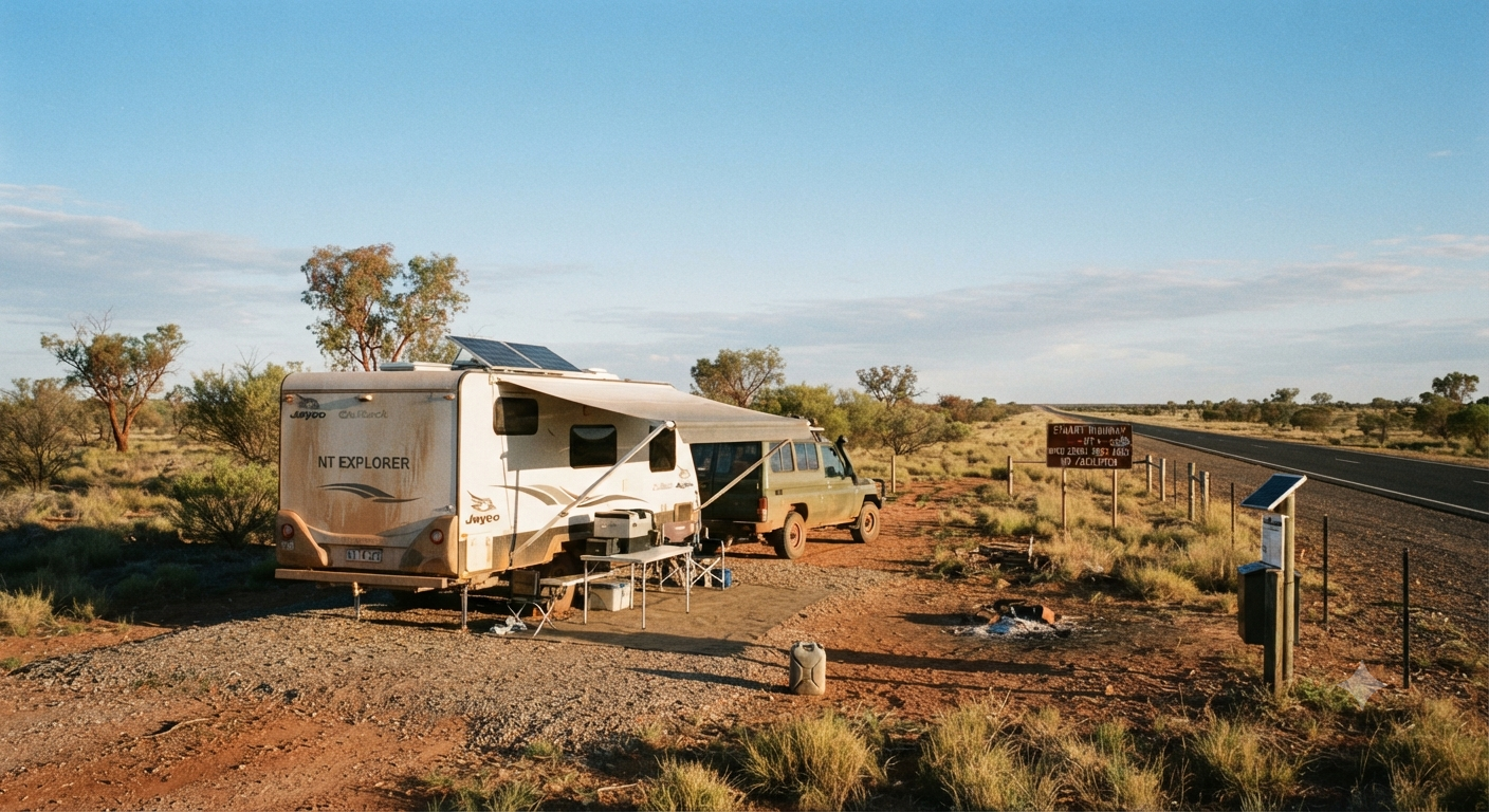
The NT Department of Infrastructure, Planning and Logistics manages a network of formal rest areas along all major sealed highways. These are designed for driver fatigue management and are available for overnight use by self-contained travellers. Most have pit toilets. Some have picnic tables and shade shelters. Water is not available at most NT rest areas — treat any tap you find as non-potable unless signage says otherwise.
Staying at a designated NT rest area is generally accepted for one to two nights. Extended camping at a rest area is not the purpose of these facilities. If you plan to stay more than two nights in one location, look for a campground, station stay or free camp with a longer-term arrangement in place.
Self-Containment
The NT does not have a formal statewide self-containment certification requirement equivalent to some other states — but travelling self-contained is strongly recommended for practical reasons. Rest areas have no grey water disposal, no dump points and no shower facilities. If your rig is not self-contained, you will need to factor caravan park access into your planning at regular intervals for basic hygiene and waste management.
National Park and Aboriginal Land
Camping inside NT national parks — including Kakadu, Litchfield and Uluru-Kata Tjuta — requires a valid park pass and in most cases a specific campsite booking. Do not free camp inside national park boundaries without confirming with Parks Australia or NT Parks and Wildlife. Fines apply.
Large portions of the NT are Aboriginal land. Entry to Aboriginal land without a permit is prohibited. Some roads cross or border Aboriginal land — confirm access requirements with the relevant land council before travelling on any road that is not a designated public highway. The Central Land Council and Northern Land Council manage permit requirements in their respective regions.
Best Time to Travel — Honest Seasonal Guide
Dry Season — April to September (Recommended)
The dry season is the correct window for most grey nomad travel in the NT. Temperatures are manageable — typically 28–32°C maximum in Darwin, 20–25°C maximum in Alice Springs, with cool to cold overnight temperatures in Central Australia (Alice Springs winter nights can drop to 5°C or below). Roads are in their best condition. Campgrounds and rest areas are accessible. Wildlife viewing is excellent as animals congregate around remaining water sources.
May to August is the peak of grey nomad season in the NT. Campgrounds fill. Popular stops like Katherine and Alice Springs get busy. Book ahead for caravan parks in these towns during the June–August window.
Wet Season — October to March (Caution — Not Recommended for Most)
The Top End wet season transforms the NT. Roads flood. Some are cut for weeks or months. Kakadu’s internal road network can become completely inaccessible. The heat and humidity in Darwin from November through March is extreme — 35°C+ with 80–90% humidity and daily afternoon storms.
Alice Springs and Central Australia have a more moderate wet season — hot (40°C+ possible) but not humid. Roads in the Red Centre are generally accessible year-round, though some outback tracks are impassable after rain.
For most grey nomads, the wet season is not the right time for an NT circuit. If you must travel in the Wet, stick to Alice Springs and the Central Australian sealed corridors and avoid the Top End and any unsealed tracks entirely.
| Month | Darwin / Top End | Alice Springs / Red Centre | Grey Nomad Verdict |
|---|---|---|---|
| January | Wet. Hot. Humid. Storms daily. | Hot. 38–42°C possible. | 🚫 Not recommended. |
| February | Peak wet season. Flooding common. | Hot. Some road closures. | 🚫 Not recommended. |
| March | Wet season easing. Roads still risky. | Cooling. Roads improving. | ⚠ Proceed with caution. |
| April | Transition. Drying out. Humidity falling. | Pleasant. 30°C days, cool nights. | ✅ Good for Red Centre. Cautious for Top End. |
| May | Dry season begins. Excellent conditions. | Ideal. Warm days, cool nights. | ✅ Excellent across the NT. |
| June | Perfect. Clear skies, 30°C, low humidity. | Cold nights (5–8°C). Warm days. | ✅ Peak season. Book ahead. |
| July | Best month of the year. Clear and dry. | Cold nights. Stunning clear days. | ✅ Peak season. Book ahead. |
| August | Excellent. Warming slightly toward end. | Warming. Cold nights easing. | ✅ Excellent. Still busy. |
| September | Late dry. Warm. Build-up approaching. | Warming to 33–35°C days. | ✅ Good. Last month of peak season. |
| October | Build-up. Hot and sticky. Storms starting. | Hot. 35–40°C possible. | ⚠ Late window. Heat management essential. |
| November | Pre-monsoon. Very hot and humid. | Very hot. Not comfortable. | 🚫 Not recommended. |
| December | Wet season. Storms and flooding. | Hot wet season. | 🚫 Not recommended. |
The Main Routes — Stuart, Victoria and Barkly Highways
🛣️ The Three Main NT Sealed Corridors
Stuart Highway (A1): Darwin → Katherine → Daly Waters → Tennant Creek → Alice Springs → SA Border (Erldunda/Marla). 1,671 km Darwin to SA border. Fully sealed. The spine of NT travel for grey nomads.
Victoria Highway (A1 westbound from Katherine): Katherine → Timber Creek → Kununurra (WA). 513 km. Fully sealed. Links the NT to the Kimberley.
Barkly Highway (A2): Three Ways Junction → Tennant Creek direction eastward → Camooweal (QLD). 641 km NT section. Fully sealed. Links the NT to Queensland outback routes.
All three are suitable for full-size caravans and motorhomes. All three have long fuel gaps that must be planned around. All three have limited or no mobile coverage for extended stretches.
The standard grey nomad NT circuit typically runs as follows — though many variations exist depending on your entry and exit points:
- Enter from SA border on the Stuart Highway heading north
- Alice Springs (2–3 nights minimum)
- North on the Stuart Highway through Tennant Creek, Daly Waters, Katherine
- Darwin (2–3 nights)
- Either: exit west on the Victoria Highway to the Kimberley (WA)
- Or: return south on the Stuart Highway
- Or: exit east on the Barkly Highway to Queensland
Top End Stops — Darwin Region and Stuart Highway North
The Darwin region offers several rest areas and informal stops within reach of the city. Howard Springs and Coolalinga serve travellers on the Stuart Highway just south of Darwin. Berry Springs is a popular spot for grey nomads wanting a night close to Darwin with access to the nature park.
🏕️ Darwin Area Stops
🏕️ Katherine Region
Stuart Highway — Middle Section
The middle section of the Stuart Highway runs from Katherine south through the remote Barkly Tableland toward Tennant Creek. This is one of the longest, most remote stretches of sealed highway in Australia. Fuel and service gaps are significant — always depart each town with a full tank.
🏕️ Katherine to Daly Waters
🏕️ Daly Waters to Tennant Creek
🏕️ Tennant Creek Region
Stuart Highway — Southern Section to SA Border
South of Tennant Creek, the Stuart Highway passes through the Barkly Tableland and into the heart of Central Australia. This section includes some of the most iconic NT landscapes — Devils Marbles, the approach to Alice Springs, and the long flat run toward the SA border at Erldunda and beyond to Marla.
🏕️ South of Tennant Creek
🏕️ Alice Springs Region
🏕️ Alice to SA Border
Victoria Highway Corridor — WA Border to Katherine
The Victoria Highway runs west from Katherine to the Western Australian border at Kununurra. It is 513 kilometres of sealed highway through spectacular gorge and savanna country. The Bullita Stock Route and surrounding Gregory National Park are accessible from this corridor for those with appropriate permits and equipment.
The Victoria Highway is suitable for standard touring rigs on the sealed surface. Some side roads and national park access tracks are not suitable for large vans. Confirm conditions before leaving the highway for any side trip.
🏕️ Victoria Highway Stops
🏕️ WA Border Area (NT Side)
Barkly Highway — Queensland Border to Three Ways
The Barkly Highway connects the NT to Queensland via Camooweal. It is a long, flat, remote corridor through the Barkly Tableland — one of the most featureless but strangely captivating stretches of road in Australia. The Three Ways junction at the intersection of the Stuart and Barkly Highways is an important waypoint for travellers moving between Queensland and the NT.
🏕️ Barkly Highway NT Stops
🏕️ Connecting to Queensland
- Hell’s Gate Rest Area (QLD border region)
- Mount Gordon Rest Area (QLD)
Medical and Emergency — NT-Specific
| Service | Location | Phone | Notes |
|---|---|---|---|
| Emergency — all | Triple Zero | 000 | Call 000 first in any life-threatening emergency. In areas with no mobile signal, a satellite device (PLB or Garmin inReach) may be your only option. |
| Royal Darwin Hospital | Rocklands Drive, Tiwi NT 0810 | (08) 8922 8888 — verify before travel | Major hospital with full emergency department. Nearest ED for all Top End travellers. |
| Alice Springs Hospital | Gap Road, Alice Springs NT 0870 | (08) 8951 7777 — verify before travel | Emergency department. Serves Central Australia. If you are south of Tennant Creek and have a serious emergency, Alice Springs is likely your destination. |
| Katherine Hospital | Gorge Road, Katherine NT 0850 | (08) 8973 9211 — verify before travel | Regional hospital. Limited specialist capacity. Serious emergencies may be transferred to Darwin. |
| NT Police | Various — by region | 131 444 (non-emergency) or 000 | NT Police have highway patrols. They are also often the first responders on remote roads where ambulance response times are long. |
| NT Roads — conditions | NT Government roads info | 1800 246 199 | Road closure and condition reports. Essential to check before travelling in or after wet season. |
| RFDS — Royal Flying Doctor Service | Multiple NT bases | Emergency: 000 — they coordinate with RFDS. Non-emergency: (08) 8920 9030 (Darwin base) | RFDS provides aeromedical evacuation from remote areas. A PLB or satellite communicator allows you to call for help from areas with no mobile signal. |
Mobile Coverage in the NT
Mobile coverage in the NT is heavily weighted toward Telstra. In towns — Darwin, Katherine, Tennant Creek, Alice Springs — usable 4G is available on Telstra. Between towns, coverage is intermittent to non-existent for extended stretches on all carriers.
| Carrier | NT Coverage Reality | Recommendation |
|---|---|---|
| Telstra | Best available. Towns and some highway sections covered. Still drops out extensively between towns. | ✅ Use Telstra. No alternative comes close. |
| Optus | Present in Darwin and Alice Springs town centres. Essentially absent on highways between towns. | ⚠ Not suitable as your sole NT carrier. |
| Vodafone / TPG | Very limited. Town centres only. Not reliable even in Katherine or Tennant Creek. | 🚫 Do not rely on Vodafone in the NT. |
| Starlink | Excellent coverage across NT. Works anywhere with a clear sky view. | ✅ Best internet option for extended NT travel. Pairs with a Telstra SIM for voice calls. |
| PLB / Garmin inReach | Works via satellite — no carrier coverage needed. Works everywhere. | ✅ Non-negotiable for NT travel. Carries emergency communication where phones cannot. |
Fuel Distances and Rules
Fuel management is the most critical practical skill for NT travel. The gaps between reliable fuel stops are longer than most grey nomads are used to in other states.
| Route Segment | Key Fuel Stops | Maximum Gap (approx.) | Notes |
|---|---|---|---|
| Darwin to Katherine (Stuart Hwy) | Darwin, Adelaide River, Hayes Creek (roadhouse), Pine Creek, Katherine | ~100 km between stops | Most manageable section. Still confirm roadhouse hours. |
| Katherine to Daly Waters | Katherine, Mataranka, Larrimah, Daly Waters | ~100 km between stops | Manageable. Larrimah and Daly Waters are small — confirm hours. |
| Daly Waters to Tennant Creek | Daly Waters, Elliott, Renner Springs, Tennant Creek | ~190 km between Elliott and Renner Springs | Carry extra fuel if your tank range is under 600 km. Elliott and Renner Springs are remote roadhouses — hours not guaranteed. |
| Tennant Creek to Alice Springs | Tennant Creek, Wauchope (roadhouse), Ti Tree, Alice Springs | ~190 km between Wauchope and Ti Tree | Depart Tennant Creek with a full tank. Wauchope and Ti Tree are small — confirm hours before relying on them. |
| Alice Springs to SA Border (Erldunda) | Alice Springs, Erldunda (Desert Oaks) | ~200 km | Depart Alice with a full tank. Erldunda is a reliable roadhouse but confirm hours. |
| Katherine to Kununurra (Victoria Hwy) | Katherine, Victoria River Roadhouse (~195 km), Timber Creek (~85 km further), Kununurra (WA — ~200 km further) | ~200 km between Timber Creek and Kununurra | Carry a fuel jerry if your tank range is under 600 km. Victoria River Roadhouse is critical — do not pass it without filling up. |
| Three Ways to QLD Border (Barkly Hwy) | Three Ways, Barkly Homestead (~260 km), Camooweal (QLD — ~75 km further) | ~260 km Three Ways to Barkly Homestead | Longest reliable gap on the NT highway network. A jerry can is strongly recommended. Barkly Homestead is a remote roadhouse — call ahead to confirm fuel availability. |
Wildlife and Road Safety
The NT has some of the highest wildlife strike rates of any road corridor in Australia. Three species are particularly relevant to grey nomad safety:
Cattle
The NT has open range cattle country. Unfenced cattle roam freely across many highway corridors, particularly on the Barkly Highway and parts of the Stuart Highway south of Daly Waters. A cattle strike at highway speed is potentially fatal. Cattle are unpredictable, often stand on warm bitumen at night, and do not move for headlights. The NT has no general fencing obligation on major highways in open range areas.
Rule: Do not drive at night in the NT. This is not a suggestion — it is the consensus of every experienced NT traveller. Between sunset and sunrise, stop and wait. The cost of a night at a rest area is nothing compared to the cost of a cattle strike.
Kangaroos and Wallabies
Common across all NT corridors. Most active at dawn and dusk. A kangaroo strike at speed can destroy a vehicle’s front end and is potentially fatal at highway speeds. Roo bars are near-universal among experienced NT travellers for good reason.
Wombats
Less common in the NT than in southern states but present in the ranges of Central Australia. Dense body mass makes them dangerous to vehicles at highway speed.
Crocodiles
Saltwater crocodiles are present in all Top End waterways, including rivers that cross or run alongside major highways. Do not swim in, stand at the edge of, or camp immediately adjacent to any Top End waterway. Freshwater crocodiles are present in some Central Australian locations but are generally not dangerous to humans unless provoked. Read all signage at any water access point. If there is no sign, assume the risk exists and stay back from the water edge.
Senior Packing Checklist — NT-Specific
This checklist is specific to NT conditions. A generic Australian grey nomad checklist is not sufficient for NT travel.
- ☐ PLB or satellite communicator (Garmin inReach or SPOT) — registered with AMSA. Non-negotiable.
- ☐ Emergency+ app installed and tested before departure from Darwin or Alice.
- ☐ Offline maps downloaded for entire NT — Hema Explorer strongly recommended over Google Maps for outback NT navigation.
- ☐ Minimum 7 days extra prescription medication beyond planned trip length. NT pharmacy options are limited outside Darwin, Katherine and Alice Springs.
- ☐ Water — minimum 20 litres per person beyond your normal tank. NT rest areas do not reliably provide potable water. Plan to arrive at each stop self-sufficient.
- ☐ Fuel jerry can — minimum 20 litres. Essential for Barkly Highway and Victoria Highway travel. Carry full.
- ☐ Air conditioning — functioning and tested before entering the NT. Dry season days in the Top End regularly reach 32–35°C. Central Australia in spring and autumn reaches 35–38°C.
- ☐ Warm layers for Central Australia winters — Alice Springs nights in June and July regularly drop below 5°C. Do not arrive underprepared for cold nights after assuming the NT is uniformly hot.
- ☐ Roo bar or equivalent front protection — strongly recommended. Cattle and kangaroo strikes at NT highway speeds are vehicle-destroying events.
- ☐ Full spare tyre — not a space-saver. NT roads can be hard on tyres. A proper spare with the same load rating as your fitted tyres.
- ☐ Insect repellent — DEET-based. Mosquitoes in the Top End are aggressive and carry disease risk including Ross River virus. Cover up at dawn and dusk.
- ☐ Travel insurance with medical evacuation cover — NT aeromedical evacuations are extremely expensive without cover. Confirm your policy covers remote Australia including helicopter and RFDS transport.
- ☐ Trip plan lodged with a trusted contact — who knows your route, your daily check-in schedule, and what to do if they don’t hear from you. This is your most important safety system.
- ☐ Cash — $200 minimum. Roadhouses in remote NT do not always accept cards. Some are EFTPOS only with no cash back. Some are cash only. Carry enough to fuel up once without card access.
- ☐ NT road permit confirmed if travelling on any route that crosses or borders Aboriginal land.
Frequently Asked Questions
1. Is free camping allowed in the Northern Territory?
Yes, within limits. NT rest areas on major highways are available for overnight use by self-contained travellers and are the primary free camping option across the NT road network. Camping on Crown land away from rest areas is generally permitted if you are not within a designated protected area. Camping inside national parks requires a Parks pass and site booking. Camping on or near Aboriginal land without a permit is prohibited. When in doubt, call the NT Department of Infrastructure or the relevant land council.
2. Do I need to be self-contained to travel the NT?
There is no formal statewide self-containment law in the NT equivalent to some other states, but travelling self-contained is strongly recommended for practical reasons. NT rest areas have no grey water disposal, no showers and no dump points. If you are not self-contained, you will need to access a caravan park regularly for basic hygiene and waste management. Given the distances between towns, this significantly limits your flexibility.
3. What is the speed limit in the NT?
On open highways in the NT, the default speed limit is 130 km/h. This applies on roads where no other speed limit is signed. However, 130 km/h is the legal maximum — it is not the recommended speed for a tow vehicle with a caravan or a large motorhome. Most experienced NT travellers tow at 100–110 km/h. Reducing speed significantly in the hour either side of dawn and dusk is essential given cattle and wildlife activity.
4. Is the NT safe to travel alone as a senior?
Yes — with the right preparation. Solo grey nomad travel in the NT is common and generally safe for fit, prepared seniors with appropriate equipment. The key requirements are: a working PLB or satellite communicator, a Telstra SIM, offline maps, a daily check-in schedule with someone at home, adequate water and fuel, and a clear personal policy of not driving after dark. If these are in place, solo NT travel is manageable. If any of them are missing, the risk increases significantly.
5. How much does it cost to fuel up across the NT?
Fuel prices in the NT are higher than in southern capital cities — often significantly so at remote roadhouses. Budget for a premium of 20–40 cents per litre above Darwin or Alice Springs prices at remote stops. This is the cost of remoteness. It is not negotiable. Factor it into your trip budget before you leave.
6. Do I need a Parks Pass for the NT?
If you are visiting any NT or federal national park — Kakadu, Litchfield, Uluru-Kata Tjuta, Nitmiluk — you need the relevant park pass. The federal Parks Australia pass covers Kakadu and Uluru-Kata Tjuta. NT Parks passes cover Litchfield, Nitmiluk and other NT-managed parks. Check the Parks Australia and NT Parks and Wildlife websites before your trip and purchase passes in advance where possible.
7. What is the best way to handle heat in a caravan in the NT?
Camp in shade wherever possible. Use a reflective windscreen cover and external reflective covers on windows during the hottest part of the day. Run air conditioning with your generator or solar during the 11am–3pm window if temperatures exceed 35°C. Stay hydrated — significantly more than you think you need. Check on medications that are affected by heat storage (many blood pressure and thyroid medications have storage temperature requirements). Read our dedicated guide: Managing Heat in a Van — Grey Nomad Guide.
Quick Verdict
The NT is not for travellers who are not ready for it. The distances are long, the heat is serious, the medical facilities are remote and the wildlife on the roads at night is a genuine danger. None of this is exaggerated. All of it is manageable with the right preparation.
For grey nomads who do prepare — who carry a PLB, travel with a full tank, have offline maps downloaded, lodge a trip plan with someone at home and do not drive after dark — the NT is one of the great Australian experiences. The Red Centre at dawn. The Katherine Gorge at first light. The Barkly at sunset when the sky turns colours that do not exist anywhere else.
Use the individual stop guides linked throughout this page to plan your exact route. Do not leave Darwin or Alice Springs without knowing your next three fuel stops, your next water fill point and your next night’s accommodation option. Get those details right and the NT takes care of the rest.
NT Scenery Rating: 5 / 5
NT Free Camping Availability: 3.5 / 5 — good rest area network, but facilities are basic
NT Difficulty Level: 4 / 5 — rewarding but demanding. Prepare accordingly.
All NT Stops — Complete Link Directory
Every Northern Territory rest area, roadhouse stop and overnight option published on this site. Organised by corridor for easy route planning.
🛣️ Stuart Highway — Darwin to Katherine
Darwin South Corridor
Pine Creek to Katherine
🛣️ Stuart Highway — Katherine to Tennant Creek
Katherine to Daly Waters
Daly Waters to Tennant Creek
🛣️ Stuart Highway — Tennant Creek to Alice Springs
Tennant Creek Surrounds
South to Alice Springs
🛣️ Stuart Highway — Alice Springs to SA Border
South of Alice Springs
🛣️ Victoria Highway — Katherine to WA Border
🛣️ Barkly Highway — Three Ways to QLD Border
🗺️ NT Overview and Related Guides
NT Hub and Related Guides
- Northern Territory Rest Areas — Overview
- Camping Near Crocodiles — Senior Safety Guide
- Best Routes to Drive Around Australia — Grey Nomads
- Grey Nomad Road Safety Checklist
- Storing Medication Safely While Travelling
- Australian Snake Safety — Grey Nomads
- Van Life Savings Spots — Save Your Best NT Stops
- 🛣️ NT Roads conditions hotline: 1800 246 199
- 🏕️ Parks Australia (Kakadu, Uluru-Kata Tjuta): parks.australia.gov.au
- 🏕️ NT Parks and Wildlife (Litchfield, Nitmiluk): nt.gov.au/leisure/parks-reserves
- 🛰️ PLB registration (AMSA): beacons.amsa.gov.au
- 🚑 RFDS Darwin: (08) 8920 9030
- 🏥 Royal Darwin Hospital: (08) 8922 8888 — verify before travel
- 🏥 Alice Springs Hospital: (08) 8951 7777 — verify before travel
- 🌿 Central Land Council (permits): clc.org.au
- 🌿 Northern Land Council (permits): nlc.org.au
- 📍 Save your NT stops: Van Life Savings Spots
COPY PROMPT ➔ ASK AI ➔ SAVE TO FORM ➔ ADD SPOT PIN ➔ GET DIRECTIONS
📍 Interactive map — find free camps, rest areas and overnight stops across the NT. Enable location for best results.

As an affiliate, I earn from qualifying purchases at no extra cost to you.
Exclusive Offer: Get 5% OFF all StarterStopper immobiliser products with promo code: RTV5
Visit StarterStopper.com to see our data-backed security solutions
As an affiliate, I earn from qualifying purchases at no extra cost to you.
“`