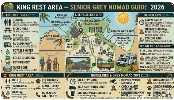
King Rest Area – Senior Grey Nomad Guide 2026
GPS coordinates, road conditions, fuel stops, facilities, heat safety, wildlife, and everything a senior traveller needs before pulling in for the night on one of Australia’s most legendary outback highways.
📅 Last reviewed: January 2026 | Stuart Highway, Northern Territory | Free overnight stop — outback highway setting
📋 Table of Contents
- Why Grey Nomads Stop at King Rest Area
- Free Camping — Know the Rules for Seniors
- Quick Facts and Key Details 2026
- How to Get to King Rest Area + GPS
- Road Conditions, Flooding and Sealed Status
- Heat and Remoteness — Senior Safety
- Wildlife — What to Watch For
- What Other Websites Don’t Tell You
- Best Time to Visit — Month-by-Month
- Free and Low-Cost Camping Alternatives Nearby
- Dump Points Near King Rest Area
- Free Water Sources Near the Stuart Highway
- Fuel Stops Along the Stuart Highway
- Caravan Parks — Paid Alternatives
- Full Facilities Comparison Table
- Rates — All Options Near King Rest Area 2026
- Senior Safety Checklist — On and Off the Road
- What to Do Near King Rest Area — Senior Activity Guide
- 🗺️ Vanlife Savings Spots — Save Every Stop
- Phone Signal and Emergency Communications
- Campfires, Cooking Restrictions and Food Nearby
- Pets at King Rest Area
- Accessibility for Seniors with Mobility Limitations
- Etiquette, Waste Management and Permits
- Emergency Scenarios — What to Do
- Packing List for This Section of the Stuart Highway
- 5 Rest Areas Near King Rest Area
- Reviews — What Grey Nomads Say
- Frequently Asked Questions
- Quick-Reference Card
- Disclaimer
1. Why Grey Nomads Stop at King Rest Area
The
(also known as King River Rest Area) is a free, 24-hour roadside stop located along the Stuart Highway in the Northern Territory, situated approximately 48 km south-east of Katherine and 96 km north of Warloch. It is best known for providing a convenient overnight stay with essential facilities like a public dump point and basic toilets for travellers heading toward the Mataranka or Katherine regions
The Stuart Highway is one of Australia’s great outback drives — a 2,834 km sealed corridor running from Port Augusta in South Australia all the way north to Darwin. For grey nomads completing the crossing, King Rest Area sits as a genuine waypoint rather than just another roadside pull-off. It gives travellers heading between Alice Springs and Tennant Creek a place to properly rest, reset, and prepare for the long stretches ahead.
The distances along the Stuart Highway are unforgiving by Australian standards. Between Alice Springs and Tennant Creek alone, you’re looking at roughly 510 kilometres of open outback road. King Rest Area sits approximately 285–290 km north of Alice Springs, making it a logical halfway stop for travellers doing this section in a day. If you’re arriving from the north heading toward Alice, it’s equally useful as a late-afternoon stop before the final push into town.
First-hand observation: pulling in just after lunch on a typical dry-season day, you’ll usually find two or three caravans, a couple of road trains parked in the truck bays, and occasionally a solo motorhome traveller stretched out in a camp chair under whatever shade they’ve managed to create. It’s a quiet stop — no music, no generators humming until later in the evening — and the open outback sky at night is as good a reason as any to stop here.
For senior travellers specifically, it offers the comfort of knowing you’re not alone in the outback with zero infrastructure nearby. Basic facilities are present, the road surface getting you there is sealed all the way, and the site is well-used enough that help is rarely far away if something goes wrong.
2. Free Camping — Know the Rules for Seniors
King Rest Area is a designated rest area managed by the Northern Territory government through the Department of Infrastructure, Planning and Logistics. As a designated rest area on a major highway, overnight stays are permitted, but there are conditions that senior travellers should understand before settling in for the night.
There is no fee to use King Rest Area. You do not need to register, book, or pay. You simply pull in, use the facilities, rest, and continue your journey. However, this is not a campsite in the national park sense — it is a rest area with a specific function, and the NT government’s position is clear: these stops are for driver fatigue, not extended recreation.
What’s Permitted at NT Rest Areas
- ✅ Overnight sleeping in your vehicle or caravan
- ✅ Use of toilet facilities (where provided)
- ✅ Picnic tables and shade shelters (where provided)
- ✅ Parking caravans, motorhomes, campervans and heavy vehicles
- ❌ Campfires (generally prohibited at sealed highway rest areas)
- ❌ Extended multi-day stays beyond 24 hours
- ❌ Generator use during quiet hours (generally 10pm–7am by convention)
- ❌ Dumping waste or grey water on-site
3. Quick Facts and Key Details 2026
| Detail | Information |
|---|---|
| Location | Stuart Highway, Northern Territory |
| Nearest Town (North) | Tennant Creek — approx. 225 km |
| Nearest Town (South) | Alice Springs — approx. 285–290 km |
| GPS Coordinates | Approx. -20.800°S, 134.200°E (see GPS section) |
| Road Type | Fully sealed — Stuart Highway (Hwy 87) |
| Suitable for Caravans | Yes — large turning areas, good clearance |
| Suitable for Heavy Vehicles | Yes — dedicated truck parking areas |
| Toilets | Yes — pit or composting type (condition varies seasonally) |
| Picnic Tables | Yes — covered/shade shelters typically present |
| Water | No potable water on site — carry your own |
| Dump Point | No — nearest at Tennant Creek or Alice Springs |
| Mobile Phone Signal | Very limited to none — Telstra best option outback |
| Campfires | Not permitted |
| Pets | Permitted on leash |
| Cost | Free |
| Max Stay | 24 hours (fatigue stop) |
| Managed By | NT Department of Infrastructure, Planning and Logistics |
Northern Territory Rest Area Network
If you’re travelling through the Northern Territory, these rest areas form part of a reliable network of free and low-cost stops across major outback highways. From the Stuart Highway to the Barkly and Victoria Highway routes, these locations are popular with caravanners, road trippers, and long-haul drivers.
- Attack Creek Rest Area on the Stuart Highway
- 41 Mile Bore Rest Area along the Barkly Highway
- Bonney Well Rest Stop in the NT outback
- Newcastle Waters Rest Area free camping stop
- King Rest Area suitable for caravans and trucks
- Limestone Creek Rest Area overnight stop
- King West Rest Area highway break stop
- Noel Buntine Memorial Rest Area scenic stop
- Sullivan Campground Rest Area camping area
- East Baines Rest Area on the Victoria Highway
- Beef Road Monument Rest Area tourist stop
- Avon Downs Rest Area on the Barkly Tablelands
- Frewena Rest Stop on the Stuart Highway
- Wonarah Bore Rest Area free camp
- Soudan Bore Rest Area roadside camping
4. How to Get to King Rest Area + GPS
📍 GPS Coordinates — King Rest Area
Approx. -20.800°S, 134.200°E
Coordinate source: Publicly available NT rest area data. Verify on your GPS device or mapping app before departure. Coordinates are approximate for general navigation — your device will locate the rest area pull-off clearly once on the Stuart Highway.
Driving Directions — From Alice Springs (Heading North)
From Alice Springs, head north on the Stuart Highway (Highway 87). The highway is sealed for the entire route to Darwin. King Rest Area is located approximately 285–290 km north of Alice Springs. You’ll pass through the small communities of Aileron (approximately 133 km north, where a roadhouse provides fuel and food) before continuing north through open red-earth country. Look for the standard blue and white NT rest area signage on the left-hand side of the highway.
Driving Directions — From Tennant Creek (Heading South)
From Tennant Creek, travel south on the Stuart Highway. King Rest Area is approximately 225 km south of Tennant Creek. You will pass Wauchope (approximately 100 km south) and the Barrow Creek area before reaching the rest area. Rest area signage will appear on your right-hand side as you head southbound.
Entry and Turning — Caravans and Motorhomes
Access is directly off the Stuart Highway — no secondary road or gravel track required. The pull-in is generous in width, allowing caravans and motorhomes to enter and exit without difficulty. Road trains use a separate designated area. Larger rigs including fifth-wheelers and B-doubles (as passenger vehicles towing) will find adequate space, though manoeuvring at peak times when the area fills up requires patience. Entry and exit are in the same direction — merge carefully with highway traffic on departure.
5. Road Conditions, Flooding and Sealed Status
Is the Road Sealed?
Yes. The Stuart Highway between Alice Springs and Tennant Creek is fully sealed bitumen for the entire length. You will not encounter any unsealed sections to reach King Rest Area. This makes it accessible by all vehicle types including caravans, motorhomes, camper trailers, and standard 2WD vehicles.
Does the Road Flood?
This is a genuinely important question for outback travel. The Stuart Highway is subject to flooding and road closures during the wet season (November to April). Seasonal creek crossings and low-lying areas can flood rapidly after heavy rain events. While the sealed highway handles water better than unsealed roads, sections can still be cut off by floodwaters.
Check Road Conditions Before You Travel
- 🌐 NT Road Report — roadreport.nt.gov.au (official NT government road conditions)
- 🌐 Bureau of Meteorology NT — bom.gov.au/nt (current and forecast weather)
- 📱 NT Road Report app — available for iOS and Android
Road Surface Quality
The Stuart Highway is generally well-maintained in the Alice Springs to Tennant Creek section, though sections can develop corrugations, cracking, and edge-of-road deterioration particularly after wet seasons. Road-train traffic is constant, and debris can occasionally be present on the road surface. Drive to conditions, particularly at dawn and dusk.
Night Driving — A Real Risk
Night driving on the Stuart Highway between Alice Springs and Tennant Creek carries significant risk due to large animals on the road. Kangaroos, cattle, camels and donkeys are all active at night along this corridor. This is one of the strongest arguments for using King Rest Area as an overnight stop rather than pushing on after dark.
6. Heat and Remoteness — Senior Safety
Central Australia is one of the most extreme heat environments on the planet. The region around King Rest Area sits in the heart of the Northern Territory’s outback, where temperatures regularly exceed 40°C in the summer months (October to April) and rarely drop below comfortable at night even in what locals call “winter.” For senior travellers, heat management is not optional — it is a survival skill.
Temperature Expectations by Season
| Season | Typical Daytime Temp | Typical Night Temp | Conditions |
|---|---|---|---|
| May – August (Dry/Winter) | 22°C – 28°C | 5°C – 12°C | Best travel season — warm days, cold nights |
| September – October | 30°C – 38°C | 16°C – 22°C | Heating rapidly — early starts essential |
| November – February (Wet) | 36°C – 44°C+ | 24°C – 28°C | Extreme heat, possible flooding, not recommended |
| March – April | 32°C – 40°C | 18°C – 24°C | Cooling but still very warm — carry extra water |
Senior Heat Safety Checklist for This Location
- ✅ Carry a minimum of 10 litres of drinking water per person above daily needs
- ✅ Have a battery-powered fan or 12V fan for your van or caravan
- ✅ Use reflective window covers on your windscreen and side windows
- ✅ Plan driving to begin before 8am and be parked by 1–2pm during hot months
- ✅ Carry electrolyte sachets for heat exhaustion management
- ✅ Have a PLB (Personal Locator Beacon) registered and activated before travel
- ✅ Tell someone your route plan and expected check-in times
7. Wildlife — What to Watch For
One of the unexpected joys of stopping at outback rest areas is the wildlife. King Rest Area, sitting in Central Australian spinifex and mulga country, offers a genuine outback wildlife experience for those who know where to look and when.
Wildlife You May Encounter
- 🦘 Red Kangaroos — Australia’s largest kangaroo. Most active at dawn, dusk and night. Keep a safe distance — a startled kangaroo can injure a person with its powerful hind legs. On the highway, they are a serious vehicle strike hazard.
- 🦎 Perentie and Goanna — Large monitor lizards that may investigate your campsite for food scraps. Do not feed them. They are not aggressive but can move quickly and have strong claws.
- 🐍 Snakes — Multiple venomous species are present in Central Australia including the Western Brown Snake and King Brown. Do not walk in long grass without looking carefully, especially at dusk. Wear closed shoes when walking around the rest area at night.
- 🐪 Feral Camels — A genuine outback hazard. Feral camels can appear on the road without warning, particularly near watercourses and during dry periods when they move toward any water source. A camel strike at highway speed is catastrophic.
- 🐄 Feral Cattle and Donkeys — Unfenced stock on remote NT roads is common. Night driving risk is significant.
- 🦜 Birds — Budgerigars in flocks, galahs, corellas, wedge-tailed eagles, and the outback speciality — the Bourke’s Parrot and various finch species near any water source. Dawn bird activity around rest areas can be spectacular.
8. What Other Websites Don’t Tell You
Most online rest area listings give you the bare minimum: coordinates, toilets yes/no, and a star rating. Here’s what the standard listings leave out about King Rest Area and this section of the Stuart Highway.
The Road Train Factor
The Stuart Highway carries some of Australia’s largest road trains — triple-trailer B-triples carrying livestock, fuel, and general freight between Darwin and the south. King Rest Area has designated truck rest bays, but when it’s busy, road trains and their crews will be sharing the space. The engine noise from a diesel road train at idle is significant. Position your caravan or motorhome away from the truck bay area if you’re a light sleeper. By convention, road train drivers typically switch off their engines — but not always.
No Water Means Seriously No Water
This cannot be overstated enough. There is no water tap, no water tank, no emergency water supply at King Rest Area. Some travellers arrive here having underestimated their water needs on the previous stretch. The nearest reliable water fill is at fuel stops along the highway (see Fuel Stops section). Running short on water in 40°C heat, 285 km from the nearest town, is an emergency situation in the making.
Toilet Condition Variability
The toilets at remote NT rest areas are maintained on a scheduled basis, not daily. During peak grey nomad season (May–August), usage is high and maintenance scheduling may not keep pace. Carry your own toilet paper, hand sanitiser, and ideally a portable camp toilet as backup. This is practical advice rather than criticism — it simply reflects the reality of remote infrastructure.
The Phantom Signal
Some travellers report getting one or two bars of Telstra signal at King Rest Area — enough to send a text message but rarely enough for a reliable phone call or data session. Do not rely on getting signal here for navigation updates, weather checks, or emergency calls unless you have a satellite communicator device. Optus and Vodafone coverage is essentially nil in this region.
The Dust
When a road train passes at highway speed, the pressure wave and dust it creates can be impressive — and if your caravan door or windows are open, dust will find a way in. This is an outback reality. Seal up your van before a road train passes if you’re sitting outside nearby.
9. Best Time to Visit — Month-by-Month Breakdown
| Month | Conditions | Senior Suitability | Notes |
|---|---|---|---|
| January | Extreme heat, possible flooding | ❌ Not recommended | 40°C+ possible, wet season risk |
| February | Extreme heat, wet season peak | ❌ Not recommended | Road closure risk |
| March | Very hot, wet season easing | ⚠️ Caution | Carry extra water, check roads |
| April | Hot, drying out | ⚠️ Caution | Shoulder season, manageable |
| May | Warm days, cooler nights | ✅ Excellent | Start of peak grey nomad season |
| June | Perfect outback weather | ✅ Excellent | Busiest month — site fills up |
| July | Perfect outback weather | ✅ Excellent | Cold overnight — pack warm layers |
| August | Warm days, still cool nights | ✅ Excellent | Busy, good conditions |
| September | Warming rapidly | ✅ Good | Heat building — start early |
| October | Hot, pre-wet season | ⚠️ Caution | 38°C+ possible — extra water needed |
| November | Very hot, wet season starting | ❌ Not recommended | Heat and storm risk |
| December | Extreme heat, wet season | ❌ Not recommended | Not suitable for extended stays |
10. Free and Low-Cost Camping Alternatives Nearby
If King Rest Area is full when you arrive — which does happen during peak dry season — or if you want to explore other options along this stretch of highway, here are the nearest alternatives:
🏕️ Barrow Creek Rest Area
Located approximately 65–70 km south of King Rest Area. Barrow Creek has a well-known roadhouse (fuel, food, cold drinks) and a basic rest area nearby. The Barrow Creek Hotel is one of the most famous outback pubs in Central Australia — worth a stop for a cold drink and a look at the history of the old telegraph station.
Facilities: Basic toilets, shaded tables, roadhouse nearby.
🏕️ Wauchope Rest Area
Approximately 100 km north of King Rest Area, near the Wauchope roadhouse. Small but functional, with toilet facilities. Fuel is available at Wauchope, making this a useful combined fuel-and-rest stop for northbound travellers.
Facilities: Basic toilets, tables. Roadhouse within 2 km.
🏕️ Aileron Rest Area
Approximately 133 km south of King Rest Area (133 km north of Alice Springs). Aileron Roadhouse provides fuel, food and limited supplies. The giant Aboriginal figure sculptures at Aileron are a popular photo stop. Rest area is suitable for caravans.
Facilities: Toilets, tables, roadhouse adjacent.
- Barrow Creek Rest Area — approx. 65 km south on Stuart Hwy
- Wauchope Rest Area — approx. 100 km north on Stuart Hwy
- Aileron Rest Area — approx. 133 km south on Stuart Hwy
- Devils Marbles Conservation Reserve — approx. 110 km north, basic camping with fees
- Tennant Creek Showgrounds — approx. 225 km north, donation-based camping available some periods
11. Dump Points Near King Rest Area
| Location | Direction | Approx. Distance | Notes |
|---|---|---|---|
| Alice Springs (multiple locations) | South | ~285–290 km | Caravan parks and council dump points available |
| Tennant Creek Caravan Park | North | ~225 km | Dump point available — check current operating status |
| Wauchope Roadhouse | North | ~100 km | Small facility — confirm on arrival |
| Barrow Creek Roadhouse | South | ~65 km | Limited — confirm availability on arrival |
Use Campermate or WikiCamps Australia to locate and verify dump points along your route before departing each day.
12. Free Water Sources Near the Stuart Highway
Water is life on the Stuart Highway. King Rest Area provides no water whatsoever. Here are the practical water fill options along this stretch:
| Location | Type | Direction from King Rest Area | Notes |
|---|---|---|---|
| Alice Springs | Town water — free taps in parks, caravan parks for a fee | South ~285 km | Fill up fully before leaving Alice |
| Aileron Roadhouse | Roadhouse — purchase or fill | South ~133 km | Available for purchase |
| Barrow Creek Roadhouse | Roadhouse water available | South ~65 km | Small supply — not reliable for large fills |
| Wauchope Roadhouse | Roadhouse water available | North ~100 km | Verify availability on arrival |
| Tennant Creek | Town water, caravan parks | North ~225 km | Full facilities — plan to fill before leaving north |
13. Fuel Stops Along the Stuart Highway
Fuel planning on this section of the Stuart Highway is critical. Distances between fuel outlets are long, prices are high compared to major centres, and opening hours at outback roadhouses should never be assumed.
Fuel Stops — Heading North from Alice Springs to Tennant Creek
| Location | Distance from Alice Springs | Fuel Type | Notes |
|---|---|---|---|
| Alice Springs (multiple servos) | 0 km | Unleaded, Diesel, LPG | Fill up here — best prices |
| Aileron Roadhouse | ~133 km north | Unleaded, Diesel | Also has food, cold drinks, basic supplies |
| Barrow Creek Roadhouse | ~265 km north | Unleaded, Diesel | Famous outback pub — open daily |
| Wauchope Roadhouse | ~360 km north | Unleaded, Diesel | Small facility — verify hours |
| Tennant Creek | ~510 km north | Unleaded, Diesel, LPG | Full town facilities — cheapest prices in this section |
Fuel Stops — Heading South from Tennant Creek to Alice Springs
| Location | Distance from Tennant Creek | Fuel Type | Notes |
|---|---|---|---|
| Tennant Creek | 0 km | Unleaded, Diesel, LPG | Fill up before heading south |
| Wauchope Roadhouse | ~100 km south | Unleaded, Diesel | Small roadhouse — open daily but verify |
| Barrow Creek Roadhouse | ~245 km south | Unleaded, Diesel | Reliable fuel stop, pub on site |
| Aileron Roadhouse | ~375 km south | Unleaded, Diesel | Last fuel before Alice Springs |
| Alice Springs | ~510 km south | Unleaded, Diesel, LPG | Best prices — fill tank here |
14. Caravan Parks — Paid Alternatives
If you want powered sites, reliable water, dump points, and a hot shower after the Stuart Highway crossing, here are the nearest caravan parks to King Rest Area:
| Park | Location | Approx. Distance | Facilities | Approx. Cost (2026) |
|---|---|---|---|---|
| Tennant Creek Caravan Park | Tennant Creek, NT | ~225 km north | Powered sites, showers, dump point, laundry, pool | $35–$50/night powered |
| Outback Caravan Park Alice Springs | Alice Springs, NT | ~285 km south | Full facilities, pool, laundry, dump point, WiFi | $40–$65/night powered |
| MacDonnell Range Holiday Park | Alice Springs, NT | ~285 km south | Full resort facilities, powered and unpowered | $45–$70/night powered |
| Barrow Creek Hotel | Barrow Creek, NT | ~65 km south | Very basic — ask at the pub, limited powered | Varies — ask on arrival |
Free campsites and powered sites fill fast during school holidays and peak season. If your preferred site is already gone, search remaining accommodation options below.
Accommodation search powered by Expedia. Booking through this search supports this website at no extra cost to you.
15. Full Facilities Comparison Table
| Facility | King Rest Area | Barrow Creek | Wauchope | Tennant Creek CP |
|---|---|---|---|---|
| Toilets | ✅ Yes (pit type) | ✅ Yes | ✅ Yes | ✅ Full flush |
| Potable Water | ❌ No | ⚠️ Limited | ⚠️ Limited | ✅ Yes |
| Showers | ❌ No | ⚠️ Roadhouse | ❌ No | ✅ Yes |
| Powered Sites | ❌ No | ❌ No | ❌ No | ✅ Yes |
| Dump Point | ❌ No | ❌ No | ❌ No | ✅ Yes |
| Shade/Shelters | ✅ Yes | ✅ Yes | ✅ Yes | ✅ Yes |
| Picnic Tables | ✅ Yes | ✅ Yes | ✅ Yes | ✅ Yes |
| Fuel Nearby | ❌ No | ✅ Yes (on site) | ✅ Yes (nearby) | ✅ Yes |
| Food Nearby | ❌ No | ✅ Yes (pub/roadhouse) | ✅ Yes (roadhouse) | ✅ Full town |
| WiFi | ❌ No | ❌ No | ❌ No | ✅ Yes (paid) |
| Mobile Signal | ⚠️ Very limited | ⚠️ Very limited | ⚠️ Very limited | ✅ Yes |
| Cost | Free | Free (rest area) | Free (rest area) | $35–$50/night |
| HV Parking | ✅ Yes | ✅ Yes | ✅ Yes | ✅ Yes |
16. Rates — All Options Near King Rest Area 2026
| Accommodation Type | Location | Approx. Nightly Rate | Notes |
|---|---|---|---|
| King Rest Area | Stuart Hwy, NT | Free | 24-hour fatigue stop — no booking |
| Barrow Creek Rest Area | Barrow Creek, NT | Free | Basic, adjacent to roadhouse |
| Wauchope Rest Area | Wauchope, NT | Free | Basic — toilet on site |
| Devils Marbles — Karlu Karlu | ~110 km north | $10–$15 per adult | National park camping — fees apply |
| Tennant Creek Caravan Park | Tennant Creek | $35–$50 powered | Full facilities, book ahead in peak season |
| Alice Springs Caravan Parks | Alice Springs | $40–$70 powered | Multiple options available, full facilities |
| Tennant Creek Showgrounds | Tennant Creek | Donation-based at times | Confirm availability before arriving |
| Hotels/Motels — Tennant Creek | Tennant Creek | $130–$220/night | For when van life genuinely exhausts you |
17. Senior Safety Checklist — On and Off the Road
- Water supply checked — minimum 10L per person for the day’s stretch
- Fuel level checked — know your range and next fuel stop distance
- PLB or satellite communicator charged and accessible
- Emergency contact notified of today’s route and expected arrival time
- Weather checked on BOM — bom.gov.au/nt
- NT Road Report checked — roadreport.nt.gov.au
- Offline maps downloaded on phone or GPS device
- Tyre pressures checked (including caravan tyres)
- First aid kit location confirmed and accessible
- Medications packed and accessible (not buried in storage)
- Sunscreen, hat and long sleeves available for any outdoor activity
- Snake-safe footwear worn when walking in rest areas
- Grey water and cassette sealed — no dumping at rest areas
- Snacks and emergency food supply on board
- Planned departure time set before 8am in warmer months
- Next overnight stop identified with a backup option noted
18. What to Do Near King Rest Area — Senior Activity Guide
King Rest Area itself is a rest stop, not a tourist attraction — but the surrounding region offers some of Australia’s most extraordinary experiences for senior travellers willing to explore beyond the highway.
🪨 Devils Marbles — Karlu Karlu Conservation Reserve (approx. 110 km north)
One of Australia’s most iconic outback sites. Huge rounded granite boulders stacked and scattered across open country, formed over millions of years of geological processes and sacred to the Warumungu, Kaytetye, Alyawarre and Warlpiri peoples. A short walk from the car park puts you among the boulders — sealed paths make it accessible for seniors with mobility considerations. Camping is available here at a fee. Sunrise and sunset lighting on the marbles is extraordinary.
📡 Barrow Creek Telegraph Station (approx. 65 km south)
A historic site on the old Overland Telegraph Line, with the famous Barrow Creek Hotel nearby — one of the outback’s most storied pubs. The hotel’s walls are plastered with visiting cards, notes, and memorabilia from decades of travellers. A cold beer here is almost a rite of passage for Stuart Highway travellers.
🌅 Outback Stargazing
This section of the NT offers some of the darkest skies in Australia. Away from any town light pollution, the night sky at King Rest Area is breathtaking — the Milky Way is visible as a physical structure, not just a vague glow. Bring a reclining camp chair, a warm blanket (it gets cold fast in winter nights), and simply look up. No app or equipment needed.
🦅 Bird Watching at Sunrise
The mulga and spinifex country around King Rest Area supports a surprisingly rich bird list. Early morning is the best time — budgerigar flocks moving with the season, cockatoos calling from distant trees, wedge-tailed eagles riding thermals by mid-morning. Binoculars are worth carrying for this section of highway.
📸 Landscape Photography
The red earth, vast sky, and sparse vegetation of Central Australia creates photographic opportunities that most travellers underestimate. Sunrise light turns the landscape deep orange and red — the hour after dawn is the best shooting window before the glare of midday flattens everything.
19. 🗺️ Vanlife Savings Spots — Save Every Stop
Planning free camps and rest area stops along the Stuart Highway can save grey nomads hundreds of dollars over a multi-week outback circuit. Use the interactive map below to find free camps, rest areas, and overnight stops across Australia — and save your own spots as you discover them.
COPY PROMPT ➔ ASK AI ➔ SAVE TO FORM ➔ ADD SPOT PIN ➔ GET DIRECTIONS
📍 Interactive map — find free camps, rest areas and overnight stops. Enable location for best results.
GPS: Approx. -20.800°S, 134.200°E | Cost: Free | Stay Limit: 24 hours | Toilets: Yes | Water: No | Signal: Very limited Telstra only
Stopping here instead of a caravan park can save approximately $35–$60 per night. On a 3-week outback circuit with 8–10 free night stops, that’s a realistic saving of $280–$600 for the journey.
| Rest Area / Stop | Highway | Approx. GPS | Postcode/Region | Key Notes | Nearby WiFi |
|---|---|---|---|---|---|
| King Rest Area | Stuart Hwy | -20.800°S, 134.200°E | NT Outback | Free, toilets, no water, 24hr stay | None |
| Barrow Creek Rest Area | Stuart Hwy | -21.543°S, 133.878°E (approx) | 0872 | Free, toilets, roadhouse adjacent | None |
| Wauchope Rest Area | Stuart Hwy | -20.644°S, 134.214°E (approx) | NT Outback | Free, basic toilets, small roadhouse nearby | None |
| Aileron Rest Area | Stuart Hwy | -22.641°S, 133.891°E (approx) | 0872 | Free, toilets, Aileron Roadhouse adjacent | None |
| Devils Marbles Camp | Stuart Hwy | -20.556°S, 134.272°E (approx) | NT Outback | Fee applies, toilets, stunning location | None |
20. Phone Signal and Emergency Communications
Mobile Coverage — The Reality
Between Alice Springs and Tennant Creek, mobile phone coverage is extremely limited. Telstra has the best network coverage in remote NT by a significant margin, but even Telstra drops to zero signal for extended stretches along this corridor. Optus and Vodafone have virtually no coverage beyond the outer suburbs of Alice Springs and Tennant Creek.
Emergency Communication Options — Strongly Recommended
| Device | How It Works | Cost Range (2026) | Suitable For |
|---|---|---|---|
| PLB (Personal Locator Beacon) | Satellite emergency signal — AMSA monitored | $250–$450 purchase, register free | All outback travellers — essential |
| Garmin inReach Mini 2 | Two-way satellite messaging + SOS | $500–$700 + subscription | Regular outback travellers |
| SPOT Gen 4 | Satellite SOS + tracking | $250–$400 + subscription | Solo travellers, senior nomads |
| Satellite Phone | Full voice calls via satellite | $800–$2000 + call costs | Extended remote travel, professional use |
| HF Radio | Long-range radio communication | $1,500–$3,000 installed | Serious outback travellers, caravans |
Emergency Numbers — When You Do Have Signal
- 🚨 000 — All emergencies (police, ambulance, fire)
- 🚔 NT Police — 131 444 (non-emergency)
- 🏥 RFDS (Royal Flying Doctor Service) — Activated through PLB or 000
- 🛣️ NT Road Report — roadreport.nt.gov.au or 1800 246 199
21. Campfires, Cooking Restrictions and Food Nearby
Campfires
Campfires are not permitted at King Rest Area or at sealed highway rest areas in the Northern Territory generally. This applies year-round. The combination of dry spinifex grass, strong outback winds, and minimal fire suppression resources in this remote location makes open fires an unacceptable risk.
Cooking at King Rest Area
Gas cooking in your caravan, motorhome, or on a portable gas stove is the standard and accepted approach. Ensure your gas cylinders are correctly connected and that you have adequate gas supply for the crossing. A camp kitchen setup under your caravan awning works well at this location given the sheltered tables.
Food — Where to Buy Nearby
| Location | Direction | Distance | What’s Available |
|---|---|---|---|
| Barrow Creek Hotel/Roadhouse | South | ~65 km | Basic meals, snacks, cold drinks, limited groceries |
| Aileron Roadhouse | South | ~133 km | Hot food, snacks, cold drinks, basic supplies |
| Wauchope Roadhouse | North | ~100 km | Basic meals and snacks |
| Tennant Creek Supermarket | North | ~225 km | Full supermarket (IGA/Woolworths) — full resupply |
| Alice Springs Supermarkets | South | ~285 km | Full range — Woolworths, Coles, IGA |
22. Pets at King Rest Area
Pets are permitted at King Rest Area, which is a designated NT highway rest area (not a national park or conservation reserve). However, responsible pet management in this environment requires specific considerations:
- ✅ Dogs and cats are permitted — keep on a leash at all times
- ✅ Clean up pet waste immediately — pack waste bags
- ⚠️ Heat danger — the bitumen surface and surrounding ground can exceed 60°C on hot days. Keep pets off hot surfaces and in shade or cool air-conditioned vehicles
- ⚠️ Snake risk — keep dogs on a short leash and away from long grass, rock piles and vegetation edges where snakes shelter
- ⚠️ Dingo risk — feral dingoes and domestic-dingo hybrids are present along this section of the Stuart Highway. Do not leave pets unattended outside, particularly at night
- ❌ Do not let pets chase or disturb wildlife
- ❌ Do not leave pets in a vehicle without ventilation or cooling on hot days — this can be fatal within minutes
23. Accessibility for Seniors with Mobility Limitations
Getting Around King Rest Area
The sealed surface of the Stuart Highway continues into the rest area itself. Parking areas and access to picnic shelters is generally on a flat or gently sloping sealed or compact surface, making navigation possible for those using walking frames, mobility aids, or wheelchairs — though the standard of accessibility provision at remote NT rest areas is basic by comparison to urban facilities.
Toilet Access
The toilet facilities at King Rest Area are pit or composting-type units. These are typically single-unit structures with a step-up entry. Handrails may or may not be present depending on the age and maintenance status of the facility. If you use a wheelchair or have significant mobility limitations, a portable toilet in your van is strongly recommended as a backup.
Shade and Shelter
Shade shelters over picnic tables are present at most NT highway rest areas including King Rest Area. These provide critical protection from the sun during the day. However, they do not provide windbreaks, so if conditions are windy (common in spring on the Stuart Highway), your caravan awning is a more comfortable alternative.
24. Etiquette, Waste Management and Permits
Rest Area Etiquette — The Unwritten Rules
- 🔇 Respect quiet hours — keep noise to a minimum after 9:30pm
- 🔌 Generators — use during daylight hours only and away from other travellers where possible
- 🚿 No grey water dumping — on the ground, into drains, or near any water source
- 🗑️ Pack all rubbish out — do not leave rubbish in or near pit toilet buildings
- 🚐 Park within designated bays — do not spread across the entire facility preventing others from stopping
- 🤝 Be courteous to road train drivers — they are working and have specific rest requirements
- 🐕 Manage your pets — barking dogs at 5am are not popular
- 💡 Exterior lights — dim or turn off lights pointed toward other travellers’ sleeping areas
Waste Management
There are generally no public bins at remote NT rest areas. This is a specific NT government policy — you are expected to carry your rubbish to the next town for disposal. Do not leave rubbish at the rest area. This policy exists because bin maintenance in remote locations is logistically difficult and attracts pest animals.
Permits — Do You Need One?
No permits are required to use King Rest Area. It is a public NT highway rest area, open to all travellers. However, if you wish to visit Aboriginal land in the surrounding region, a permit may be required from the relevant Aboriginal Land Council. Always check land permissions before turning off the Stuart Highway onto unsealed tracks in this region.
25. Emergency Scenarios — What to Do
Scenario 1: Vehicle Breakdown
Pull off the road safely and activate your hazard lights. Do not remain in or near the traffic lane. If you have phone signal, call NRMA, RAA, or your roadside assist provider. If no signal, activate your PLB if the situation is life-threatening (injury, medical emergency, extreme heat without shelter). For a non-life-threatening breakdown, stay with your vehicle and wait for passing road trains or motorists who will typically stop to assist on the Stuart Highway.
Scenario 2: Medical Emergency
Activate your PLB immediately if the situation is serious. The Royal Flying Doctor Service (RFDS) can reach most locations along the Stuart Highway. If you have satellite communication (Garmin inReach, SPOT), send an emergency message with your GPS coordinates. If you have phone signal, call 000.
Scenario 3: Running Out of Water
This is a genuine life-threatening emergency in summer. Flag down passing vehicles — the Stuart Highway has reasonable traffic and most travellers carry spare water. Conserve what you have — stay in shade, minimise activity, do not exercise. Activate PLB if distress is imminent.
Scenario 4: Flash Flooding
If you encounter floodwater on or crossing the Stuart Highway, do not attempt to drive through it. Turn around and wait for conditions to change. Check NT Road Report for updates. If stranded, stay with your vehicle and activate emergency communication if needed.
26. Packing List for This Section of the Stuart Highway
| Category | Essential Items |
|---|---|
| Water | 10L+ per person per day above regular needs, jerry cans as reserve, water purification tablets |
| Fuel | Full tank before departing, 20L jerry can reserve, PetrolSpy app for prices |
| Food | 3 days’ supply above expected needs, easy-prepare meals, snacks, electrolytes |
| Emergency Communication | PLB (registered), satellite messenger (optional), emergency contacts list in paper form |
| Navigation | GPS device with NT maps loaded, offline Google Maps downloaded, paper map backup |
| Heat Management | Reflective windscreen covers, battery fan, water misting spray, cool pack, sunscreen SPF 50+ |
| Cold Nights (May–Aug) | Sleeping bag rated to 0°C, thermal layers, warm socks, hot water bottle |
| Wildlife Safety | Torch, closed footwear for night walks, snake bite bandages in first aid kit |
| Vehicle | Tyre repair kit, jump starter pack, tow rope, basic tool kit, spare belts and fluids |
| Toilet | Toilet paper, hand sanitiser, portable camp toilet as backup |
| Waste | Waste bags for all rubbish (no bins at rest areas), grey water containment |
| Pets | Leash, water bowl, shade cover, pet first aid kit |
| Medical | Full first aid kit, prescription medications (3+ days extra supply), insect repellent |
27. 5 Rest Areas Near King Rest Area — Stuart Highway NT
- Barrow Creek Rest Area — Approx. 65 km south. Toilets, shaded tables, Barrow Creek Hotel and roadhouse adjacent. Famous outback pub — don’t miss it. GPS approx. -21.543°S, 133.878°E.
- Wauchope Rest Area — Approx. 100 km north. Basic toilets, tables, small roadhouse with fuel and food nearby. GPS approx. -20.644°S, 134.214°E.
- Aileron Rest Area — Approx. 133 km south. Toilets, tables, Aileron Roadhouse immediately adjacent for fuel, food and cold drinks. Giant Aboriginal sculptures nearby — photo stop. GPS approx. -22.641°S, 133.891°E.
- Devils Marbles (Karlu Karlu) Campground — Approx. 110 km north. Fee-based camping, toilets, one of Australia’s most iconic sites. Sunrise at the boulders is unmissable. GPS approx. -20.556°S, 134.272°E.
- Tea Tree Rest Area — Approx. 210 km south of King Rest Area. Basic roadside stop with toilets. Tea Tree Roadhouse nearby for fuel and basic supplies. Useful interim stop on the long Alice Springs to Tennant Creek run.
Northern Territory Rest Area Network
If you’re travelling through the Northern Territory, these rest areas form part of a reliable network of free and low-cost stops across major outback highways. From the Stuart Highway to the Barkly and Victoria Highway routes, these locations are popular with caravanners, road trippers, and long-haul drivers.
- Attack Creek Rest Area on the Stuart Highway
- 41 Mile Bore Rest Area along the Barkly Highway
- Bonney Well Rest Stop in the NT outback
- Newcastle Waters Rest Area free camping stop
- King Rest Area suitable for caravans and trucks
- Limestone Creek Rest Area overnight stop
- King West Rest Area highway break stop
- Noel Buntine Memorial Rest Area scenic stop
- Sullivan Campground Rest Area camping area
- East Baines Rest Area on the Victoria Highway
- Beef Road Monument Rest Area tourist stop
- Avon Downs Rest Area on the Barkly Tablelands
- Frewena Rest Stop on the Stuart Highway
- Wonarah Bore Rest Area free camp
- Soudan Bore Rest Area roadside camping
RV LIFE Trip Wizard — USA Road Trip Planning
RV LIFE Trip Wizard is a USA-based RV route planning platform — ideal for North American visitors to this site who are planning their own van or RV adventures. Australian travellers should use apps like Campermate, WikiCamps, or the NT Road Report for local planning.

As an affiliate, I earn from qualifying purchases at no extra cost to you.
28. Reviews — What Grey Nomads Say About King Rest Area
“Perfect halfway stop heading north to Tennant Creek. Toilets were clean enough when we arrived mid-morning. We had the place to ourselves for a couple of hours which was lovely — just us and the spinifex. Road trains came through later in the afternoon and parked up for the night. No dramas. The star-gazing at 10pm was worth the stop alone.”
“Functional rather than flash. Exactly what you’d expect from a remote NT rest area. Toilets needed attention when we were there. No water — and I can’t stress enough how important it is to carry your own. We filled up in Alice Springs and still felt we could have carried more. The flies were something else in the mid-morning. Bring a fly net.”
“We pulled in late afternoon heading south, exhausted after a long day from Tennant Creek. Shaded table, a flat area for the van, quiet other than a road train early morning. The red earth country at sunset was magnificent — we sat outside with a glass of wine and just watched the sky change colour. Completely free, completely genuine outback. Five stars for the experience.”
“Signal was pretty much zero for Telstra on our phones. Make sure you have your offline maps downloaded before you get here. We had a PLB which gave us peace of mind. The site was fine for a one-night stop but nothing more than that. Flies were intense.”
Exclusive Offer: Get 5% OFF all StarterStopper immobiliser products with promo code: RTV5
Visit StarterStopper.com to see our data-backed security solutions
As an affiliate, I earn from qualifying purchases at no extra cost to you.
29. Frequently Asked Questions
Can I stay overnight at King Rest Area NT?
Yes. King Rest Area is a designated highway rest area where overnight stays are permitted under Northern Territory road fatigue management policy. The maximum stay is 24 hours. No booking or fee is required. It is free to use.
Is there water at King Rest Area?
No. There is no potable water available at King Rest Area. This is critical information for outback travel — carry all water you will need from the previous town (Alice Springs or Tennant Creek). The nearest supplementary water sources are roadhouses at Barrow Creek (approx. 65 km south) or Wauchope (approx. 100 km north).
Is the road to King Rest Area sealed?
Yes. King Rest Area is directly on the Stuart Highway, which is fully sealed bitumen from Alice Springs to Darwin. No unsealed roads are required to access this rest area.
Can I have a campfire at King Rest Area?
No. Campfires are not permitted at NT highway rest areas. Use a gas stove for all cooking.
Is there mobile phone signal at King Rest Area?
Mobile signal is very limited to non-existent. Telstra may provide very occasional one-to-two bar coverage but this cannot be relied upon. Carry a PLB or satellite communicator for any emergency communication needs.
Does King Rest Area flood?
The rest area itself sits adjacent to the sealed Stuart Highway and is not directly in a flood zone. However, sections of the Stuart Highway between Alice Springs and Tennant Creek can flood and close during the wet season (November–April). Always check NT Road Report before travelling this stretch in wet season months.
Can I take my caravan to King Rest Area?
Yes. King Rest Area is on the sealed Stuart Highway with good entry/exit access for caravans, motorhomes and fifth-wheelers. The pull-in area is generous and suitable for large rigs.
Is there a dump point at King Rest Area?
No. The nearest dump points are in Alice Springs (approx. 285 km south) and Tennant Creek (approx. 225 km north). Use Campermate or WikiCamps to locate the nearest verified dump point to your current position.
What are the flies like at King Rest Area?
Central Australian flies are famously persistent. Between August and November particularly, flies can be intense. A fly net for your hat is not a luxury — it is a genuine quality-of-life item that experienced outback travellers consider essential. Apply insect repellent to exposed skin.
Is King Rest Area pet friendly?
Yes, pets are permitted on a leash. Exercise particular caution regarding heat danger on the ground surface, snake risk in vegetation, and dingo risk at night.
30. Quick-Reference Card
📍 King Rest Area — Stuart Highway NT
| GPS | Approx. -20.800°S, 134.200°E |
| Highway | Stuart Highway (Hwy 87), Northern Territory |
| To Alice Springs | ~285–290 km south |
| To Tennant Creek | ~225 km north |
| Nearest Fuel (South) | Barrow Creek ~65 km |
| Nearest Fuel (North) | Wauchope ~100 km |
| Road Type | Fully sealed bitumen |
| Cost | Free |
| Max Stay | 24 hours |
| Toilets | Yes (pit type — carry your own TP) |
| Water | None — carry 10L+ per person |
| Dump Point | None — nearest Alice or Tennant Creek |
| Campfires | Not permitted |
| Mobile Signal | Very limited — Telstra only, unreliable |
| Pets | Yes — leash required |
| HV Parking | Yes — dedicated truck bays |
| Best Visit Season | May to August |
| Emergency | 000 / PLB essential / NT Police 131 444 |
| Road Conditions | roadreport.nt.gov.au |
| Weather | bom.gov.au/nt |
© 2026 RetireToVanLife.com — All rights reserved. Written for Senior Grey Nomads. Safe travels. 🚐