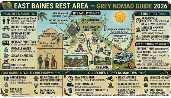
East Baines Rest Area
Senior Grey Nomad Guide 2026 — GPS coordinates, road conditions, Victoria Highway fuel distances, flood warnings, wildlife, accessibility tips and everything you need to plan a safe and comfortable overnight stop at East Baines Rest Area on one of Australia’s most scenic outback drives.
📅 Last reviewed: January 2026 | Victoria Highway, Northern Territory | Free overnight rest area — remote outback setting
📋 Table of Contents
- Why Grey Nomads Stop at East Baines Rest Area
- Free Camping — Know the Limits for Seniors
- Quick Facts and Key Details 2026
- How to Get There + GPS Coordinates
- Road Conditions, Flooding and Unsealed Sections
- Heat and Remoteness — Seniors Must Read
- Wildlife — Birds, Reptiles and What to Watch For
- What Other Websites Don’t Tell You
- Best Time to Visit — Month-by-Month Breakdown
- Free and Low-Cost Camping Alternatives Nearby
- Dump Points Near East Baines Rest Area
- Free Water Sources in the Region
- Fuel Stops Along the Victoria Highway
- Caravan Parks — Paid Alternatives
- Full Facilities Comparison Table
- Rates — All Options Near East Baines 2026
- Senior Safety Checklist — On and Off the Road
- What to Do Near East Baines — Senior Activity Guide
- Vanlife Savings Spots — GPS and Postcodes
- Phone Signal and Emergency Communications
- Campfires, Cooking Restrictions and Food Nearby
- Pets at East Baines Rest Area
- Accessibility for Seniors with Mobility Limitations
- Permits, Fees, Etiquette and Waste Management
- Emergency Scenarios — What to Do
- Packing List for This Section of the Victoria Highway
- Rest Areas Near East Baines on the Victoria Highway
- Reviews — What Grey Nomads Say
- Frequently Asked Questions
- Quick-Reference Card
- Disclaimer
Why Grey Nomads Stop at East Baines Rest Area
The East Baines Rest Area sits on the Victoria Highway in the Northern Territory, positioned in the broad and remote corridor that stretches between Katherine and the Western Australian border near Kununurra. Named after the East Baines River — a tributary of the broader Baines River system that drains into the Keep River watershed — this rest area offers travellers a genuine outback pause in country that few Australians ever see up close.
For grey nomads making the iconic west-to-east or east-to-west run along the Victoria Highway, East Baines Rest Area represents a logical and strategically useful overnight stop. It sits roughly between the Victoria River Roadhouse area and Timber Creek — a section of the highway that can feel long and monotonous without a planned break point. Pulling in here breaks the drive into manageable chunks and gives travellers a chance to rest, cook, and experience the surrounding landscape before pushing on.
A first-hand style observation from a grey nomad traveller in July 2025: “We hadn’t planned to stop at East Baines — it was just on the GPS as a rest area. We pulled in around 4pm and ended up staying two nights. The quiet was extraordinary. No road trains audible after dark, a spectacular sky full of stars, and a goanna that wandered through camp each morning like he owned the place. Definitely going back.”
The rest area also serves as a useful staging point for travellers interested in exploring the broader Keep River National Park corridor to the west and the rugged escarpment country surrounding the East Baines River drainage. This is genuine remote Australia — vast, quiet, and rewarding for travellers who take the time to stop and absorb it.
Free Camping — Know the Limits for Seniors
East Baines Rest Area is part of the Northern Territory’s roadside rest area network, managed to provide safe stopping points for road users on the Victoria Highway. It is intended primarily as a short-term overnight rest stop — not a long-stay campground. Understanding the rules before you arrive avoids any issues on the road.
As with all remote NT rest areas, there are no booking systems, no check-in procedures, and no formal management presence on site. This makes it a genuinely free and flexible stop — but it also means you are entirely self-sufficient. No staff will check on you, assist with problems, or provide information. You are responsible for your own safety and compliance with any applicable rules.
Quick Facts and Key Details 2026
| Detail | Information |
|---|---|
| 📍 Location | Victoria Highway, Northern Territory, Australia |
| 🗺️ Nearest Town (East) | Katherine — approx. 260 km east |
| 🗺️ Nearest Town (West) | Kununurra, WA — approx. 120 km west |
| 🏘️ Nearest Service Point (East) | Timber Creek — approx. 55 km east |
| 🏘️ Nearest Service Point (West) | Keep River NP / WA border — approx. 50 km west |
| 📬 Nearest Postcode | NT 0852 (Timber Creek / Victoria Highway region) |
| 💲 Cost | Free (confirm current status — NT road authority) |
| 🛣️ Road Type | Sealed — Victoria Highway access direct from bitumen |
| 🚐 Caravan Suitability | Yes — standard caravans and motorhomes |
| 🚛 Truck / Road Train Access | Yes — heavy vehicle corridor |
| 🚽 Toilets | Basic pit toilet facilities (verify condition on arrival) |
| 🪣 Water | No potable water — carry your own supply |
| 🔥 Campfires | Subject to NT fire regulations — check before arrival |
| 📶 Mobile Coverage | Very limited — Telstra partial in some spots only |
| 🐾 Pets | Permitted on lead at roadside rest areas |
| 🌡️ Climate | Wet Season (Nov–Apr), Dry Season (May–Oct) |
| 🌊 Flood Risk | HIGH during Wet Season — East Baines River area subject to flooding |
| ⛽ Nearest Fuel (East) | Timber Creek — approx. 55 km east |
| ⛽ Nearest Fuel (West) | Kununurra, WA — approx. 120 km west |
| 🌐 Road Conditions | roadreport.nt.gov.au |
📡 GPS Coordinates — East Baines Rest Area
-15.7183° S, 129.8947° E
Coordinates sourced from publicly available mapping data. Always cross-reference with your GPS unit on arrival. The rest area is located directly off the Victoria Highway — watch for the signed pull-off on the south side of the highway in the East Baines River area.
How to Get There + GPS Coordinates
East Baines Rest Area is accessed directly from the Victoria Highway (Highway 1) — the sealed highway connecting Katherine in the NT to Kununurra in WA. No unsealed approach road is required. The pull-in is directly off the bitumen, making it accessible to all standard vehicle and caravan combinations.
Travelling West from Katherine (NT)
Head west from Katherine on the Victoria Highway. Pass through the Victoria River Roadhouse area and continue to Timber Creek (approximately 200 km from Katherine). After passing through Timber Creek, continue west for approximately 55 km. The East Baines Rest Area pull-in appears on the left (south) side of the highway, signed and visible with adequate sight distance for long vehicles to slow safely. The approach is flat and the rest area is set slightly back from the highway.
Travelling East from Kununurra (WA)
Cross the WA/NT border and head east on the Victoria Highway. After approximately 120 km from Kununurra, the East Baines Rest Area appears on the right (south) side of the highway. This is a useful first stop after the long run from Kununurra if you are planning to break the journey before reaching Timber Creek or pushing on toward the Victoria River Roadhouse.
Road Surface and Vehicle Access
The Victoria Highway is fully sealed on the approach to East Baines Rest Area. The rest area access and internal area is compacted gravel or dirt. In typical Dry Season conditions, this surface is firm and suitable for standard caravans and motorhomes. There is adequate turning space for most rig configurations — arrive during daylight hours so you can assess the site properly before committing.
Using our GPS, access coming from the Timber Creek direction is smooth and straightforward. The rest area sits in a relatively open section of the highway with good visibility in both directions — useful when pulling back out onto a highway used by road trains. Check your mirrors and give yourself plenty of time before merging back onto the highway when departing.
Road Conditions, Flooding and Unsealed Sections
The Victoria Highway is one of Australia’s most flood-affected sealed highways during the Wet Season. The East Baines River — which the rest area is named after — drains a large catchment and can flood the surrounding low-lying areas rapidly during heavy monsoonal rainfall events. The highway in this area has a history of flood closures that can last from hours to weeks.
Always check current road conditions before travelling this section:
- NT Road Report — roadreport.nt.gov.au (official NT Government road conditions — check before every day of driving during the Wet Season)
- Bureau of Meteorology — bom.gov.au for weather forecasts and flood watch alerts
Dry Season Road Conditions (May–October)
The Victoria Highway is generally in good condition during the Dry Season. Minor surface damage and potholes from the previous Wet Season are common — maintain a safe and appropriate speed. Corrugations can appear on sealed surfaces in remote NT due to road base movement. Road train wash on gravel shoulders can be significant — stay well to the left when heavy vehicles approach.
Wet Season Conditions (November–April)
Travel along this corridor during the Wet Season is strongly discouraged for caravans, motorhomes, and conventional vehicles. Road closures, flooded causeways, soft shoulders, and extreme heat and humidity combine to create genuinely dangerous conditions. If you must travel during this period, carry minimum 10 days of food and water, a satellite communicator, and inform someone of your precise itinerary and expected check-in times.
Does the Road Flood Near East Baines?
Yes — this is one of the more flood-prone sections of the Victoria Highway. The East Baines River crossing and surrounding low-lying plain areas are known to flood during significant rainfall events. Even after the rain stops, floodwaters can take days to drain from low-lying sections of the highway. Check the NT Road Report daily during any period of monsoonal activity in the region.
Keep River National Park — Nearby Access Notes
Keep River National Park, located approximately 50 km west of East Baines Rest Area near the WA/NT border, features remarkable sandstone formations, Aboriginal rock art, and diverse wildlife. Internal park tracks are unsealed and 4WD recommended in some sections. Many tracks close entirely during the Wet Season.
Day-use facilities within Keep River NP include basic picnic areas and interpretive walks. Entry to the park is free as of 2026 but confirm with NT Parks. Contact NT Parks and Wildlife: 1300 650 730 for current access conditions before visiting.
Heat and Remoteness — Seniors Must Read
East Baines Rest Area is located in genuinely remote outback NT. The nearest hospital is in Katherine, approximately 260 km to the east. Emergency services response times in this corridor are extended significantly compared to populated areas. This is not a reason to avoid the area — it is a reason to be exceptionally well prepared.
Water is Non-Negotiable
There is no potable water at East Baines Rest Area. In high temperatures, dehydration can set in faster than most people anticipate. Carry a minimum of 10 litres of drinking water per person per day as a safety reserve — this is above and beyond your daily consumption. Fill tanks at Timber Creek or Kununurra before arriving at this rest area.
Tell Someone Your Plans
Before leaving Timber Creek or Kununurra, inform a responsible person of your exact route, planned stops including East Baines, and your expected check-in or arrival time at the next destination. If you fail to make contact, they should notify NT Police to begin a welfare check. This single action has saved lives in remote Australia.
Wildlife — Birds, Reptiles and What to Watch For
The East Baines River corridor and surrounding Victoria Highway country supports remarkable biodiversity. This is Top End country — one of the most ecologically diverse regions in Australia — and stopping overnight gives you access to wildlife experiences that day-driving travellers simply miss.
Birds
Birdwatching at East Baines Rest Area is exceptional, particularly at dawn and dusk. Species commonly observed in this corridor include red-tailed black cockatoos (one of Australia’s most spectacular parrots), brolgas, blue-winged kookaburras, rainbow bee-eaters, and a wide variety of raptors including the majestic wedge-tailed eagle. Finch flocks, including the beautiful Gouldian finch in some seasons, have been recorded in the broader region. Bring quality binoculars — this is genuinely world-class birdwatching territory.
Reptiles
Monitor lizards (goannas) are frequent campsite visitors throughout the NT and will investigate any accessible food. Keep all food secured in hard containers. Snakes — including the king brown, western brown, and death adder — are present across this region. Standard precautions apply: check inside shoes and around gear left on the ground, walk carefully at night with a torch, and never reach into any area you cannot see clearly.
Nocturnal Wildlife and Road Hazards
Wallabies, euros, and cattle are all active at dusk and dawn along the Victoria Highway. Collisions with large animals at highway speeds are catastrophic and kill travellers every year in remote Australia. If possible, plan to be parked and settled well before sunset, and do not resume driving until full daylight. If you must drive at dawn or dusk, reduce speed significantly and scan the road edges constantly.
What Other Websites Don’t Tell You
Campground listing apps will give you the basics on East Baines Rest Area. Here is what they consistently leave out for serious outback travellers:
- Road train noise: The Victoria Highway carries heavy freight 24 hours a day. East Baines Rest Area sits close to the highway and road train pass-bys at night are loud and disruptive for light sleepers. Position your camp as far from the road as the rest area allows and pack quality earplugs.
- The stars are extraordinary: At 260 km from Katherine and 120 km from Kununurra, East Baines is genuinely dark-sky country. On a clear Dry Season night the Milky Way is visible from horizon to horizon. This alone is worth stopping for. Bring a camp chair and spend an hour looking up after dinner.
- Flies peak between 9am and 4pm: Bush fly density in this corridor during the Dry Season can be genuinely relentless. A fly-proof head net, long sleeves, and DEET-based repellent are not optional comfort items — they are practical necessities for doing anything outside between mid-morning and late afternoon.
- No rubbish disposal: NT rest areas at this level of remoteness rarely have rubbish bins. Carry all waste out to Timber Creek or Kununurra. This is a strict carry-in, carry-out location.
- The landscape rewards patience: At first glance this can look like flat, featureless scrub. Spend a few hours sitting quietly and the landscape reveals itself — birds, reptiles, dramatic cloud formations, and the extraordinary quality of light in the late afternoon over red earth country. Grey nomads who rush through miss the best of it.
- Telstra is your only realistic option: If you rely on Optus or another carrier, you will have zero connectivity along most of the Victoria Highway between Katherine and Kununurra. A Telstra SIM or satellite communicator is the practical solution for travellers in this corridor.
Best Time to Visit — Month-by-Month Breakdown
| Month | Season | Conditions | Suitability for Grey Nomads |
|---|---|---|---|
| January | Wet Season | Heavy rain, flooding, highway closures likely | ❌ Not recommended |
| February | Wet Season | Peak rainfall, extreme humidity, high flood risk | ❌ Not recommended |
| March | Late Wet | Rain easing but highway may still be affected | ⚠️ Check daily conditions |
| April | Transition | Drying out — landscape lush and green after rains | ⚠️ Check road report before travelling |
| May | Early Dry | Excellent — comfortable days, cool nights, clear roads | ✅ Highly recommended |
| June | Dry Season | Peak season — ideal weather, busy rest areas | ✅ Best time to visit |
| July | Dry Season | Peak season — can be cold at night (8–14°C) | ✅ Best time to visit |
| August | Dry Season | Excellent — slightly warmer than July | ✅ Highly recommended |
| September | Late Dry | Warming rapidly — less crowded than peak months | ✅ Good choice |
| October | Build-up | Hot and increasingly humid — storm activity begins | ⚠️ Caution advised — heat risk for seniors |
| November | Wet Season | Storms and rain increasing — road flood risk rising | ❌ Not recommended |
| December | Wet Season | Heavy rain, highway flood closures possible | ❌ Not recommended |
Free and Low-Cost Camping Alternatives Nearby
The Victoria Highway and surrounding NT corridor offer several additional free and low-cost stops within reasonable range of East Baines Rest Area. These alternatives are useful if East Baines is crowded during peak season or if you want to break the drive into even shorter stages.
Northern Territory Rest Area Network
If you’re travelling through the Northern Territory, these rest areas form part of a reliable network of free and low-cost stops across major outback highways. From the Stuart Highway to the Barkly and Victoria Highway routes, these locations are popular with caravanners, road trippers, and long-haul drivers.
- Attack Creek Rest Area on the Stuart Highway
- 41 Mile Bore Rest Area along the Barkly Highway
- Bonney Well Rest Stop in the NT outback
- Newcastle Waters Rest Area free camping stop
- King Rest Area suitable for caravans and trucks
- Limestone Creek Rest Area overnight stop
- King West Rest Area highway break stop
- Noel Buntine Memorial Rest Area scenic stop
- Sullivan Campground Rest Area camping area
- Beef Road Monument Rest Area tourist stop
- Avon Downs Rest Area on the Barkly Tablelands
- Frewena Rest Stop on the Barkly Highway
- Wonarah Bore Rest Area free camp
- Soudan Bore Rest Area roadside camping
Dump Points Near East Baines Rest Area
There is no dump point at East Baines Rest Area. This is a basic roadside stop — waste management is entirely your responsibility. The nearest confirmed dump point access points in this region are as follows:
- Timber Creek (~55 km east): Small town — check locally for dump point access. Verify current availability at CamperMate.com.au before relying on this option.
- Kununurra, WA (~120 km west): Multiple dump points available at caravan parks and public facilities. The most reliable option in this corridor. Verify locations via CamperMate before arriving.
- Katherine (~260 km east): Full dump point facilities at caravan parks and some public amenity locations. The best-resourced option on the NT side.
Free Water Sources in the Region
Water availability along the Victoria Highway between Katherine and Kununurra is extremely limited. This is one of the most critical planning considerations for any traveller on this route — and particularly important for senior grey nomads travelling in hot conditions.
- Katherine (260 km east): Fill all tanks here before heading west. Katherine has multiple caravan parks, a service station, and a reliable town water supply. This is your primary fill-up point for the westward journey.
- Timber Creek (~55 km east): Water may be available at the local caravan park or roadhouse — verify before relying on this source. Confirm on arrival.
- Kununurra, WA (~120 km west): Full town water supply available at caravan parks and public facilities. An excellent water fill point after crossing the WA/NT border.
As a minimum, carry 60+ litres of potable water per couple when travelling the Victoria Highway between Katherine and Kununurra. In temperatures above 35°C, consumption and incidental loss (cooking, washing) increases significantly. A quality gravity filter as a backup for treating raw water in a genuine emergency is worthwhile for extended outback travel.
Fuel Stops Along the Victoria Highway
Fuel planning on the Victoria Highway is one of the most important logistics tasks for grey nomads. Prices increase substantially at remote roadhouses, and the distances between stops are significant. Fill at every available opportunity when you have the capacity.
| Fuel Stop | Direction from East Baines | Approx. Distance | Fuel Available | Notes |
|---|---|---|---|---|
| Timber Creek | East | ~55 km | Unleaded, Diesel | Small town — fuel available, verify hours before relying on it |
| Victoria River Roadhouse | East | ~130 km | Unleaded, Diesel | Remote roadhouse — limited hours, higher prices than Katherine |
| Katherine | East | ~260 km | All grades | Full service town — cheapest fuel in the region, best place to fill up |
| Kununurra (WA) | West | ~120 km | All grades | Full service town — fill before crossing into NT for the eastward run |
| Keep River NP / Border Area | West | ~50 km | None confirmed | Do not rely on this area for fuel — no guaranteed service station |
Caravan Parks — Paid Alternatives
If you prefer powered sites, full amenities, or simply need a proper shower and laundry day after remote camping, the following paid options serve the East Baines Rest Area corridor.
Timber Creek (~55 km East)
Timber Creek is the closest town to East Baines Rest Area and offers basic caravan park facilities. It is a small outback community with a local store, fuel, and limited food options. The caravan park provides a powered site option for travellers who want a step up from free camping without committing to the longer drive to Katherine or Kununurra. Rates in 2026 are estimated at $30–$50 per night for powered sites — confirm directly on arrival or via phone.
Kununurra, WA (~120 km West)
Kununurra is the first major service town to the west and offers multiple well-equipped caravan parks. After a stretch of remote Victoria Highway travel, many grey nomads use Kununurra as a 2–3 night base for resupply, laundry, rest, and exploration of the surrounding Kimberley region. Powered site rates in 2026 range from approximately $40–$70 per night. Book well in advance for June and July — parks fill up quickly during peak season.
Katherine (~260 km East)
Katherine has several caravan parks ranging from basic to well-equipped, with powered sites, dump points, hot showers, laundry, and camp kitchens. Rates range from approximately $35–$65 per night for powered sites. Katherine is also the best place on this route to stock up on food, supplies, and fuel before heading west.
Free campsites and powered sites fill fast during the Dry Season (May–September). If your preferred site is already taken, search remaining accommodation options below for Timber Creek, Katherine or Kununurra.
Accommodation and flight search powered by Expedia. Booking through this search supports this website at no extra cost to you. As an affiliate, I earn from qualifying purchases at no extra cost to you.
Full Facilities Comparison Table
| Facility | East Baines Rest Area | Timber Creek | Kununurra (WA) | Katherine (NT) |
|---|---|---|---|---|
| Cost | Free | ~$30–$50/night | ~$40–$70/night | ~$35–$65/night |
| Toilets | Basic pit toilet | Yes (flush) | Yes (full) | Yes (full) |
| Showers | No | Yes (basic) | Yes (full) | Yes (full) |
| Potable Water | No — carry own | Yes (verify) | Yes | Yes |
| Dump Point | No | Enquire locally | Yes | Yes |
| Power | No | Powered sites available | Yes | Yes |
| Shade | Partial — natural | Some trees | Park-dependent | Park-dependent |
| Fuel | No (55 km to Timber Creek) | Yes | Yes (all grades) | Yes (all grades) |
| Food / Supplies | No | Limited local store | Full supermarkets | Full supermarkets |
| Mobile Signal | Very limited | Limited — Telstra best | Yes | Yes |
| WiFi | No | No confirmed | Some parks offer it | Some parks offer it |
| Caravan Access | Yes — sealed highway | Yes | Yes | Yes |
| Pet Friendly | Yes (on lead) | Enquire | Park-dependent | Park-dependent |
| Rubbish Bins | Unlikely — carry out | Yes | Yes | Yes |
| Night Sky Quality | Outstanding — dark sky | Good | Good | Moderate (town lights) |
Rates — All Options Near East Baines 2026
| Location | Type | Est. Rate 2026 | Notes |
|---|---|---|---|
| East Baines Rest Area | Free overnight | $0 | No facilities beyond basic toilet — self-contained essential |
| Timber Creek Caravan Park | Powered / unpowered | ~$30–$50/night | Basic facilities — confirm rates on arrival |
| Kununurra Caravan Parks | Powered sites | ~$40–$70/night | Multiple options — book ahead in June/July peak |
| Katherine Caravan Parks | Powered sites | ~$35–$65/night | Multiple options — good facilities, best prices in region |
| Keep River NP Camping | Basic bush camp | ~$0–$10/night | Check NT Parks for current fees and permit requirements |
Senior Safety Checklist — On and Off the Road
- All water tanks filled to capacity before leaving Katherine or Kununurra (minimum 60L per couple beyond daily needs)
- Fuel tank full — top up at every available stop on this corridor
- PLB charged, tested, and registered with AMSA — carried on person or within easy reach
- Satellite communicator charged if carrying one (Garmin inReach or equivalent)
- Responsible person informed of full itinerary, including East Baines stop, with check-in times agreed
- NT Road Report checked before departure: roadreport.nt.gov.au
- BOM weather forecast reviewed for next 72 hours: bom.gov.au
- Remote-rated first aid kit fully stocked (include pressure bandages for snake bite)
- Medications packed for at least 14 days beyond trip length
- Vehicle and caravan mechanically serviced before entering this remote corridor
- Full-size spare tyre — inflated and in serviceable condition
- Tyre repair kit and portable 12V compressor on board
- Recovery kit: traction boards, tow strap, rated shackles, folding shovel
- Offline maps downloaded on phone and/or Hema Explorer before leaving mobile coverage
- Physical road atlas or Hema map of NT as paper backup
- Fly nets, DEET insect repellent, SPF 50+ sunscreen, wide-brim hat all accessible
- Rubbish bags packed — no bins at East Baines, carry all waste to Timber Creek or Kununurra
- Generator noise etiquette — restrict to daylight hours
- Crocodile safety rules understood — no approach to river or water body edges
- Driving schedule planned to avoid dawn/dusk wildlife strike periods where possible
- Emergency contacts written on paper in glove box: NT Police 131 444, AMSA 1800 641 792, Triple Zero 000
What to Do Near East Baines — Senior Activity Guide
Keep River National Park (approx. 50 km west)
Keep River National Park straddles the NT/WA border and is one of the Northern Territory’s most underrated national parks. The park features spectacular sandstone formations, ancient Gurindji Aboriginal rock art sites, and diverse Top End wildlife. For seniors, the Jinumum Walk and the Keep River Gorge walk are accessible and rewarding day options during the Dry Season. Picnic tables and basic interpretive facilities are available at the main day-use area. Entry to Keep River NP is free — confirm with NT Parks before visiting as fees may change.
Birdwatching at Dawn
Set your alarm for 5:30am and sit quietly near the campsite with your binoculars for 90 minutes after first light. The East Baines River corridor is exceptional birdwatching country — red-tailed black cockatoos, brolgas, raptors, and finch flocks are all possible. A dawn birding session at East Baines is one of those outback experiences that reminds you exactly why you chose this lifestyle.
Stargazing
East Baines Rest Area is genuine dark-sky territory. On a clear Dry Season night, the Milky Way is fully visible from horizon to horizon with no light pollution in any direction. Bring a reclining camp chair, a warm layer (nights can drop to 10°C in July), and a stargazing app. This is genuinely one of the best dark-sky locations available to grey nomads without leaving the highway corridor.
Photography
The combination of red earth, open savanna, river-fringe vegetation, dramatic cloud formations (especially in the Build-up season), and the quality of NT afternoon light makes this corridor outstanding for landscape photography. Golden hour — the 45 minutes before sunset — is particularly spectacular in this area. Set up your camera on a tripod facing west for sunset compositions over the open scrub country.
Timber Creek — Town Visit
Timber Creek (55 km east) is a small but historically significant outback town. It served as a droving and cattle industry hub and has a small but interesting local museum and history walk. The Victoria River winds past the town and provides a pleasant and scenic backdrop. Stop for fuel, a coffee, and a look around before or after your stay at East Baines. Local traveller note: “We spent a morning in Timber Creek and ended up having a brilliant chat with a local at the roadhouse. He pointed us toward a lookout track we’d never have found on our own — views right down the river valley. Worth the detour.”
🗺️ Vanlife Savings Spots — GPS Coordinates and Postcodes
Save every stop before you leave mobile coverage. The Vanlife Savings Spots interactive map below lets you pin free camps, rest areas, and overnight stops across the NT, Victoria Highway corridor, and into the Kimberley. Use it to plan your complete route before heading into low-signal country.
COPY PROMPT ➔ ASK AI ➔ SAVE TO FORM ➔ ADD SPOT PIN ➔ GET DIRECTIONS
📍 Interactive map — find free camps, rest areas and overnight stops along the Victoria Highway and across the NT and Kimberley. Enable location for best results.
| Stop Name | Postcode | Latitude | Longitude | Notes | Nearby WiFi |
|---|---|---|---|---|---|
| East Baines Rest Area | 0852 | -15.7183 | 129.8947 | Free overnight — Victoria Highway — basic pit toilet — no water | None |
| Timber Creek | 0852 | -15.6576 | 130.4810 | Town services — fuel, food, caravan park — 55 km east | Limited — enquire locally |
| Keep River NP Day Use | 0852 | -15.8027 | 129.0748 | National park — picnic area, walks, rock art — 50 km west | None |
| Sullivan Campground Rest Area | 0852 | -15.6097 | 131.1140 | Free overnight — Victoria River area — ~130 km east | None |
| Kununurra (WA) | 6743 | -15.7750 | 128.7369 | Full services — caravan parks, fuel, supermarkets — 120 km west | Yes — library, caravan parks |
| Katherine (NT) | 0850 | -14.4649 | 132.2651 | Full services — caravan parks, dump points, fuel, supermarkets | Yes — library, cafés |
Phone Signal and Emergency Communications
Mobile phone coverage along the Victoria Highway between Katherine and Kununurra is largely absent. East Baines Rest Area at approximately 260 km from Katherine and 120 km from Kununurra is deep within the no-coverage zone. Telstra has the broadest network in the NT but provides no reliable signal at this location. Optus and Vodafone/TPG have no meaningful coverage across most of this highway corridor.
Emergency Contacts — Write These Down Physically
- Triple Zero Emergency: 000 (may connect via satellite on some handsets — do not rely on this)
- NT Police: 131 444
- AMSA (PLB rescue coordination): 1800 641 792
- Royal Flying Doctor Service: Contact via PLB activation or satellite communicator
- NT Road Report: roadreport.nt.gov.au
- NT Parks and Wildlife: 1300 650 730
Campfires, Cooking Restrictions and Food Nearby
Campfire Regulations
Campfire rules in the NT vary by location, season, and current fire danger conditions. At East Baines Rest Area, a standard NT roadside rest area, campfires may or may not be permitted depending on the current fire danger period and any active fire restrictions in the region. During the late Dry Season (August–October), fire danger in the NT rises significantly as dry grass accumulates and wind conditions increase.
Cooking at the Campground
A portable gas stove or built-in van/motorhome cooktop is the recommended and most practical cooking method. There are no electric barbecues at East Baines Rest Area. If a campfire is legally permitted and conditions are safe, use an existing fire ring or cleared area — never create new fire scars in vegetation. Completely extinguish all fires before sleeping or leaving the site (drown with water, stir, drown again — never leave a fire smouldering).
Food and Supplies — What’s Available Nearby
| Location | Distance | Direction | Food / Supplies Available |
|---|---|---|---|
| Timber Creek | ~55 km | East | Small local store, roadhouse food, limited packaged goods — higher prices than Katherine |
| Kununurra (WA) | ~120 km | West | Full supermarkets, restaurants, takeaway, all supplies — excellent resupply point |
| Victoria River Roadhouse | ~130 km | East | Basic hot food, snacks, cold drinks — limited stock, variable hours |
| Katherine (NT) | ~260 km | East | Full supermarkets, restaurants, pharmacies, all supplies |
Stock up comprehensively in Katherine or Kununurra before heading into the corridor. Treat East Baines Rest Area as a self-contained overnight stop — bring everything you need, including enough food for an extra day in case of unexpected delays.
Pets at East Baines Rest Area
Pets are generally permitted at NT roadside rest areas when kept on a lead and under effective control at all times. East Baines Rest Area as a roadside stop should accommodate leashed pets. However, be aware of the following important considerations specific to this location and the broader region.
Snake risk: Keep pets on a short lead at all times. Dogs that sniff under rocks, logs, or dense grass are at high risk of snake strike in this region. The nearest veterinary service for snake-bitten pets is in Katherine (approximately 260 km east). Carry a pet first aid reference and know how to apply a pressure bandage for snake bite as an emergency measure while transporting to a vet.
National Park land: If you are day-tripping into Keep River National Park from East Baines Rest Area, note that dogs and other domestic animals are prohibited within NT national parks. Do not bring pets into the national park — leave them secured in your van with adequate ventilation, water, and shade if temperatures allow.
Accessibility for Seniors with Mobility Limitations
East Baines Rest Area is a remote, natural environment and is not equipped with formal disability or accessibility infrastructure. The ground surface is compacted dirt and gravel and may be uneven in areas between parking spaces and the toilet facility.
- Toilets: Basic pit toilet — not designed to wheelchair accessibility standards. Approach path may be uneven. Seniors with mobility limitations are advised to assess on arrival before committing to the site for an overnight stay.
- Ground Surface: Compacted gravel and earth — generally manageable for walking frames and sturdy footwear, but not designed for wheelchairs or mobility scooters. Rough patches can exist, particularly after rain.
- Self-Contained Advantage: A self-contained motorhome with onboard bathroom facilities is the most practical and dignified option for seniors with mobility limitations at remote NT rest areas. You become completely independent of whatever facilities (or lack thereof) exist on site.
- Shade Access: Natural shade from existing trees may be limited. Ensure your awning is operational and provides adequate cover for chairs, cooking area, and entry/exit points of your vehicle.
- Medical Access: The nearest hospital is in Katherine (260 km east). Factor this distance into your risk planning if you or your travel partner has a medical condition that may require urgent attention.
Permits, Fees, Etiquette and Waste Management
Permits and Fees
East Baines Rest Area as a NT roadside rest area does not currently require a paid permit for short-term overnight use. If you are planning to access Keep River National Park for day use or camping within the park, confirm current entry fees and permit requirements with NT Parks (1300 650 730) before visiting. National park fees and camping permit requirements in the NT can change.
Campground Etiquette
- Respect quiet hours — fellow travellers need genuine rest after long outback driving days. Keep noise low after 9pm and before 7am.
- Generators: Limit use to reasonable daylight hours. A 7am–9pm window is the accepted community standard where no formal rules are posted.
- Space awareness: Do not set up directly beside existing occupied sites when space is available elsewhere in the rest area. Give other travellers room.
- No vegetation damage: Do not cut live trees or shrubs for any purpose. Dead wood collection for fires should only occur where fires are legally permitted.
- Leave no trace: Take everything you bring in back out with you. This is a carry-in, carry-out environment with no waste disposal on site.
Waste Management
There are no rubbish bins at East Baines Rest Area. Pack multiple robust bin bags as part of your standard van kit for remote NT travel. All food waste, packaging, and general rubbish must be transported to the next town with proper disposal facilities (Timber Creek 55 km east or Kununurra 120 km west). Do not bury, burn, or leave waste at the rest area. Grey water should be dispersed well away from the river, waterways, and other campers’ sites. Black water must only ever be disposed of at a designated dump point.
Emergency Scenarios — What to Do
Vehicle Breakdown
Pull completely off the sealed surface if possible, engage hazard lights, and place warning triangles or safety markers behind your vehicle if you have them. Activate your satellite communicator or PLB if you cannot reach mechanical assistance. Road train drivers and other travellers on the Victoria Highway do stop to assist where they safely can. NRMA, RACQ, AANT, and equivalent roadside assistance services can reach remote NT locations, but wait times will be extended — potentially 4–8+ hours in this remote corridor. Carry shade, water, and patience.
Medical Emergency
Activate your PLB immediately for any life-threatening medical emergency. The Royal Flying Doctor Service operates across the NT and can reach remote locations with appropriate landing areas. NT Ambulance: 000. The nearest hospital is in Katherine (260 km east). Do not attempt to drive a critically ill person to hospital without RFDS coordination — a PLB activation gives RFDS your position and the ability to coordinate the most appropriate response.
Flood Stranding
If the Victoria Highway floods on either side of East Baines Rest Area and you are trapped, stay with your vehicle. You have shelter, supplies (if prepared correctly), and your PLB. Notify AMSA via PLB that you are stranded but safe. Roads in this region can reopen within hours after rain stops, or closures can extend for several days. Carrying 7–10 days of food and water in your van is emergency planning, not paranoia — it is exactly what the situation may require.
Packing List for This Section of the Victoria Highway
- Minimum 60 litres potable water per couple (above daily needs) — filled at Katherine or Kununurra
- 7–10 days emergency food supply beyond planned trip length
- Full fuel tank — auxiliary tank or jerry cans for extended range on this corridor
- Registered PLB — carried on person or immediately accessible at all times
- Two-way satellite communicator (Garmin inReach or equivalent) for routine check-ins
- Remote-specification first aid kit — include snake bite pressure bandages
- MaxTrax or equivalent traction boards
- Tow strap and rated shackles
- Full-size spare tyre (correctly inflated, in serviceable condition)
- Tyre plug repair kit and 12V portable compressor
- Portable gas stove with sufficient gas canisters for trip duration plus reserve
- DEET-based insect repellent and quality fly head nets
- Wide-brim hat, long-sleeve sun shirts, SPF 50+ sunscreen
- Warm layers — Dry Season nights can drop to 8°C in June/July
- Quality awning and UV shade sail for daytime shelter
- Rubbish bags — minimum 5 heavy-duty bags for carry-out waste management
- Offline maps: Hema Explorer app downloaded covering NT and WA Kimberley
- Physical Hema map of NT as paper backup
- Quality binoculars — birdwatching in this corridor is outstanding
- Camera with charged batteries and spare storage cards
- Camp chair for stargazing and dawn wildlife watching
- Emergency contacts list printed and stored in glove box
Travelling Remote? Protect Your Vehicle.
Exclusive Offer: Get 5% OFF all StarterStopper immobiliser products with promo code: RTV5
Visit StarterStopper.com to see our data-backed security solutions
As an affiliate, I earn from qualifying purchases at no extra cost to you.
Rest Areas Near East Baines on the Victoria Highway
- Sullivan Campground Rest Area — approximately 130 km east, near the Victoria River Roadhouse. Free overnight campground with river setting and basic facilities. View Sullivan Campground Rest Area guide
- Noel Buntine Memorial Rest Area — commemorative and scenic rest point along the Victoria Highway corridor. View Noel Buntine Memorial Rest Area guide
- Limestone Creek Rest Area — a useful break-point stop in the NT highway network. View Limestone Creek Rest Area guide
- King Rest Area — suitable for caravans and heavy vehicles along the NT highway corridor. View King Rest Area guide
- King West Rest Area — highway break stop on the Victoria Highway. View King West Rest Area guide
For the complete NT rest area network and free camping database, visit RetireToVanLife.com.
Reviews — What Grey Nomads Say About East Baines Rest Area
“We stopped here on the way back from Kununurra in August and ended up staying two nights. The dark sky at night was the best we’d seen on the entire trip. Not another soul around after the first night. Toilet was clean when we arrived. Flies were bad between 10am and 3pm — but that’s the NT for you. Pack your fly net and you’re fine.”
“Good free stop on a long day’s drive from Katherine. We arrived at about 3pm and had plenty of space. The pit toilet was very basic but functional. No water on site — make sure you’re stocked up before arriving. The only downside was a couple of road trains going through at 3am — loud but expected on this highway. Would stop again.”
“We saw a massive wedge-tailed eagle circling camp for about an hour on our second morning. Just incredible. We did a day trip into Keep River National Park from here — absolutely worth it. The rock art is stunning and the gorge walk is easy enough for us older travellers. East Baines is a perfect base for that visit.”
Travelling from the USA? RV LIFE Trip Wizard is a USA-based RV trip planning tool
RV LIFE Trip Wizard is a USA-specific RV route planner that helps American travellers find campgrounds, plan routes, and manage their RV trips across North America. It is designed specifically for the US market and road network and is not applicable to Australian travel planning.

As an affiliate, I earn from qualifying purchases at no extra cost to you.
Frequently Asked Questions
Is East Baines Rest Area free to use?
Yes — East Baines Rest Area is a free overnight stop as part of the NT roadside rest area network. No fees apply for standard overnight use. Always confirm current conditions with NT road authorities as rules can change.
How long can you stay at East Baines Rest Area?
The standard NT roadside rest area maximum stay is 20 hours. Confirm current stay limits with NT road authorities before planning a multi-night stop at this location.
Is the road to East Baines Rest Area sealed?
Yes. The Victoria Highway is fully sealed on the approach. The internal rest area access track is unsealed (compacted dirt/gravel) and is suitable for standard caravans and motorhomes in Dry Season conditions.
Does the Victoria Highway flood near East Baines Rest Area?
Yes — the East Baines River area and surrounding low-lying plain are flood-prone during the Wet Season (November–April). The highway can close for days or longer. Always check roadreport.nt.gov.au before travelling this corridor.
Is there water at East Baines Rest Area?
No potable water is available. Carry all your water supply before arriving. Fill tanks in Katherine or Kununurra as appropriate to your direction of travel.
Are there crocodiles near East Baines Rest Area?
The East Baines River may support freshwater crocodile populations. Do not approach the river bank, swim, wade, or allow pets or children near any water body in this region.
What is the nearest fuel to East Baines Rest Area?
Timber Creek is approximately 55 km east and is the nearest fuel stop. Kununurra (WA) is approximately 120 km west. Katherine is approximately 260 km east — the best-priced fuel in the region.
Can I take my caravan to East Baines Rest Area?
Yes — the Victoria Highway approach is sealed and suitable for standard caravans and motorhomes. The internal rest area is on compacted gravel/dirt and is generally manageable for most standard setups in Dry Season conditions.
Is there mobile phone reception at East Baines Rest Area?
Mobile reception is essentially absent at this location. Telstra may have an extremely weak signal in some conditions. Do not rely on mobile connectivity for navigation or emergency communication. Always carry a PLB or satellite communicator on this route.
What is near East Baines Rest Area to visit?
Keep River National Park (approx. 50 km west) is the most notable nearby attraction, featuring sandstone formations, Aboriginal rock art, and diverse wildlife. Timber Creek (55 km east) offers a small town experience with history, fuel, and basic food. The immediate area is outstanding for birdwatching and astrophotography.
Quick-Reference Card
📋 East Baines Rest Area — Quick Reference 2026
| Location | Victoria Highway, NT — between Timber Creek and Kununurra |
| GPS | -15.7183° S, 129.8947° E |
| Google Maps | Open in Google Maps |
| Cost | Free (confirm current status) |
| Max Stay | 20 hours (standard NT rest area) — confirm with NT road authority |
| Road | Sealed highway — unsealed internal rest area track |
| Toilets | Basic pit toilet — verify condition on arrival |
| Water | None — fill tanks in Katherine or Kununurra |
| Nearest Fuel (East) | Timber Creek ~55 km |
| Nearest Fuel (West) | Kununurra ~120 km |
| Nearest Town (East) | Katherine ~260 km |
| Flood Risk | HIGH Nov–Apr — check roadreport.nt.gov.au before travel |
| Best Time | May to September (Dry Season) |
| Crocodiles | Possible — stay well away from river and water edges |
| Phone Signal | Essentially none — carry PLB at all times |
| Nearest NP | Keep River National Park ~50 km west |
| NT Parks | 1300 650 730 |
| NT Road Report | roadreport.nt.gov.au |
| BOM Weather | bom.gov.au |
| Emergency | 000 / NT Police 131 444 / AMSA 1800 641 792 |
| Pets | On lead — crocodile and snake risk — not permitted in national parks |
| Caravan OK? | Yes — standard caravans and motorhomes via sealed highway |
| Night Sky | Outstanding — genuine dark sky location |
© 2026 RetireToVanLife.com — All rights reserved. Written for Senior Grey Nomads. Safe travels. 🚐