Nullarbor Rest Areas Grey Nomad Guide 2026
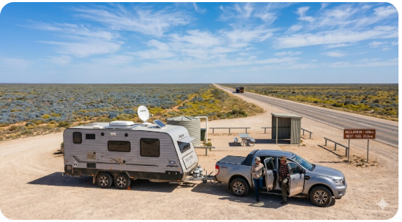
Nullarbor rest areas are the lifeline of one of Australia’s most remote highway crossings — and for senior grey nomads aged 60 and over, knowing exactly what each stop offers before you arrive is the difference between a safe, enjoyable crossing and a genuinely dangerous situation. This 2026 guide covers every major rest area from Ceduna in South Australia to Norseman in Western Australia, with verified GPS coordinates, honest facility detail, overnight suitability, water and fuel planning, medical contacts, and the practical information most guides skip entirely.
- Route: Eyre Highway — Ceduna SA to Norseman WA
- Total distance: Approximately 1,200 km
- Recommended driving days: 3 to 4 for most senior grey nomads
- Key challenge: Fuel and water gaps of up to 200 km between stops
- Mobile coverage: Highly limited — Telstra is best, still patchy
- Best season: April to September (avoid December to February heat)
- Toilets at rest areas: Major roadhouses yes — basic rest areas often no
- Dump points en route: Limited — plan carefully
- State border quarantine: Yes — biosecurity inspection at Border Village WA
- What the Nullarbor crossing actually involves
- Before you leave Ceduna — the essential checklist
- South Australia rest areas — Ceduna to Border Village
- Western Australia rest areas — Eucla to Norseman
- Overnight planning — 3-day and 4-day itineraries
- Water management on the Nullarbor
- Fuel planning — the calculation most travellers get wrong
- Mobile coverage and satellite communication
- Medical and emergency contacts along the route
- Security at Nullarbor rest areas
- What to do at rest areas beyond sleeping
- Best time of year for the crossing
- GPS master table — all rest areas
- Connecting your route — before and after the Nullarbor
- People also ask
- Quick verdict
What the Nullarbor crossing actually involves
The Nullarbor Plain is not a road trip with a few long stretches between towns. The Eyre Highway runs approximately 1,200 kilometres from Ceduna in South Australia to Norseman in Western Australia — and for senior grey nomads, it demands a different level of preparation than almost any other Australian highway.
Fuel stops can be 200 kilometres apart. Mobile coverage disappears for hours at a time. Summer temperatures regularly exceed 40°C. And the rest areas you will be relying on for sleep, meals, and safety vary enormously in what they actually offer.
The most important thing to understand before you read a single GPS coordinate in this guide: you cannot afford to arrive at an overnight rest area and discover it does not suit your rig or your needs. On the Nullarbor, the next option can be 80 to 120 kilometres away.
Before you set your route, bookmark our Rest Areas South Australia 2026 — Complete Senior Grey Nomad Guide and our companion Free Camping South Australia 2026 guide — you will want both open as you plan the SA section of this crossing.
Before you leave Ceduna — the essential checklist
Ceduna is your last major service town before the crossing begins. It has supermarkets, fuel, a hospital, pharmacies, and reliable mobile coverage. This is where you make sure everything is right — not Penong, not Nundroo.
| Pre-departure check | Detail | ✓ |
|---|---|---|
| Fuel | Full tank plus jerry cans if your vehicle range is under 400 km loaded | ☐ |
| Water | Full tanks plus minimum 20 litres per person as a buffer | ☐ |
| Groceries | Fully stocked — fresh food for 4 days minimum | ☐ |
| Vehicle check | Tyre pressures, oil, coolant, brakes, tow coupling, lights | ☐ |
| Medications | Full supply — next pharmacy is a long way from many stops | ☐ |
| Emergency contacts | Someone at home has your full itinerary and daily check-in plan | ☐ |
| Satellite communicator | EPIRB, SPOT, or inReach charged and accessible — not buried in storage | ☐ |
| Biosecurity items | Know what fresh produce you are carrying — WA inspection at Border Village is thorough | ☐ |
| CPAP battery | Fully charged — most rest areas have no power | ☐ |
For a comprehensive pre-trip preparation list, our Grey Nomad Packing Checklist and Grey Nomad Road Safety Checklist are both worth completing the evening before you depart Ceduna.
South Australia rest areas — Ceduna to Border Village
This section covers approximately 480 kilometres and contains the majority of named rest areas on the SA side of the crossing. Distances below are measured from Ceduna.
Penong Roadhouse
| Field | Detail |
|---|---|
| Distance from Ceduna | 75 km |
| Address | Eyre Highway, Penong SA 5690 |
| GPS | -31.9271, 133.0158 |
| GPS accuracy note | Within approximately 50m — confirm on arrival |
| Fuel | Yes |
| Toilets | Yes — at roadhouse |
| Water | Available at roadhouse |
| Overnight suitability | Limited — too early in the crossing for most travellers |
| Senior note | Use as a fuel and stretch stop — not an overnight destination |
Nundroo Roadhouse Rest Area
| Field | Detail |
|---|---|
| Distance from Ceduna | 159 km |
| Address | Eyre Highway, Nundroo SA 5690 |
| GPS | -31.7703, 132.2219 |
| GPS accuracy note | Within approximately 50m — confirm on arrival |
| Fuel | Yes |
| Toilets | Yes |
| Water | Available at roadhouse |
| Overnight suitability | Moderate — functional for late starters from Ceduna |
| Senior note | Mobile coverage becomes unreliable shortly after here — Telstra is best option |
Yalata Rest Area
| Field | Detail |
|---|---|
| Distance from Ceduna | Approximately 200 km |
| Address | Eyre Highway near Yalata community, SA 5690 |
| GPS | -31.4808, 131.8283 |
| GPS accuracy note | Within approximately 50m — confirm on arrival |
| Fuel | No — do not rely on fuel here |
| Toilets | Yes — basic |
| Water | Do not rely on it — carry your own |
| Overnight suitability | Low — basic facilities only |
| Senior note | Do not enter the Yalata community area — the rest area on the highway is accessible but community land requires permission |
Nullarbor Roadhouse Rest Area
| Field | Detail |
|---|---|
| Distance from Ceduna | Approximately 250 km |
| Address | Eyre Highway, Nullarbor SA 5690 |
| GPS | -31.4415, 130.9023 |
| GPS accuracy note | Within approximately 50m — confirm on arrival |
| Fuel | Yes — fill here regardless of level |
| Toilets | Yes |
| Water | Yes — refill here |
| Food | Café and basic supplies |
| Overnight suitability | Good — recommended Day 1 overnight stop |
| Senior note | One of the best overnight stops on the SA side — space for rigs, facilities functional |
Head of Bight Rest Area and Viewing Platform
This is not a standard rest area — it is a managed visitor site with an entry fee and one of the most remarkable natural experiences available on the entire crossing. Between June and October, Southern Right Whales gather in the Bight to calve and nurse. The cliff-top viewing platforms are accessible and genuinely outstanding.
| Field | Detail |
|---|---|
| Distance from Ceduna | Approximately 295 km (12 km detour from highway) |
| Address | Head of Bight Road, Yalata SA 5690 |
| GPS (turnoff) | -31.4964, 130.1072 |
| GPS accuracy note | Within approximately 50m of highway turnoff — confirm on arrival |
| Facilities | Visitor centre, toilets, viewing platforms, entry fee applies |
| Overnight suitability | Not recommended — continue to next roadhouse |
| Senior note | If crossing June to October, build a half-day here into your itinerary — do not rush this stop |
Mundrabilla Roadhouse Rest Area (SA)
| Field | Detail |
|---|---|
| Distance from Ceduna | Approximately 360 km |
| Address | Eyre Highway, Mundrabilla SA 6443 |
| GPS | -31.8338, 127.8594 |
| GPS accuracy note | Within approximately 50m — confirm on arrival |
| Fuel | Yes |
| Toilets | Yes |
| Water | Available |
| Overnight suitability | Moderate — functional, limited stock |
Border Village Rest Area
Border Village is where the SA/WA biosecurity inspection occurs. This is one of the most thoroughly enforced quarantine checkpoints in Australia. Fresh fruit, vegetables, honey, and certain plant material must be declared and may be confiscated. Dispose of anything you are unsure about before you arrive at the checkpoint.
| Field | Detail |
|---|---|
| Distance from Ceduna | Approximately 480 km |
| Address | Eyre Highway, Border Village WA 6443 |
| GPS | -31.6846, 129.0017 |
| GPS accuracy note | Within approximately 50m — confirm on arrival |
| Fuel | Yes |
| Toilets | Yes |
| Water | Available |
| Overnight suitability | Good — legitimate overnight stop for those crossing the border late |
| Senior note | WA biosecurity inspection — declare everything, lose nothing unexpectedly |
Western Australia rest areas — Eucla to Norseman
Once you cross into WA, the road quality is generally excellent and Main Roads WA maintains the rest areas well. Distances between fuel stops remain significant — plan as carefully as you did on the SA side.
For a broader understanding of overnight parking rights in WA, read our guide on Can You Park a Campervan Anywhere in Western Australia? before relying on any rest area as a free overnight stop.
Eucla Roadhouse and Rest Area
| Field | Detail |
|---|---|
| Distance from Ceduna | Approximately 492 km (approx 12 km inside WA) |
| Address | Eyre Highway, Eucla WA 6443 |
| GPS | -31.6760, 128.8877 |
| GPS accuracy note | Within approximately 50m — confirm on arrival |
| Fuel | Yes |
| Toilets | Yes |
| Water | Available — refill here |
| Accommodation | Basic motel rooms available |
| Overnight suitability | Very good — one of the better stops on the crossing |
| Senior note | Time zone changes here — WA is 45 minutes behind SA standard time. Adjust devices. The Eucla Telegraph Station ruins (partially sand-buried) are worth a short walk. |
Madura Roadhouse and Madura Pass Rest Area
| Field | Detail |
|---|---|
| Distance from Ceduna | Approximately 590 km |
| Address | Eyre Highway, Madura WA 6443 |
| GPS | -31.8960, 127.0225 |
| GPS accuracy note | Within approximately 50m — confirm on arrival |
| Fuel | Yes |
| Toilets | Yes |
| Water | Available |
| Overnight suitability | Moderate — adequate |
| Senior note | Madura Pass lookout is the most significant elevation change on the entire crossing — worth stopping for even if you do not need fuel. Views from the Hampton Tableland down to the Roe Plain are genuinely striking by Nullarbor standards. |
Cocklebiddy Roadhouse Rest Area
| Field | Detail |
|---|---|
| Distance from Ceduna | Approximately 660 km |
| Address | Eyre Highway, Cocklebiddy WA 6443 |
| GPS | -32.0393, 126.0875 |
| GPS accuracy note | Within approximately 50m — confirm on arrival |
| Fuel | Yes — fill here |
| Toilets | Yes |
| Water | Available |
| Overnight suitability | Good |
| Senior note | Cocklebiddy Cave is nearby — one of the world’s longest underwater cave systems, but specialist diving access only. The name is real, the cave is extraordinary, access is not for casual visitors. |
Caiguna Roadhouse Rest Area — Gateway to the 90 Mile Straight
| Field | Detail |
|---|---|
| Distance from Ceduna | Approximately 700 km |
| Address | Eyre Highway, Caiguna WA 6443 |
| GPS | -32.2679, 125.4881 |
| GPS accuracy note | Within approximately 50m — confirm on arrival |
| Fuel | Yes — fill here before the 90 Mile Straight |
| Toilets | Yes |
| Water | Available |
| Overnight suitability | Good — if tired before the straight, stop here |
| Senior note | The 90 Mile Straight (actually 146.6 km — the longest straight road in Australia) begins here heading west. Drive this rested. Senior fatigue on this stretch is a real and documented risk. |
90 Mile Straight Fatigue Stop Rest Areas
There are several basic rest bays along the 146.6 km straight between Caiguna and Balladonia. These exist for one reason: fatigue management. Use them.
| Facility | What is available | Senior recommendation |
|---|---|---|
| Toilets | Some bays have basic toilets — many have nothing | Do not rely on it — carry your own supplies |
| Water | No potable water at any straight rest bay | Fill at Caiguna before starting |
| Shade | Minimal to none | Drive the straight early morning to avoid peak heat |
| Overnight suitability | Emergency only | Aim for Balladonia as your overnight target |
Balladonia Roadhouse and Rest Area
| Field | Detail |
|---|---|
| Distance from Ceduna | Approximately 895 km |
| Address | Eyre Highway, Balladonia WA 6443 |
| GPS | -32.4485, 123.6498 |
| GPS accuracy note | Within approximately 50m — confirm on arrival |
| Fuel | Yes — fill here, Norseman is still 193 km away |
| Toilets | Yes |
| Water | Available |
| Museum | Small Skylab museum — NASA’s Skylab space station scattered debris across this area in 1979. Worth 20 minutes. |
| Overnight suitability | Very good — one of the top overnight recommendations on the WA side |
| Senior note | Night skies here are exceptional — no light pollution for hundreds of kilometres in any direction. Sleep here, wake before dawn, and look up. |
Fraser Range Station Camping
| Field | Detail |
|---|---|
| Distance from Ceduna | Approximately 1,000 km |
| Address | Eyre Highway, Fraser Range WA 6443 |
| GPS | -32.4099, 122.7631 |
| GPS accuracy note | Within approximately 50m of station entrance — confirm on arrival |
| Facilities | Powered and unpowered camping, toilets, showers |
| Fees | Yes — camping fees apply |
| Overnight suitability | Very good — the best overnight option in this section if you want a proper camp |
| Senior note | Book ahead in peak season — April to October fills quickly with grey nomads on the crossing |
Norseman — End of the Nullarbor Crossing
| Field | Detail |
|---|---|
| Distance from Ceduna | Approximately 1,200 km |
| Address | Roberts Street, Norseman WA 6443 |
| GPS (town centre) | -32.1942, 121.7789 |
| GPS accuracy note | Within approximately 50m of town centre — confirm caravan park location on arrival |
| Facilities | Full town — supermarket, fuel, medical centre, caravan parks, cafés, pharmacy |
| Overnight suitability | Excellent — full services for the first time since Ceduna |
| Senior note | Do a full vehicle check here. Top up medications. Resupply properly. Then decide whether to head north to Kalgoorlie or southwest toward Esperance. |
Overnight planning — 3-day and 4-day itineraries
| Day | 3-Day Plan | 4-Day Plan (Recommended for seniors) |
|---|---|---|
| Day 1 | Ceduna → Nullarbor Roadhouse (~250 km) | Ceduna → Nullarbor Roadhouse (~250 km) |
| Day 2 | Nullarbor Roadhouse → Cocklebiddy (~350 km, includes border crossing) | Nullarbor Roadhouse → Eucla (~250 km, includes Head of Bight detour if June–Oct, includes border crossing) |
| Day 3 | Cocklebiddy → Norseman via Balladonia (~400 km) | Eucla → Balladonia via 90 Mile Straight (~380 km) |
| Day 4 | — | Balladonia → Norseman (~193 km, relaxed finish with optional Fraser Range stop) |
Water management on the Nullarbor
Water is where grey nomads most often miscalculate on the Nullarbor. The roadhouses sell bottled water but it is expensive and supply is not guaranteed. Most travellers with proper rigs carry water tanks and refill at major stops.
| Stop | Water available? | Action |
|---|---|---|
| Ceduna | Yes — mains water | Fill completely before departure |
| Penong / Nundroo | Yes — roadhouse | Top up if you have capacity |
| Yalata rest area | Do not rely on it | Carry your own through this section |
| Nullarbor Roadhouse | Yes | Fill here — important stop |
| Mundrabilla / Border Village | Yes — roadhouse | Top up if capacity allows |
| Eucla / Madura / Cocklebiddy / Caiguna | Yes — roadhouses | Fill at every opportunity |
| 90 Mile Straight rest bays | No | Carry from Caiguna |
| Balladonia / Norseman | Yes | Full resupply available at Norseman |
Fuel planning — the calculation most travellers get wrong
Towing a van significantly reduces fuel economy. If your vehicle normally achieves 11 to 12 litres per 100 km unladen, expect 15 to 18 litres per 100 km towing a loaded caravan in warm conditions on the Nullarbor.
Always calculate your range on the higher consumption figure, not your optimistic unladen number.
| Fuel stop | Distance to next fuel | Action |
|---|---|---|
| Ceduna to Penong | 75 km | Fill in Ceduna, Penong is optional top-up |
| Penong to Nundroo | 84 km | Fill at Nundroo |
| Nundroo to Nullarbor Roadhouse | Approximately 90 km | Fill at Nullarbor Roadhouse regardless of level |
| Nullarbor Roadhouse to Mundrabilla | Approximately 110 km | Fill at Mundrabilla |
| Mundrabilla to Border Village | Approximately 120 km | Fill at Border Village |
| Eucla to Madura | Approximately 100 km | Fill at Madura |
| Caiguna to Balladonia | Approximately 192 km — longest gap | Fill completely at Caiguna — this is the critical gap |
| Balladonia to Norseman | 193 km | Fill at Balladonia |
Mobile coverage and satellite communication
Mobile coverage on the Nullarbor is limited and this is not an area where optimism is useful. Telstra has the best coverage of any Australian network on this route — with repeater towers at major roadhouses and some stretches between. Even Telstra has significant dead zones. Optus and Vodafone are unreliable for large portions of the crossing.
Many Nullarbor travellers also use UHF CB radio Channel 40 to communicate with road trains when overtaking or being overtaken. Road trains on the Nullarbor can be up to 53.5 metres long and overtaking requires significant planning and distance. A CB radio is a genuine safety tool here, not a novelty.
For the broader legal picture on sleeping and overnight stays across Australian states, our guide on Can You Sleep in a Campervan Anywhere in Australia? Rules by State 2026 covers SA and WA rules in detail.
Medical and emergency contacts along the route
Medical facilities on the Nullarbor are extremely limited. The roadhouses can call for Royal Flying Doctor Service assistance, but response times are measured in hours, not minutes. If you are managing a serious chronic condition, discuss this crossing with your GP before departure.
| Service | Location | GPS | Phone |
|---|---|---|---|
| Ceduna District Health Service | 12 Poynton Street, Ceduna SA 5690 | -32.1304, 133.6630 | (08) 8626 2300 |
| Norseman Medical Centre | Norseman WA 6443 | -32.1942, 121.7789 | Confirm current listing before travel |
| Royal Flying Doctor Service | Australia-wide emergency response | — | 1800 625 800 |
| Emergency | Australia-wide | — | 000 |
Security at Nullarbor rest areas
The Nullarbor is remote but it is also a well-travelled highway. Most grey nomads report no security issues. The remoteness that makes the Nullarbor appealing also means that vehicle-based crime is relatively low simply because there are fewer people — and fewer opportunities — than in coastal towns and popular camping spots.
That said, basic precautions apply at every stop:
- Lock your vehicle overnight even at remote rest areas
- Do not leave valuables visible — especially in vehicle cabs at roadhouse stops where you leave the vehicle unattended
- If something feels wrong about a rest area or another vehicle, trust that instinct and move on to the next stop
- Keep your satellite communicator charged and accessible — not buried in a storage compartment
For broader security awareness before any remote Australian crossing, our guide on How Caravan Theft Happens in Australia: Grey Nomad Guide covers the most common methods and how to prevent them.
What to do at rest areas beyond sleeping
Grey nomads who treat Nullarbor rest areas as purely functional miss the best parts of the crossing. Here is what is actually worth doing:
| Experience | Where | Senior tip |
|---|---|---|
| Night sky stargazing | Any rest area away from roadhouse lighting | Balladonia is the standout — zero light pollution. Bring a reclining chair, not just a neck-craning stand. |
| Southern Right Whale watching | Head of Bight (June to October) | Build a half-day minimum into your itinerary. Do not rush this. |
| Sunrise and sunset watching | Any rest area facing east or west | The flat horizon means sunrises and sunsets here are long, slow, and extraordinary. Set your alarm. |
| Bird life observation | Rest areas with any scrubby vegetation | Major Mitchell’s Cockatoos, Wedge-tailed Eagles, and honeyeaters are common. Eagles on roadkill — slow down when pulling in. |
| Madura Pass viewpoint | Madura WA | The only significant elevation change on the crossing — a view that earns its novelty simply by existing here. |
| Skylab museum | Balladonia Roadhouse | 20 minutes well spent — the story of the 1979 Skylab re-entry over this exact region is genuinely entertaining. |
Best time of year for the Nullarbor crossing
| Season | Conditions | Senior verdict |
|---|---|---|
| Summer (Dec–Feb) | 40°C+ temperatures, dangerous heat, limited shade at rest areas | Avoid unless your rig has strong cooling and you can drive exclusively in early morning hours |
| Autumn (Mar–May) | Cooling quickly, manageable temperatures, less traffic | Very good — excellent choice |
| Winter (Jun–Aug) | Cool to cold nights, pleasant days, whale season active at Head of Bight | Best overall — peak grey nomad season. Busiest rest areas but best conditions. |
| Spring (Sep–Nov) | Warming up, whales still present early in the season, wildflowers in WA | Very good — especially September/October |
GPS master table — all major Nullarbor rest areas
| Location | State | Postcode | GPS (within ~50m) | Fuel | Toilets | Water | Overnight |
|---|---|---|---|---|---|---|---|
| Ceduna | SA | 5690 | -32.1304, 133.6630 | Yes | Yes | Yes | Excellent |
| Penong Roadhouse | SA | 5690 | -31.9271, 133.0158 | Yes | Yes | Yes | Limited |
| Nundroo Roadhouse | SA | 5690 | -31.7703, 132.2219 | Yes | Yes | Yes | Moderate |
| Yalata Rest Area | SA | 5690 | -31.4808, 131.8283 | No | Basic | No | Low |
| Nullarbor Roadhouse | SA | 5690 | -31.4415, 130.9023 | Yes | Yes | Yes | Good |
| Head of Bight turnoff | SA | 5690 | -31.4964, 130.1072 | No | At visitor site | No | Not recommended |
| Mundrabilla Roadhouse | SA | 6443 | -31.8338, 127.8594 | Yes | Yes | Yes | Moderate |
| Border Village | WA border | 6443 | -31.6846, 129.0017 | Yes | Yes | Yes | Good |
| Eucla | WA | 6443 | -31.6760, 128.8877 | Yes | Yes | Yes | Very good |
| Madura | WA | 6443 | -31.8960, 127.0225 | Yes | Yes | Yes | Moderate |
| Cocklebiddy | WA | 6443 | -32.0393, 126.0875 | Yes | Yes | Yes | Good |
| Caiguna | WA | 6443 | -32.2679, 125.4881 | Yes | Yes | Yes | Good |
| 90 Mile Straight rest bays | WA | 6443 | Various — use navigation app | No | Some | No | Emergency only |
| Balladonia | WA | 6443 | -32.4485, 123.6498 | Yes | Yes | Yes | Very good |
| Fraser Range Station | WA | 6443 | -32.4099, 122.7631 | No | Yes | Yes | Very good (fee) |
| Norseman | WA | 6443 | -32.1942, 121.7789 | Yes | Yes | Yes | Excellent |
Save all of these stops before you lose signal using your Vanlife Savings Spots workflow.
Connecting your route — before and after the Nullarbor
The Nullarbor crossing rarely exists in isolation. Most grey nomads are doing an east-to-west or west-to-east crossing as part of a broader journey.
Approaching from the east through SA: Our Rest Areas South Australia 2026 guide covers the full SA network. Pair it with the Free Camping South Australia 2026 guide to plan your stops before Ceduna.
Approaching from Victoria: The Melbourne to South Australia — Complete Senior Grey Nomad Rest Area Guide 2026 covers the full approach from the east. Also bookmark Rest Areas Victoria 2026 and Free Camping Victoria 2026 for the Victorian leg.
Coming through outback NSW: Outback NSW Rest Areas for Grey Nomads 2026 covers that territory before you connect to SA.
After Norseman heading up the WA coast: Our guide to Free Camping in Shark Bay Western Australia is essential reading if you are heading north after the crossing.
Planning the full Australian circumnavigation: The Best Routes to Drive Around Australia for Grey Nomads gives you the strategic framework for the whole loop.
If you are considering full-time or extended van living and want to know the real costs, Living In A Camper: Real Costs, Daily Life, And How To Know If It Fits You gives you an honest breakdown before you commit.
And if you want to understand the legal distinctions between free camping and overnight parking before you rely on a rest area for the night, our guide on Free Camping vs Overnight Parking Australia explains the difference clearly.
Frequently Asked Questions — Nullarbor Rest Areas for Grey Nomads
How many days does it take to cross the Nullarbor in a caravan?
Most senior grey nomads take 3 to 4 days for the full Ceduna to Norseman crossing. Four days is the recommended pace — it allows for Head of Bight in whale season, manageable daily distances, and arriving at Norseman without fatigue.
What are the best overnight stops on the Nullarbor?
The best overnight stops for grey nomads are the Nullarbor Roadhouse (SA), Eucla (WA), Cocklebiddy (WA), Balladonia (WA), and Fraser Range Station (WA). Balladonia is particularly recommended for night sky viewing.
Are there free rest areas to sleep at on the Nullarbor?
Yes. Most of the roadhouse carparks on the Nullarbor allow overnight stops at no charge for travelling grey nomads. Always confirm current signage on arrival — rules can change. For paid camping with facilities, Fraser Range Station is the standout option between Balladonia and Norseman.
What is the longest gap between fuel stops on the Nullarbor?
The longest fuel gap is approximately 192 km between Caiguna and Balladonia on the WA side. This section includes the entire 90 Mile Straight. Fill completely at Caiguna regardless of your fuel level.
Is there mobile coverage on the Nullarbor?
Limited. Telstra has the best coverage and provides signal at major roadhouses and some stretches between. Significant dead zones exist. Optus and Vodafone are unreliable for large portions of the crossing. A satellite communicator is strongly recommended.
What do I need to declare at the WA border?
The biosecurity checkpoint at Border Village requires declaration of all fresh fruit, vegetables, honey, and certain plant material. WA has strict biosecurity rules to protect its agricultural industries. Inspectors are thorough — declare everything and dispose of items you are uncertain about before you arrive at the checkpoint.
When can you see whales at Head of Bight?
Southern Right Whales are typically present at Head of Bight from June to October, with peak numbers usually in July and August. Entry fees apply at the managed viewing area. This is one of the most extraordinary wildlife viewing experiences in Australia and should be built into your itinerary if you are crossing in season.
Is the Nullarbor safe for senior grey nomads travelling solo?
Yes, with proper preparation. The key requirements are: a working satellite communicator, someone at home with your itinerary, full fuel and water planning, and never pushing on when fatigued. Solo senior travellers cross the Nullarbor successfully every year. The risk comes from under-preparation, not the road itself.
Quick verdict — is the Nullarbor crossing worth it?
Grey nomads who have crossed the Nullarbor tend to describe it in one of two ways. Those who under-prepared found it stressful, expensive, and exhausting. Those who planned it properly — who stopped when they were tired, who took the whale detour, who slept under the stars at Balladonia, who arrived at Norseman on their own terms — those are the ones already planning the return crossing.
- Rest Areas South Australia 2026
- Free Camping South Australia 2026
- Melbourne to South Australia Rest Areas 2026
- Can You Park a Campervan Anywhere in Western Australia?
- Free Camping in Shark Bay Western Australia
- Grey Nomad Safety Tips 2026
- Grey Nomad Packing Checklist
- Grey Nomad Road Safety Checklist
- Can You Sleep in a Campervan Anywhere in Australia?
- How Caravan Theft Happens in Australia
- Best Routes to Drive Around Australia for Grey Nomads
- Vanlife Savings Spots
📍 Interactive map — find free camps, rest areas and overnight stops. Enable location for best results.
Nullarbor roadhouse carparks and free stops fill fast in peak season. If your preferred stop is already crowded or unsuitable, search remaining accommodation options below.
Accommodation search powered by Expedia. Booking through this search supports this website at no extra cost to you. As an affiliate, I earn from qualifying purchases at no extra cost to you.

As an affiliate, I earn from qualifying purchases at no extra cost to you.
Exclusive Offer: Get 5% OFF all StarterStopper immobiliser products with promo code: RTV5
Visit StarterStopper.com to see our data-backed security solutions
As an affiliate, I earn from qualifying purchases at no extra cost to you.