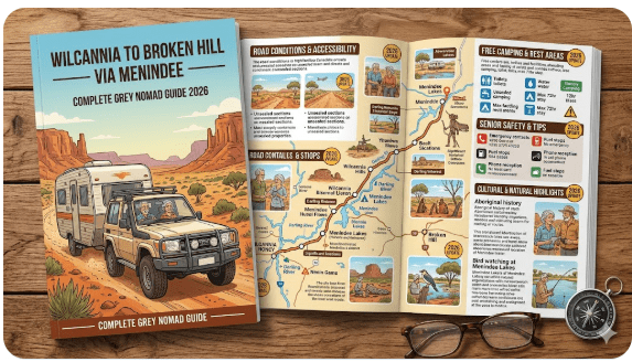
Wilcannia to Broken Hill via Menindee: The Complete Senior Grey Nomad Guide 2026
Every rest area, free camp, fuel stop, road condition, dump point, GPS coordinate and senior safety tip between Wilcannia and Broken Hill — including Menindee Lakes. Everything you need to travel this remote outback corridor safely and confidently in 2026.
📅 Last reviewed: January 2026 | Far West NSW — Wilcannia to Broken Hill Corridor | Free overnight stops reviewed | Suitable for caravans, motorhomes and campervans
📋 Table of Contents
- Why Grey Nomads Travel This Route
- Route Overview — Wilcannia to Broken Hill
- Free Camping — Know the NSW Rules for Seniors 2026
- All 11 Stops — Complete GPS and Facilities Guide
- Road Conditions, Flooding and Unsealed Sections
- Fuel Stops Along the Route
- Heat and Remoteness — Senior Safety in Far West NSW
- Wildlife — Birds, Reptiles and What to Watch For
- Best Time to Travel — Month-by-Month Breakdown
- Dump Points Near the Route
- Free Water Sources Along the Corridor
- Menindee Showers and Facilities
- Paid Alternatives — Caravan Parks and Showgrounds
- Full Facilities Comparison Table — All 11 Stops
- Senior Safety Checklist — On and Off the Road
- What to Do Near the Route — Senior Activity Guide
- Vanlife Savings Spots — GPS Coordinates and Postcodes
- Phone Signal and Emergency Communications
- Campfires, Cooking Restrictions and Food Purchases
- Pets Along the Route
- Accessibility for Seniors with Mobility Limitations
- Camping Etiquette, Waste Management and Permits
- Emergency Scenarios — What to Do
- Packing List for This Section of Outback NSW
- Reviews — What Grey Nomads Say
- Frequently Asked Questions
- Quick-Reference Card
- Disclaimer
🏜️ Why Grey Nomads Travel This Route
The corridor between Wilcannia, Menindee and Broken Hill is one of the great grey nomad journeys of outback New South Wales. It’s a road that delivers genuine Australian wilderness — vast red plains, silver river gums, the shimmering Menindee Lakes system, and the unmistakable silhouette of Broken Hill rising from the Barrier Range. For retired travellers in caravans, motorhomes or camper vans, this stretch of far western NSW offers something increasingly rare: solitude, starry skies and affordable or free overnight stops spaced conveniently along the way.
This isn’t a road you travel because it’s easy. You travel it because it’s unforgettable. The Darling River at Wilcannia, the pink pelicans of Menindee Lakes, the copper-coloured landscapes rolling west toward Broken Hill — this is the Australia that exists beyond the coastal tourist trail, and it rewards those who make the effort.
But the route demands respect. Distances between services are significant. Summer heat can be extreme. Mobile phone coverage is patchy. And the road conditions — while mostly sealed — can deteriorate quickly after rain. This guide covers every stop, every hazard, every fuel station and every senior-specific concern so you can travel this corridor with confidence in 2026.
🗺️ Route Overview — Wilcannia to Broken Hill
The primary route from Wilcannia to Broken Hill runs along the Barrier Highway (A32) heading west, with a significant detour option south through Menindee — a detour most grey nomads consider essential rather than optional. Here’s how the route geography breaks down:
| Leg | Route | Distance | Road Type | Est. Drive Time |
|---|---|---|---|---|
| Wilcannia → East of Wilcannia Rest Area | Barrier Hwy east | ~8 km east | Sealed | 10 min |
| Wilcannia → Menindee (via Menindee Rd) | MR79 south | ~110 km | Mostly sealed | 1.5 hrs |
| Menindee → Broken Hill | MR79 / Barrier Hwy | ~112 km | Sealed | 1.5 hrs |
| Wilcannia → Broken Hill (direct) | Barrier Hwy (A32) | ~195 km | Sealed | 2.5 hrs |
| Broken Hill → Thackaringa Hills | Barrier Hwy west | ~40 km west | Sealed | 30 min |
| Broken Hill → West Rest Area (Eastbound) | Barrier Hwy west | ~15 km west | Sealed | 20 min |
The route passes through one of the most sparsely populated regions of NSW. Between Wilcannia and Broken Hill, you will encounter very few towns. Menindee (population approximately 500) is the only township of note between the two larger centres. Plan your fuel, water and supplies accordingly — this guide covers all of that in detail below.
🏕️ Free Camping — Know the NSW Rules for Seniors 2026
Rest areas along NSW state roads and highways are governed by NSW Transport rules. The standard rule across NSW is that travellers may stay for a maximum of 20 hours in any 24-hour period at a designated rest area. This applies to all rest areas on this route including East of Wilcannia, Wilcannia–Menindee Road, Netallie Hill, Dolo Hill, Broken Hill, Broken Hill South, Thackaringa Hills, West Broken Hill (Eastbound) and Popiltah Lake.
Cawndilla Campground at Menindee Lakes is different — it is a designated campground within the Kinchega National Park system and has its own fee and permit structure (see the Menindee section below).
Key rules across all NSW rest areas on this route:
- Maximum 20-hour stay in any 24-hour period
- No permanent structures, awnings pegged into ground at some locations
- No campfires at roadside rest areas (fire regulations apply — see campfire section)
- Leave no trace — pack out all rubbish
- Generator use restricted to daylight hours at most stops — check signage on arrival
- Self-contained vehicles preferred — no grey water disposal on ground
- Pets permitted but must remain under control
📍 All 11 Stops — Complete GPS and Facilities Guide
This hub guide covers every stop in the Wilcannia → Menindee → Broken Hill corridor. Each stop has its own detailed article on this site — click the links for the full individual stop guides. Below you’ll find the essential fast facts for each location.
East of Wilcannia Rest Area
Location: Barrier Highway, approximately 8 km east of Wilcannia, NSW 2836
GPS: Approx. -31.544, 143.461 (verify on arrival — signage present)
Road Type: Sealed — Barrier Highway (A32)
Facilities: Picnic tables, toilets (pit style), some shade trees
Stay Limit: 20 hours NSW rule
Cost: Free
Best For: Travellers arriving from the east needing a pre-Wilcannia rest or departing east after visiting Wilcannia
Wilcannia–Menindee Road Rest Area
Location: MR79, between Wilcannia and Menindee, NSW
GPS: Approx. -31.812, 143.201 (verify on arrival — signage present)
Road Type: Sealed with some gravel sections possible after flood events
Facilities: Basic — tables, toilets (pit style), limited shade
Stay Limit: 20 hours NSW rule
Cost: Free
Best For: Breaking up the drive between Wilcannia and Menindee (approximately 55 km from Wilcannia)
Netallie Hill Rest Area
Location: Menindee Road corridor, Far West NSW
GPS: Approx. -32.012, 143.198 (verify on arrival)
Road Type: Sealed
Facilities: Picnic tables, pit toilets, elevated position with views
Stay Limit: 20 hours NSW rule
Cost: Free
Best For: Elevated position gives good views of the surrounding plains — a favourite for sunset photography
Dolo Hill Rest Area
Location: Menindee Road corridor, Far West NSW
GPS: Approx. -32.156, 143.192 (verify on arrival)
Road Type: Sealed
Facilities: Basic picnic and toilet facilities
Stay Limit: 20 hours NSW rule
Cost: Free
Best For: Midpoint rest between Wilcannia and Menindee for those who prefer not to drive straight through
📡 GPS Quick Reference — Menindee Road Stops
These coordinates are approximate. Always verify with signage on arrival and cross-reference with Google Maps or your GPS device before departure.
Netallie Hill: -32.012, 143.198 | Dolo Hill: -32.156, 143.192
→ Open Google Maps and enter coordinates manually for navigation
Menindee Showers and Facilities
Location: Menindee Township, NSW 2879
GPS: Approx. -32.397, 142.421
What’s Available: Public showers (fee may apply), public toilets, limited town facilities, fuel (check current operating hours), small general store
Cost: Showers typically $2–$5 coin-operated (verify on arrival — prices subject to change)
Best For: Freshening up before or after visiting Menindee Lakes and Kinchega National Park
Cawndilla Campground — Menindee Lakes
Location: Lake Cawndilla, Kinchega National Park, near Menindee NSW 2879
GPS: Approx. -32.480, 142.351
Road Type: Access road is unsealed — suitable for caravans and motorhomes in dry conditions
Facilities: Pit toilets, picnic tables, fire rings (restrictions apply — check current total fire ban status), no powered sites, no showers on site
Stay Limit: Standard National Parks NSW booking rules apply — minimum 1 night, maximum varies by booking
Cost: National Parks NSW fee applies — vehicle entry fee plus camping fee. Check nationalparks.nsw.gov.au for current 2026 rates
Booking: Book via NSW National Parks booking system. Can fill during school holidays and long weekends.
🦅 Kinchega National Park — Menindee Lakes
Kinchega National Park encompasses the Menindee Lakes system — a series of large reservoirs on the Darling River that are internationally recognised under the Ramsar Convention as wetlands of global importance. The lakes support extraordinary birdlife including pelicans, ibis, egrets, cormorants, spoonbills and dozens of duck species.
The park also contains the historic Kinchega Homestead, the 19th-century woolshed, the Darling River walking trail and excellent stargazing conditions. This is one of inland NSW’s genuinely unmissable destinations for grey nomads.
Entry Fee (2026): Standard National Parks NSW vehicle fee applies. Seniors with a NSW Seniors Card may be eligible for reduced fees — check at entry or via nationalparks.nsw.gov.au.
Broken Hill Rest Area
Location: Barrier Highway, approaching Broken Hill from the east, NSW 2880
GPS: Approx. -31.977, 141.567
Road Type: Sealed — Barrier Highway
Facilities: Toilets, picnic tables, shade structures, dump point (verify on arrival)
Stay Limit: 20 hours NSW rule
Cost: Free
Best For: Pre-entry rest before navigating Broken Hill, or for travellers who prefer to camp just outside the city rather than inside
Broken Hill South Rest Area
Location: South of Broken Hill city, NSW 2880
GPS: Approx. -32.012, 141.461
Road Type: Sealed
Facilities: Toilets, picnic tables, parking for large vehicles
Stay Limit: 20 hours NSW rule
Cost: Free
Best For: Travellers heading south toward Mildura or arriving from SA via the Silver City Highway
Thackaringa Hills Rest Area
Location: Barrier Highway, west of Broken Hill, NSW 2880
GPS: Approx. -31.986, 141.112
Road Type: Sealed — Barrier Highway heading toward SA border
Facilities: Toilets, picnic tables, elevated position with views of Thackaringa Hills
Stay Limit: 20 hours NSW rule
Cost: Free
Best For: Travellers heading west toward Cockburn and the SA border, or arriving from SA wanting a rest before entering Broken Hill
West Broken Hill Rest Area (Eastbound)
Location: Barrier Highway, west side of Broken Hill, NSW 2880 (eastbound lanes)
GPS: Approx. -31.977, 141.298
Road Type: Sealed
Facilities: Toilets, picnic tables, heavy vehicle parking
Stay Limit: 20 hours NSW rule
Cost: Free
Best For: Eastbound travellers who have crossed from SA and need a rest before tackling the Barrier Highway toward Wilcannia
Popiltah Lake Rest Area
Location: Near Popiltah Lake, Barrier Highway corridor, far west NSW
GPS: Approx. -31.901, 141.789
Road Type: Sealed access, lake area may have unsealed tracks
Facilities: Basic — toilets, picnic tables, lake views
Stay Limit: 20 hours NSW rule
Cost: Free
Best For: Birdwatching, sunrise photography and quiet overnight stops with lake views — a real hidden gem on this corridor
🛣️ Road Conditions, Flooding and Unsealed Sections
Understanding road conditions is absolutely critical on this route. Far western NSW is flood-prone country — the Darling River system feeds an enormous catchment, and flood water from Queensland and northern NSW can arrive in this region weeks after the rainfall that caused it. A clear blue sky over Wilcannia does not mean the road ahead is open.
Barrier Highway (A32) — Wilcannia to Broken Hill
The Barrier Highway is the main sealed highway between these two centres. It is suitable for all vehicles including caravans and motorhomes under normal conditions. The road is sealed and maintained by NSW Transport. However:
- Some low-lying sections are subject to surface flooding after heavy rain
- Rough patches, corrugations and potholing occur — drive at a speed appropriate to conditions
- Heavy vehicle traffic (particularly road trains) is common — give them room
- Sections of the highway may be closed entirely during major flood events
Wilcannia–Menindee Road (MR79)
This is the road most grey nomads are most cautious about — and with good reason. The road:
- Is sealed for most of its length
- Passes through the Darling River floodplain in places
- Is subject to closure after significant rainfall as floodwater spreads across low-lying areas
- Has sections that become slippery and treacherous when wet
- Should not be attempted when warnings are in place
Kinchega National Park Access (to Cawndilla Campground)
The access road into Kinchega National Park and Cawndilla Campground is unsealed. This road:
- Is suitable for caravans and motorhomes in dry conditions
- Becomes extremely treacherous when wet — surfaces turn to slick clay
- Should not be attempted by caravans or large motorhomes in wet conditions
- Can become impassable after rain — you may be stuck inside the park until the road dries
• livetraffic.com.au — NSW live traffic and road closures
• bom.gov.au — Weather forecasts for the region
• NSW National Parks: nationalparks.nsw.gov.au — Park alerts and road closures
Country Gate Rules — Where They Apply
Within Kinchega National Park and on some pastoral properties adjacent to rest areas, you may encounter gates. Follow these rules without exception:
- If a gate is open — drive through and leave it open
- If a gate is closed — open it, drive through and close it behind you
- If a gate is closed and locked — do not attempt to open it. A locked gate means no access.
⛽ Fuel Stops Along the Route
Fuel availability is one of the most critical planning considerations for this corridor. The distances between reliable fuel sources are significant, and prices are higher than metropolitan areas. Always fill your tank before leaving a major centre.
| Location | Fuel Type Available | Distance from Wilcannia | Distance from Broken Hill | Notes |
|---|---|---|---|---|
| Wilcannia | Unleaded, Diesel | 0 km | ~195 km east | Fill up here before heading west or south. Limited hours — check before arriving late. |
| Menindee | Unleaded, Diesel | ~110 km south | ~112 km north | Small town — confirm fuel availability before departure. Variable hours. May be closed Sunday/public holidays. |
| Broken Hill | Unleaded, Diesel, LPG | ~195 km west | 0 km | Multiple service stations available. Best prices in the region. Fill here before heading west toward SA. |
| Cockburn (SA border) | Unleaded, Diesel | ~240 km west | ~44 km west | Small SA border community. Fuel available but confirm hours. |
| Cobar (east) | Unleaded, Diesel, LPG | ~240 km east | ~435 km east | Larger regional centre — multiple fuel options. |
Fuel tank range tip for seniors: If your vehicle + caravan combination returns 15L/100km, a 100-litre tank gives you approximately 650 km of range. However, always plan to refuel before you drop below 25% capacity in remote areas. Don’t gamble on Menindee’s fuel supply being available when you arrive.
🌡️ Heat and Remoteness — Senior Safety in Far West NSW
Broken Hill sits at the edge of a true desert climate. Summer temperatures in the Wilcannia–Menindee–Broken Hill region regularly exceed 40°C and can climb past 47–48°C on extreme days. For senior travellers, this is not a region to underestimate. Heat-related illness is a genuine and serious risk.
Temperature Ranges by Season
| Season | Typical Daytime Temp | Typical Night Temp | Senior Risk Level |
|---|---|---|---|
| Summer (Dec–Feb) | 38–47°C+ | 22–28°C | 🔴 HIGH — avoid travel |
| Autumn (Mar–May) | 25–35°C | 12–18°C | 🟡 MODERATE — plan carefully |
| Winter (Jun–Aug) | 14–20°C | 1–7°C | 🟢 LOW — ideal travel season |
| Spring (Sep–Nov) | 22–35°C | 10–18°C | 🟡 MODERATE — watch forecasts |
Essential Heat Safety Rules for This Route
- Carry a minimum of 10 litres of drinking water per person beyond your normal supply — accessible inside the cabin, not in the van
- Travel in the early morning — be parked by 11am during hot weather
- Check that your air conditioning is serviced and functioning before departing
- Tell someone your route and expected arrival time every day
- Know the signs of heat exhaustion: heavy sweating, weakness, fast/weak pulse, nausea, muscle cramps
- Know the signs of heat stroke: high body temperature (103°F+/39.4°C+), hot/red/dry skin, rapid strong pulse, possible unconsciousness — this is a medical emergency
- Keep a hat, sunscreen and loose clothing accessible at all times
🦎 Wildlife — Birds, Reptiles and What to Watch For
The Wilcannia to Broken Hill corridor passes through some of Australia’s most ecologically significant outback landscapes. For grey nomads who take the time to look, the wildlife along this route is extraordinary.
Birds
The Menindee Lakes region is arguably the finest inland birdwatching location in New South Wales. When water levels are good, the lakes support:
- Australian Pelican — in enormous flocks, sometimes thousands at once
- Royal Spoonbill and Yellow-billed Spoonbill
- Straw-necked Ibis and Australian White Ibis
- Great Egret, Intermediate Egret and Little Egret
- Nankeen Night-Heron
- Pink-eared Duck, Hardhead, Shoveler and many other species
- Brolga — occasionally sighted in the floodplain areas
- Budgerigars — in large flocks across the plains, especially after rain
Along the Barrier Highway, watch for raptors including Wedge-tailed Eagles, Black-shouldered Kites and Spotted Harriers hunting along road verges.
Reptiles and Other Wildlife
- Goannas (Lace Monitor) — common around rest areas and campgrounds. Do not feed them — they can become aggressive.
- Eastern Brown Snake — highly venomous and common across the region. Always check around your campsite, especially at dawn and dusk. Wear closed shoes at night.
- Mulga Snake (King Brown) — another highly venomous species common in this region
- Red-bellied Black Snake — less common in the drier western areas but possible near water
- Bearded Dragon — harmless and frequently seen basking on roads and roadsides
- Kangaroos and Wallabies — dawn and dusk driving is dangerous in this region. Kangaroos frequently cross the highway at these times.
- Emus — common and unpredictable on roads. They run erratically and can cause serious vehicle damage.
- Wombats — less common in the far west but possible near Kinchega NP
📅 Best Time to Travel — Month-by-Month Breakdown
| Month | Temperature | Rainfall Risk | Bird Activity | Overall Rating |
|---|---|---|---|---|
| January | Very hot (40–47°C) | Low but possible | Low | 🔴 Avoid |
| February | Very hot (38–45°C) | Low | Low–Moderate | 🔴 Avoid |
| March | Hot (30–40°C) | Low | Moderate | 🟡 With caution |
| April | Warm (22–32°C) | Very low | Good | 🟢 Good |
| May | Mild (16–26°C) | Very low | Very good | 🟢 Excellent |
| June | Cool (10–20°C) | Very low | Very good | 🟢 Excellent |
| July | Cool (9–18°C) | Very low | Excellent | 🟢 Peak season |
| August | Mild (12–22°C) | Very low | Excellent | 🟢 Peak season |
| September | Warm (17–28°C) | Low | Very good | 🟢 Excellent |
| October | Warm (22–32°C) | Low–Moderate | Good | 🟡 Good but warming |
| November | Hot (28–38°C) | Moderate | Moderate | 🟡 Watch forecasts |
| December | Very hot (35–44°C) | Low–Moderate | Low | 🔴 Avoid |
🚽 Dump Points Near the Route
Dump points for grey water and black water tanks are available in the main centres along this route. Do not dump at rest areas — it is illegal and damages the environment.
| Location | Address / Area | Cost | Notes |
|---|---|---|---|
| Broken Hill | Multiple locations — check CamperMate | Free–$5 | Best dump point options on the route. Check CamperMate for current verified locations. |
| Wilcannia | Town area — verify locally | Free | Limited facilities — confirm availability on arrival at the visitor information point |
| Menindee | Town area — verify locally | Free | Small town — limited dump facilities. Confirm on arrival. |
💧 Free Water Sources Along the Corridor
Free potable water is available in the main centres but is limited along the highway. Plan your water supply carefully:
- Wilcannia: Town water available — fill tanks before departing
- Menindee: Town water available — the water is sourced from the Menindee Lakes system. Quality can vary — use your own filter if you’re sensitive to taste/odour
- Broken Hill: Town water available from multiple locations. Broken Hill’s water comes from Menindee Lakes via a pipeline.
- Rest areas on route: Most do not have reliable water supplies. Do not rely on finding water at highway rest areas.
🚿 Menindee Showers and Town Facilities
Menindee is the key service town on the Menindee Lakes leg of this route. Despite its small size (approximately 500 residents), it offers several facilities that are important for grey nomads:
- Public showers: Available in town — coin-operated, typically $2–$5. Verify current prices and availability on arrival as facilities change.
- Toilets: Public toilets available in the main township area
- General store / supermarket: Small store with basic supplies. Do not expect a full supermarket. Stock up on essentials in Broken Hill or Cobar before arriving.
- Fuel: Available — variable hours (see fuel section)
- Hotel/Pub: The Menindee Hotel (the Burke and Wills Hotel) is a famous outback pub with meals and accommodation available — a genuine piece of Australian history
- Post Office: Available during business hours
- Mobile phone coverage: Telstra has the best coverage in Menindee. Optus and Vodafone coverage is limited.
→ Full guide: Menindee Showers and Facilities
🏨 Paid Alternatives — Caravan Parks and Accommodation
If free camps and rest areas are full, or if you need powered sites, showers or laundry, there are paid options along this route:
| Location | Option | Approx. Cost/Night (2026) | Powered Sites? |
|---|---|---|---|
| Wilcannia | Wilcannia Caravan Park | $25–$40 | Yes |
| Menindee | Menindee Lake Hotel / Local options | $20–$45 | Limited |
| Broken Hill | Multiple caravan parks | $35–$55 | Yes — multiple parks |
| Kinchega NP | Cawndilla Campground (NP fee) | $6–$20 (vehicle entry + camping) | No — bush camping only |
Free campsites and powered sites fill fast during school holidays and peak season — particularly July and August in Broken Hill. If your preferred stop is already taken, search remaining accommodation options below.
Accommodation search powered by Expedia. Booking through this search supports this website at no extra cost to you. As an affiliate, I earn from qualifying purchases.
📊 Full Facilities Comparison Table — All 11 Stops
| Stop | Toilets | Picnic Tables | Shade | Water | Dump Point | Cost | HV OK? | Stay Limit |
|---|---|---|---|---|---|---|---|---|
| East of Wilcannia | ✅ Pit | ✅ | Some | ❌ | ❌ | Free | ✅ | 20 hrs |
| Wilcannia–Menindee Rd | ✅ Pit | ✅ | Limited | ❌ | ❌ | Free | ✅ | 20 hrs |
| Netallie Hill | ✅ Pit | ✅ | Limited | ❌ | ❌ | Free | ✅ | 20 hrs |
| Dolo Hill | ✅ Pit | ✅ | Limited | ❌ | ❌ | Free | ✅ | 20 hrs |
| Menindee Facilities | ✅ Flush | ✅ | ✅ | ✅ | Verify | $2–$5 showers | ✅ | Town area |
| Cawndilla Campground | ✅ Pit | ✅ | ✅ Trees | ❌ | ❌ | NP fee | ✅ | NP rules |
| Broken Hill RA | ✅ | ✅ | ✅ | Verify | Verify | Free | ✅ | 20 hrs |
| Broken Hill South | ✅ | ✅ | Some | ❌ | ❌ | Free | ✅ | 20 hrs |
| Thackaringa Hills | ✅ | ✅ | Some | ❌ | ❌ | Free | ✅ | 20 hrs |
| West BH Eastbound | ✅ | ✅ | Some | ❌ | ❌ | Free | ✅ | 20 hrs |
| Popiltah Lake | ✅ | ✅ | Limited | ❌ | ❌ | Free | ✅ | 20 hrs |
✅ Senior Safety Checklist — On and Off the Road
Use this checklist before departing each morning on this route. It is not printable — review it on screen and make it a daily habit:
- Checked today’s weather forecast on BOM for the route ahead
- Checked live traffic conditions on livetraffic.com.au
- Fuel tank is at least 75% full or topped up in last town
- Fresh water supply topped up — minimum 20 litres accessible in cabin
- Told someone (family/friend) today’s route and expected destination
- Phone is fully charged — satellite communicator is charged and registered
- Food supplies sufficient for 2 extra days (in case of unplanned stop)
- Tyre pressure checked — including caravan tyres and spare
- Caravan coupling, safety chains and brake breakaway cable checked
- Medications packed and accessible in cabin — not stored in hot van
- First aid kit checked — pressure bandages included for snake bite
- Departing before 9am if temperatures above 30°C are forecast
- Air conditioning working and serviced recently
- Planned rest stop no more than 2 hours from current location
- Generator fuel topped up if relying on it for cooling/power
- Known the address/GPS of nearest hospital: Broken Hill Base Hospital
🎯 What to Do Near the Route — Senior Activity Guide
Broken Hill
Broken Hill is one of the great outback cities of Australia — and arguably the most underrated. For senior travellers, it offers far more than most people expect:
- Pro Hart Gallery — the famous Broken Hill artist’s gallery, now operated by his family. A must-visit.
- Broken Hill Regional Art Gallery — one of the oldest regional galleries in NSW, with an outstanding collection
- Line of Lode Miners Memorial — a moving and architecturally significant memorial to the miners killed in Broken Hill’s mines. The views over the city from here are spectacular.
- Royal Flying Doctor Service Museum — a genuinely fascinating facility telling the story of the RFDS, which is especially relevant for grey nomads travelling remote Australia
- School of the Air — tours of the original School of the Air facility — a unique piece of Australian educational history
- Sculpture Symposium — 12 large sculptures on a mesa overlooking the city, created by 12 international artists in 1993. Extraordinary.
- Day trip to Silverton — the ghost town 23 km north of Broken Hill. Silverton was the filming location for parts of Mad Max 2 and many other films. The pub, the museum and the painted hills are unmissable.
Menindee Lakes / Kinchega National Park
- Birdwatching at dawn on Lake Menindee and Lake Cawndilla
- Kinchega Homestead Heritage Tour (self-guided)
- 19th Century Woolshed inspection (heritage listed)
- Darling River walking trail
- Stargazing — the Menindee area has some of the darkest skies in NSW
- Fishing in the Darling River (licence required)
Wilcannia
- Darling River foreshore — beautiful river gums and a peaceful setting
- Heritage buildings tour — Wilcannia was once the third-busiest river port in Australia during the steamboat era
- Wilcannia Museum (open limited hours — check locally)
🗺️ Vanlife Savings Spots — GPS Coordinates and Postcodes
Save every stop on this route to your personal map. Use the interactive map below to find all free camps, rest areas and overnight stops along the Wilcannia to Broken Hill corridor. You can add your own spot pins, save GPS coordinates and get directions directly from the map.
COPY PROMPT ➔ ASK AI ➔ SAVE TO FORM ➔ ADD SPOT PIN ➔ GET DIRECTIONS
📍 Interactive map — find free camps, rest areas and overnight stops along the Wilcannia–Menindee–Broken Hill corridor. Enable location for best results.
| Stop Name | Postcode | Approx. Lat | Approx. Long | Nearby WiFi | Full Guide |
|---|---|---|---|---|---|
| East of Wilcannia RA | 2836 | -31.544 | 143.461 | None — use Wilcannia town | Guide |
| Wilcannia–Menindee Rd RA | 2836 | -31.812 | 143.201 | None | Guide |
| Netallie Hill RA | 2836 | -32.012 | 143.198 | None | Guide |
| Dolo Hill RA | 2836 | -32.156 | 143.192 | None | Guide |
| Menindee Showers/Facilities | 2879 | -32.397 | 142.421 | Menindee Hotel — ask locally | Guide |
| Cawndilla Campground | 2879 | -32.480 | 142.351 | None — remote NP location | Guide |
| Broken Hill RA | 2880 | -31.977 | 141.567 | Broken Hill city — McDonald’s, library | Guide |
| Broken Hill South RA | 2880 | -32.012 | 141.461 | Broken Hill city | Guide |
| Thackaringa Hills RA | 2880 | -31.986 | 141.112 | None | Guide |
| West BH Eastbound RA | 2880 | -31.977 | 141.298 | None | Guide |
| Popiltah Lake RA | 2880 | -31.901 | 141.789 | None | Guide |
📡 Phone Signal and Emergency Communications
Mobile phone coverage on this route is limited and patchy. This is not like travelling the Pacific Highway — you will have extended periods with no signal at all. Plan accordingly.
| Location | Telstra | Optus | Vodafone | Notes |
|---|---|---|---|---|
| Wilcannia township | ✅ Good | ⚠️ Limited | ❌ Poor | Telstra strongly recommended in this region |
| Barrier Hwy — Wilcannia to BH | ⚠️ Patchy | ❌ Very poor | ❌ None | Long stretches with no coverage at all |
| Menindee Road (MR79) | ⚠️ Very patchy | ❌ None | ❌ None | Consider this a no-coverage road outside town |
| Menindee township | ✅ Adequate | ❌ Poor | ❌ None | Telstra tower in town |
| Kinchega National Park | ❌ None to very poor | ❌ None | ❌ None | Assume no coverage — carry PLB |
| Broken Hill city | ✅ Excellent | ✅ Good | ✅ Good | Full service — use this opportunity to check in |
• Personal Locator Beacon (PLB) — registered with AMSA, free to use in emergency, contacts rescue services via satellite
• Satellite communicator (Garmin inReach, SPOT) — allows two-way messaging from anywhere with a view of the sky
• HF Radio — traditional outback communication still used on stations in this region
For a genuine medical emergency in a location with no signal, a PLB or satellite communicator is the difference between help arriving in hours vs. days. This is not an optional piece of gear on this route.
Travelling Remote Australia? Protect your van and caravan with StarterStopper immobiliser security.
Exclusive Offer: Get 5% OFF all StarterStopper products with promo code: RTV5
Visit StarterStopper.com — data-backed vehicle security solutions
As an affiliate, I earn from qualifying purchases at no extra cost to you.
🔥 Campfires, Cooking Restrictions and Food Purchases
Campfires at Rest Areas
Campfires are not permitted at NSW roadside rest areas on this route. This is a firm rule — there are no fire pits at highway rest areas and lighting a fire is an offence, particularly during Total Fire Ban periods.
Campfires at Cawndilla Campground (Kinchega NP)
Campfires are permitted in designated fire rings at Cawndilla Campground when no Total Fire Ban is in force. During a Total Fire Ban, all fires including gas cookers are prohibited (unless your gas cooker has an on/off switch — check the current legislation). Always check the current fire danger rating at bom.gov.au and via NSW Rural Fire Service before lighting any fire.
Cooking Options on This Route
- Portable gas cooker with a built-in regulator — usable during Total Fire Ban if it meets current regulations
- 12V portable induction cooktop — excellent if you have solar/battery capacity
- Coleman camp stove — practical and portable
- Consider hot meals from the Menindee Hotel or Broken Hill restaurants to break the cooking routine
Food Purchases Along the Route
| Location | Food Available | Full Supermarket? | Restaurant/Café? |
|---|---|---|---|
| Wilcannia | ✅ General store, takeaway | ❌ Limited | ⚠️ Limited options |
| Menindee | ✅ Small general store | ❌ Very limited | ✅ Burke & Wills Hotel meals |
| Broken Hill | ✅ Full supermarkets (Woolworths, IGA) | ✅ Yes | ✅ Multiple options |
| Kinchega NP / Rest areas | ❌ None | ❌ | ❌ |
🐾 Pets Along the Route
Travelling with a dog or cat on this route requires careful planning:
- Roadside rest areas: Pets are permitted but must remain on a leash at all times. Do not allow dogs to roam freely — snake strikes on dogs are common in this region.
- Kinchega National Park / Cawndilla Campground: Pets are NOT permitted in National Parks NSW — this includes Kinchega National Park. This is a non-negotiable rule to protect native wildlife. If you’re travelling with a pet, you cannot stay at Cawndilla Campground.
- Broken Hill: Standard council leash laws apply in town areas
- Heat risk for pets: Never leave pets in a vehicle in this climate — temperatures inside a parked vehicle can reach lethal levels within minutes. Plan every stop around your pet’s safety.
- Snake risk for pets: Dogs are particularly vulnerable to snake bites in this region. Keep them on a short leash at all times, especially at dawn and dusk. Know the location of the nearest vet — Broken Hill has veterinary services.
♿ Accessibility for Seniors with Mobility Limitations
This route is generally accessible for seniors with mobility limitations when travelling in a motorhome or caravan, but there are specific considerations:
Rest Area Accessibility
- Most rest areas on this route have sealed or compacted gravel parking areas — generally accessible for wheelchairs and mobility aids in dry conditions
- Toilet facilities at rest areas are typically basic pit-style toilets. Accessible (disabled) toilets are available at Broken Hill rest areas. Limited or no accessible facilities at the more remote stops.
- Ground surfaces at rest areas can be uneven. Take care, especially at night and in unfamiliar territory.
Kinchega National Park Access
- The unsealed access road requires a capable vehicle. Low ground clearance mobility scooters should not be used on the access road surface.
- The Darling River walking trail has some sections that are suitable for those with limited mobility. The track surface is compacted and relatively flat near the homestead.
- Cawndilla Campground is on unsealed ground — uneven surfaces apply throughout
Broken Hill Accessibility
Broken Hill is the most accessible point on this route for seniors with mobility needs. The city has:
- Accessible toilets at major public facilities
- Supermarkets with mobility aids available
- Medical facilities including Broken Hill Base Hospital
- Flat to gently sloping terrain through much of the city centre
- Accessible caravan park sites with powered access
🌿 Camping Etiquette, Waste Management and Permits
At NSW Roadside Rest Areas
- Pack out all rubbish — bins at remote rest areas are often limited or absent
- No grey water or black water disposal on the ground
- No digging cat holes — use the provided toilets or your own cassette/composting system
- Keep noise levels low, particularly at night — other travellers need to rest
- Do not leave food scraps that attract wildlife — including large raptors like kites and eagles
- No campfires at rest areas (see fire section)
- Respect other travellers’ space — don’t park your entire setup next to someone who has clearly chosen a private spot
At Kinchega National Park / Cawndilla Campground
- A National Parks NSW vehicle entry fee is payable at the park entry point or via the online booking system
- Camping fees are payable in addition to vehicle entry
- Book in advance via nationalparks.nsw.gov.au
- Stay on designated tracks — do not create new tracks or camp outside designated areas
- Do not remove plants, rocks, wood or any natural material from the park
- Firewood collection is prohibited — bring your own or use gas
- Quiet hours typically apply from 9:30pm — check park rules on arrival
🚨 Emergency Scenarios — What to Do
Breakdown on the Barrier Highway
If you break down between Wilcannia and Broken Hill:
- Pull as far off the road as safely possible
- Turn on hazard lights and set up warning triangles if you have them
- Assess your mobile signal — if you have Telstra, try calling your roadside assist or emergency contacts
- If no signal, activate your PLB or satellite communicator if it’s a genuine emergency
- Stay with your vehicle — do not walk along the highway in heat
- Use shade inside your vehicle and ration water
- Road trains and trucks frequent this highway — wave down a truck if necessary. Truckies are generally excellent in roadside emergency situations.
Medical Emergency on the Route
In a medical emergency:
- Call 000 if you have signal — explain your location as precisely as possible
- If no mobile signal, activate your PLB (if registered with AMSA, this summons emergency services)
- The Royal Flying Doctor Service operates from Broken Hill and can reach most locations in the region
- The nearest hospitals are: Broken Hill Base Hospital (+61 8 8080 1333) and Wilcannia Health Service (+61 8 8077 4000)
Flash Flooding on the Road
- Never attempt to drive through floodwater — even 30cm of fast-moving water can sweep a caravan off the road
- Turn around and return to the last town
- Check livetraffic.com.au for road closure updates
- Wait for the all-clear — in remote areas this can take several days
- Contact family/friends to let them know you are safe and stationary
🎒 Packing List for This Section of Outback NSW
| Category | Item | Priority |
|---|---|---|
| Water | Minimum 20L drinking water per person (beyond normal supply) | 🔴 Essential |
| Navigation | Offline maps downloaded (Google Maps, Hema Explorer) | 🔴 Essential |
| Communication | PLB registered with AMSA or satellite communicator | 🔴 Essential |
| First Aid | Full kit including pressure immobilisation bandages (snake bite) | 🔴 Essential |
| Vehicle | Roadside emergency kit, tyre inflator, tow strap | 🔴 Essential |
| Medications | Full prescription supply + 7 days extra | 🔴 Essential |
| Heat | Sunscreen SPF 50+, wide-brim hat, lightweight long sleeve shirts | 🔴 Essential |
| Food | Minimum 3 extra days of non-perishable food | 🟠 High |
| Fuel | Jerry can of extra fuel (10–20L) if tank range is limited | 🟠 High |
| Wildlife | Binoculars for birdwatching (Menindee Lakes) | 🟡 Recommended |
| Night | Red-light torch for stargazing and nocturnal navigation | 🟡 Recommended |
| Cold | Warm bedding — winter nights drop to 2–4°C | 🟠 Seasonal |
| Camping | Portable gas cooker with extra canisters (no campfires at rest areas) | 🟠 High |
| Waste | Rubbish bags for pack-out — no bins at remote rest areas | 🟠 High |
⭐ Reviews — What Grey Nomads Say
“We did the full loop — Wilcannia, down to Menindee Lakes, then across to Broken Hill. Best three weeks of our retirement trip so far. The pelicans at Menindee blew us away — we counted over 400 in one flock. Cawndilla Campground is brilliant if you book ahead. The stars there are something else.”
“Broken Hill surprised us completely. We only planned one night and ended up staying four. The Pro Hart gallery, the Sculpture Symposium, Silverton — this place punches well above its weight for a city that small. The rest area on the east side of town is fine for a night — very quiet.”
“The Menindee Road was fine when we went through in May — sealed all the way, no issues. But check before you go after any rain up north. We met a couple who waited three days for it to clear earlier in the season. Fill up in Wilcannia, fill up in Menindee, you’ll be fine.”
“Netallie Hill is a lovely little stop that most people drive past. We got there around 4pm, set up and watched the sun go down over the plains. The colours were extraordinary. Pit toilet is basic but functional. Quiet night — only one other van there. Would stop again.”
“Popiltah Lake is a genuine hidden gem. We almost didn’t stop but the sign caught our eye. Gorgeous lake, beautiful afternoon light, and we had the whole place to ourselves. Bring the bird book — lots of waterbirds even in the dry season when we were there.”
❓ Frequently Asked Questions
Is the road from Wilcannia to Menindee sealed?
Yes, MR79 between Wilcannia and Menindee is mostly sealed. However, it crosses low-lying flood-prone country and sections can be closed or become impassable after significant rainfall. Always check livetraffic.com.au before departing.
Can I take my caravan to Cawndilla Campground at Menindee Lakes?
Yes, the access road to Cawndilla is generally suitable for caravans and motorhomes in dry conditions. The road is unsealed and becomes extremely dangerous when wet — do not attempt it after rain or when wet weather is forecast. Booking through National Parks NSW is required.
How long can I stay at the rest areas on this route?
The maximum permitted stay at NSW roadside rest areas is 20 hours in any 24-hour period. This applies to all highway rest areas on this route. Cawndilla Campground (National Park) has different rules managed through the NSW National Parks booking system.
Where is the nearest hospital to the Menindee Lakes area?
The nearest hospital is Broken Hill Base Hospital, approximately 112 km from Menindee. The Royal Flying Doctor Service operates from Broken Hill and is the primary emergency medical service for this region. Always carry a PLB or satellite communicator.
Is there mobile phone coverage along the Barrier Highway between Wilcannia and Broken Hill?
Telstra provides some coverage but it is patchy along the Barrier Highway corridor. There are extended sections with no coverage at all. Optus and Vodafone have very limited or no coverage. Menindee township has Telstra coverage. Kinchega National Park has effectively no mobile coverage.
Are pets allowed at Cawndilla Campground and Kinchega National Park?
No. Pets are strictly prohibited within Kinchega National Park, which includes Cawndilla Campground. This is a NSW National Parks rule designed to protect native wildlife. Fines apply for breaches.
Is there fuel between Wilcannia and Broken Hill via Menindee?
Fuel is available in Menindee, but hours are limited and it should not be solely relied upon. Fill up in Wilcannia before heading south, top up in Menindee if available, and plan to fill up fully upon reaching Broken Hill. Do not attempt this loop without ensuring sufficient range to reach Broken Hill from any point.
What is the best time of year to see the pelicans at Menindee Lakes?
The pelicans and other waterbirds are most spectacular when lake levels are high — typically following good rainfall in the upper Darling River catchment. The winter months (June–August) generally offer the best combination of good weather, good bird activity and comfortable temperatures. However, bird numbers vary significantly year to year depending on water levels.
Is Broken Hill worth visiting for more than one night?
Absolutely — most experienced grey nomad travellers recommend a minimum of two to three nights in Broken Hill. The art galleries, mining heritage, Silverton day trip, Sculpture Symposium and Kinchega National Park all combine to make this one of the most rewarding destination experiences in outback NSW.
📌 Quick-Reference Card — Wilcannia to Broken Hill 2026
Route at a Glance
| Total Route Distance | ~195 km direct / ~260 km via Menindee loop |
| Road Type | Mostly sealed; Kinchega NP access is unsealed |
| Free Rest Stops | 10 free stops (20hr limit) + 1 NP campground (fee) |
| Fuel: Wilcannia | Unleaded + Diesel — fill up here heading west/south |
| Fuel: Menindee | Available — limited hours — verify before relying on it |
| Fuel: Broken Hill | Full range — fill up here before heading in any direction |
| Nearest Hospital | Broken Hill Base Hospital: +61 8 8080 1333 |
| Wilcannia Health Service | +61 8 8077 4000 |
| Best Travel Season | May to September |
| Mobile Coverage | Telstra only — patchy. Carry PLB or sat communicator. |
| Pets in NP | Strictly prohibited — Kinchega NP |
| Campfires at Rest Areas | Not permitted |
| Max Stay — Rest Areas | 20 hours NSW rule |
| Road Conditions Check | livetraffic.com.au before every departure |
| Weather Check | bom.gov.au — check every morning |
| Dump Points | Broken Hill (best option) — check CamperMate app |
| NP Bookings | nationalparks.nsw.gov.au |
| Fuel Price Check | petrolspy.com.au |
🔐 Travel Safely — Remote Australia Essentials
Travelling the Wilcannia to Broken Hill corridor means extended periods in remote country with no mobile coverage and limited services. These are the tools experienced grey nomads use to stay safe:
- PLB (Personal Locator Beacon) — registered with AMSA, free to activate in genuine emergency. Non-negotiable for remote travel.
- Satellite communicator (Garmin inReach) — two-way messaging from anywhere with a sky view
- Offline mapping — Hema Explorer app with downloaded maps for NSW
- Vehicle immobiliser — protect your investment when parked at remote stops
Use code RTV5 for 5% off StarterStopper vehicle security products at StarterStopper.com.
As an affiliate, I earn from qualifying purchases at no extra cost to you.
The information in this guide is provided in good faith for planning purposes only. Facility details, road conditions, pricing, opening hours and availability can change without notice. Always verify current conditions directly with local authorities, NSW National Parks, livetraffic.com.au and BOM before travel. GPS coordinates provided are approximate and sourced from publicly available mapping data — verify before use. This guide does not constitute emergency, medical or legal advice. The author and retiretovanlife.com accept no liability for decisions made based on information contained in this article. Travel in remote Australia involves genuine risks — assess them carefully and plan accordingly.