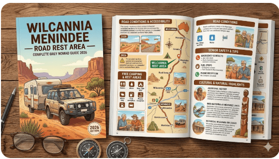
Wilcannia Menindee Road Rest Area
Complete Senior Grey Nomad Guide 2026 — GPS coordinates, road conditions, flooding risk, fuel stops, facilities, wildlife, and everything you need for a safe and comfortable overnight stop on one of outback New South Wales’s most travelled outback corridors.
📅 Last reviewed: January 2026 | Wilcannia–Menindee corridor, NSW 2832 / 2879 | Free overnight rest area — remote outback setting | Max stay 20 hours (NSW road rules)
📋 Table of Contents
- Why Grey Nomads Stop at the Wilcannia Menindee Road Rest Area
- Free Camping — Know the Limits for Seniors
- Quick Facts and Key Details 2026
- How to Get There + GPS Coordinates
- Road Conditions, Flooding and Unsealed Sections
- Heat and Remoteness — Senior Safety
- Wildlife — Birds, Reptiles and What to Watch For
- What Other Websites Don’t Tell You
- Best Time to Visit — Month-by-Month Breakdown
- Free and Low-Cost Camping Alternatives Nearby
- Dump Points Near the Rest Area
- Free Water Sources Along the Corridor
- Fuel Stops Along the Route
- Caravan Parks and Paid Alternatives
- Full Facilities Comparison Table
- Rates — All Options Near This Rest Area 2026
- Senior Safety Checklist — On and Off the Road
- What to Do Near the Rest Area — Senior Activity Guide
- Vanlife Savings Spots — GPS Coordinates and Postcodes
- Phone Signal and Emergency Communications
- Campfires, Cooking Restrictions and Food Near the Rest Area
- Pets at This Rest Area
- Accessibility for Seniors with Mobility Limitations
- Permits, Etiquette and Waste Management
- Emergency Scenarios — What to Do
- Packing List for This Section of Highway
- Rest Areas — The Full Wilcannia to Broken Hill Corridor List
- Reviews — What Grey Nomads Say
- Frequently Asked Questions
- Quick-Reference Card
- Disclaimer
1. Why Grey Nomads Stop at the Wilcannia Menindee Road Rest Area
The Wilcannia to Menindee Road Rest Area sits along one of the most iconic outback driving corridors in New South Wales — the sealed route that links the two historic river towns of Wilcannia (on the Darling River) and Menindee (on the Menindee Lakes system), before continuing east to Broken Hill. For grey nomads travelling west from Broken Hill or east from Wilcannia, this rest area is a perfectly positioned mid-point stop that removes fatigue risk on what is a genuinely long and lonely stretch of outback highway.
Drivers travelling the full Wilcannia to Broken Hill distance of approximately 195 kilometres have very limited options for a safe, legal, supervised pull-over. The rest area on this road fills that critical gap. It is a recognised NSW Government roadside rest area, which means it is legally designated for overnight stays of up to 20 hours under NSW road rules — a significant benefit over simply pulling off the road on a dirt track.
Beyond fatigue management, the rest area offers something that money cannot always buy in the outback: silence, stars, and the raw beauty of the NSW far-west plains. Red earth, mulga scrub, the occasional wedge-tailed eagle circling overhead, and near-zero light pollution make this a genuinely memorable overnight stop — not just a functional one.
This corridor is also part of the broader Wilcannia–Menindee–Broken Hill Route Guide, which covers the full journey from Wilcannia through to Broken Hill with every rest area, fuel stop, and overnight option documented for grey nomads.
2. Free Camping — Know the Limits for Seniors
In New South Wales, roadside rest areas designated by Transport for NSW allow travellers to stop for a maximum of 20 consecutive hours. This is a legal provision designed to prevent fatigue driving — not to create a long-term camping destination. Senior travellers need to understand this distinction clearly before planning to stay.
The rest area is free of charge with no booking required. It is a first-come, first-served stop. During peak touring season (April to September), it does fill up — particularly with road trains pulling in overnight and grey nomads heading west chasing warmer weather. Arriving before 3:00 PM is strongly recommended.
No camping permit is required to use this rest area. No fees are payable. Simply pull in, set up within the designated parking bays, and observe quiet hours after 10:00 PM as a matter of courtesy to other travellers.
3. Quick Facts and Key Details 2026
| Detail | Information |
|---|---|
| Location | Menindee Road (Silver City Highway / B79), between Wilcannia and Menindee, NSW |
| Postcode | 2832 (Wilcannia district) / 2879 (Menindee district) |
| Road Name | Menindee Road / Silver City Highway (B79 designation varies by section) |
| GPS Coordinates | Approx. -31.88, 142.87 (see GPS section below for full details) |
| Cost | Free — no booking required |
| Stay Limit | 20 hours maximum (NSW Road Rules) |
| Road Surface | Sealed bitumen — full route Wilcannia to Broken Hill |
| Toilets | Pit/long-drop toilets on site — condition varies seasonally |
| Shade | Limited natural shade (low mulga scrub) — no shade sails or shelters |
| Tables / BBQ | Picnic table(s) — no electric BBQ — bring your own cooking setup |
| Water | No potable water — carry your own supply (minimum 20L recommended) |
| Power | No mains power — solar and battery systems only |
| Mobile Signal | Very limited — Telstra marginally better — no reliable data connection |
| Fires | No open fires — use enclosed gas cookers only |
| Pets | Permitted on leash — clean up required |
| Big Rigs / Caravans | Yes — suitable for large rigs including road trains |
| Nearest Town | Menindee (~50–60km east) / Wilcannia (~40–50km west) |
| Nearest Fuel | Wilcannia (~40–50km west) or Menindee (~50–60km east) |
| Flood Risk | Low sections of road can flood after heavy rain — check conditions |
4. How to Get There + GPS Coordinates
📍 GPS Coordinates — Wilcannia Menindee Road Rest Area
-31.8800° S, 142.8700° E
Coordinate source: Publicly available data cross-referenced with NSW Transport rest area mapping and satellite imagery. Verify in your GPS device before departure.
Postcode reference zone: 2832–2879 (Wilcannia to Menindee corridor)
Driving Directions from Key Points
| Starting Point | Direction | Approximate Distance | Approximate Drive Time | Road |
|---|---|---|---|---|
| Wilcannia | East / North-East | ~45–50 km | ~30–35 min | Menindee Road (B79) |
| Menindee | West / South-West | ~50–60 km | ~35–40 min | Menindee Road (B79) |
| Broken Hill | West | ~155–165 km | ~1 hr 45 min | B79 via Menindee |
| Cobar | West via Wilcannia | ~330 km | ~3 hr 30 min | Barrier Hwy then B79 |
| Dubbo | West via Cobar | ~580 km | ~6 hrs | Mitchell Hwy / Barrier Hwy / B79 |
| Adelaide | East via Broken Hill | ~600 km | ~6 hrs | B79 / Silver City Hwy / A32 |
Road Train and Large Vehicle Access
The Menindee Road (B79) is a well-maintained sealed highway used heavily by B-double and road train freight vehicles travelling between Broken Hill and western NSW. The rest area itself has a wide pull-off bay designed to accommodate large vehicles. Caravans, motorhomes, fifth-wheelers and large campervans all navigate this road without issue under normal dry conditions.
5. Road Conditions, Flooding and Unsealed Sections
Is the Road Sealed?
Yes — the entire route from Wilcannia to Menindee and onward to Broken Hill is sealed bitumen. This is a significant and important fact for grey nomads, as many travellers assume outback NSW roads are unsealed. The B79 / Menindee Road is a gazetted state highway and is maintained by Transport for NSW. Two-wheel drive vehicles, standard caravans, and campervans can travel this route without any 4WD requirement under normal dry conditions.
How to Check Road Conditions Before You Drive
- 📡 Live Traffic NSW: livetraffic.com — official NSW Government road conditions, closures and incidents
- 🌧️ Bureau of Meteorology: bom.gov.au — rainfall data for the upper Darling catchment — rain upstream = flood risk downstream
- 📞 Ring Wilcannia locals: The servo in Wilcannia often knows if the road east is wet before official systems update
- 📱 Hema Explorer App: Outback-specific mapping with condition reports from other travellers
Unsealed Side Roads Off the Main Corridor
The main Menindee Road is sealed. However, if you are planning to visit Cawndilla Campground or any of the Kinchega National Park access tracks near Menindee, you will encounter unsealed gravel and dirt roads. These are generally suitable for 2WD vehicles in dry conditions but become impassable in wet weather. A 4WD is recommended if rain is forecast.
Gates on Station Tracks
If you venture onto any private station (farm) tracks near this corridor, observe outback gate rules:
- If a gate is open — drive through and leave it open
- If a gate is closed — open it, drive through, and close it behind you
- If a gate is locked — do not open it. A locked gate means no access, full stop
6. Heat and Remoteness — Senior Safety
The Wilcannia–Menindee corridor sits in one of Australia’s hottest and most remote regions. Average summer maximum temperatures in Wilcannia regularly reach 44–47°C in January and February. Overnight minimums rarely drop below 25°C in peak summer. This is not exaggeration — it is official Bureau of Meteorology data. For senior travellers, this presents real risks that must be planned for, not ignored.
Remoteness and Self-Sufficiency
The rest area sits approximately 45–60 kilometres from the nearest town in either direction. In the event of a medical emergency, breakdown, or accident, response times for emergency services from Broken Hill or Wilcannia can exceed 60–90 minutes or more. Self-sufficiency is not optional in this region — it is survival planning.
- Carry a minimum 20 litres of water per person beyond normal daily drinking supplies
- Carry a Personal Locator Beacon (PLB) — registered with AMSA. In an emergency without mobile signal, this is your lifeline
- Carry a basic first aid kit including electrolyte sachets, sunscreen SPF50+, and heat illness treatment protocols
- Carry enough food for at least 48 hours beyond your planned stay
- Carry emergency vehicle recovery gear: tow rope, tyre repair kit, jumper cables
- Leave your detailed travel plan — route, stops, expected times — with a responsible person who will contact police if you don’t check in
7. Wildlife — Birds, Reptiles and What to Watch For
The mulga scrubland and red earth plains of the Wilcannia–Menindee corridor support a surprisingly rich and varied wildlife community. For grey nomad birdwatchers and nature lovers, an overnight stop at this rest area — particularly at dawn and dusk — can be genuinely spectacular.
Birds Commonly Seen
- 🦅 Wedge-tailed Eagle — frequently seen soaring above the highway, sometimes feeding on road kill. Give them space — they are large birds and slow to take off from the road surface
- 🦜 Major Mitchell’s Cockatoo — stunning pink and white birds, often seen in pairs or small flocks feeding in mulga
- 🦜 Budgerigars — in good seasons, flocks of thousands can sweep across the plains in undulating waves — one of the outback’s great wildlife spectacles
- 🦜 Galahs — very common across the entire corridor
- 🦅 Brown Falcon and Nankeen Kestrel — frequently perched on power poles and fence posts
- 🐦 Diamond Dove and Zebra Dove — small ground-feeding doves common around the rest area
- 🦢 Brolgas and Pelicans — near the Menindee Lakes end of the corridor, particularly after good rains
Reptiles and Other Wildlife
- 🐍 Eastern Brown Snake — highly venomous and common in this region. Never walk in long grass or around the rest area at night without a torch. Shake out shoes and boots before putting them on. Keep a clean camp
- 🐍 King Brown Snake (Mulga Snake) — also present and highly venomous. Treat all large brown-coloured snakes as potentially deadly
- 🦎 Bearded Dragon — frequently seen basking on the road surface and fence posts
- 🦎 Blue-tongue Lizard — common around campsites and in mulga scrub
- 🦘 Red Kangaroo and Euro (Common Wallaroo) — most active at dawn and dusk. Road collision risk is highest in the hour before and after sunrise and sunset — drive with extreme caution
- 🐑 Feral Goats — large mobs are common in this region and wander onto roads without warning
- 🐫 Feral Camels — less common on this corridor than further north, but occasionally reported. A camel-vehicle collision at highway speed is catastrophic
8. What Other Websites Don’t Tell You
Most generic camping apps and road guide websites list the Wilcannia Menindee Road Rest Area with three words: “toilets, tables, free.” Here is what they consistently leave out:
- Toilet condition: The pit toilet at this rest area is maintained by Transport for NSW, but service frequency is low. In summer heat, conditions inside can be unpleasant. Carry your own toilet paper. A portable toilet setup in your van is a serious quality-of-life upgrade on this corridor.
- No shade in summer: The mulga scrub is low-growing. There are no tall trees, no shade sails, no shelters. In summer this is a serious issue. Even your caravan awning will not provide adequate relief in 45°C heat without additional airflow.
- Road train noise: This is a busy freight corridor. Road trains pass through the night — particularly westbound runs heading into South Australia. Light sleepers should bring earplugs or choose a campsite position as far from the highway edge as the bay allows.
- The road floods faster than you think: The Darling River system means water can arrive on sections of this road within hours of heavy upstream rainfall, even with clear skies above the rest area itself. Local knowledge says: if rain is reported anywhere in the upper Darling catchment to the north or east, treat any low dip in this road as a potential flood zone.
- Telstra is the only real option: Optus and Vodafone coverage is essentially non-existent between Wilcannia and Menindee. Even Telstra signal is weak and intermittent. If you rely on a non-Telstra SIM for emergencies, carry a PLB as your backup.
- Wind: The NSW far-west plains are notorious for strong north-westerly winds that pick up red dust and reduce visibility. Dust can be incredibly fine and penetrate seemingly sealed vehicles. Keep a microfibre cloth handy for cameras and lenses.
- This is serious snake country: Almost no listing mentions this. The Eastern Brown Snake is one of the world’s most venomous snakes and is common along this entire corridor. Your camp shoes should never be left on the ground outside at night.
9. Best Time to Visit — Month-by-Month Breakdown
| Month | Avg Max Temp | Conditions | Grey Nomad Rating |
|---|---|---|---|
| January | 42–46°C | Extreme heat, dust, flies, occasional storm | ❌ Avoid |
| February | 40–44°C | Extreme heat, humid storms possible | ❌ Avoid |
| March | 34–38°C | Hot, flies, easing late month | ⚠️ Caution |
| April | 26–30°C | Pleasant, light breeze, wildflowers possible | ✅ Good |
| May | 21–25°C | Excellent conditions, low flies, cool nights | ✅✅ Excellent |
| June | 16–20°C | Cool to cold nights (near 0°C), clear days, peak season | ✅✅ Excellent |
| July | 15–19°C | Cold nights, clear skies, peak grey nomad season | ✅✅ Peak Season |
| August | 18–22°C | Warming days, cold mornings, still busy | ✅✅ Excellent |
| September | 23–27°C | Warm, wildflowers, emus and kangaroos active | ✅✅ Excellent |
| October | 28–33°C | Warming up, flies increasing, still manageable | ✅ Good |
| November | 33–38°C | Hot, flies, dust storms possible | ⚠️ Caution |
| December | 38–44°C | Summer heat builds, not recommended | ❌ Avoid |
10. Free and Low-Cost Camping Alternatives Nearby
- East of Wilcannia Rest Area — Approximately 15–20km east of Wilcannia township. Free, basic facilities, sealed road access.
- Netallie Hill Rest Area — Further along the Menindee Road corridor. Free overnight stop with basic facilities.
- Dolo Hill Rest Area — Between Menindee and Broken Hill. Free, quiet, good stargazing.
- Cawndilla Campground — Inside the Menindee Lakes system. Longer stays permitted, basic facilities, stunning lake views. One of the best free camps in western NSW.
- Popiltah Lake Rest Area — Near Menindee. Lakeside setting with basic facilities and excellent bird watching.
- Broken Hill Rest Area — Town outskirts, free overnight, close to Broken Hill facilities.
- Broken Hill South Rest Area — South approach to Broken Hill. Good southbound stopping point.
- Kinchega National Park Campgrounds — Near Menindee. Requires NSW National Parks pass. More structured camping with some facilities. Contact NSW National Parks for current fees and conditions.
11. Dump Points Near the Rest Area
There is no dump point at the Wilcannia Menindee Road Rest Area itself. This is standard for roadside rest areas on this corridor. Grey water and black water must be managed using your onboard holding tanks until you reach a designated dump point.
| Location | Distance from Rest Area | Cost | Notes |
|---|---|---|---|
| Menindee Caravan Park | ~50–60km east | Small fee or free with stay | Best option heading east. Confirm availability on arrival. |
| Wilcannia (check locally) | ~45–50km west | Free (council facility) | Ask at the servo or Wilcannia Visitor Information for current location |
| Broken Hill — multiple sites | ~155–165km east | Free (council) | Multiple dump points available in Broken Hill — check campermate.com.au |
12. Free Water Sources Along the Corridor
| Water Source | Location | Type | Notes |
|---|---|---|---|
| Wilcannia Township | Wilcannia, NSW 2836 | Treated town water — tap at servo / caravan park | Fill up before heading east — last guaranteed water heading east |
| Menindee Township | Menindee, NSW 2879 | Treated town water | Available at caravan park and local facilities. See Menindee Showers & Facilities |
| Broken Hill | Broken Hill, NSW 2880 | Town water — multiple tap points | Full facilities available — multiple fill points in town |
| Rest Area | Wilcannia Menindee Road | ❌ NONE | Do not rely on finding water here |
For detailed information on shower and water facilities in Menindee, see our dedicated guide: Menindee Showers and Facilities Guide 2026.
13. Fuel Stops Along the Route
Fuel planning is absolutely critical on the Wilcannia–Menindee–Broken Hill corridor. The distances between fuel stops are significant, and fuel availability in small outback towns can change without notice (servo closed, fuel delivery delayed, or simply sold out).
| Town / Fuel Stop | Distance from Rest Area | Direction | Fuel Available | Notes |
|---|---|---|---|---|
| Wilcannia | ~45–50km | West | ULP, Diesel | One servo — may be closed Sunday afternoons. Check hours ahead. |
| Menindee | ~50–60km | East | ULP, Diesel | Limited hours — fill up regardless of tank level |
| Broken Hill | ~155–165km | East via Menindee | All fuel types including LPG | Multiple servos — most open extended hours. Cheapest fuel on this corridor. |
| Cobar | ~280km west of Broken Hill | West of Wilcannia | ULP, Diesel, LPG | Major service town — fuel is generally cheaper here than at smaller stops |
| Ivanhoe | ~170km north-east of Wilcannia | North via Hillston | ULP, Diesel | Very limited hours — phone ahead on (02) 6835 1015 |
14. Caravan Parks and Paid Alternatives
If the rest area is full, you need more than 20 hours, you want a shower, or the heat has simply beaten you, these paid options are the nearest alternatives:
Menindee Caravan Park (Approx. 50–60km East)
Menindee has a small caravan park that offers powered and unpowered sites, basic shower facilities, and a dump point. It is the closest full-service option east of the rest area. Check current availability and rates directly with the park — amenities and pricing can change seasonally in remote outback towns.
Wilcannia — Ask Locally
Wilcannia has limited formal accommodation infrastructure. Ask locally at the servo or pub for current options — informal arrangements with the local showground are sometimes possible during touring season.
Broken Hill — Full Range of Options
Broken Hill is the regional hub and offers a full range of accommodation from free council rest areas through to motel and hotel accommodation. For senior travellers needing a full rest with proper shower facilities, Broken Hill is the best destination on this corridor.
Free campsites and powered sites fill fast in peak season. Search remaining accommodation options for Broken Hill and the Menindee region below.
Accommodation search powered by Expedia. Booking through this link supports this website at no extra cost to you. As an affiliate, I earn from qualifying purchases.
15. Full Facilities Comparison Table
| Facility | Wilcannia Menindee Road Rest Area | Cawndilla Campground | Menindee Caravan Park | Broken Hill (Council Rest Area) |
|---|---|---|---|---|
| Cost | Free | Free | Paid | Free |
| Toilets | ✅ Pit toilet | ✅ Pit toilet | ✅ Flush | ✅ Flush |
| Showers | ❌ None | ❌ None | ✅ Yes | ❌ None (pay at Menindee) |
| Potable Water | ❌ None | ❌ None | ✅ Yes | ✅ Yes |
| Power | ❌ None | ❌ None | ✅ Powered sites | ❌ None |
| Dump Point | ❌ None | ❌ None | ✅ Yes | ✅ Yes (council) |
| Big Rig Access | ✅ Yes | ✅ Yes | ✅ Most rigs | ✅ Yes |
| Stay Limit | 20 hours | Check with NPWS | No limit (paid) | 20 hours |
| Tables / BBQ | ✅ Tables / ❌ No BBQ | ✅ Tables | ✅ Full facilities | ✅ Tables |
| Mobile Signal | ⚠️ Very weak Telstra | ⚠️ Very weak | ⚠️ Marginal Telstra | ✅ Good Telstra / Optus |
| WiFi | ❌ None | ❌ None | ⚠️ Check locally | ✅ Library WiFi |
16. Rates — All Options Near This Rest Area 2026
| Option | Unpowered | Powered | Notes |
|---|---|---|---|
| Wilcannia Menindee Road Rest Area | Free | N/A | 20hr limit. No booking. |
| East of Wilcannia Rest Area | Free | N/A | 20hr limit. Basic. |
| Cawndilla Campground | Free (check NPWS) | N/A | Within Menindee Lakes area. Confirm with NPWS. |
| Popiltah Lake Rest Area | Free | N/A | Lakeside. 20hr limit. |
| Menindee Caravan Park | ~$20–$30/night est. | ~$35–$45/night est. | Confirm directly — prices change seasonally |
| Kinchega NP Camping | ~$6–$12/person/night | N/A | NSW NP pass or daily fee applies. Book via NSW NPWS. |
| Broken Hill (multiple caravan parks) | ~$25–$35/night est. | ~$40–$55/night est. | Multiple options — book ahead in peak season |
All rates are estimates for 2026. Confirm directly with each operator before arrival. Outback caravan park pricing can change with little notice.
17. Senior Safety Checklist — On and Off the Road
📋 Before You Leave the Last Town — Essential Checks
Complete this checklist every time you leave a town heading into a remote section of this corridor.
- Fuel tank is full (do not leave with less than full)
- Water containers are topped up (minimum 20L per person on board)
- Food supply for minimum 48 hours beyond planned stay
- PLB is charged, registered with AMSA, and within reach
- Someone responsible knows your route and expected arrival time
- Road conditions checked via livetraffic.com before departure
- BOM weather check completed for next 48 hours in the region
- Offline maps downloaded and working on your device
- First aid kit is accessible and stocked (include electrolytes, snake bite bandages)
- Medications — sufficient supply plus minimum 3 days extra
- Vehicle tyre pressures checked — including caravan tyres
- Caravan hitch and safety chains inspected
- Refrigerator running and set to correct temperature
- Waste tanks have adequate capacity for planned overnight stop
- Snake bite bandages are packed and you know how to apply compression bandaging
- Shoes are never left outside on the ground overnight (snake prevention)
- Torch with fresh batteries accessible for night-time toilet visits
- Emergency contact numbers saved: NSW SES 132 500, Police 000, Broken Hill Base Hospital (08) 8080 1333
18. What to Do Near the Rest Area — Senior Activity Guide
Menindee Lakes and Kinchega National Park (~50–60km East)
The Menindee Lakes system is one of western NSW’s great natural wonders — a vast network of interconnected lakes on the Darling River system that, when full, supports enormous populations of waterbirds including pelicans, spoonbills, herons, cormorants, and ducks. Kinchega National Park, which surrounds part of the lakes, offers:
- Historic Kinchega Woolshed (free entry — a remarkable piece of outback pastoral history)
- Boat ramp access to Lake Wetherell and Lake Menindee
- Designated camping areas within the park (fees apply — NSW NP pass required)
- Self-drive heritage trail around the old Kinchega Station homestead ruins
- Excellent fishing — golden perch (yellowbelly), Murray cod, bream — subject to current fishing regulations and season closures
Wilcannia and the Historic Darling River (~45–50km West)
Wilcannia is an undervisited gem of outback NSW with genuine historical significance as a former inland river port. In the 1880s, Wilcannia was the third-busiest port in NSW — riverboats carried wool downstream to the Murray and on to Adelaide. Today the town retains its sandstone architecture and offers:
- Wilcannia Heritage Wharf — historic wharf where riverboats once docked
- Sandstone heritage buildings along Reid Street
- Darling River swimming and picnic area
- Local Aboriginal cultural experiences (check Visitor Information for current operators)
Stargazing
With virtually no light pollution on the Wilcannia–Menindee corridor, the night sky at this rest area is extraordinary. The Milky Way is visible to the naked eye on clear moonless nights. Bring a basic star chart or use the free SkyMap app (download offline) for identification. The dry winter air in June–August makes for particularly clear viewing.
Photography
The red earth plains, mulga scrub, dramatic skies, and incredible light quality of the NSW far west make this one of Australia’s premier photography corridors. Golden hour (first and last hour of sunlight) produces extraordinary colour. Wide-angle landscape and wildlife telephoto photography are both well rewarded here.
19. 🗺️ Vanlife Savings Spots — GPS Coordinates and Postcodes
Use the interactive Vanlife Savings Spots map below to find and save every free camp, rest area, and overnight stop along the Wilcannia–Menindee–Broken Hill corridor. Pin your location, get directions, and build your route before you lose mobile coverage.
📍 Interactive map — find free camps, rest areas and overnight stops along the Wilcannia–Menindee–Broken Hill corridor. Enable location for best results.
| Stop Name | Postcode | Approx. Latitude | Approx. Longitude | Notes | Nearby WiFi |
|---|---|---|---|---|---|
| East of Wilcannia Rest Area | 2836 | -31.5700 | 143.4900 | Free, basic pit toilet, sealed road | None |
| Wilcannia Menindee Road Rest Area | 2832 | -31.8800 | 142.8700 | This guide — free, 20hr limit | None |
| Netallie Hill Rest Area | 2879 | -32.0100 | 142.4500 | Free, basic facilities | None |
| Dolo Hill Rest Area | 2880 | -32.0900 | 142.0800 | Free, great stargazing | None |
| Popiltah Lake Rest Area | 2879 | -32.3800 | 142.3200 | Free, lakeside setting | None |
| Cawndilla Campground | 2879 | -32.4500 | 142.3800 | Free camp within Menindee Lakes | None |
| Broken Hill Rest Area | 2880 | -31.9500 | 141.4700 | Free, 20hr limit, town edge | Broken Hill Library |
| Broken Hill South Rest Area | 2880 | -31.9800 | 141.4600 | Free, southbound approach | Broken Hill Library |
| Thackaringa Hills Rest Area | 2880 | -32.1500 | 141.1800 | Free, west of Broken Hill | None |
| West Broken Hill Rest Area (Eastbound) | 2880 | -31.9400 | 141.3900 | Free, eastbound travellers | None |
20. Phone Signal and Emergency Communications
Mobile Coverage
Mobile coverage between Wilcannia and Menindee is extremely limited. Telstra provides the only realistic coverage on this corridor, and even Telstra signal is weak and intermittent for most of the route. Optus and Vodafone coverage is effectively zero between towns.
| Communication Method | Coverage at Rest Area | Recommendation |
|---|---|---|
| Telstra Mobile (voice) | ⚠️ Weak / intermittent | Primary carrier — best option but unreliable |
| Telstra Mobile (data) | ❌ Effectively none | Download everything offline before departure |
| Optus Mobile | ❌ None | Not suitable for emergency use on this corridor |
| Vodafone / Others | ❌ None | Not suitable for emergency use on this corridor |
| PLB (Personal Locator Beacon) | ✅ Satellite — works anywhere | Essential — register free with AMSA at beacons.amsa.gov.au |
| Garmin inReach / SPOT | ✅ Satellite — works anywhere | Allows two-way messaging — excellent for regular check-ins |
| CB Radio (UHF) | ✅ Local range only | Useful for communicating with road trains and other travellers |
| HF Radio | ✅ Long range | RFDS frequency — relevant for medical emergencies |
Public WiFi Near This Rest Area
There is no public WiFi at the rest area or anywhere between Wilcannia and Menindee. The nearest reliable public WiFi is at:
- Broken Hill Public Library — free WiFi for visitors. Ideal for route planning, downloading offline maps, and data uploads before heading west.
- Menindee Caravan Park — check with park on current WiFi availability (may have limited hotspot service)
- Wilcannia — extremely limited — do not rely on finding WiFi here
21. Campfires, Cooking Restrictions and Food Near the Rest Area
Campfires
Open campfires are NOT permitted at NSW roadside rest areas. This applies year-round — not just during Total Fire Ban periods. The rest area sits in a dry mulga and saltbush landscape where fire spreads rapidly. Use an enclosed gas cooker or alcohol stove for all cooking.
Cooking Setup Recommendations
- 2-burner LPG camp stove — primary cooking method
- 1kg LPG cylinders — carry minimum 2 spares
- Electric induction cooker with battery/inverter backup — excellent for minimising LPG use
- Pressure cooker — reduces cooking time and fuel use in remote settings
- 12V electric frypan — works well in vans with solar
Food Purchase Near the Rest Area
There is no food available at the rest area or anywhere on the road between Wilcannia and Menindee. Stock up before departure:
- Wilcannia — small general store / servo with limited supplies. Stock can be limited — do not rely on finding fresh produce. Basic tinned goods, bread, and snacks are usually available.
- Menindee — small store with basic provisions. Stock up here if heading west toward Wilcannia.
- Broken Hill — full supermarkets (Woolworths and Coles) plus fresh produce markets. Best place to provision for a week-long western NSW outback trip.
22. Pets at This Rest Area
Pets are permitted at the Wilcannia Menindee Road Rest Area, as it is a public road reserve rest area — not a national park or designated no-pet zone. However, senior pet owners need to be aware of the following:
- Keep dogs on leash at all times — this is a courtesy requirement and is important for the safety of other travellers’ pets and children
- Clean up all pet waste — carry biodegradable waste bags and use the rubbish bin if available, or take waste with you
- Snake risk is real: Small dogs are extremely vulnerable to snake bite in this region. Never allow your dog to explore under logs, in long grass, or around rock piles — especially at dawn and dusk when snakes are most active
- Heat risk for dogs: In summer, the ground surface temperature at this rest area can reach 70°C+ on dark soil. Dog paw burns from hot ground can happen within seconds. Walk dogs only in the early morning or after sunset in summer months
- Carry pet water separately — your dog’s water needs are additional to your own human water requirements. Factor this into your water carrying plan
- Know the nearest vet: The nearest veterinary services are in Broken Hill. There is no vet in Menindee or Wilcannia. In a snake bite emergency with a pet, you are looking at a minimum 1.5–2 hour drive to veterinary care
23. Accessibility for Seniors with Mobility Limitations
The Wilcannia Menindee Road Rest Area is a basic roadside facility. It has not been specifically designed for seniors with mobility limitations, but it is usable with some planning:
| Feature | Status | Notes for Seniors |
|---|---|---|
| Car Park Surface | Sealed / gravel | Generally firm and flat — suitable for walkers and rollators |
| Toilet Access | Pit toilet — basic structure | No grab rails — bring a portable grab rail or rail clamp if needed |
| Toilet Distance from Parking | Short walk — typically under 30m | Manageable for most seniors — uneven ground possible |
| Picnic Table Height | Standard height | May not suit wheelchairs — check on arrival |
| Wheelchair Access | ⚠️ Limited | No dedicated accessible facilities — self-contained van setup recommended |
| Ground Surface | Red earth / gravel | May be uneven — use non-slip footwear at all times |
| Lighting | ❌ No lighting | Essential to carry a torch for any night movement |
24. Permits, Etiquette and Waste Management
Permits
No permit is required to use the Wilcannia Menindee Road Rest Area. It is a free, open-access NSW Government roadside rest facility. No booking, no fee, no permit — just pull in and follow the rules.
Camping Etiquette
- Observe the 20-hour maximum stay limit — it exists for good reason and ensures space remains available for fatigued drivers
- Quiet hours after 10:00 PM — generators off, music off
- Leave the site exactly as you found it — take all rubbish with you if bins are full or absent
- Do not create new fire rings or attempt to burn rubbish
- Park within designated bays where possible — do not spread your setup across the full rest area if others need space
- Be considerate of road trains pulling in overnight — leave room for heavy vehicle parking
- Do not dump grey water or toilet waste on the ground at or near the rest area
Waste Management
Pack-in, pack-out principles apply at all remote rest areas. If you cannot find a rubbish bin, take your waste to the next town for disposal. Grey water should be contained in a grey water tank and disposed of at a designated dump point. Black water must be contained and taken to a dump point — never dumped on the ground or in a pit toilet. See our Dump Points section above for the nearest options.
25. Emergency Scenarios — What to Do
Medical Emergency
- Attempt to call 000 on your mobile — even with weak signal, 000 calls are prioritised and may connect
- If no mobile signal — activate your PLB immediately
- Stay with the casualty — keep them cool, hydrated (if conscious), and calm
- Flag down passing road trains or vehicles — all freight drivers on this corridor carry UHF CB radio and can relay emergency calls
- Nearest hospital: Broken Hill Base Hospital — (08) 8080 1333 — approximately 90–120 minutes east via Menindee
- Royal Flying Doctor Service (RFDS) Broken Hill base can be activated via 000 or PLB — response time varies but typically 30–60 minutes for aircraft
Vehicle Breakdown
- Pull safely off the road — use the rest area parking bay or as far from the travel lane as possible
- Activate hazard lights and place warning triangles behind the vehicle
- Contact your roadside assist provider (NRMA, RAA, RACQ) — advise your GPS location
- In extreme heat — stay inside your van with shade and water, not outside in the sun
- Wait for passing traffic if necessary — flag down a road train or other vehicle
- Do not attempt to walk to the nearest town in summer heat — this is a survival error
Road Flooding
- Never drive through floodwater on a rural road — you cannot assess the depth or whether the road surface beneath is intact
- Turn around and return to the last town
- If stranded at the rest area due to flooding on both sides — you are safe, you have water and food (if properly provisioned), stay put and await conditions to clear
- Activate PLB if you need rescue or have a medical situation and the road is blocked
- Check livetraffic.com for road closure updates — if you have any signal
26. Packing List for This Section of Highway
🎒 Essential Outback Packing List — Wilcannia to Broken Hill Corridor
This list is designed specifically for this remote, hot, and arid section of outback NSW. It supplements your normal van life kit.
Water and Heat Management
- Minimum 20L water per person in addition to onboard tank
- Water purification tablets or Lifestraw as emergency backup
- Electrolyte sachets — minimum 20 sachets
- SPF 50+ sunscreen — large tube
- Wide-brim hat and UV protective clothing
- Portable 12V fan for van ventilation
- Reflective window covers for all windows
Safety and Communication
- PLB — registered with AMSA, fully charged
- Satellite communicator (optional but highly recommended)
- UHF CB radio — channel 40 for highway communication
- Offline maps downloaded (Hema Explorer or Google Maps offline)
- Written emergency contact list (not just in your phone)
- First aid kit with snake bite bandages and compression bandaging
- Torch with spare batteries
- Emergency whistle
Vehicle and Camping
- 20L jerry can of fuel (minimum)
- Tyre repair kit and portable compressor
- Jumper cables or jump starter pack
- Tow rope
- Spare engine oil, coolant, and power steering fluid
- Gas cooker with minimum 2 spare 1kg cylinders
- 48–72 hours of emergency food supply
- Rubbish bags (pack-in, pack-out)
- Grey water containment tank with sufficient capacity
- Portable toilet (if no onboard black water system)
🔒 Protect Your Van in Remote Areas: Get 5% OFF all StarterStopper immobiliser products with promo code: RTV5
Visit StarterStopper.com — data-backed vehicle security solutions →
As an affiliate, I earn from qualifying purchases at no extra cost to you.
27. Rest Areas — The Full Wilcannia to Broken Hill Corridor List
For the complete corridor overview, see the Wilcannia–Menindee–Broken Hill Route Guide. Below is a quick-reference summary of every rest area stop on this corridor:
| Rest Area | Direction from Wilcannia | Approx Distance | Free | Toilets | Water |
|---|---|---|---|---|---|
| East of Wilcannia Rest Area | East | ~15–20km | ✅ | ✅ Pit | ❌ |
| Wilcannia Menindee Road Rest Area (this guide) | East | ~45–50km | ✅ | ✅ Pit | ❌ |
| Netallie Hill Rest Area | East | ~80–90km | ✅ | ✅ Pit | ❌ |
| Popiltah Lake Rest Area | East via Menindee | ~110km | ✅ | ✅ | ❌ |
| Dolo Hill Rest Area | East (Menindee–BH) | ~140km | ✅ | ✅ Pit | ❌ |
| Broken Hill Rest Area | East | ~195km | ✅ | ✅ | ✅ nearby |
| Broken Hill South Rest Area | East / South | ~200km | ✅ | ✅ | ✅ nearby |
| West Broken Hill Rest Area (Eastbound) | West of Broken Hill | ~180km | ✅ | ✅ | ❌ |
| Thackaringa Hills Rest Area | West of Broken Hill | ~215km | ✅ | ✅ Pit | ❌ |
28. Reviews — What Grey Nomads Say
“We stopped here on our way from Broken Hill to Cobar in June. Arrived at 2pm and had our pick of spots. Quiet by 9pm, a few road trains pulled in overnight but we slept well with earplugs. The toilet was basic but clean. Stars were absolutely unbelievable. Would happily stop here again.”
“Functional rest stop — nothing more. Pit toilet smelled in the heat (October visit — probably not ideal timing). No shade at all which was brutal. We only stopped for 2 hours to eat lunch and rest, not overnight. If you’re doing an overnight here I’d do it in May, June, July or August only.”
“We travel this road every year heading west. This rest area is exactly what it needs to be — wide enough for our 26ft van and tow vehicle to park properly, a working toilet, and the most spectacular night sky you’ll ever see. We always leave Broken Hill mid-morning, arrive here for lunch and a rest, then push through to Wilcannia before dark. Works perfectly.”
“Watched three wedge-tailed eagles circling right above the camp in the morning. Kangaroos came right up to the rest area at dusk. My husband and I are keen birdwatchers and this corridor is genuinely impressive if you’re patient and quiet. Bring binoculars.”
29. Frequently Asked Questions
Can I stay overnight at the Wilcannia Menindee Road Rest Area?
Yes. This is a designated NSW Government roadside rest area and overnight stays of up to 20 consecutive hours are legally permitted under NSW road rules. No booking or permit is required and there is no cost.
Is the road from Wilcannia to Menindee sealed?
Yes. The entire route from Wilcannia to Menindee and onward to Broken Hill is sealed bitumen. No 4WD is required under normal dry conditions. However, low sections can flood after rain — always check conditions before departure at livetraffic.com.
Is there water at the rest area?
No. There is no potable water supply at this rest area. Carry a minimum of 20 litres per person beyond your normal onboard supply. Fill up in Wilcannia or Menindee before entering the corridor.
What is the nearest fuel stop?
Wilcannia is approximately 45–50km to the west, and Menindee is approximately 50–60km to the east. Always fill your tank at the last town before attempting the Wilcannia–Menindee section. Both towns have limited hours — check ahead if possible.
Is there mobile phone coverage at the rest area?
Mobile coverage is extremely limited. Telstra provides weak and intermittent signal. Do not rely on mobile phones for emergency contact on this corridor. Carry a registered PLB or satellite communicator as your emergency backup.
Can I take my dog to this rest area?
Yes — dogs are permitted on leash. Be aware of snake risk (Eastern Brown Snakes are common in this region), ground heat in summer, and the distance to the nearest veterinary services (Broken Hill, ~155km). Never leave dogs unattended outside the vehicle.
Can big rigs and caravans use this rest area?
Yes. The rest area is designed to accommodate heavy vehicles including road trains. Large caravans, fifth-wheelers, motorhomes, and big rigs can all use this facility under normal conditions.
Does the road between Wilcannia and Menindee flood?
Yes — low sections of the road can flood during and after significant rainfall, including after upstream rain that occurs well away from the rest area. Always check road conditions before departure. Never drive through floodwater on a rural road regardless of apparent depth.
What is the best time of year to stop here?
May to September — particularly June, July, and August — offer the best conditions. Summer months (December to February) bring extreme heat that makes an overnight stop dangerous without proper preparation and cooling systems.
Are there any shops or services at the rest area?
None whatsoever. The rest area has a pit toilet and picnic table(s) only. No shop, no fuel, no water, no power, no WiFi. Self-sufficiency is mandatory.
30. Quick-Reference Card
📋 Wilcannia Menindee Road Rest Area — Quick Reference 2026
| GPS | -31.8800° S, 142.8700° E |
| Road | Menindee Road / B79 — fully sealed |
| Cost | Free — no booking required |
| Stay Limit | 20 hours maximum (NSW Law) |
| Toilets | Pit toilet on site — carry your own paper |
| Water | None — carry 20L per person minimum |
| Power | None — solar/battery only |
| Mobile Signal | Telstra weak / intermittent only |
| Nearest Fuel | Wilcannia ~45–50km W / Menindee ~50–60km E |
| Nearest Dump Point | Menindee Caravan Park ~50–60km E |
| Nearest Hospital | Broken Hill Base Hospital — (08) 8080 1333 |
| Emergency | 000 (if signal) / PLB (always carry) |
| Best Months | May–September |
| Campfires | Prohibited — gas cooker only |
| Pets | On leash — snake and heat risk apply |
| Big Rigs | Yes — road train accessible |
| Full Route Guide | Wilcannia–Menindee–Broken Hill Route Guide |
🗺️ Continue Planning Your Route — All Stops on This Corridor
Navigate every stop on the Wilcannia–Menindee–Broken Hill corridor with our full suite of individual rest area guides:
- East of Wilcannia Rest Area
- Netallie Hill Rest Area
- Dolo Hill Rest Area
- Popiltah Lake Rest Area
- Cawndilla Campground — Menindee Lakes
- Menindee Showers and Facilities Guide
- Broken Hill Rest Area
- Broken Hill South Rest Area
- Thackaringa Hills Rest Area
- West Broken Hill Rest Area (Eastbound)
- Full Wilcannia–Menindee–Broken Hill Route Guide
31. Disclaimer
© 2026 RetireToVanLife.com — All rights reserved. Written by a Senior Grey Nomad for Senior Grey Nomads. Safe travels. 🚐