Dolo Hill Rest Area
Complete Senior Grey Nomad Guide 2026 — GPS coordinates, road conditions, flood risk, fuel stops, facilities, wildlife, distances and everything you need to stop safely on one of outback NSW’s most remote highways.
📅 Last reviewed: January 2026 | Silver City Highway, NSW 2835 | Free overnight stop — remote outback setting — 20-hour NSW limit
📋 Table of Contents
- Why Grey Nomads Stop at Dolo Hill Rest Area
- Free Camping — Know the Limits for Seniors
- Quick Facts and Key Details 2026
- How to Get to Dolo Hill Rest Area + GPS
- Road Conditions, Flooding and Sealed vs Unsealed
- Heat and Remoteness — Senior Safety
- Wildlife — Birds, Reptiles and What to Watch For
- What Other Websites Don’t Tell You
- Best Time to Visit — Month-by-Month Breakdown
- Free and Low-Cost Camping Nearby
- Dump Points Near Dolo Hill
- Free Water Sources in the Region
- Fuel Stops Along the Silver City Highway
- Caravan Parks — Paid Alternatives
- Full Facilities Comparison Table
- Rates — All Options Near Dolo Hill 2026
- Senior Safety Checklist — On and Off the Road
- What to Do Near Dolo Hill — Senior Activity Guide
- Vanlife Savings Spots — GPS Coordinates and Postcodes
- Phone Signal and Emergency Communications
- Campfires, Cooking Restrictions and Food Nearby
- Pets at Dolo Hill Rest Area
- Accessibility for Seniors with Mobility Limitations
- Permits, Fees, Etiquette and Waste Management
- Emergency Scenarios — What to Do
- Packing List for This Section of the Silver City Highway
- 5 Rest Areas Near Dolo Hill
- Reviews — What Grey Nomads Say
- Frequently Asked Questions
- Quick-Reference Card
- Disclaimer
1. Why Grey Nomads Stop at Dolo Hill Rest Area
The Dolo Hill Rest Area sits on the Silver City Highway between Wilcannia and Menindee in far-western New South Wales — a remote but significant stretch of outback road that connects the Darling River towns with Broken Hill and beyond. For grey nomads travelling the classic Wilcannia → Menindee → Broken Hill corridor, Dolo Hill is a natural waypoint that breaks up a long, featureless drive through true Australian mulga country.
This isn’t a glamorous rest area with manicured lawns and powered sites. It’s honest outback NSW — a basic sealed pull-off with minimal facilities, surrounded by low scrub, red dirt, and the kind of silence that most people spend their whole working lives dreaming about. That’s exactly why grey nomads love it.
The elevated position of Dolo Hill gives you a subtle but appreciated rise in an otherwise flat landscape. Sunsets across the mulga are extraordinary. Nights are genuinely dark — you’ll see more stars here than most Australians see in a lifetime. And the daytime stillness, punctuated only by birdsong and the occasional road train, is restorative in a way that no caravan park in a town can replicate.
The rest area is also significant for its position on a named hill — a rarity in this part of the world where the land is almost uniformly flat. The slight elevation makes it easier to get a mobile signal (though it remains unreliable), and it allows you to scan the horizon in every direction. Whether you’re a grey nomad, a long-haul driver, a solo traveller, or a family on a cross-country drive, Dolo Hill is one of those stops that stays with you.
2. Free Camping — Know the Limits for Seniors
Rest areas on NSW state highways are not designated free campsites — they are driver fatigue stops funded by Transport for NSW. However, they are legally available for overnight stays under NSW road rules, subject to the 20-hour maximum stay limit. This is the rule most seniors misunderstand.
That said, a 20-hour window is generous for a good night’s sleep, a morning coffee, and a relaxed breakfast before getting back on the road. Most grey nomads arrive late afternoon, settle in for the night, and depart by mid-morning — well within the limit.
What Is and Isn’t Permitted
- ✅ Overnight stay (up to 20 hours)
- ✅ Sleeping in your vehicle, caravan, or camper
- ✅ Using the basic facilities if provided
- ✅ Parking multiple vehicles (space permitting)
- ❌ Open campfires (total fire bans apply frequently — see Section 21)
- ❌ Permanent or extended stays beyond 20 hours
- ❌ Dumping grey water or black water on the ground
- ❌ Leaving rubbish behind — pack it out
- ❌ Generators after 10pm in consideration of other users
3. Quick Facts and Key Details 2026
| Detail | Information |
|---|---|
| 📍 Name | Dolo Hill Rest Area |
| 🛣️ Highway | Silver City Highway (Barrier Highway connects at Wilcannia) |
| 📮 Nearest Postcode | NSW 2835 (Menindee area) |
| 🗺️ Approximate Location | Between Wilcannia and Menindee, approximately 90–100 km north of Wilcannia |
| 💲 Cost | Free |
| ⏱️ Maximum Stay | 20 hours (NSW Transport rule) |
| 🚛 Heavy Vehicles | Yes — suitable for road trains and large rigs |
| 🚿 Showers | None |
| 🚽 Toilets | Pit toilet or drop toilet (basic; verify on arrival) |
| 💧 Drinking Water | Not available — carry your own |
| 🔌 Power | No powered sites |
| 📶 Mobile Signal | Extremely limited — Telstra marginally better than Optus/Vodafone |
| 🌐 WiFi | None |
| 🔥 Campfires | Subject to Total Fire Ban conditions — check before arriving |
| 🐕 Pets | Permitted — keep on lead |
| 🏕️ Camping Type | Roadside rest area — self-contained recommended |
| 🌡️ Climate Zone | Semi-arid / arid outback — extreme summer heat |
| 🗑️ Dump Point | None on site — nearest at Menindee or Wilcannia |
📡 GPS Coordinates — Dolo Hill Rest Area
Approx. −32.15°S, 142.35°E
These are approximate publicly available coordinates based on the known location of Dolo Hill on the Silver City Highway between Wilcannia and Menindee. Always cross-reference with your GPS unit or navigation app before arrival.
📍 Open in Google Maps | 🍎 Open in Apple Maps
Coordinate source: Publicly available mapping data. Verify with your own GPS device on approach. The rest area is signed from the highway — watch for the blue rest area sign.
4. How to Get to Dolo Hill Rest Area + GPS
From Wilcannia (Travelling North)
Head north from Wilcannia on the Silver City Highway. Dolo Hill Rest Area is approximately 90–100 km north of Wilcannia. The road is sealed throughout and suitable for all vehicle types including large motorhomes, caravans, and road trains. The terrain is flat to gently undulating mulga scrub country. Travel time from Wilcannia is approximately 60–75 minutes depending on your rig.
From Menindee (Travelling South)
Head south from Menindee on the Silver City Highway. Dolo Hill Rest Area is approximately 95–105 km south of Menindee. Travel time is approximately 60–80 minutes from Menindee, again depending on your vehicle size and speed. The area is sign-posted — watch for the blue Transport for NSW rest area sign.
From Broken Hill (Travelling South-West then West)
From Broken Hill, head south-west on the Silver City Highway to Menindee (approximately 110 km), then continue south toward Dolo Hill (a further 95–105 km). Total distance from Broken Hill to Dolo Hill is approximately 200–215 km, and takes roughly 2–2.5 hours. This is a common route for grey nomads coming off the Broken Hill Rest Area network and heading toward Wilcannia and beyond.
From Cobar / Bourke (Travelling West)
From Cobar, head west on the Barrier Highway to Wilcannia (approximately 200 km), then north on the Silver City Highway to Dolo Hill (approximately 95 km). Total from Cobar is approximately 295 km. From Bourke, use the Mitchell Highway to Bourke–Louth–Wilcannia back road OR the longer sealed route via Cobar.
🗺️ Route Summary — Dolo Hill Rest Area
📍 From Wilcannia: ~95 km north on Silver City Highway — approx. 70 min
📍 From Menindee: ~100 km south on Silver City Highway — approx. 70 min
📍 From Broken Hill: ~210 km south-west via Menindee — approx. 2 hr 15 min
📍 From Cobar: ~295 km via Barrier Highway to Wilcannia then north — approx. 3 hr
🔗 Full route guide: Wilcannia–Menindee Road Rest Area Guide
Vehicle Types and Suitability
| Vehicle Type | Suitable? | Notes |
|---|---|---|
| Motorhome / Class A / B | ✅ Yes | Sealed highway all the way |
| Caravan + Tow Vehicle | ✅ Yes | Good clearance in rest area |
| Camper Trailer | ✅ Yes | Easy access |
| Road Train | ✅ Yes | Designed for heavy vehicles |
| 2WD Car / Hatchback | ✅ Yes | Sealed surface only |
| Motorcycle | ✅ Yes | Carry extra water — remote |
| Bicycle / E-Bike | ⚠️ Caution | Distances are very large — not recommended solo |
5. Road Conditions, Flooding and Sealed vs Unsealed
The Silver City Highway — Sealed
The Silver City Highway between Wilcannia and Menindee is sealed (bitumen) for its entire length. This is critical information for grey nomads planning the route — you do not need a 4WD for this section. Large motorhomes, caravans, and even B-doubles can travel this road in normal dry conditions.
Does the Road Flood?
Yes — the Silver City Highway can flood and has done so dramatically in recent years during major rain events, particularly during La Niña cycles (2021–2023 saw extensive flooding throughout far-western NSW). The Darling River system dominates this landscape and when it floods, floodwaters spread across the plains and can inundate roads for days or weeks.
Key flood risk points include:
- Low-lying sections near creek crossings — water runs across the road surface during and after heavy rain
- The approach to Menindee near the Menindee Lakes system — prone to inundation during flood events
- Sections near the Darling River floodplain south of Menindee
Live Road Conditions — Check Before You Leave
- 🔗 NSW Live Traffic — official real-time road condition updates
- 🔗 Bureau of Meteorology — Far Western NSW Forecasts
- 🔗 Transport for NSW — road closures and flood information
Road Surface Condition — Pothole and Wear Issues
While the highway is sealed, this is a remote outback road maintained by NSW Roads on a limited budget. Sections of the Silver City Highway can develop significant potholes, edge breaks, and surface degradation — particularly after wet seasons. Grey nomads should:
- Drive at or below the speed limit (100 km/h on most sections)
- Reduce speed at night to avoid kangaroos and wombats on the road
- Check tyre pressure before departing any major town
- Carry at least one spare tyre — two spares are recommended for remote travel
6. Heat and Remoteness — Senior Safety
The stretch of Silver City Highway between Wilcannia and Menindee passes through some of the most remote and climatically extreme country in New South Wales. For senior grey nomads, this demands specific planning that younger travellers often overlook.
Temperature Extremes
Summer temperatures in this region regularly exceed 45°C (113°F). Nights can drop below 10°C in winter. There is almost no shade at Dolo Hill beyond your own vehicle. The sun is intense, ultraviolet radiation is extreme at this latitude, and the dry desert air accelerates dehydration rapidly.
Water — The Single Most Important Item You Carry
There is no drinking water at Dolo Hill Rest Area. The nearest reliable water is at Wilcannia or Menindee — both approximately 95–100 km away. Grey nomads should carry a minimum of 20 litres of drinking water per person for this section, and more if travelling in summer or if your vehicle uses water for cooling.
Remoteness — What It Really Means
In urban Australia, “remote” means a 30-minute drive to a supermarket. Out here, remote means:
- No mobile coverage for emergency calls on most networks
- No other travellers may pass for extended periods at night
- Ambulance response times measured in hours, not minutes
- No roadside assistance companies operate in this area
- Nearest hospital: Broken Hill (approx. 210 km from Dolo Hill)
7. Wildlife — Birds, Reptiles and What to Watch For
Despite its bare appearance, the mulga scrub around Dolo Hill is alive with wildlife — much of it fascinating for senior nature lovers, and some of it requiring caution.
Birds
This section of outback NSW sits within the mulga birding zone — one of Australia’s most diverse arid-zone bird habitats. At Dolo Hill you may see:
- Budgerigars — huge flocks moving through in season, a breathtaking sight
- Major Mitchell’s Cockatoo — the iconic pink and white cockatoo of the outback interior
- Australian Ringneck (Mallee Ringneck subspecies) — common in mulga country
- Wedge-tailed Eagle — frequently seen soaring overhead or on road kills
- Brown Songlark, Rufous Songlark — singing from mulga branches in spring
- Crested Bellbird — listen for the distinctive ringing call at dawn
- Black-faced Woodswallow — congregates in groups on fence wires
- Cockatiels — flocks visiting any available water source
Reptiles
- Eastern Brown Snake — one of Australia’s most venomous. Present throughout this region. Never approach, always watch where you step, especially around the toilet area and scrub edge at night.
- Bearded Dragon — commonly seen basking on the road edge and in scrub
- Gidgee Skink — found in rocky and mulga areas
- Blue-tongued Lizard — often seen near rest areas
Mammals
- Red Kangaroo — Australia’s largest marsupial. Extremely active at dawn and dusk. A collision with a large red kangaroo at highway speed is lethal — drive slowly at night or don’t drive at night at all.
- Western Grey Kangaroo — also present
- Feral Goat — in large numbers on the road at night in this region
- Feral Pig — less common but present
- Echidna — occasionally seen crossing the road
8. What Other Websites Don’t Tell You
Most online sources list Dolo Hill Rest Area with two lines of text: “rest area, toilet, free.” Here’s what they consistently leave out:
The Toilet May Not Be Clean — Or Open
Remote rest area toilets on the Silver City Highway are maintained by Central Darling Shire Council under contract with Transport for NSW. Servicing frequency is not guaranteed — during flood events, maintenance crews cannot access the area. Senior travellers should always carry their own toilet supplies and never assume the facility will be usable. A portable camp toilet or composting unit in your rig removes this uncertainty entirely.
Road Trains Pass at Night — It’s Loud
The Silver City Highway carries significant heavy freight between Broken Hill and Wilcannia and south to Mildura. Road trains pass through the night. If you are a light sleeper or have a caravan that rocks when trucks pass, park as far from the highway edge as the rest area allows and use earplugs.
There Is No Phone Signal for Most Carriers
Telstra has the best (though still intermittent) coverage in this corridor. Optus and Vodafone coverage is unreliable to non-existent. Do not rely on your phone for emergency calls. A PLB or satellite communicator is essential — not optional.
The Flies Are Intense in Warm Months
Bush flies in outback NSW are relentless between September and April. They are drawn to eyes, nose, and mouth. A fly net over your hat is not a joke — it’s a sanity-preserving item. Many grey nomads leave a rest area prematurely because they underestimated the flies. Come prepared.
The Hill Gives You a View — and Wind
Dolo Hill’s slight elevation above the surrounding plains creates a wind channel. While this provides welcome cooling in summer and keeps some flies away, it can make caravan stabilisation more important than usual. Chock your wheels and use stabiliser legs if the wind picks up overnight.
9. Best Time to Visit — Month-by-Month Breakdown
| Month | Temp Range | Conditions | Grey Nomad Rating |
|---|---|---|---|
| January | 22–47°C | Extreme heat — dangerous for seniors | ❌ Avoid |
| February | 22–45°C | Hot, possible thunderstorms and flash flooding | ❌ Avoid |
| March | 18–40°C | Cooling but still very hot | ⚠️ Caution |
| April | 12–30°C | Excellent — comfortable days, cool nights | ✅ Ideal |
| May | 8–24°C | Best month — warm days, cold nights | ✅ Ideal |
| June | 4–18°C | Cold nights — bring adequate winter bedding | ✅ Good |
| July | 3–17°C | Cold but clear — stunning stargazing nights | ✅ Good |
| August | 5–20°C | Warming — excellent wildflower period after rain | ✅ Good |
| September | 10–27°C | Spring warming — bird activity peaks | ✅ Ideal |
| October | 14–34°C | Warming fast — still good for experienced travellers | ✅ Good |
| November | 18–40°C | Hot — start and finish drives in cooler hours | ⚠️ Caution |
| December | 20–45°C | Summer heat returns — dangerous for seniors | ❌ Avoid |
Peak grey nomad season: April through September. If you are travelling this corridor, aim to arrive at Dolo Hill in daylight and depart before midday the following day.
10. Free and Low-Cost Camping Nearby
If Dolo Hill is occupied, unsuitable, or you want a more comfortable alternative on the same route, these nearby free or low-cost options are the best choices:
| Location | Distance from Dolo Hill | Type | Cost |
|---|---|---|---|
| Netallie Hill Rest Area | ~30–40 km south | Roadside rest area | Free (20 hr) |
| Wilcannia–Menindee Road Rest Area | ~60–70 km south | Roadside rest area | Free (20 hr) |
| East of Wilcannia Rest Area | ~100 km south | Roadside rest area | Free (20 hr) |
| Menindee Town — Showground / Riverside | ~100 km north | Town camp | Low cost / donation |
| Cawndilla Campground | ~110 km north (near Menindee Lakes) | National Park campground | Nominal fee |
| Popiltah Lake Rest Area | ~130 km north | Roadside rest area | Free (20 hr) |
11. Dump Points Near Dolo Hill
There is no dump point at Dolo Hill Rest Area. This is standard for roadside rest areas in NSW. The nearest dump points are:
- Wilcannia — approximately 95 km south. Check with the local council or visitor information for the current dump point location.
- Menindee — approximately 100 km north. The Menindee Showers and Facilities page has current facility details.
- Broken Hill — approximately 110 km north-east of Menindee. Multiple dump points available in town. See Broken Hill Rest Area guide.
12. Free Water Sources in the Region
Reliable free or low-cost water sources along this corridor:
| Location | Type | Distance from Dolo Hill | Notes |
|---|---|---|---|
| Wilcannia — town tap points | Town water (reticulated) | ~95 km south | Check with council for current filling points |
| Menindee — town facilities | Town water | ~100 km north | Available at caravan park and showground |
| Broken Hill — multiple points | Town water + servo water | ~210 km north-east | Most reliable water source in region |
Senior Rule of Thumb: Carry a minimum of 40 litres of drinking water when departing any town on this corridor. Fill to capacity at every opportunity — do not assume the next town’s water point will be accessible.
13. Fuel Stops Along the Silver City Highway
Fuel planning is not optional on this route — it is a survival consideration. The distances between serviced fuel stops on the Silver City Highway corridor are significant, and running out of fuel in 45°C heat with no phone signal is a genuine emergency.
| Town / Fuel Stop | Direction from Dolo Hill | Approx. Distance | Fuel Types | Notes |
|---|---|---|---|---|
| Wilcannia | South | ~95 km | ULP, Diesel | Limited hours — fill up before 5pm |
| Menindee | North | ~100 km | ULP, Diesel | Small town — one servo; verify hours |
| Broken Hill | North-East (via Menindee) | ~210 km | All types inc. LPG | Most reliable fuel and pricing in region |
| Cobar | South-East (via Wilcannia) | ~295 km | All types | Good fuel and supplies stop eastbound |
| Ivanhoe | South (via Wilcannia, Barrier Hwy) | ~280 km | ULP, Diesel | Small — verify hours |
Diesel vs Petrol — Senior Traveller Planning
Most modern motorhomes and tow vehicles in Australia run on diesel. Both Wilcannia and Menindee stock diesel, but availability can be interrupted during floods or delivery delays. If you are diesel-dependent, carry a minimum 20-litre diesel jerry can as a reserve on this corridor.
14. Caravan Parks — Paid Alternatives
If the rest area is unsuitable, you need powered sites, showers, or you simply want a proper night’s rest, these are the nearest paid options:
Menindee (North — approx. 100 km)
🏕️ Menindee Caravan Park / Menindee Lakes Tourist Park
Type: Caravan park with powered sites, ablutions, dump point
Location: Menindee, NSW 2879
Why go: Access to the stunning Menindee Lakes system — one of the great inland water spectacles of NSW. Showers, flush toilets, and a proper meal at the pub make this a genuine reward after a long outback drive.
Contact: Verify current rates and availability directly — prices change seasonally. Expect $25–$45 per night for a powered site in 2026.
Wilcannia (South — approx. 95 km)
🏕️ Wilcannia Caravan Park
Type: Basic caravan park — verify current operational status before arrival
Location: Wilcannia, NSW 2836
Why go: Access to the Darling River, the historic Royal Hotel, and the sandstone buildings of heritage Wilcannia. The town has a complex and fascinating history — worth an afternoon if you have time.
Note: Wilcannia’s tourism facilities have historically been variable. Always call ahead and confirm current availability.
When van life or the rest area doesn’t meet your needs, find motel, hotel, or cabin options in the nearest towns below.
Accommodation search powered by Expedia. Booking through this link supports this website at no extra cost to you.
15. Full Facilities Comparison Table
| Facility | Dolo Hill Rest Area | Netallie Hill Rest Area | Menindee Caravan Park | Broken Hill (Town) |
|---|---|---|---|---|
| Cost | Free | Free | $25–$45/night | $20–$50/night |
| Toilets | Pit toilet (basic) | Pit toilet (basic) | Flush toilets | Flush toilets |
| Showers | ❌ None | ❌ None | ✅ Yes | ✅ Yes |
| Drinking Water | ❌ None | ❌ None | ✅ Yes | ✅ Yes |
| Power | ❌ None | ❌ None | ✅ Powered sites | ✅ Powered sites |
| Dump Point | ❌ None | ❌ None | ✅ Yes | ✅ Yes |
| WiFi | ❌ None | ❌ None | ⚠️ Limited | ✅ Available |
| Mobile Signal | ⚠️ Very poor | ⚠️ Very poor | ⚠️ Moderate | ✅ Good (Telstra) |
| Heavy Vehicle OK | ✅ Yes | ✅ Yes | ✅ Yes | ✅ Yes |
| Maximum Stay | 20 hours | 20 hours | Unlimited | Unlimited |
| Pets | ✅ On lead | ✅ On lead | Check policy | Check policy |
| Nearest Fuel | 95–100 km | 60–70 km | In town | In town |
16. Rates — All Options Near Dolo Hill 2026
| Option | Nightly Rate (2026) | What’s Included |
|---|---|---|
| Dolo Hill Rest Area | Free | Parking space, pit toilet (when operational), 20-hr limit |
| Netallie Hill Rest Area | Free | Basic rest stop, 20-hr limit |
| East of Wilcannia Rest Area | Free | Basic rest stop, 20-hr limit |
| Menindee Caravan Park (unpowered) | ~$20–$28 | Toilets, basic facilities |
| Menindee Caravan Park (powered) | ~$30–$45 | Power, toilets, showers |
| Wilcannia Caravan Park | ~$20–$35 | Verify current status — call ahead |
| Cawndilla Campground (NP) | ~$6–$10 pp | Basic bush camping at Menindee Lakes |
| Broken Hill Caravan Parks | $30–$55 | Full facilities, powered, WiFi, pool |
All rates are approximate 2026 estimates. Prices change — always confirm directly with the operator or via CamperMate before arrival.
17. Senior Safety Checklist — On and Off the Road
Before You Leave Town
- Fuel tank filled to maximum (both main tank and jerry can)
- Fresh water tanks filled to capacity
- Dump point used — grey and black tanks emptied
- Fridge/freezer stocked with minimum 3 days food supply
- Medications checked — minimum 7-day supply accessible, not packed deep
- Road conditions checked — livetraffic.com
- Weather checked — bom.gov.au
- Someone informed of your route and expected arrival time
- PLB / satellite communicator charged and registered
- Spare tyres checked — pressure and condition
- All hatches, windows, and doors secured
- Jockey wheel wound up / tow hitch properly coupled
- Vehicle tyres checked — pressure correct for load
- Sunscreen and fly net packed and accessible
- First aid kit checked — located in accessible position
On Arrival at Dolo Hill Rest Area
- Park level — use spirit level and levelling blocks
- Stabiliser legs deployed
- Shade awning deployed if hot
- Check surrounds for snakes before walking in scrub
- Note which direction Wilcannia and Menindee are located
- Check PLB battery and registration
- Note arrival time — 20-hour limit applies from this moment
- Record estimated departure time
18. What to Do Near Dolo Hill — Senior Activity Guide
Dolo Hill itself is a rest area — not an attraction. But within reach of this stop are some of the most remarkable natural and cultural experiences in inland Australia:
Menindee Lakes System (approx. 100 km north)
The Menindee Lakes are a network of natural lakes fed by the Darling River and managed as a water storage system for western NSW. When full, they are extraordinary — vast sheets of water teeming with waterbirds including pelicans, herons, egrets, spoonbills, and thousands of ducks. The sunsets over Menindee Lake are world-class. Grey nomads consistently rate this as one of the top 10 natural experiences of an inland Australia trip.
Kinchega National Park (accessed from Menindee)
Adjacent to the Menindee Lakes, Kinchega National Park protects a large section of the Darling River floodplain and the lake system. It has a rich Aboriginal and pastoral history, with the historic Kinchega Woolshed still standing. Day walks, wildlife viewing, and self-guided drives are available. Entry fees apply — check NSW National Parks for current rates.
Wilcannia — Heritage and History (approx. 95 km south)
Wilcannia is one of the most historically significant towns in outback NSW. Once known as the “Queen City of the West,” it was a major Darling River port in the 1800s. The sandstone buildings along Reid Street are genuinely beautiful. The Royal Hotel and the local Aboriginal cultural heritage are worth an afternoon of exploration.
Broken Hill — Regional Hub (approx. 210 km north-east via Menindee)
For grey nomads seeking a town stop with galleries, restaurants, museums, and full services, Broken Hill is excellent. The Pro Hart Gallery, the Broken Hill Regional Art Gallery, the Line of Lode Miners Memorial, and the Silverton ghost town and Mundi Mundi Plains lookout are all senior-friendly and genuinely world-class.
Plan Your Route with StarterStopper Vehicle Security
Remote travel in outback NSW means your vehicle security matters more, not less. A stolen vehicle or immobilised car 200 km from the nearest town is a genuine crisis. StarterStopper provides data-backed immobiliser solutions for grey nomads travelling Australia’s most remote highways.
Exclusive Offer: Get 5% OFF all StarterStopper immobiliser products with promo code: RTV5
As an affiliate, I earn from qualifying purchases at no extra cost to you.
19. 🗺️ Vanlife Savings Spots — GPS Coordinates and Postcodes
Save every stop along this Silver City Highway corridor using the Vanlife Savings Spots interactive map. Pin Dolo Hill, Netallie Hill, the Wilcannia rest areas, Menindee Lakes, and every fuel stop so you always know exactly where you are and what’s ahead.
COPY PROMPT ➔ ASK AI ➔ SAVE TO FORM ➔ ADD SPOT PIN ➔ GET DIRECTIONS
📍 Interactive map — find free camps, rest areas and overnight stops along the Silver City Highway. Enable location for best results.
Key GPS Coordinates for This Corridor
| Location | Approx. Coordinates | Postcode | Public WiFi Nearby |
|---|---|---|---|
| Dolo Hill Rest Area | −32.15°S, 142.35°E (approx) | 2835 | None |
| Netallie Hill Rest Area | ~−32.45°S, 142.25°E (approx) | 2836 | None |
| Wilcannia Town Centre | −31.5612°S, 143.3759°E | 2836 | Library (limited hours) |
| Menindee Township | −32.3956°S, 142.4161°E | 2879 | Limited — check locally |
| Menindee Lake | −32.4042°S, 142.4298°E | 2879 | None |
| Broken Hill CBD | −31.9538°S, 141.4677°E | 2880 | Library, McDonalds, CBD free WiFi zones |
| Cawndilla Campground | ~−32.45°S, 142.35°E (approx) | 2879 | None |
Approximate coordinates based on publicly available mapping data. Cross-reference with your GPS device on approach. Wilcannia and Broken Hill coordinates sourced from Google Maps public data.
20. Phone Signal and Emergency Communications
Mobile Coverage at Dolo Hill
Mobile phone coverage at Dolo Hill Rest Area is extremely limited and unreliable. Do not plan your emergency communications around your mobile phone on this corridor.
| Carrier | Signal at Dolo Hill | Notes |
|---|---|---|
| Telstra | ⚠️ Intermittent / 1 bar | Best of a bad situation — marginally better than others |
| Optus | ❌ Minimal to none | Do not rely on Optus for communications here |
| Vodafone / TPG | ❌ None | No coverage in this corridor |
Emergency Communication Options
- Personal Locator Beacon (PLB) — registered with AMSA. Activates a 406 MHz distress signal received by the COSPASSARSAT satellite network and relayed to Rescue Coordination Centre Australia (RCCAUS). No subscription fee. Buy from BCF, Anaconda, or Jaycar. Register at beacons.amsa.gov.au
- Garmin inReach Mini / SE+ — two-way satellite messaging, SOS function, tracking. Requires monthly subscription. Ideal for frequent remote travellers.
- EPIRB — maritime use but also works on land. Larger and less convenient than a PLB for road travel.
- Sat Phone — full voice communication anywhere. Expensive but valuable for extended remote travel.
Royal Flying Doctor Service
The RFDS Broken Hill base covers this region. They are genuinely heroic — but they need to be called. Without a PLB or satellite communicator, they cannot find you. Register your PLB, carry it on your person (not in the van), and know how to activate it.
21. Campfires, Cooking Restrictions and Food Nearby
Campfires at Dolo Hill Rest Area
Open campfires are subject to Total Fire Ban (TFB) conditions which are frequently declared throughout far-western NSW during the warmer months (October–March). Even when no TFB is in place, the rest area’s roadside verge position and the dry scrub environment make open fires inappropriate and potentially dangerous.
Cooking Options at Dolo Hill
- ✅ Gas stove / camp stove — permitted in most conditions (check TFB specifics for portable gas)
- ✅ LPG BBQ with enclosed flame — generally permitted even on TFB days (verify current legislation)
- ✅ 12V electric cooking — no fire risk; ideal for remote camping
- ✅ Induction cooktop (if generator or solar powered)
- ❌ Open wood fire — do not light at this rest area
- ❌ Solid fuel brazier or fire pit — not appropriate at roadside rest areas
Food and Supplies Nearby
There are no shops, cafes, or food services at or near Dolo Hill. Nearest food options:
- Wilcannia (95 km south): Limited grocery supplies at the local store; the Royal Hotel serves meals (verify hours — limited and sometimes erratic)
- Menindee (100 km north): Small store with basic supplies; the Burke and Wills Hotel serves meals
- Broken Hill (210 km north-east): Full supermarkets (Woolworths, IGA), multiple restaurants, cafes, bakeries, and takeaway options
22. Pets at Dolo Hill Rest Area
Pets are permitted at Dolo Hill Rest Area as it is a roadside transport rest stop, not a national park or restricted area. However, responsible pet management in this environment is critical:
- 🐕 Keep dogs on a lead at all times — native wildlife is present and a dog chasing wildlife in remote scrub is a serious situation
- 🐍 Snake risk is very real — keep your dog close and out of the scrub edges, especially at dawn and dusk
- 🦅 Wedge-tailed Eagles can take small dogs and cats — do not leave small pets unattended outside
- ☀️ Heat is dangerous for pets — never leave an animal in an enclosed vehicle in summer. Even in mild temperatures, vehicles heat to lethal temperatures quickly
- 💧 Extra water for pets — dogs dehydrate faster than humans in outback heat; carry a minimum of 5 extra litres per dog per day
- 🗑️ Pack up all pet waste — never leave it at a rest area
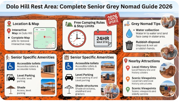
23. Accessibility for Seniors with Mobility Limitations
Dolo Hill Rest Area is a basic roadside stop — it was designed primarily for driver fatigue management, not as a disability-accessible tourism facility. That said, the sealed pull-off surface and flat parking area make it reasonably accessible for most mobility limitations.
| Accessibility Feature | Status at Dolo Hill | Notes |
|---|---|---|
| Sealed parking surface | ✅ Yes | Good for wheelchairs and walkers to reach vehicle |
| Level parking area | ⚠️ Mostly flat | May need levelling blocks on slight grade |
| Accessible toilet | ❌ Not available | Pit toilet only — not wheelchair accessible |
| Steps or kerbs | ✅ Generally none | Flat pull-off from highway |
| ACROD permit relevance | ⚠️ N/A | No designated disabled bays — first in, best positioned |
| Distance to toilet | ⚠️ Short walk | Surface varies — may be compacted dirt |
| Emergency services access | ✅ Accessible by road | Sealed highway access for ambulance |
Recommendations for Senior Travellers with Mobility Issues
- Carry your own portable toilet if you have mobility or continence requirements — do not rely on the pit toilet
- Use a caravan or motorhome with internal bathroom for maximum comfort and independence
- If using a walking frame or wheelchair, Menindee and Broken Hill have far better accessibility than this rest area
- Carry a fold-out ramp if your vehicle step height is a concern
- A shower chair and internal shower in your rig is the only shower option until you reach a town
24. Permits, Fees, Etiquette and Waste Management
Do You Need a Permit?
No permit is required to stop at Dolo Hill Rest Area. It is a free public facility maintained by Transport for NSW and managed by Central Darling Shire Council. There are no booking systems, no entry gates, and no check-in process. First come, first served.
Grey Nomad Etiquette — The Unwritten Rules
- Do not occupy more space than you need — allow room for other travellers
- Keep noise to a minimum after 9pm — people are sleeping
- Generators: acceptable during daylight hours; consider other users and switch off by 9pm
- Do not leave fire rings, tent pegs, or any modifications to the site
- Leave the area cleaner than you found it — if you see rubbish others left, pick it up
- Do not approach or interact aggressively with other travellers — in remote settings, goodwill between travellers is a genuine safety net
- Wave to truck drivers — they’re doing a hard job and they can help in an emergency
Waste Management
This is not negotiable in remote outback NSW:
- ❌ No grey water dumping on the ground — this contaminates the environment and attracts pests
- ❌ No black water dumping on the ground — illegal and dangerous
- ❌ No rubbish left at the rest area — this area has no regular bin collection; pack your rubbish out to the nearest town bin
- ✅ Use your grey water tank and dump it at a proper dump point in Menindee or Wilcannia
- ✅ Carry a lidded rubbish bin in your rig — bears and foxes will tear open unsecured bags overnight
25. Emergency Scenarios — What to Do
Medical Emergency
- Activate PLB immediately — do not waste time trying to get a phone signal
- Note your GPS coordinates from your device and write them down
- Make the patient comfortable in the shade — use your vehicle’s air conditioning if heat-related
- Place a flag, bright tarp, or strobe light visible from the air and road
- Wait — RFDS from Broken Hill will respond. They will land on the highway if necessary
- For heart attack or stroke: activate PLB, administer aspirin if available and not contraindicated, keep patient calm
Vehicle Breakdown
- Get completely off the highway surface — do not park on the road
- Place emergency triangles behind your vehicle at 50m and 100m on the road
- Try Telstra signal — if no coverage, use PLB for life-threatening situations only
- Flag down passing vehicles — road trains carry radios and can relay your position
- Do not walk toward Wilcannia or Menindee — 95+ km in outback heat will kill you
- Stay with your vehicle — it is visible from the air; you are not
- NRMA and most roadside assist companies do not operate in this area — you are self-reliant
Flash Flooding — Road Becomes Impassable
- Do NOT attempt to drive through floodwater
- Return to the last town you came from if water is rising
- If stranded at the rest area, move your vehicle to the highest available point
- Monitor water level — if rising, activate PLB
- Contact NSW Live Traffic via satellite communicator for road status
26. Packing List for This Section of the Silver City Highway
This list is specifically tailored to the Wilcannia → Dolo Hill → Menindee → Broken Hill corridor. It goes beyond the standard caravan checklist to address the specific challenges of this remote outback route.
Water and Hydration
- Main water tank — full (minimum 80–120 L for two people)
- Additional portable water containers — minimum 20 L
- Water purification tablets or filter (Sawyer, LifeStraw) — backup only
- Electrolyte tablets or hydration sachets
Fuel and Vehicle
- Main fuel tank — full
- Jerry cans — minimum 20 L diesel or petrol reserve
- Two spare tyres (not just one)
- Tyre inflation kit / compressor
- Basic toolkit — jump leads, tow rope, shovel
- Engine oil and coolant — 2 L each minimum
Communication and Emergency
- PLB — registered with AMSA, battery tested
- Satellite communicator (optional but strongly recommended)
- Paper map of the Silver City Highway corridor
- Written list of emergency contacts and GPS coordinates
- RFDS contact information written down
Health and Senior-Specific Items
- All regular medications — minimum 2-week supply
- Comprehensive first aid kit including pressure bandages
- Sunscreen SPF 50+ (large supply)
- Wide-brim hat and fly net
- Insect repellent — DEET-based for outback flies and mosquitoes
- Anti-histamine and hydrocortisone cream
- Aspirin (if not contraindicated — for cardiac events)
- Snake bite kit with pressure bandages
- Reading glasses and sunglasses (spares)
Food and Cooking
- Minimum 3 days of self-sufficient food supply
- Gas cooktop and minimum 2 full gas cylinders
- Insulated cooler or 12V fridge (fridge preferred)
- Long-life milk, tinned goods, dried goods
- Coffee / tea — essential for morale at remote stops
27. Rest Areas Near Dolo Hill — Silver City Highway Corridor
The following five rest areas are the key stops on the Silver City Highway and Barrier Highway corridor closest to Dolo Hill. Each has its own page on this website with full details:
| # | Rest Area | Direction from Dolo Hill | Approx. Distance | Guide Link |
|---|---|---|---|---|
| 1 | Netallie Hill Rest Area | South | ~35 km | Full Guide → |
| 2 | Wilcannia–Menindee Road Rest Area | South | ~65 km | Full Guide → |
| 3 | East of Wilcannia Rest Area | South (then east) | ~105 km | Full Guide → |
| 4 | Popiltah Lake Rest Area | North | ~130 km | Full Guide → |
| 5 | Broken Hill Rest Area | North-East (via Menindee) | ~210 km | Full Guide → |
🛣️ Full Corridor Route Guides
📍 Wilcannia → Menindee Road Rest Area Guide
📍 Broken Hill South Rest Area Guide
📍 Thackaringa Hills Rest Area Guide
📍 West Broken Hill Rest Area (Eastbound) Guide
28. Reviews — What Grey Nomads Say About Dolo Hill Rest Area
“We stopped here on our way from Wilcannia to Menindee in May. The silence was incredible — we hadn’t heard nothing like it since leaving Adelaide. The toilet was passable. Flies were present but not as bad as we expected. Stunning sunset. Would stop again. Carry water — there’s none here.”
“Functional. Does what it says on the tin — a place to pull over and rest. Toilet was there but I wouldn’t call it clean. No water, no power, no mobile signal. We had our PLB and that’s the only reason I felt safe stopping here. The stars at night were absolutely unbelievable though.”
“This is what grey nomad travel is about. We parked up at 5pm, had a cold beer watching the mulga turn gold, heard a crested bellbird for the first time in years, and woke up to a sea of stars at 2am. No phone, no news, no noise. Just Australia. Brilliant.”
“Good stop but be warned — a road train went past at 3am going flat out and rocked the van something fierce. Earplugs next time. Fuel up in Wilcannia before you come north. We were lower than expected after the long drive and it gave us a scare.”
29. Frequently Asked Questions
Is Dolo Hill Rest Area free to stay at overnight?
Yes. Dolo Hill Rest Area is a free roadside rest stop maintained by Transport for NSW. There is no fee for stopping or sleeping overnight. The maximum stay is 20 consecutive hours under NSW Transport rules.
Is there drinking water at Dolo Hill Rest Area?
No. There is no drinking water available at Dolo Hill. Carry all the water you need from Wilcannia (95 km south) or Menindee (100 km north). For two people, carry a minimum of 40 litres when travelling this corridor.
Is the Silver City Highway sealed between Wilcannia and Menindee?
Yes. The Silver City Highway is sealed (bitumen) for its entire length between Wilcannia and Menindee. You do not need a 4WD to reach Dolo Hill Rest Area. All vehicle types including large motorhomes and caravans can travel this road in dry conditions.
Does the road flood near Dolo Hill?
Yes, it can. The Silver City Highway in this region is subject to flooding during significant rain events and when the Darling River system is in flood. Always check live road conditions at livetraffic.com before departure. Never drive through floodwater.
Is there mobile phone coverage at Dolo Hill?
Coverage is extremely limited. Telstra offers the best chance of a marginal signal, but this is not reliable. Optus and Vodafone have little to no coverage. Carry a PLB or satellite communicator as your primary emergency communication device.
Can I light a campfire at Dolo Hill Rest Area?
Open campfires are subject to Total Fire Ban conditions which are frequently in force in far-western NSW between October and March. Even when no ban is in place, open fires at roadside rest areas are not appropriate. Use a gas stove or LPG BBQ for cooking.
How far is the next fuel stop from Dolo Hill?
Wilcannia is approximately 95 km south; Menindee is approximately 100 km north. Both are small towns with limited fuel services — always fill up in the town before heading into this corridor. Carry a 20-litre jerry can reserve minimum.
Are there toilets at Dolo Hill Rest Area?
A basic pit toilet or drop toilet is present, but cleanliness and operational status is not guaranteed. Carry your own portable toilet supplies. Never assume a remote rest area toilet will be in usable condition.
Can I bring my dog to Dolo Hill Rest Area?
Yes. Pets are permitted at this roadside rest area. Keep your dog on a lead at all times due to snake risk, eagle activity, and the proximity to the highway. Carry extra water for your pet and never leave them in an enclosed vehicle in warm weather.
What is the best time of year to visit Dolo Hill?
April through September is the best period for grey nomads. May and September are the ideal months — comfortable daytime temperatures, cold but manageable nights, excellent birdlife, and minimal fly activity compared to summer. Avoid January–February when temperatures regularly exceed 45°C.
30. Quick-Reference Card — Dolo Hill Rest Area
📋 Dolo Hill Rest Area — Quick Reference 2026
| Location | Silver City Highway, between Wilcannia and Menindee, NSW |
| GPS (approx.) | −32.15°S, 142.35°E — verify with your GPS device |
| Postcode Area | NSW 2835 |
| Cost | Free — 20-hour maximum stay (NSW rule) |
| Toilets | Basic pit toilet — not guaranteed clean or operational |
| Water | None — carry minimum 40L for 2 people |
| Power | None — solar/battery required |
| Dump Point | None — Wilcannia (95 km) or Menindee (100 km) |
| Fuel (nearest) | Wilcannia 95 km south / Menindee 100 km north |
| Mobile Signal | Extremely limited — carry PLB |
| Heavy Vehicles | Suitable — highway sealed |
| Road Surface | Sealed — can flood; check livetraffic.com |
| Best Months | April, May, September |
| Pets | Permitted — keep on lead, watch for snakes |
| Emergency | Activate PLB — RFDS Broken Hill responds |
| Road Conditions | livetraffic.com |
| Weather | bom.gov.au |
| Dump Points | campermate.com.au |
| Fuel Prices | petrolspy.com.au |
🛣️ Complete Silver City Highway Corridor Guide — All Rest Areas
Navigate the full Wilcannia to Broken Hill corridor using our stop-by-stop guide network:
- East of Wilcannia Rest Area
- Wilcannia–Menindee Road Rest Area
- Netallie Hill Rest Area
- Dolo Hill Rest Area (you are here)
- Popiltah Lake Rest Area
- Cawndilla Campground — Menindee Lakes
- Menindee Showers and Facilities
- Broken Hill Rest Area
- Broken Hill South Rest Area
- Thackaringa Hills Rest Area
- West Broken Hill Rest Area (Eastbound)
🔐 Vehicle Security for Remote Travel
Exclusive Offer: Get 5% OFF all StarterStopper immobiliser products with promo code: RTV5
As an affiliate, I earn from qualifying purchases at no extra cost to you.
Disclaimer
The information in this guide is provided in good faith based on publicly available data, grey nomad community reports, and research current as of January 2026. Road conditions, facility availability, fuel prices, and rest area status can change without notice — particularly in remote outback NSW following weather events or flooding.
Always verify current road conditions at NSW Live Traffic before departure. Always check current weather at Bureau of Meteorology. Always carry a registered Personal Locator Beacon when travelling remote outback roads.
GPS coordinates provided are approximate, sourced from publicly available mapping platforms. Verify with your own navigation device on approach. RetireToVanLife.com accepts no liability for decisions made based on information in this guide. You travel at your own risk — always plan accordingly.
This article was written by a Senior Grey Nomad for Senior Grey Nomads. It reflects real-world experience and community knowledge, not government or tourism authority endorsement.
© 2026 RetireToVanLife.com — All rights reserved. Written by a Senior Grey Nomad for Senior Grey Nomads. Safe travels. 🚐