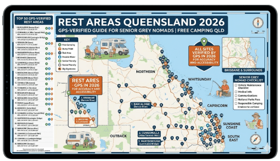
Rest Areas Queensland 2026 — GPS-Verified Guide for Senior Grey Nomads
Every GPS-verified rest area in Queensland covered for senior grey nomads in 2026. Overnight rules, toilets, dump points, water, medical contacts and safety notes — organised by highway and region so you can plan your entire Queensland route in one place.
📅 Last reviewed: April 2026 | Queensland — all regions covered
Queensland rest areas are managed by the Department of Transport and Main Roads on state highways and by local councils on regional roads. The quality varies enormously — a rest area on the Warrego Highway near Roma is a completely different experience to a remote stopping bay in outback Channel Country. This guide organises every GPS-verified Queensland rest area by highway corridor and region so you can plan a full route without leaving one page.
Table of Contents
- Queensland Rest Area Rules Every Grey Nomad Needs to Know
- Warrego Highway — Mitchell to Roma to Charleville
- Charleville to Goondiwindi Corridor
- Carnarvon Highway — Roma to Rolleston to Emerald
- Capricorn Highway — Emerald to Longreach and Outback QLD
- Matilda Highway — Outback and Channel Country
- North Queensland — Townsville, Bowen, Airlie Beach, Cairns
- South East Queensland — Darling Downs and Burnett Highway
- Coastal Queensland — Sunshine Coast to Bundaberg
- Facilities Comparison Table
- Frequently Asked Questions
1. Queensland Rest Area Rules Every Grey Nomad Needs to Know
Queensland has specific rules for rest area use that differ from other states. Understanding these before you leave saves time, money and stress on the road.
| Rule | What It Means for Grey Nomads in QLD |
|---|---|
| Stay limit | Most Queensland TMR rest areas allow up to 24 hours. Some council-managed reserves allow 48–72 hours. Always check the posted sign on arrival — it overrides any website. |
| Overnight sleeping | Legal and encouraged at designated rest areas for driver fatigue reasons. Setting up camp chairs and awnings is generally tolerated at free camping sites but not always explicitly permitted at highway rest bays. |
| Open fires | Prohibited at all Queensland TMR rest areas. Fire restrictions apply across large areas of the state November through March. Check Queensland Fire and Emergency Services before lighting anything. |
| Grey and black water | Never discharge at a rest area. Queensland has strict environment protection laws. Plan your dump point before you need it. |
| Generators | No specific prohibition at most sites — switch off by 9pm as a community courtesy. |
| Crocodile country | North of Rockhampton, crocodiles are present in all waterways. Never camp at the water’s edge. Always read warning signs at rest areas near rivers and creeks. See our senior guide to camping safely near crocodiles in Queensland. |
| Water | Never assume rest area tap water is potable without on-site verification. In outback Queensland carry minimum 20L. Fill every time you pass through a town. |
2. Warrego Highway — Mitchell to Roma to Charleville
The Warrego Highway is the main westbound route from Brisbane through Toowoomba, Roma and Charleville toward the South Australian border. It is one of the great grey nomad outback highways — long, flat, red and genuinely spectacular once you clear the Darling Downs. Rest areas are reliable and well-spaced on this corridor.
Mitchell Rest Area
Maranoa River town stop on the Warrego Highway — GPS, dump point, facilities and senior safety guide.
Full GPS Guide →Roma Rest Area
Major outback hub on the Warrego — full resupply, hospital, dump point and grey nomad overnight guide.
Full GPS Guide →Morven Rest Area
Small but reliable Warrego Highway stop between Roma and Charleville — GPS and overnight details.
Full GPS Guide →Charleville Rest Area
Gateway to outback Queensland — GPS, dump point, hospital contacts and full senior grey nomad guide.
Full GPS Guide →Blythdale Rest Area
Between Roma and Charleville on the Warrego — GPS, facilities and overnight rules for grey nomads 2026.
Full GPS Guide →Moolayember Rest Area
Warrego Highway free camping — GPS, overnight rules and safety notes for senior grey nomads.
Full GPS Guide →3. Charleville to Goondiwindi Corridor
The corridor from Charleville southeast to Goondiwindi via Cunnamulla covers the remote Balonne and Maranoa regions — genuine outback Queensland with excellent free camping, sparse services and spectacular red dirt landscapes. The Balonne Highway south from Charleville and the Carnarvon Highway north connect the dots on this leg.
Dirranbandi Rest Area
Remote Balonne Highway stop — GPS, overnight rules, facilities and senior safety guide 2026.
Full GPS Guide →St George Rest Area
Balonne River town on the Carnarvon Highway — GPS, dump point, hospital and grey nomad guide.
Full GPS Guide →Goondiwindi Rest Area
NSW-QLD border town — major resupply stop with GPS, dump point and full senior travel guide.
Full GPS Guide →Yowah Rest Area
Remote outback stop in opal country — GPS, overnight rules, water and senior safety guide 2026.
Full GPS Guide →Palm Tree Creek Rest Area
Outback Queensland creek-side stop — GPS, dump point, water and grey nomad guide 2026.
Full GPS Guide →Isisford to Bimerah Rd Rest Area
Remote outback stop on the Isisford to Bimerah Road — GPS and free camping guide for seniors.
Full GPS Guide →4. Carnarvon Highway — Roma to Rolleston to Emerald
The Carnarvon Highway runs north from St George through Roma and up to Rolleston and Emerald — connecting the Warrego Highway to the Capricorn Highway through the central Queensland highlands. It passes through spectacular Carnarvon Gorge country and has some excellent rest areas in elevated, cool country.
Injune Rest Area
Gateway town to Carnarvon Gorge — GPS, facilities, overnight rules and senior safety guide 2026.
Full GPS Guide →Rolleston Rest Area
Central QLD junction town — GPS, dump point, facilities and grey nomad guide on the Carnarvon Highway.
Full GPS Guide →Coominglah Range Rest Area
Elevated rest area in the Carnarvon Range — GPS, overnight rules and senior safety notes 2026.
Full GPS Guide →Jimbour Rest Area
Darling Downs stop on the Carnarvon Highway — GPS, facilities and overnight guide for grey nomads.
Full GPS Guide →5. Capricorn Highway — Emerald, Longreach and Outback QLD
The Capricorn Highway runs due west from Rockhampton through Emerald, Barcaldine, Longreach and Barcoo to the Northern Territory border. It is one of Australia’s great grey nomad outback routes — long, flat, red and genuinely remote beyond Longreach. The rest areas are well-spaced but services become increasingly limited as you head west.
Springsure Rest Area
Central QLD farming town stop on the Carnarvon to Capricorn route — GPS and senior guide 2026.
Full GPS Guide →Emerald Rest Area
Major Central QLD hub on the Capricorn Highway — GPS, hospital, dump point and full grey nomad guide.
Full GPS Guide →Capella Rest Area
Coal country stop between Emerald and Mackay — GPS, facilities and overnight guide for grey nomads.
Full GPS Guide →Longreach Darr River Waterhole
Iconic outback free camping spot near Longreach — GPS, overnight rules and full senior safety guide.
Full GPS Guide →Thomson River Weir Camp Longreach
Free camping at the Thomson River Weir near Longreach — GPS and senior grey nomad guide 2026.
Full GPS Guide →Yaraka Rest Area
End-of-the-road outback stop at Yaraka — GPS, facilities and safety notes for adventurous grey nomads.
Full GPS Guide →Tambo Rest Area
Barcoo Shire stop on the Capricorn Highway — GPS, dump point, facilities and grey nomad guide 2026.
Full GPS Guide →Blackall Rest Area
Wool capital of outback QLD — GPS, overnight rules, dump point and senior grey nomad guide 2026.
Full GPS Guide →Stubby Bend Free Camping
Outback QLD free camping — GPS, overnight rules and full senior grey nomad guide 2026.
Full GPS Guide →6. Matilda Highway — Outback and Channel Country
The Matilda Highway runs from Cunnamulla north through Charleville, Longreach, Winton, Cloncurry and Mount Isa — the spine of outback Queensland and one of the most famous grey nomad routes in Australia. The Channel Country west of this highway is some of the most remote and spectacular landscape in the country.
Cambell Park Rest Area
Matilda Highway stop in outback QLD — GPS, overnight rules and senior safety guide 2026.
Full GPS Guide →Gilbert River East Rest Area
Remote stop on the Gulf Developmental Road — GPS, overnight rules and outback safety guide 2026.
Full GPS Guide →Valley of the Lagoons Road Rest Area
Spectacular far north QLD stop — GPS, facilities and senior safety notes for grey nomads 2026.
Full GPS Guide →7. North Queensland — Townsville, Bowen, Airlie Beach, Cairns
North Queensland runs from Bowen and the Whitsundays north through Townsville, Ingham and Cairns to the Cape York Peninsula. This is crocodile country — all waterways north of Rockhampton have resident crocodiles and rest areas near rivers require extra caution. The Bruce Highway is the main north-south corridor with rest areas at reliable intervals.
Guthalungra Rest Area
Bruce Highway stop between Bowen and Ayr — GPS, facilities, overnight rules and senior safety guide.
Full GPS Guide →Airlie Beach Rest Area
Whitsundays gateway — GPS, overnight parking rules and senior grey nomad guide for Airlie Beach 2026.
Full GPS Guide →Grey Nomad Free Camping Airlie Beach
Complete free camping guide for the Airlie Beach and Whitsundays region for senior grey nomads.
Full Regional Guide →Free Camping Home Hill QLD
Burdekin district stop south of Townsville — GPS, facilities and retiree-friendly guide 2026.
Full Guide →Free Camping Bowen QLD
Bowen — gateway to the Whitsundays and great grey nomad base — complete retiree-friendly guide.
Full Guide →Free Camping Proserpine QLD
Whitsundays hinterland town — GPS, free camping options and retiree-friendly guide 2026.
Full Guide →Free Camping Mackay QLD
Coal coast city — complete free camping and rest area guide for seniors near Mackay 2026.
Full Guide →Free Camping Near Hospitals Rockhampton
Medical safety planning for grey nomads — free camping near Rockhampton Hospital 2026.
Full Safety Guide →Free Camping Cairns
Complete retiree-friendly free camping guide for Cairns and the Far North QLD region 2026.
Full Guide →Free Camping Cairns and Port Douglas
Complete senior couples guide to free camping in Cairns and Port Douglas 2026.
Full Guide →Pet-Friendly Free Camping Cairns
Travelling with your dog in Far North QLD — complete pet-friendly free camping guide for seniors.
Full Guide →Pet-Friendly Free Camping Port Douglas
Travelling with pets in Port Douglas — complete retiree-friendly guide for senior grey nomads.
Full Guide →Valley of the Lagoons Rest Area
Spectacular Atherton Tablelands stop — GPS, facilities and senior safety notes for grey nomads.
Full GPS Guide →Senior Guide to Tully QLD Rest Stops
Toilet and rest stop guide for seniors in and around Tully on the Bruce Highway 2026.
Full Guide →8. South East Queensland — Darling Downs and Burnett Highway
South East Queensland extends from the Queensland-NSW border through Stanthorpe, Toowoomba and the Darling Downs west toward Roma. The Burnett Highway runs north from Gympie through Kingaroy to Rockhampton — a popular alternative to the Bruce Highway for grey nomads who prefer inland country to coastal traffic.
Greenwood Grange Rest Area
Burnett Highway stop in central QLD — GPS, facilities and full senior grey nomad guide 2026.
Full GPS Guide →Binjour Range Rest Area
Burnett Highway elevated stop in the ranges — GPS, overnight rules and safety notes 2026.
Full GPS Guide →Free Camping Gympie QLD
Burnett Highway base town — complete retiree-friendly guide to free camping in and around Gympie.
Full Guide →Free Camping Gunalda QLD
Small town stop north of Gympie on the Bruce Highway — retiree-friendly guide 2026.
Full Guide →Free Camping Tiaro QLD
Bruce Highway town stop between Gympie and Maryborough — retiree-friendly guide 2026.
Full Guide →9. Coastal Queensland — Sunshine Coast to Bundaberg
The coastal corridor from the Sunshine Coast north through Noosa, Gympie, Maryborough, Hervey Bay and Bundaberg is one of the most popular grey nomad stretches in Australia. Free camping is limited compared to outback QLD but the towns along this corridor are warm, well-serviced and genuinely welcoming to grey nomads.
Free Camping Tin Can Bay QLD
Dolphin feeding and free camping at Tin Can Bay — retiree-friendly guide for grey nomads 2026.
Full Guide →Free Camping Rainbow Beach QLD
Gateway to Fraser Island — complete retiree-friendly free camping guide for Rainbow Beach 2026.
Full Guide →Free Camping Hervey Bay QLD
Whale watching capital of Australia — complete retiree-friendly free camping guide 2026.
Full Guide →Free Camping Bundaberg QLD
Rum capital and grey nomad favourite — complete free camping guide for Bundaberg 2026.
Full Guide →Free Riverside Camping Queensland
Complete guide to free riverside camping across Queensland for retirees — GPS verified 2026.
Full Guide →10. Facilities Comparison — What to Expect at Each Type of QLD Stop
| Stop Type | Toilets | Water | Dump Point | Power | Typical Stay Limit |
|---|---|---|---|---|---|
| Queensland TMR highway rest area | Usually yes | Sometimes — verify | No | No | 24 hours |
| Council-managed rest area | Usually yes | Sometimes — verify | Occasionally | No | 48–72 hours |
| Free camping reserve | Pit toilets sometimes | Rarely — carry your own | No | No | Varies — check signage |
| Showgrounds (free overnight) | Yes | Yes | Sometimes | Paid sites only | Check with caretaker |
| Roadside stopping bay | No | No | No | No | Short rest only |
| National Park campground | Pit toilets | Rarely | No | No | Permit required — book via QLD NPWS |
11. Frequently Asked Questions
Can you camp overnight at Queensland rest areas?
Yes — sleeping overnight at a designated Queensland TMR rest area is legal and encouraged for driver fatigue safety. Most allow a maximum stay of 24 hours. Always check the posted sign at each individual site as rules vary by location and council.
Are Queensland rest areas free to use?
Yes — all Queensland TMR highway rest areas are free with no booking required. Some council-managed reserves charge a small nightly fee. National Park campgrounds require a permit booked through the Queensland Parks and Wildlife Service website.
What is the best Queensland highway for grey nomads?
For outback adventure, the Capricorn Highway from Rockhampton to Longreach is one of the great grey nomad routes in Australia. For coastal scenery, the Bruce Highway from Brisbane to Cairns has good rest areas but carries heavy traffic. For a quieter inland experience, the Burnett Highway from Gympie to Rockhampton is excellent. See our complete grey nomad routes guide for full planning advice.
Do Queensland rest areas have dump points?
Most Queensland highway rest areas do not have dump points. The nearest dump point is usually in the nearest town — check Campermate, WikiCamps or the Dump Point Finder website before you need it. Never discharge at a rest area — Queensland EPA can issue on-the-spot fines.
Is it safe to camp near water in Queensland?
North of Rockhampton, crocodiles are present in all waterways. Never camp at the water’s edge at rest areas near rivers or creeks. Always read warning signs posted at each site. See our complete senior guide to camping safely near crocodiles in Queensland before travelling north of Rockhampton.
What are the best rest areas in outback Queensland?
The Longreach Darr River Waterhole, Thomson River Weir Camp, Tambo Rest Area and Blackall Rest Area are among the best free camping options in outback Queensland for senior grey nomads. For the full outback route, see our Free Camping Queensland guide 2026.
Free campsites and powered sites fill fast during school holidays and peak season. If your preferred site is already gone, search remaining accommodation options below to explore the region.
Accommodation and flight search powered by Expedia. Booking through this search supports this website at no extra cost to you. As an affiliate, I earn from qualifying purchases at no extra cost to you.

As an affiliate, I earn from qualifying purchases at no extra cost to you.
As an affiliate, I earn from qualifying purchases at no extra cost to you.