Netallie Hill Rest Area
Complete Senior Grey Nomad Guide 2026 — GPS coordinates, road conditions, flood risk, fuel distances, facilities, wildlife, heat warnings and everything you need for a safe and comfortable overnight stop on one of outback NSW’s most remote stretches of highway.
📅 Last reviewed: January 2026 | Silver City Highway, NSW 2835 | Free overnight rest area — remote outback setting
📋 Table of Contents
- Why Grey Nomads Stop at Netallie Hill
- Free Camping — Know the Rules for Seniors 2026
- Quick Facts and Key Details 2026
- How to Get There + GPS Coordinates
- Road Conditions, Flooding and Unsealed Sections
- Heat and Remoteness — Senior Safety
- Wildlife — Birds, Reptiles and What to Watch For
- What Other Websites Don’t Tell You
- Best Time to Visit — Month-by-Month Breakdown
- Free and Low-Cost Camping Nearby
- Dump Points Near Netallie Hill
- Free Water Sources in the Region
- Fuel Stops Along the Silver City Highway
- Caravan Parks — Paid Alternatives
- Full Facilities Comparison Table
- Rates — All Options Near Netallie Hill 2026
- Senior Safety Checklist — On and Off the Road
- What to Do Near Netallie Hill — Senior Activity Guide
- Vanlife Savings Spots — GPS Coordinates and Postcodes
- Phone Signal and Emergency Communications
- Campfires, Cooking Restrictions and Food Purchases
- Pets at Netallie Hill Rest Area
- Accessibility for Seniors with Mobility Limitations
- Permits, Fees, Etiquette and Waste Management
- Emergency Scenarios — What to Do
- Packing List for This Section of Highway
- 5 Rest Areas Near Netallie Hill
- Reviews — What Grey Nomads Say
- Frequently Asked Questions
- Quick-Reference Card
- Disclaimer
1. Why Grey Nomads Stop at Netallie Hill Rest Area
The Netallie Hill Rest Area sits on the Silver City Highway between Wilcannia and Menindee in the far west of New South Wales. For grey nomads driving the long, flat stretches of this iconic outback corridor, Netallie Hill is one of the few obvious landmarks — a gentle rise in otherwise pancake-flat mulga scrub — and the rest area positioned near it offers a logical, safe and legal place to pull off, stretch, rest or camp overnight.
For senior travellers, especially those managing fatigue on long driving days between Broken Hill and Wilcannia (or the reverse), this rest area is a genuine asset. The highway is not heavily patrolled, traffic thins to almost nothing by dusk, and the silence and star-filled sky are, by most accounts, unforgettable. But remote also means risk — and this guide covers every angle, including what many online sources skip entirely.
The rest area also serves as a waypoint for travellers heading to Menindee Lakes, the Kinchega National Park, or those making the longer haul through to Broken Hill. It is a known overnight truck stop as well, so expect occasional semi-trailer traffic nearby, particularly overnight.
2. Free Camping — Know the Rules for Seniors 2026
Rest areas on NSW state highways are managed under the Roads and Maritime Services (Transport for NSW) framework. Netallie Hill Rest Area is a designated rest area on the Silver City Highway, which means:
- Overnight stays are permitted for up to 20 hours under NSW rest area rules.
- There is no fee to stay.
- You are expected to be a traveller using the highway — not setting up a permanent camp.
- No open fires are permitted in or immediately adjacent to rest areas on state highways.
- Generators may be used but common courtesy applies — keep noise reasonable, especially after 9 pm.
- Waste must be packed out. There are no bins at all remote highway rest areas. Carry your own rubbish bags.
Under NSW Road Rules, a driver who has been driving for 2 hours must take a minimum 15-minute break. Rest areas like Netallie Hill fulfil this legal requirement. Seniors should note that fatigue is a leading cause of crashes on outback highways — using rest areas is not optional, it is smart and legal.
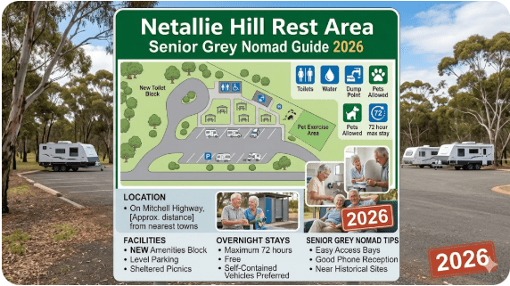
3. Quick Facts and Key Details 2026
| Detail | Information |
|---|---|
| 📍 Name | Netallie Hill Rest Area |
| 🗺️ Highway | Silver City Highway (A32) |
| 📮 Postcode Region | NSW 2835 (Wilcannia LGA) |
| 📐 GPS (approx.) | -31.785, 143.285 (see GPS section for full detail) |
| 💰 Cost | Free |
| ⏱️ Max Stay | 20 hours (NSW highway rest area rule) |
| 🚿 Toilets | Pit toilet / long-drop (verify on arrival — remote areas) |
| 🚰 Water | None — carry all water |
| 🗑️ Bins | None — pack out all rubbish |
| 🔌 Power | None |
| 📶 Phone Signal | Very limited to none — Telstra best option |
| 🚛 Heavy Vehicle Access | Yes — used by trucks |
| 🚌 Motorhome / Big Rig | Yes — sealed pull-off bay |
| 🐕 Pets | Permitted (on lead) |
| 🔥 Campfires | Not permitted at highway rest area |
| 🏕️ Caravan Access | Yes — sealed surface |
| 🌡️ Climate | Arid — extreme heat in summer, cold nights in winter |
4. How to Get to Netallie Hill Rest Area + GPS
📡 GPS Coordinates — Netallie Hill Rest Area
-31.7850° S, 143.2850° E
Coordinate source: Publicly available mapping data (OpenStreetMap / NSW Roads data). Verify with your GPS unit on approach.
DMS Format: 31°47’6″ S, 143°17’6″ E
Driving Directions from Key Points
| From | Direction | Distance (approx.) | Travel Time (approx.) | Road |
|---|---|---|---|---|
| Wilcannia | South / Southeast | ~90 km | ~1 hr | Silver City Highway (A32) — sealed |
| Menindee | North / Northwest | ~100 km | ~1 hr 10 min | Silver City Highway (A32) — sealed |
| Broken Hill | North | ~195 km | ~2 hrs | Silver City Highway (A32) — sealed throughout |
| Cobar | East | ~340 km via Wilcannia | ~3 hrs 40 min | Kidman Way / Mitchell Highway then Silver City |
| Sydney | East | ~980 km | ~10–11 hrs | Multiple highways — plan carefully |
Travelling the Wilcannia → Menindee → Broken Hill Corridor
If you are driving the full corridor from Wilcannia through to Broken Hill, this rest area sits at a natural mid-point. For the full route guide including all rest areas, fuel stops and road warnings along this stretch, see the dedicated route guide:
👉 Wilcannia to Menindee Road — Rest Area Guide
👉 Broken Hill Rest Area Guide
👉 East of Wilcannia Rest Area Guide
5. Road Conditions, Flooding and Unsealed Sections
Is the Silver City Highway Sealed to Netallie Hill?
Yes — the Silver City Highway (A32) is fully sealed (bitumen) for the entire distance between Wilcannia and Broken Hill, which includes the Netallie Hill Rest Area. This means caravans, motorhomes, large rigs and 2WD vehicles can access this rest area without any off-road capability.
Does the Road Flood?
- Flooding is most likely February to April following summer monsoon rains inland.
- The low-lying areas between Wilcannia and Menindee are particularly susceptible — the Darling River floodplain extends well beyond the main channel.
- Floodwater in this region is slow to drain due to flat topography. A flooded road section can remain closed for days or weeks.
- Always check road conditions before departure.
➔ NSW Live Traffic — livetraffic.com
➔ Bureau of Meteorology — bom.gov.au
➔ Broken Hill Council (Central Darling Shire) road closure updates
➔ Ask locally at fuel stops in Wilcannia or Menindee — locals know before the websites update.
Are There Unsealed Roads Near Netallie Hill?
The rest area itself is accessed directly from the sealed highway. However, surrounding station tracks, fire trails and any road heading toward the Darling River or lake system will be unsealed and may become impassable after rain. Do not attempt unsealed tracks in a caravan or large rig without local knowledge, 4WD capability and adequate supplies.
6. Heat and Remoteness — Senior Safety Planning
Netallie Hill Rest Area is in one of the most remote, harsh and thermally extreme parts of New South Wales. For senior grey nomads — particularly those travelling solo or with a partner — understanding and planning for the heat and isolation is not optional. It is essential.
Summer Temperatures
- Travel outback NSW in summer only if your vehicle and van have functioning air conditioning.
- Carry a minimum of 20 litres of drinking water per person beyond what you expect to need.
- Never leave pets or passengers in parked vehicles in summer heat.
- Plan driving for early morning (5 am–11 am) and avoid driving in the hottest part of the afternoon.
- If your vehicle breaks down: Stay with the vehicle. It is easier to spot than a person on foot and provides shade.
Winter Conditions
Winter nights (June–August) in this part of NSW drop to near zero or below zero degrees Celsius overnight. While this is far more comfortable for daytime driving, ensure your sleeping setup has adequate insulation. Condensation and cold floors in vans are common issues. A good quality sleeping bag rated to 0°C minimum is recommended.
7. Wildlife — Birds, Reptiles and What to Watch For
The country around Netallie Hill is classic semi-arid mulga and saltbush scrub — sparse, ancient and alive with wildlife if you know where to look. For grey nomads with an interest in birdwatching and nature, this stretch of country is genuinely rewarding.
Birds
- Major Mitchell’s Cockatoo — one of Australia’s most beautiful parrots; common in mulga country west of the Darling.
- Budgerigars — enormous flocks after good rains; an extraordinary spectacle.
- Emus — frequently seen crossing or running alongside the highway. Slow down — they are unpredictable and a large emu at highway speed can cause serious vehicle damage.
- Wedge-tailed Eagles — commonly seen feeding on roadkill. They are slow to take flight and a collision can crack windscreens. Flash your headlights when approaching.
- Australian Pratincoles, Brolgas, Little Corellas — all sighted in the broader region.
Reptiles and Other Wildlife
- Bearded Dragons — often seen on warm bitumen warming themselves at sunrise and sunset.
- Perentie and Lace Monitor Goannas — large lizards; generally not aggressive unless cornered.
- Kangaroos and Wallabies — peak collision risk is at dawn and dusk. Use roo bars, reduce speed and scan ahead constantly.
- Feral Camels and Goats — less common in this corridor but not unheard of. On the road at night they are extremely dangerous.
8. What Other Websites Don’t Tell You About Netallie Hill
Most travel websites and apps list Netallie Hill Rest Area with a pin, a brief facilities note and nothing else. Here is what they consistently miss — and what actually matters to senior travellers spending a night here in 2026.
- The toilet situation is unreliable. Remote highway rest areas in NSW have had their toilet facilities locked, damaged or removed without public notice. Do not count on a working toilet being present. Carry your own portable camp toilet and a privacy tent as standard equipment on this highway.
- Truck traffic is real. The Silver City Highway carries B-double and road train traffic between Broken Hill and Wilcannia. Trucks do stop at this rest area — often at 2 am or 3 am with engines running (idling for air conditioning). Earplugs or white noise are worth packing.
- The “hill” is barely a hill. Netallie Hill is a very subtle rise in the landscape — perhaps 15–20 metres above the surrounding plain. Don’t expect dramatic scenery. The value is in the silence, the stars and the legal overnight status of the rest area, not the elevation.
- Wind can be severe. The far west of NSW is exposed to strong westerly and northwesterly winds, particularly in spring and summer. A caravan or van side-on to the prevailing wind can experience significant buffeting. Park with the nose into the wind where possible.
- The flies are genuine. Between September and April, outback flies in this region are persistent and can make outdoor time genuinely unpleasant. A quality fly head net is one of the best investments a grey nomad can make before travelling western NSW.
- No lighting. The rest area has no artificial lighting whatsoever. This is excellent for stargazing but means you need a good headlamp or lantern for navigating at night.
- App data is often wrong. Apps like Wikicamps and Campermate are useful but crowdsourced. Some data for this location is out of date. Always cross-check with Live Traffic NSW and ask at the last fuel stop before proceeding.
9. Best Time to Visit Netallie Hill — Month-by-Month Breakdown
| Month | Temp Range (Day/Night) | Conditions | Senior Rating |
|---|---|---|---|
| January | 40–47°C / 22–28°C | Extreme heat, possible storms, flies | ❌ Avoid |
| February | 39–45°C / 20–26°C | Extreme heat, flood risk, flies | ❌ Avoid |
| March | 35–42°C / 18–24°C | Cooling slightly, flood risk remains | ⚠️ Caution |
| April | 28–35°C / 12–18°C | Pleasant days, cooler nights, some flies | ✅ Good |
| May | 22–28°C / 6–12°C | Excellent travel weather, cold nights | ✅✅ Excellent |
| June | 17–22°C / 1–6°C | Cool to cold, very dry, clear skies | ✅✅ Excellent |
| July | 16–21°C / 0–5°C | Cold nights, frost possible, clear days | ✅✅ Excellent |
| August | 19–25°C / 3–8°C | Warming, very pleasant, peak nomad season | ✅✅ Excellent |
| September | 25–32°C / 8–14°C | Warm days, windy, wildflowers after rain | ✅ Good |
| October | 30–37°C / 12–18°C | Heating up, flies increasing | ⚠️ Caution |
| November | 36–42°C / 18–24°C | Hot, flies bad, avoid midday travel | ❌ Avoid if possible |
| December | 38–46°C / 22–28°C | Extreme heat, holiday traffic, flies | ❌ Avoid |
10. Free and Low-Cost Camping Nearby
If Netallie Hill doesn’t suit your schedule, setup or size, there are several alternatives within reasonable driving distance along this highway corridor.
| Location | Distance from Netallie Hill | Type | Cost | Facilities |
|---|---|---|---|---|
| Wilcannia–Menindee Road Rest Area | ~60–80 km N | Highway Rest Area | Free | Basic / limited |
| Dolo Hill Rest Area | ~40–50 km S | Highway Rest Area | Free | Basic / limited |
| Cawndilla Campground (Menindee Lakes) | ~100 km SE | National Park campground | Low cost fee | Toilets, fire rings, lake access |
| Menindee Showground / Caravan Park | ~100 km SE | Town park | Low cost / donation | Power, water, showers |
| East of Wilcannia Rest Area | ~100 km N | Highway Rest Area | Free | Basic |
11. Dump Points Near Netallie Hill Rest Area
| Location | Distance | Address / Notes | Cost |
|---|---|---|---|
| Menindee Caravan Park | ~100 km SE | Menindee — check with park office on arrival | May apply |
| Broken Hill — Civic area | ~195 km S | Multiple dump points in Broken Hill — see Campermate.com.au for current locations | Free / Low cost |
| Wilcannia | ~90 km N | Limited facilities — ask at servo or council | Varies |
For information on showers and facilities available in Menindee, see: Menindee Showers and Facilities Guide
12. Free Water Sources in the Region
- Wilcannia: Fuel stations, servo facilities and the town water supply — fill tanks before leaving heading south.
- Menindee: Town water, caravan park facilities, serviced campgrounds at Kinchega National Park area.
- Broken Hill: Full town water, fuel and services — fill tanks here if heading north.
13. Fuel Stops Along the Silver City Highway
Fuel planning on the Silver City Highway between Broken Hill and Wilcannia is serious business. There are no fuel stops between Wilcannia and Menindee on the main highway. The distance is approximately 190 km, meaning a vehicle with a 60-litre tank and average consumption of 12L/100km has enough fuel — but a caravan, large motorhome or rig towing heavy will use significantly more.
| Fuel Stop | Direction from Netallie Hill | Distance (approx.) | Fuel Type Available | Notes |
|---|---|---|---|---|
| Wilcannia (servo) | North | ~90 km | ULP, Diesel | Check opening hours — limited. Use PetrolSpy.com.au for current prices |
| Menindee (servo) | South / Southeast | ~100 km | ULP, Diesel | Small town — verify hours before relying on late arrivals |
| Broken Hill (multiple) | South | ~195 km | ULP, Diesel, LPG, AdBlue | Full city services — best prices and reliability on route |
| Cobar (via Kidman Way) | East (via Wilcannia) | ~340 km | ULP, Diesel | Long diversion — only relevant if heading east from Wilcannia |
14. Caravan Parks — Paid Alternatives Near Netallie Hill
If you want power, showers, a dump point and a reliable water supply, the nearest options are in Menindee (~100 km) and Broken Hill (~195 km). There are no commercial caravan parks between Wilcannia and Menindee on the Silver City Highway.
| Park / Option | Location | Powered Sites | Showers | Approx. Cost/Night |
|---|---|---|---|---|
| Menindee Caravan Park | Menindee NSW | Yes | Yes | $25–$40 |
| Lake Pamamaroo Campground (Kinchega NP) | ~20 km from Menindee | No | No | NPWS fee applies (~$6–$12/person) |
| Broken Hill Caravan Parks (multiple) | Broken Hill NSW | Yes | Yes | $30–$55 |
| Wilcannia Weir (free camp) | Wilcannia NSW | No | No | Free (verify current status locally) |
Free campsites and rest areas fill fast during peak grey nomad season (May–August). If you need power, a hot shower or a proper bed after a long outback day, search for remaining accommodation options below.
Accommodation search powered by Expedia. Booking through this link supports this website at no extra cost to you.
15. Full Facilities Comparison Table
| Facility | Netallie Hill Rest Area | Menindee Caravan Park | Kinchega NP Campground | Broken Hill Parks |
|---|---|---|---|---|
| Cost | Free | $25–$40/night | NPWS fee | $30–$55/night |
| Toilets | Pit toilet (verify) | Flush toilets | Composting / pit | Flush toilets |
| Showers | None | Yes | None | Yes |
| Water | None | Yes | Tank water (boil) | Yes |
| Power | None | Yes | None | Yes |
| Dump Point | None | Yes | None | Yes |
| Wi-Fi | None | Limited | None | Available in town |
| Phone Signal | Very limited | Limited (Telstra) | Very limited | Good (all networks) |
| Caravan Access | Yes (sealed) | Yes | Yes (unsealed) | Yes |
| Max Stay | 20 hours | No limit | NPWS permit period | No limit |
| Pets | Yes (on lead) | Check with park | No (National Park) | Check with park |
16. Rates — All Options Near Netallie Hill 2026
| Option | Type | 2026 Rate (approx.) | Notes |
|---|---|---|---|
| Netallie Hill Rest Area | Free highway rest area | $0 | 20 hr max, no facilities guaranteed |
| Wilcannia Weir | Free camp (verify) | $0 | Check current status on arrival or with council |
| Menindee Caravan Park | Powered / unpowered | $25–$40/night | Prices vary — call ahead |
| Lake Pamamaroo / Kinchega NP | NPWS campground | ~$6–$12 per adult/night | Book via NPWS website |
| Broken Hill caravan parks | Full-service park | $30–$55/night | Multiple options, book ahead in peak season |
| Broken Hill motels / hotels | Accommodation | $100–$200/night | Search via Expedia widget above |
17. Senior Safety Checklist — On and Off the Road
Before You Leave Your Last Town (Wilcannia or Menindee / Broken Hill)
- Fuel tank full (carry jerry can as backup)
- Water tanks full — minimum 20 litres per person
- Food and snacks for at least 48 hours beyond planned stop
- Checked Live Traffic NSW for road closures or flooding
- Checked BOM weather forecast for next 48 hours
- Told a responsible person your route, destination and ETA
- First aid kit stocked and accessible
- Phone charged and satellite communicator (EPIRB or PLB) ready
- Medications packed and accounted for
- Dump tanks empty
On Arrival at Netallie Hill Rest Area
- Parked clear of the highway with handbrake on
- Checked for snakes, insects and hazards around campsite
- Noted wind direction and oriented vehicle/van accordingly
- Verified toilet status (if applicable)
- Checked phone signal — noted best spot for emergencies
- Activated satellite communicator tracking if available
- Set alarm to ensure departure within 20-hour window
- Secured loose items against overnight wind
Health and Medical Checklist for Remote Travel
- Current prescription medications packed in accessible location
- Medical alert information visible in vehicle (blood type, conditions, emergency contacts)
- EPIRB or PLB registered with AMSA and within reach
- Adequate hydration maintained throughout day
- Sun protection (SPF 50+, hat, long sleeves) for any outdoor activity
- Snake bite kit and pressure bandages in first aid kit
18. What to Do Near Netallie Hill — Senior Activity Guide
Netallie Hill Rest Area is not a destination in itself — it is a waypoint on a journey through one of Australia’s most extraordinary landscapes. But there are genuine experiences available within reach for seniors who want to do more than just stop and sleep.
Menindee Lakes and Kinchega National Park (~100 km)
🌿 Kinchega National Park
One of NSW’s most accessible outback national parks, Kinchega sits on the Darling River floodplain near Menindee. The lakes system is internationally significant for waterbirds and can host hundreds of thousands of migratory birds after good seasons. The historic Kinchega woolshed and the shearing shed interpretation trail are excellent for seniors on foot — flat, accessible and fascinating.
Access: Mostly unsealed road from Menindee — approximately 20 km. Check conditions with NPWS Broken Hill before proceeding. 2WD accessible in dry conditions. Camping fees apply.
Menindee Town
- Burke and Wills historical connection — the Burke and Wills expedition camped near Menindee in 1860. The Maiden’s Hotel (one of Australia’s oldest continuously operating pubs) is a genuine outback landmark.
- Darling River walking track — flat, easy access, suitable for seniors.
- Cawndilla Lake birdwatching — spectacular after good rains. See Cawndilla Campground guide for details.
Wilcannia (~90 km north)
- Wilcannia Bridge and Darling River — historically the third-busiest river port in Australia in the 1880s.
- Historic sandstone buildings in the main street.
- Public toilets and services available in town.
Broken Hill (~195 km south)
- Pro Hart Gallery, Silverton ghost town, Living Desert sculptures — all accessible and senior-friendly.
- Broken Hill is a full regional city with excellent facilities, hospitals, shopping and accommodation.
- For full details, see the Broken Hill Rest Area and Guide.
Stargazing at Netallie Hill
19. 🗺️ Vanlife Savings Spots — GPS Coordinates and Postcodes
Use the interactive Vanlife Savings Spots map below to find, save and navigate to free camps, rest areas and overnight stops along the Silver City Highway corridor and beyond. Save Netallie Hill and all stops along your route before you lose phone signal — this tool works best with a saved list ready before you enter the outback.
📍 Interactive map — find free camps, rest areas and overnight stops along the Silver City Highway. Enable location for best results. Save spots before entering no-signal zones.
| Stop Name | Postcode | Latitude | Longitude | Notes | Nearby WiFi |
|---|---|---|---|---|---|
| Netallie Hill Rest Area | 2835 | -31.7850 | 143.2850 | Free, 20hr max, pit toilet (verify), no water | None |
| East of Wilcannia Rest Area | 2836 | -31.559 | 143.500 | Highway rest area — basic facilities | None |
| Wilcannia–Menindee Road Rest Area | 2836 | -31.700 | 143.300 | Highway rest area | None |
| Dolo Hill Rest Area | 2835 | -31.900 | 143.250 | Highway rest area — south of Netallie Hill | None |
| Cawndilla Campground | 2879 | -32.200 | 142.450 | Lake / NP campground — fees apply | None |
| Broken Hill Rest Area | 2880 | -31.956 | 141.454 | City rest area — full facilities nearby | Available in town |
| Popiltah Lake Rest Area | 2880 | -31.850 | 141.800 | Outback lake setting — basic | None |
| Thackaringa Hills Rest Area | 2880 | -31.980 | 141.200 | West of Broken Hill — basic | None |
20. Phone Signal and Emergency Communications
Communication Options for Seniors at Netallie Hill
| Device | Coverage | Cost | Recommended |
|---|---|---|---|
| Telstra mobile phone | Patchy — 1–2 bars possible on hill | Standard plan | Primary phone option |
| Optus / Vodafone | Unlikely in this area | Standard plan | Carry as backup only |
| Personal Locator Beacon (PLB) | Satellite — 100% coverage | ~$300–$500 purchase, free registration | ✅✅ Strongly recommended |
| Satellite Messenger (Garmin inReach) | Satellite — 100% coverage | Device + monthly subscription | ✅✅ Highly recommended |
| HF Radio | Australia-wide via RFDS | Equipment cost | ✅ For extended remote travel |
| UHF CB Radio | Line of sight only (~30 km) | $80–$300 | Useful for truck communications on highway |
✔ Register your PLB/EPIRB free at beacons.amsa.gov.au
✔ Leave a trip plan with a trusted person including your expected route, rest stops and return date
✔ Call 000 in any emergency — satellite devices can relay your position to emergency services even when your phone has no signal
The nearest hospital with full emergency services is Broken Hill Base Hospital (~195 km south). The Royal Flying Doctor Service (RFDS) operates from Broken Hill and covers this entire region. In a serious medical emergency at Netallie Hill, activate your PLB and remain with your vehicle.
21. Campfires, Cooking Restrictions and Food Purchases
Campfire Rules at NSW Highway Rest Areas
- Check current fire restrictions: NSW Rural Fire Service — rfs.nsw.gov.au
- A gas stove inside your van or motorhome is generally permitted during fire bans — check the specific order for clarification.
- Use an enclosed gas or electric cooking setup to avoid fire risk and comply with regulations.
Food Purchases Near Netallie Hill
There are no shops, cafes or food outlets at or near Netallie Hill Rest Area. The nearest food options are:
- Wilcannia (~90 km north): Small supermarket/general store, fuel station with basic snacks. Limited opening hours — call ahead.
- Menindee (~100 km south): Small general store and pub with meals. Confirm opening hours before relying on this option for a meal.
- Broken Hill (~195 km south): Full range of supermarkets, restaurants, takeaway food — stock up here if heading north.
22. Pets at Netallie Hill Rest Area
Pets are permitted at Netallie Hill Rest Area — it is a highway rest area, not a national park, so the standard ban on dogs does not apply here. However, responsible pet management in this environment is non-negotiable.
- Keep dogs on a lead at all times. Livestock properties border the highway — a dog off-lead is a serious legal and safety issue in rural NSW.
- Heat kills pets rapidly. Never leave a dog or cat unattended in a vehicle at this rest area in summer — temperatures inside parked vehicles can exceed 60°C within minutes on a hot day.
- Snakes are a genuine hazard for dogs. Keep dogs close and on lead, especially at dawn and dusk.
- Pack out all pet waste. There are no bins at this rest area.
- Water for pets: Carry dedicated water for your animals. Dogs travelling in hot outback conditions need significantly more water than at home.
23. Accessibility for Seniors with Mobility Limitations
Netallie Hill Rest Area is on a sealed highway surface, which makes basic access reasonable for seniors with mobility limitations. However, detailed accessibility information for this specific site is limited — here is what is reliably known and what to plan for.
| Feature | Status | Notes |
|---|---|---|
| Sealed access from highway | ✅ Yes | Sealed pull-off bay |
| Flat parking surface | ✅ Generally | Rest areas on flat terrain — minimal gradient |
| Accessible toilet | ❓ Uncertain | Pit toilets are generally NOT wheelchair accessible — carry portable option |
| Handrails / grab bars | ❌ None expected | Remote rest area — no infrastructure |
| Lighting | ❌ None | Total darkness at night — bring bright lantern |
| Uneven ground beyond bitumen | ⚠️ Possible | Gravel, dirt and scrub beyond the sealed bay |
| Wheelchair suitable | ⚠️ Limited | Vehicle access yes; site amenities not designed for wheelchair access |
24. Permits, Fees, Etiquette and Waste Management
Permits and Fees
No permit is required to use Netallie Hill Rest Area. It is a free, designated highway rest area managed under NSW Transport for NSW. No booking or registration is needed. Simply pull in, stay up to 20 hours, and move on.
Etiquette at Remote Rest Areas
- Arrive quietly. Other travellers may already be asleep. Turn off engine as soon as safely parked. Avoid door slamming, loud conversations or generator noise late at night.
- Park considerately. Leave space for trucks and other large vehicles — they have legal rest requirements too.
- Generators: If you must run a generator, finish by 9 pm and do not start before 7 am. This is an unwritten but widely respected rule in the grey nomad community.
- Lights: Dim your van lighting and avoid pointing bright lights at neighbouring vehicles.
Waste Management
- Carry dedicated rubbish bags — minimum two (one for general waste, one for food scraps).
- A portable camp toilet with biodegradable waste bags is strongly recommended.
- Grey water: use a grey water tank or carry a bucket system and dispose at the next town’s dump point.
- Fly-proof all food waste storage — outback flies will find any opening in seconds.
25. Emergency Scenarios — What to Do at Netallie Hill
Medical Emergency
- Activate PLB immediately if life-threatening.
- Call 000 — if you have any signal, 000 will attempt to connect via any available network including Telstra emergency roaming.
- RFDS Broken Hill is the primary aerial response for medical emergencies in this region.
- If driving to the nearest town is feasible and safe, Broken Hill Base Hospital (195 km south) has full emergency services.
- Menindee has basic medical clinic facilities — check current operating status before relying on this option.
Vehicle Breakdown
- Place hazard triangles or LED warning lights on the road behind your vehicle immediately.
- Stay in the shade of your vehicle — do not walk in the heat.
- Signal passing trucks via UHF Channel 40 — truck drivers are often the fastest source of help on remote highways.
- Conserve water and food until help arrives.
Flash Flooding
- If water begins to sheet across the highway, do not drive into it. Pull to high ground (even a slight elevation helps) and wait.
- Floodwater in this region can contain hidden debris, soft mud edges and unexpected depth.
- Activate satellite communicator to report your position and status.
- Notify 000 or SES NSW (132 500) if safe to call.
Snake Bite
- Apply a pressure immobilisation bandage from the bite site up the limb. Do not wash the bite or cut it.
- Keep the victim still and calm — movement spreads venom faster.
- Call 000 and activate PLB for aerial evacuation.
- Do not drive a snake bite victim without help — unconsciousness can occur rapidly with eastern or western brown snake envenomation.
26. Packing List for the Silver City Highway Corridor
Water and Food
- 20+ litres of drinking water per person (beyond tank water)
- Electrolyte sachets or tablets
- 3–5 days emergency food supply (canned, dried, long-life)
- Portable stove and fuel canisters
- Can opener and cooking utensils
Safety and Communications
- PLB (Personal Locator Beacon) — registered with AMSA
- Satellite messenger (Garmin inReach or equivalent)
- UHF CB radio (Channel 40 — highway channel)
- First aid kit with snake bite bandages, medications
- Fire extinguisher accessible in vehicle
- Hazard triangles or LED warning lights
- Emergency blanket (space blanket)
- Torch and spare batteries / headlamp
Vehicle and Recovery
- Jerry can with 10–20 litres spare fuel
- Spare tyre (fully inflated and checked)
- Tyre repair kit / compressor
- Jumper cables or jump starter pack
- Tow rope
- Engine coolant / radiator water
- Basic tool kit
Comfort and Livability
- Fly head net (essential September–April)
- SPF 50+ sunscreen, lip balm, wide-brim hat
- Sleeping bag rated to 0°C (winter nights)
- Portable camp toilet + biodegradable bags
- Rubbish bags (minimum 3–4 spare)
- Insect repellent (DEET-based for outback)
- Earplugs (truck noise at rest area overnight)
🔒 Travelling Remote? Protect Your Rig.
Exclusive Offer: Get 5% OFF all StarterStopper immobiliser products with promo code: RTV5
Visit StarterStopper.com — data-backed vehicle security for grey nomads
As an affiliate, I earn from qualifying purchases at no extra cost to you.
27. 5 Rest Areas Near Netallie Hill — Silver City Highway Corridor
Planning your rest stops along the Silver City Highway between Wilcannia and Broken Hill is critical for safe driving. Here are the five key rest areas in this corridor, in order from north to south:
- East of Wilcannia Rest Area — ~100 km north of Netallie Hill. Highway rest area on the Barrier Highway east of Wilcannia. Basic facilities.
- Wilcannia–Menindee Road Rest Area — ~60–80 km north. On the Silver City Highway heading south from Wilcannia. Basic facilities.
- Netallie Hill Rest Area — This guide. Approximately mid-corridor between Wilcannia and Menindee.
- Dolo Hill Rest Area — ~40–50 km south of Netallie Hill. Next major rest area heading toward Menindee.
- Broken Hill Rest Area — ~195 km south. Full city facilities nearby. The major service hub for this region.
28. Reviews — What Grey Nomads Say About Netallie Hill
“Pulled in here around 4 pm heading to Menindee. Quiet spot, the stars that night were absolutely incredible — the best we’ve seen in 6 years of grey nomad travel. The pit toilet was functional but basic. No issues with the trucks overnight. Would stop here again.”
“Does the job as a rest stop. Don’t expect anything — no water, bins are non-existent, the toilet was locked when we arrived. We had our own setup so it wasn’t a problem. The road is perfectly fine — smooth bitumen all the way. Just make sure you fill up in Broken Hill before heading north. Fuel in Menindee is expensive.”
“We use this rest area every time we do the Silver City run. It breaks the drive perfectly and the sunrise over the scrubland the next morning is something you can’t get in a caravan park. Two nights we’ve seen emus walking past at dawn. Carry everything you need and it’s a 5-star spot.”
“The flies in October were absolutely brutal. We lasted about 20 minutes outside the van and then hid inside. The rest area itself is fine — sealed, flat, easy to get in and out with the rig. But go in May, not October. We learned that lesson the hard way.”
“The highlight was getting a strong enough Telstra signal on top of the ‘hill’ (it’s not much of a hill, but it helped) to send a quick WhatsApp message. Otherwise no signal at all. Good stop, would recommend for the stars alone. Take earplugs for the trucks.”
29. Frequently Asked Questions — Netallie Hill Rest Area
Is Netallie Hill Rest Area free to stay at?
Yes. Netallie Hill Rest Area is a free designated highway rest area on the Silver City Highway. No fees, no bookings, no permits required. Stays are limited to 20 hours under NSW highway rest area rules.
Can I stay overnight at Netallie Hill Rest Area?
Yes. Overnight stays are permitted for up to 20 hours. This makes it a legal overnight stop for caravans, motorhomes, campervans and tents.
Does the Silver City Highway flood near Netallie Hill?
Yes — the surrounding country is susceptible to flooding after significant inland rainfall events. The highway can be closed due to floodwater sheeting across the road surface. Always check livetraffic.com before travelling this section, particularly between February and April.
Is there phone signal at Netallie Hill?
Very limited. Telstra may provide a marginal signal in some conditions — particularly from the higher ground of the rest area — but this cannot be relied upon. Carry a PLB or satellite communicator for emergency communication.
Is the road sealed to Netallie Hill?
Yes. The Silver City Highway is fully sealed (bitumen) between Wilcannia and Broken Hill, including the section where Netallie Hill Rest Area is located. Caravans, motorhomes and 2WD vehicles can access it without issue.
How far is the nearest fuel from Netallie Hill?
Approximately 90 km north to Wilcannia and 100 km south to Menindee. There is no fuel available between these two towns on the Silver City Highway. Fill up before leaving either town.
Are pets allowed at Netallie Hill Rest Area?
Yes — pets are permitted at this highway rest area (it is not a national park). Keep dogs on a lead at all times and never leave pets in vehicles in summer heat.
Is there a dump point at Netallie Hill?
No. The nearest dump points are in Menindee (~100 km) and Broken Hill (~195 km). Empty your tanks before arriving.
Is Netallie Hill Rest Area suitable for large rigs?
Yes — the rest area is used by road trains and semi-trailers and has adequate space for large rigs. The sealed pull-off bay accommodates heavy vehicles.
What is there to do near Netallie Hill?
The main nearby attractions are Kinchega National Park and the Menindee Lakes system (~100 km south) and the historic town of Wilcannia (~90 km north). The rest area itself is best for stargazing, birdwatching and breaking a long drive.
30. Quick-Reference Card — Netallie Hill Rest Area 2026
📋 Netallie Hill Rest Area — At a Glance
| Location | Silver City Highway (A32), NSW — between Wilcannia and Menindee |
| GPS | -31.7850, 143.2850 |
| Postcode Region | NSW 2835 |
| Cost | Free |
| Max Stay | 20 hours (NSW rules) |
| Toilets | Pit toilet — verify on arrival |
| Water | None — carry all water |
| Power | None |
| Dump Point | None — nearest in Menindee or Broken Hill |
| Phone Signal | Very limited — Telstra marginal |
| Road Condition | Sealed highway — good in dry conditions |
| Flood Risk | Yes — check Live Traffic NSW before travel (Feb–Apr risk) |
| Nearest Fuel (N) | Wilcannia ~90 km north |
| Nearest Fuel (S) | Menindee ~100 km south |
| Nearest Hospital | Broken Hill Base Hospital ~195 km south |
| Best Months | May–August (winter–spring) |
| Pets | Yes — on lead |
| Fires | Not permitted |
| Emergency | 000 / PLB activation / RFDS Broken Hill |
| Road Conditions | livetraffic.com |
| Weather | bom.gov.au |
| Fuel Prices | petrolspy.com.au |
© 2026 RetireToVanLife.com — All rights reserved. Written by a Senior Grey Nomad for Senior Grey Nomads. Safe travels. 🚐