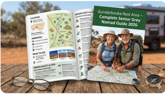
Gunderbooka Rest Area – Complete Senior Grey Nomad Guide 2026
Gunderbooka Rest Area
Complete Senior Grey Nomad Guide 2026 — GPS coordinates, road conditions, Gunderbooka National Park access, fuel stops, facilities, wildlife and everything you need for a comfortable and safe stop in one of outback NSW’s most scenic locations.
📅 Last reviewed: January 2026 | Gunderbooka region, NSW 2840 | Free overnight stop — remote outback setting
The Gunderbooka Rest Area is where the Mitchell Highway corridor begins to feel genuinely remote. Sitting approximately 60 to 80 kilometres from Bourke in the Gunderbooka region of far western New South Wales, this rest area is positioned near one of the most significant natural and cultural landmarks in the outback — Gunderbooka National Park, a landscape of ancient sandstone formations, Aboriginal rock art and exceptional birdwatching that rewards grey nomads who take the time to stop and explore.
Unlike the stops closer to Bourke, Gunderbooka places you genuinely in the middle of outback NSW. The surrounding country changes character here — red plains give way to low rocky rises, mulga scrub thickens and the silence at night is complete. There are no towns nearby, no services within easy reach and no other travellers visible in any direction on a typical weeknight. This is exactly what most grey nomads come out here for, and the Gunderbooka Rest Area delivers it in full.
But genuine remoteness demands genuine preparation. This guide covers everything you need — GPS coordinates, road conditions including flood and unsealed road risks, fuel planning across the full corridor, what other websites leave out, a month-by-month visiting guide, wildlife identification, senior accessibility, emergency planning and honest traveller reviews. This post is part of our complete guide to rest areas near Bourke NSW covering nine locations on the full corridor.
📋 Table of Contents
- Why Grey Nomads Stop at Gunderbooka Rest Area
- Gunderbooka National Park — What Grey Nomads Need to Know
- Free Camping — Know the Limits for Seniors
- Your Two Main Options Side by Side
- Quick Facts and Key Details 2026
- How to Get to Gunderbooka Rest Area + GPS
- Road Conditions, Flooding and Unsealed Sections
- Heat and Remoteness — Senior Safety
- Wildlife — Birds, Reptiles and What to Watch For
- What Other Websites Don’t Tell You
- Best Time to Visit — Month-by-Month Breakdown
- Free and Low-Cost Camping Alternatives Nearby
- Dump Points Near Gunderbooka
- Free Water Sources on This Corridor
- Fuel Stops Along the Mitchell Highway
- Showground Donation or Caravan Park — Paid Alternatives
- Full Facilities Comparison Table
- Rates — All Options Near Bourke 2026
- Senior Safety Checklist — On and Off the Road
- What to Do Near Gunderbooka — Senior Activity Guide
- Vanlife Savings Spots — GPS Coordinates and Postcodes
- Phone Signal and Emergency Communications
- Campfires, Cooking Restrictions and Food Near Gunderbooka
- Pets at Gunderbooka Rest Area
- Accessibility for Seniors with Mobility Limitations
- Permits, Fees, Etiquette and Waste Management
- Emergency Scenarios — What to Do
- Packing List for This Section of Highway
- 5 Nearby Rest Areas on the Mitchell Highway Corridor
- Reviews — What Grey Nomads Say
- Frequently Asked Questions
- Quick-Reference Card
- Disclaimer
Why Grey Nomads Stop at Gunderbooka Rest Area
Ask experienced outback travellers which rest area on the Bourke–Cobar corridor they actually remember, and Gunderbooka comes up repeatedly. It is not just a place to sleep — it is a place that has a character of its own, defined by the dramatic sandstone formations of the Gunderbooka range visible on the horizon, the exceptional birdwatching in the surrounding mulga and rocky country, and the sense that you are genuinely deep in the Australian outback rather than just passing through it.
Positioned roughly midway between Bourke and the turn-off toward Cobar, Gunderbooka sits at a natural midpoint that makes it a logical overnight stop whether you are northbound or southbound. From Bourke, it represents approximately 60 to 80 kilometres of driving — a comfortable two to three hours including a fuel stop. From Cobar, it is a similar proposition heading north. In both directions, it sits at a point where the day’s driving feels complete and the evening can be spent appreciating the country rather than anxiously covering more distance.
The rest area itself is functional in the way that good outback infrastructure should be — a firm, flat surface suitable for heavy vehicles and large caravans, a pit toilet, picnic tables and adequate space. What makes the experience exceptional is not the infrastructure but the location — the ancient rocky landscape around Gunderbooka, the bird calls at dawn, the complete absence of artificial light at night and the extraordinary quality of the outback sky after dark.
Gunderbooka National Park — What Grey Nomads Need to Know
🏔️ Gunderbooka National Park — Quick Overview
Gunderbooka National Park protects a significant area of sandstone ranges, mulga woodland and ancient Aboriginal cultural sites in far western NSW. The park contains Aboriginal rock art of significant cultural importance, dramatic rocky gorges and exceptional wildlife habitat. It is managed by NSW National Parks and Wildlife Service.
Important for caravanners: Access to the park’s interior involves unsealed roads that are not suitable for on-road caravans or 2WD campervans. The rest area on the highway is accessible to all vehicles — the national park interior is a separate matter requiring appropriate vehicle capability and current road condition checking.
What is inside Gunderbooka National Park?
- Gunderbooka Mountain — A dramatic sandstone formation rising from the surrounding plains. The mountain is a significant landmark visible from the highway corridor and a site of cultural importance to local Aboriginal communities.
- Aboriginal rock art — The park contains significant Aboriginal engravings and art sites of cultural and historical importance. These sites must be treated with respect — do not touch, climb on or disturb rock art in any way.
- Gorge country — Rocky gorges and escarpments that contrast dramatically with the surrounding flat red plains. Excellent photography opportunities particularly in morning and late afternoon light.
- Mulga woodland habitat — The park protects significant areas of mulga woodland supporting a diverse range of woodland bird species and reptiles.
- Night skies — The park’s remoteness and absence of light pollution make it one of the best dark-sky locations in NSW. Stargazing here on a clear night is exceptional.
Can you camp in Gunderbooka National Park?
Camping within Gunderbooka National Park requires checking current National Parks NSW information before your visit. Camping arrangements and requirements can change — verify the current situation directly with NSW National Parks and Wildlife Service before planning an in-park stay. A parks pass may be required for vehicle entry to the park. The highway rest area does not require any national park permit.
Access to the national park from the rest area
The road from the Mitchell Highway to the Gunderbooka National Park interior is unsealed. In dry conditions it is manageable for 4WD high-clearance vehicles and experienced off-road caravanners with appropriate setups. In wet conditions it can become impassable. Standard on-road caravans, 2WD campervans and low-clearance vehicles should not attempt the unsealed access road in any conditions. Always check the NSW National Parks website for current road conditions before attempting this route.
Free Camping — Know the Limits for Seniors
The Gunderbooka Rest Area on the Mitchell Highway is a NSW Transport for NSW designated roadside rest area. The maximum permitted stay is 20 hours under NSW road rules. This is the same limit that applies to all NSW roadside rest areas on this corridor.
Practical notes for senior travellers:
- Arrive in the afternoon, sleep overnight, depart by late morning — comfortably within the 20-hour limit.
- If you want to spend more time exploring Gunderbooka National Park, investigate camping within the park itself through National Parks NSW — different rules and potentially different facilities apply.
- Check posted signage on arrival — remote rest areas can have temporary restrictions during extreme weather or after flooding.
- No booking, no fee, no check-in — pull in, read the signs, comply.
Your Two Main Options Side by Side
When you are in the Gunderbooka area, your realistic stopping options are the free highway rest area or continuing to Bourke or Cobar for paid facilities. Here is the comparison:
| Feature | Gunderbooka Rest Area (Highway) | Gunderbooka National Park Camping | Bourke / Cobar Caravan Parks |
|---|---|---|---|
| Cost | Free | Check National Parks NSW | $20–$45/night |
| Powered Site | ❌ | ❌ Typically | ✅ |
| Toilet | ✅ Pit toilet | ⚠️ Varies by site | ✅ Flush |
| Shower | ❌ | ❌ Typically | ✅ |
| Dump Point | ❌ | ❌ | ✅ |
| Potable Water | ❌ | ❌ Carry all water | ✅ |
| Road Access | ✅ Sealed highway | ⚠️ Unsealed — check conditions | ✅ Sealed |
| Stay Limit | 20 hours | Check National Parks NSW | Flexible |
| National Park Atmosphere | Adjacent to park country | ✅ Within the park | ❌ |
| Night Sky Quality | ✅ Outstanding | ✅ Outstanding | ⚠️ Town light |
| Distance to Emergency Services | ~60–80km to Bourke | ~60–80km+ to Bourke | In town |
Quick Facts and Key Details 2026
| Detail | Information |
|---|---|
| Name | Gunderbooka Rest Area |
| Type | NSW Roadside Rest Area — Heavy Vehicle Stop |
| Highway | Mitchell Highway (B79) — near Gunderbooka Road junction |
| Locality | Gunderbooka region, far western NSW |
| Distance to Bourke | ~60–80km north |
| Distance to Cobar | ~90–105km south |
| Postcode | 2840 |
| State | New South Wales (NSW) |
| GPS Latitude | -30.4801 |
| GPS Longitude | 146.0412 |
| Coordinate Source | Publicly available mapping data (OpenStreetMap / Google Maps cross-referenced) |
| Cost | Free |
| Max Stay | 20 hours (NSW road rules) |
| Toilet | Pit toilet on site |
| Picnic Tables | Yes |
| Potable Water | Not available — must be self-sufficient |
| Dump Point | Not at this site — nearest in Bourke or Cobar |
| Powered Sites | No |
| Shower | No |
| Highway Access | Sealed (Mitchell Highway) |
| National Park Access | Unsealed road — 4WD recommended, check conditions |
| Surface at Rest Area | Flat, firm — heavy vehicle rated |
| Mobile Coverage | Very limited to absent — PLB essential |
| Nearby WiFi | None — nearest in Bourke or Cobar |
| Pets | Permitted at rest area — lead required |
| Campfires | Not permitted at this rest area |
| Nearest Fuel North | Bourke ~60–80km |
| Nearest Fuel South | Cobar ~90–105km |
| Emergency Services | Bourke Hospital ~60–80km north |
| National Park | Gunderbooka National Park — nearby, unsealed access |
How to Get to Gunderbooka Rest Area + GPS
📍 GPS Coordinates — Gunderbooka Rest Area
-30.4801, 146.0412
Mitchell Highway (B79), Gunderbooka region, approximately 60–80km south-east of Bourke township, NSW 2840
Coordinates sourced from publicly available mapping data. Verify with your own GPS unit on approach. The rest area is signed from the Mitchell Highway. Save these coordinates before leaving Bourke or Cobar — mobile data is unreliable along this corridor. The Gunderbooka area is where the highway begins to curve slightly toward the south-east, and the rest area appears in this section.
Coming from Bourke — heading south-east
Depart Bourke heading south on the Mitchell Highway. Fill your fuel tank completely and top up all water containers before leaving Bourke. The drive to the Gunderbooka Rest Area is approximately 60–80km — allow around 45 minutes to one hour. Watch for the NSW blue rest area sign on the left side of the highway as you travel through the Gunderbooka locality. The surrounding country begins to take on a different character in this area as the flat red plains give way to slightly more undulating country with rocky rises visible to the south-east.
Coming from Cobar — heading north
Depart Cobar northbound on the Mitchell Highway. Fill up completely in Cobar before departing — Bourke is approximately 167km north and Gunderbooka is roughly 90–105km into that run. The rest area will appear on your right (east side of highway) as you travel north through the Gunderbooka locality. Watch for the advance warning signage.
Approaching from the Gunderbooka Road (unsealed access)
If you are approaching from the direction of Gunderbooka National Park via the unsealed Gunderbooka Road, you will join the Mitchell Highway in the vicinity of the rest area. This route is only appropriate for 4WD high-clearance vehicles in dry conditions — do not attempt it in a standard caravan setup or after any rain.
Vehicle access summary
- All vehicles on the Mitchell Highway: ✅ — fully sealed highway access to the rest area
- Large caravans and fifth-wheelers: ✅ — heavy vehicle rest area design, wide and flat
- 2WD vehicles on highway: ✅ — no unsealed sections on the main highway route
- Gunderbooka National Park interior via unsealed road: ⚠️ 4WD high-clearance only, dry conditions, check current road conditions before attempting
Road Conditions, Flooding and Unsealed Sections
Mitchell Highway — sealed between Bourke and Cobar
The Mitchell Highway is fully sealed for its entire length between Bourke and Cobar, including through the Gunderbooka locality. The road surface in the Gunderbooka section is generally in reasonable condition, though flood-related repair sections from 2022–2024 events exist in this corridor. Some repaired areas have a rougher feel and edge-drop hazards — reduce speed on patched sections.
Does the highway flood near Gunderbooka?
Yes. The Mitchell Highway between Bourke and Cobar passes through low-lying areas that are subject to flooding after significant rain. The Gunderbooka area, while not as flat as the country immediately north of Bourke, still contains drainage lines that can sheet water across the highway after heavy rain events — local or from catchments well to the west and north.
Unsealed road to Gunderbooka National Park — detailed assessment
This is where travellers in this area commonly get into trouble. The unsealed road from the Mitchell Highway into the Gunderbooka National Park area looks passable on a dry day. It can become completely impassable within minutes of rain beginning. The specific challenges are:
- Clay surface. The red clay soils in this region become extremely slippery when wet — far more so than sandy or gravelly outback surfaces. A 4WD in low range can lose traction on wet clay slopes in this area.
- No mobile coverage. If you become stuck on the unsealed road to Gunderbooka National Park, you have no mobile coverage to call for help. Your PLB is your only emergency communication tool.
- No other traffic. Unlike the Mitchell Highway where a passing truck is a realistic source of assistance, the Gunderbooka National Park access road carries virtually no traffic. A breakdown or bogging here is a serious situation.
- Distance from assistance. The nearest mechanical assistance is in Bourke or Cobar — both at least 60–105km away on sealed road, plus the unsealed distance from the park back to the highway.
Heat and Remoteness — Senior Safety
The Gunderbooka Rest Area is more remote than any of the stops closer to Bourke. At 60–80km from Bourke and 90–105km from Cobar, you are genuinely at the midpoint of a long stretch of highway with no town services in either direction. In a medical emergency, help is at least one hour away. In a vehicle emergency, you may be waiting for assistance for several hours.
Heat management at Gunderbooka
- The Gunderbooka area experiences the same extreme heat as the surrounding region. Summer maximums of 40–44°C are standard. The rocky escarpments of the Gunderbooka range can radiate stored heat well into the evening, making the surrounding environment feel hotter at night than the open plains to the north.
- There is no shade infrastructure at the highway rest area beyond whatever natural shade exists from mulga scrub. Your awning is your only reliable shade source — set it up before the heat peaks, not after.
- Water is entirely your responsibility. There is no water at Gunderbooka Rest Area. You carried everything you have from Bourke or Cobar. Manage it carefully.
- If the temperature is above 38°C and you have no air conditioning in your van, the Gunderbooka Rest Area in summer is a health risk. Stay in Bourke or Cobar where air-conditioned facilities are accessible.
The overnight cold in winter at this location
The rocky terrain around Gunderbooka creates its own microclimate. The sandstone formations radiate warmth in the evenings but the open areas cool rapidly after midnight. June and July nights can reach 0–2°C. The slight elevation change from the flat plains also means wind can be channelled through gaps in the rocky country — a cold wind on a clear winter night at Gunderbooka can feel significantly colder than the temperature reading suggests. Have a quality sleeping bag and accessible warm layers.
Wildlife — Birds, Reptiles and What to Watch For
The Gunderbooka region is one of the genuine wildlife highlights of the Mitchell Highway corridor. The combination of the flat mulga plains and the rocky sandstone country of the Gunderbooka range creates a habitat mosaic that supports an exceptional diversity of species — particularly birds.
Birdwatching at Gunderbooka — what makes it special
Serious birdwatchers make specific trips to the Gunderbooka area. For grey nomads who appreciate birds but are not dedicated twitchers, the dawn chorus at this stop on a still morning is one of the great free experiences of outback NSW. Species you may encounter:
- Bourke’s Parrot — Reaches high density in the mulga country around Gunderbooka. Dawn and dusk flight activity can be spectacular. Look for birds flying to water sources in the rocky areas.
- Major Mitchell Cockatoo — The salmon-pink and white cockatoo is commonly seen in the Gunderbooka area, favouring the mulga and cypress pine habitat at the base of the rocky ranges.
- Wedge-tailed Eagle — Pairs nest on the Gunderbooka range escarpments. Soaring pairs are frequently visible over the rest area, particularly in the morning thermal hours.
- Peregrine Falcon — Rocky cliff faces at Gunderbooka provide nesting habitat for Australia’s fastest bird. Watch cliff faces in the mornings for perched or stooping birds.
- Grey-crowned Babbler — Noisy family groups in mulga scrub near the rest area. Entertaining to watch as they work cooperatively through the scrub.
- Redthroat — A bird of mulga scrub and rocky areas — the Gunderbooka area is good habitat for this small, elusive species.
- Striated Grasswren — Possible in appropriate spinifex and rocky habitat near Gunderbooka Mountain. A sought-after species for dedicated birders.
- Budgerigar — Large flocks in good seasons, particularly moving between water sources in the rocky terrain.
- Diamond Dove — Small, beautiful and common in the mulga country near this rest area.
- White-winged Triller — Seasonal migrant that can be common in mulga woodland during spring and summer.
Reptiles at Gunderbooka
- Eastern Brown Snake — Common in this region. Rocky areas around Gunderbooka also support King Brown Snakes. Both are highly venomous. Always wear closed footwear and look before stepping anywhere near rocks, logs or vegetation.
- King Brown Snake (Mulga Snake) — Particularly associated with mulga country and rocky terrain — both present at Gunderbooka. A very large and venomous snake.
- Inland Taipan — Australia’s most venomous snake inhabits the black soil country further west but its range can extend into the Gunderbooka region. Treat any large brown snake in this area as potentially dangerous.
- Bearded Dragon — Abundant on fence posts, rocks and sunny surfaces near the rest area.
- Military Dragon — Found in sandy and rocky areas in the Gunderbooka region — a beautiful species with distinctive markings.
- Blue-tongue Lizard — Common in mulga scrub near the rest area.
Mammals at Gunderbooka
- Red Kangaroo — The dominant large mammal. Active at dawn and dusk near the rest area. Can move onto the highway at night — reduce speed in low-light conditions.
- Euro (Common Wallaroo) — Rocky country around Gunderbooka Mountain supports euros, which are harder to see than kangaroos but present in the rockier terrain.
- Yellow-footed Rock-wallaby — The Gunderbooka sandstone escarpments are potential habitat for this beautiful endangered species. A sighting is considered exceptional but has been reported in this area.
- Echidna — Occasional sightings at and near the rest area, particularly in the cooler months when they are more active during daylight hours.
What Other Websites Don’t Tell You
Gunderbooka is genuinely different from the other corridor stops
The rest areas north of here — Prattenville, South of Bourke, Beemery — are all on flat open plains. Gunderbooka is different. The proximity of the sandstone ranges changes the landscape character entirely. The country feels older here, more layered, more interesting. This is not just a transit rest area — it is a place with genuine atmosphere that repays people who take time to sit quietly and pay attention.
The light at Gunderbooka is exceptional
The combination of the sandstone formations, the mulga scrub and the quality of outback light produces extraordinary photography opportunities at this location. The golden hour before sunset, when the cliffs of Gunderbooka Mountain glow red-orange against a deepening blue sky, is one of those moments that experienced outback travellers specifically plan for. Arrive in the afternoon rather than at the last minute if photography is important to you.
Night sky — among the best on the entire corridor
The Gunderbooka area combines the zero light pollution of deep outback NSW with slightly elevated terrain that pushes the horizon down and opens the sky further. On a clear winter or autumn night, the view from this rest area is genuinely world-class. The absence of any other travellers on most nights means complete silence to accompany what you see. Many grey nomads specifically choose Gunderbooka as their overnight stop for this reason alone.
The unsealed road temptation is real — and dangerous without preparation
When you arrive at Gunderbooka on a clear autumn morning and the road toward the national park looks solid and inviting, it is tempting to take the turn. Many travellers do, without adequate preparation. Be honest about your vehicle capability, your recovery gear, your water supply and your communications equipment before making that decision. The park is worth visiting — but only with the right setup and the right conditions.
Flying insects can be a significant issue in the warmer months
The rocky terrain around Gunderbooka creates sheltered areas that support high fly populations in warm weather. The transition from the open highway plains to the slightly broken country near the rest area concentrates insects in ways that open plains stops do not. From September through April, a fly net for your hat and quality insect repellent are non-negotiable at Gunderbooka.
Best Time to Visit — Month-by-Month Breakdown
| Month | Avg High (°C) | Avg Low (°C) | Conditions at Gunderbooka | Senior Rating |
|---|---|---|---|---|
| January | 40–44°C | 23–26°C | Extreme heat. Rocky terrain radiates heat at night. Flies intense. Avoid. | ⚠️ Avoid |
| February | 39–43°C | 22–25°C | Extreme heat. Flooding risk from summer storms. Road damage possible. | ⚠️ Avoid |
| March | 35–39°C | 18–22°C | Heat easing. Wildflowers possible after good rain. Flies reducing but still present. | ⚠️ With caution |
| April | 28–32°C | 12–16°C | Excellent. Comfortable days, cool nights. Wildflowers possible. Highly recommended. | ✅ Excellent |
| May | 22–27°C | 7–11°C | Outstanding outback autumn. Cool nights. Bird activity peaks. Best month overall. | ✅ Excellent |
| June | 17–22°C | 1–5°C | Cold nights — frost possible. Warm sunny days. Exceptional stargazing. Pack warm gear. | ✅ Very Good |
| July | 18–22°C | 0–4°C | Peak grey nomad season. Cold nights — quality sleeping bag essential. Brilliant days. | ✅ Very Good |
| August | 22–27°C | 4–8°C | Warming beautifully. Outstanding birdwatching as spring approaches. Highly recommended. | ✅ Excellent |
| September | 27–32°C | 9–13°C | Spring wildflowers in good seasons. Heat building. Early morning starts recommended. | ✅ Very Good |
| October | 31–36°C | 14–18°C | Hot. Flies building rapidly. Drive early. Rocky terrain heat absorption begins to be an issue. | ⚠️ With caution |
| November | 35–40°C | 18–22°C | Hot and fly season at full intensity. Rocky terrain magnifies heat. Experienced travellers only. | ⚠️ With caution |
| December | 38–43°C | 22–25°C | Extreme heat. Rocky terrain creates heat trap conditions. Avoid without full cooling setup. | ⚠️ Avoid |
Free and Low-Cost Camping Alternatives Nearby
If Gunderbooka is not suitable on arrival or you want to explore nearby options, here are your closest alternatives on the corridor — all covered in detail as part of our complete Bourke rest areas guide:
- Prattenville Rest Area (Southbound) — ~35–55km north, southbound HV stop on open plains
- South of Bourke Rest Area — ~50–65km north, first stop south of Bourke
- Bourke Rest Area and Truck Stop — ~60–80km north, in town with flush toilet and all services
- Curraweena Rest Area — ~20–40km south, quiet overnight stop further south
- Greenwood Grange Rest Area — Further south toward Cobar
- Redbank Rest Area — Roadside free camp further south on the corridor
- Cobar Free Camp Truck Stop — ~90–105km south, near Cobar town with services
Dump Points Near Gunderbooka
There is no dump point at the Gunderbooka Rest Area. This is one of the most isolated stops on the corridor in terms of services — plan your tank emptying carefully around this stop.
| Dump Point Location | Direction | Distance | Notes |
|---|---|---|---|
| Bourke Caravan Park | North | ~60–80km | Most reliable option north — phone ahead to confirm |
| Bourke Rest Area / Truck Stop | North | ~60–80km | Check on arrival — may have dump point |
| Cobar Caravan Park / facilities | South | ~90–105km | Multiple options in Cobar — see Cobar guide |
Free Water Sources on This Corridor
There is absolutely no potable water at the Gunderbooka Rest Area. At this distance from both Bourke and Cobar, you are genuinely committed to whatever water you carried from the last town.
| Water Source | Direction | Distance | Notes |
|---|---|---|---|
| Bourke township — multiple locations | North | ~60–80km | Full town water supply — fill everything here before heading south |
| Bourke Caravan Park | North | ~60–80km | Fresh water — ask if non-guest filling is permitted |
| Cobar township | South | ~90–105km | Full town water — fill completely before heading north through Gunderbooka |
Fuel Stops Along the Mitchell Highway
Gunderbooka sits in the middle of the longest fuel gap on the Bourke–Cobar corridor. Fuel planning here is critical — being stranded without fuel between these towns is a serious situation.
| Town | Direction | Distance from Gunderbooka | Fuel Types | Notes |
|---|---|---|---|---|
| Bourke | North | ~60–80km | Unleaded, Diesel, LPG | Multiple servos. Fill completely before heading south. Last fuel before Gunderbooka heading south. |
| Cobar | South | ~90–105km | Unleaded, Diesel, LPG | Major town. Multiple fuel options. Fill completely before heading north. Last fuel before Gunderbooka heading north. |
| Cunnamulla (QLD) | North (via Bourke) | ~260–280km via Bourke | Unleaded, Diesel | North of Bourke — relevant if continuing north from the corridor |
| Nyngan | South-east (via Cobar) | ~355km via Cobar | Unleaded, Diesel | On Barrier Highway east of Cobar — further planning point |
Showground Donation or Caravan Park — Paid Alternatives
There are no paid accommodation options at Gunderbooka itself. The nearest paid options are in Bourke (60–80km north) or Cobar (90–105km south):
Bourke Caravan Park (~60–80km north)
Powered sites, hot showers, flush toilets, dump point and laundry. Best option if you want full facilities and are travelling northbound. In peak season book ahead. Rates approximately $20–$45 per night in 2026.
Bourke Showground (~60–80km north)
Donation-based camping when available outside of show dates. Contact the showground committee to confirm. More space and quieter than the caravan park. Basic facilities.
Cobar Caravan Park and facilities (~90–105km south)
Cobar is a substantial outback town with multiple accommodation options including caravan parks with powered sites and full facilities. See our Cobar free camp guide for details on the free options. The caravan park provides a full-service alternative for southbound travellers who want facilities.
Camping within Gunderbooka National Park
If NSW National Parks manages designated camping areas within Gunderbooka National Park at the time of your visit, this is an option for travellers with appropriate vehicles and equipment. Check the NSW National Parks website for current availability, fees and booking requirements before your trip. Park camping experiences a very different character to the highway rest area — deeper in the landscape, surrounded by the national park’s rocky formations and wildlife.
Full Facilities Comparison Table
| Facility | Gunderbooka Rest Area | Prattenville Rest Area | Bourke Truck Stop | Bourke Caravan Park |
|---|---|---|---|---|
| Cost | Free | Free | Free | $20–$45/night |
| Powered Site | ❌ | ❌ | ❌ | ✅ |
| Flush Toilet | ❌ Pit only | ❌ Pit only | ✅ | ✅ |
| Hot Shower | ❌ | ❌ | ❌ | ✅ |
| Dump Point | ❌ | ❌ | ⚠️ Check | ✅ |
| Potable Water | ❌ | ❌ | ⚠️ Check | ✅ |
| Picnic Tables | ✅ | ✅ | ✅ | ✅ |
| HV Access | ✅ | ✅ | ✅ | ✅ |
| Phone Coverage | ❌ Very limited | ⚠️ Patchy | ✅ Good | ✅ Good |
| Night Sky | ✅✅ Outstanding | ✅ Outstanding | ⚠️ Town light | ⚠️ Town light |
| National Park Near | ✅ Adjacent | ❌ | ❌ | ❌ |
| Birdwatching | ✅✅ Exceptional | ✅ Very Good | ✅ Good | ✅ Good |
| Hospital Access | ~60–80km north | ~25–35km north | In town | In town |
| Stay Limit | 20 hours | 20 hours | 20 hours | Flexible |
Rates — All Options Near Gunderbooka 2026
| Option | 2026 Rate | What’s Included | Booking |
|---|---|---|---|
| Gunderbooka Rest Area | Free | Pit toilet, picnic table, parking | No booking |
| Prattenville Rest Area | Free | Pit toilet, parking | No booking |
| South of Bourke Rest Area | Free | Pit toilet, parking | No booking |
| Bourke Rest Area / Truck Stop | Free | Flush toilet, parking, town access | No booking |
| Gunderbooka NP Camping | Check National Parks NSW | Varies by site | Check National Parks NSW |
| Bourke Showground | Donation | Basic facilities, space | Contact showground |
| Bourke Caravan Park — Unpowered | ~$20–$28/night | Toilet, shower, water, laundry access | Recommended in peak |
| Bourke Caravan Park — Powered | ~$32–$45/night | Full facilities + 240V power | Book ahead July–August |
| Cobar caravan park options | ~$25–$40/night | Varies by park | Check locally |
All rates indicative for 2026. Confirm current pricing directly with each provider. National Parks NSW fees and booking requirements change — always check the NSW National Parks website for current Gunderbooka park camping information.
Senior Safety Checklist — On and Off the Road
Gunderbooka demands the most thorough preparation of any rest area on the Bourke–Cobar corridor. Copy this into your phone notes or write on a glovebox card before departing from either Bourke or Cobar:
Before leaving your last town heading to Gunderbooka:
- Fuel tank completely full — Gunderbooka is 60–80km from Bourke and 90–105km from Cobar
- ALL water containers filled to maximum — there is no water at Gunderbooka or between towns
- Dump point used — tanks emptied before departing
- Food supply adequate — three-day emergency reserve above planned needs
- Live Traffic NSW checked — road conditions in both directions confirmed
- PLB registered, charged and physically accessible — not in storage
- Satellite communicator charged and checked in if carrying one
- Home contact briefed — departure time, Gunderbooka as planned overnight, next check-in time
- Medications in insulated case — heat management confirmed
- Tyres at correct pressure for loaded weight
- Van hitch, safety chains and all lights confirmed operational
- GPS loaded with Gunderbooka coordinates — offline maps downloaded
- National park visit decision made — if yes, 4WD capability confirmed, unsealed road conditions checked, extra water for day trip carried
- Awning pegs and guy ropes accessible
- Snake awareness — closed footwear worn at all times outside the van
On arrival at Gunderbooka Rest Area:
- Read all posted signage — stay limits and any current restrictions
- Assess pit toilet condition before committing to overnight stop
- Position van for shade — check sun angle and set up awning before heat peaks
- Test for any Telstra signal — send check-in message immediately if any signal present
- Secure all food and waste — remote area with active wildlife including feral animals
- Check surrounds for snake activity before letting pets or children explore
- Note exact GPS position — valuable if emergency requires location reporting
- Check water supply — confirm adequate for planned stay plus emergency reserve
Before departing Gunderbooka:
- All rubbish collected and bagged — carry out if bins are absent or full
- Fuel calculation confirmed for next leg in chosen direction
- Van hitched, chains connected, all lights operational
- Check under and around van for overnight animal visitors before driving
- Check-in message sent to home contact before leaving signal area
- Live Traffic NSW checked before departing if any weather overnight
- National park visit completed or rescheduled — do not attempt unsealed road if any overnight rain occurred
What to Do Near Gunderbooka — Senior Activity Guide
Unlike the transit stops closer to Bourke, Gunderbooka offers genuine local experiences within or very close to the rest area itself, in addition to the broader Bourke and Cobar regional attractions.
At and immediately around the rest area
- Sunrise watching. Set your alarm and position your chair to the east. The Gunderbooka sandstone formations catch the first light dramatically — the transition from grey to pink to gold to red across the rocky outcrops is extraordinary. Bring a hot drink and simply sit with it.
- Dawn birdwatching. The one hour after sunrise at Gunderbooka is one of the finest birdwatching windows in outback NSW. Sit quietly near the mulga scrub at the rest area margin with binoculars and a field guide. Bourke’s Parrot, Major Mitchell Cockatoos and a diverse range of mulga woodland species are all realistic sightings.
- Stargazing. On a clear night with no moon, the Gunderbooka Rest Area has one of the finest dark skies in far western NSW. The slight elevation and proximity to the rocky terrain pushes the visible horizon down and opens the sky. Milky Way, Magellanic Clouds and satellite tracks are all visible to the naked eye. A reclining chair and 20 minutes for dark adaptation is all you need.
- Photography. The golden hour light on the Gunderbooka sandstone formations is exceptional for photography. The combination of the ancient red rock, the mulga green and the outback sky provides compositions that photograph well at virtually any skill level.
Gunderbooka National Park day trip (4WD, dry conditions only)
- Gunderbooka Mountain. The dramatic sandstone formation is the centrepiece of the national park. The approach provides increasingly impressive views as you travel the unsealed access road. Aboriginal cultural significance is significant — treat the area and any art sites with complete respect.
- Rock art sites. Aboriginal engravings and art within the national park. Do not touch. Do not photograph with flash. Read all interpretive signage. This is a living cultural landscape, not a museum exhibit.
- Wildlife watching in the park. The national park’s rocky terrain and mulga woodland supports Yellow-footed Rock-wallabies, euros and a range of reptile and bird species not as easily seen from the highway rest area.
Regional attractions accessible via Bourke
- Back O’ Bourke Exhibition Centre — 60–80km north in Bourke. Air-conditioned, excellent outback cultural history museum. Senior-friendly and fully accessible.
- Darling River Walk — Bourke township. Flat, accessible foreshore walk with exceptional birdwatching.
- Bourke Weir and Lock — Historical irrigation infrastructure on the Darling River.
🗺️ Vanlife Savings Spots — GPS Coordinates and Postcodes
At Retire to Van Life, we map every stop so you can save, plan and navigate with confidence. Use the interactive map below to save Gunderbooka and all corridor stops to your route planner. Copy these GPS coordinates into your phone notes before leaving Bourke or Cobar — there is no mobile data at Gunderbooka.
| Stop Name | Postcode | Latitude | Longitude | Notes |
|---|---|---|---|---|
| Gunderbooka Rest Area | 2840 | -30.4801 | 146.0412 | This site — near national park, remote, exceptional wildlife |
| Prattenville Rest Area (Southbound) | 2840 | -30.2544 | 145.9187 | ~35–55km north — southbound HV stop |
| South of Bourke Rest Area | 2840 | -30.1883 | 145.9301 | ~50–65km north — transit stop near Bourke |
| Bourke Rest Area / Truck Stop | 2840 | -30.0887 | 145.9351 | ~60–80km north — in town, flush toilet, all services |
| Beemery Rest Area | 2840 | -29.9812 | 145.9187 | ~80–100km north — north of Bourke, dark sky stop |
| Curraweena Rest Area | 2840 | -30.6234 | 146.0891 | ~20–40km south — quiet overnight stop |
| Greenwood Grange Rest Area | 2840 | -30.7812 | 146.1203 | Further south toward Cobar |
| Redbank Rest Area | 2840 | -30.9456 | 146.2134 | Roadside free camp south |
| Cobar Free Camp / Truck Stop | 2835 | -31.4987 | 145.8301 | ~90–105km south — near Cobar town with services |
| Bourke township — fuel and water | 2840 | -30.0921 | 145.9368 | Last services north of Gunderbooka |
| Cobar township — fuel and water | 2835 | -31.4991 | 145.8436 | Last services south of Gunderbooka |
Coordinates sourced from publicly available mapping data. Always verify with your own GPS unit on approach. Highway signs provide final on-ground confirmation for rest areas.
COPY PROMPT ➔ ASK AI ➔ SAVE TO FORM ➔ ADD SPOT PIN ➔ GET DIRECTIONS
📍 Interactive map — find free camps, rest areas and overnight stops near Gunderbooka NSW. Enable location for best results.
Phone Signal and Emergency Communications
Mobile coverage at Gunderbooka Rest Area
Mobile coverage at Gunderbooka is very limited to completely absent. This is one of the most communication-isolated stops on the entire Bourke–Cobar corridor. The slight change in terrain from flat plains to rocky country can occasionally provide a weak Telstra signal from elevated ground near the rest area — but this is not reliable and cannot be planned around. Optus and Vodafone coverage is effectively absent at this distance from any town.
Communications equipment for Gunderbooka
- AMSA-registered PLB — Non-negotiable at this location. Register at the Australian Maritime Safety Authority website before departing home. Keep it charged, accessible and activated in your name.
- Garmin inReach or equivalent satellite communicator — Strongly recommended for this stop. Two-way messaging allows daily check-in messages to family without relying on mobile coverage. At Gunderbooka’s level of isolation, this is not a luxury — it is a serious safety tool.
- Written emergency plan. Write on paper (not just in your phone) the following: GPS coordinates of Gunderbooka Rest Area, distance and direction to Bourke Hospital, your PLB activation procedure, your home contact’s phone number. Place this paper where your travelling partner can find it without needing to access any electronic device.
Satellite communicator check-in protocol at Gunderbooka
Before leaving the last town with mobile coverage (Bourke or Cobar), send a detailed check-in message through your satellite communicator to your home contact: your planned overnight location (Gunderbooka Rest Area with GPS coordinates), your planned departure time the next day, your planned next destination, and your expected next check-in time. Then send a confirmation message when you arrive safely at the rest area and another before departing the next morning.
Campfires, Cooking Restrictions and Food Near Gunderbooka
Campfires at Gunderbooka Rest Area
Open campfires are not permitted at the Gunderbooka Rest Area. This prohibition applies year-round regardless of fire danger rating. In the dry outback conditions of this region, any open fire represents a significant bushfire risk — particularly near the mulga scrub and dry grass country surrounding the rest area.
Campfires within Gunderbooka National Park
Fire regulations within Gunderbooka National Park are managed separately by NSW National Parks and Wildlife Service. Check current regulations directly with National Parks NSW before any visit. During Total Fire Ban periods, all fires including gas cookers used outdoors may be prohibited in and around the national park area.
Cooking options at this remote stop
- Van or motorhome gas cooker — Your primary cooking method at this stop. Plan meals that are practical to prepare on a gas cooker and do not require fresh refrigerated ingredients.
- Portable gas BBQ under the awning — A comfortable outdoor cooking option if wind conditions allow. The slight shelter provided by nearby mulga scrub at Gunderbooka reduces wind impact compared to fully exposed plains stops.
- One-pot meal planning. At a remote stop like Gunderbooka, simple one-pot meals that minimise cooking time and washing up are practical. Rice, lentils, canned proteins and dehydrated vegetables are outback kitchen staples for a reason.
Food supply planning for Gunderbooka
There are no food purchase options at or near the Gunderbooka Rest Area. Everything you eat at this stop comes from your onboard supplies. Plan your provisions before departing from Bourke (60–80km north) or Cobar (90–105km south). A minimum three-day emergency food reserve above your planned needs is appropriate for this level of remoteness.
Pets at Gunderbooka Rest Area
Pets are permitted at the highway rest area. Pets are generally not permitted within NSW National Parks — check current national park rules before taking any animal onto the national park access road or into the park itself.
Pet safety at Gunderbooka — elevated risk considerations
- Snake risk is very high at this location. The rocky mulga country around Gunderbooka supports Eastern Brown Snakes, King Brown Snakes and potentially Inland Taipan in the broader region. Keep dogs on a short lead at all times and check ground level before allowing pets near any vegetation, rocks or structures.
- Lead at all times. Open outback country with active wildlife. An off-lead dog at Gunderbooka can encounter kangaroos, emus and feral animals — all of which can cause injury to a dog or provoke the dog to run onto the highway.
- Water for pets. At this remote location, every litre of water is precious. Calculate your pet’s water needs separately and include them in your total water planning. A dog needs 50–100ml per kg of body weight per day under normal conditions — more in heat.
- Nearest vet. Bourke is approximately 60–80km north. Know the route and the Bourke vet contact details before you arrive at Gunderbooka with a pet. In a snake bite emergency for a dog, every minute to treatment matters.
- Pets in national parks. Confirm current NSW National Parks regulations regarding pets before taking any animal off the highway onto national park land. Regulations exist to protect wildlife and are enforced.
Accessibility for Seniors with Mobility Limitations
| Accessibility Feature | Status at Gunderbooka | Notes |
|---|---|---|
| Flat, firm parking area | ✅ Yes | Heavy vehicle rated surface — stable for van exit and mobility aids |
| Accessible toilet | ❌ No | Pit toilet only — not wheelchair accessible |
| Wheelchair access to picnic area | ⚠️ Partial | Surface around picnic tables is firm but may have minor undulations — assess on arrival |
| Handrail at toilet | ❌ Not confirmed | Basic pit toilet — carry a portable grab rail if required for stability |
| Natural shade | ⚠️ Some mulga shade | Better natural shade than open plains stops — mulga scrub near rest area provides partial shade in some positions |
| Wind exposure | ⚠️ Moderate | Less exposed than open plains stops due to proximity of scrub — but still requires awning anchoring |
| Nearest accessible toilet | Bourke or Cobar — 60–105km | Both towns have accessible public toilet facilities |
| Emergency medical access | ⚠️ Bourke ~60–80km | Further from hospital than corridor stops closer to Bourke — this must factor into risk assessment for seniors with health conditions |
| Step-free van exit | ✅ Firm level surface | Stable surface allows reliable step placement for high van entry |
Permits, Fees, Etiquette and Waste Management
Permits and fees
No permit or fee is required to use the Gunderbooka highway rest area. It is a public NSW Transport for NSW facility. Simply pull in, read all posted signage and comply with the conditions. Note: Gunderbooka National Park is a separate managed facility — a parks pass or entrance fee may be required for vehicle entry to the national park. Check NSW National Parks before visiting.
Etiquette — particularly important at a remote and ecologically significant location
- Leave no trace. At a remote stop near a national park, the leave-no-trace ethic is not just courtesy — it is a responsibility to the ecosystem. Carry every piece of rubbish out. Do not leave any food scraps on the ground.
- Respect the national park boundary. The cultural and natural significance of Gunderbooka National Park means the standards applying there are higher than at a simple highway rest area. If you visit the park, follow all posted rules without exception.
- Do not disturb wildlife. At this location, wildlife disturbance has real ecological consequences. Do not approach roosting birds, nesting raptors or reptiles sunning themselves. Observe from distance.
- No generator noise in the remote setting. The quiet of Gunderbooka at night is part of what makes it exceptional. Running a generator at this remote stop disrupts the experience for all other travellers. If you need power, plan your power management around solar or battery — not generator use at a quiet outback rest area.
- The 20-hour rule. Respect it — it keeps the facility available for all travellers.
Waste management
- Grey water: Never release on the ground at any NSW rest area. This is particularly important near a national park where grey water can affect local water sources. Carry to the dump point in Bourke or Cobar.
- Black water: Dump points only. No exceptions anywhere in outback NSW.
- Bins: If provided, use them. If full or absent, carry all waste with you — do not leave rubbish at a remote site where collection schedules are infrequent.
- Human waste (if toilet is unavailable): If the pit toilet is genuinely unusable, bury human waste at least 15cm deep and 100 metres from any water source, track or rest area facility. Carry waste trowels and appropriate bags for any toilet paper.
Emergency Scenarios — What to Do
Scenario 1: Medical emergency at Gunderbooka
This is the highest-risk emergency scenario on the Bourke–Cobar corridor given the distance from hospital and lack of mobile coverage.
- Attempt a 000 call — even without a signal bar showing, some emergency calls connect through any available tower. Try from multiple positions including from higher ground near the rest area.
- If no connection — activate your PLB immediately if the situation is life-threatening. Search and rescue coordination will begin within minutes of activation.
- If the patient can be moved safely and you can drive — Bourke Hospital is approximately 60–80km north on sealed highway. Drive directly there, activating hazard lights and driving at the best safe speed.
- Send an emergency message through your satellite communicator (if carrying one) specifying your location (GPS coordinates), the nature of the emergency and the number of people involved.
- Flag a passing vehicle on the Mitchell Highway — truck drivers carry first aid equipment and can relay an emergency call once they reach mobile coverage.
Scenario 2: Vehicle breakdown or tyre blowout
- Move completely into the rest area away from the highway carriageway.
- Activate hazard lights and place warning triangles on both approach sides.
- Attempt roadside assistance provider — confirm before leaving home that your policy covers this location. Coverage is available for some providers but response times from this distance are measured in hours, not minutes.
- If no mobile signal — notify home contact via satellite communicator and arrange coordination.
- Flag a passing truck — they can relay a message to emergency services or your roadside assistance provider once they reach coverage.
- Your emergency water and food reserve exists exactly for extended waits in this scenario. You may wait several hours for assistance.
Scenario 3: Stranded due to flooding in both directions
- Do not attempt to drive through floodwater under any circumstances.
- You are genuinely stranded between two flood events — this is when your PLB and emergency supplies become critical.
- Activate your satellite communicator and notify your home contact of your exact position and situation.
- If the situation is life-threatening — PLB activation initiates coordinated emergency response.
- Your emergency water (minimum two-day reserve) and food supply support you through the wait. A road closure between Bourke and Cobar can last 5–10 days in a significant flood event.
- Flag passing emergency or road maintenance vehicles — these are among the first vehicles on the road after a closure event and can provide assistance and information.
Scenario 4: Getting stuck on the Gunderbooka National Park unsealed road
- Stop the vehicle immediately — do not attempt to power through if you are losing traction. This creates a deeper bogging situation.
- Assess recovery options — jack and board recovery, traction boards, winch recovery depending on your equipment.
- If you cannot self-recover — activate your PLB or satellite communicator. You have no mobile coverage on this road.
- Stay with your vehicle — do not attempt to walk back to the highway in outback heat. Your vehicle provides shade, and passing traffic on the highway (though rare) is more likely to notice a vehicle on the side road than a person walking.
- This is exactly why the pre-departure checklist includes: PLB accessible, satellite communicator active, extra water for a day trip, someone who knows your exact plan and expected return time.
Packing List for This Section of Highway
This list is specifically calibrated for the Gunderbooka stop — the most remote rest area on the Bourke–Cobar corridor:
Water and food — expanded for remote stop
- Minimum 20L drinking water per person — filled completely in Bourke or Cobar
- Additional 3–5L per dog per day in warm weather
- Five-day emergency food reserve at this level of remoteness — not three days
- Electrolyte sachets — critical in summer
- One-pot meal ingredients — practical for remote cooking
- 12V or solar LED lantern — cook before dark, but have backup lighting
Navigation and communications — elevated requirements at Gunderbooka
- GPS unit with offline Australia-wide maps — absolutely not phone-dependent
- PLB — AMSA registered, charged, physically accessible, registration checked recently
- Satellite communicator — strongly recommended at this location, not optional
- All corridor GPS coordinates copied to phone offline before leaving town
- National park GPS coordinates saved separately if visiting
- Written emergency plan on paper — accessible without any electronic device
- Home contact fully briefed with specific check-in protocol
Shelter, comfort and wildlife protection
- Quality awning — 3m x 2.5m minimum — natural mulga shade helps but awning is essential
- Awning pegs and guy ropes — wind is variable in rocky mulga country
- Binoculars — 8×42 ideal — birdwatching at this stop is exceptional
- Bird field guide — Australian birds or NSW-specific app downloaded offline
- Reclining camp chair — for stargazing and dawn birdwatching
- Fly net hat — September through May essential
- DEET insect repellent
- Closed footwear — worn at all times outside the van at this snake-active location
- Quality sleeping bag rated to -5°C for winter visits
- Camera — this location rewards photography at any skill level
Vehicle and safety — expanded for remote location
- Spare tyre in good condition — checked before departure
- Tyre repair kit and portable inflator
- Jump starter pack
- Basic tool kit
- Fire extinguisher accessible
- Remote first aid kit — wilderness rated
- Warning triangles
- Recovery gear if visiting national park unsealed road — traction boards, hi-lift jack, recovery straps
- Waste trowel for toilet emergency
- Extra fuel jerry can if rig fuel consumption is high for the 167km corridor gap
5 Nearby Rest Areas on the Mitchell Highway Corridor
Part of our complete Bourke rest area guide — the five closest rest areas to Gunderbooka, in distance order:
| # | Rest Area | Direction | Approx Distance | Key Feature |
|---|---|---|---|---|
| 1 | Curraweena Rest Area | South | ~20–40km | Quiet overnight stop — next stop south |
| 2 | Prattenville Rest Area (Southbound) | North | ~35–55km | Southbound HV stop on open plains |
| 3 | South of Bourke Rest Area | North | ~50–65km | Transit stop south of Bourke town |
| 4 | Greenwood Grange Rest Area | South | ~40–60km | Highway caravan and truck stop toward Cobar |
| 5 | Bourke Rest Area / Truck Stop | North | ~60–80km | In Bourke town — flush toilet, dump point, all services |
Reviews — What Grey Nomads Say
“Gunderbooka is our favourite stop on the entire Bourke–Cobar run. The birdwatching at dawn is extraordinary — we saw Bourke’s Parrot, Major Mitchell and a pair of Wedge-tails all before 8am without moving from our chairs. The sandstone formations catch the morning light in a way that has to be seen to be understood. This is why we travel.”
“We attempted the unsealed road to the national park after what seemed like a dry spell. Made it about 4km before the surface became slippery clay. Turned around safely but it was a warning. The rest area on the highway is genuinely excellent — do not risk the unsealed road unless you are completely confident in your setup and the road has been dry for at least 48 hours.”
“Stopped here in July for one night and stayed two. The cold was real — minus one overnight — but the stars were beyond anything I had seen in 20 years of outback travel. Absolutely zero light pollution, complete silence and the full Milky Way from horizon to horizon. A sleeping bag rated to minus five and a thermos of hot tea before bed. Worth every kilometre to get here.”
“The pit toilet needed work when we were there — carry your own supplies always at remote stops. The rest area surface itself is solid and easy to get in and out with the van. No mobile coverage at all but the satellite messenger kept us connected. The surrounding country is beautiful and the complete quiet at night after weeks of highway driving is restorative in a way I did not expect.”
“Important for senior travellers: we are both in our 70s and my husband has a heart condition. We discussed Gunderbooka carefully before choosing it as an overnight stop. We confirmed we had full water, PLB, satellite messenger and that the roads in both directions were clear. It was one of the best nights of our trip. But we would not have stopped here without all of that preparation in place.”
Frequently Asked Questions
Is the Gunderbooka Rest Area free to stay overnight?
Yes. The Gunderbooka Rest Area on the Mitchell Highway is a free NSW roadside rest area. Overnight stays of up to 20 hours are permitted under NSW road rules at no charge. No booking or fee is required. Always check posted signage on arrival for any current restrictions.
Where is the Gunderbooka Rest Area located?
On the Mitchell Highway in the Gunderbooka region of far western NSW, approximately 60–80 kilometres south-east of Bourke township and approximately 90–105 kilometres north of Cobar. GPS coordinates: approximately -30.4801, 146.0412.
Is the road to Gunderbooka Rest Area sealed?
The Mitchell Highway providing access to the rest area is fully sealed. Access roads into Gunderbooka National Park from the highway are unsealed and suitable for 4WD high-clearance vehicles in dry conditions only.
What facilities does the Gunderbooka Rest Area have?
Pit toilet, picnic tables and a flat firm area suitable for heavy vehicles and caravans. No potable water, no powered sites, no dump point, no shower facilities. Complete self-sufficiency is required.
Is Gunderbooka National Park worth visiting?
Yes — it contains significant Aboriginal rock art, dramatic sandstone formations and exceptional wildlife. However, access involves unsealed roads and is appropriate only for 4WD high-clearance vehicles in dry conditions. Check NSW National Parks for current access conditions and any permit requirements before visiting.
Is there mobile phone coverage at Gunderbooka?
Very limited to absent. Assume no coverage and carry a PLB and preferably a satellite communicator. This is not a negotiable recommendation at this level of remoteness.
How far is Gunderbooka from Bourke and from Cobar?
Approximately 60–80km south-east of Bourke and 90–105km north of Cobar on the Mitchell Highway.
Can I take my pets to Gunderbooka?
Pets are permitted at the highway rest area on a lead. Pets are generally not permitted within NSW National Parks — check current regulations before taking any animal onto the national park access road.
What is the best time of year to visit Gunderbooka?
May and August are the standout months — exceptional birdwatching, comfortable temperatures and outstanding stargazing. April through September is the recommended window for senior travellers. Avoid December through February due to extreme heat.
Does the Gunderbooka Rest Area have a dump point?
No. The nearest dump points are in Bourke (60–80km north) and Cobar (90–105km south). Empty your tanks before departing from either town when Gunderbooka is your planned stop.
Quick-Reference Card
Copy into your phone notes before leaving Bourke or Cobar — no mobile data is available at Gunderbooka.
📋 Gunderbooka Rest Area — Quick Reference 2026
| GPS | -30.4801, 146.0412 |
| Highway | Mitchell Highway (B79) |
| Region | Gunderbooka, far western NSW |
| Postcode | 2840 |
| Cost | Free |
| Max Stay | 20 hours (NSW road rules) |
| Toilet | Pit toilet — carry your own supplies |
| Water | None — fill completely in Bourke or Cobar |
| Dump Point | None — Bourke (north) or Cobar (south) |
| Fuel North | Bourke ~60–80km |
| Fuel South | Cobar ~90–105km — NO fuel between |
| Hospital | Bourke District Hospital ~60–80km north |
| Phone Coverage | ❌ Very limited to absent — PLB essential |
| Emergency | 000 / PLB / satellite communicator |
| National Park | Gunderbooka NP — nearby, unsealed access, 4WD dry only |
| Pets | Permitted at rest area — not in national park |
| Campfires | Not permitted at rest area |
| Night Sky | ✅✅ Outstanding — one of the best on corridor |
| Birdwatching | ✅✅ Exceptional — best on the Bourke–Cobar corridor |
| Best Months | May and August — excellent April through September |
| Avoid | December through February |
| Hub Guide | retiretovanlife.com/rest-areas-near-bourke/ |
- South of Bourke Rest Area free camping NSW
- Beemery Rest Area caravan stop Bourke NSW
- Bourke Rest Area free camp and truck stop NSW
- Prattenville Rest Area southbound heavy vehicle stop NSW
- Gunderbooka Rest Area outback NSW caravan rest stop
- Curraweena Rest Area free overnight stop NSW outback
- Greenwood Grange Rest Area truck and caravan parking NSW
- Redbank Rest Area NSW free camping roadside stop
- Cobar free camp truck stop NSW grey nomad guide
🛠️ What experienced grey nomads carry for remote outback stops like Gunderbooka
- AMSA-Registered PLB — Non-negotiable at Gunderbooka’s level of remoteness. Register at beacons.amsa.gov.au. Keep it charged, registered in your name and physically accessible at all times.
- Garmin inReach Mini 2 — Strongly recommended at this location. Two-way satellite messaging when there is no mobile coverage at all. Subscription required — worth every cent for the Bourke–Cobar corridor.
- 8×42 Binoculars — The birdwatching at Gunderbooka is exceptional. Quality binoculars transform the experience. Bourke’s Parrot and Major Mitchell Cockatoo in morning light through good glass is extraordinary.
- Reclining Camp Chair — For the stargazing and dawn birdwatching that make Gunderbooka special. Your back will thank you for not lying on the ground in the cold.
- Quality Sleeping Bag (-5°C rated) — Winter nights at Gunderbooka reach near-freezing. A quality sleeping bag is the difference between a memorable experience and a miserable one.
- Portable Solar Panel (200W) — Remote stop with no powered sites. Clear outback skies at Gunderbooka provide excellent solar charging conditions.
- 20L BPA-free Water Jerry Cans (x2) — At this distance from both towns, carry maximum water. Two 20L cans plus your onboard tank provides genuine security at this remote location.
- Wilderness First Aid Kit — Standard kits are inadequate when help is 60–80km away. Get a kit rated for remote scenarios with snake bite protocols included.
- Traction Recovery Boards — If you plan to explore the Gunderbooka National Park unsealed road, these are essential. Clay soils in this region bog vehicles quickly and can be difficult to self-recover from without the right equipment.
Some links on this page may be affiliate links. We may earn a small commission if you purchase through them at no extra cost to you. This helps keep our guides free for all travellers.
Disclaimer
Information accuracy: All information in this guide is provided in good faith based on publicly available data, traveller reports and research current at the time of writing (January 2026). Facilities, road conditions, pricing, national park regulations and rest area conditions can change without notice. Always verify current conditions directly — check Live Traffic NSW for road closures, check NSW National Parks for current park access and fee requirements, and read all posted signage on arrival at any rest area or park facility.
GPS coordinates: Coordinates are sourced from publicly available mapping data and are indicative only. Verify with your own GPS unit on approach. Highway signs provide final on-ground confirmation for rest areas. National park coordinates should be confirmed with NSW National Parks before attempting unsealed access roads.
Unsealed road access: Information about the unsealed road to Gunderbooka National Park is provided as general guidance only. Road conditions change rapidly in outback NSW and the advice in this guide may not reflect current conditions. Drivers are solely responsible for assessing the suitability of unsealed roads for their vehicle and equipment before attempting any unsealed route.
Health and safety: Outback travel at this level of remoteness involves significant inherent risks. This guide provides general information only and does not constitute safety, medical or emergency management advice. Consult your GP before undertaking remote outback travel, particularly with pre-existing health conditions. Carry appropriate safety equipment and communications for your level of remoteness.
Aboriginal cultural sites: Information about Aboriginal cultural sites in and near Gunderbooka National Park is provided for general awareness only. The management and access to these sites is the responsibility of the relevant Aboriginal communities and NSW National Parks. All directions to respect these sites and follow posted signage represent the minimum standard of appropriate behaviour.
Affiliate disclosure: This website participates in affiliate programs. Some links may result in a small commission to this site at no extra cost to you. All recommendations are based on genuine usefulness to grey nomad and senior travellers.
Not a substitute for professional advice: Nothing in this guide constitutes legal, medical, emergency management or cultural heritage management advice. In a life-threatening emergency, call 000 or activate your PLB.
Free campsites and rest areas fill fast during peak grey nomad season. If you need a proper bed with air conditioning after a long outback drive, search remaining accommodation options in Bourke or Cobar below.
Accommodation and flight search powered by Expedia. Booking through this search supports this website at no extra cost to you. As an affiliate, I earn from qualifying purchases at no extra cost to you.

As an affiliate, I earn from qualifying purchases at no extra cost to you.
Exclusive Offer: Get 5% OFF all StarterStopper immobiliser products with promo code: RTV5
Visit StarterStopper.com to see our data-backed security solutions
As an affiliate, I earn from qualifying purchases at no extra cost to you.