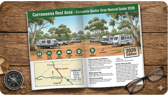
Curraweena Rest Area – Complete Senior Grey Nomad Guide 2026
Curraweena Rest Area
Complete Senior Grey Nomad Guide 2026 — GPS coordinates, facilities, road conditions, fuel stops, dump points, safety tips and everything you need for a comfortable free overnight stop between Bourke and Cobar on the Mitchell Highway.
📅 Last reviewed: January 2026 | Mitchell Highway, Curraweena NSW 2840 | Free overnight stop
The Curraweena Rest Area occupies a genuinely strategic position on the Mitchell Highway — sitting roughly midway between Bourke and Cobar in the heart of far western New South Wales outback country. At approximately 80 to 100 kilometres south of Bourke and 65 to 85 kilometres north of Cobar, it catches travellers at the point where the two-town gap between these outback centres feels most real. There is nothing between Bourke and Cobar except highway, sky, red plains and mulga scrub — and the Curraweena Rest Area is the anchor point in the middle of all of it.
For grey nomads and senior caravanners making the long inland run, Curraweena is exactly where the afternoon fatigue calculation happens. You left Bourke this morning — do you push on to Cobar before dark, or do you stop here, set up camp in the quiet of the outback evening and finish the run to Cobar fresh in the morning? For many experienced outback travellers, the answer depends on what time it is when they reach Curraweena. Past 2pm? Stop. Before midday? Continue. The rest area makes that decision easy by providing a reliable, comfortable and genuinely peaceful overnight stop at exactly the right place on the highway.
This guide is part of our complete guide to rest areas near Bourke NSW — nine locations across the full Cobar–Bourke–Queensland corridor. Bookmark that hub page if you are planning the wider trip.
📋 Table of Contents
- Why Grey Nomads Stop at Curraweena Rest Area
- Free Camping — Know the Limits for Seniors
- Your Two Main Options Side by Side
- Quick Facts and Key Details 2026
- How to Get to Curraweena Rest Area + GPS
- Road Conditions, Flooding and Unsealed Sections
- Heat and Remoteness — Senior Safety
- Wildlife — Birds, Reptiles and What to Watch For
- What Other Websites Don’t Tell You
- Best Time to Visit — Month-by-Month Breakdown
- Free and Low-Cost Camping Alternatives Nearby
- Dump Points Near Curraweena
- Free Water Sources on This Corridor
- Fuel Stops Along the Mitchell Highway
- Showground Donation or Caravan Park — Paid Alternatives
- Full Facilities Comparison Table
- Rates — All Options on the Corridor 2026
- Senior Safety Checklist — On and Off the Road
- What to Do Near Curraweena — Senior Activity Guide
- Vanlife Savings Spots — GPS Coordinates and Postcodes
- Phone Signal and Emergency Communications
- Campfires, Cooking Restrictions and Food Near Curraweena
- Pets at Curraweena Rest Area
- Accessibility for Seniors with Mobility Limitations
- Permits, Fees, Etiquette and Waste Management
- Emergency Scenarios — What to Do
- Packing List for This Section of Highway
- 5 Nearby Rest Areas on the Mitchell Highway Corridor
- Reviews — What Grey Nomads Say
- Frequently Asked Questions
- Quick-Reference Card
- Disclaimer
Why Grey Nomads Stop at Curraweena Rest Area
The Mitchell Highway between Bourke and Cobar is 167 kilometres of sealed two-lane outback highway with no towns, no fuel stops, no shops and no services of any kind in between. It is one of the genuinely remote stretches of the inland highway network in NSW — not dramatically remote in the way of the Birdsville Track, but remote enough that a breakdown, a medical event or a vehicle running dry on fuel becomes a serious situation rather than a manageable inconvenience.
The Curraweena Rest Area sits at roughly the midpoint of this gap. That positioning is not accidental — it is where NSW Transport placed a formal rest area precisely because the midpoint of a long remote highway gap is where driver fatigue peaks and where a reliable pull-off is most needed. For grey nomads planning the run, Curraweena answers the question that every experienced outback driver asks: where do I stop if I need to?
Beyond its strategic position, Curraweena offers something the town-adjacent stops cannot — genuine outback quiet. No truck stop noise, no town traffic, no generator hum from neighbouring vans in a busy park. Just the sound of the wind in the mulga, the occasional car on the highway and the extraordinary outback night sky. For grey nomads who came to outback NSW for exactly this experience, Curraweena delivers it.
The rest area is a proper heavy vehicle stop — not just a widened road shoulder. Wide entry, flat surface, adequate space for large rigs and maintained facilities. It functions reliably as an overnight stop in all but the most extreme weather conditions.
Free Camping — Know the Limits for Seniors
The Curraweena Rest Area is a NSW Transport for NSW designated roadside rest area. The maximum permitted stay under NSW road rules is 20 hours. This is sufficient for an afternoon arrival, an overnight stay and a morning departure — the standard grey nomad overnight stop pattern.
Practical notes for senior travellers:
- Arrive in the afternoon, depart the following morning — entirely within the 20-hour limit with no pressure.
- Check all posted signage on arrival. Temporary restrictions can be applied during extreme weather events, road maintenance periods or after flooding.
- No booking, no fee, no check-in process. Pull in, read the signs, comply with conditions.
- First-come, first-served basis. In peak grey nomad season (June–August), popular midpoint stops like Curraweena can fill up by late afternoon — arrive by 3pm for best choice of bay.
Your Two Main Options Side by Side
At the Curraweena midpoint, your practical overnight options are the free rest area itself or pushing on to either Bourke (80–100km north) or Cobar (65–85km south) for paid facilities. Here is the comparison:
| Feature | Curraweena Rest Area | Cobar or Bourke Caravan Park |
|---|---|---|
| Cost | Free | $20–$45/night depending on site |
| Powered Sites | ❌ No | ✅ Yes |
| Toilet | ✅ Pit toilet | ✅ Flush toilet |
| Shower | ❌ No | ✅ Yes |
| Dump Point | ❌ No | ✅ Yes |
| Potable Water | ❌ No — self-sufficient required | ✅ Yes |
| Town Services | ❌ None — remote location | ✅ Full town access |
| Noise Level | ✅ Very low — quiet outback setting | ⚠️ Town and truck stop noise |
| Night Sky | ✅ Outstanding dark sky | ⚠️ Town light pollution |
| Heavy Vehicle Access | ✅ Purpose-built stop | ✅ Good |
| Distance to nearest fuel | Cobar ~65–85km or Bourke ~80–100km | In town |
| Emergency services access | Cobar or Bourke — 65–100km away | In town |
| Stay Limit | 20 hours NSW rule | Flexible at caravan park |
Quick Facts and Key Details 2026
| Detail | Information |
|---|---|
| Name | Curraweena Rest Area |
| Type | NSW Roadside Rest Area — Heavy Vehicle Stop |
| Highway | Mitchell Highway (B79) |
| Locality | Curraweena, between Bourke and Cobar NSW |
| Distance from Bourke | ~80–100km south of Bourke township |
| Distance from Cobar | ~65–85km north of Cobar township |
| Postcode | 2840 |
| State | New South Wales (NSW) |
| GPS Latitude | -30.6234 |
| GPS Longitude | 146.0891 |
| Coordinate Source | Publicly available mapping data (OpenStreetMap / Google Maps cross-referenced) |
| Cost | Free |
| Max Stay | 20 hours (NSW road rules) |
| Toilet | Pit toilet on site |
| Picnic Tables | Yes |
| Potable Water | Not available — must be fully self-sufficient |
| Dump Point | Not at this site |
| Powered Sites | No |
| Shower | No |
| Access Road | Sealed Mitchell Highway — both directions |
| Surface at stop | Flat, hardpacked or sealed — heavy vehicle rated |
| Mobile Coverage | Limited to absent — Telstra may provide weak signal |
| Nearby WiFi | None — nearest in Cobar or Bourke township |
| Pets | Permitted — must be on lead |
| Campfires | Not permitted |
| Nearest Fuel North | Bourke ~80–100km |
| Nearest Fuel South | Cobar ~65–85km |
| Nearest Hospital | Cobar District Hospital ~65–85km south or Bourke ~80–100km north |
| Night Sky | Outstanding — zero light pollution in any direction |
How to Get to Curraweena Rest Area + GPS
📍 GPS Coordinates — Curraweena Rest Area
-30.6234, 146.0891
Mitchell Highway (B79), Curraweena locality, approximately 80–100km south of Bourke, NSW 2840
Coordinates sourced from publicly available mapping data. Save these before leaving either Bourke or Cobar — mobile data connectivity on the Mitchell Highway between these two towns is unreliable. The rest area is signed from the highway with the standard NSW blue rest area sign. Verify with your own GPS unit on approach.
Coming from Bourke — heading south
Depart Bourke heading south on the Mitchell Highway. Fill your fuel tank and all water containers completely before leaving Bourke. The Curraweena Rest Area is approximately 80–100km south of town — allow approximately one hour at open road highway speed. Watch for the NSW blue rest area signage well before the entry. The highway is straight and flat in this section — the sign gives you adequate advance warning to slow a large van and position for the entry. The stop is on the left (east) side of the highway heading south.
Coming from Cobar — heading north
Depart Cobar heading north on the Mitchell Highway. Fill fuel and water completely in Cobar before departing. The Curraweena Rest Area is approximately 65–85km north of Cobar — allow approximately 45 minutes to one hour. The stop appears on the right (also east) side of the highway when approaching from the south. Watch for the NSW blue sign giving advance warning of the entry.
Vehicle access
- All standard vehicles, caravans and motorhomes: ✅ — sealed highway access, flat stop surface
- Large caravans and fifth-wheelers: ✅ — heavy vehicle stop with wide entry and generous turning space
- Road trains and B-doubles: ✅ — purpose-designed for these vehicles
- 2WD vehicles: ✅ — no unsealed sections on the approach
Road Conditions, Flooding and Unsealed Sections
Is the Mitchell Highway sealed at Curraweena?
Yes. The Mitchell Highway is fully sealed for the entire 167km between Cobar and Bourke, including through the Curraweena locality. The road is a two-lane sealed bitumen highway for its full length. However, some sections between Cobar and Bourke have experienced significant flood damage in the 2022–2024 period and have been subject to patch repairs. These repaired sections can have a rougher surface profile and occasional edge-drop variations — reduce speed on obviously repaired sections and be aware of the potential for edge crumbling particularly after wet weather.
Does this section of the Mitchell Highway flood?
Yes — and this is the most important road hazard to understand on the Cobar–Bourke corridor. The Curraweena locality sits in flat plains country that is part of the broader Darling River catchment system. Water from catchment rain events hundreds of kilometres away can sheet across this section of highway with little or no warning from local conditions. The sky above you can be completely clear while the highway is flooded by water arriving from an upstream event days earlier.
What to do if you are at Curraweena when flooding occurs
If you are already stopped at Curraweena and flooding occurs on the highway ahead or behind you:
- Do not attempt to drive through or around floodwater under any circumstances
- Stay at the rest area — it is elevated from the road surface and less likely to flood than the low-lying carriageway
- Activate your satellite communicator to notify your home contact of your situation and position
- Activate your PLB if the situation becomes life-threatening
- Your emergency water and food reserve exists for exactly this situation — a multi-day wait
Unsealed roads near Curraweena
The Mitchell Highway remains sealed through this locality. All roads leaving the highway in the Curraweena area are unsealed pastoral tracks not suitable for caravans or 2WD vehicles. Do not leave the sealed highway in this region without genuine 4WD capability and recovery equipment.
Heat and Remoteness — Senior Safety
The Curraweena Rest Area is the most remote stop in the Bourke corridor cluster — genuinely midway between two towns with no services of any kind within 65–100km in either direction. This remoteness changes the risk profile for senior travellers compared to the in-town stops at Bourke or the closer-to-town stops like Prattenville or South of Bourke.
Remoteness risk assessment
- Emergency services response time: An ambulance from Cobar or Bourke responding to Curraweena faces a 45-minute to 1.5-hour drive each way. A helicopter response is possible but not guaranteed depending on availability and conditions. Your PLB and your own ability to drive to the nearest hospital are your primary emergency resources here.
- Mobile phone coverage: Limited to absent at this location. Do not plan any emergency response around being able to make a mobile call from Curraweena.
- Vehicle breakdown impact: A breakdown here is more serious than at any other stop in this cluster. Roadside assistance providers may take several hours to reach this location. Ensure your vehicle, tyres and van are in good condition before departing either town.
Heat management at this remote open location
- The Curraweena area regularly reaches 44–48°C in summer. An unshaded van at a stop with no water supply in this heat is a dangerous environment. If you are stopping here in the warmer months, your awning, your onboard water and your van’s cooling system are not conveniences — they are safety equipment.
- Drive the morning, rest the afternoon. The outback driving rule applies absolutely here. Be moving by 7am, stationary by 1pm in summer months. The hour between noon and 2pm on an outback highway in December or January is genuinely dangerous for senior drivers.
- Know your personal heat threshold. Senior travellers have reduced heat tolerance. If you feel unwell in heat at any point — stop immediately, get into shade, drink water. Do not try to push through heat illness on an outback highway.
Winter cold at Curraweena
Winter nights at this open plains location drop to 1–4°C in June and July. The flat open country provides no shelter from cold air movement. A quality sleeping bag rated to -5°C is appropriate for winter stays. Have warm layers accessible — not in storage — before you arrive at Curraweena in winter months.
Wildlife — Birds, Reptiles and What to Watch For
The Curraweena locality sits in the mulga and open plains country of the Mitchell Highway corridor — some of the most biodiverse outback habitat in NSW. The relative remoteness and low human disturbance of this midpoint location means wildlife here is less habituated to human presence than at the town-adjacent stops, making sightings feel more raw and genuine.
Birds at and near Curraweena
- Wedge-tailed Eagle — The dominant raptor of this landscape. Pairs are territorial over large areas and regularly patrol the highway corridor. Often seen feeding on road kill on the highway verge — give them significant space and slow down.
- Major Mitchell Cockatoo — The pink and white cockatoo of the mulga. Common in this habitat south of Bourke and north of Cobar. Often seen in small groups in mulga at dawn and dusk.
- Bourke’s Parrot — Named for the nearby town to the north, this beautiful small parrot favours exactly the mulga habitat found around Curraweena. Dawn is the best time for sightings.
- Budgerigar — In years following good rainfall, enormous wild flocks pass through this part of the corridor. Thousands of birds in a single flock is not unusual — one of Australia’s truly spectacular wildlife events.
- Inland Dotterel — Regularly seen on bare gravel areas around rest stops on this section of the Mitchell Highway.
- Little Button-quail — Flushes from grassy edges near the rest area at dawn. Easy to miss but worth watching for.
- Barn Owl — Active at night around rest areas on this corridor, hunting small rodents attracted to food scraps left by travellers. If you are awake at 2am, listen for the eerie screech call.
Mammals near Curraweena
- Red Kangaroo — The largest kangaroo species, common on the open plains around Curraweena. Active at dawn and dusk. On the highway, a collision with a large male Red Kangaroo at speed causes catastrophic vehicle damage. Reduce speed significantly in low-light conditions on this section of road.
- Euro (Common Wallaroo) — Found in rocky areas and along dry creek lines near the highway in this region.
- Feral cats and foxes — Common around rest areas throughout the outback corridor. Keep food secured and pets contained overnight.
Reptiles
- Eastern Brown Snake — One of the world’s most venomous snakes, common throughout this region. Always wear closed footwear at rest areas. Check around the base of your van, toilet structure and picnic tables before approaching at ground level.
- King Brown Snake (Mulga Snake) — Large and venomous. Mulga country throughout this region supports King Brown populations. Treat any large snake encountered here as highly dangerous.
- Bearded Dragon — Common on warm bitumen and fence posts near the highway. Harmless — fascinating to observe.
- Perentie — Australia’s largest lizard. Found in rocky and sandy outback country. Occasionally seen near the highway in this region. Impressive at up to 2 metres in length — harmless to humans if not provoked.
What Other Websites Don’t Tell You
Generic campsite apps list Curraweena with a single line. Here is the practical detail those listings miss:
This is the most isolated stop in the Bourke corridor cluster
Every other rest area in our Bourke corridor guide is within 40km of either Bourke or Cobar. Curraweena is the exception — it is 65–100km from both towns simultaneously. That isolation is what makes it special as a quiet overnight stop, and what makes preparation more important here than anywhere else on this corridor. You are genuinely on your own at Curraweena in a way that you are not at the closer stops.
The silence here is remarkable
Between midnight and 5am at Curraweena, road traffic on the Mitchell Highway is extremely sparse. The silence in the middle of the night at this location — genuine outback silence, broken only by the occasional night bird call or distant coyote-equivalent howl of a dingo — is something most people who live in towns and cities never experience. For grey nomads who sought this kind of quiet, Curraweena delivers it completely.
The midpoint math is your planning tool
If you departed Bourke at 8am and your average speed on the highway is approximately 90km/h, you reach Curraweena at approximately 9am to 9:30am — too early to stop for the night. If you departed at 11am, you arrive at approximately 12:30pm to 1pm — potentially a good time to stop for the afternoon heat and assess whether to push on. If you departed at 2pm — stop immediately. Doing the simple time-distance calculation from your departure point tells you whether Curraweena is a break stop, a lunch stop or an overnight stop for your specific day.
It is a genuine star-gazing location
Zero light pollution from any direction. The Milky Way from horizon to horizon. The Magellanic Clouds visible to the naked eye. Satellite tracks crossing the sky every few minutes. The Curraweena Rest Area on a clear winter night is one of the finest star-gazing locations on the entire Mitchell Highway corridor. Bring a reclining chair, allow 20 minutes for your eyes to adapt to the dark, and look up.
The pit toilet condition varies more than at town-adjacent stops
Being remote, the servicing schedule for the Curraweena pit toilet is less frequent than for in-town facilities. Carry your own toilet paper and hand sanitiser as standard practice. If the toilet is in poor condition on arrival, you are 65–100km from the nearest alternative — this makes your own composting toilet or van toilet system a worthwhile investment for extended outback travel.
Best Time to Visit — Month-by-Month Breakdown
| Month | Avg High (°C) | Avg Low (°C) | Conditions | Senior Rating |
|---|---|---|---|---|
| January | 40–45°C | 24–27°C | Extreme heat. No shade. Remote location magnifies heat risk significantly. Avoid. | ⚠️ Avoid |
| February | 39–44°C | 23–26°C | Extreme heat continues. Flooding possible from summer storms. Avoid. | ⚠️ Avoid |
| March | 35–40°C | 19–22°C | Heat easing. Still hot at this exposed location. Experienced travellers with full heat setup only. | ⚠️ With caution |
| April | 28–33°C | 13–17°C | Excellent. Comfortable days, mild nights. Remote setting at its most accessible for seniors. | ✅ Excellent |
| May | 23–28°C | 8–12°C | Perfect outback autumn. Cool nights — have warm layer ready. Ideal for remote stop. | ✅ Excellent |
| June | 18–22°C | 2–5°C | Cold nights. Warm sunny days. Exceptional star-gazing. Peak grey nomad season. | ✅ Very Good |
| July | 18–22°C | 1–4°C | Peak season. Very cold nights — sleeping bag essential. Extraordinary open sky days and nights. | ✅ Very Good |
| August | 22–27°C | 5–9°C | Warming. Still excellent. Wildlife very active. Quieter than July peak. | ✅ Excellent |
| September | 27–32°C | 10–14°C | Spring. Warming. Wildflowers in good years. Early starts recommended. | ✅ Very Good |
| October | 32–37°C | 15–19°C | Heat building. Flies increasing. Morning driving only. Open location magnifies exposure. | ⚠️ With caution |
| November | 36–41°C | 19–23°C | Hot. Fly season intense. Remote exposed stop — experienced travellers with full setup only. | ⚠️ With caution |
| December | 39–44°C | 22–26°C | Extreme heat. Remote exposed location — genuine danger for senior travellers. Avoid. | ⚠️ Avoid |
Free and Low-Cost Camping Alternatives Nearby
If Curraweena is full or does not suit your needs on arrival, your nearest alternatives are all further away than at the town-adjacent stops — this is the reality of a genuine midpoint location. All are covered in our complete Bourke rest areas guide:
- Prattenville Rest Area (Southbound) — ~45–65km north toward Bourke
- South of Bourke Rest Area — ~65–85km north, first stop south of Bourke
- Bourke Rest Area and Truck Stop — ~80–100km north, in town with full access
- Greenwood Grange Rest Area — Further south toward Cobar
- Redbank Rest Area — Further south on the corridor
- Cobar Free Camp Truck Stop — ~65–85km south, near Cobar township
- Gunderbooka Rest Area — Off-highway scenic stop in the Bourke–Cobar region
Dump Points Near Curraweena
There is no dump point at the Curraweena Rest Area. Being the most remote stop on this corridor, the nearest dump options are in the towns at either end of the gap.
| Location | Direction | Distance | Notes |
|---|---|---|---|
| Bourke Caravan Park | North | ~80–100km | Most reliable option in Bourke — phone ahead to confirm availability |
| Bourke Rest Area / Truck Stop | North | ~80–100km | May have dump point — confirm on arrival |
| Cobar — multiple options | South | ~65–85km | Multiple dump options in Cobar township — see Cobar guide |
Free Water Sources on This Corridor
There is no potable water at the Curraweena Rest Area. The isolation of this midpoint location makes water self-sufficiency more critical here than at any other stop on the Bourke corridor cluster.
| Water Source | Direction | Distance | Notes |
|---|---|---|---|
| Bourke township — multiple taps and services | North | ~80–100km | Town water supply — fill completely before heading south |
| Cobar township — multiple taps and services | South | ~65–85km | Town water supply — fill completely before heading north |
| Curraweena Rest Area | Here | — | No water available on site |
Fuel Stops Along the Mitchell Highway
The Curraweena Rest Area sits midway in the longest fuel gap on the Mitchell Highway corridor — the 167km stretch between Bourke and Cobar with no intermediate fuel whatsoever. This makes fuel planning at Curraweena the most mathematically important stop on the corridor.
| Town | Direction | Distance from Curraweena | Fuel Types | Notes |
|---|---|---|---|---|
| Bourke | North | ~80–100km | Unleaded, Diesel, LPG | Multiple servos. Fill completely before heading south from Bourke. |
| Cobar | South | ~65–85km | Unleaded, Diesel, LPG | Multiple servos. Fill completely before heading north from Cobar. |
| Cunnamulla QLD | North via Bourke | ~280–300km total | Unleaded, Diesel | First fuel north of Bourke — fill in Bourke, no fuel between Bourke and Cunnamulla |
| Nyngan | South-east via Cobar | ~320km via Cobar | Unleaded, Diesel | On the Barrier Highway beyond Cobar — further planning reference point |
Showground Donation or Caravan Park — Paid Alternatives
There are no paid accommodation options at Curraweena itself — this is a remote locality with no town facilities. The nearest paid options are in the towns at either end of the gap:
Cobar (~65–85km south)
Cobar has a caravan park with powered sites, showers, laundry and dump point. It also has a free camping option at the Cobar truck stop — see our Cobar free camp guide for full details. Cobar is a well-serviced outback town with multiple accommodation options including motels for nights when van life fatigue warrants a proper bed.
Bourke (~80–100km north)
Bourke has the Bourke Caravan Park with full facilities, the Bourke Showground donation option and motel accommodation. See our Bourke Rest Area guide for full details on all options in Bourke. Bourke is the more northerly option — if you are heading north anyway, push on to Bourke for facilities rather than backtracking from Curraweena.
Full Facilities Comparison Table
| Facility | Curraweena Rest Area | Prattenville Rest Area | Bourke Truck Stop | Cobar Free Camp |
|---|---|---|---|---|
| Cost | Free | Free | Free | Free |
| Powered Site | ❌ | ❌ | ❌ | ❌ |
| Flush Toilet | ❌ Pit only | ❌ Pit only | ✅ | ✅ |
| Hot Shower | ❌ | ❌ | ❌ | ❌ |
| Dump Point | ❌ | ❌ | ⚠️ Check | ⚠️ Check |
| Potable Water | ❌ | ❌ | ⚠️ Check | ⚠️ Check |
| Town Access | ❌ Remote | ❌ ~25–35km | ✅ In town | ✅ In town |
| Phone Coverage | ❌ Absent | ⚠️ Patchy | ✅ Good | ✅ Good |
| Night Sky | ✅ Outstanding | ✅ Excellent | ⚠️ Town light | ⚠️ Town light |
| Noise Level | ✅ Very quiet | ⚠️ Some traffic | ⚠️ Trucks | ⚠️ Some traffic |
| Hospital Access | 65–100km away | ~25–35km | In town | In town |
| Stay Limit | 20 hours | 20 hours | 20 hours | 20 hours |
Rates — All Options on the Corridor 2026
| Option | 2026 Rate | What’s Included | Booking |
|---|---|---|---|
| Curraweena Rest Area | Free | Pit toilet, picnic table, parking — remote setting | No booking |
| Prattenville Rest Area | Free | Pit toilet, parking — southbound stop | No booking |
| South of Bourke Rest Area | Free | Pit toilet, parking | No booking |
| Bourke Rest Area / Truck Stop | Free | Flush toilet, parking, town access | No booking |
| Cobar Free Camp / Truck Stop | Free | Toilet, parking, town access | No booking |
| Bourke Showground | Donation | Basic facilities, space | Contact showground |
| Bourke Caravan Park — Unpowered | ~$20–$28/night | Toilets, shower, water, laundry | Recommended peak |
| Bourke Caravan Park — Powered | ~$32–$45/night | Full facilities + 240V power | Book ahead July–Aug |
| Cobar Caravan Park — Powered | ~$30–$42/night | Full facilities + 240V power | Recommended peak |
All rates indicative for 2026. Confirm current pricing directly with each provider before arrival.
Senior Safety Checklist — On and Off the Road
This checklist is specifically calibrated for the isolation of Curraweena — the most remote stop in this corridor cluster. Copy into your phone notes before departing either Bourke or Cobar:
Before leaving Bourke or Cobar heading toward Curraweena:
- Fuel tank completely full — calculated range to next town confirmed adequate
- All water containers at maximum — minimum 15L per person plus pet allowance
- Three-day emergency food reserve on board — more than planned trip requirements
- Dump point used before departing — no dump facilities for 65–100km
- Live Traffic NSW checked — Mitchell Highway clear in both directions
- PLB registered, charged and physically accessible — not buried in storage
- Satellite communicator charged and subscription active
- Home contact briefed — departure time, Curraweena as planned overnight, next check-in time
- Medications in insulated case — not in hot storage compartment
- Tyres checked — correct pressure for loaded weight
- Van hitch, safety chains and all lights confirmed operational
- GPS loaded with Curraweena coordinates and all corridor stops — offline maps downloaded
- Awning pegs and guy ropes accessible — wind exposure at open plains stop
- Warm layers accessible for night — this is the most remote stop and coldest winter nights on the corridor
On arrival at Curraweena:
- Check all posted signage — stay limits and current conditions
- Assess pit toilet before committing to overnight
- Position van optimally — shade in afternoon, wind protection if applicable
- Secure awning thoroughly — pegs and guy ropes before the afternoon wind builds
- Attempt mobile signal — send check-in message on satellite communicator if no mobile
- Secure all food and waste — remote location attracts feral animals overnight
- Check area for snake activity before letting pets out
- Note exact GPS position — important if emergency requires reporting your location
- Calculate your fuel status and confirm you have adequate range for departure tomorrow
Before departing next morning:
- All rubbish collected — carry out everything you brought in
- Fuel range confirmed for next leg — Cobar or Bourke
- Van hitched, chains connected, all lights operational
- Check under and around van for overnight animal visitors
- Check-in message sent to home contact via satellite communicator or phone if signal present
- Live Traffic NSW checked before heading out — flood risk assessment for direction of travel
What to Do Near Curraweena — Senior Activity Guide
Curraweena itself has no town, no facilities and no commercial attractions — it is open outback country. The experiences here are the landscape itself, the wildlife and the extraordinary sky. For many grey nomads, these are the experiences that brought them to outback NSW in the first place.
At the rest area itself
- Sunrise watching. The flat open horizon in every direction makes Curraweena an exceptional sunrise location. Wide, unobstructed, extraordinary colour. Set your alarm — it is worth it.
- Star-gazing. Zero light pollution. The Milky Way from horizon to horizon on a clear night. One of the finest dark-sky locations on the Mitchell Highway corridor. A reclining chair and a warm layer are all you need.
- Birdwatching at dawn and dusk. The mulga surrounding the rest area is active with Major Mitchell Cockatoos, Bourke’s Parrots and various raptors at low-light hours. Bring binoculars.
- Photography. The open plains light of outback NSW — particularly the golden hour around sunrise and sunset — is extraordinary for landscape photography. The rest area’s open setting gives you unobstructed shooting in any direction.
In Cobar (~65–85km south) — day access if passing through
- Cobar Heritage Centre and Mine Lookout — The Great Cobar Copper Mine lookout provides dramatic views over one of Australia’s significant open-cut mining operations. The heritage centre tells the story of Cobar’s mining history. Worth a stop.
- Cobar Regional Art Gallery — Small but quality regional gallery with a focus on outback NSW art and culture.
- Fort Bourke Stockade Walk — Historic walk through Cobar’s heritage precinct. Flat, paved and suitable for most mobility levels.
In Bourke (~80–100km north) — if continuing north
- Back O’ Bourke Exhibition Centre — The standout cultural experience of the entire corridor. Air-conditioned, fully accessible, superb interpretation.
- Darling River Walk — Flat foreshore walk with outstanding birdwatching at dawn and dusk.
- Fred Hollows Grave — A meaningful visit for many Australians.
🗺️ Vanlife Savings Spots — GPS Coordinates and Postcodes
At Retire to Van Life, we map every stop so you can save, plan and navigate confidently. Use the interactive map below to save Curraweena and all corridor stops to your route. Copy these GPS coordinates into your phone notes before you lose mobile data connectivity on the Mitchell Highway between Bourke and Cobar.
| Stop Name | Postcode | Latitude | Longitude | Notes |
|---|---|---|---|---|
| Curraweena Rest Area | 2840 | -30.6234 | 146.0891 | This site — midpoint Bourke–Cobar corridor |
| Prattenville Rest Area (Southbound) | 2840 | -30.2544 | 145.9187 | ~45–65km north — southbound HV stop |
| South of Bourke Rest Area | 2840 | -30.1883 | 145.9301 | ~65–85km north — first stop south of Bourke |
| Bourke Rest Area / Truck Stop | 2840 | -30.0887 | 145.9351 | ~80–100km north — in town, flush toilet |
| Beemery Rest Area | 2840 | -29.9812 | 145.9187 | North of Bourke — dark sky, quiet |
| Greenwood Grange Rest Area | 2840 | -30.7812 | 146.1203 | ~15–25km south toward Cobar |
| Redbank Rest Area | 2840 | -30.9456 | 146.2134 | Further south — roadside free camp |
| Cobar Free Camp / Truck Stop | 2835 | -31.4987 | 145.8301 | ~65–85km south — near Cobar town |
| Cobar township — fuel and supplies | 2835 | -31.4962 | 145.8378 | Town centre — fuel, food, water, dump point |
| Bourke township — fuel and supplies | 2840 | -30.0921 | 145.9368 | Town centre — fuel, food, water, dump point |
Coordinates sourced from publicly available mapping data. Verify with your own GPS unit on approach. Highway signs provide final on-ground confirmation for all rest areas.
COPY PROMPT ➔ ASK AI ➔ SAVE TO FORM ➔ ADD SPOT PIN ➔ GET DIRECTIONS
📍 Interactive map — find free camps, rest areas and overnight stops on the Mitchell Highway corridor. Enable location for best results.
Phone Signal and Emergency Communications
Mobile coverage at Curraweena Rest Area
Mobile coverage at Curraweena is limited to absent. Being midway between two towns on open plains with no repeater infrastructure nearby, Telstra may provide an extremely weak signal in some conditions — but this cannot be relied upon for emergency calls or data access. Optus and Vodafone coverage is not reliably present at this location. Your emergency communications at Curraweena must not depend on mobile phone connectivity.
Essential communications equipment — Curraweena is where it matters most
Of all the stops on the Bourke corridor cluster, Curraweena is where satellite communication equipment is most critical. You are at the furthest point from emergency services on the entire corridor:
- AMSA-registered PLB — Activates satellite search and rescue regardless of mobile coverage. Works anywhere in Australia. Register free at the Australian Maritime Safety Authority website. Keep it charged, physically accessible and registered in your name. At Curraweena, this is your primary emergency tool.
- Garmin inReach or equivalent satellite messenger — Two-way messaging via satellite. Allows daily check-in messages to family when mobile coverage is absent. Essential for extended outback travel that includes remote midpoint stops like Curraweena.
- Written emergency plan in your van — Write the distance to Cobar (south) and Bourke (north) on a card in your van. Write your PLB activation steps. Write your home contact number. Keep this card where your travelling partner can find it without needing to use a phone or computer.
Campfires, Cooking Restrictions and Food Near Curraweena
Campfires at Curraweena Rest Area
Open campfires are not permitted at any NSW roadside rest area including Curraweena. This prohibition applies year-round regardless of fire danger rating. The surrounding mulga scrub and dry grass country is highly flammable — a campfire at this exposed location in dry outback conditions poses a serious fire risk.
Cooking at this remote stop
- Van or motorhome gas cooker — Your primary and most practical cooking method. Cook inside or in the sheltered lee of your van if wind is a factor.
- Portable gas BBQ under the awning — Works well in calm conditions. Use a wind shield if cooking in any breeze.
- Gas cooker wind management — The open plains setting at Curraweena means wind is a real cooking challenge. A proper portable wind shield for your gas burner is a worthwhile investment for outback travel.
Total Fire Ban periods
During declared Total Fire Ban periods in NSW, outdoor cooking restrictions may apply even to gas cookers. Check the NSW Rural Fire Service Fires Near Me app each morning before breaking camp. In the mulga country around Curraweena, a Total Fire Ban can be declared rapidly during hot, dry, windy conditions — these are exactly the conditions that make this open plains stop high-risk for any outdoor ignition source.
Food supplies — the nearest town is 65–100km away
There are no food supplies of any kind at Curraweena. This is a remote rest area on open plains with no commercial operations nearby. All food must be brought from Cobar or Bourke before departing for this stop. Provision properly before leaving either town — carry at least three days of food beyond your planned trip duration as an emergency reserve.
Pets at Curraweena Rest Area
Pets are permitted at the Curraweena Rest Area as a public NSW roadside rest area.
Pet safety at this remote open plains location
- Lead requirement is essential here. The open plains around Curraweena have no fencing for long distances. A dog that bolts after a kangaroo or bird can disappear into open mulga country with no easy way to follow or retrieve it. A strong, short lead at all times is non-negotiable at this remote stop.
- Snake risk is high. King Brown Snakes and Eastern Browns are both present throughout the mulga country at Curraweena. Keep dogs on a short lead, check all ground thoroughly before allowing pets near vegetation, and be especially vigilant at dawn and dusk when snakes are most active on warm ground near the rest area surface.
- Water for pets — critical at remote stops. At 65–100km from the nearest town water, running out of pet water at Curraweena is a genuine problem. Calculate your pet’s water requirements separately and add them to your total water budget. In summer, a large dog may need 4–6 litres per day in outback heat.
- Heat danger for pets in summer. Never leave any animal in a parked vehicle at Curraweena in warm weather. The remote location makes veterinary assistance hours away — pet heat illness prevention is your responsibility entirely here.
- Feral animals overnight. Feral cats, foxes and kangaroos are present near the rest area. Keep pets inside your van overnight or in a secure animal enclosure. Do not let dogs sleep outside untethered at a remote outback stop.
- Nearest vet. The nearest veterinary service is in Cobar (~65–85km south) or Bourke (~80–100km north). Know this route before you stop and carry a basic pet first aid kit appropriate for remote travel.
Accessibility for Seniors with Mobility Limitations
| Accessibility Feature | Status at Curraweena | Notes |
|---|---|---|
| Flat, firm parking area | ✅ Yes | Heavy vehicle rated surface — stable for van exit and mobility aid use |
| Accessible toilet | ❌ No | Pit toilet only — not wheelchair accessible |
| Wheelchair access to picnic area | ⚠️ Partial | Firm compacted surface around tables — manageable for most mobility aids in dry conditions |
| Handrail at toilet | ❌ Not confirmed | Basic pit toilet structure — carry a portable grab rail if required |
| Natural shade | ❌ Very limited | Open plains — awning is your only reliable shade source |
| Wind exposure | ⚠️ High | Open plains, no windbreak — can affect mobility aid stability in strong wind |
| Emergency services access | ⚠️ Remote — 65–100km | This is the most important accessibility consideration — medical help is not close |
| Nearest accessible facilities | Cobar ~65–85km south | Cobar has accessible public toilets and the heritage centre has accessible facilities |
| Step-free van exit | ✅ Flat firm surface | Stable step placement — surface does not shift underfoot |
Permits, Fees, Etiquette and Waste Management
Permits and fees
No permit required. No fee applies. Curraweena Rest Area is a public NSW roadside rest area managed by Transport for NSW. Pull in, read posted signage, comply with conditions.
Etiquette — especially important at remote stops
- Leave no trace — absolute requirement. At a remote stop like Curraweena, rubbish left behind has no collection service. Wind carries it across the landscape for kilometres. Everything you bring in leaves with you. No exceptions.
- Toilet courtesy. You are sharing this facility with every other traveller who stops here. If you found it in acceptable condition, leave it that way. Carry your own paper and hand sanitiser and clean up after yourself.
- Generator noise. The outback quiet at Curraweena is one of its most valued qualities. Running a generator late into the night or before 7am is particularly inconsiderate at a remote stop where quiet is the primary reason travellers choose this location. Manage your power needs to minimise generator use.
- The 20-hour rule. As at all NSW rest areas — respect it. The stop is also used by fatigued truck drivers with legal obligations to rest.
- Space sharing. In peak grey nomad season, Curraweena can have multiple vehicles overnight. Do not spread your setup across more than one bay. Position your awning to avoid encroaching on neighbouring spaces.
Waste management at remote Curraweena
- Grey water: Do not release on the ground at any NSW rest area. Hold in your tank. Empty at the dump point in Cobar or Bourke.
- Black water: Never on the ground. Dump points in Cobar or Bourke only.
- All rubbish: Carry it out. If bins are provided and full, carry your rubbish to the next town. Do not add to a full bin — wind will scatter it across the landscape.
- Food scraps: Do not scatter on the ground. Attract feral animals and create hygiene problems at the rest area for all subsequent travellers.
Emergency Scenarios — What to Do
Scenario 1: Medical emergency at Curraweena
This is the scenario that requires the most preparation at this remote midpoint stop:
- Attempt 000 — if any Telstra signal exists, a 000 call may connect even with very weak signal.
- If no signal — activate your PLB immediately for any life-threatening situation. This initiates satellite search and rescue. Response time to Curraweena will be significant — your PLB activation alerts AMSA who coordinate with local emergency services and potentially aviation resources.
- Use your satellite communicator to notify your home contact and request they call emergency services on your behalf, advising your GPS coordinates.
- If the patient is stable and can be transported — drive to Cobar (south, ~65–85km) or Bourke (north, ~80–100km). Cobar is generally closer. Drive at a safe speed — road condition allowing.
- Flag passing vehicles for assistance — trucks on the Mitchell Highway will stop for a genuine emergency and can communicate via CB radio with other drivers and potentially dispatch.
Scenario 2: Vehicle or caravan breakdown at Curraweena
- Move completely clear of the highway carriageway into the rest area.
- Activate hazard lights and place warning triangles on both approach sides.
- Contact your roadside assistance provider via satellite communicator if no mobile signal.
- Confirm before you leave home that your roadside assistance policy covers remote outback NSW at this distance from town — not all policies do.
- A truck driver stopping at the rest area may be able to assist with minor repairs or relay your situation via CB radio to nearby drivers who may be closer to town.
Scenario 3: Flood cuts highway — stranded at Curraweena midpoint
This is the scenario that Curraweena’s isolation makes most serious:
- Do not attempt to drive through or around floodwater in either direction.
- The rest area is your base — it is elevated from the road surface and unlikely to flood directly.
- Activate your satellite communicator immediately — notify your home contact of your position, the situation and your water and food status.
- Assess your emergency water and food reserves. A flood closure on this corridor can last 5–10 days. This is why three-day emergency reserves are the minimum recommendation — not a luxury.
- If your reserves are insufficient for a multi-day wait and the situation is life-threatening — activate your PLB. This is the correct tool for a genuine survival emergency.
- Conserve fuel — do not run your engine or generator more than necessary. You may need that fuel to drive out when the road clears.
Packing List for This Section of Highway
This list is calibrated for the specific conditions of the Bourke–Curraweena–Cobar midpoint corridor. Copy into phone notes or write on a glovebox card:
Water — the most critical item for Curraweena
- Minimum 15L drinking water per person per day — filled completely in last town
- Three-day emergency reserve above planned trip requirements
- Additional water for pets — minimum 3L per dog per day
- 20L BPA-free jerry can as a supplementary reserve
- Electrolyte sachets — critical for any outback travel in warm months
- Insulated drink bottle per person
Food
- Three-day emergency food reserve above planned trip requirements
- Pre-prepared meals for Curraweena stop — reduce cooking complexity at remote location
- Snacks easily accessible in the cab — do not stop eating during long highway runs
Navigation and communications — critical at this remote stop
- GPS unit with offline Australia-wide maps — not solely phone-dependent
- PLB — AMSA registered, charged, physically accessible
- Satellite messenger — subscription active, charged, home contact set up to receive messages
- All corridor GPS coordinates saved offline on phone and GPS unit
- Written emergency card in van — distances to Cobar and Bourke, PLB activation steps, home contact number
Shelter and comfort at open plains stop
- Quality awning — minimum 3m x 2.5m — essential at exposed open location
- Heavy-duty awning pegs and guy ropes — open plains wind is real and sudden at Curraweena
- Wind shield for gas cooker
- Fly net hat — September through May non-negotiable on this corridor
- DEET insect repellent
- Sleeping bag rated to -5°C — winter nights at open plains stops are cold
- Warm jacket and layers physically accessible before arriving — not in storage
- Sunscreen SPF50+ and wide-brim hat
- Reclining camp chair — for the extraordinary stargazing and sunrise at this dark sky location
- Binoculars — for birdwatching in the mulga around the rest area
Vehicle and safety
- Spare tyre in good condition — checked before departing last town
- Tyre repair kit and portable inflator
- Jump starter pack
- Basic tool kit
- Fire extinguisher accessible
- Remote-rated first aid kit — not a standard kit
- Warning triangles for breakdown
- Recovery kit if travelling off-highway at any point on this trip
5 Nearby Rest Areas on the Mitchell Highway Corridor
Part of our complete Bourke rest area guide — the five closest rest areas to Curraweena, in distance order:
| # | Rest Area | Direction | Approx Distance | Key Feature |
|---|---|---|---|---|
| 1 | Greenwood Grange Rest Area | South | ~15–25km | Truck and caravan stop toward Cobar |
| 2 | Prattenville Rest Area (Southbound) | North | ~45–65km | Southbound HV stop toward Bourke |
| 3 | Redbank Rest Area | South | ~30–50km | Roadside free camping stop |
| 4 | South of Bourke Rest Area | North | ~65–85km | First stop south of Bourke town |
| 5 | Cobar Free Camp Truck Stop | South | ~65–85km | In-town stop at Cobar — flush toilet, town access |
Reviews — What Grey Nomads Say
“We stopped at Curraweena heading south from Bourke in May. Got there about 2pm, set up the awning and spent the afternoon just watching the landscape. The silence from about 9pm until dawn was something I have never experienced in 20 years of travelling. Not a single sound except a barn owl calling once at about midnight. Extraordinary. The stars were ridiculous — my wife cried. We go back every year now.”
“Important warning — take water seriously here. We arrived in September and our van water pump failed. We had enough bottled water for 24 hours but it was a stark reminder that there is nothing for a long way in either direction. The PLB is not just for show at this stop. Otherwise it’s a brilliant remote overnight spot.”
“The pit toilet needed attention when we were there in August but we carry our own gear so it wasn’t a problem. Everything else about Curraweena was perfect. Flat entry for our 23-footer, solid surface, completely quiet overnight. Saw Major Mitchell Cockatoos at dawn about 30 metres from the van. Best two hours of the whole trip.”
“Heading north from Cobar we arrived at Curraweena around 11am — too early to stay the night, but we stopped for morning tea and 45 minutes of birdwatching. Three Bourke’s Parrots in the mulga right next to the van. Got going again refreshed. The rest area was in good condition, the surface was excellent for parking the motorhome and the light was just spectacular on the plains that morning.”
Frequently Asked Questions
Is the Curraweena Rest Area free to stay overnight?
Yes. The Curraweena Rest Area is a free NSW roadside rest area. Overnight stays of up to 20 hours are permitted under NSW road rules at no charge. No booking or fee is required. Check posted signage on arrival for any current restrictions.
Where is the Curraweena Rest Area located?
The Curraweena Rest Area is on the Mitchell Highway in the Curraweena locality of far western NSW, approximately 80–100km south of Bourke and 65–85km north of Cobar. GPS coordinates are approximately -30.6234, 146.0891.
What facilities does the Curraweena Rest Area have?
Pit toilet, picnic tables and a flat hardpacked or sealed area suitable for heavy vehicles and caravans. No potable water, no powered sites, no dump point, no shower on site.
Is there mobile phone coverage at Curraweena?
Limited to absent. Telstra may provide a very weak signal in some conditions but coverage cannot be relied upon. Always carry a PLB and satellite communicator when stopping at Curraweena — these are your primary emergency communications here.
How far is Curraweena from Cobar?
Approximately 65–85 kilometres north of Cobar on the sealed Mitchell Highway.
How far is Curraweena from Bourke?
Approximately 80–100 kilometres south of Bourke on the sealed Mitchell Highway.
Is there fuel near Curraweena?
No. Curraweena is midway between the two nearest fuel stops. Cobar is approximately 65–85km south and Bourke is approximately 80–100km north. Fill your tank completely in whichever town you are departing from before heading toward Curraweena — there is no fuel between these towns.
Does the Curraweena Rest Area have a dump point?
No. The nearest dump points are in Bourke (~80–100km north) or Cobar (~65–85km south). Empty your holding tanks in the last town before heading into the Bourke–Cobar gap.
Can large caravans use the Curraweena Rest Area?
Yes. The Curraweena Rest Area is a purpose-built heavy vehicle stop designed for semi-trailers and road trains, making it suitable for large caravans, fifth-wheelers and motorhomes. The surface is flat and firm with wide entry geometry.
Is Curraweena Rest Area suitable for senior travellers with health concerns?
For fit, self-sufficient senior travellers, Curraweena is an excellent and genuinely peaceful overnight stop. For travellers with significant health conditions requiring rapid medical access, the distance from emergency services (65–100km) requires careful consideration. Carry a PLB, a satellite communicator, adequate emergency water and food, and discuss your specific medical needs with your GP before travelling to remote outback locations.
Quick-Reference Card
Copy into your phone notes before leaving Bourke or Cobar — mobile connectivity at Curraweena is unreliable.
📋 Curraweena Rest Area — Quick Reference 2026
| GPS | -30.6234, 146.0891 |
| Highway | Mitchell Highway (B79) |
| Locality | Curraweena, between Bourke and Cobar NSW |
| Postcode | 2840 |
| Cost | Free |
| Max Stay | 20 hours (NSW road rules) |
| Toilet | Pit toilet on site |
| Water | None — fill completely in Bourke or Cobar |
| Dump Point | None — use Bourke or Cobar |
| Fuel North | Bourke — ~80–100km |
| Fuel South | Cobar — ~65–85km |
| Hospital North | Bourke District Hospital ~80–100km |
| Hospital South | Cobar District Hospital ~65–85km |
| Phone Coverage | Limited to absent — Telstra weak signal only |
| Emergency | 000 if signal / PLB if no signal — ACTIVATE PLB for life-threatening |
| Pets | Permitted — lead essential, snake risk high, water critical |
| Campfires | Not permitted |
| Wind exposure | Open plains — secure awning with heavy-duty pegs and guy ropes |
| Night Sky | Outstanding — zero light pollution, full dark sky |
| Best Months | Late April through mid-September |
| Avoid | December through February |
| Isolation level | HIGH — most remote stop on Bourke corridor cluster |
| Hub Guide | retiretovanlife.com/rest-areas-near-bourke/ |
- South of Bourke Rest Area free camping NSW
- Beemery Rest Area caravan stop Bourke NSW
- Bourke Rest Area free camp and truck stop NSW
- Prattenville Rest Area southbound heavy vehicle stop NSW
- Gunderbooka Rest Area outback NSW caravan rest stop
- Curraweena Rest Area free overnight stop NSW outback
- Greenwood Grange Rest Area truck and caravan parking NSW
- Redbank Rest Area NSW free camping roadside stop
- Cobar free camp truck stop NSW grey nomad guide
🛠️ What experienced grey nomads carry for remote midpoint stops like Curraweena
- AMSA-Registered PLB — At Curraweena, this is your most important piece of equipment. 65–100km from emergency services. No mobile coverage. The PLB is your lifeline. Register free at beacons.amsa.gov.au — do it before you leave home.
- Garmin inReach Mini 2 — Two-way satellite messaging. Daily check-in messages to family when mobile coverage is absent. Essential for remote midpoint stops. Subscription required.
- Heavy-Duty Awning Peg Set and Guy Ropes — Open plains wind is real and sudden at Curraweena. Cheap pegs will pull out. Use heavy-duty steel pegs rated for the load and pre-attach guy ropes before the wind arrives.
- 20L BPA-free Water Jerry Can — Your supplementary water reserve between towns. Fill in Bourke or Cobar. At Curraweena you are as far from water as you get on this corridor.
- Sleeping Bag (-5°C rated) — Winter nights at open plains stops reach 1–4°C. A quality sleeping bag is comfort gear in May and safety gear in July.
- Portable Solar Panel (100–200W) — Clear outback skies at this open plains location provide excellent solar charging. Keep batteries topped without the generator noise that disrupts the extraordinary quiet of Curraweena.
- Reclining Camp Chair — For the star-gazing that makes Curraweena one of the finest dark-sky stops on the Mitchell Highway. The night sky here is worth the trip.
- Remote First Aid Kit — Standard kits are not adequate when help is 65–100km away. A kit specifically rated for remote outback scenarios is the minimum for Curraweena.
Some links on this page may be affiliate links. We may earn a small commission if you purchase through them at no extra cost to you. This helps keep our guides free for all travellers.
Disclaimer
Information accuracy: All information in this guide is provided in good faith based on publicly available data, traveller reports and research current at the time of writing (January 2026). Facilities, road conditions, pricing and regulations can change without notice. Always verify conditions directly — check Live Traffic NSW for road closures, confirm facility availability locally and read all posted signage before using any rest area.
GPS coordinates: Coordinates are sourced from publicly available mapping data and are indicative only. Verify with your own GPS unit on approach. Highway signage provides final on-ground confirmation.
Free campsites and powered sites fill fast during school holidays and peak season. If your preferred site is already gone, search remaining accommodation options below to explore the region.
Accommodation and flight search powered by Expedia. Booking through this search supports this website at no extra cost to you. As an affiliate, I earn from qualifying purchases at no extra cost to you.

As an affiliate, I earn from qualifying purchases at no extra cost to you.
Exclusive Offer: Get 5% OFF all StarterStopper immobiliser products with promo code: RTV5
Visit StarterStopper.com to see our data-backed security solutions
As an affiliate, I earn from qualifying purchases at no extra cost to you.