Redbank Rest Area
Senior Grey Nomad Guide 2026 — GPS coordinates, road conditions, fuel stops, facilities, wildlife, heat warnings and everything you need for a safe overnight stop on the Kamilaroi Highway between Cobar and Bourke, outback NSW.
📅 Last reviewed: January 2026 | Kamilaroi Highway, NSW 2836 | Free overnight rest area — outback highway setting
📋 Table of Contents
- Why Grey Nomads Stop at Redbank Rest Area
- Free Camping — Know the Limits for Seniors
- Quick Facts and Key Details 2026
- How to Get There + GPS
- Road Conditions, Flooding and Sealed Highway
- Heat and Remoteness — Senior Safety
- Wildlife — Birds, Reptiles and What to Watch For
- What Other Websites Don’t Tell You
- Best Time to Visit — Month-by-Month
- Free and Low-Cost Camping Nearby
- Dump Points Near Redbank Rest Area
- Free Water Sources Near Cobar
- Fuel Stops Along the Kamilaroi Highway
- Caravan Parks — Paid Alternatives
- Full Facilities Comparison Table
- Rates — All Options Near Redbank 2026
- Senior Safety Checklist
- What to Do Near Redbank — Senior Activity Guide
- Vanlife Savings Spots — GPS & Postcodes
- Phone Signal and Emergency Communications
- Campfires, Cooking and Food Purchases
- Pets at Redbank Rest Area
- Accessibility for Seniors with Mobility Limitations
- Camping Etiquette and Waste Management
- Emergency Scenarios — What to Do
- Packing List for This Section of Highway
- 5 Rest Areas Near Redbank on the Kamilaroi Highway
- Reviews — What Grey Nomads Say
- Frequently Asked Questions
- Quick-Reference Card
- Disclaimer
1. Why Grey Nomads Stop at Redbank Rest Area
The Redbank Rest Area is a designated roadside rest stop located on the Kamilaroi Highway (A71), approximately 38 kilometres north of Cobar in outback New South Wales. It sits in a remote, flat landscape typical of the NSW western plains and is one of several spaced rest areas that service the long stretch of highway between Cobar and Bourke — a distance of approximately 165 kilometres with very few services in between.
For senior grey nomads travelling the Kamilaroi Highway, Redbank Rest Area serves a very practical purpose: it breaks up a long drive in a region where fatigue, heat, and distance are genuine hazards. The stop is sized to accommodate caravans and heavy vehicles, and its off-road position away from the highway shoulder provides a safer environment for overnight stays than a simple roadside pull-off.
The area is also used as a base point for travellers gauging their fuel range. With Cobar approximately 38km south and Bourke approximately 127km north, this stop sits within a manageable driving range of both fuel sources. Many grey nomads use it specifically as an early evening stop, arriving before dusk to avoid driving in the fading light where kangaroos and livestock become genuine road hazards.
First-hand observation: Arriving late one afternoon in cooler months, we found two caravans already settled in, with another pulling in shortly after dark. The spacing at the area was comfortable — no crowding, and the overnight quiet was genuine outback silence. At first light, kookaburras and corellas were active around the surrounding scrub.
2. Free Camping — Know the Limits for Seniors
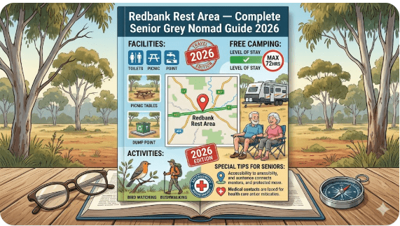
Redbank Rest Area is a free overnight stop under the Transport for NSW rest area framework. Like all gazetted NSW rest areas on state highways, the maximum permitted stay is 20 hours. This rule applies regardless of vehicle type — caravans, motorhomes, campervans and trucks alike.
For senior travellers, this 20-hour limit is generally more than sufficient for an overnight break. The rest area is not a campsite — it does not have powered sites, camp kitchens, or shower facilities. It is designed as a roadside safety stop with basic amenities.
What Is and Isn’t Permitted
- ✅ Overnight parking (within 20-hour limit)
- ✅ Self-contained vehicles and caravans
- ✅ Portable gas cooking (check current fire restrictions)
- ✅ Pets on leads
- ❌ Open campfires (prohibited at rest areas — see fire section)
- ❌ Extended stays beyond 20 hours
- ❌ Dumping grey water or waste on site
- ❌ Generator use during quiet hours (check posted signage on arrival)
3. Quick Facts and Key Details 2026
| Detail | Information |
|---|---|
| Rest Area Name | Redbank Rest Area |
| Highway | Kamilaroi Highway (A71) |
| Location | Approx. 38km north of Cobar, NSW |
| Nearest Town (South) | Cobar — approx. 38km |
| Nearest Town (North) | Bourke — approx. 127km |
| Postcode Region | NSW 2836 (Cobar LGA) |
| GPS Coordinates | Approx. -31.237, 145.874 (verify via Google Maps before travel) |
| Road Surface to Area | Sealed — Kamilaroi Highway is bitumen |
| Cost | Free |
| Maximum Stay | 20 hours (NSW law) |
| Toilets | Basic pit/composting toilet — verify on arrival |
| Tables / Shelter | Picnic tables, shade shelter (verify on arrival) |
| Powered Sites | No |
| Water Supply | No potable water — carry your own |
| Dump Point | Not at this location — nearest in Cobar |
| Mobile Signal | Limited/patchy — Telstra performs best in this region |
| Heavy Vehicle Access | Yes — rest area designed for trucks and caravans |
| Manager / Authority | Transport for NSW |
4. How to Get There + GPS
📍 GPS Coordinates — Redbank Rest Area
-31.237, 145.874
Kamilaroi Highway (A71), approx. 38km north of Cobar, NSW 2836
Coordinate source: Publicly available mapping data — verify using Google Maps or your GPS device before travel. Coordinates are approximate and should be confirmed prior to departure.
Travelling North from Cobar
From Cobar, travel north on the Kamilaroi Highway (A71). The highway is fully sealed and in generally good condition, though outback highway surfaces can develop corrugations, edge breaks, and animal strike damage between maintenance cycles. The Redbank Rest Area is located on the left (west) side of the highway as you travel north, approximately 38km from the Cobar township. Watch for the blue rest area sign well in advance — entries can appear quickly on open highway stretches.
Travelling South from Bourke
From Bourke, travel south on the Kamilaroi Highway approximately 127km. The rest area will appear on your right (west) side of the highway. The flat, featureless landscape means you may have good visibility of the rest area ahead — but do not let that encourage late braking. Slow down well in advance, particularly if towing a caravan.
Caravan, Motorhome and Big Rig Access
The rest area is designed to accommodate heavy vehicles and caravans. The entry and exit are sealed, with sufficient turning radius for larger rigs. The surface within the rest area is compacted gravel or similar — suitable for caravans but can be uneven in places. Level parking is not guaranteed; carry levelling blocks.
Navigation Tips
- Do not solely rely on in-car GPS in remote NSW — signal and mapping data can be outdated
- Download the offline Google Maps area for the Cobar–Bourke corridor before departing
- Check LiveTraffic NSW for any road closures or incidents before setting out
- The Kamilaroi Highway between Cobar and Bourke has no fuel stops — plan your fuel at Cobar
5. Road Conditions, Flooding and Sealed Highway
Is the Kamilaroi Highway Sealed?
Yes. The Kamilaroi Highway (A71) between Cobar and Bourke is fully sealed bitumen. It is suitable for all vehicles including caravans, motorhomes, and conventional 2WD vehicles. No 4WD is required to access Redbank Rest Area.
Does the Road Flood?
The Kamilaroi Highway traverses flat, low-lying outback plains. During and after significant rainfall events — particularly in summer and early autumn — sections of the highway can flood or become waterlogged. The outback soil has low absorption capacity, meaning surface water can sit on or across the road for extended periods after heavy rain.
Road Condition Resources
- LiveTraffic NSW — official road conditions
- Bureau of Meteorology — Cobar weather forecast
- Cobar Visitor Information Centre — phone ahead for local conditions
Edge Breaks and Surface Damage
Outback highways experience significant freight traffic — road trains, B-doubles and heavy agricultural vehicles use these routes year-round. Edge break (crumbling at the road edge) is common and can be hazardous for caravanners forced onto the shoulder. Keep well left but be aware of shoulder conditions, especially after wet weather.
Unsealed Roads — Side Routes
The Kamilaroi Highway itself is sealed to both Cobar and Bourke. However, if you intend to take any station roads, fire trails, or explore off the main highway corridor, you will encounter unsealed tracks that become impassable in wet conditions and are not recommended for caravans at any time.
6. Heat and Remoteness — Senior Safety
The Redbank Rest Area sits in one of the most climatically extreme regions of NSW. Summer temperatures in the Cobar–Bourke corridor regularly exceed 40°C, and the flat open landscape offers no natural relief from solar radiation. For senior travellers, this is not just uncomfortable — it is a genuine health risk.
Heat Management at This Location
- There is no mains power — you cannot run air conditioning unless on a generator or solar/battery system
- The rest area has limited shade — a shelter structure if maintained, but no trees providing sustained shade
- Ground temperatures in summer can significantly exceed air temperature
- Drink water well before you feel thirsty — in this heat, thirst is already a sign of dehydration
- If you feel unwell, do not wait — flag down a passing vehicle or call 000
Remoteness Risk
If you break down or have a medical emergency at Redbank Rest Area, help may be 30–60 minutes away under normal conditions — and potentially much longer if mobile coverage is poor and you cannot contact assistance. This is not a reason to avoid the area, but it is a reason to be prepared.
- Carry a satellite communicator (e.g. EPIRB, PLB, or Garmin inReach) for remote travel
- Tell someone your travel plan — departure point, destination, expected arrival time
- Register your travel plan with Emergency+ app (available free from the App Store and Google Play)
- Cobar Hospital: located in Cobar, approximately 38km south — (02) 6836 2011
7. Wildlife — Birds, Reptiles and What to Watch For
The outback landscape surrounding Redbank Rest Area supports a range of native wildlife. While the area feels sparse, the spinifex, mulga scrub and red soil plains around Cobar support surprisingly diverse species — most active around dawn and dusk.
Commonly Sighted Species
- Eastern Grey Kangaroos and Red Kangaroos — most active at dawn, dusk and after dark. Extreme road hazard on the highway at night. Do not drive the Kamilaroi Highway after dark if it can be avoided.
- Emus — common in this region and unpredictable around vehicles. They can appear on or near the road without warning.
- Corellas and Cockatoos — often seen in large flocks near rest areas, particularly if water is nearby.
- Wedge-tailed Eagles — frequently seen feeding on roadkill on outback highways. Give them time to move — they are slow to take flight from road level.
- Reptiles — goannas (monitor lizards), blue-tongue lizards, and various snake species inhabit the surrounding scrub. Check under and around your vehicle before moving it, particularly if parked on warm ground overnight.
- Feral animals — feral goats, pigs, and foxes are present in this region. Do not leave food unsecured outside your van.
Snake Awareness
Eastern Brown Snakes and other venomous species are present in this region year-round, with activity peaking in warmer months. Always wear enclosed shoes when walking away from your vehicle at a rest area. Check inside any item stored on or near the ground. If you see a snake, do not approach it — observe from a safe distance and allow it to move on.
8. What Other Websites Don’t Tell You
Most rest area directories list Redbank as a dot on a map with a toilet icon. Here is what the listings leave out:
- No water on site. This is not a campsite — there is no tap, tank, or bore water at the rest area. Carry all water you need for cooking, drinking and washing.
- Generator etiquette matters. Other travellers are trying to sleep. In this quiet outback setting, a generator running after 9pm is inconsiderate and potentially disruptive to everyone on site. Use solar where possible.
- The highway noise is real. Road trains travel the Kamilaroi Highway at night. If you are a light sleeper, position your van with your sleeping area away from the highway side. Ear plugs are a worthwhile investment for outback rest area stopovers.
- Dust. Every passing road train on the adjacent highway will push a wave of fine red dust into the rest area. Keep windows and vents filtered, and secure anything loose outside.
- Flies. In the warmer months, flies are relentless in this region. A quality fly net or head covering is not optional — it’s essential for comfortable outdoor time.
- Sunrise orientation. The rest area faces east into an open plain. Sunrise is early and bright in outback NSW — block-out curtains or blinds in your van are highly recommended.
9. Best Time to Visit — Month-by-Month Breakdown
| Month | Temperature Range | Conditions | Suitability for Seniors |
|---|---|---|---|
| January | 22°C – 40°C+ | Extreme heat, possible storms, flood risk | ⚠️ Not recommended |
| February | 21°C – 39°C+ | Heat continues, storm season | ⚠️ Not recommended |
| March | 18°C – 35°C | Temperatures beginning to ease slightly | ⚠️ Marginal — plan carefully |
| April | 13°C – 28°C | Comfortable days, cool nights | ✅ Excellent |
| May | 8°C – 24°C | Ideal — clear skies, mild days | ✅ Excellent |
| June | 4°C – 19°C | Cold nights, beautiful clear days | ✅ Very good — cold overnight |
| July | 3°C – 18°C | Peak grey nomad season — cool and dry | ✅ Best month |
| August | 5°C – 21°C | Warming up, clear and dry | ✅ Excellent |
| September | 9°C – 26°C | Warming quickly — pleasant days | ✅ Very good |
| October | 13°C – 31°C | Getting warm — manageable with preparation | ✅ Good |
| November | 17°C – 36°C | Heat building — spring storms possible | ⚠️ Plan carefully |
| December | 20°C – 40°C+ | Summer heat returns — extreme conditions | ⚠️ Not recommended |
Temperature ranges are based on historical BOM climate data for the Cobar region. Check current forecasts at bom.gov.au before travel.
10. Free and Low-Cost Camping Nearby
The Kamilaroi Highway corridor between Cobar and Bourke has several designated rest areas that serve as free overnight stops. These are your primary free alternatives if Redbank is full or not suitable on a given night.
Nearby Rest Areas on the Kamilaroi Highway
All rest areas listed below are on the sealed Kamilaroi Highway (A71) between Cobar and Bourke. Distances are approximate and measured from Redbank Rest Area.
- Gunderbooka Rest Area — north of Cobar, near Gunderbooka National Park
- Curraweena Rest Area — further north toward Bourke
- Bourke Rest Area — in Bourke township, free camp and truck stop NSW
- South of Bourke Rest Area — free camping south of Bourke township
- Beemery Rest Area — caravan stop near Bourke NSW
- Cobar Free Camp and Truck Stop — in Cobar, grey nomad guide
- Prattenville Rest Area Southbound — heavy vehicle stop NSW
- Greenwood Grange Rest Area — truck and caravan parking NSW
11. Dump Points Near Redbank Rest Area
There is no dump point at Redbank Rest Area. This is a basic roadside stop with no waste management infrastructure. All grey and black water must be managed in your own self-contained system and disposed of at a proper dump point.
Nearest Dump Points
| Location | Approximate Distance from Redbank | Notes |
|---|---|---|
| Cobar Caravan Park / Town | ~38km south | Check current availability — use Campermate or WikiCamps to confirm dump point locations and access |
| Bourke Town | ~127km north | Dump point facilities available in town — verify current status before travel |
12. Free Water Sources Near Cobar
There is no water supply at Redbank Rest Area. Do not travel this corridor assuming you can source water en route — in remote outback NSW, water availability is not guaranteed at any rest area or roadside stop.
Where to Fill Up on Water
- Cobar (38km south) — potable town water is available. Fill your tanks before departing north. Cobar service stations and caravan parks can direct you to water sources.
- Bourke (127km north) — town water available. Fill tanks on arrival if heading north or west.
13. Fuel Stops Along the Kamilaroi Highway
The Kamilaroi Highway between Cobar and Bourke has no fuel stops between the two towns. This is a critical planning point — the distance is approximately 165km. If your vehicle or caravan has a smaller fuel range, carry a jerry can of spare fuel.
| Fuel Stop | Direction from Redbank | Approximate Distance | Notes |
|---|---|---|---|
| Cobar — multiple service stations | South | ~38km | Diesel and unleaded available. Cobar has multiple fuel options — use PetrolSpy to compare prices before you arrive. |
| Bourke — service stations in town | North | ~127km | Diesel and unleaded. Fuel prices in Bourke are typically higher than Cobar — fill up in Cobar when heading north. |
| Nyngan — Mitchell Highway | South (via Cobar) | ~143km from Redbank (via Cobar) | If coming from the Mitchell Highway east of Cobar. Nyngan has fuel — fill before the Cobar–Bourke run. |
| Cunnamulla — QLD | North (via Bourke) | ~330km from Redbank (via Bourke) | If heading north into QLD — plan fuel carefully. Bourke is your last reliable fuel before the Queensland border region. |
14. Caravan Parks — Paid Alternatives
If you prefer a powered site, hot shower, or dump point access, the nearest caravan parks are in Cobar and Bourke. These are the practical alternatives for nights when you want more comfort or when the rest area is too busy.
Cobar (approx. 38km south)
Cobar has caravan park accommodation with powered sites, ablution blocks, and dump points. Contact local Cobar accommodation providers directly for current rates and availability. The Cobar Visitor Information Centre can assist: (02) 6836 2448.
Bourke (approx. 127km north)
Bourke has caravan park facilities in town. Bourke is a significant outback tourist hub and caravan parks here are generally well-maintained. Contact Bourke Visitor Information Centre for current options: (02) 6872 1222.
15. Full Facilities Comparison Table
| Facility | Redbank Rest Area | Cobar Caravan Park | Bourke Caravan Park |
|---|---|---|---|
| Cost | Free | $35–$55/night est. | $30–$50/night est. |
| Powered Sites | No | Yes | Yes |
| Toilets | Basic (verify on arrival) | Flush toilets | Flush toilets |
| Showers | No | Yes (hot) | Yes (hot) |
| Dump Point | No | Yes | Yes |
| Potable Water | No | Yes | Yes |
| Camp Kitchen | No | Varies | Varies |
| Shade / Shelter | Limited (structure if maintained) | Trees / structures | Trees / structures |
| Wi-Fi | No | Sometimes (verify) | Sometimes (verify) |
| Max Stay | 20 hours | Flexible | Flexible |
| Heavy Vehicle Access | Yes | Yes | Yes |
| Pet Friendly | Yes (on lead) | Varies — confirm direct | Varies — confirm direct |
Rates and facilities for Cobar and Bourke caravan parks are estimated for 2026. Verify current rates directly with the parks before arrival.
16. Rates — All Options Near Redbank 2026
| Option | Estimated Rate (2026) | Notes |
|---|---|---|
| Redbank Rest Area | Free | 20-hour maximum stay — no bookings |
| Cobar Caravan Park (powered) | $35–$55/night est. | Contact park directly for 2026 rates |
| Bourke Caravan Park (powered) | $30–$50/night est. | Contact park directly for 2026 rates |
| Cobar Showground (unpowered) | Gold coin donation or small fee | Verify directly — availability and facilities vary |
| Nearby Free Rest Areas | Free | 20-hour maximum stay — see section 10 |
17. Senior Safety Checklist — On and Off the Road
- Checked LiveTraffic NSW for current road conditions before departure
- Checked BOM weather forecast for Cobar and Bourke regions
- Fuel tank full — confirmed no fuel available between Cobar and Bourke
- Water supply confirmed — minimum 20 litres drinking water per person in vehicle cab
- Told a responsible person your travel plan and expected arrival time
- PLB, EPIRB or satellite communicator charged and accessible
- Medications packed and accessible — not locked in storage areas
- Levelling blocks and chocks carried for uneven rest area surfaces
- Fly net / head covering packed for outback rest areas
- Block-out blinds or curtains fitted in sleeping area
- Spare tyre in good condition — checked before departure
- Emergency contact number for Cobar Hospital saved: (02) 6836 2011
- Emergency+ app installed and location services enabled
- Torch accessible in sleeping area — not packed in storage
- Snake-aware footwear in place — closed shoes worn at rest areas
- Generator fuel sufficient if not on solar — not run after 9pm
- Grey and black water tanks confirmed sealed — no dumping at rest area
- Vehicle secured before sleep — check all doors, hatches, and annexes
18. What to Do Near Redbank — Senior Activity Guide
Redbank Rest Area itself is a stopover point, not a tourist destination. However, the broader Cobar–Bourke corridor offers genuine outback experiences for senior travellers with time to explore.
Cobar (38km south)
- Cobar Regional Museum — located in the former Great Cobar Copper Mine manager’s residence, the museum covers the mining history of the region and is well worth 1–2 hours. Entry fee applies.
- Cobar Heritage Centre — excellent introduction to the copper mining history and outback culture of the region.
- Peak Gold Mine Lookout — elevated view over the open-cut mine and township from a purpose-built viewing platform. Free. Good morning activity.
- Cobar Visitor Information Centre — great starting point for self-guided driving tours of the region.
- Cobar township walk — the main street has heritage architecture from the copper mining era, cafés, and essential supplies.
Bourke (127km north)
- Back O’ Bourke Exhibition Centre — award-winning outback interpretive centre. Highly recommended for grey nomads. Admission fees apply.
- Port of Bourke Historic Site — celebrates the Darling River paddlesteamer era. Self-guided walking trail along the riverbank.
- Bourke Wharf and Darling River — peaceful sunrise walk or birdwatching along the Darling River foreshore.
- North Bourke Bridge — historic lift bridge over the Darling River — worth a photograph.
Gunderbooka National Park (en route, via side road)
Gunderbooka National Park — Day Visit Option
Gunderbooka National Park is located west of the Kamilaroi Highway, approximately 80km north of Cobar. The park offers walking trails, birdwatching, and access to Mount Grenfell Historic Site (Aboriginal rock art). Note: Access tracks into Gunderbooka National Park are unsealed and not suitable for caravans or large motorhomes. Day-trippers from the highway should leave their caravan parked safely at a rest area or Cobar before attempting the park access road. Park fees and entry conditions apply — check NSW National Parks for current information before visiting.
19. 🗺️ Vanlife Savings Spots — GPS Coordinates and Postcodes
Use the interactive Vanlife Savings Spots map below to locate Redbank Rest Area and other free camps, rest areas, and overnight stops along the Kamilaroi Highway and surrounding outback NSW region. Save your spots, add pins, and plan your route before you leave mobile coverage.
COPY PROMPT ➔ ASK AI ➔ SAVE TO FORM ➔ ADD SPOT PIN ➔ GET DIRECTIONS
📍 Interactive map — find free camps, rest areas and overnight stops. Enable location for best results.
| Location | Postcode | Approx. Latitude | Approx. Longitude | Notes |
|---|---|---|---|---|
| Redbank Rest Area | 2836 | -31.237 | 145.874 | Kamilaroi Hwy — verify on Google Maps before travel |
| Cobar Free Camp / Truck Stop | 2835 | -31.499 | 145.839 | In Cobar township — verify current access |
| Gunderbooka Rest Area | 2840 | -30.953 | 145.882 | Kamilaroi Hwy north of Cobar |
| Bourke Rest Area | 2840 | -30.093 | 145.936 | Near Bourke township — verify current conditions |
All GPS coordinates are approximate and sourced from publicly available mapping data. Verify each location using Google Maps or your GPS device before travel. Coordinates should not be used as the sole means of navigation in remote areas.
20. Phone Signal and Emergency Communications
Mobile coverage at Redbank Rest Area is limited and unreliable. The Kamilaroi Highway corridor north of Cobar passes through areas with sparse or no mobile coverage. Telstra provides the broadest coverage in outback NSW, but even Telstra signal can be patchy or absent at this location.
What to Expect
- Telstra: Possible 1–2 bar signal at some times — not reliable for calls or data
- Optus / Vodafone: Coverage is minimal to non-existent in this corridor
- Starlink: If you carry a portable Starlink unit, this is the most reliable connectivity option for remote outback NSW
- Public WiFi: No public WiFi at this rest area or nearby. The nearest public WiFi is in Cobar township (library or visitor centre)
Emergency Communication — Non-Negotiable for Remote Travel
- Emergency number: 000 (if you have any mobile signal)
- Emergency+ app: Provides your GPS coordinates to emergency services — download before leaving coverage
- PLB: Register at AMSA.gov.au — free registration
- Garmin inReach / SPOT: Subscription satellite communicators — allow two-way messaging from anywhere
- Cobar Hospital: (02) 6836 2011 — save before leaving town
- NSW Police: 131 444 (non-emergency)
21. Campfires, Cooking and Food Purchases
Campfires
Open campfires are not permitted at NSW rest areas. This is a consistent rule across the state highway rest area network. The Kamilaroi Highway corridor is also subject to Total Fire Ban days during fire danger periods — typically October through March, though this varies by year and conditions.
Cooking at the Rest Area
- Portable gas stoves and BBQs are generally permitted outside of Total Fire Ban periods
- Cook in a sheltered position — outback winds can make gas cooking difficult and unpredictable
- Do not leave cooking equipment unattended in wind
- Dispose of gas canisters responsibly — not in roadside bins
Food Purchases Near Redbank
There are no food or grocery facilities near Redbank Rest Area. Stock up in Cobar before heading north — Cobar has supermarkets, bakeries, cafés, and takeaway outlets. There is limited food service in Bourke township to the north, but variety decreases significantly in comparison to Cobar.
- Cobar: Supermarket, bakery, cafés, IGA or similar — full grocery restocking available
- Bourke: Limited supermarket and basic services — restock in Cobar before northbound travel
22. Pets at Redbank Rest Area
Pets are permitted at NSW roadside rest areas, including Redbank, provided they are kept on a lead at all times. This is both a courtesy to other travellers and a safety measure — the outback environment presents genuine hazards for dogs including snakes, goannas, and extreme heat.
Pet Safety in the Outback
- Never leave pets in a closed vehicle in outback NSW — temperatures inside a parked vehicle can become fatal within minutes in summer
- Dogs should be walked on lead only — do not allow them to roam near scrub where snakes may be sheltering
- Carry fresh water specifically for your pet — rest areas have no water supply
- Check paws after walking on hot ground — bitumen and bare earth can cause burns in summer heat
- Carry basic pet first aid supplies including contact information for the nearest vet (Cobar)
- Flea and tick prevention is recommended — bush ticks are present in some outback NSW areas
23. Accessibility for Seniors with Mobility Limitations
Redbank Rest Area is a basic roadside stop and has limited accessibility infrastructure. The following information is intended to help seniors with mobility limitations plan realistically for this stop.
Surface and Access
- The entry from the highway is sealed — suitable for all vehicles
- The internal surface is compacted gravel or similar — may be uneven, rutted after rain, or dusty in dry conditions
- There are no sealed paths or paved walkways within the rest area
- Walking frames, wheelchairs, or mobility scooters may have difficulty on gravel surfaces
Toilet Access
If a toilet structure is present and maintained, it is a basic pit or composting toilet. These are typically not wheelchair accessible. Confirm current toilet status via LiveTraffic NSW or by calling Transport for NSW before travel if toilet access is essential.
Recommendations for Mobility-Limited Travellers
- Park as close to the toilet facility as possible on arrival
- Carry a portable toilet in your caravan as a backup
- Use a folding step with handrail for safer entry/exit from your vehicle or caravan
- Avoid walking on the highway shoulder or edge at any time
- Alert travel companions to your mobility needs before the stop so they can assist with setup and access
24. Camping Etiquette and Waste Management
Rest Area Etiquette
- Arrive, rest, move on — rest areas are not campsites. The 20-hour rule exists to keep them available for everyone.
- Give space — park considerately, leaving room for late arrivals, heavy vehicles and trucks which need extra space to manoeuvre.
- Noise after dark — keep voices, generators and entertainment systems quiet after 9pm. In the outback silence, sound carries significantly.
- No rubbish left behind — if there is no bin, take your rubbish with you. Never leave rubbish at a remote rest area.
- No grey water dumping — do not empty grey water tanks onto the rest area surface or into any drain. Use a proper dump point.
Waste Management
- Use the bin at the rest area if provided — do not overfill it
- If the bin is full, take rubbish with you to Cobar or Bourke
- Carry biodegradable bags for dog waste and dispose of them in bins, not on the ground
- Grey and black water management: self-contained vehicle requirements apply — use dump points in Cobar or Bourke
25. Emergency Scenarios — What to Do
Medical Emergency
- Call 000 — if you have mobile signal
- Activate your PLB or satellite communicator if no phone coverage
- Flag down a passing vehicle — the Kamilaroi Highway has regular traffic during daylight hours
- Cobar Hospital: (02) 6836 2011 — approximately 38km south
- Provide your GPS coordinates: -31.237, 145.874 (Redbank Rest Area approximate location)
Vehicle Breakdown
- Stay with your vehicle — do not walk along the highway
- Place warning triangles or lights visible to approaching traffic
- Call your roadside assistance provider (NRMA, RAA, or equivalent)
- In summer, shade is essential — do not wait outside in direct sun
- Signal for help from passing trucks — truck drivers on outback routes are generally willing to assist or relay a message
Flood or Road Closure
- Check LiveTraffic NSW: livetraffic.com
- Do not drive through floodwater — wait for the road to reopen
- You have water and supplies — use your caravan as a shelter if required
- Contact your travel contact to advise of the delay
26. Packing List for the Cobar–Bourke Highway Section
- Minimum 20 litres drinking water per person (separate from caravan tank — in vehicle cab)
- Full fuel tank — jerry can if your range is under 200km
- PLB or satellite communicator — charged and accessible
- Spare tyre in serviceable condition
- Basic tools: tyre changing gear, jumper cables or jump starter
- First aid kit — including snake bite bandages
- Medications — accessible, not packed in external storage
- Sun protection: sunscreen SPF50+, hat, long sleeves, UV sunglasses
- Fly net / insect repellent
- Levelling blocks and chocks
- Portable toilet (backup if rest area toilets unavailable)
- Insect screens for all caravan vents and windows
- Block-out blinds or curtains in sleeping area
- Torch and spare batteries
- Closed footwear (not thongs) — snake protection
- Emergency contact list — written on paper, not just in phone
- Food supplies for at least 2 days beyond planned needs
- BOM weather forecast checked and printed or saved offline
- LiveTraffic NSW checked — road conditions confirmed clear
- Travel plan lodged with responsible contact person
27. 5 Rest Areas Near Redbank on the Kamilaroi Highway
| Rest Area | Direction from Redbank | Approx. Distance | Notes |
|---|---|---|---|
| Cobar Free Camp / Truck Stop | South | ~38km | In Cobar — fuel, food, dump point access nearby |
| Gunderbooka Rest Area | North | ~42km | Near Gunderbooka National Park access — popular stop |
| Curraweena Rest Area | North | ~90km est. | Further toward Bourke — outback setting |
| South of Bourke Rest Area | North | ~120km est. | Near Bourke — good stop before town |
| Prattenville Rest Area Southbound | South (off-route) | Varies | On southbound approach — heavy vehicle stop NSW |
28. Reviews — What Grey Nomads Say
“Stopped here heading north to Bourke in July — perfect timing. The rest area was quiet, there was enough room for our 24-foot van and we had a full night’s sleep. Only two other rigs on site. No water so make sure you’re topped up in Cobar.”
“Facilities were basic but that’s all you need for a one-night stop. The toilet was functional when we were there. Flies were relentless in October — bring a fly net. Road train noise overnight but nothing that stopped us sleeping.”
“Used this as a halfway point on a long run from Nyngan toward Bourke. Nothing flash but it does exactly what it’s supposed to do. Good sealed entry, firm surface, and we were moving again by 7am. Would use again.”
29. Frequently Asked Questions
Is Redbank Rest Area free to stay at?
Yes. Redbank Rest Area is a free roadside rest area on the Kamilaroi Highway in outback NSW. There is no charge for overnight stays. The maximum permitted stay under NSW law is 20 hours.
How far is Redbank Rest Area from Cobar?
Redbank Rest Area is approximately 38 kilometres north of Cobar on the Kamilaroi Highway (A71).
How far is Redbank Rest Area from Bourke?
Redbank Rest Area is approximately 127 kilometres south of Bourke on the Kamilaroi Highway (A71).
Is the Kamilaroi Highway sealed between Cobar and Bourke?
Yes. The Kamilaroi Highway (A71) is fully sealed bitumen between Cobar and Bourke. No 4WD is required. However, outback highway surfaces can have edge breaks, potholes, and animal hazards — reduce speed appropriately.
Is there water at Redbank Rest Area?
No. There is no potable water supply at Redbank Rest Area. Carry all drinking and cooking water from Cobar or your last supply point. Do not assume any outback rest area has water unless confirmed.
Is there a dump point at Redbank Rest Area?
No. The nearest dump points are in Cobar (approximately 38km south) and Bourke (approximately 127km north). Check Campermate.com.au for current dump point locations in Cobar.
Can I have a campfire at Redbank Rest Area?
No. Open campfires are not permitted at NSW rest areas. Gas cooking is generally permitted outside of Total Fire Ban periods — always check current fire restrictions before use.
Is Redbank Rest Area suitable for caravans and big rigs?
Yes. The rest area is designed to accommodate heavy vehicles and caravans. The entry from the Kamilaroi Highway is sealed, and the internal area provides turning space for larger combinations. The surface inside is compacted gravel — carry levelling blocks.
What is the mobile coverage like at Redbank Rest Area?
Mobile coverage is limited and unreliable. Telstra provides the best coverage in this region, but signal may be patchy or absent. Carry a PLB or satellite communicator for emergency communication. Do not rely on mobile phone coverage for safety in this corridor.
Are pets allowed at Redbank Rest Area?
Yes. Pets are permitted at NSW roadside rest areas. They must be kept on a lead at all times. Be aware of the snake risk in the surrounding scrub and do not allow pets to roam freely.
Is there fuel available between Cobar and Bourke?
No. There are no fuel stops on the Kamilaroi Highway between Cobar and Bourke — a distance of approximately 165km. Fill your tank in Cobar before travelling north, and carry a jerry can if your vehicle’s range is under 200km.
30. Quick-Reference Card
📋 Redbank Rest Area — Quick Reference 2026
| Location | Kamilaroi Highway (A71), ~38km north of Cobar, NSW 2836 |
| GPS (approx.) | -31.237, 145.874 — verify before travel |
| Cost | Free |
| Max Stay | 20 hours (NSW law) |
| Toilets | Basic — verify on arrival |
| Water | None — carry your own |
| Dump Point | Nearest in Cobar (~38km) or Bourke (~127km) |
| Fuel (nearest south) | Cobar ~38km |
| Fuel (nearest north) | Bourke ~127km |
| Mobile Signal | Limited — Telstra best option |
| Campfires | Not permitted |
| Pets | On lead — permitted |
| Road Surface | Sealed highway — gravel surface in rest area |
| Emergency | 000 / PLB / Cobar Hospital: (02) 6836 2011 |
| Road Conditions | livetraffic.com |
| Weather | bom.gov.au |
- South of Bourke Rest Area — free camping NSW
- Beemery Rest Area — caravan stop Bourke NSW
- Bourke Rest Area — free camp and truck stop NSW
- Prattenville Rest Area Southbound — heavy vehicle stop NSW
- Gunderbooka Rest Area — outback NSW caravan rest stop
- Curraweena Rest Area — free overnight stop NSW outback
- Greenwood Grange Rest Area — truck and caravan parking NSW
- Cobar Free Camp Truck Stop — grey nomad guide
Free campsites and powered sites fill fast during school holidays and peak season. If your preferred site is already gone, search remaining accommodation options below to explore the region.
Accommodation and flight search powered by Expedia. Booking through this search supports this website at no extra cost to you. As an affiliate, I earn from qualifying purchases at no extra cost to you.
Protect your van in remote areas: Get 5% OFF all StarterStopper immobiliser products with promo code: RTV5
Visit StarterStopper.com to see our data-backed security solutions
As an affiliate, I earn from qualifying purchases at no extra cost to you.
RV LIFE Trip Wizard — USA-Based RV Trip Planning Tool
RV LIFE Trip Wizard is a USA-based RV trip planning tool designed for American RV travellers. If you are visiting Australia from the United States and planning an RV or motorhome hire trip, this tool may help you plan your US leg or research routes before arrival. Please note: RV LIFE Trip Wizard is designed for the US road network and is not applicable for Australian outback highway planning.

As an affiliate, I earn from qualifying purchases at no extra cost to you.
31. Disclaimer
The information in this guide is compiled from publicly available sources and is intended for general travel planning purposes only. Facilities, road conditions, GPS coordinates, and regulations at Redbank Rest Area and surrounding locations can change without notice. Always verify current conditions using official sources — including LiveTraffic NSW, Bureau of Meteorology, and Transport for NSW — before travelling to or relying on this location.
GPS coordinates provided in this article are approximate and sourced from publicly available mapping data. They should be used as a starting point only and verified using Google Maps or your GPS device before travel. Do not use approximate coordinates as your sole means of navigation in remote outback NSW.
RetireToVanLife.com accepts no liability for decisions made on the basis of information in this article. Travel in remote outback NSW carries inherent risks — plan carefully, carry appropriate safety equipment, and always tell someone your travel plans.
Last reviewed: January 2026. Information is subject to change.
© 2026 RetireToVanLife.com — All rights reserved. Written for Senior Grey Nomads. Safe travels. 🚐