Home › Free Camping & Rest Areas › Newell Highway Free Camping — Moree to Coonabarabran
✅ Last updated: March 2026. Written for Australian senior grey nomads travelling the Newell Highway
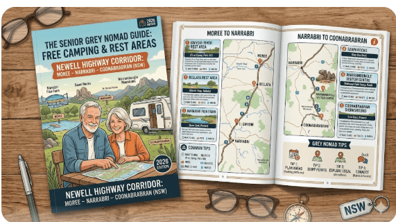
Newell Highway Free Camping: Moree to Narrabri to Coonabarabran — Complete Senior Grey Nomad Rest Area Guide 2026
Where are the best free rest areas on the Newell Highway between Moree and Coonabarabran in 2026 — and which ones are genuinely safe, accessible and suitable for senior caravanners? This is the only guide that covers every stop on this corridor with honest GPS, hospital distances and senior ratings.
- Route: Newell Highway (B84 / A39) — Moree south through Narrabri to Coonabarabran, NSW
- Total corridor distance: Approximately 370 km (Moree to Coonabarabran)
- Number of rest areas covered: 10 individual stops — all free, all with individual guides
- Road surface: ✅ Fully sealed throughout — suitable for all caravans and motorhomes
- Flood risk: ⚠️ Moderate — some stops near creek crossings; check after rain
- Telstra coverage: ⚠️ Generally reasonable on the highway; patchy at individual rest areas
- Power at rest areas: ❌ None — CPAP users must carry battery backup
- Dump points at rest areas: ❌ None — use Moree, Narrabri or Coonabarabran
- Key hospitals: Moree (north) → Narrabri (mid) → Coonabarabran (south)
- Best travel months: May–September (cooler, lower flood risk, peak grey nomad season)
- Suitable for: Caravans ✅ | Motorhomes ✅ | Big rigs ✅ | Pets on leash ✅
📋 Table of Contents
- Why Grey Nomads Travel This Newell Highway Corridor
- The Honest Senior Traveller Briefing — Before You Leave Moree
- The Complete Route Map — All 10 Rest Areas North to South
- Master Facilities Comparison — All 10 Stops Side by Side
- Individual Stop Guides — Every Rest Area on This Corridor
- Dump Points on This Corridor — GPS North to South
- Potable Water — GPS North to South
- Fuel Stations — Distances and Gaps on the Newell Highway
- Hospitals and Emergency Services — Full Corridor Reference
- Monthly Weather and Best Time to Travel This Corridor
- Flood Risk — Which Rest Areas Are Most Vulnerable
- Senior Trip Planning — Suggested 3-Day and 5-Day Itineraries
- Master GPS Reference Table — Every Stop on This Corridor
- Frequently Asked Questions — Newell Highway Free Camping 2026
1. Why Grey Nomads Travel This Newell Highway Corridor
The Newell Highway is one of Australia’s great grey nomad routes — the principal inland highway of New South Wales, stretching from the Queensland border in the north to Victoria in the south. The corridor covered in this guide — Moree south through Narrabri to Coonabarabran — is one of the most travelled sections on the entire Newell, and for good reason.
This stretch connects the rich agricultural plains of the Moree district with the dramatic volcanic landscapes of the Warrumbungle Range near Coonabarabran. Along the way, grey nomads pass through the cotton country of the Namoi Valley, the observatory ridge above Narrabri, and the mulga scrublands that mark the transition from the black soil plains to the tablelands. It is a journey of genuine landscape variety on a route that is straightforward, fully sealed and well-serviced by rest areas.
For senior travellers, this corridor offers something rare on Australian inland highways: a series of free rest areas spaced at practical intervals, close enough to service towns that genuine emergency backup is always within reach, yet remote enough to offer the quiet, dark-sky overnight experience that grey nomads travel inland Australia to find.
This hub page brings together all 10 individual rest area guides that retiretovanlife.com has published for this corridor. Use it as your master planning reference before you leave — or as a quick-reference tool when you are on the road and need to decide where to stop tonight.
2. The Honest Senior Traveller Briefing — Before You Leave Moree
Before you pull out of Moree, Narrabri or Coonabarabran heading for one of the free rest areas on this corridor, read this section. It is the honest briefing that no app or forum post gives you all in one place.
- No power at any rest area on this corridor. Every single free stop listed in this guide has zero mains power. CPAP users must carry a fully charged lithium battery or be prepared to use a generator courteously. The nearest powered sites are in the towns at either end — Moree, Narrabri or Coonabarabran.
- No potable water at any rest area. Fill your tanks in whichever town you depart from. Do not assume there is a tap at any of these rest areas. There is not.
- No dump points at any rest area. Manage your cassette and black water tank capacity before you leave town. Gaps between confirmed dump points on this corridor can exceed 170 km.
- Flood risk is real on this corridor. The Newell Highway crosses multiple creek and river systems between Moree and Coonabarabran. After significant rainfall, rest areas near crossings can become inaccessible. Always check Live Traffic NSW and BOM flood warnings before departing any town on this route after rain.
- Kangaroo strikes are extremely common. Do not drive this highway at night towing a caravan. Eastern grey kangaroos are active at dawn and dusk on the Newell. Always wait 45 minutes after full sunrise before departing a rest area.
- Telstra signal is variable. Do not rely on having phone signal at any individual rest area. Carry a registered PLB. Tell someone your overnight plan before you lose signal leaving town.
- The Newell carries heavy vehicle traffic 24 hours. Every rest area on this corridor is a designated heavy vehicle fatigue stop. Road trains and B-doubles pass throughout the night. Light sleepers should bring quality earplugs.
3. The Complete Route — All 10 Rest Areas North to South
The following table shows every rest area covered in this cluster, in order from north to south. Use this as your route planning reference. Click any stop name to open the full individual guide for that location.
| # | Rest Area / Stop | Nearest Town | Direction from Town | Full Guide |
|---|---|---|---|---|
| 1 | Boggabri Rest Area | Boggabri / Narrabri | Near Boggabri, south of Narrabri | Full Guide → |
| 2 | South Narrabri Stopping Bay | Narrabri | South of Narrabri township | Full Guide → |
| 3 | Bohena Creek Rest Area | Narrabri | South of Narrabri — Bohena Creek crossing | Full Guide → |
| 4 | Yarraman Rest Area | Narrabri / Coonabarabran | Between Narrabri and Coonabarabran | Full Guide → |
| 5 | Gowan Rest Area (Southbound) | Narrabri / Coonabarabran | Between Narrabri and Coonabarabran — southbound | Full Guide → |
| 6 | Camkeena Rest Area | Narrabri / Coonabarabran | Between Narrabri and Coonabarabran | Full Guide → |
| 7 | Belah Hill Rest Area | Coonabarabran | North of Coonabarabran — Belah Hill | Full Guide → |
| 8 | Coolabah Northwest Rest Area | Coolabah / Nyngan | Northwest of Coolabah — Barrier Highway | Full Guide → |
| 9 | Mooki River Rest Area | Quirindi | North of Quirindi — Mooki River crossing, Newell Highway | Full Guide → |
| 10 | Square Bush Rest Area | Narrabri / Coonabarabran | Newell Highway corridor | Full Guide → |
4. Master Facilities Comparison — All 10 Stops at a Glance
Use this master table to compare every stop on this corridor side by side. For full details on any individual stop, click the guide link in the table above or in Section 5 below.
| Rest Area | Cost | Toilets | Water | Power | Dump | Big Rigs | Flood Risk | Pets | Senior Rating |
|---|---|---|---|---|---|---|---|---|---|
| Boggabri | ✅ Free | ✅ Pit | ❌ | ❌ | ❌ | ✅ | ⚠️ Check | ✅ Leash | ⭐⭐⭐ |
| South Narrabri | ✅ Free | ✅ Pit | ❌ | ❌ | ❌ | ✅ | ⚠️ Check | ✅ Leash | ⭐⭐⭐ |
| Bohena Creek | ✅ Free | ✅ Pit | ❌ | ❌ | ❌ | ✅ | ⚠️ Creek | ✅ Leash | ⭐⭐⭐ |
| Yarraman | ✅ Free | ✅ Pit | ❌ | ❌ | ❌ | ✅ | ⚠️ Check | ✅ Leash | ⭐⭐⭐ |
| Gowan (SB) | ✅ Free | ✅ Pit | ❌ | ❌ | ❌ | ✅ | ⚠️ Check | ✅ Leash | ⭐⭐⭐ |
| Camkeena | ✅ Free | ✅ Pit | ❌ | ❌ | ❌ | ✅ | ⚠️ Check | ✅ Leash | ⭐⭐⭐ |
| Belah Hill | ✅ Free | ✅ Pit | ❌ | ❌ | ❌ | ✅ | ✅ Low | ✅ Leash | ⭐⭐⭐⭐ |
| Coolabah NW | ✅ Free | ✅ Pit | ❌ | ❌ | ❌ | ✅ | ⚠️ Check | ✅ Leash | ⭐⭐⭐ |
| Mooki River | ✅ Free | ✅ Pit | ❌ | ❌ | ❌ | ✅ | ⚠️ River | ✅ Leash | ⭐⭐⭐⭐ |
| Square Bush | ✅ Free | ✅ Pit | ❌ | ❌ | ❌ | ✅ | ⚠️ Check | ✅ Leash | ⭐⭐⭐ |
⚠️ Senior ratings and facility symbols based on publicly available information as at March 2026. Verify all details before travel — facilities can change. Individual stop guides contain full GPS, hospital distances and senior-specific detail.
5. Individual Stop Guides — Every Rest Area on This Corridor
Each stop below has a summary card and a direct link to the full individual guide. The full guides contain complete GPS coordinates, hospital distances, dump point locations, water sources, senior checklists, FAQ sections and honest ratings.
🛑 Stop 1 — Boggabri Rest Area
Location: Newell Highway, near Boggabri NSW 2382 — south of Narrabri
Cost: Free | Toilets: ✅ Pit | Water: ❌ | Power: ❌ | Dump: ❌
Big Rigs: ✅ | Pets: ✅ Leash | Flood Risk: ⚠️ Check after rain
Senior notes: A useful stop on the Narrabri–Boggabri section of the Newell. Close enough to Narrabri for hospital access in an emergency. Prepare all supplies in Narrabri before heading south.
🛑 Stop 2 — South Narrabri Stopping Bay
Location: Newell Highway, south of Narrabri township, NSW 2390
Cost: Free | Toilets: ✅ Pit | Water: ❌ | Power: ❌ | Dump: ❌
Big Rigs: ✅ | Pets: ✅ Leash | Flood Risk: ⚠️ Check after rain
Senior notes: This stopping bay is the closest free stop to Narrabri — an advantage for seniors who want the free overnight experience while remaining close to town services and hospital. Narrabri District Hospital is a short drive north.
🛑 Stop 3 — Bohena Creek Rest Area
Location: Newell Highway, Bohena Creek crossing, south of Narrabri, NSW
Cost: Free | Toilets: ✅ Pit | Water: ❌ | Power: ❌ | Dump: ❌
Big Rigs: ✅ | Pets: ✅ Leash | Flood Risk: ⚠️ Creek crossing — check after rain
Senior notes: A creek-crossing location means flood risk is a real consideration here. The riparian vegetation makes it one of the more attractive stops on this section. Always check BOM and Live Traffic NSW before arriving after rain events anywhere in the Narrabri district.
🛑 Stop 4 — Yarraman Rest Area
Location: Newell Highway, between Narrabri and Coonabarabran, NSW
Cost: Free | Toilets: ✅ Pit | Water: ❌ | Power: ❌ | Dump: ❌
Big Rigs: ✅ | Pets: ✅ Leash | Flood Risk: ⚠️ Check after rain
Senior notes: A mid-corridor stop positioned usefully between Narrabri and Coonabarabran. Suitable for a driver fatigue break or an overnight stop when spacing your daily driving distances. Fill all tanks and dump point before leaving either town.
🛑 Stop 5 — Gowan Rest Area (Southbound)
Location: Newell Highway, between Narrabri and Coonabarabran, NSW — southbound carriageway
Cost: Free | Toilets: ✅ Pit | Water: ❌ | Power: ❌ | Dump: ❌
Big Rigs: ✅ | Pets: ✅ Leash | Flood Risk: ⚠️ Check after rain
Senior notes: Note the directional designation — this rest area is on the southbound side of the highway. Travellers heading north should be aware that access may require checking which side of the highway the entry is on. See the individual guide for specific access notes.
🛑 Stop 6 — Camkeena Rest Area
Location: Newell Highway, between Narrabri and Coonabarabran, NSW
Cost: Free | Toilets: ✅ Pit | Water: ❌ | Power: ❌ | Dump: ❌
Big Rigs: ✅ | Pets: ✅ Leash | Flood Risk: ⚠️ Check after rain
Senior notes: A mid-corridor stop on the Narrabri–Coonabarabran section. Like all stops on this stretch, carries no power, water or dump point. The full guide contains specific GPS, distance to hospital and senior checklist for this location.
🛑 Stop 7 — Belah Hill Rest Area
Location: Newell Highway, Belah Hill, north of Coonabarabran, NSW 2357
Cost: Free | Toilets: ✅ Pit | Water: ❌ | Power: ❌ | Dump: ❌
Big Rigs: ✅ | Pets: ✅ Leash | Flood Risk: ✅ Low — elevated position on a hill
Senior notes: Belah Hill’s elevated position gives it a lower flood risk than creek-crossing rest areas on this corridor — a genuine advantage. The approach up the hill requires checking your rig’s brake and engine performance. Senior rating is higher than average for this corridor specifically because of the reduced flood risk and elevated aspect.
🛑 Stop 8 — Coolabah Northwest Rest Area
Location: Barrier Highway, northwest of Coolabah, NSW 2831
GPS (approx): -31.747, 146.641
Cost: Free | Toilets: ✅ Pit | Water: ❌ | Power: ❌ | Dump: ❌
Big Rigs: ✅ | Pets: ✅ Leash | Flood Risk: ⚠️ Check after rain — western NSW flood plains
Nearest Hospital: ⛑️ Nyngan Multi-Purpose Service — ~90 km east | (02) 6835 7000
Senior notes: This is the most remote stop in this cluster — on the Barrier Highway rather than the Newell. No water, no power and an unreliable phone signal make preparation critical. The night sky here is exceptional. The nearest hospital is 90 km east in Nyngan.
🛑 Stop 9 — Mooki River Rest Area
Location: Newell Highway, Mooki River crossing, near Quirindi NSW 2343
GPS (approx): -31.5087, 150.6391
Cost: Free | Toilets: ✅ Pit | Water: ❌ | Power: ❌ | Dump: ❌
Big Rigs: ✅ | Pets: ✅ Leash (supervise near river) | Flood Risk: ⚠️ River location — check BOM before arrival
Nearest Hospital: ⛑️ Quirindi Community Hospital — ~10 km south | (02) 6746 1200
Senior notes: One of the most popular stops on the Newell and one of the best positioned for senior safety — Quirindi Hospital is only 10 km south. The riverside river gum setting is genuinely beautiful. Flood risk is the primary caution — always check BOM Mooki River flood warnings before arriving after any rain.
🛑 Stop 10 — Square Bush Rest Area
Location: Newell Highway, NSW — Narrabri / Coonabarabran corridor
Cost: Free | Toilets: ✅ Pit | Water: ❌ | Power: ❌ | Dump: ❌
Big Rigs: ✅ | Pets: ✅ Leash | Flood Risk: ⚠️ Check after rain
Senior notes: The complete individual guide for Square Bush Rest Area — including confirmed GPS, hospital distance, senior checklist and full facility details — is available at the link below.
6. Dump Points on This Corridor — GPS North to South
There are no dump points at any of the rest areas on this corridor. Plan your cassette and black water tank management around the towns. Here are the confirmed dump point locations at the major towns, north to south.
| Town | Location Notes | GPS (Approx) | Confirm With |
|---|---|---|---|
| 🗑️ Moree | Confirm exact location at toiletmap.gov.au — Moree township | Approx -29.4659, 149.8316 (approx) | Moree Plains Shire: (02) 6757 0300 (verify) |
| 🗑️ Narrabri | Confirm exact location at toiletmap.gov.au — Narrabri township | Approx -30.3228, 149.7841 (approx) | Narrabri Shire: (02) 6792 9200 (verify) |
| 🗑️ Boggabri | Small town — confirm availability with Narrabri Shire before relying on this | Approx -30.7082, 150.0315 (approx) | Narrabri Shire: (02) 6792 9200 (verify) |
| 🗑️ Coonabarabran | Confirm exact location at toiletmap.gov.au — Coonabarabran township | Approx -31.2726, 149.2788 (approx) | Warrumbungle Shire: (02) 6849 1300 (verify) |
| 🗑️ Quirindi (Mooki River corridor) | Confirm exact location at toiletmap.gov.au — Quirindi township | Approx -31.5139, 150.6784 (approx) | Liverpool Plains Shire: (02) 6746 1755 (verify) |
7. Potable Water — GPS North to South on This Corridor
No potable drinking water is available at any of the 10 rest areas on this corridor. Fill your tanks at every town you pass through.
| Town / Location | Water Status | GPS (Approx) | Notes |
|---|---|---|---|
| 💧 Moree | ✅ Mains scheme water | Approx -29.4659, 149.8316 | Fill here before heading south. Moree has artesian spa baths — a grey nomad favourite. |
| 💧 Narrabri | ✅ Mains scheme water | Approx -30.3228, 149.7841 | Key top-up point on this corridor. Fill here before heading south toward Coonabarabran. |
| 💧 Boggabri | ✅ Town water — confirm access point | Approx -30.7082, 150.0315 | Small town. Confirm caravan park or public tap access before relying on this as a top-up point. |
| 💧 Coonabarabran | ✅ Mains scheme water | Approx -31.2726, 149.2788 | Key top-up point. Fill here before heading north. Warrumbungle National Park is nearby — water not guaranteed in the park. |
| 💧 Rest Areas — All 10 Stops | ❌ None — no potable water at any rest area on this corridor | — | Do not use creek, river or dam water. Do not use unmarked taps. Carry minimum 2 days emergency reserve beyond planned daily use. |
8. Fuel Stations — Distances and Gaps on the Newell Highway
| Town | Fuel Types | Distance from Narrabri | Notes |
|---|---|---|---|
| ⛽ Moree | Unleaded, diesel, LPG | ~145 km north | Full service city. Multiple fuel options. Fill here before heading south. |
| ⛽ Narrabri | Unleaded, diesel, LPG | — | Full service regional town. Multiple fuel stations. Key top-up point on this corridor — do not leave Narrabri with less than three-quarters of a tank heading south. |
| ⛽ Boggabri | Unleaded, diesel — confirm hours | ~45 km south | Small town. Fuel available but verify hours before relying on it — do not plan Boggabri as your only fuel stop on this section. |
| ⛽ Coonabarabran | Unleaded, diesel, LPG | ~170 km south | Full service regional town. Multiple fuel options. Fill here before heading north or west toward Warrumbungle. |
9. Hospitals and Emergency Services — Full Corridor Reference
Save these hospital details before you lose signal leaving any town on this corridor. Verify all phone numbers before travel — regional hospital contact details can change.
| Hospital | Address | Phone | GPS (Approx) | Serves |
|---|---|---|---|---|
| ⛑️ Moree District Hospital | Hospital Road, Moree NSW 2400 | (02) 6757 0100 (verify) | Approx -29.4750, 149.8444 | Northern end of corridor — rest areas north of Narrabri |
| ⛑️ Narrabri District Hospital | Maitland Street, Narrabri NSW 2390 | (02) 6799 2000 (verify) | Approx -30.3213, 149.7789 | Central corridor — stops 1–6 on this cluster |
| ⛑️ Coonabarabran District Hospital | Cassilis Street, Coonabarabran NSW 2357 | (02) 6849 2000 (verify) | Approx -31.2706, 149.2762 | Southern corridor — stops 7 and south |
| ⛑️ Quirindi Community Hospital | Ramsay Street, Quirindi NSW 2343 | (02) 6746 1200 (verify) | Approx -31.5162, 150.6834 | Mooki River Rest Area — 10 km south |
| ⛑️ Nyngan Multi-Purpose Service | Pangee Street, Nyngan NSW 2825 | (02) 6835 7000 (verify) | Approx -31.558, 147.202 | Coolabah Northwest Rest Area — ~90 km east |
10. Monthly Weather and Best Time to Travel This Corridor
| Month | Temp Range | Flood Risk | Senior Travel Rating |
|---|---|---|---|
| January–February | 32–42°C days / 18–24°C nights | ⚠️ High — storm season | ⛔ Avoid — extreme heat and flood risk combined |
| March–April | 24–32°C days / 12–18°C nights | ⚠️ Moderate | ⚠️ Acceptable — check conditions before each stop |
| May–August | 15–22°C days / 3–8°C nights | ✅ Very low | ✅ Excellent — peak grey nomad season; cold nights so pack warm bedding |
| September–October | 20–28°C days / 8–13°C nights | ⚠️ Low–moderate — spring storms | ✅ Very good — beautiful landscape; check flood status at creek/river stops |
| November–December | 28–38°C days / 16–22°C nights | ⚠️ Moderate–high | ⚠️ Caution — heat building rapidly; flood risk increasing from November |
Temperature ranges represent averages for the Narrabri / northern NSW tablelands region. Source: Bureau of Meteorology (bom.gov.au). Always check the current BOM forecast before departure.
11. Flood Risk — Which Rest Areas Are Most Vulnerable
Flooding is the single most important situational awareness topic for grey nomads on this corridor. Understanding which stops carry the highest risk allows you to make informed decisions quickly — especially when weather conditions change during your trip.
| Rest Area | Flood Risk Level | Reason | Fallback If Flooded |
|---|---|---|---|
| Bohena Creek | ⚠️ Moderate–High | Sits at a creek crossing — can flood after rain in the Narrabri district | Narrabri — 20 min north |
| Mooki River | ⚠️ Moderate–High | Riverside location — Mooki River can rise quickly after Liverpool Range rainfall | Quirindi — 10 km south |
| Boggabri | ⚠️ Low–Moderate | Near Namoi River system — check after significant rain | Narrabri — 45 km north |
| Belah Hill | ✅ Low | Elevated position on a hill — not in a flood plain | Coonabarabran — south on the Newell |
| All others | ⚠️ Check after rain | Variable — flat terrain; check Live Traffic NSW before each stop after rain | Nearest town north or south on the Newell |
12. Senior Trip Planning — Suggested Itineraries on This Corridor
3-Day Senior Itinerary — Moree to Coonabarabran (North to South)
| Day | Morning | Overnight Stop | Senior Notes |
|---|---|---|---|
| Day 1 | Depart Moree — fuel, water, dump point, artesian baths if time. Drive ~145 km south to Narrabri. Top up all supplies in Narrabri. | South Narrabri Stopping Bay or Narrabri Caravan Park (powered) | Hospital 5 min north. Good base if you need full services. Visit CSIRO radio telescope if time permits. |
| Day 2 | Depart Narrabri. Optional detour to Bohena Creek for a lunch stop. Continue south ~125 km. | Camkeena Rest Area or Belah Hill Rest Area | Belah Hill preferred for lower flood risk. Coonabarabran is 30–45 min south as fallback if needed. |
| Day 3 | Arrive Coonabarabran. Fuel, water, dump point. Explore Coonabarabran. Option: day trip to Warrumbungle National Park (NSW Parks pass required). | Coonabarabran Caravan Park or camp within Warrumbungle NP (NSW Parks pass required) | Coonabarabran is the Astronomy Capital of Australia — Siding Spring Observatory is 35 km west. Coonabarabran Hospital is in town for senior peace of mind. |
5-Day Senior Itinerary — Slow Travel Version
| Day | Plan | Overnight |
|---|---|---|
| Day 1–2 | Moree — artesian baths, town exploration, restocking | Moree Caravan Park (powered) — 2 nights |
| Day 3 | Drive Moree to Narrabri (~145 km). Top up all supplies. CSIRO Australia Telescope visit (free) if time. | South Narrabri Stopping Bay (free) or Narrabri Caravan Park (powered) |
| Day 4 | Narrabri south. Rest stop at Yarraman or Gowan for lunch. Continue to Belah Hill area. | Belah Hill Rest Area (free — preferred for low flood risk) |
| Day 5 | Arrive Coonabarabran. Full restocking. Siding Spring Observatory drive. Evening astronomy session. | Coonabarabran Caravan Park — 2+ nights recommended |
COPY PROMPT ➔ ASK AI ➔ SAVE TO FORM ➔ ADD SPOT PIN ➔ GET DIRECTIONS
📍 Interactive map — find free camps, rest areas and overnight stops. Enable location for best results.
13. Master GPS Reference Table — Every Stop on This Corridor
Save this entire table to your phone before leaving any town with reliable signal. All GPS coordinates marked (approx) should be verified in Google Maps or your navigation app before departure. Confirmed GPS for individual stops is available in each stop’s full guide.
| Location | Type | Postcode | GPS (Approx) |
|---|---|---|---|
| Boggabri Rest Area | 🛑 Free Rest Area | 2382 | See individual guide |
| South Narrabri Stopping Bay | 🛑 Free Rest Area | 2390 | See individual guide |
| Bohena Creek Rest Area | 🛑 Free Rest Area | 2390 | See individual guide |
| Yarraman Rest Area | 🛑 Free Rest Area | 2390 | See individual guide |
| Gowan Rest Area (Southbound) | 🛑 Free Rest Area | 2390 | See individual guide |
| Camkeena Rest Area | 🛑 Free Rest Area | 2390 | See individual guide |
| Belah Hill Rest Area | 🛑 Free Rest Area | 2357 | See individual guide |
| Coolabah Northwest Rest Area | 🛑 Free Rest Area | 2831 | -31.747, 146.641 (approx) |
| Mooki River Rest Area | 🛑 Free Rest Area | 2343 | -31.5087, 150.6391 (approx) |
| Square Bush Rest Area | 🛑 Free Rest Area | NSW | See individual guide |
| ⛑️ Moree District Hospital | Hospital | 2400 | Approx -29.4750, 149.8444 |
| ⛑️ Narrabri District Hospital | Hospital | 2390 | Approx -30.3213, 149.7789 |
| ⛑️ Coonabarabran District Hospital | Hospital | 2357 | Approx -31.2706, 149.2762 |
| ⛑️ Quirindi Community Hospital | Hospital | 2343 | Approx -31.5162, 150.6834 |
| 🗑️ Dump Point — Narrabri | Dump Point | 2390 | Approx -30.3228, 149.7841 — verify toiletmap.gov.au |
| 🗑️ Dump Point — Coonabarabran | Dump Point | 2357 | Approx -31.2726, 149.2788 — verify toiletmap.gov.au |
| 💧 Water — Narrabri | Potable Water | 2390 | Approx -30.3228, 149.7841 |
| 💧 Water — Coonabarabran | Potable Water | 2357 | Approx -31.2726, 149.2788 |
14. Frequently Asked Questions — Newell Highway Free Camping Moree to Coonabarabran 2026
Is there free camping on the Newell Highway between Moree and Coonabarabran?
Yes. There are 10 free rest areas covered in this guide, all managed by Transport for NSW. No permit, booking or fee is required at any of them. Each has pit toilets but no power, water or dump points. See the individual stop guides for full details on each location.
How far is it from Narrabri to Coonabarabran on the Newell Highway?
Approximately 170 km. Allow approximately 2 hours driving time in a caravan at highway speeds. There are multiple rest areas spaced along this section for driver fatigue breaks. Top up fuel, water and dump point in Narrabri before heading south — there are no full-service towns between Narrabri and Coonabarabran.
Do the Newell Highway rest areas between Narrabri and Coonabarabran flood?
Some do — particularly those near creek crossings such as Bohena Creek Rest Area. Always check Live Traffic NSW at livetraffic.com or call 132 701 and BOM flood warnings at bom.gov.au before arriving at any rest area on this corridor after rain. Belah Hill Rest Area carries the lowest flood risk as it sits on an elevated hill position.
Are there dump points on the Newell Highway between Narrabri and Coonabarabran?
No dump points are available at any of the rest areas on this corridor. The nearest confirmed dump points are in Narrabri (north end) and Coonabarabran (south end). Always empty your tanks before departing either town. Verify exact dump point locations at toiletmap.gov.au.
What is the nearest hospital to the Newell Highway rest areas between Narrabri and Coonabarabran?
Narrabri District Hospital (Maitland St, Narrabri — (02) 6799 2000, verify before travel) serves the northern section of this corridor. Coonabarabran District Hospital (Cassilis St, Coonabarabran — (02) 6849 2000, verify before travel) serves the southern section. For any stop in the middle of the corridor, the closer hospital depends on your exact position — see the individual guide for each stop.
Is there drinking water at the Newell Highway rest areas on this corridor?
No. There is no potable drinking water at any of the 10 rest areas covered in this guide. Fill your tanks in Moree, Narrabri or Coonabarabran — whichever is your most recent town. Carry a minimum of two days emergency drinking water beyond your planned daily use.
Are the Newell Highway rest areas suitable for caravans and big rigs?
Yes. All 10 rest areas in this guide are Transport for NSW heavy vehicle fatigue stops, designed for trucks, B-doubles, caravans and motorhomes of all sizes. Access is from the sealed Newell Highway at every stop. No unsealed roads are required.
What is the best free camp on the Newell Highway between Narrabri and Coonabarabran for senior travellers?
Based on the criteria most important to senior grey nomads — flood risk, proximity to medical facilities, shade and ease of access — Belah Hill Rest Area rates highest on this corridor due to its elevated position (lowest flood risk of all stops) and relative proximity to Coonabarabran. The Mooki River Rest Area (near Quirindi, on the southern extension of this corridor) rates very well for its proximity to Quirindi Community Hospital (only 10 km) and its attractive river setting. See the individual guides for full details on both.
Does Telstra have coverage at the Newell Highway rest areas on this corridor?
Telstra has reasonable coverage along the highway itself but individual rest areas — particularly those in valleys or creek crossings — can have patchy or absent signal. Always carry a registered PLB when travelling this corridor. Do not rely on mobile phone signal for emergency communication at any rest area on the Narrabri–Coonabarabran stretch.
- 🚨 Emergency: 000
- 🛣️ Live Traffic NSW: 132 701 | livetraffic.com
- 🌊 BOM Flood Warnings: bom.gov.au
- ⛑️ Narrabri Hospital: (02) 6799 2000 (verify) | Maitland St, Narrabri NSW 2390
- ⛑️ Coonabarabran Hospital: (02) 6849 2000 (verify) | Cassilis St, Coonabarabran NSW 2357
- ⛑️ Moree Hospital: (02) 6757 0100 (verify) | Hospital Rd, Moree NSW 2400
- 📞 Nurse-on-Call (non-emergency): 1300 60 60 24
- 🗑️ Dump Points: Narrabri town | Coonabarabran town | Verify at toiletmap.gov.au
- 💧 Water: Fill in Moree, Narrabri or Coonabarabran — no potable water at any rest area on this corridor
📖 All Individual Stop Guides — This Corridor
- Boggabri Rest Area — Full Senior Guide
- South Narrabri Stopping Bay — Full Senior Guide
- Bohena Creek Rest Area — Full Senior Guide
- Yarraman Rest Area — Full Senior Guide
- Gowan Rest Area Southbound — Full Senior Guide
- Camkeena Rest Area — Full Senior Guide
- Belah Hill Rest Area — Full Senior Guide
- Coolabah Northwest Rest Area — Full Senior Guide
- Mooki River Rest Area — Full Senior Guide
- Square Bush Rest Area — Full Senior Guide
More grey nomad resources:
Disclaimer: All rest area and facility information in this hub guide is provided in good faith based on publicly available data as of March 2026. Facilities, road conditions, flood risk, hospital services and contact numbers can change without notice. Always verify current conditions with Transport for NSW (132 701), the relevant local Shire Council, Live Traffic NSW (livetraffic.com) and the Bureau of Meteorology (bom.gov.au) before travel. GPS coordinates marked (approx) should be verified against your preferred navigation app before departure. Hospital phone numbers must be verified before travel as contact details for regional NSW health services can change. This article does not constitute medical, flood safety or travel safety advice. Carry appropriate travel insurance, a registered PLB, and adequate emergency supplies including water, food and fuel when travelling inland NSW highways. Never drive through floodwater. Individual stop guides contain more detailed information — always read the relevant guide before stopping at any location on this corridor.
Free rest areas fill fast in peak grey nomad season. If a stop is unsuitable or you need full facilities tonight, search remaining accommodation options in Narrabri, Coonabarabran or nearby towns.
Accommodation and flight search powered by Expedia. Booking through this search supports this website at no extra cost to you. As an affiliate, I earn from qualifying purchases at no extra cost to you.

As an affiliate, I earn from qualifying purchases at no extra cost to you.
“`