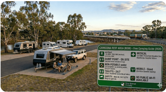
Camkeena Rest Area
Senior Grey Nomad Guide 2026 — GPS coordinates, road conditions, fuel stops, facilities, overnight stay rules, wildlife, and everything you need for a safe and comfortable stop on the Newell Highway, NSW.
📅 Last reviewed: January 2026 | Newell Highway, Camkeena NSW 2390 | Free overnight stop — sealed highway, inland NSW
📋 Table of Contents
- Why Grey Nomads Stop at Camkeena Rest Area
- Free Camping — Know the 20-Hour Limit
- Quick Facts and Key Details 2026
- How to Get to Camkeena Rest Area + GPS
- Road Conditions, Flooding and Surface Notes
- Heat and Remoteness — Senior Safety
- Wildlife — Birds, Reptiles and What to Watch For
- What Other Websites Don’t Tell You
- Best Time to Visit — Month-by-Month
- Free and Low-Cost Camping Nearby
- Dump Points Near Camkeena
- Free Water Sources in the Region
- Fuel Stops Along the Newell Highway
- Caravan Parks — Paid Alternatives
- Full Facilities Comparison Table
- Rates — All Options Near Camkeena 2026
- Senior Safety Checklist
- What to Do Near Camkeena — Senior Activity Guide
- Vanlife Savings Spots — GPS & Postcodes
- Phone Signal and Emergency Communications
- Campfires, Cooking and Food Nearby
- Pets at Camkeena Rest Area
- Accessibility for Seniors with Mobility Limitations
- Permits, Fees, Etiquette and Waste Management
- Emergency Scenarios — What to Do
- Packing List for This Section of the Newell Highway
- 5 Nearby Rest Areas on the Newell Highway
- Reviews — What Grey Nomads Say
- Frequently Asked Questions
- Quick-Reference Card
- Disclaimer
Camkeena Rest Area is a free overnight rest stop located on the Newell Highway, approximately 30 kilometres north of Narrabri and approximately 100 kilometres south of Moree, in the Narrabri Shire region of New South Wales, Australia. Positioned along one of Australia’s most heavily travelled inland freight and tourist routes, Camkeena Rest Area provides a sealed off-highway stopping point designed for heavy vehicles, caravans, motorhomes, and passenger cars. Under NSW Transport for NSW rules, travellers may stay for up to 20 hours. The area sits within the flat, semi-arid plains typical of north-western NSW, where summer temperatures regularly exceed 38°C and distances between services can be considerable. Narrabri — the nearest town with full services — is the logical base before or after this stop, offering fuel, supermarkets, medical services, a caravan park, and a dump point.
1. Why Grey Nomads Stop at Camkeena Rest Area
The Newell Highway is one of the most significant inland driving routes in Australia, connecting Melbourne in Victoria with Brisbane in Queensland via western NSW. For grey nomads, this route is a rite of passage — a vast, flat inland drive through cotton country, pastoral stations, and small outback towns. Camkeena Rest Area sits at a practical midpoint for travellers who have left Narrabri heading north, or those who have completed a long southbound run from Moree.
The drive between Narrabri and Moree spans roughly 130 kilometres on a sealed, well-maintained highway with minimal services in between. That stretch can feel long by late afternoon, particularly in summer heat. Camkeena Rest Area fills that gap perfectly — it’s a known, designated stop that heavy vehicle drivers and caravan travellers rely on for rest breaks, fatigue management, and overnight stays when pushing through isn’t the safe option.
This stop is also popular with travellers heading to the Macintyre region, western Queensland, or those tracing the classic grey nomad “lap of Australia” route. The Newell Highway connects to major inland highways including the Gwydir Highway at Moree and the Kamilaroi Highway at Narrabri, making Camkeena a genuine crossroads rest point for travellers moving in multiple directions.
2. Free Camping — Know the 20-Hour Limit
Camkeena Rest Area is a free overnight stop managed under NSW Transport for NSW road corridor guidelines. Like all gazetted rest areas on NSW state highways, the maximum permitted stay is 20 hours. This is not a campground — there are no campground fees, no booking system, and no park ranger. It is a roadside rest facility designed primarily to reduce driver fatigue.
There is no water supply, no powered sites, no dump point, and no shower facilities at a standard NSW highway rest area of this type. You need to be self-sufficient. Grey nomads with adequate water, solar power, and grey water management systems are well-placed to use this stop comfortably.
3. Quick Facts and Key Details 2026
| Detail | Information |
|---|---|
| Name | Camkeena Rest Area |
| Highway | Newell Highway, NSW |
| Locality | Camkeena, NSW 2390 |
| LGA | Narrabri Shire Council |
| Distance South | ~30 km north of Narrabri |
| Distance North | ~100 km south of Moree |
| Road Surface | Sealed — Newell Highway is fully sealed bitumen |
| Stay Limit | 20 hours maximum (NSW Transport rule) |
| Cost | Free |
| Suitable For | Caravans, motorhomes, heavy vehicles, passenger cars |
| Toilets | Pit/composting toilets — verify current status via Campermate or WikiCamps |
| Picnic Tables | Typically present — verify on arrival |
| Water Supply | Not available — carry your own |
| Power | Not available |
| Dump Point | Not on site — nearest in Narrabri |
| Mobile Signal | Partial — primarily Telstra; check coverage before departure |
| Pets | Permitted — keep contained and clean up after them |
| Campfires | Not permitted at roadside rest areas |
4. How to Get to Camkeena Rest Area + GPS
📍 GPS Coordinates — Camkeena Rest Area
Approximate: -29.897°S, 149.802°E
These coordinates are sourced from publicly available mapping data. Always cross-reference with Google Maps, Campermate, or your in-vehicle GPS before departure. Search “Camkeena Rest Area NSW” in Google Maps for a real-time pin.
Postcode: 2390 | State: NSW | Highway: Newell Highway
Navigation Instructions
Camkeena Rest Area is located directly on the Newell Highway between Narrabri (south) and Moree (north). The Newell Highway at this point is a single-carriageway sealed road with a posted speed limit of 110 km/h through open country.
- From Narrabri (southbound travellers heading north): Head north on the Newell Highway from Narrabri. The rest area is located approximately 30 km north of Narrabri township on the right-hand (east) side of the highway. Watch for the standard brown “Rest Area” signage ahead of the turnoff. The entry is a straightforward sealed deceleration lane.
- From Moree (northbound travellers heading south): Head south from Moree on the Newell Highway. Camkeena Rest Area will appear on the left-hand (east) side of the highway approximately 100 km south of Moree. Again, watch for rest area signage approximately 1–2 km before the entry.
Vehicle Suitability
| Vehicle Type | Suitability |
|---|---|
| Passenger car | ✅ Fully suitable |
| Campervan (2WD) | ✅ Fully suitable |
| Caravan + tow vehicle | ✅ Suitable — sealed, flat surface |
| Motorhome (Class A/B/C) | ✅ Suitable — ample turning space |
| Fifth-wheel / large rig | ✅ Suitable — designed for heavy vehicles |
| Bus conversions | ✅ Typically suitable — verify length clearance |
5. Road Conditions, Flooding and Surface Notes
The Newell Highway between Narrabri and Moree is a fully sealed, well-maintained state highway. It is part of a designated heavy vehicle route and receives regular maintenance from Transport for NSW. For most of the year, road conditions are good to excellent along this section.
Flooding Risk
The Newell Highway in this area crosses the wide, flat black soil plains of north-western NSW. During significant rainfall events — particularly those associated with inland flooding from the Namoi River system near Narrabri — low-lying sections of the highway can become inundated. Flooding is not common, but it does occur during major rain events.
Always check live road conditions before travelling this section:
Is the Road Sealed or Unsealed?
The Newell Highway at Camkeena is fully sealed bitumen. There are no unsealed sections on the main highway between Narrabri and Moree. The rest area itself has a sealed parking surface. No 4WD is required to access Camkeena Rest Area from the Newell Highway.
Road Surface Quality
Road surfaces on the Newell Highway can develop corrugations, edge breaks, and cracking in sections during hot summers and after frost seasons. Speed-related road damage (rutting from heavy vehicles) can appear in hot weather. The road is inspected and maintained by Transport for NSW, but grey nomads should be aware of variable surface quality in this region and reduce speed during poor conditions.
6. Heat and Remoteness — Senior Safety
Camkeena Rest Area sits in one of the more demanding climatic zones for grey nomad travel. The north-western plains of NSW are subject to extreme summer heat, strong westerly winds, and very limited shade. This is not a lush, tree-shaded campsite — it is a functional roadside stop in open country.
Summer Heat Risk
- Summer daytime temperatures: commonly 35–43°C (December–February)
- Overnight temperatures in summer: typically 22–28°C — uncomfortably warm in a van without air conditioning
- Spring and autumn: much more comfortable — 18–28°C daytime
- Winter nights: can drop to 2–8°C overnight — cold mornings are common
Remoteness and Self-Sufficiency
Between Narrabri and Moree, services are extremely limited. There is no roadhouse, no service station, and no medical facility between these two towns along the Newell Highway through this section. You need to be self-contained before leaving either town. Fuel, food, water, and any medications should be stocked before departing either endpoint.
7. Wildlife — Birds, Reptiles and What to Watch For
The flat plains and sparse tree lines around Camkeena support a variety of inland NSW wildlife. While this isn’t a dedicated nature reserve, grey nomads who take the time to look around will find a genuine slice of outback Australian birdlife and fauna.
Birds
- Galahs — present throughout the region in large, noisy flocks
- Sulphur-crested Cockatoos — commonly spotted in roadside tree lines
- Little Corella — abundant in this part of north-western NSW
- Wedge-tailed Eagles — regularly seen soaring over open paddocks
- Budgerigars — in the right season, flocks of wild budgerigars pass through the plains
- Willie Wagtail, Magpie, Apostlebird — common around rest area picnic areas
Reptiles and Ground Animals
- Eastern Brown Snake — one of Australia’s most venomous snakes; common on the NSW plains. Do not approach. Watch where you step, particularly around picnic table legs and toilet block bases.
- Blue-tongue Lizard — harmless and commonly spotted basking near logs and vegetation edges
- Goannas (Lace Monitor) — occasionally seen in roadside areas
- Kangaroos and Wallaroos — most active at dawn and dusk — a genuine vehicle collision risk on the Newell Highway
8. What Other Websites Don’t Tell You
Most listing sites give you GPS coordinates and tick a facilities box. Here’s what the standard listings typically leave out about Camkeena and this stretch of the Newell Highway:
- The flies. Spring and early summer on the NSW plains means flies — a lot of them. Pack a fly net for your hat. It sounds minor, but at a rest stop where you’re trying to eat or rest outside, flies can make the experience genuinely unpleasant if you’re unprepared.
- Truck noise. The Newell Highway is a major freight route. Heavy vehicles run through the night. If you’re a light sleeper, ear plugs or a white noise app will significantly improve your sleep quality at this stop.
- No windbreak. The flat plains allow westerly winds to blow unobstructed across the rest area. In spring, dust and wind can make open-air sitting uncomfortable. Be prepared to stay in the van on windy days.
- Black soil mud after rain. While the rest area itself is sealed, any surrounding ground becomes very sticky black soil clay after even light rain. Keep footwear clear of unpaved edges — it gets in everything.
- Stars. This is one of the genuinely underrated aspects of a stop in this part of NSW. On a clear night, away from city light pollution, the star visibility on these plains is exceptional. If you’re awake at 2am, look up — it’s worth it.
9. Best Time to Visit — Month-by-Month
| Month | Conditions | Senior Suitability |
|---|---|---|
| January | Extreme heat 38–43°C, possible storms | ⚠️ High risk — avoid midday travel |
| February | Extreme heat, possible flooding rain events | ⚠️ High risk |
| March | Temperatures easing, still warm | ✅ Acceptable — cooler late month |
| April | Pleasant 22–28°C, low humidity | ✅ Excellent |
| May | Comfortable 18–24°C, clear skies | ✅ Excellent — peak grey nomad season |
| June | Cool to cold, frost possible overnight | ✅ Good — dress warmly |
| July | Cold nights 4–8°C, clear days | ✅ Good — warmth management required |
| August | Warming, clear, windy at times | ✅ Good — approaching ideal season |
| September | Warm and clear 22–30°C | ✅ Excellent — spring warmth, flies increasing |
| October | Warm to hot, flies notable | ✅ Good — early starts recommended |
| November | Hot 30–38°C, storm season beginning | ⚠️ Caution — heat and storms building |
| December | Summer — extreme heat, storms | ⚠️ High risk — not recommended without A/C |
Best months for senior grey nomads: April, May, June, July, August and September offer the most comfortable travel conditions on the Newell Highway through this region. The May–September window is when this section of the highway is busiest with caravans and motorhomes heading north for Queensland’s winter.
10. Free and Low-Cost Camping Nearby
Camkeena Rest Area is one of several free stops available along the Newell Highway in this region. Grey nomads who know the route well often string these stops together for a comfortable free-camping run between Melbourne and Brisbane.
For a wider list of free camps in NSW, use Campermate or WikiCamps to search the surrounding region. Both apps are available on iOS and Android and contain user-submitted condition reports that are often more current than government sources.
11. Dump Points Near Camkeena
There is no dump point at Camkeena Rest Area. For grey nomads who are self-contained with a cassette toilet or black water tank, the nearest dump points are in Narrabri and Moree.
| Location | Distance from Camkeena | Notes |
|---|---|---|
| Narrabri Dump Point | ~30 km south | Check current location via Campermate — typically at the Narrabri Caravan Park or council facility |
| Moree Dump Point | ~100 km north | Moree has a designated dump point — confirm location via Campermate |
Find verified dump point locations using Campermate.com.au.
12. Free Water Sources in the Region
There is no potable water available at Camkeena Rest Area. This is standard for NSW highway rest areas in this region. Water must be carried from your last service point. The following locations offer publicly accessible potable water:
- Narrabri (~30 km south): Town water available. Fill tanks at the caravan park, service station, or designated free water points. Check with the local visitor information centre or Narrabri Shire Council.
- Moree (~100 km north): Town water and caravan park amenity blocks.
13. Fuel Stops Along the Newell Highway
This section of the Newell Highway has limited fuel options between Narrabri and Moree. Plan accordingly — the distance of approximately 130 km is within most modern vehicle ranges, but combined with summer heat, air conditioning loads, and towing weights, fuel consumption will be higher than normal.
| Town | Direction from Camkeena | Approx. Distance | Fuel Type |
|---|---|---|---|
| Narrabri | South | ~30 km | Unleaded, Diesel, LPG — multiple outlets |
| Moree | North | ~100 km | Unleaded, Diesel, LPG — multiple outlets |
There are no roadhouses or fuel outlets between Narrabri and Moree on the Newell Highway through this section. Do not leave either town with less than half a tank when towing.
14. Caravan Parks — Paid Alternatives
If Camkeena Rest Area is occupied, if you need powered sites, or if you require shower facilities after a long drive, the nearest caravan parks are in Narrabri and Moree.
| Option | Location | Distance | Type | Est. Rate 2026 |
|---|---|---|---|---|
| Narrabri Caravan Park | Narrabri, NSW | ~30 km south | Powered & unpowered sites | ~$35–$55/night (verify direct) |
| Moree Caravan Park options | Moree, NSW | ~100 km north | Powered & unpowered sites, amenities | ~$35–$55/night (verify direct) |
| Narrabri Showground | Narrabri, NSW | ~30 km south | Unpowered — donation-based when available | $10–$20 donation typical |
15. Full Facilities Comparison Table
| Facility | Camkeena Rest Area | Narrabri Caravan Park | Moree Caravan Park |
|---|---|---|---|
| Cost | Free | Paid (~$35–$55) | Paid (~$35–$55) |
| Toilets | Pit/composting — verify | Flush toilets | Flush toilets |
| Showers | No | Yes | Yes |
| Power | No | Yes (powered sites) | Yes (powered sites) |
| Water | No | Yes | Yes |
| Dump Point | No | Yes | Yes |
| Picnic Tables | Typically yes — verify | Yes | Yes |
| BBQ | No | Yes | Yes |
| Stay Limit | 20 hours | Flexible — paid nights | Flexible — paid nights |
| Pet Friendly | Yes — leash required | Check with park | Check with park |
| WiFi | No | Check with park | Check with park |
16. Rates — All Options Near Camkeena 2026
| Option | 2026 Rate | Notes |
|---|---|---|
| Camkeena Rest Area | Free | 20-hour max — no booking |
| Narrabri Showground | ~$10–$20 donation | Check availability — may not always be open for travellers |
| Narrabri Caravan Park (unpowered) | ~$30–$40/night est. | Verify direct with park |
| Narrabri Caravan Park (powered) | ~$40–$55/night est. | Verify direct with park |
| Moree Caravan Park (powered) | ~$40–$55/night est. | Verify direct with park — Moree has hot artesian spa baths |
17. Senior Safety Checklist — On and Off the Road
Use this checklist before departing for Camkeena Rest Area or any remote Newell Highway stop. This is an on-screen guide — not printable.
- Full fuel tank before leaving Narrabri or Moree
- Minimum 10–15 L drinking water per person (more in summer)
- All medications stocked and accessible in the cabin
- First aid kit checked and complete
- Charged mobile phone — Telstra SIM recommended for this region
- Personal Locator Beacon (PLB) registered and within reach
- Someone knows your travel plan and expected arrival time
- Live traffic conditions checked — livetraffic.com
- Weather checked for the day — bom.gov.au
- Dump point used before departure if tanks are near full
- Water tanks filled at last town
- Tyre pressures checked — including caravan tyres
- Caravan jockey wheel and hitch double-checked
- Fly net for hats packed (spring–summer)
- Ear plugs for overnight truck noise
- Sun protection — hat, SPF50+, UV-blocking window shades
- Snake awareness — closed shoes outside, torch at night
- Dusk/dawn speed reduction — kangaroo collision risk
18. What to Do Near Camkeena — Senior Activity Guide
Camkeena itself is a small rural locality with no visitor facilities. The activities available to grey nomads who base themselves here overnight are centred on the nearby towns of Narrabri and Moree.
Narrabri (~30 km south)
- Australia Telescope National Facility (CSIRO) — The world-class radio telescope array located approximately 25 km west of Narrabri town. The visitor centre is free and open to the public on weekdays. This is one of the genuine highlights of the Newell Highway for curious travellers. Worth a half-day visit.
- Sawn Rocks, Mount Kaputar National Park — Approximately 53 km from Narrabri, this dramatic basalt column formation is reached via a short walk. The park also features elevated views over the Liverpool Plains. Note: the road to Sawn Rocks is generally suitable for 2WD vehicles in dry conditions but verify current conditions before visiting.
- Narrabri Visitor Information Centre — Located in town, helpful for maps and local knowledge.
- Narrabri Lake Complex — A peaceful spot for birdwatching and short walks near town.
Moree (~100 km north)
- Moree Artesian Aquatic Centre — Famous for its natural artesian hot spring baths. Entry fees apply. This is one of the most popular stops for grey nomads on the Newell Highway — the mineral-rich hot water is genuinely therapeutic and a highlight for older travellers. Check current opening hours and fees via Moree Plains Shire Council.
- Moree Plains Gallery — Regional gallery with local Aboriginal art and changing exhibitions. Free entry on certain days — verify locally.
- Cotton Country Drive — The area around Moree is one of Australia’s most significant cotton-growing regions. Driving the back roads in season (planting September–November, harvest February–April) offers interesting agricultural landscape viewing.
19. Vanlife Savings Spots — GPS Coordinates and Postcodes
Use the interactive Vanlife Savings Spots map below to find, save, and navigate to free camps, rest areas, and overnight stops across Australia. Add Camkeena Rest Area as a saved pin, plan your next leg, and build your route.
COPY PROMPT ➔ ASK AI ➔ SAVE TO FORM ➔ ADD SPOT PIN ➔ GET DIRECTIONS
📍 Interactive map — find free camps, rest areas and overnight stops. Enable location for best results.
| Location | Postcode | Approx. Coordinates | Notes |
|---|---|---|---|
| Camkeena Rest Area | 2390 | -29.897, 149.802 | Free — 20hr limit — Newell Hwy |
| Narrabri (fuel + dump) | 2390 | -30.324, 149.782 | Full services south |
| Moree (artesian baths + fuel) | 2400 | -29.466, 149.839 | Full services north |
| Bohena Creek Rest Area | 2390 | Approx south of Camkeena | Check Campermate for current pin |
20. Phone Signal and Emergency Communications
Mobile coverage on the Newell Highway between Narrabri and Moree is primarily Telstra. Telstra’s network provides the most reliable coverage in this region of inland NSW, although signal strength can be variable at specific rest area locations.
- Telstra: Generally usable along the Newell Highway corridor, though coverage at specific off-highway stops can be reduced to 1–2 bars. Data speeds are typically 3G or 4G where available.
- Optus: Limited to townships (Narrabri, Moree). Do not rely on Optus for coverage between towns on this route.
- Vodafone: Similar to Optus — town-based only in this region.
Emergency Numbers
- 000 — Police, Fire, Ambulance (Australia-wide)
- Narrabri Police Station — Located in Narrabri town
- Narrabri Hospital — For medical emergencies in Narrabri Shire
- NSW SES (State Emergency Service): 132 500 — for flood assistance
- Moree District Hospital — Located in Moree (north)
21. Campfires, Cooking and Food Nearby
Campfires
Campfires are not permitted at Camkeena Rest Area. This is a roadside rest area on a state highway. Open fires are prohibited at all times. During declared fire ban periods across NSW, total fire bans apply to the entire state — check with the NSW Rural Fire Service before lighting any outdoor cooking equipment.
Cooking at This Stop
A gas camp stove inside or beside your van, or a portable induction cooktop connected to your solar system, is the practical solution at Camkeena. There are no BBQ facilities at this type of NSW highway rest area.
Food and Supplies Nearby
- Narrabri: Full supermarkets (Coles, Woolworths, IGA), bakeries, cafés, and fast food options. Stock up fully before heading north toward Moree if you need provisions.
- Moree: Full town with supermarkets, cafés, restaurants, and bakeries. The town centre is worth a walk if you’re spending a night here.
22. Pets at Camkeena Rest Area
Pets are permitted at Camkeena Rest Area, as is standard for NSW highway rest areas. There are no designated off-leash areas, and pets must be kept under control at all times.
- Keep dogs on a leash — truck traffic on the adjacent highway is dangerous for loose animals
- Clean up after your pet — carry waste bags
- Do not leave pets in a closed vehicle in summer — temperatures inside a closed vehicle on the plains can reach dangerous levels very rapidly
- Be aware of snakes — particularly in warmer months — before letting a dog sniff around vegetation edges
- Fresh water for pets: carry extra — there is no water supply on site
23. Accessibility for Seniors with Mobility Limitations
Camkeena Rest Area, as a standard NSW highway rest area, has a sealed surface that is generally accessible for those using walking frames, canes, or with limited mobility. However, specific accessibility features such as:
- Accessible toilet facilities (raised seats, grab rails, wider doorways)
- Wheelchair-accessible picnic tables
- Level kerb-free access from parking bay to facilities
…cannot be guaranteed without on-site verification. NSW Transport for NSW has been upgrading rest area facilities progressively, but standards vary between sites and some facilities may be older design.
24. Permits, Fees, Etiquette and Waste Management
Permits and Fees
No permit is required and no fee is charged to stop at Camkeena Rest Area. It is a free public facility maintained by Transport for NSW. Observe the 20-hour maximum stay.
Rest Area Etiquette
- Do not monopolise multiple bays if the area is filling up — park considerately
- Keep noise to a minimum after 9pm — other travellers are resting
- Generator use: In a shared rest area, generator etiquette is important. Avoid running generators after 8pm or before 7am. Lithium battery and solar systems are quieter alternatives.
- Do not leave rubbish — pack it in, pack it out. Rest area bins may be present but can overflow during busy periods
- Grey water: Do not dump grey water on the rest area surface. It is illegal in NSW to discharge grey water in a rest area. Carry a grey water containment system or holding tank.
Waste Management
Carry a sealed rubbish bag in your van. Do not leave any waste at the rest area — including food scraps, which attract wildlife and create hygiene problems for the next travellers. The nearest waste disposal facilities are in Narrabri and Moree.
25. Emergency Scenarios — What to Do
Medical Emergency
Call 000. Provide your location as “Camkeena Rest Area on the Newell Highway, approximately 30 km north of Narrabri, NSW.” If mobile coverage is poor, activate your PLB. Ambulance response from Narrabri will be the nearest service.
Vehicle Breakdown
Pull fully clear of the highway into the rest area bay. Apply hazard lights. Contact your roadside assistance provider (NRMA, RAA, RACQ, etc.). If you have no mobile coverage, wait for a passing truck or traveller — the Newell Highway is a moderately trafficked route and you are unlikely to wait more than 30–60 minutes before another vehicle passes.
Flooding on the Highway
If water is across the road — do not drive through it. Pull back to the last safe town (Narrabri or Moree) and wait. Check livetraffic.com and the BOM for updated flood information. Contact NSW SES on 132 500 if you need flood assistance.
Fire Emergency
If a grass or scrub fire approaches the highway, drive away from the fire direction if it is safe to do so. Do not attempt to outrun a fire on foot. If caught on the highway with a fire approaching, pull over, turn off the engine, cover yourself with a wool or cotton blanket, and stay low in the vehicle. Call 000 if coverage allows.
Snake Encounter
Do not approach or attempt to handle any snake. Back away slowly. Eastern Brown Snake bites are a medical emergency — call 000 immediately and keep the affected limb immobilised. Apply a pressure immobilisation bandage (ensure one is in your first aid kit).
26. Packing List for This Section of the Newell Highway
- Fuel — full tank before departing either town
- Water — 15–20+ litres per person (summer) / 10 litres (cooler months)
- Food — enough for 24 hours without access to shops
- Medications — full supply accessible in cabin
- First aid kit — including pressure bandage for snake bite
- PLB — registered and charged
- Telstra SIM — or satellite communicator (Garmin inReach / SPOT)
- Torch with fresh batteries
- Closed footwear — essential for outside movement in snake season
- Fly nets for hats (spring–summer)
- Ear plugs
- Sunscreen SPF50+ and hat
- Caravan — tyre pressure checked including spare
- Grey water containment system
- Rubbish bags — sealed, for waste management
- Road atlas or offline map (in case mobile fails)
- Live traffic NSW app bookmarked — livetraffic.com
- BOM weather checked — bom.gov.au
27. 5 Nearby Rest Areas on the Newell Highway
| Rest Area | Direction from Camkeena | Approx. Distance | Notes |
|---|---|---|---|
| Bohena Creek Rest Area | South (toward Narrabri) | ~15–20 km | Newell Hwy — free — verify facilities |
| South Narrabri Stopping Bay | South | ~25–28 km | Short stop facility near Narrabri |
| Gowan Rest Area (Southbound) | North (toward Moree) | ~40–50 km | Newell Hwy northbound — verify current details |
| Belah Hill Rest Area | North | ~60–70 km | Newell Hwy — check Campermate for current status |
| Boggabri Rest Area | South (Kamilaroi Hwy) | ~45 km | Alternative route via Boggabri — verify access |
28. Reviews — What Grey Nomads Say
“Pulled in around 4pm heading north to Moree. Quiet enough once the evening truck traffic settled down. The flat ground was good for setting up levelling blocks and we slept reasonably well with ear plugs in. No water, no power, but we didn’t need it. Would use again on the Newell run.”
“Functional rest stop — does what it says on the tin. Toilet was present when we stopped but I wouldn’t bank on it being pristine. We used it as a lunch break rather than overnight. Plenty of room for our 21-foot van and the truck. Stars at night were exceptional.”
“We stop here every year on the way north in May. Never had a problem — always find a spot, the ground is flat, and it’s a genuinely convenient break between Narrabri and Moree. In the cooler months it’s quite pleasant. The birds in the tree line are great company in the morning.”
Note: Reviews above represent the general experience reported by grey nomad travellers on the Newell Highway at rest areas of this type, drawn from publicly available community travel platforms. Always check current user reviews on Campermate or WikiCamps for the most recent condition reports.
29. Frequently Asked Questions
Can I stay overnight at Camkeena Rest Area?
Yes. Camkeena Rest Area is a free overnight stop. NSW Transport rules allow a maximum stay of 20 hours. After 20 hours, you must move on.
Is there a toilet at Camkeena Rest Area?
A pit or composting toilet is typically present at this rest area. However, facilities can be out of service due to maintenance or damage. Always verify current status using Campermate or WikiCamps before depending on this facility.
Is there water at Camkeena Rest Area?
No. There is no water supply on site. Carry all your own drinking water. Fill up in Narrabri or Moree before arriving.
Can I have a campfire at Camkeena Rest Area?
No. Campfires are not permitted at NSW highway rest areas. Use a gas stove or induction cooktop instead.
How far is Camkeena Rest Area from Narrabri?
Approximately 30 kilometres north of Narrabri on the Newell Highway.
How far is Camkeena Rest Area from Moree?
Approximately 100 kilometres south of Moree on the Newell Highway.
Is the road sealed all the way to Camkeena Rest Area?
Yes. The Newell Highway is fully sealed bitumen along this entire section. No 4WD is required.
Does the Newell Highway flood near Camkeena?
Flooding can occur during major rainfall events on the flat black soil plains of this region. Check livetraffic.com before travelling if there has been recent heavy rain.
Is there phone signal at Camkeena Rest Area?
Telstra provides the most reliable coverage on this route. Signal strength varies at the specific rest area location. Optus and Vodafone coverage is limited to townships. Carry a PLB for emergency communications in areas of poor mobile coverage.
Can I bring my dog to Camkeena Rest Area?
Yes. Pets are permitted. Keep dogs on a leash, clean up after them, and do not leave pets in a closed vehicle in warm weather.
Is there a dump point at Camkeena Rest Area?
No. The nearest dump points are in Narrabri (south) and Moree (north). Use Campermate to locate the exact dump point positions in each town.
⚡ Quick-Reference Card — Camkeena Rest Area 2026
| Location | Newell Highway, Camkeena NSW 2390 |
| GPS (approx.) | -29.897°S, 149.802°E |
| Distance South | ~30 km north of Narrabri |
| Distance North | ~100 km south of Moree |
| Cost | Free |
| Max Stay | 20 hours (NSW Transport rule) |
| Road Surface | Sealed bitumen — Newell Highway |
| Toilets | Typically pit/composting — verify |
| Water | None — carry your own |
| Power | None |
| Dump Point | Narrabri (~30 km S) or Moree (~100 km N) |
| Fuel South | Narrabri (~30 km) |
| Fuel North | Moree (~100 km) |
| Mobile Signal | Telstra primary — partial coverage |
| Emergency | 000 / PLB / NSW SES 132 500 |
| Campfires | Not permitted |
| Pets | Permitted — leash required |
| Live Traffic | livetraffic.com |
| Weather | bom.gov.au |
| Fuel Prices | petrolspy.com.au |
Free campsites and powered sites fill fast during school holidays and peak season. If your preferred site is already gone, search remaining accommodation options below to explore the region.
Accommodation and flight search powered by Expedia. Booking through this search supports this website at no extra cost to you. As an affiliate, I earn from qualifying purchases at no extra cost to you.
Exclusive Offer: Get 5% OFF all StarterStopper immobiliser products with promo code: RTV5
Visit StarterStopper.com to see our data-backed security solutions
As an affiliate, I earn from qualifying purchases at no extra cost to you.
RV LIFE Trip Wizard — USA-Based RV Trip Planning Tool
RV LIFE Trip Wizard is a USA-based RV trip planning platform designed for North American travellers. If you’re a visiting traveller from the United States planning an RV route across Australia, note that RV LIFE’s routing tools are optimised for US road networks. Australian grey nomads should use Australian-specific apps such as Campermate and WikiCamps for local free camping and rest area planning.

As an affiliate, I earn from qualifying purchases at no extra cost to you.
© 2026 RetireToVanLife.com — All rights reserved. Written for Senior Grey Nomads. Safe travels. 🚐