Free Camping Yorke Peninsula SA — Grey Nomad Guide 2026
The complete loop guide for caravans and motorhomes — foreshore free camps, Copper Triangle history, sealed roads all the way around, and honest advice on fuel, medical facilities and what to expect in every season.
Last reviewed: June 2026. Information is current to the best of our knowledge at time of publication. Always verify conditions locally before departure.
📋 Table of Contents
- Location Overview — Where Is Yorke Peninsula?
- The Loop Route — Clockwise vs Anticlockwise
- Free and Low-Cost Overnight Stays
- Full Facilities Table — All Major Stops
- Road Access, Fuel Distances and Flood Risk
- Copper Triangle — Moonta, Kadina, Wallaroo
- Innes National Park
- Dump Points Around the Loop
- Medical and Emergency Contacts
- Mobile Coverage by Carrier
- Best Time to Visit — Honest Seasonal Guide
- GPS Coordinates and Postcodes Table
- FAQ — 10 Questions Answered
- Quick Verdict
- Planning Tips and Internal Links
- Disclaimer
1. Location Overview — Where Is Yorke Peninsula?
Yorke Peninsula is a boot-shaped landmass that juts south-west from the South Australian mainland, lying between Gulf St Vincent to the east and Spencer Gulf to the west. It is one of the most recognisable geographic features on a map of South Australia — broad at the top near the Copper Triangle towns of Moonta, Kadina and Wallaroo, then narrowing progressively as it runs south toward Innes National Park at the tip, near Marion Bay and Stenhouse Bay.
From Adelaide, the most common entry point is via the Yorke Highway heading north-west through Balaklava, then picking up the road through Maitland — a drive of approximately 160 kilometres to Maitland and roughly 190 kilometres to Ardrossan on the eastern Gulf St Vincent coast. Most travellers will find themselves on the road for around two hours from Adelaide’s northern suburbs, depending on where they join the highway and how they’re towing.
The peninsula covers an area of approximately 5,800 square kilometres and is largely flat agricultural land — wheat, barley and sheep country — with a coastline that alternates between sandy beaches, limestone cliffs and protected coves. This flat topography is excellent news for grey nomads: there are very few steep grades or tight switchbacks anywhere on the main loop roads, and large caravans and fifth-wheelers handle the peninsula with ease.
📍 Geographic Reference Point — Maitland, Yorke Peninsula SA
-34.3667, 137.6667
Maitland is commonly used as the central reference town for the peninsula. It sits at the northern end of the loop and serves as the main inland service hub.
Postcode: 5573 — Open in Google Maps
⚠ GPS note: Coordinates are within 50 metres of the stated location and are provided as navigation guidance only. Always confirm on arrival against current signage.
The peninsula is not a remote destination in the way that outback South Australia can be. Towns are spaced reasonably close together on the main loop, fuel is available at several points, and phone coverage — while variable — is generally adequate on Telstra along the main roads. That said, it is not a destination to treat casually. Some coastal free camps are isolated, medical facilities are limited to one main hospital and a handful of clinics, and the southern tip around Innes National Park is genuinely away from services.
2. The Loop Route — Clockwise vs Anticlockwise
The Yorke Peninsula loop is approximately 600 kilometres in total distance, depending on which entry and exit points you use and how many detours you take. The loop can be driven in either direction and both work well — but there are practical reasons why many grey nomads favour one direction over the other.
Clockwise (Recommended for most grey nomads)
Entering via Ardrossan or Maitland and travelling south down the Gulf St Vincent side (eastern coast), then looping west at the tip through Innes National Park, then north up the Spencer Gulf side (western coast) through Warooka, Yorketown, Minlaton and back through the Copper Triangle. This is the most popular direction and means you reach the quieter southern camps before the crowds thin out in the afternoon. You also have the option to visit the Copper Triangle on the final leg — a good way to end the trip near services if you need to restock before heading home.
Anticlockwise
Entering via Kadina and the Copper Triangle first, then south down the Spencer Gulf side through Minlaton and Yorketown, around the tip and back up the Gulf St Vincent coast. This works equally well logistically. Some travellers prefer to get the history and heritage towns done early and spend their final days at the quieter eastern foreshore camps.
Entry and Exit Points
The main sealed entry points from the mainland are:
- Yorke Highway via Balaklava and Maitland — the primary sealed route, suitable for all rigs
- Port Wakefield Road connecting to Kadina/Wallaroo — via the copper towns at the top of the peninsula
- The ferry crossing between Wallaroo and Lucky Bay — note: the SeaSA ferry service between Wallaroo and Lucky Bay (Port Neill area on Eyre Peninsula) was a seasonal service. Availability and timetables change; confirm current operation before planning around it
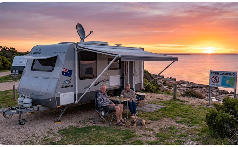
3. Free and Low-Cost Overnight Stays — Town by Town
Below is a comprehensive town-by-town guide to every major overnight stop on the loop. We have listed what is known to be available and flagged where information may change. Always verify current rules with the Yorke Peninsula Council or the relevant land manager before arrival, as free camping conditions on foreshore areas can and do change.
Ardrossan — Eastern Coast, Gulf St Vincent
📍 Ardrossan Foreshore Free Camp
-34.4233, 137.9203
Ardrossan Esplanade foreshore area, Ardrossan SA 5571
⚠ GPS note: Coordinates are within 50 metres of the stated location and are provided as navigation guidance only. Always confirm on arrival against current signage.
Ardrossan sits on the eastern coast of the peninsula approximately 150 kilometres from Adelaide via the Yorke Highway. It is typically the first major stop for travellers entering the peninsula from the Adelaide direction and heading south. The foreshore area along the esplanade has historically provided free overnight camping for self-contained vehicles, with a flat sealed surface, ocean views across Gulf St Vincent and relatively good facilities for a free camp.
The site is flat, which is a significant advantage for grey nomads dealing with levelling, knee or back issues. Toilets are available in the area. The town itself has a supermarket, fuel, a hotel and basic services. The nearby jetty is a popular fishing spot — whiting and snapper are commonly targeted. The boat ramp is accessible and well-used by locals and visitors alike.
- Surface: Flat, primarily grassed foreshore with some sealed nearby areas
- Toilets: Available nearby
- Showers: Not confirmed at the free camp area — check at the caravan park if needed
- Water: Not reliably available at the free camp — tank up before arrival
- Dump point: Present in Ardrossan — see dump point section below
- Fuel: Available in town
- Rig size: Suitable for large caravans and motorhomes
- Stay limit: Verify current limits with Yorke Peninsula Council — limits can apply
Port Vincent — Eastern Coast
📍 Port Vincent Foreshore Camping
-34.7783, 137.8567
Port Vincent Esplanade foreshore area, Port Vincent SA 5581
⚠ GPS note: Coordinates are within 50 metres of the stated location and are provided as navigation guidance only. Always confirm on arrival against current signage.
Port Vincent is a popular grey nomad stop approximately 45 kilometres south of Ardrossan. The foreshore camping area is well-regarded and consistently cited by travellers as one of the nicer free stops on the eastern side of the loop. The beach here is calm and sheltered, making it suitable for a morning walk along the water’s edge — an easy flat stroll that suits travellers with limited mobility.
The town has a hotel, a small general store and limited fuel availability — confirm current fuel hours before relying on it. The foreshore area is grassed and relatively flat. This is a popular spot and can fill during school holidays and long weekends. In June you will likely find it quiet and comfortable, with cooler temperatures ideal for sleeping.
- Surface: Grassed foreshore, generally flat
- Toilets: Available
- Showers: Not confirmed at free camp — limited
- Water: Limited — carry your own
- Rig size: Suits larger rigs with care on approach roads
- Fishing: Good jetty fishing — snapper, garfish, whiting
Edithburgh — Southern Eastern Coast
📍 Edithburgh Foreshore Camping
-35.0833, 137.7500
Edithburgh Esplanade foreshore, Edithburgh SA 5583
⚠ GPS note: Coordinates are within 50 metres of the stated location and are provided as navigation guidance only. Always confirm on arrival against current signage.
Edithburgh is one of the most charming small towns on the peninsula and a genuine highlight of the loop. The foreshore camping is free for self-contained vehicles and sits close to one of the peninsula’s most photographed features — the Edithburgh tidal pool. This ocean pool is cut into the limestone rock shelf and fills naturally with seawater. It is a wonderful facility for grey nomads: flat access, a calm salt-water swim environment and a genuinely beautiful setting.
The town has a small museum, a hotel and limited shopping. There is a dump point in Edithburgh, which makes this a practical stop for those needing to empty tanks. The cemetery here contains the graves of victims from the 1901 wreck of the passenger ship Clan Ranald — a sobering piece of local history that is easy to visit on foot.
- Tidal pool: Flat limestone access — excellent for seniors, highly recommended
- Dump point: Available in Edithburgh
- Toilets: Available near foreshore
- Fuel: Limited — verify before arrival. Yorketown is approximately 22 kilometres inland and has fuel
- Rig size: Suitable for most rigs — confirm turning space at foreshore entry
Yorketown — Inland Service Town
📍 Yorketown Rest Area
-35.0167, 137.5833
Yorketown SA 5576
⚠ GPS note: Coordinates are within 50 metres of the stated location and are provided as navigation guidance only. Always confirm on arrival against current signage.
Yorketown is the main inland service town for the southern half of the peninsula and is an important resupply and rest point. It sits roughly in the middle of the peninsula east-to-west and is accessed by sealed roads from both coasts. The town has a supermarket, fuel, a hotel, a medical clinic and banking facilities — making it the most practical inland stop on the loop.
There is a rest area in Yorketown suitable for overnight parking for self-contained vehicles. It is not a scenic stop, but it is practical and well-positioned if you need services. The Yorketown Hospital is the main medical facility for the southern peninsula — details in the medical section below.
- Fuel: Available in town — fill up here before heading to the southern tip
- Supermarket: Yes — restock here
- Medical: Yorketown Hospital — 08 8852 1200
- Dump point: Check with council for current location
Warooka — Quiet Western Coast Camp
📍 Warooka Free Camp
-34.9833, 137.4167
Warooka SA 5577
⚠ GPS note: Coordinates are within 50 metres of the stated location and are provided as navigation guidance only. Always confirm on arrival against current signage.
Warooka is a small, quiet agricultural town on the western side of the southern peninsula, closer to Spencer Gulf. It is off the main tourist trail and sees far fewer visitors than the eastern foreshore towns. There is a basic free camping rest area here that suits self-contained travellers looking for a quiet night without crowds. Facilities are minimal and the town itself has very limited services, but the sense of solitude is genuine.
Warooka is approximately 30 kilometres north of Marion Bay. If you are travelling the loop anticlockwise and have come down the western coast, Warooka makes a logical stop before heading to Marion Bay and then around to the eastern coast.
- Services: Very limited — tank up and stock up at Yorketown before arrival
- Surface: Flat — verify current access on arrival
- Suited for: Self-contained rigs only — no waste disposal facilities confirmed
Marion Bay — Gateway to Innes National Park
📍 Marion Bay
-35.2333, 136.9833
Marion Bay SA 5575
⚠ GPS note: Coordinates are within 50 metres of the stated location and are provided as navigation guidance only. Always confirm on arrival against current signage.
Marion Bay is a small coastal settlement at the southern end of the western coast, just north of Innes National Park. It is the last place to access fuel and supplies before entering the national park and the final outpost before the tip of the peninsula. There is low-cost camping available in the Marion Bay area, and the surroundings are genuinely beautiful — expansive beaches, good surf (for observers, not swimmers), and a wide open sky that photographers love in winter light.
The general store at Marion Bay is the essential last stop before Innes National Park. Do not assume you can resupply inside the park — you cannot. Fill water, empty waste and buy food at Marion Bay before entering.
- Fuel: Available at Marion Bay — last fuel before Innes NP
- General store: Basic supplies available — hours may vary in off-peak season, phone ahead
- Low-cost camping: Available in the township area — confirm current rates
- Rig size: Suitable for larger rigs into Marion Bay on sealed roads
Innes National Park — Entry Fee Applies
Innes National Park covers the toe of the Yorke Peninsula boot and is managed by the Department for Environment and Water (DEW). It is a spectacular environment — rugged coastline, historic ruins at Inneston, excellent birdlife and some of the best shore fishing on the peninsula. The park contains the ruins of the former gypsum mining town of Inneston, which are accessible on a flat sealed road and are genuinely worth visiting even if you are not camping in the park.
Several campgrounds exist within the park at varying levels of facilities. Brown Beach and Shell Beach campgrounds are popular. Facilities vary by site — some have drop toilets and limited water, others are more basic. Check the DEW website for current campground details and book ahead.
- Entry fee: Applies — check current rates at DEW SA
- Booking: Essential — online via the SA national parks booking system
- Roads inside park: Mix of sealed and unsealed — large rigs should check road conditions before entering on unsealed sections
- Fuel: None inside the park — fill at Marion Bay
- Water: Limited — carry sufficient supply
- Phone coverage: Very limited to nil inside the park on all carriers
Minlaton — Copper Triangle Gateway, Harry Butler Memorial
📍 Minlaton
-34.7667, 137.5833
Minlaton SA 5575
⚠ GPS note: Coordinates are within 50 metres of the stated location and are provided as navigation guidance only. Always confirm on arrival against current signage.
Minlaton is the main service town in the central-western portion of the peninsula and a key stop on the loop. It has fuel, a supermarket, a hospital (Minlaton Hospital — confirm current services as rural hospital facilities can change), a hotel and good facilities for travellers. Minlaton is also home to the famous Red Devil aircraft — a replica of the Bristol Monoplane flown by Captain Harry Butler, who in 1919 made the first airmail flight in South Australia, piloting the plane from Adelaide to Minlaton. The aircraft is displayed at the Harry Butler Memorial — a flat, easy-access attraction that is genuinely interesting for anyone with an interest in early Australian aviation.
- Fuel: Available — fill up here when on the western loop
- Harry Butler Memorial: Flat access, no significant walking required
- Medical: Confirm current services at Minlaton Hospital
- Overnight: Rest area or caravan park options — confirm current availability
Maitland — Yorke Peninsula’s Largest Inland Town
📍 Maitland
-34.3667, 137.6667
Maitland SA 5573
⚠ GPS note: Coordinates are within 50 metres of the stated location and are provided as navigation guidance only. Always confirm on arrival against current signage.
Maitland is the administrative centre of Yorke Peninsula and its largest inland town. It sits at the northern end of the peninsula and is typically either the starting or ending point for travellers doing the loop. The town has a supermarket, fuel, a hospital (Maitland Hospital — confirm current services), a caravan park, a hotel and government services including the Yorke Peninsula Council office. If you need to sort out any administrative matter — such as querying free camping rules — this is the place to do it.
The Yorke Peninsula Visitor Information Centre is worth stopping at before you begin the loop. They will have current information on road conditions, free camp availability and any closures. The town also has a dump point, which is convenient if you are just starting or finishing the loop.
- Fuel: Available
- Supermarket: Yes — good place to do a full restock
- Visitor information: Available — recommended first stop
- Dump point: Present in town
- Hospital: Confirm current services
4. Full Facilities Table — All Major Stops
| Town / Stop | Toilets | Water | Dump Point | Showers | Fuel | Supermarket | Big Rig OK | Cost |
|---|---|---|---|---|---|---|---|---|
| Ardrossan | ✅ Yes | ⚠ Limited | ✅ Yes | ⚠ Check | ✅ Yes | ✅ Yes | ✅ Yes | Free |
| Port Vincent | ✅ Yes | ⚠ Carry own | ⚠ Check | ❌ Limited | ⚠ Verify hours | ⚠ Small store | ✅ Yes | Free |
| Edithburgh | ✅ Yes | ⚠ Carry own | ✅ Yes | ⚠ Check | ⚠ Verify | ⚠ Very limited | ✅ Yes | Free |
| Yorketown | ✅ Yes | ✅ Yes | ⚠ Check council | ⚠ Check | ✅ Yes | ✅ Yes | ✅ Yes | Free rest area |
| Warooka | ⚠ Basic | ❌ Carry own | ❌ Not confirmed | ❌ No | ❌ Very limited | ❌ No | ✅ Yes | Free |
| Marion Bay | ✅ Yes | ⚠ Limited | ⚠ Check | ⚠ Check | ✅ Yes | ⚠ Small store | ✅ Yes | Low cost |
| Innes National Park | ✅ Drop toilets | ⚠ Very limited | ❌ No | ❌ No | ❌ No | ❌ No | ⚠ Sealed areas only | Paid + entry fee |
| Minlaton | ✅ Yes | ✅ Yes | ✅ Yes | ⚠ Check | ✅ Yes | ✅ Yes | ✅ Yes | Check locally |
| Maitland | ✅ Yes | ✅ Yes | ✅ Yes | ✅ Caravan park | ✅ Yes | ✅ Yes | ✅ Yes | Free rest area / park |
| Moonta | ✅ Yes | ✅ Yes | ✅ Yes | ✅ Caravan park | ✅ Yes | ✅ Yes | ✅ Yes | Caravan park rates |
| Kadina | ✅ Yes | ✅ Yes | ✅ Yes | ✅ Yes | ✅ Yes | ✅ Yes | ✅ Yes | Park rates apply |
| Wallaroo | ✅ Yes | ✅ Yes | ✅ Yes | ✅ Yes | ✅ Yes | ✅ Yes | ✅ Yes | Park rates apply |
⚠ Key: ✅ Confirmed available | ⚠ Uncertain — verify before arrival | ❌ Not available or not confirmed. All facilities information is based on best available data as of June 2026 and is subject to change. Always verify locally.
5. Road Access, Fuel Distances and Flood Risk
Are the Roads Sealed?
Yes — the main loop roads around Yorke Peninsula are sealed for their entire length. This is one of the key features that makes Yorke Peninsula so well suited to large caravans and motorhomes. You do not need a high-clearance vehicle or an off-road-capable rig to complete the standard loop. The Yorke Highway, the roads linking the coastal towns and the roads through the Copper Triangle are all sealed and well-maintained.
The exception is within Innes National Park, where some internal tracks are unsealed gravel or limestone and should be assessed on a site-by-site basis. If you are driving a large motorhome or towing a long caravan, stick to the sealed roads inside the park. Some campgrounds and lookouts may be accessible only via unsealed tracks — do not attempt these in wet conditions or with an oversized rig without local advice.
Do the Roads Flood?
Flooding is not a common hazard on Yorke Peninsula’s main roads in the way it is in northern South Australia. The peninsula is relatively flat and the drainage system on the main sealed roads is generally adequate. However, localised flooding can occur after heavy winter rainfall, particularly on lower-lying sections of road near creek crossings and on any unsealed tracks. June is the wettest month of the year on the peninsula — if you encounter standing water on a road, do not attempt to drive through it regardless of depth. Turn around and wait for the water to subside or find an alternative route.
Fuel Distances — Where to Fill Up
This is an important planning consideration. Not every town on the loop has reliable fuel. Below is a guide to confirmed fuel locations and approximate distances between them on the main loop:
| Town | Fuel Available | Approx. Distance to Next Fuel North | Approx. Distance to Next Fuel South | Notes |
|---|---|---|---|---|
| Kadina | ✅ Yes | ~50 km to Port Wakefield (off peninsula) | ~45 km to Maitland or Moonta | Multiple fuel options in the Copper Triangle |
| Wallaroo | ✅ Yes | ~20 km to Kadina | ~30 km to Moonta | Copper Triangle cluster — fuel easy to find |
| Moonta | ✅ Yes | ~20 km to Kadina | ~50 km to Minlaton | Fill here before heading south on the western loop |
| Maitland | ✅ Yes | ~50 km to Port Wakefield (off peninsula) | ~50 km to Minlaton or Ardrossan | Key fuel stop at top of loop |
| Ardrossan | ✅ Yes | ~50 km to Maitland | ~45 km to Port Vincent or Edithburgh | Fill here before heading south on eastern coast |
| Minlaton | ✅ Yes | ~50 km to Maitland | ~40 km to Yorketown | Important mid-loop western fuel stop |
| Yorketown | ✅ Yes | ~40 km to Minlaton | ~50 km to Marion Bay | Last reliable fuel before southern tip |
| Marion Bay | ✅ Yes | ~50 km to Yorketown | Last fuel before Innes NP | Fill tank completely here — no fuel inside park |
| Port Vincent | ⚠ Verify hours | ~45 km to Ardrossan | ~40 km to Edithburgh | Do not rely on without confirming first |
| Edithburgh | ⚠ Verify | ~40 km to Port Vincent | ~30 km to Yorketown (inland) | Verify current availability before relying on it |
6. The Copper Triangle — Moonta, Kadina and Wallaroo
The three towns of Moonta, Kadina and Wallaroo sit in a rough triangle at the northern end of the peninsula and together form what is known as the Copper Triangle — a reference to the massive copper mining industry that defined the region from the 1860s through the early twentieth century. These towns have a strong Cornish heritage, with many of the original miners and their families having emigrated from Cornwall in England. The influence is still visible today in the architecture, place names, food traditions (Cornish pasties are taken seriously here) and the annual Kernewek Lowender festival.
Moonta
Moonta is the historical heart of the copper mining area. The Moonta Mines State Heritage Area is the key attraction — a large, flat heritage precinct with preserved mine buildings, engine houses and the Moonta Mines Museum. A small tourist train runs through the precinct, making it accessible for travellers who cannot manage extended walking. The heritage trail is partly flat and partly on gentle paths. Moonta Bay, a few kilometres from the main town, has a long sandy beach and a caravan park.
Kadina
Kadina is the largest and most commercially active of the three towns. It has the best supermarkets, fuel options, a hospital (Kadina/Copper Coast Health — confirm current services), banks, hardware stores and most of the services you would need on the loop. The Kadina Heritage Museum is worth a visit. If you need to do a significant restock of supplies or deal with any practical matter, Kadina is the town to do it in.
Wallaroo
Wallaroo is the coastal town of the trio and has the most obvious maritime character. The old smelter chimney stack is a landmark. There is a good caravan park near the foreshore, a jetty, a heritage museum and access to the Wallaroo beach. Wallaroo also has a supermarket, fuel and a hotel. The foreshore area makes for a pleasant flat evening walk.
7. Innes National Park — What Grey Nomads Need to Know
Innes National Park deserves its own section because it is qualitatively different from the rest of the Yorke Peninsula loop experience. This is a managed national park at the very tip of the peninsula — remote, beautiful, and unforgiving if you arrive unprepared.
The park protects a dramatic stretch of coastline including tall limestone cliffs, sheltered coves, heath and mallee scrubland, and significant wildlife habitat. It is one of the best places in South Australia to see western grey kangaroos at close range, and birdlife is exceptional. The historic ruins of Inneston — a former gypsum mining town abandoned in the 1930s — are accessible on a sealed road and are one of the most atmospheric and unusual attractions on the peninsula.
Camping Inside the Park
There are multiple campgrounds inside Innes National Park, ranging from relatively well-facilitated sites with drop toilets and tank water to very basic bush camping spots. Advance online booking through the DEW SA national parks booking system is mandatory. Walk-in arrivals without a booking are turned away during busy periods and may find sites unavailable even in June.
What Most Guides Don’t Tell You
Most travel articles about Innes NP focus on the scenery and gloss over the practical reality: mobile coverage is effectively non-existent inside much of the park. If you have a medical emergency inside Innes National Park, you will need a satellite communicator or personal locator beacon (PLB) to call for help. This is not optional advice — it is critical information for any grey nomad, particularly those with heart conditions, diabetes or other health considerations who travel this area.
Senior-Friendly Experiences Inside the Park
- Inneston ruins: Accessible on a sealed road — you can drive directly to the site. The ruins are on flat ground and easily explored from the car park.
- Stenhouse Bay jetty: A short, flat walk from the car park. Good fishing and views.
- Pondalowie Bay: Spectacular coastal scenery accessible from the car park. The walk to the cliff edge is short but may be on uneven ground — assess carefully.
- Wildlife viewing: Kangaroos are often visible from the road and picnic areas — no walking required.
8. Dump Points Around the Yorke Peninsula Loop
Managing grey water and black water is a practical reality for all caravan and motorhome travellers. Below is a list of known dump point locations around the loop. Always verify locations are open and functional before planning around them — dump points can be temporarily closed for maintenance or relocated.
| Town | Dump Point Location | Notes |
|---|---|---|
| Ardrossan | Near the caravan park / foreshore area | Verify exact location with council or on arrival |
| Edithburgh | In town — confirm current location | Generally reliable — check before departure |
| Maitland | In town — confirm with council | Good facilities — recommended first stop dump if starting loop here |
| Minlaton | In town | Confirm exact location locally |
| Kadina | In town — caravan park area or showgrounds | Copper Triangle — best facilities on the loop |
| Moonta | Moonta Bay caravan park area | Confirm with caravan park |
| Wallaroo | In town — confirm locally | Generally available |
| Yorketown | Check with Yorke Peninsula Council | Inland town — verify current location |
Contact for dump point information: Yorke Peninsula Council — (08) 8832 0000. The Campermate app and WikiCamps Australia app both list dump points and are updated by user contributions — useful for real-time verification.
9. Medical and Emergency Contacts
| Facility | Location | Phone | Notes |
|---|---|---|---|
| Yorketown Hospital | Yorketown SA 5576 | 08 8852 1200 | Main medical facility for the southern peninsula. Emergency services available — confirm current hours of operation before travel. |
| Kadina / Copper Coast Health Service | Kadina SA 5554 | Confirm current number with SA Health | Services the northern Copper Triangle area. Confirm current services — rural health services can change. |
| Maitland Hospital | Maitland SA 5573 | Confirm current number with SA Health | Confirm current services — may be limited to clinic hours. |
| Minlaton Hospital | Minlaton SA 5575 | Confirm current number with SA Health | Confirm current services — rural hospital, may have limited after-hours capacity. |
| Emergency — Police, Fire, Ambulance | All areas | 000 | Call 000 for all life-threatening emergencies. Requires mobile coverage — use PLB if no signal. |
| SES (State Emergency Service) | All areas | 132 500 | For flood, storm or non-life-threatening emergency assistance. |
| Royal Flying Doctor Service | Serves regional SA | Via 000 or satellite communicator | The RFDS provides aeromedical evacuations from remote sites. Activate via 000 or PLB. |
| Poison Information | National | 13 11 26 | 24-hour national poisons hotline. |
CPAP and Power Considerations
If you rely on a CPAP machine for sleep apnoea, be aware that free camps on the peninsula have no powered sites. Most modern CPAP machines can run from a 12-volt battery or dual battery system. If you do not have a dual battery setup, plan your stops around powered caravan parks at Maitland, Kadina, Moonta Bay or Wallaroo. Running a CPAP directly from your van’s main battery overnight will deplete it — this is a safety issue, not just an inconvenience, if it leaves you unable to start your vehicle in the morning.
Medication and Refrigeration
Medications requiring refrigeration (such as insulin) need a 12-volt fridge running from your battery system. Verify that your battery bank and solar input are adequate for overnight refrigeration at free camps, particularly in June when solar generation is reduced due to shorter days and lower sun angles. Carry a minimum of two days’ emergency medication supply beyond what you expect to need.
10. Mobile Coverage by Carrier
Mobile coverage on Yorke Peninsula is patchy and highly variable. The peninsula is not well served by Optus or Vodafone outside the main towns. Telstra provides the best coverage across the loop, but even on Telstra, gaps exist — particularly in the south of the peninsula and inside Innes National Park.
| Area | Telstra | Optus | Vodafone / TPG | Notes |
|---|---|---|---|---|
| Copper Triangle (Kadina, Moonta, Wallaroo) | ✅ Good | ✅ Good in town | ⚠ Limited | Best coverage on the peninsula |
| Maitland | ✅ Good | ⚠ Variable | ⚠ Limited | Generally reliable in town |
| Ardrossan | ✅ Good | ⚠ Variable | ⚠ Limited | Reliable on Telstra |
| Port Vincent | ✅ Generally good | ⚠ Patchy | ❌ Poor | Telstra recommended |
| Edithburgh | ⚠ Variable | ⚠ Patchy | ❌ Poor | Do not rely on coverage — test on arrival |
| Yorketown | ✅ Good in town | ⚠ Variable | ⚠ Limited | In-town coverage adequate on Telstra |
| Minlaton | ✅ Good | ⚠ Variable | ⚠ Limited | Reliable in town |
| Warooka | ⚠ Patchy | ❌ Poor | ❌ Poor | Do not rely on mobile coverage here |
| Marion Bay | ⚠ Variable | ❌ Poor | ❌ Poor | Coverage marginal — verify on Telstra before going further south |
| Innes National Park (interior) | ❌ None to very limited | ❌ None | ❌ None | Carry a PLB or satellite communicator — this is non-negotiable |
11. Best Time to Visit — Honest Seasonal Guide
Autumn (March to May) — Highly Recommended
Autumn is one of the two prime windows for Yorke Peninsula. The scorching summer heat has passed, the light is golden and warm, the sea is still holding summer temperature, and the crowds have thinned significantly after Easter. Days are pleasant and evenings cool. Fishing is excellent. Free camps have space. This is when many experienced grey nomads do the loop and it shows — you will meet a good community of fellow travellers at the foreshore camps.
Winter (June to August) — Including Current Month
You are reading this in June 2026, so winter conditions apply. Winter on Yorke Peninsula is cool and occasionally wet but not extreme. Daytime temperatures in June typically range from around 10°C to 17°C. Night temperatures can drop to 6°C to 8°C at coastal camps — a sleeping bag rated to 0°C is sensible. Rain is possible, particularly heavy falls from frontal systems. The upside: this is the quietest period on the peninsula, free camp sites are easy to find, fishing is good, and the winter light on the Gulf is exceptional for photography. The tidal pool at Edithburgh is available year-round and is particularly peaceful in winter. Crowds are minimal.
Spring (September to November) — Highly Recommended
Spring is arguably the best time of year for wildflowers, birdlife and generally perfect camping weather. The peninsula’s mallee and heath areas — particularly around Innes NP — produce a genuine wildflower display in September and October. Temperatures are mild, crowds are building but not overwhelming before the school holiday peak, and camping conditions are ideal.
Summer (December to February) — Approach With Caution
Summer brings the heat. Temperatures regularly exceed 35°C and can reach above 40°C. Free camps at coastal foreshore areas with no shade can become genuinely dangerous for older travellers in these conditions. If you travel in summer, stay near shade, avoid the southern peninsula where services are limited, and keep a close eye on your water supply. The Christmas and January school holidays bring the heaviest crowds — free camps fill completely, foreshore areas are noisy and busy, and the relaxed pace that makes the peninsula so appealing evaporates entirely.
Easter and Long Weekends
Avoid all free camp foreshore sites over Easter and every long weekend. They fill days in advance, are heavily used, noisy at night and the dump points and toilets struggle under the load. If you must travel at these times, book a powered site at a caravan park instead.
12. GPS Coordinates and Postcodes — Quick Reference
| Town / Location | GPS Coordinates | Postcode | Notes |
|---|---|---|---|
| Ardrossan | -34.4233, 137.9203 | 5571 | Eastern coast, Gulf St Vincent |
| Port Vincent | -34.7783, 137.8567 | 5581 | Eastern coast foreshore camp |
| Edithburgh | -35.0833, 137.7500 | 5583 | Tidal pool, foreshore camp, dump point |
| Yorketown | -35.0167, 137.5833 | 5576 | Inland service town, hospital, fuel |
| Warooka | -34.9833, 137.4167 | 5577 | Quiet western camp |
| Marion Bay | -35.2333, 136.9833 | 5575 | Gateway to Innes NP — last fuel |
| Innes National Park (Stenhouse Bay area) | -35.2833, 136.8833 | 5575 | Entry fee applies — book ahead |
| Minlaton | -34.7667, 137.5833 | 5575 | Harry Butler Memorial, fuel, western loop |
| Maitland | -34.3667, 137.6667 | 5573 | Largest inland town, visitor info |
| Moonta | -34.0667, 137.5833 | 5558 | Copper Triangle heritage |
| Kadina | -33.9667, 137.7167 | 5554 | Largest Copper Triangle town, full services |
| Wallaroo | -33.9333, 137.6333 | 5556 | Coastal, foreshore, caravan park |
⚠ GPS note: All coordinates are within 50 metres of the stated location and are provided as navigation guidance only. Always confirm on arrival against current signage.
13. What Most Travel Guides Miss About Yorke Peninsula
Most articles about Yorke Peninsula are written by tourism marketers or weekend visitors. They focus on the sunny days, the fishing, the history and the beauty — which are all real. But here is what they do not tell you.
The Wind Is Significant
Yorke Peninsula is exposed to strong south-westerly winds, particularly in winter and spring. These winds come off the Southern Ocean with nothing to slow them down by the time they reach the peninsula. At foreshore camps, this can make life uncomfortable if you are not prepared. Bring a quality wind break for your awning. Check the Bureau of Meteorology forecast before heading to an exposed coastal site — a 40-knot wind at a foreshore camp with no shelter is not a pleasant night.
The Southern Tip Is Genuinely Remote for Grey Nomads
Marion Bay and Innes NP look close on the map from Yorketown. They are not conveniently close when it comes to emergency services. Ambulance response times to the southern tip are long. The Royal Flying Doctor Service can be activated but requires an open area for landing. Any serious medical event in the southern third of the peninsula requires planning. If you or your partner have a history of cardiac events, discuss whether the southern tip is appropriate for your trip without an upgraded emergency communication device.
Foreshore Rules Do Change
Councils respond to community complaints and overuse by tightening or eliminating free camping provisions. A site that was freely available two or three years ago may now have a fee, a stay limit of 24 hours, or may be closed to camping entirely. Do not rely on old forum posts or outdated travel guides. Phone the Yorke Peninsula Council on (08) 8832 0000 before you go, or check their website for current camping rules.
The Fishing Is World Class but Licences Apply
Recreational fishing on the peninsula is genuinely outstanding — garfish, snapper, whiting, King George whiting and squid are commonly caught. But a South Australian recreational fishing licence is required for most finfish and rock lobster. Do not fish without a current licence — rangers do patrol. Buy your licence online through the PIRSA website before departure.
June Sunsets Are Extraordinary
This is not a marketing line. The angle of the winter sun on the Gulf at sunset in June produces colours that summer visitors never see. The combination of clear post-frontal air, low angle light and the flat calm water of Gulf St Vincent on still evenings makes for photography that will stop you in your tracks. The foreshore at Port Vincent or Ardrossan facing west at sunset in June is worth the trip alone.
14. Connecting Your Yorke Peninsula Trip to the Wider SA Circuit
Yorke Peninsula fits naturally into a broader South Australian grey nomad itinerary. Many travellers combine it with a loop through other regions of the state. Here are the logical connections and relevant resources from our site:
- For a comprehensive guide to all free camping options across the state, see our full guide to free camping South Australia.
- Heading north from the Copper Triangle toward the Eyre Peninsula or Flinders Ranges? See our guide to free camping near Port Augusta SA — Port Augusta is the gateway north and west from the peninsula region.
- For a guide to all official rest areas where you can legally overnight across the state, see our rest areas South Australia guide.
- If you are continuing west toward the Eyre Peninsula, see our guide to free camping near Ceduna SA.
- Heading toward the steel city? Our guide to free camping near Whyalla covers all your options.
- Before you hit the road for any extended trip, read our grey nomad safety tips — particularly relevant for solo travellers and those with health conditions.
- Planning a longer drive around the country? Our guide to the best routes to drive around Australia puts Yorke Peninsula in context as part of a national circuit.
- Arriving from the east? Our Melbourne to South Australia rest areas guide covers the approach from the border.
15. FAQ — Your Questions Answered
1. Is free camping on Yorke Peninsula foreshore areas legal?
Yes, in most designated foreshore areas it is legal for self-contained vehicles, but this is subject to the current rules set by the Yorke Peninsula Council and is not universal across all foreshore areas. Some areas have stay limits of 24 to 48 hours, some require self-containment certification, and some areas that were previously open may now have restrictions. The golden rule is to contact the Yorke Peninsula Council on (08) 8832 0000 before you go and confirm current rules for each specific location you intend to stay at. Do not rely solely on information from apps or forum posts — these are often outdated.
2. Can I do the Yorke Peninsula loop in a large caravan or 40-foot motorhome?
Yes, the main loop roads are entirely sealed and have no significant steep grades or tight switchbacks. Larger rigs handle the standard loop with ease. The areas to be careful with are: entry points to coastal foreshore camps where access roads may be narrow or have speed humps; the internal roads of Innes National Park where some areas are unsealed and not suitable for large rigs; and any off-loop detours onto rural roads that may not be maintained to the same standard. If you are in a very large rig, do a clockwise loop and assess each foreshore turn-off before committing. Most main foreshore car parks have been used by large rigs before — but conditions can change seasonally.
3. What is the best direction to drive the loop?
Both directions work well. Clockwise (south down the eastern Gulf St Vincent coast, around the tip, north up the western Spencer Gulf coast through the Copper Triangle) is the more popular direction and works particularly well if you want to get the quieter southern camps early in your trip while you are freshest. Anticlockwise lets you deal with the major towns and services first and end on the quieter eastern coast. There is no safety or logistical reason to strongly prefer one over the other — choose based on which sights you want to prioritise and what day of the week you are arriving.
4. How long does the Yorke Peninsula loop take?
You can drive the loop in a single long day if you wanted to — but that would be missing the entire point. Most grey nomads spend seven to fourteen days on the loop, spending two to three nights at their favourite foreshore spots and one to two nights at the Copper Triangle towns. A minimum of five days is recommended to see the main highlights without feeling rushed. If you want to camp inside Innes National Park and explore the tip properly, allow at least two full days just for that section. There is no rush — the loop will reward those who take it slowly.
5. Is the Yorketown Hospital the only hospital on the peninsula?
No, but it is the primary reference hospital for the southern half of the peninsula. The Copper Triangle at the northern end is served by the Kadina health service. Minlaton and Maitland have facilities, but the level of services available at each — particularly after hours and for emergencies — can change with rural health service restructuring. Always confirm current services before travel by phoning the facility directly or checking SA Health’s website. For any life-threatening emergency anywhere on the peninsula, call 000 immediately and do not attempt to self-transport to hospital — wait for the ambulance.
6. What is the mobile coverage like for CPAP data monitoring apps and remote health monitoring?
If you use a CPAP machine that syncs data to a cloud app, or if you use a remote blood pressure or heart rate monitoring device that requires mobile data, be aware that mobile coverage is inconsistent across the peninsula — particularly in the south. In-town coverage at the larger towns (Kadina, Maitland, Yorketown, Ardrossan) is generally adequate on Telstra for data transmission. At coastal foreshore camps, coverage may be sufficient for text messages but unreliable for sustained data connections. Inside Innes National Park, do not rely on mobile connectivity for any health monitoring purpose. If your health monitoring is medically important, plan your camps around areas with confirmed Telstra coverage.
7. Are there ATMs and banking services on the peninsula?
ATMs are available in the main towns: Kadina, Wallaroo, Maitland and Yorketown. Some hotels and supermarkets in smaller towns offer EFTPOS cash out. The southern peninsula has very limited banking access — carry cash before heading south of Yorketown. In June 2026, tap-and-go payment is available at most businesses in the main towns but not reliably available at small stores in remote locations. Carry enough cash to cover two to three days of fuel and supplies without relying on electronic payment.
8. Is the Edithburgh tidal pool accessible for people with limited mobility?
The Edithburgh tidal pool is accessed via a short walk from the car park area near the foreshore. The path involves some uneven limestone surface and a short descent to the pool itself. People with significant mobility limitations or balance issues should assess the path carefully on arrival before committing to the walk. It is not steep, but it is not a smooth sealed path either. The pool itself is filled naturally by the tide and provides a calm, shallow saltwater swimming environment. In June the water will be cool — around 14°C to 16°C — which is bracing but perfectly safe for a short swim. The surrounding scenery of the tidal rock shelf is beautiful and worth seeing even if you choose not to enter the water.
9. Can I bring my dog on the Yorke Peninsula loop?
Dogs are permitted in many foreshore camping areas subject to local council rules — generally on a lead at all times and cleaned up after. However, dogs are strictly prohibited in Innes National Park and in any area designated as a conservation zone or shorebird nesting area. If you travel with a dog, check the specific rules for each site before arrival. The Yorke Peninsula Council can advise on which foreshore areas permit dogs. During winter in June, dogs generally experience fewer issues with heat but keep them warm at night — a small dog in a tent at a coastal foreshore camp in June will feel the cold.
10. What should I not miss on the Yorke Peninsula loop that most tourists overlook?
Several things stand out as underappreciated. First, the Inneston historic ruins inside Innes NP are genuinely extraordinary — an entire ghost town preserved in situ, accessible by sealed road, and almost eerie in their stillness. Second, the Edithburgh museum is small but contains a remarkable collection of items from the Clan Ranald shipwreck — a piece of history that most visitors walk past. Third, the walk to the Troubridge Island lighthouse can be arranged via a tour from Edithburgh — the island is a breeding ground for little penguins and fairy prions and is one of the most unusual wildlife experiences in South Australia. Fourth, the drive along the Balgowan coast road between Ardrossan and Port Victoria (on the western side of the peninsula near the top) passes through genuinely beautiful farming and coastal landscape that rarely appears in travel guides. Fifth, the Moonta Bay beach at low tide in June with no tourists is a very fine place to spend an afternoon doing absolutely nothing.
16. Quick Verdict
Yorke Peninsula is one of the most practical and genuinely enjoyable grey nomad loop destinations in South Australia. Sealed roads throughout, multiple free foreshore camps spaced at comfortable distances, excellent fishing, rich heritage history in the Copper Triangle and the spectacular tip at Innes National Park — it ticks almost every box. It is not without its challenges: medical facilities are limited in the south, mobile coverage disappears inside the park, foreshore camping rules require verification, and winter wind at coastal camps demands proper preparation. But for experienced grey nomads travelling in a self-contained rig in June 2026, the peninsula offers a quiet, beautiful and affordable week or more of travel with minimal difficulty. We rate it highly — with the honest caveat that preparation and local knowledge are more important here than at better-serviced destinations.
17. Planning Your Trip — Essential Resources
- Full SA free camping guide: free camping South Australia
- Heading north after the loop: free camping near Port Augusta SA
- All official rest areas across SA: rest areas South Australia
- Continuing west on the Eyre Peninsula: free camping near Ceduna SA
- Steel city options: free camping near Whyalla
- Safety on the road — must read: grey nomad safety tips
- The big picture itinerary: best routes to drive around Australia
- Arriving from the east: Melbourne to South Australia rest areas
- Contact Yorke Peninsula Council to verify current free camping rules at all foreshore stops
- Book Innes National Park campsite online in advance — even in June
- Ensure your self-containment certificate is current and on board
- Fill fuel at every confirmed fuel stop when heading south of Yorketown
- Carry a registered PLB or satellite communicator
- Pack for cool, potentially wet and windy winter conditions at foreshore camps
- Carry at least two days’ water supply beyond what you expect to need
- Load the Telstra coverage map — note dead spots before you need them
- Carry a current SA recreational fishing licence if you plan to fish
- Have the Yorketown Hospital number saved: 08 8852 1200
- Carry cash — the southern peninsula has very limited electronic payment options
- Check BOM for weather forecasts before camping at exposed foreshore sites
Disclaimer
COPY PROMPT ➔ ASK AI ➔ SAVE TO FORM ➔ ADD SPOT PIN ➔ GET DIRECTIONS
📍 Interactive map — find free camps, rest areas and overnight stops. Enable location for best results.

As an affiliate, I earn from qualifying purchases at no extra cost to you.
Exclusive Offer: Get 5% OFF all StarterStopper immobiliser products with promo code: RTV5
Visit StarterStopper.com to see our data-backed security solutions
As an affiliate, I earn from qualifying purchases at no extra cost to you.