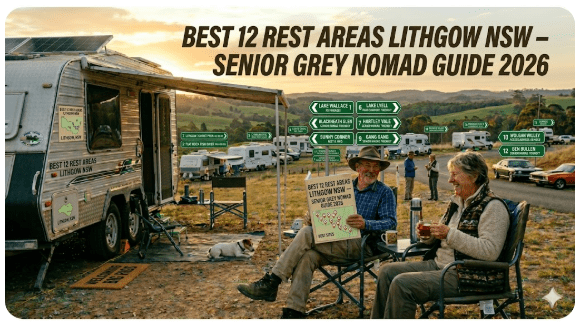
Best 12 Rest Areas Lithgow NSW — Senior Grey Nomad Guide 2026
GPS coordinates, overnight rules, road conditions, fuel stops, dump points, facilities and everything a senior grey nomad needs to stop safely in the Lithgow region on the Great Western Highway and Bells Line of Road.
📅 Last reviewed: June 2026 | Lithgow Region, NSW 2790 | Mix of free overnight stops, roadside rest areas and low-cost camping
Rest Areas Lithgow NSW are a collection of roadside rest stops, free camping reserves, and overnight parking areas located in and around Lithgow, a regional city in the Central Tablelands of New South Wales, approximately 140 km west of Sydney via the Great Western Highway (A32). Lithgow sits at an elevation of roughly 1,015 metres above sea level on the western fall of the Blue Mountains. The rest areas and free camps in this guide cover a broad corridor stretching from Marrangaroo in the east through to Capertee and Ben Bullen in the north, and Portland to the south-west, serving grey nomads, caravanners, truck drivers and long-distance travellers crossing between Sydney and Bathurst or heading north toward Mudgee and the Hunter Valley.
📋 Table of Contents
- Why Grey Nomads Stop Near Lithgow
- Free Camping — Know the Limits for Seniors
- Quick Facts and Key Details 2026
- The 12 Rest Areas Near Lithgow — Full List with GPS
- How to Get to Lithgow + GPS Navigation
- Road Conditions, Flooding and Unsealed Sections
- Cold Nights and Altitude — Senior Safety Warning
- Wildlife — Birds, Reptiles and What to Watch For
- What Other Websites Don’t Tell You
- Best Time to Visit Lithgow — Month-by-Month
- Free and Low-Cost Camping Alternatives Nearby
- Dump Points Near Lithgow
- Free Water Sources Near Lithgow
- Fuel Stops Along the Great Western Highway
- Caravan Parks and Showground — Paid Alternatives
- Full Facilities Comparison Table
- Rates — All Options Near Lithgow 2026
- Senior Safety Checklist — On and Off Road
- What to Do Near Lithgow — Senior Activity Guide
- Vanlife Savings Spots — GPS Coordinates and Postcodes
- Phone Signal and Emergency Communications
- Campfires, Cooking Restrictions and Food Near Lithgow
- Pets at Lithgow Rest Areas
- Accessibility for Seniors with Mobility Limitations
- Permits, Fees, Etiquette and Waste Management
- Emergency Scenarios — What to Do
- Packing List for This Section of Highway
- Reviews — What Grey Nomads Say
- Frequently Asked Questions
- Quick-Reference Card
- Disclaimer
Why Grey Nomads Stop Near Lithgow
Lithgow is a natural crossroads for grey nomads travelling between Sydney and western or northern NSW. Whether you are heading toward Bathurst, Orange, Mudgee, or crossing the Blue Mountains for the first time in a caravan, Lithgow and its surrounds provide a logical and practical overnight staging point before or after the steep descent of the Blue Mountains.
The Great Western Highway (A32) passes directly through Lithgow, connecting to the Bell’s Line of Road (B86) which heads north toward Richmond and the Hawkesbury. Travellers heading to Mudgee or the Hunter Valley typically pass through or near Lithgow, making the rest areas in this corridor genuinely useful rather than incidental stops.
From a budget perspective, Lithgow’s cluster of free rest areas, recreation reserves and low-cost showgrounds make it one of the better-value overnight corridors in central NSW for self-contained travellers. Stopping here instead of a powered site in Katoomba or Bathurst can save a meaningful amount on a tight grey nomad budget.
Free Camping — Know the Limits for Seniors
In New South Wales, official roadside rest areas managed by Transport for NSW permit stops for rest purposes, typically up to 20 hours, though this can vary by site. The 20-hour limit is a fatigue management provision, not a free camping entitlement. You are expected to be resting from driving, not setting up a long-term camp.
Some locations in this guide — such as Lake Wallace (Wallerawang), Portland Town Common, and Sunny Corner Recreation Reserve — are not highway rest areas but recreation or community reserves where longer stays may be permitted. Rules vary by council and land manager. Always verify locally before settling in.
Self-contained vehicles are generally looked upon more favourably at free-camping reserves, but this does not automatically grant access everywhere. Carry your self-containment certificate if your state or territory requires one, and be prepared to show it.
Quick Facts and Key Details 2026
| Detail | Information |
|---|---|
| Region | Lithgow, Central Tablelands, NSW |
| Postcode | 2790 (Lithgow), 2850 (Capertee area), 2847 (Ben Bullen area) |
| Distance from Sydney | Approx. 140 km west via Great Western Highway (A32) |
| Distance from Bathurst | Approx. 66 km east via Great Western Highway |
| Distance from Mudgee | Approx. 108 km north via Castlereagh Highway |
| Elevation | Approx. 1,015 m above sea level |
| Primary Highway | Great Western Highway (A32) |
| Secondary Roads | Bells Line of Road (B86), Castlereagh Highway (B55), Mudgee Road |
| Overnight Cost | Free (highway rest areas); donation or small fee at some reserves |
| Max Stay (Highway) | 20 hours (check individual site signage) |
| Local Council | Lithgow City Council |
| Nearest Hospital | Lithgow Hospital, Lithgow St, Lithgow NSW 2790 |
| Emergency | 000 |
The 12 Rest Areas Near Lithgow — Full List with GPS
The following 12 locations represent the best-known rest stops, free camps, and overnight-friendly areas in the broader Lithgow region. GPS coordinates listed are sourced from publicly available mapping data. Always verify on arrival as conditions change.
1. Marrangaroo Tunnel Hill Rest Area
Location: Great Western Highway, Marrangaroo NSW, approximately 8 km east of Lithgow CBD
GPS: Approximately -33.481, 150.115 (westbound carriageway approach area — verify on arrival)
Surface: Sealed hardstand
Facilities: Toilets, picnic tables
Heavy Vehicle: Yes
Overnight: Up to 20 hours (check posted signage)
Notes: Located near the historic Marrangaroo rail tunnel area on the main Sydney–Lithgow highway corridor. This is a useful stop for travellers arriving from Sydney who want to rest before or after the Blue Mountains descent. It can be busy with trucks overnight.
2. Meadow Glen Rest Area
Location: Great Western Highway, between Lithgow and Hartley NSW
GPS: Approximately -33.491, 150.093 (verify on arrival)
Surface: Sealed
Facilities: Toilets, picnic tables
Heavy Vehicle: Yes
Overnight: Up to 20 hours (check posted signage)
Notes: A quieter rest stop than Marrangaroo, set in a small clearing with some tree coverage. Good option for travellers heading east toward the Blue Mountains who want one final comfortable stop before the descent.
More info: Meadow Glen Rest Area — full guide
3. Pearsons Lookout Rest Area
Location: Great Western Highway, near Lithgow (eastbound), NSW
GPS: Approximately -33.492, 150.101 (verify on arrival)
Surface: Sealed
Facilities: Toilets, scenic views
Heavy Vehicle: Limited — check clearances on entry
Overnight: Check posted signage
Notes: Pearson’s Lookout is noted for its elevated views toward the Lithgow valley and surrounding ridgelines. Worth a brief stop even if not overnight. The approach can be narrow — caravanners with long rigs should exercise caution.
More info: Pearsons Lookout Rest Area — full guide
4. Lake Wallace (Wallerawang) Free Camping
Location: Lake Wallace Drive, Wallerawang NSW 2845 — approximately 11 km west of Lithgow CBD
GPS: Approximately -33.415, 150.052 (lake foreshore area — verify on arrival)
Surface: Gravel and grass
Facilities: Toilets, boat ramp, picnic tables, walking tracks around the lake
Heavy Vehicle: Yes — gravel area accommodates caravans and motorhomes
Overnight: Free camping permitted — check Lithgow City Council rules and current signage
Notes: Lake Wallace is a popular local recreation area. The foreshore provides flat gravel camping with water views. Fishing is popular here. This is one of the better free-camping options in the immediate Lithgow region for self-contained rigs. By late afternoon on weekends, a number of caravans and campervans typically arrive. Quieter mid-week.
More info: Lake Wallace Wallerawang — full guide
5. Portland Town Common
Location: Portland NSW 2847 — approximately 25 km south-west of Lithgow via Wallerawang Road
GPS: Approximately -33.357, 149.998 (town common area — verify on arrival)
Surface: Grass and gravel
Facilities: Basic — public toilets nearby in town
Heavy Vehicle: Yes
Overnight: Historically used as a free camping area — verify current rules with Lithgow City Council before arrival
Notes: Portland is a small town south-west of Lithgow with a cement works heritage. The town common is a traditional travellers’ stop. Access from Lithgow via Wallerawang Road is sealed and suitable for caravans. Portland has fuel, a small supermarket and a pub.
More info: Portland Town Common — full guide
6. Sunny Corner Recreation Reserve
Location: Sunny Corner Road, Sunny Corner NSW — approximately 30 km south-east of Lithgow via Thompsons Creek Road
GPS: Approximately -33.560, 150.024 (reserve entrance — verify on arrival)
Surface: Dirt and gravel — partially unsealed road to access
Facilities: Basic pit toilets, fire rings (check fire restrictions before use)
Heavy Vehicle: Low-clearance caravans not recommended — rough access track sections
Overnight: Free camping permitted at the reserve — bush camping style
Notes: A bush camping experience in State Forest surrounds. The access road from Lithgow involves some unsealed sections. Not suitable for large motorhomes or on-road caravans in wet conditions. Best suited to 4WD-towed off-road caravans or campervans. Popular with motorbike tourers and bush campers.
More info: Sunny Corner Recreation Reserve — full guide
7. Capertee Rest Area
Location: Castlereagh Highway, Capertee NSW 2846 — approximately 55 km north of Lithgow
GPS: Approximately -33.173, 150.011 (roadside area near Capertee village — verify on arrival)
Surface: Gravel and grass
Facilities: Basic — toilets at Capertee village nearby
Heavy Vehicle: Yes
Overnight: Check posted signage — used as a rest stop by travellers heading north toward Mudgee
Notes: Capertee Valley is famous for being one of the widest canyons in the world and is an outstanding bird-watching destination — particularly for the Regent Honeyeater. The approach on the Castlereagh Highway from Lithgow is sealed and suitable for caravans.
More info: Capertee Rest Area — full guide
8. Ben Bullen Rest Area
Location: Castlereagh Highway, Ben Bullen NSW 2845 — approximately 35 km north of Lithgow
GPS: Approximately -33.293, 150.025 (roadside area — verify on arrival)
Surface: Sealed shoulder / gravel
Facilities: Basic — limited
Heavy Vehicle: Yes
Overnight: Used as a rest stop — check posted signage
Notes: Ben Bullen sits in open farming country between Lithgow and Capertee. A quiet, uncrowded stop with little traffic overnight. Good mobile signal on Telstra in clear weather. Useful for travellers heading north toward Mudgee or Dunedoo who left Lithgow late in the day.
More info: Ben Bullen Rest Area — full guide
9. Lidsdale State Forest Rest Area
Location: Near Lidsdale NSW 2790 — off Mudgee Road, approximately 15 km north-west of Lithgow
GPS: Approximately -33.378, 150.041 (forest road entry area — verify on arrival)
Surface: Unsealed gravel — suitable for high-clearance vehicles in dry conditions
Facilities: Basic pit toilet, open area
Heavy Vehicle: Caravans with high clearance in dry conditions only — not suitable after rain
Overnight: Bush camping style — Forestry NSW managed area
Notes: A bush stop in pine and eucalypt forest country. The access road is unsealed and can become slippery after rain — exercise caution. Do not enter in wet weather with a low-clearance caravan. A pleasant stop for self-contained campervans and robust off-road rigs.
More info: Lidsdale State Forest Rest Area — full guide
10. Lockyers Track Campground
Location: Wollemi National Park, accessed from Nullo Mountain Road, west of Rylstone — approximately 80 km north of Lithgow
GPS: Approximately -32.932, 150.123 (verify with NSW National Parks before travel)
Surface: Unsealed 4WD track access
Facilities: Pit toilet, open camping area
Heavy Vehicle: 4WD required — not suitable for caravans or motorhomes
Overnight: Camping permitted — NSW National Parks fee may apply; check npws.nsw.gov.au
Notes: This is a remote bush camping location requiring a 4WD and confidence on unsealed tracks. Not suitable for seniors travelling alone or in conventional caravans. Included for completeness and for those with off-road capable setups. Tell someone your plans before heading in — mobile reception is very limited.
More info: Lockyers Track Campground — full guide
11. Londonderry Reserve (Lithgow area)
Location: Londonderry Road area, Lithgow region NSW
GPS: Verify current coordinates via Campermate or WikiCamps before travel
Surface: Gravel and grass
Facilities: Basic
Heavy Vehicle: Check access on arrival
Overnight: Check current rules with Lithgow City Council
Notes: A local reserve area. Rules and access conditions can change. Always verify before making it your overnight destination.
More info: Londonderry Reserve — full guide
12. Blackfellows Hand Rest Area
Location: Great Western Highway near Hartley NSW — approximately 20 km east of Lithgow, near the historic Hartley village
GPS: Approximately -33.530, 150.183 (roadside area — verify on arrival)
Surface: Sealed hardstand
Facilities: Toilets, picnic tables, heritage interpretation signage nearby
Heavy Vehicle: Yes
Overnight: Up to 20 hours (check posted signage)
Notes: Located near the historic Hartley village precinct and the Cox’s River crossing. The area has deep Aboriginal and European heritage. The view down into the Hartley Valley from this section of highway is one of the more striking in the Blue Mountains foothills. A worthwhile stop for history-interested travellers as well as those needing a rest break before or after the mountain climb.
More info: Blackfellows Hand Rest Area — full guide
How to Get to Lithgow + GPS Navigation
From Sydney (East) — Great Western Highway
The primary approach to Lithgow from Sydney is via the Great Western Highway (A32), departing the Western Motorway (M4) at Lapstone or Penrith and continuing west through Katoomba and Blackheath. The mountain section involves significant grades and winding road — exercise caution when descending westward with a caravan or motorhome. The descent into Lithgow from the east involves the famous Lithgow zigzag area (the original railway route) and steep highway grades near Clarence and Bell.
📍 GPS — Lithgow City Centre Navigation Reference
-33.4839, 150.1575
Lithgow CBD centre reference point. Use individual rest area GPS coordinates listed above for specific stops.
From Bathurst (West)
From Bathurst, travel east on the Great Western Highway approximately 66 km to Lithgow. The road is sealed, dual carriageway for much of the route, and suitable for all caravans and motorhomes. No significant grades or concerns westbound until east of Lithgow where the Blue Mountains climb begins.
From Mudgee (North)
Arriving from Mudgee, travel south via the Castlereagh Highway (B55) approximately 108 km to Lithgow. This route passes through Rylstone, Kandos and Lidsdale. The road is mostly sealed two-lane highway but with some narrow sections and no overtaking zones. Suitable for standard caravans. Allow approximately 1.5–2 hours from Mudgee depending on rig size.
From Bells Line of Road (North-East)
The Bells Line of Road (B86) approaches Lithgow from the north-east via Bilpin, Mount Tomah and Bell. This is a scenic but narrower road, particularly between Bell and Lithgow. Caravanners should exercise caution — the road is sealed but has tight corners and limited passing opportunities. Not recommended for very long rigs or wide trailers.
Road Conditions, Flooding and Unsealed Sections
Great Western Highway (A32) — Sealed, All-Weather
The main highway through Lithgow is fully sealed and maintained by Transport for NSW. It does not flood under normal conditions. The road is suitable for all vehicle types including heavy vehicles, motorhomes and caravans in all weather. Check Live Traffic NSW (livetraffic.com) before departing for any incident reports or road closures, particularly after storms on the Blue Mountains section.
Castlereagh Highway (B55) — Lithgow to Mudgee
Sealed two-lane highway. Can experience localised flooding at low-lying creek crossings between Lidsdale and Rylstone after heavy rainfall. Check conditions via Live Traffic NSW or call 132 701 before heading north if rain has been significant.
Sunny Corner Road and Lidsdale Forest Access — Unsealed
These roads involve unsealed sections. After rain they can become slippery, muddy, and impassable for low-clearance vehicles. Caravans and on-road motorhomes should not attempt these routes in wet weather. Even after a light shower, some sections become extremely slippery and braking on grades becomes difficult. 4WD is recommended for Lockyers Track and other forest access routes.
Bells Line of Road (B86)
Sealed but winding and narrow in sections between Bell and Lithgow. Not recommended for large caravans. Can be affected by fog, ice and frost in winter mornings at altitude. Check Bureau of Meteorology — Lithgow forecasts for temperature and frost warnings.
Cold Nights and Altitude — Senior Safety Warning
Lithgow’s elevation of approximately 1,015 metres means temperatures can drop significantly overnight, even in summer. In winter (June–August), overnight lows regularly reach near zero or below freezing. Frost is common and snow occasionally falls on higher ground nearby.
Summer temperatures in Lithgow are generally mild (averaging 20–26°C daytime) but nights can still drop to 8–12°C. This makes Lithgow a comfortable summer destination compared to hotter western plains but demands preparation year-round.
Dehydration can still occur in cooler temperatures — seniors should maintain fluid intake and not skip meals due to cold.
Wildlife — Birds, Reptiles and What to Watch For
Birds
The Lithgow region and particularly Capertee Valley (55 km north) is a world-class birdwatching destination. Capertee Valley is globally recognised as habitat for the critically endangered Regent Honeyeater. Other species regularly seen in the broader Lithgow bushland include:
- Eastern Yellow Robin
- Superb Fairywren
- Crimson Rosella
- Gang-gang Cockatoo (higher altitude areas)
- White-throated Treecreeper
- Various raptor species including Wedge-tailed Eagle
Reptiles
Eastern Brown Snakes are present throughout the Lithgow region. They are most active in warmer months (October–April) particularly in the morning and early evening. Eastern Browns are highly venomous and fast-moving.
Kangaroos and Wallabies
Kangaroos and wallabies are common along roadsides particularly at dawn and dusk. The stretch of highway between Lithgow and Capertee and the approach roads to Sunny Corner and Lidsdale are known kangaroo zones. Drive to the speed limit and be alert between dusk and dawn.
What Other Websites Don’t Tell You
Most listing websites simply give you a name and a dot on a map. Here is what experienced travellers have learned from actually using these stops:
- The Blue Mountains descent is the real challenge. Many travellers focus on finding a stop in Lithgow but underestimate the highway grades getting there. Plan to arrive before 3pm if possible, especially westbound from Sydney in a caravan, to allow daylight for setup.
- Lithgow itself has good facilities. The town has supermarkets (Woolworths, ALDI), fuel stations, a hospital, and a laundromat. It is a genuine service town, not just a highway marker.
- Weekend campers arrive early. Lake Wallace in particular sees local families and travellers from Sydney on Friday and Saturday afternoons. Mid-week is significantly quieter.
- Frost on the windscreen is real. Winter mornings require scrapers or a cover. Budget 20–30 extra minutes in your morning departure on frosty days.
- The Capertee Valley is frequently overlooked. Many travellers pass straight through on the Castlereagh Highway without realising they are driving through one of the world’s great canyon landscapes and a premier birdwatching location.
- Truck noise at highway rest areas can be significant. Trucks idle engines overnight for warmth and climate control. If you are a light sleeper, earplugs are essential at Marrangaroo and any highway-adjacent stop.
Best Time to Visit Lithgow — Month-by-Month
| Month | Conditions | Recommendation |
|---|---|---|
| January | Warm days (~24°C), mild nights (~12°C), occasional thunderstorms | Good — carry rain gear and watch for afternoon storms |
| February | Similar to January — fire danger period | Good — check fire danger ratings daily |
| March | Cooling, autumn colours begin, drier conditions | Excellent — one of the best months |
| April | Crisp days, cold nights (~4–6°C), low rain | Excellent — bring winter gear for nights |
| May | Cold, potential frost | Good for those prepared for cold |
| June | Near-zero nights, frost likely, possible snow nearby | Cold — well-equipped travellers only |
| July | Coldest month, frost near-certain, occasional snow | Winter only — caravans must be fully winterised |
| August | Still cold, beginning to warm mid-month | Manageable with good equipment |
| September | Warming rapidly, wildflowers emerging, low rain | Very good — spring colour and comfortable temps |
| October | Warm and dry, peak bushwalking season | Excellent — busy on weekends |
| November | Hot days possible, increased fire risk | Good — check Total Fire Ban status |
| December | School holiday crowds, warmer nights | Busy — arrive early to secure sites |
Free and Low-Cost Camping Alternatives Nearby
- Lake Wallace (Wallerawang) free camping Lithgow NSW
- Lockyers Track Campground bush camping Lithgow NSW
- Londonderry Reserve free camp Lithgow NSW
- Sunny Corner Recreation Reserve forest camping Lithgow NSW
- Capertee Rest Area Lithgow NSW roadside stop
- Lidsdale State Forest Rest Area Lithgow NSW bush stop
- Marrangaroo Tunnel Hill Rest Area Lithgow NSW highway stop
- Meadow Glen Rest Area Lithgow NSW quiet stop
- Pearsons Lookout Rest Area Lithgow NSW scenic stop
- Ben Bullen Rest Area Lithgow NSW free stop
- Portland Town Common free camping Lithgow NSW
- Blackfellows Hand Rest Area Lithgow NSW historic site
Beyond this list, travellers heading south-west toward Bathurst will find additional stops and showground options at Bathurst and Blayney. Travellers heading north toward Mudgee will find the Rylstone Showground (donation-based) approximately 75 km north as a reliable budget stop.
Dump Points Near Lithgow
Grey water and black water management is essential for responsible travel. Verified dump point locations near Lithgow include:
| Location | Address / Details | Cost |
|---|---|---|
| Lithgow Visitor Information Centre | 1 Cooerwull Rd, Lithgow NSW 2790 — verify availability with centre | Check locally |
| Lithgow Council Caravan Park Area | Verify current dump point locations with Lithgow City Council (02 6354 9999) | Check locally |
| Portland (nearest) | Verify via Campermate — search Portland NSW dump points | Typically free |
Free Water Sources Near Lithgow
Potable water in the Lithgow region is available at:
- Lithgow CBD — public taps at Mort Oval and various parks in the town centre
- Portland — public taps near the main street shopping area
- Wallerawang — check with local facilities near Lake Wallace foreshore
- Service stations — most allow travellers to fill water containers with advance request
Fuel Stops Along the Great Western Highway
Fuel is readily available on the main highway corridors. Note that fuel prices in regional areas can be higher than Sydney metropolitan prices. Use PetrolSpy.com.au to compare current prices before filling up.
| Location | Direction | Approximate Distance from Lithgow | Fuel Types |
|---|---|---|---|
| Lithgow (multiple stations) | Town centre | 0 km | ULP, Diesel, Premium |
| Wallerawang | West of Lithgow (A32) | ~11 km | ULP, Diesel |
| Portland | South-west via Wallerawang Rd | ~25 km | ULP, Diesel |
| Bathurst | West (A32) | ~66 km | ULP, Diesel, Premium, LPG |
| Katoomba | East (A32) — Blue Mountains | ~40 km | ULP, Diesel, Premium |
| Rylstone | North (Castlereagh Hwy) | ~75 km | ULP, Diesel |
| Mudgee | North (Castlereagh Hwy) | ~108 km | ULP, Diesel, Premium, LPG |
Caravan Parks and Showground — Paid Alternatives
When free camps are full, noisy, or unsuitable, the following paid options near Lithgow provide powered sites and proper facilities:
| Facility | Location | Type | Estimated Cost 2026 |
|---|---|---|---|
| Lithgow Tourist Caravan Park | Lithgow NSW 2790 | Powered and unpowered sites | ~$35–$55/night (powered) — verify directly |
| Lithgow Showground | Showground Rd, Lithgow | Donation/fee basis during non-show periods | Check with Lithgow Show Society |
| Portland (local accommodation) | Portland NSW 2847 | Hotel/motel options | Check locally |
| Rylstone Showground | Rylstone NSW 2849 | Donation-based overnight | ~$5–$10 donation suggested |
Free campsites and powered sites fill fast during school holidays and peak season. If your preferred site is already taken, search accommodation options below to explore the Lithgow region.
Accommodation search powered by Expedia. Booking through this search supports this website at no extra cost to you. As an affiliate, I earn from qualifying purchases.
Full Facilities Comparison Table
| Location | Toilets | Picnic Tables | Water | HV OK | Sealed Access | Overnight | Cost |
|---|---|---|---|---|---|---|---|
| Marrangaroo Tunnel Hill | ✅ | ✅ | ❌ | ✅ | ✅ | ✅ 20hr | Free |
| Meadow Glen | ✅ | ✅ | ❌ | ✅ | ✅ | ✅ 20hr | Free |
| Pearsons Lookout | ✅ | Limited | ❌ | Limited | ✅ | Check signs | Free |
| Lake Wallace (Wallerawang) | ✅ | ✅ | Check | ✅ | ✅ | ✅ | Free |
| Portland Town Common | Nearby | Limited | Town | ✅ | ✅ | Verify | Free |
| Sunny Corner Reserve | Pit | Limited | ❌ | ❌ | Partial | ✅ | Free |
| Capertee Rest Area | Nearby | Limited | ❌ | ✅ | ✅ | Check signs | Free |
| Ben Bullen Rest Area | Limited | Limited | ❌ | ✅ | ✅ | Check signs | Free |
| Lidsdale State Forest | Pit | Limited | ❌ | Dry only | Partial | ✅ | Free |
| Lockyers Track | Pit | ❌ | ❌ | ❌ | ❌ 4WD | ✅ Fee | Check NPWS |
| Londonderry Reserve | Basic | Limited | ❌ | Check | Check | Verify | Free |
| Blackfellows Hand | ✅ | ✅ | ❌ | ✅ | ✅ | ✅ 20hr | Free |
Rates — All Options Near Lithgow 2026
| Option | Type | Cost Per Night (Est. 2026) | Notes |
|---|---|---|---|
| Highway Rest Areas (x5) | Free overnight rest | $0 | 20hr max, toilets included |
| Lake Wallace | Free camp reserve | $0 | Verify rules with council |
| Portland Town Common | Free camp | $0 | Verify rules with council |
| Sunny Corner Reserve | Free bush camp | $0 | Self-contained only |
| Rylstone Showground | Donation overnight | ~$5–$10 donation | Basic facilities, check availability |
| Lithgow Tourist Caravan Park | Powered site | ~$35–$55 | Verify current rates directly |
| Lockyers Track (NPWS) | Camping fee | Check npws.nsw.gov.au | 4WD access, remote |
Senior Safety Checklist — On and Off Road
Use this checklist before departing any rest area or free camp in the Lithgow region:
- Check Live Traffic NSW for road conditions on your route
- Check Bureau of Meteorology for overnight temperature and frost warnings
- Check Total Fire Ban status via NSW Rural Fire Service if using campfires
- Tell a responsible person your route and expected arrival time
- Carry minimum 10 litres of drinking water per person
- Ensure gas heater is working and ventilation is adequate
- Carry a torch, first aid kit, and snake bite pressure bandages
- Top up fuel in Lithgow before heading north on Castlereagh Highway
- Check brake system before any downhill section on Blue Mountains descent
- Wear closed shoes when walking in bushland
- Carry a phone charger and portable battery bank
- Check caravan jockey wheel, coupling and lights before departure
- Ensure medications are stocked for at least 5 days beyond planned trip length
- Carry emergency contacts written on paper — not just in your phone
What to Do Near Lithgow — Senior Activity Guide
Lithgow Small Arms Factory Museum
Located in Lithgow, this is a fascinating heritage museum covering Australia’s defence manufacturing history. Suitable for seniors with good accessibility. Check opening hours before visiting.
Zig Zag Railway
The historic Zig Zag Railway at Lithgow is an iconic piece of Australian railway heritage. The original route was used from 1869 to enable trains to descend the Blue Mountains escarpment. The tourist railway experience may operate seasonally — check current operating status locally before planning a visit.
Capertee Valley Birdwatching
Approximately 55 km north of Lithgow on the Castlereagh Highway, the Capertee Valley is considered one of the great birdwatching locations in Australia. The valley is the habitat of the critically endangered Regent Honeyeater. No entry fee to drive through the valley — simply pull over safely on the roadside and observe. Bring binoculars.
Lake Wallace Walking Track
A gentle lakeside walking track around Lake Wallace at Wallerawang is suitable for most mobility levels. The flat track around the foreshore takes approximately 45–60 minutes at a leisurely pace. Good for morning exercise before departing camp.
Hartley Historic Site
The Hartley Historic Site, managed by NSW National Parks, is located approximately 25 km east of Lithgow on the Great Western Highway. The preserved convict-era courthouse (1837) and surrounding historic buildings are a worthwhile stop for history enthusiasts. Entry fees apply to some buildings — check NSW National Parks for current information.
Gardens of Stone National Park (Day Visit)
Accessible north of Lithgow, the Gardens of Stone National Park features spectacular pagoda rock formations. The park is suitable for day visits. Some walking tracks require moderate fitness. Check NSW National Parks for access details and any entry requirements before visiting.
🗺️ Vanlife Savings Spots — GPS Coordinates and Postcodes
Use the interactive map below to save your favourite stops, plan your route through the Lithgow region, and discover free camps and rest areas you may not have considered. Add a pin for every stop you use — it helps build the community map for all grey nomads.
COPY PROMPT ➔ ASK AI ➔ SAVE TO FORM ➔ ADD SPOT PIN ➔ GET DIRECTIONS
📍 Interactive map — find free camps, rest areas and overnight stops near Lithgow NSW. Enable location for best results.
| Location | Postcode | GPS (Approx) | Type |
|---|---|---|---|
| Lithgow CBD Reference | 2790 | -33.4839, 150.1575 | Town centre reference |
| Lake Wallace (Wallerawang) | 2845 | -33.415, 150.052 | Free camping reserve |
| Portland Town Common | 2847 | -33.357, 149.998 | Free camp (verify) |
| Capertee Rest Area | 2846 | -33.173, 150.011 | Roadside rest area |
| Ben Bullen Rest Area | 2845 | -33.293, 150.025 | Roadside rest area |
| Blackfellows Hand Rest Area | 2790 | -33.530, 150.183 | Highway rest area |
| Sunny Corner Reserve | 2790 | -33.560, 150.024 | Free bush camp |
Phone Signal and Emergency Communications
Mobile phone coverage in the Lithgow region varies significantly depending on your location and carrier:
- Lithgow CBD and Great Western Highway corridor: Generally good Telstra and Optus coverage
- Capertee Valley: Coverage can be patchy — Telstra performs best but not guaranteed throughout the valley
- Lidsdale State Forest and Sunny Corner: Very limited or no mobile coverage in some sections
- Lockyers Track (remote): No reliable mobile coverage — carry a satellite communication device (PLB or satellite messenger)
Public WiFi is not widely available at rest areas in this region. Lithgow town centre has some public WiFi access points. The Lithgow Library on Mort Street offers free public WiFi during library hours.
Campfires, Cooking Restrictions and Food Near Lithgow
Campfire Rules
Campfires in the Lithgow region are subject to Total Fire Ban (TFB) restrictions during the fire danger period, typically October through March, though this varies year to year. During a Total Fire Ban, no open fires are permitted regardless of location.
- At highway rest areas — campfires are not generally permitted
- At State Forest reserves (Lidsdale, Sunny Corner) — fire rings may be present but check current fire danger ratings before lighting any fire
- Always check current fire danger status at NSW Rural Fire Service (rfs.nsw.gov.au) before arrival
Cooking Options
Gas stoves and enclosed barbecue units (not open flame) may be permitted during Total Fire Bans — check the specific ban conditions at rfs.nsw.gov.au. Electric barbecues are available at some day-use areas in the region.
Food Purchases Near Lithgow
- Lithgow CBD: Woolworths, ALDI, IGA, multiple cafes and takeaway options
- Wallerawang: Small general store and fuel outlet
- Portland: Small supermarket, bakery, pub
- Capertee: Very limited — a small general store operates periodically but do not rely on it. Stock up in Lithgow.
Pets at Lithgow Rest Areas
- Highway rest areas — pets are permitted, but must be kept on a lead at all times
- Lake Wallace and recreation reserves — pets on leads generally permitted; check council signage on site
- National Parks (Gardens of Stone, Wollemi) — pets are NOT permitted in NSW National Parks. This includes Lockyers Track Campground.
- State Forest reserves — pets generally permitted on leads; confirm with Forestry NSW if unsure
Accessibility for Seniors with Mobility Limitations
The following notes apply to accessibility at the main rest areas and free camps in this guide:
| Location | Accessible Toilets | Flat Ground | Notes |
|---|---|---|---|
| Marrangaroo Tunnel Hill | Check on site | Generally flat | Sealed hardstand — good accessibility |
| Meadow Glen | Check on site | Generally flat | Sealed — good general access |
| Blackfellows Hand | Check on site | Generally flat | Sealed — suitable for mobility aids |
| Lake Wallace | Yes (check condition) | Flat lakeside | Best accessibility in the group — flat gravel foreshore |
| Sunny Corner Reserve | Pit toilet — basic | Uneven ground | Not suitable for wheelchairs or mobility aids |
| Lockyers Track | Pit toilet | Uneven | Not suitable for limited mobility — remote 4WD access |
Travellers with significant mobility limitations should prioritise the sealed highway rest areas (Marrangaroo, Meadow Glen, Blackfellows Hand) and Lake Wallace (Wallerawang) which offer the flattest ground and best general access in this region.
Permits, Fees, Etiquette and Waste Management
Permits
No permits are required for highway rest area stays in NSW (up to the posted time limit). Some National Parks campsites in the region, including those in Wollemi National Park, require advance booking and fee payment via NSW National Parks booking system.
Etiquette
- Keep noise to a minimum between 10pm and 7am — other travellers, including truck drivers, may be sleeping
- Do not block truck bays with caravans — heavy vehicles need these spaces for mandatory rest breaks
- Pack out all rubbish — bins at rest areas are often limited or absent
- Do not grey-dump at rest areas — use dedicated dump points
- Leave the site as you found it — or better
- Respect other travellers’ space — do not set up too close to other campers
Waste Management
Grey water must not be released on the ground at most rest areas and reserves. Self-contained vehicles should use their grey water holding tanks or approved biodegradable disposal methods where permitted. Use designated dump points for black water disposal only. Carry a rubbish bag for all waste and dispose of it at the next town with a public bin or transfer station.
Emergency Scenarios — What to Do
Medical Emergency
Call 000. The nearest hospital is Lithgow Hospital on Lithgow Street, Lithgow NSW 2790. From remote areas north of Lithgow with no mobile signal, use a PLB to alert emergency services.
Vehicle Breakdown on Blue Mountains Descent
If your vehicle or caravan develops a problem on the Great Western Highway descent, pull completely off the road if possible. Turn on hazard lights. Do not attempt repairs on the road edge. Call your roadside assistance provider and advise them of your location as specifically as possible (highway marker posts are visible at regular intervals). If in immediate danger, call 000.
Bush Fire
If a fire is approaching your camp, do not wait for it to arrive. Leave immediately via the main sealed road. Do not attempt to save possessions. Drive away from smoke with headlights on. Call 000 when safe to do so. Monitor NSW RFS for live incident maps.
Bogged Vehicle
If your rig becomes bogged on an unsealed forest road, do not spin wheels aggressively — this digs deeper. Use traction boards if carried. If you cannot self-recover, contact your roadside assistance provider. In areas with no mobile signal, a PLB or satellite communicator is the only reliable option.
Packing List for This Section of Highway
- Cold weather gear — thermal layers, warm sleeping bag (rated below 5°C minimum), extra blankets
- Frost window cover or ice scraper for windscreen
- Gas heater (functional) with adequate gas cylinders — check ventilation
- Carbon monoxide detector for enclosed sleeping spaces
- 10+ litres stored drinking water per person
- Full fuel tank topped up in Lithgow before heading north
- Traction boards and tow strap (for unsealed access roads)
- First aid kit with snake bite pressure bandages
- Registered Personal Locator Beacon (PLB)
- Paper map of the region (do not rely solely on phone GPS)
- Earplugs (for highway rest area truck noise)
- Rubbish bags for waste management
- Torch and spare batteries
- Medications stocked for at least 5 days beyond planned trip
- Emergency contact list on paper
- Binoculars (for Capertee Valley birdwatching)
- Brake controller checked before Blue Mountains descent
Reviews — What Grey Nomads Say About Lithgow Rest Areas
“Lake Wallace at Wallerawang is our go-to stop when crossing from Sydney to Bathurst. The foreshore is flat, the toilets are clean, and it is far quieter than the highway rest areas on the main road. We usually arrive mid-week and have the place largely to ourselves.”
“Blackfellows Hand rest area was a good overnight stop heading up to Lithgow from the Blue Mountains direction. Quiet, sealed, and the toilets were functional. There were a few trucks but nothing that kept us awake with earplugs in. The views into the Hartley Valley the next morning were a bonus.”
“The Capertee Valley was a genuine highlight. We stopped the van on the roadside near the valley floor and spotted species we had never seen before — a brilliant spot for birdwatching. The rest area nearby was basic but adequate for a single night.”
“Do not underestimate the cold at Lithgow in April. We arrived in shorts and were scrambling for extra blankets by 9pm. Great stop, beautiful area — but come prepared for proper mountain temperatures.”
Frequently Asked Questions
Can I camp overnight at Lithgow rest areas?
Yes, highway rest areas in NSW typically allow stays of up to 20 hours for fatigue rest purposes. This is not free camping — it is a road safety provision. Always check the signs posted at each individual rest area, as rules can differ. Do not treat highway rest areas as multi-night campsites.
Is Lake Wallace at Wallerawang free to camp at?
Lake Wallace has historically been used as a free camping area and is listed on various camping apps. Verify current rules with Lithgow City Council (02 6354 9999) before arrival, as regulations can change.
Is the road to Capertee suitable for caravans?
Yes — the Castlereagh Highway from Lithgow to Capertee is sealed and suitable for all standard caravans and motorhomes. The road is two lanes with some overtaking lanes. No significant grades or access concerns for road-going rigs.
Do I need a 4WD to access camping near Lithgow?
For the main highway rest areas and Lake Wallace — no, standard 2WD vehicles and caravans are fine. For Lidsdale State Forest in dry conditions, high clearance helps. For Lockyers Track and some Sunny Corner access roads — yes, 4WD is required.
Is there a dump point in Lithgow?
Dump points exist in the Lithgow area — verify current locations and availability with Lithgow City Council or via Campermate.com.au as these can change.
What is the maximum stay at NSW highway rest areas?
The commonly cited figure is 20 hours, but always defer to the signage posted at the specific rest area. Signs at the site are the legal authority — not any website including this one.
Is there phone reception north of Lithgow toward Capertee?
Telstra generally provides the best coverage through the Castlereagh Highway corridor. Coverage in the Capertee Valley itself can be patchy. Carry a PLB for travel into remote areas.
Can I light a campfire at Sunny Corner Recreation Reserve?
Only when there is no Total Fire Ban in effect. Always check the NSW RFS website before lighting any fire, regardless of location. During the fire danger period (October–March), assume fires may be banned unless you have confirmed otherwise.
⚡ Quick-Reference Card — Rest Areas Lithgow NSW 2026
| Region | Lithgow, Central Tablelands NSW |
| Postcode | 2790 (Lithgow) |
| Distance Sydney | ~140 km west via A32 |
| Distance Bathurst | ~66 km east via A32 |
| Distance Mudgee | ~108 km north via B55 |
| Best Free Camp | Lake Wallace, Wallerawang |
| Best Highway Stop | Blackfellows Hand or Meadow Glen |
| Max Stay (Highway) | 20 hours — check site signage |
| Fuel (Before North) | Fill up in Lithgow before Castlereagh Hwy |
| Cold Warning | Sub-zero nights possible June–August |
| Snake Warning | Eastern Brown — active Oct–Apr |
| Emergency | 000 |
| Live Traffic NSW | livetraffic.com or 132 701 |
| Weather BOM | bom.gov.au |
| Dump Points | campermate.com.au — search Lithgow |
| Fuel Prices | petrolspy.com.au |
| NPWS Bookings | nationalparks.nsw.gov.au |
Exclusive Offer: Get 5% OFF all StarterStopper immobiliser products with promo code: RTV5
Visit StarterStopper.com to see our data-backed security solutions
As an affiliate, I earn from qualifying purchases at no extra cost to you.
RV LIFE Trip Wizard — USA-Based RV Trip Planning Tool
RV LIFE Trip Wizard is a USA-based RV trip planning tool designed for North American travellers. Australian travellers: this tool is built for the US road network. If you are visiting this page from the USA and planning an RV trip, RV LIFE Trip Wizard may assist with your US route planning.

As an affiliate, I earn from qualifying purchases at no extra cost to you.
© 2026 RetireToVanLife.com — All rights reserved. Written for Senior Grey Nomads. Safe travels. 🚐