Free Camping Near Devonport: Best Rest Areas After the Spirit of Tasmania
You have just stepped off the Spirit of Tasmania at an ungodly hour. This guide covers the best free and low-cost overnight stops within striking distance of the Devonport terminal — with verified GPS, honest facility notes, and everything a senior grey nomad needs to know before pulling in for their first night on Tassie soil.
📅 Last reviewed: May 2026 | Devonport, Tasmania | Free / Self-Contained Rules Apply
Free camping near Devonport is the first real decision every grey nomad makes after the Spirit of Tasmania docks — and it is one that most travellers get wrong. The ferry arrives at 6am (day crossing) or between 6am and 7am (overnight crossing depending on the season), and the instinct is to either drive straight through or pay for a powered site before you have even had a coffee. Neither is necessary. Within 20 kilometres of the Devonport terminal there are several legitimate free and low-cost overnight options that are suitable for caravans, motorhomes and self-contained vans — and knowing where they are before you roll down the ramp makes the difference between a relaxed first morning in Tasmania and a stressful one. This guide covers every viable option honestly, including the ones that other sites gloss over.
- The Spirit of Tasmania docks at Devonport on the Mersey River — the terminal is at 6 Esplanade, East Devonport, TAS 7310
- The closest free rest area to the terminal is Don Reserve / Railton Road area — approximately 8km west
- Ambleside Rest Area on the Bass Highway is the most popular grey nomad first-night stop — sealed, flat, toilets, suitable for large rigs
- Self-contained requirements apply in most Devonport council areas — have your CMCA or accreditation card ready if asked
- No dump point is available at free rest areas near Devonport — the closest is at the Devonport Showgrounds or the council depot on Formby Road
- Telstra coverage is reliable in the Devonport area — Optus is patchy once you leave the city centre
- Do not rely on finding fuel open at 6am on arrival — fuel up before the ferry departs Melbourne or Geelong if possible
- The Mersey Bluff Caravan Park is the only powered option within walking distance of the terminal — book ahead in peak season (Dec–Feb)
What You Will Find in This Guide
- Location, Address and GPS
- Can You Stay Overnight?
- Facilities — Toilets, Water and Dump Point
- Mobile Coverage and Wi-Fi
- Fuel — Finding the Cheapest Nearby
- How to Get There
- What to Expect on Arrival
- Safety for Senior Grey Nomads
- Medical and Emergency Contacts
- Dump Points, Water and Supplies Nearby
- Things to Do for Seniors
- Best Time of Year to Stop Here
- Fires, Generators and Overnight Etiquette
- Packing Checklist for Seniors
- GPS Coordinates and Postcodes
- Frequently Asked Questions
- Quick Verdict
1. Location, Address and GPS
The key reference point for all grey nomads arriving by ferry is the Spirit of Tasmania terminal at East Devonport. From there, three main free or low-cost overnight options are within practical reach for a tired traveller who does not want to drive far on their first morning in Tasmania.
📍 Primary Reference: Ambleside Rest Area — Bass Highway
GPS: -41.1798, 146.3012
Coordinates are within 50 metres of the Ambleside Rest Area on the Bass Highway, approximately 8km west of central Devonport. Always confirm against on-site signage on arrival. These coordinates are provided as navigation guidance only.
Address: Bass Highway, Ambleside TAS 7315 | Postcode: 7315
| Detail | Information |
|---|---|
| Ferry Terminal Address | 6 Esplanade, East Devonport TAS 7310 |
| Nearest Town | Devonport (population approx. 25,000) |
| Primary Highway | Bass Highway (A1) — runs east–west through Devonport |
| Postcode (Devonport) | 7310 |
| Postcode (Ambleside / West) | 7315 |
| Distance from terminal to Ambleside Rest Area | Approximately 10–12km via Bass Highway |
| Distance from terminal to Latrobe (alt. stop) | Approximately 15km south via the Bass Highway / Tarleton Street |
| State | Tasmania |
2. Can You Stay Overnight?
Yes — overnight stays are permitted at designated rest areas on the Bass Highway near Devonport, including the Ambleside Rest Area. However, the rules are specific and enforced more consistently than many grey nomads expect for a regional Tasmanian town.
- Ambleside Rest Area: Overnight stays permitted. Maximum stay is typically 24 hours, though signage on arrival should be checked — rules can be updated by the state roads authority without notice.
- Self-contained requirement: Tasmania does not have a universal statewide self-contained requirement for rest areas, but individual councils increasingly enforce self-contained rules in areas near populated centres. Devonport City Council has progressively tightened rules in recent years — carry your CMCA Self-Contained Accreditation card or equivalent documentation.
- Latrobe area free camping: The town of Latrobe (15km south of Devonport) has historically allowed overnight parking near the recreation ground and river areas — verify current rules via Latrobe Council or WikiCamps (wikicamps.com.au) before banking on this option.
- Don Reserve area: Rest stops along the Don River area have been subject to rule changes in recent years. As of May 2026 this area should be verified on arrival — do not assume free camping is permitted without checking signs.
- If your preferred spot is full: The Devonport Showgrounds occasionally accepts self-contained vehicles overnight for a small fee — contact them directly to confirm before arriving.
3. Facilities — Toilets, Water and Dump Point
| Facility | What Is Available | What Seniors Should Know |
|---|---|---|
| Toilets | Yes — at Ambleside Rest Area (public toilets, unlocked) | Toilet block is basic but serviceable. Cleanliness varies — carry your own supplies. Grab rails not guaranteed. |
| Potable Water | No confirmed potable water tap at rest area | Do not rely on this stop for fresh water. Fill tanks before leaving Melbourne or at Devonport’s town centre before heading west. |
| Dump Point | Not at rest area — nearest is in central Devonport | See Section 10 for dump point location and GPS details. |
| Showers | None at free rest areas near Devonport | Shower at the Devonport Recreation Centre (paid) or a local caravan park if needed post-ferry. |
| Bins | Yes — at Ambleside Rest Area | Do not overfill — bins are council-serviced and sometimes full by Sunday evening. |
| Power | None | CPAP users — ensure batteries or inverter are charged before docking. The ferry has power outlets on board; use them. |
| Shade | Partial — some tree cover at Ambleside | Morning sun can be intense in summer. Arrive early and position accordingly. |
- Site suitable for: caravans, motorhomes, campervans and self-contained vans
- Road access: sealed — Bass Highway frontage, straightforward pull-in for large rigs
- Site surface: gravel and bitumen hardstand
- Camping permitted: Yes — overnight rest area stays permitted (verify signage on arrival)
- Maximum overnight stay: 24 hours (confirm on-site)
- Boat ramp: No
- Picnic tables: Yes — basic tables present
- Potable water: Not confirmed — do not rely on it
- Mobile coverage: Good — Telstra reliable at this location; Optus acceptable
- TV reception: Possible with rooftop antenna — not guaranteed
- Rubbish bins: Yes
- Open fires: No — prohibited at road rest areas
- Generator use: Discouraged — quiet hours apply from approximately 9pm; check signage
- Number of sites: Informal hardstand — room for approximately 6–10 larger rigs depending on configuration
4. Mobile Coverage and Wi-Fi
Good news for the Devonport area — this is one of the better-covered regional hubs in Tasmania. Mobile coverage is reliable by Tasmanian standards, but it degrades quickly once you leave the Bass Highway corridor and head inland or south.
- Telstra: Strong 4G coverage in central Devonport and along the Bass Highway through Ambleside and Don. Recommended carrier for this region.
- Optus: Reasonable in the Devonport CBD and along the highway. Patchy in residential fringe areas and unreliable west of Ulverstone.
- Vodafone / TPG: Limited to central Devonport. Do not rely on it beyond the town boundary.
- Wi-Fi: Available at Devonport Library (free, bring your device). The ferry terminal has limited Wi-Fi while docked — use it to download offline maps before you disembark.
5. Fuel — Finding the Cheapest Nearby
Fuel pricing in Devonport is generally better than the rest of Tasmania — it is the largest northern hub and has genuine competition between major brands. Fill up here. Do not assume you will find cheaper fuel elsewhere on the island.
- Coles Express / Shell, Devonport CBD area: Multiple outlets along the Bass Highway and Formby Road. Diesel available at all major outlets.
- United Petroleum, Devonport: Often among the cheapest in the area — check price boards before committing.
- Latrobe (15km south): Has a service station — useful if heading south toward Hobart. Prices slightly higher than central Devonport as of recent checks.
- Spreyton / Ambleside area: Small servo on the Bass Highway heading west — convenient but not always the cheapest. Confirm diesel availability before relying on it for a large tank.
6. How to Get There
From the Spirit of Tasmania Terminal (East Devonport)
When you drive off the ferry ramp at East Devonport, you will exit onto the Esplanade heading south-west. Follow the Esplanade to the roundabout, take the Bass Highway (A1) west. Ambleside Rest Area is approximately 10–12km along the Bass Highway on the western side of the Don River crossing — it sits on the highway itself and is signposted as a rest area. The turn-in is wide enough for a standard van and caravan combination.
From Launceston (Heading North-West to Devonport)
Follow the Bass Highway (A1) north-west from Launceston toward Devonport. The Ambleside Rest Area will appear on your right approximately 10km before you reach the Devonport CBD. It is well-signposted on the highway.
Driving Notes for Seniors Towing Vans
- The Bass Highway between Devonport and the rest area is dual carriageway for most of the stretch — merging onto it directly from the ferry terminal via Formby Road is straightforward but expect heavy traffic during the post-ferry rush (6am–7:30am).
- The Don River bridge on the Bass Highway has a narrow shoulder — do not attempt a U-turn here under any circumstances with a van attached.
- Speed limit is 100km/h on the Bass Highway outside of town limits — reduce to 50km/h through residential zones which are not always clearly signed for first-time visitors.
- The roundabout at the eastern end of the Bass Highway (Formby Road / Best Street intersection) can be tight for large rigs — approach slowly and use the outer lane for your exit.
- Do not use Google Maps routing for large rigs in the Devonport CBD — it will sometimes send you through streets with low overhead clearance or tight turns. Use Hema Explorer (hema.com.au) or a dedicated caravan routing app.
- If you are heading to Latrobe instead, take the Tarleton Street exit south from the Bass Highway just east of the Don River bridge — clear signage and a comfortable turn for most rigs.
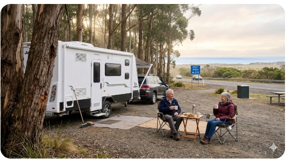
7. What to Expect on Arrival
Here is what nobody else will tell you about arriving in Devonport by ferry: the post-ferry chaos is real and it lasts about 45 minutes. Every vehicle on the ship disembarks at once. Campervans, semi-trailers, passenger cars and caravans all converge on the same exit road at the same time. The traffic dissipates quickly once everyone makes their choice of direction — but the first 20 minutes off the boat are not the moment to be consulting your GPS or making routing decisions.
- Have your first stop pre-programmed into your GPS the night before docking — Ambleside Rest Area coordinates are in this guide.
- The rest area on the Bass Highway is visible from the highway and well-signed — you will not miss it if you are watching for it.
- Expect company — Ambleside is a well-known grey nomad first-night stop and it is rarely empty, especially during peak season (October to March). Arriving mid-morning after the 6am crossing means you may find spots already taken by others who arrived before you found their bearings.
- The surface is hardstand gravel and bitumen — level enough for most rigs. Large slide-outs should be checked for clearance from kerbs and adjacent vehicles.
- Noise: the Bass Highway runs immediately adjacent — expect road noise at night. Light sleepers should have earplugs or be prepared to use a white noise app.
8. Safety for Senior Grey Nomads
Personal Safety
- Ambleside Rest Area is on the Bass Highway — it is a public, visible, well-trafficked location. This is a genuine positive for solo travellers, particularly women travelling alone.
- Lock your vehicle and close all windows at night — even in low-crime areas. The post-ferry period attracts a cross-section of travellers and opportunistic theft, while rare, does occur at highway rest areas.
- If you feel unsafe at any rest area, drive to the nearest 24-hour service station or well-lit public space. Do not feel obligated to stay.
- Carry your phone fully charged at all times — the Emergency Plus app (available on iOS and Android, no link required) provides your exact GPS location to emergency services when you call 000. Install it before you leave the ferry terminal.
- For solo seniors: let someone on the mainland know your planned first-night location before you dock. A simple text with the rest area name and rough GPS is enough.
Trip Safety
- Tasmania drives on the left but many of its highways are single-lane in each direction with no shoulder — this is a significant adjustment for travellers used to wide Queensland or Western Australian roads.
- Wildlife — specifically wombats, wallabies and Tasmanian devils — is an extreme hazard on Tasmanian roads at dawn and dusk. Do not drive in the hour after the ferry docks if it is still dark. Wombat strikes can cause serious vehicle damage and injury.
- Check your tyre pressures before leaving the terminal — cold overnight crossings on a metal ferry deck can drop tyre pressure noticeably.
- Review our Grey Nomad Road Safety Checklist before any long driving day in Tasmania — the roads here genuinely reward preparation.
- Download the TasALERT app (Tasmanian emergency alerts) before leaving Devonport — fires and road closures in Tasmania can develop quickly, particularly in summer.
9. Medical and Emergency Contacts
| Service | Address | GPS (approx.) | Phone |
|---|---|---|---|
| Emergencies | Any location in Tasmania | — | 000 |
| Healthdirect (medical advice line) | Phone only — 24/7 | — | 1800 022 222 |
| Mersey Community Hospital (nearest major hospital) | Brickport Road, Latrobe TAS 7307 | -41.2385, 146.4034 (approx. — verify on arrival) | (03) 6478 5000 |
| North West Regional Hospital (Burnie — secondary option) | Brickport Road, Burnie TAS 7320 | -41.0567, 145.9144 (approx. — verify on arrival) | (03) 6430 6666 |
| Devonport Police | 21–23 Oldaker Street, Devonport TAS 7310 | -41.1774, 146.3550 (approx.) | (03) 6421 4211 |
10. Dump Points, Water and Supplies Nearby
| Need | Best Nearby Option | Notes |
|---|---|---|
| Dump Point | Devonport Showgrounds, Devonport — or Formby Road Council Depot area | Verify current access via CamperMate dump point finder before driving there. Access hours may be restricted. Free of charge in most cases. |
| Fresh Water (tanks) | Devonport service stations and selected caravan parks | Fill tanks in Devonport before heading west or south — water access becomes less reliable as you move into rural areas. |
| Groceries | Coles Devonport (Formby Road) or Woolworths Devonport (Best Street) | Both open from 7am — good for a first-morning restock. Parking for vans is available at the Coles car park on the western side of the store. |
| Fuel | Multiple outlets on Bass Highway and Formby Road, Devonport | See Section 5. Diesel available at all major outlets. Fill up here. |
| Pharmacy | Multiple chemists in Devonport CBD — Terry White, Chemist Warehouse | Chemist Warehouse on Rooke Street is typically cheapest for repeat prescriptions. Open from 8:30am most days. |
| LPG Refill | BOC Gas agent in Devonport industrial area or selected service stations | Call ahead to confirm LPG swap availability — not all stations carry the full range of cylinder sizes. |
11. Things to Do for Seniors in the Devonport Area
| Activity | Location | Why Seniors Like It |
|---|---|---|
| Devonport Food and Wine Festival (seasonal) | Devonport CBD Waterfront | Flat, easy access, excellent Tasmanian produce — verify 2026 dates locally |
| Home Hill — Joseph Lyons Museum | 77 Middle Road, Devonport | Fascinating and undervisited — the historic home of Australia’s only Tasmanian-born Prime Minister. Steps are manageable for most seniors. Small admission fee. |
| Mersey Bluff Lighthouse and Tiagarra Cultural Centre | Bluff Road, Devonport | Flat coastal walk, Indigenous cultural exhibits, excellent Bass Strait views — no significant climbing required |
| Bass Strait Maritime Centre | 5–7 Gloucester Avenue, Devonport | Engaging exhibits about the Spirit of Tasmania and Bass Strait history — air-conditioned, wheelchair accessible, small admission fee |
| Latrobe Platypus Reserve Walk | Gilbert Street, Latrobe (15km south) | One of the best accessible platypus watching spots in Australia — flat, short walk, best at dawn or dusk |
What Most Grey Nomad Guides Miss About Devonport
Nearly every travel article about Devonport dismisses it as a transit point — the place you pass through on the way to Cradle Mountain or the east coast. This undersells it significantly. The town has a genuinely excellent food culture built around the Cradle to Coast Tasting Trail, and the morning farmers market (held regularly near the waterfront — check current schedule at Tourism Tasmania) is one of the best small-market experiences in northern Tasmania. Tasmanian produce, particularly the cheeses and cool-climate wines, is outstanding and the prices at local deli counters in Devonport are considerably cheaper than you will find in Hobart or at roadside stands.
The Latrobe Platypus Reserve, 15 kilometres south, is also almost entirely absent from grey nomad guides despite being one of the most reliable accessible platypus watching spots in the country. The Gilbert Street reserve walk is flat, short (under 500 metres return), and the platypus are present year-round in the Warrawee Reserve section of the Mersey River. Dawn and dusk are the reliable viewing windows. If you have never seen a platypus in the wild, this is genuinely one of the best-odds spots in Australia — and it costs nothing.
Finally: the Don River Railway (check current operating days) is a heritage steam and diesel railway running along the Don River that most mainlanders have never heard of. It runs on weekends and some public holidays, and while it is modest in scale, it is a genuinely charming half-morning activity for travellers who enjoy railway history. The access is flat and the carriages are heritage standard — not wheelchair accessible in the strict sense, but manageable for most seniors with reasonable mobility.
12. Best Time of Year to Stop Here
| Season | What It Is Like in Devonport | Senior Verdict |
|---|---|---|
| Summer (Dec–Feb) | Temperatures 18–26°C average; occasional heat spikes to 30°C+. Busiest period — rest areas full, ferry heavily booked. Longest daylight hours. | Busy but pleasant. Book ferry well in advance. Ambleside rest area frequently at capacity — have a backup plan. |
| Autumn (Mar–May) | Temperatures 12–22°C. Crowds thin sharply after Easter. Stunning autumn colour in the Tamar Valley and Sheffield. Occasional early frosts at night. | ⭐ Excellent. Best balance of weather, crowd levels and rest area availability. This is the sweet spot for grey nomads. |
| Winter (Jun–Aug) | Temperatures 5–14°C. Rain frequent. Some elevated areas snowbound. Ferry sailings occasionally disrupted by Bass Strait swells. | Manageable with good cold-weather preparation but not ideal. Rest areas quiet. Some facilities reduced. Not recommended for first-time Tassie visitors in a van without good insulation and heating. |
| Spring (Sep–Nov) | Temperatures 10–20°C. Wildflowers excellent. Occasional spring storms. Wombat and wildlife activity peaks — extra caution at dawn and dusk on roads. | Very good. Pre-Christmas rush not yet arrived. Rest areas comfortable. Scenery outstanding. |
13. Fires, Generators and Overnight Etiquette
- Open fires: Prohibited at all highway rest areas in Tasmania. No exceptions. Do not attempt to light a fire at Ambleside or any similar roadside stop.
- Generators: Use is discouraged at rest areas near residential areas. If you must run a generator, limit it to daylight hours (8am–8pm) and never run it through the night. Neighbour courtesy is the rule — if someone asks you to turn it off, do so.
- Quiet hours: Standard courtesy is 9pm to 7am. Keep voices, music and equipment noise to a minimum during these hours. Other travellers — including families and solo women — are relying on the same space.
- Grey water: Do not dump grey water on the ground at rest areas in Tasmania. Tasmania has strict environmental protections and grey water discharge on road reserves is a fineable offence. Use your grey water tank and empty at a proper dump point.
- Rubbish: If bins are full, pack it out. Do not pile rubbish beside overflowing bins — this attracts wildlife (particularly ravens, possum and bandicoots in this area) and reflects poorly on all van travellers.
- Parking etiquette: Position your rig to leave maximum room for other vehicles. Do not spread chairs, awnings and equipment across the hardstand area unnecessarily when the rest area is busy.
14. Packing Checklist for Seniors — Devonport Arrival
| Item | Why It Matters at Devonport | ☐ |
|---|---|---|
| CPAP battery or inverter — fully charged before docking | No power at free rest areas. Use ferry cabin power outlets overnight to charge. | ☐ |
| Offline maps downloaded (Maps.me or Google Maps offline) | Coverage drops fast outside Devonport. Download the full Tasmanian map package before leaving the terminal area. | ☐ |
| WikiCamps or CamperMate app — offline cache downloaded | Essential for locating dump points, water, and free camps as you move around Tasmania. | ☐ |
| Emergency Plus app installed and tested | Provides exact GPS location to 000 call takers — critical in areas without an address. | ☐ |
| Cold-weather layers (even in summer) | Devonport nights are cooler than mainland travellers expect year-round. Bass Strait wind chill is significant. | ☐ |
| Wildlife awareness — no driving at dawn/dusk on first day | Wombat and wallaby strike risk is highest at low light. Rest first, drive after full daylight. | ☐ |
| Full water tanks before leaving Devonport | No potable water at Ambleside Rest Area. Fill before you leave the city. | ☐ |
| Prescriptions — minimum 2 weeks supply | Some specialist medications are harder to source in rural Tasmania. Devonport has the best pharmacy options on the north coast. | ☐ |
| CMCA self-contained accreditation card | Increasingly requested at Tasmanian rest areas and informal free camps. | ☐ |
| Earplugs or white noise app | Bass Highway road noise is constant at Ambleside. Light sleepers will struggle without noise management. | ☐ |
| Grey Nomad Packing Checklist reviewed | Full senior travel checklist at retiretovanlife.com/grey-nomad-packing-checklist | ☐ |
COPY PROMPT ➔ ASK AI ➔ SAVE TO FORM ➔ ADD SPOT PIN ➔ GET DIRECTIONS
📍 Interactive map — find free camps, rest areas and overnight stops. Enable location for best results.
15. GPS Coordinates and Postcodes
| Location | Address and Postcode | GPS (approx. within 50m) | Notes |
|---|---|---|---|
| Ambleside Rest Area (primary stop) | Bass Highway, Ambleside TAS 7315 | -41.1798, 146.3012 | Confirm on arrival against signage. Hardstand, toilets, bins. |
| Devonport Town Centre | Rooke Street, Devonport TAS 7310 | -41.1781, 146.3549 | Nearest town for fuel, groceries, pharmacy, dump point. |
| Mersey Community Hospital (nearest hospital) | Brickport Road, Latrobe TAS 7307 | -41.2385, 146.4034 | Approximately 15km from Ambleside Rest Area. Full emergency department. |
| North West Regional Hospital (secondary) | Brickport Road, Burnie TAS 7320 | -41.0567, 145.9144 | Approximately 50km west of Devonport. Full emergency services. |
| Launceston (nearest major city south-east) | Brisbane Street, Launceston TAS 7250 | -41.4332, 147.1441 | Approximately 100km south-east of Devonport via the Bass Highway. |
16. Frequently Asked Questions
Is free camping available near Devonport, Tasmania?
Yes — there are legitimate free overnight rest area stops within 15 kilometres of the Devonport ferry terminal. The Ambleside Rest Area on the Bass Highway is the most widely used by grey nomads arriving on the Spirit of Tasmania. Latrobe (15km south) also has historically been used for informal overnight stays — verify current rules at both locations before arriving, as Tasmanian councils have been progressively tightening overnight parking rules in recent years.
Can caravans and motorhomes stay overnight near Devonport?
Yes — the Ambleside Rest Area on the Bass Highway accommodates caravans and motorhomes. The hardstand area is flat, the access from the highway is wide, and the site is large enough for standard van-and-caravan combinations. Slide-out units should check clearances on arrival. Self-contained certification is increasingly expected in the Devonport area — carry your CMCA card or equivalent documentation.
What is the GPS for Ambleside Rest Area near Devonport?
The GPS coordinates for the Ambleside Rest Area on the Bass Highway are approximately -41.1798, 146.3012 — within 50 metres of the rest area entrance. These are provided as navigation guidance only. Always confirm against on-site signage on arrival. Enter these coordinates into your GPS app or Hema Explorer before leaving the terminal.
Are there toilets at free camping spots near Devonport?
Yes — the Ambleside Rest Area has public toilets. They are basic but functional and are generally unlocked around the clock. Cleanliness varies depending on how recently they have been serviced. Carry your own toilet paper, hand sanitiser and wipes regardless of what facilities say they have on paper — rest area amenity blocks in Tasmania are not always maintained to high standards.
Is there a dump point near Devonport?
There is no dump point at the free rest areas themselves. The nearest dump point for arriving travellers is in the Devonport area — search the CamperMate dump point finder using postcode 7310 for current locations, hours and access notes. Dump before you leave Devonport if you are heading west or south — rural dump points become less frequent beyond the city.
Can you get potable water near the Devonport rest areas?
No potable water has been confirmed at the Ambleside Rest Area or other free stops in the Devonport vicinity as of May 2026. Fill your tanks in Devonport at a service station, the Coles or Woolworths car park area, or a caravan park before heading to any free stop. Do not drink from any unmarked tap or tank at a rest area without testing or boiling first.
Is free camping near Devonport safe for solo senior travellers?
The Ambleside Rest Area sits directly on the Bass Highway — it is a visible, well-trafficked location rather than an isolated bush stop. This makes it a reasonable choice for solo travellers including women travelling alone. As with any public rest area, standard precautions apply: lock your vehicle and doors at night, keep your phone charged, have the Emergency Plus app installed, and let someone know your planned stop before you leave the ferry. If you feel uncomfortable on arrival for any reason, drive to the 24-hour service station in Devonport rather than staying at a spot that does not feel right.
What is the nearest hospital to the Devonport rest areas?
The Mersey Community Hospital at Latrobe is the nearest emergency department — located at Brickport Road, Latrobe TAS 7307, approximately 15km from the Ambleside Rest Area. Phone: (03) 6478 5000. For life-threatening emergencies call 000. For medical advice that does not require emergency care, call Healthdirect on 1800 022 222 — available 24 hours.
What happens if the Spirit of Tasmania arrives late and it is still dark when I disembark?
This is a question most articles do not address — but it matters. If the overnight ferry is delayed and you disembark into pre-dawn darkness, do not drive immediately to a rest area along the Bass Highway. Tasmania’s wildlife strike risk — particularly wombats — at low light is serious enough to warrant waiting at the terminal car park or the 24-hour servo near the terminal until there is adequate daylight to drive safely. The ferry terminal at East Devonport has a car park, and you are legally permitted to wait there while conditions improve. Your safety and your van are more important than getting to a rest area 30 minutes sooner.
17. Quick Verdict
Free camping near Devonport does exactly what it needs to do for a grey nomad arriving on the Spirit of Tasmania — it provides a safe, flat, accessible first-night stop without requiring you to drive far in an unfamiliar state on limited sleep. The Ambleside Rest Area is not spectacular. It is a highway rest stop with toilets, bins, reasonable Telstra coverage and enough room for most rigs. It is also genuinely useful: close enough to Devonport for morning errands, quiet enough after the highway traffic eases in the evening, and familiar enough in format that you do not need to figure anything out while you are still recovering from the crossing.
The honest weaknesses: road noise from the Bass Highway is constant and significant if you are a light sleeper. There is no power, no dump point and no potable water on site. In peak summer it fills up fast — sometimes by 8am on the morning after the overnight crossing. The self-contained enforcement in the Devonport council area is real and increasing. None of these are dealbreakers, but they are things to know before you arrive, not after. Use this stop for what it is: a bridge between the ferry and a rested first full day in Tasmania. Then plan properly from there.

As an affiliate, I earn from qualifying purchases at no extra cost to you.
Exclusive Offer: Get 5% OFF all StarterStopper immobiliser products with promo code: RTV5
Visit StarterStopper.com to see our data-backed security solutions
As an affiliate, I earn from qualifying purchases at no extra cost to you.