Queensland Free Camping Guide
A comprehensive, honest guide to free and low-cost camping across Queensland for senior grey nomads — covering the best regions, GPS reference points, facilities, safety, medical access, seasonal planning and practical arrival expectations for caravans, motorhomes and campervans.
📅 Last reviewed: June 2026 | Queensland QLD — State-wide | Rules, access and facilities vary significantly by region, council and land manager — always verify locally before arrival
Queensland is the heartland of grey nomad travel in Australia. Every winter, tens of thousands of senior travellers migrate north in caravans and motorhomes, drawn by warm temperatures, vast outback landscapes, tropical coastline and some of the most generous free camping access of any Australian state. From the Gold Coast hinterland to Cape York, from the Channel Country to the Coral Sea coast, Queensland offers a free camping network that rewards those who plan carefully. But the state’s sheer size, climate variability, remote access roads and inconsistent facilities mean that preparation is everything. This guide gives you the honest, practical picture — region by region.
- State: Queensland (QLD)
- Best free camping regions: Outback QLD, Cape York, Savannah Way, Sunshine Coast hinterland, Gulf Country, Darling Downs
- Peak season for grey nomads: May to September (dry season, mild temperatures)
- Avoid: November to March in the north and outback (wet season, road closures, extreme heat)
- Toilets: Present at many council and QPWS sites — absent at most informal stops
- Dump points: Available in most major towns — not at roadside rest areas
- Potable water: Unreliable at free stops — always carry your own supply
- Power: No power at free camping areas — solar and battery essential
- Phone signal: Telstra best. Optus reasonable on the coast. Minimal coverage in outback and Cape York.
- Key booking system: Queensland Parks and Wildlife Service (QPWS) — book online at parks.des.qld.gov.au
- Free camp app: WikiCamps and Campermate — essential for Queensland trip planning
Table of Contents
- Queensland free camping regions — location and GPS overview
- Can you camp free in Queensland? Rules and legal overview
- Facilities: toilets, water, bins and dump points across Queensland
- Mobile coverage and public Wi-Fi across Queensland
- How to get to Queensland’s best free camping regions
- What to expect on arrival at Queensland free camps
- Safety for senior grey nomads in Queensland
- Medical and emergency contacts across Queensland
- Dump points, water and supplies across Queensland
- Things to do for seniors across Queensland
- Best time of year to camp free in Queensland
- Fires, generators and overnight etiquette in Queensland
- Packing checklist for seniors in Queensland
- GPS coordinates and postcodes — save every key stop
- Frequently Asked Questions
- Quick verdict — is Queensland worth it for grey nomads?
- Queensland rest areas and free camping — GPS links by region
Section 1 — Queensland Free Camping Regions: Location and GPS Overview
Queensland is Australia’s second-largest state, covering 1,852,642 square kilometres. For grey nomads, it divides naturally into distinct camping regions, each with its own character, access requirements and seasonal window. The following overview covers the seven primary free camping regions used by senior travellers, with GPS reference points for navigation planning.
📍 GPS Reference — Outback Queensland Hub (Longreach)
Longreach QLD 4730 — central outback Queensland navigation reference. Qantas Founders Museum and major services.
📍 GPS Reference — Cape York Gateway (Cairns)
Cairns QLD 4870 — northern Queensland hub. Starting point for Cape York Peninsula access and Savannah Way.
📍 GPS Reference — Gulf Country Hub (Mount Isa)
Mount Isa QLD 4825 — western Queensland hub. Gateway to Gulf of Carpentaria and Savannah Way westbound.
| Region | Key Towns | Postcodes | Best Access Route | Season |
|---|---|---|---|---|
| Outback Queensland | Longreach, Barcaldine, Winton, Charleville | 4730, 4671, 4735, 4470 | Landsborough Highway, Matilda Way | April–September |
| Cape York Peninsula | Cooktown, Weipa, Coen, Laura | 4871, 4874, 4892, 4871 | Mulligan Highway, Peninsula Developmental Road | May–October (dry season only) |
| Gulf Country | Karumba, Normanton, Burketown, Cloncurry | 4891, 4890, 4830, 4824 | Gulf Developmental Road, Savannah Way | April–September |
| Sunshine Coast Hinterland | Maleny, Montville, Kenilworth, Gympie | 4552, 4560, 4574, 4570 | Bruce Highway, Landsborough–Maleny Road | Year-round |
| Darling Downs | Toowoomba, Warwick, Stanthorpe, Goondiwindi | 4350, 4370, 4380, 4390 | New England Highway, Cunningham Highway | Year-round (cold winters) |
| Whitsundays and Mackay Region | Airlie Beach, Bowen, Proserpine, Mackay | 4802, 4805, 4800, 4740 | Bruce Highway | April–October |
| Fraser Coast and South East QLD | Hervey Bay, Maryborough, Rainbow Beach, Noosa | 4655, 4650, 4251, 4567 | Bruce Highway | Year-round |
Section 2 — Can You Camp Free in Queensland? Rules and Legal Overview
Yes — Queensland has an extensive network of legitimate free and low-cost camping areas. However, the rules governing where you can camp, for how long, and under what conditions vary significantly depending on who manages the land. Understanding the land management framework before you arrive prevents expensive mistakes and helps preserve access for all grey nomads.
The four main land management categories in Queensland
- Queensland Parks and Wildlife Service (QPWS) sites: Managed national park and state forest camp areas. Many require a booking and a small fee (typically $6–$8 per person per night). Some areas are free with booking. Booking is done online at parks.des.qld.gov.au. Do not arrive unbooked at QPWS sites — rangers enforce booking requirements and issue fines.
- Local council rest areas and free camps: Many Queensland councils operate designated free camping areas for grey nomads — often with toilets, dump points and time limits (typically 48–72 hours). Council free camps are some of the best-value overnight stops in Australia. Rules and facilities vary enormously by council — check the specific council website or use Campermate for recent reports.
- State-managed roadside rest areas: Transport and Main Roads QLD operates highway rest areas for driver fatigue stops. These permit overnight stays for safety purposes but are not intended as extended camping areas. Most impose a 20-hour maximum stay.
- Private property and farmstay: Requires explicit landowner permission. Never assume that pulling off onto a farm track or station road is permitted. In remote Queensland, private properties are often unfenced and the boundaries are not obvious — if in doubt, do not camp.
Section 3 — Facilities: Toilets, Water, Bins and Dump Points Across Queensland
Facility quality across Queensland’s free camping network ranges from purpose-built amenity blocks at popular council camps to nothing at all at remote outback stops. The only safe assumption is to carry your own supply of everything until you can confirm what is available at your specific destination.
| Facility | What Is Available | What Seniors Should Know |
|---|---|---|
| Toilets | Present at most QPWS booking sites and better council camps. Absent at roadside rest areas (some exceptions), informal outback stops and most remote bush camps. | Pit and vault toilets are common at outback QPWS sites — not suitable for those with significant mobility limitations. Check the QPWS booking site listing for specific amenity details before booking. |
| Potable Water | Available at some QPWS sites and better council camps. Not available at roadside rest areas or informal stops. Bore water is sometimes present but quality varies. | Carry a minimum 40 litres per person for any outback, Cape York or Gulf Country leg. Water is a survival issue in Queensland’s interior — do not underestimate demand in summer and shoulder season heat. |
| Dump Point | Not at rest areas or informal camps. Available at most major Queensland towns — Cairns, Townsville, Mackay, Rockhampton, Bundaberg, Hervey Bay, Toowoomba, Mount Isa, Longreach. | Use the Dump Point Finder on the Hema Explorer app or Campermate to locate the nearest dump point to your camp. Plan disposal at each major town stop — do not wait until your tank is full before seeking a dump point. |
| Showers | Not available at free camps. Available at swimming pools, caravan parks and some council facilities in major towns for a day fee. | Budget $5–$10 for shower access at caravan parks on extended remote legs. In outback Queensland, a solar shower bag is a practical and low-cost alternative for short stops. |
| Bins | Present at council camps and QPWS booking sites. Absent at most informal stops and highway rest areas. | Pack in, pack out at any stop without confirmed bin access. Do not leave rubbish — it is the primary cause of free camp closures across Queensland. |
| Power | Not available at any free camping location in Queensland. | Solar and battery essential. CPAP users need a minimum 100Ah lithium or 200Ah AGM battery plus adequate solar input for Queensland’s sunny conditions. Queensland’s solar resource is excellent — a 200W panel system performs well state-wide. |
Section 4 — Mobile Coverage and Public Wi-Fi Across Queensland
Queensland’s mobile coverage picture is one of the most variable in Australia. Coastal areas and major highway corridors have reasonable Telstra coverage. The moment you leave the Bruce Highway or New England Highway corridors heading inland, coverage deteriorates rapidly. In the outback, Gulf Country and Cape York, extended no-coverage zones are the norm rather than the exception.
- Gold Coast, Brisbane, Sunshine Coast (SE QLD): Excellent Telstra, Optus and Vodafone coverage. Full 4G and 5G in urban areas. Free public Wi-Fi available in major CBD areas and shopping centres.
- Bruce Highway corridor (Brisbane to Cairns): Reasonable Telstra 4G coverage through most major towns. Coverage drops between towns — particularly between Mackay and Townsville, and north of Cairns. Optus coastal coverage is acceptable but thinner inland.
- Cairns and Tropical North QLD: Good Telstra and Optus coverage in Cairns CBD and surrounds. Cairns Library (151 Abbott Street) and McDonald’s outlets offer free Wi-Fi. Coverage drops rapidly heading toward the Atherton Tablelands and Daintree.
- Outback Queensland (Longreach, Winton, Charleville, Barcaldine): Telstra only in towns. No Optus or Vodafone coverage in most outback areas. Between towns on the Landsborough and Capricorn Highways, expect no coverage for hundreds of kilometres.
- Cape York Peninsula: Telstra coverage in Cooktown and Weipa only. The entire Peninsula Developmental Road north of Cooktown has no reliable mobile coverage. A satellite device is essential for communication on Cape York.
- Gulf Country (Karumba, Normanton, Burketown): Telstra in Normanton and Karumba towns only. The Gulf Developmental Road has no mobile coverage for the majority of its length.
- Darling Downs and South West QLD: Telstra reasonable in Toowoomba, Warwick and Stanthorpe. Coverage drops significantly west of Roma and south of Cunnamulla.
Section 5 — How to Get to Queensland’s Best Free Camping Regions
Queensland’s size means that getting to its best free camping areas is itself a significant journey for most travellers. The routes below cover the primary approaches used by grey nomads entering from NSW and from the Northern Territory or South Australia.
From NSW — Eastern Coastal Route (Bruce Highway approach)
The most common grey nomad entry point into Queensland is via the Pacific Highway or New England Highway from NSW into southeast Queensland, then north on the Bruce Highway (A1). The Bruce Highway runs 1,700km from Brisbane to Cairns and is the primary artery for grey nomads heading to the Whitsundays, Townsville, Cairns and Cape York. It is a sealed two-lane highway for its entire length — suitable for all caravan sizes with appropriate driving care.
From NT or SA — Western Inland Routes
Grey nomads approaching Queensland from the Northern Territory or South Australia typically enter via the Barkly Highway from Mount Isa, the Savannah Way from Darwin/Katherine, or the Cunnamulla/Charleville approach from NSW via the Matilda Way. These routes traverse remote outback Queensland and require full self-sufficiency preparation — see Section 6 and Section 7 for remote travel specifics.
Driving notes for seniors towing vans in Queensland
- The Bruce Highway has significant heavy vehicle traffic — particularly north of Mackay. Allow extra overtaking distance and do not feel pressured by trucks following closely. Use passing lanes and pullouts to allow faster traffic to pass safely.
- Road trains are common on outback Queensland roads — some exceeding 53 metres in length. When meeting a road train on an unsealed road, slow to a near stop and pull as far left as the road allows. Do not attempt to pass a road train on an unsealed outback road unless you have clear visibility for at least 500 metres ahead.
- The Peninsula Developmental Road to Cape York is an unsealed four-wheel-drive track north of Cooktown — not suitable for two-wheel-drive vehicles or caravans that are not specifically fitted for off-road travel. Do not attempt Cape York without a genuine 4WD tow vehicle and appropriate van setup.
- Fuel stops on outback Queensland routes can be 200–300km apart. Fill at every available opportunity and carry a minimum 20% fuel reserve beyond your planned range.
- Queensland road trains pass with considerable air turbulence — if you are towing a caravan, grip the wheel firmly and expect a lateral push when a road train passes in the opposite direction at speed.
- Rest every two hours — fatigue is a significant risk on long flat outback stretches where the monotony of the road can lull even experienced drivers into inattention.
Section 6 — What to Expect on Arrival at Queensland Free Camps
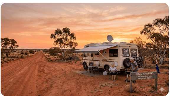
Queensland’s free camping experience varies more dramatically than almost any other Australian state. A council camp in a coastal town near Hervey Bay may have sealed car parks, clean toilets, a dump point, shade trees and a visitor information board. A bush camp in outback Queensland may be nothing more than a cleared area beside a dirt track with a hand-painted sign on a fence post. Both are legitimate camping experiences — but arriving expecting the former at the latter is how trips go wrong.
- Council-managed free camps in coastal and regional Queensland are generally the best-maintained free stops in the country. Many have been developed specifically to attract grey nomads and are well-signed, clearly delineated and regularly serviced. Check with Campermate for user-reported conditions in the past 30 days before arrival.
- QPWS sites range from excellent (Carnarvon Gorge, Undara, Lawn Hill) to very basic (remote national park walk-in sites). Amenity listings on the QPWS booking site are generally accurate but do not always reflect current maintenance status — a pit toilet that was serviceable three months ago may not be today.
- Outback roadside stops are often informal, unmarked and without any facilities. They are used by grey nomads on the basis of convention and tolerance rather than formal permission. Always check for signage — including “No Camping” signs — before setting up in any outback informal stop.
- Queensland’s tropical north (Cairns to Cape York) can be genuinely hot and humid even in the dry season — manage your setup time to avoid prolonged outdoor activity during the hottest part of the day (11am to 3pm).
- Insects are a significant Queensland camp reality — mozzies, March flies, sandflies and midges vary by region and season. A quality insect repellent, long sleeves after sunset and a well-sealed van are essential in tropical and coastal Queensland.
Section 7 — Safety for Senior Grey Nomads in Queensland
Personal safety
- Queensland is generally a safe state for grey nomad travel. The overwhelming majority of free camp interactions involve nothing more concerning than fellow travellers sharing local knowledge. However, opportunistic theft at popular tourist rest areas — particularly on the Bruce Highway near major cities — does occur. Lock all vehicle and van doors at night and keep valuables out of sight.
- Crocodile safety in northern Queensland is not optional. Saltwater crocodiles are present in all river systems, estuaries, coastal areas and some freshwater locations north of Rockhampton — and in some locations south of this line. Never swim in, wade into, or stand at the water’s edge in any Queensland waterway north of Rockhampton without first checking for current crocodile warning signs. This rule has no exceptions — saltwater crocodiles are ambush predators and attacks are fatal.
- Marine stingers (box jellyfish and irukandji) are present in Queensland coastal waters from October to May. During stinger season, swim only in netted enclosures at patrolled beaches. Do not swim in unnetted ocean water north of Bundaberg during stinger season regardless of water appearance.
- Solo travellers in outback and remote Queensland should establish a daily check-in routine with a trusted contact before entering any area with limited mobile coverage — which means most of outback, Gulf Country and Cape York Queensland.
- Carry a registered PLB at all times in remote Queensland. See our full caravan security and safety guide for additional detail on protecting yourself and your vehicle on the road.
Trip safety
- Download the Queensland Fire and Emergency Services (QFES) app and the Bureau of Meteorology app before entering Queensland. Both provide real-time alerts for fires, floods and severe weather that are directly relevant to grey nomad travel decisions.
- Check road conditions daily on 131940.com.au when travelling in outback or remote Queensland — road closures from flooding or maintenance can change overnight and may require significant route alterations.
- Carry a minimum five-day water supply in outback, Cape York and Gulf Country areas. Carry a minimum 20% fuel reserve beyond your planned range on every outback leg.
- If you break down in remote Queensland, stay with your vehicle and activate your PLB if you cannot self-rescue or make contact within your agreed timeframe. Do not walk for help in remote outback Queensland — distances and conditions make this approach life-threatening.
- Carry a comprehensive vehicle recovery kit for any unsealed road travel — including tyre repair equipment, jump leads, tow rope, shovel and traction boards for sandy or boggy conditions.
Section 8 — Medical and Emergency Contacts Across Queensland
Queensland’s medical infrastructure is concentrated in its major coastal cities. In remote and outback areas, the Royal Flying Doctor Service is the primary emergency medical provider — response times are measured in hours, not minutes. Know your nearest hospital before you set up camp at any remote location.
| Service / Hospital | Address | GPS | Phone |
|---|---|---|---|
| Cairns Hospital | 165 The Esplanade, Cairns QLD 4870 | -16.9219° S, 145.7747° E | (07) 4226 0000 |
| Townsville University Hospital | 100 Angus Smith Drive, Douglas QLD 4814 | -19.3197° S, 146.7572° E | (07) 4433 1111 |
| Rockhampton Hospital | Canning Street, Rockhampton QLD 4700 | -23.3722° S, 150.5117° E | (07) 4920 6211 |
| Bundaberg Hospital | Bourbong Street, Bundaberg QLD 4670 | -24.8656° S, 152.3486° E | (07) 4150 2222 |
| Mount Isa Hospital | 30 Camooweal Street, Mount Isa QLD 4825 | -20.7269° S, 139.4944° E | (07) 4744 4444 |
| Longreach Hospital | 115 Eagle Street, Longreach QLD 4730 | -23.4395° S, 144.2508° E | (07) 4658 1500 |
| Royal Flying Doctor Service (QLD) | — | — | 1300 669 569 |
| Emergency (Police, Fire, Ambulance) | Australia-wide | — | 000 |
| Healthdirect (24hr nurse helpline) | Australia-wide | — | 1800 022 222 |
Section 9 — Dump Points, Water and Supplies Across Queensland
There is no dump point at any roadside rest area or informal free camping location in Queensland. Grey nomads must plan dump point and water access around major town stops throughout their trip. The following table covers the primary supply needs for different regions of Queensland.
| Need | Best Options by Region | Senior Notes |
|---|---|---|
| Dump Point — Coastal QLD | Hervey Bay, Bundaberg, Rockhampton, Mackay, Townsville, Cairns — all have council dump points, often at showgrounds or visitor centres. | Use Campermate or Hema Explorer dump point locator. Most coastal dump points are free. Some require a small fee ($2–$5). |
| Dump Point — Outback QLD | Longreach, Winton, Barcaldine, Charleville, Cunnamulla, Roma — all have showground or council dump points. | Call ahead to confirm access — outback dump points can be locked or out of service without online updates. Most outback councils welcome grey nomads and are responsive to phone enquiries. |
| Fresh Water — Coastal QLD | All major coastal towns have free town tap access. Many council caravan parks allow non-guests to fill water tanks for a small fee. | Fill at every opportunity on the Bruce Highway — do not assume the next stop will have water. |
| Fresh Water — Outback QLD | Town taps in Longreach, Winton, Barcaldine, Charleville, Cunnamulla, Quilpie. Water quality good in most outback towns. | Between outback towns, distances of 200–300km without water access are normal. Carry a minimum 40 litres per person before leaving any outback town. |
| Groceries and Fuel — Coastal QLD | Full supermarket and fuel access at all major Bruce Highway towns. Woolworths, Coles and independent IGA stores are well-distributed. | Fuel prices on the Bruce Highway are generally reasonable. Avoid tourist-zone service stations near popular attractions where prices can be significantly higher. |
| Groceries and Fuel — Outback QLD | Independent stores in Longreach, Winton, Barcaldine, Charleville. Limited selection — stock up at the last major town before entering remote areas. | Outback fuel prices are significantly higher than coastal prices — expect to pay 30–50 cents per litre more. Budget accordingly and fill at every available stop. |
For advice on planning your caravan park versus free camp balance on extended Queensland trips, see our guide on how long you can stay in a caravan park in Australia.
Section 10 — Things to Do for Seniors Across Queensland
Queensland’s grey nomad appeal extends well beyond the camping itself — the state offers an extraordinary range of senior-friendly experiences across every region, from world-class reef snorkelling to outback heritage museums, tropical rainforest drives and heritage rail journeys.
| Activity | Location | Why Seniors Like It |
|---|---|---|
| Qantas Founders Museum | Longreach QLD 4730 | World-class aviation museum in the outback. Fully accessible. Air-conditioned. Guided tours. One of the best regional museums in Australia. |
| Great Barrier Reef day cruise | Cairns and Port Douglas QLD 4870 | Multiple operators offer senior-friendly reef cruises with pontoon platforms, semi-submersible viewing and snorkelling — no diving required. Accessible boarding at Cairns marina. |
| Carnarvon Gorge National Park | Carnarvon Gorge QLD 4702 | Spectacular sandstone gorge with Aboriginal rock art. The main gorge walk is flat and well-maintained for the first 4km — accessible for most fitness levels. QPWS camping available. |
| Undara Lava Tubes | Undara QLD 4871 | Guided tours of ancient volcanic lava tubes. Fully guided — no navigation required. Unique geological experience. QPWS camping nearby. |
| Kuranda Scenic Railway | Cairns to Kuranda QLD 4872 | Heritage railway journey through tropical rainforest. Fully seated, no walking required. One of Australia’s most scenic rail journeys. Accessible boarding at Cairns station. |
Best Senior-Friendly Ideas Across Queensland
- The outback Queensland “Dinosaur Trail” through Winton, Richmond and Hughenden is flat, driveable and genuinely fascinating — world-class dinosaur fossil discoveries with excellent interpretive centres in each town.
- The Savannah Way between Cairns and Broome (WA) is one of Australia’s great grey nomad routes — plan the Queensland section between Cairns and Mount Isa as a self-contained three-to-four week experience.
- Hervey Bay is one of Queensland’s most senior-friendly coastal towns — flat, accessible, excellent whale watching (July to November), calm bay swimming, and one of the country’s best grey nomad communities.
- The Darling Downs wine and produce region around Stanthorpe offers accessible cellar doors, apple orchards and granite belt scenery — a pleasant and underrated alternative to the wine regions of NSW and Victoria.
- Cooktown is the northern gateway for Cape York adventurers — even if you do not venture further north, Cooktown’s James Cook Museum, botanic gardens and historical buildings make it a worthwhile destination in its own right.
For full-time van life inspiration and tips on making the most of extended Queensland stays, read our guide to living in a camper full-time.
Section 11 — Best Time of Year to Camp Free in Queensland
| Season | What It Is Like | Senior Verdict |
|---|---|---|
| Summer (Dec–Feb) | Extreme heat and humidity in the north and outback. Wet season in northern and central QLD — widespread flooding, road closures and inaccessible camps. Cyclone risk in northern coastal areas. Southeast QLD is warm and pleasant but tourist peak season. | Avoid northern and outback Queensland entirely. Southeast QLD (Gold Coast, Sunshine Coast, Fraser Coast) is manageable but busy and expensive. Most grey nomads leave Queensland for the south or southeast in summer. |
| Autumn (Mar–May) | The wet season ends progressively from south to north. March–April still carries flood risk in far north QLD. By May, the dry season is established across most of the state. Temperatures moderate rapidly from April. | Excellent from May onward — this is the start of peak grey nomad season. April is good for southeast and Darling Downs. May marks the opening of the outback and Cape York season for most travellers. |
| Winter (Jun–Aug) | Ideal conditions across most of Queensland. Mild to warm days (20–28°C), cool nights in the south and outback (8–15°C), dry and clear in the north. Peak grey nomad season — popular sites and council camps fill quickly. | Best season overall for the full Queensland experience. Book QPWS sites well in advance. Popular council camps near the coast and in outback towns can fill by early afternoon in July. Arrive early. |
| Spring (Sep–Nov) | Temperatures begin rising from September. October and November bring increasing heat in the outback and north. The wet season begins in far north QLD from late November. Southeast QLD is pleasant throughout spring. | September and October are good for the outback before it heats up. The window for Cape York closes from late October as tracks deteriorate with early wet season rain. Southeast QLD is excellent through spring. |
Section 12 — Fires, Generators and Overnight Etiquette in Queensland
Queensland’s fire risk, wildlife sensitivities and the sheer volume of grey nomads using the free camping network mean that etiquette and rule compliance are not optional — they directly determine whether these areas remain accessible for all travellers.
- Open fires: Prohibited at all QPWS national park sites unless a fire ring or fireplace is specifically provided and signage permits fire use. During total fire ban periods — declared by the Queensland Fire and Emergency Services — no fires of any kind are permitted, including gas barbecues in some declarations. Check the QFES website or app before lighting any fire. Outback Queensland carries extreme fire risk from August to October — treat fire restrictions as absolute.
- Generators: Not permitted at QPWS national park and state forest camp sites. At council camps and rest areas, check specific site signage — rules vary. Where generators are permitted, standard quiet hours apply: typically 8pm to 8am. Never run a generator in an enclosed or semi-enclosed space — carbon monoxide risk is real and documented.
- Noise: Queensland’s free camp community is heavily senior-dominated and generally respectful of quiet hours. Keep music, television and generator noise at low levels after 9pm regardless of location.
- Wildlife interference: Do not feed wildlife at any Queensland camp. Feeding kangaroos, possums, birds and other wildlife creates habituation that leads to aggressive behaviour and ultimately to culling. This is particularly relevant at popular coastal and outback camp areas where wildlife is accustomed to human presence.
- Rubbish: Pack in, pack out at any location without confirmed bin access. Rubbish dumping at Queensland free camps is a documented and growing problem — it directly causes council and QPWS closures of otherwise excellent sites.
- Grey water and waste: Never discharge grey water or black water onto the ground at any Queensland camp. This is both a health violation and an environmental offence. Dispose of all waste at designated dump points only.
Section 13 — Packing Checklist for Seniors in Queensland
Queensland’s combination of extreme heat, remote distances, variable facilities, wildlife hazards and the specific demands of tropical travel means your packing list needs to go beyond a generic camping checklist. The following table is location-specific to Queensland’s conditions.
| Item | Why It Matters in Queensland | ☐ |
|---|---|---|
| Registered PLB | Essential for Cape York, outback and Gulf Country travel — no mobile coverage for hundreds of kilometres. Must be registered with AMSA before departure. | ☐ |
| Satellite messenger (Garmin inReach or equivalent) | Strongly recommended for solo travellers and all Cape York and Gulf Country routes — provides two-way communication and GPS tracking where mobile coverage is absent. | ☐ |
| 40+ litres potable water per person | Water is a survival issue in outback and Cape York Queensland — distances between confirmed water sources can exceed 300km. | ☐ |
| Fuel jerry cans (20–40 litres reserve) | Fuel stops on outback routes can be 200–300km apart — and occasionally closed. A 20% fuel reserve is the minimum safe margin. | ☐ |
| Quality insect repellent (DEET-based) | Mozzies, sandflies and March flies are intense in tropical, coastal and outback QLD — particularly near water and at dusk and dawn. Ross River Fever risk is real. | ☐ |
| Stinger suit or rashguard (northern QLD) | Marine stingers are present in northern QLD coastal waters October to May. A full-body lycra stinger suit is required for ocean swimming in stinger season. | ☐ |
| Solar system (200W+ panels, 100Ah+ lithium battery) | No power at free camps. Queensland’s solar resource is excellent — a well-sized system fully covers CPAP, device charging and LED lighting needs. | ☐ |
| Cooling system (12V fan, evaporative cooler or reverse cycle) | Even in the dry season, Queensland can deliver 35°C+ days — particularly in the outback from August onward. Heat illness risk for seniors in enclosed vans is real. | ☐ |
| QPWS booking confirmation (printed and digital) | Rangers at national park sites check bookings. No booking confirmation means no entry at QPWS sites during peak season. | ☐ |
| Hema Explorer app (offline Queensland maps) | Covers outback tracks, station roads and Cape York routes not available on Google Maps. Download offline maps for your full Queensland route before leaving coverage. | ☐ |
| Snake bite bandages (compression bandages) | Queensland has significant snake populations — particularly in outback and bushland areas. Pressure immobilisation bandages are the correct first response to any snake bite. Carry at least four. | ☐ |
| Crocodile awareness signage familiarity | Know what current crocodile warning signs look like and treat them as absolute. Never approach, swim near or camp at the water’s edge in northern Queensland waterways. | ☐ |
COPY PROMPT ➔ ASK AI ➔ SAVE TO FORM ➔ ADD SPOT PIN ➔ GET DIRECTIONS
📍 Interactive map — find free camps, rest areas and overnight stops across Queensland. Enable location for best results.
Section 14 — GPS Coordinates and Postcodes: Save Every Key Stop
Save these coordinates to your GPS or phone before leaving mobile coverage. Queensland’s distances between services make offline GPS references essential — do not rely on live navigation in outback, Cape York or Gulf Country regions.
| Location | Address + Postcode | GPS | Notes |
|---|---|---|---|
| Longreach (Outback Hub) | Eagle Street, Longreach QLD 4730 | -23.4422° S, 144.2500° E | Fuel, groceries, dump point, Qantas Founders Museum, hospital |
| Cairns (North QLD Hub) | Sheridan Street, Cairns QLD 4870 | -16.9186° S, 145.7781° E | Full services, Cairns Hospital, QPWS booking centre, Cape York gateway |
| Mount Isa (Western QLD Hub) | Camooweal Street, Mount Isa QLD 4825 | -20.7256° S, 139.4927° E | Fuel, hospital, dump point, Savannah Way junction |
| Hervey Bay (SE QLD Coast) | Boat Harbour Drive, Hervey Bay QLD 4655 | -25.2882° S, 152.8346° E | Whale watching, grey nomad hub, full services, dump point |
| Townsville Hospital | 100 Angus Smith Drive, Douglas QLD 4814 | -19.3197° S, 146.7572° E | Major regional hospital — serves north QLD including outback and Gulf Country referrals |
For a comprehensive collection of verified Queensland free camping GPS coordinates and overnight stops, bookmark our Vanlife Savings Spots guide and update your saved stops before each leg of your Queensland trip.
Section 15 — Frequently Asked Questions
Is camping free in Queensland?
Partially. Queensland has a large network of genuinely free camping areas — including many council-operated sites and informal roadside stops — but it also has an extensive QPWS booking system where fees of $6–$8 per person per night apply at national park and state forest sites. The best free camping in Queensland is found at council-operated areas in regional towns, which are often purpose-built for grey nomads and offer toilets and dump points at no cost. The word “free” needs to be understood in the context of Queensland’s multi-layered land management system — not every stop is free and not every free stop is legal.
Can caravans and motorhomes stay overnight in Queensland?
Yes — at designated rest areas, council free camps and QPWS booking sites. Queensland has one of the most generous overnight vehicle stop policies of any Australian state. Many regional councils actively encourage grey nomad overnight stays as an economic development strategy. However, roadside rest areas managed by Transport and Main Roads impose a 20-hour maximum stay limit and are intended for fatigue management rather than extended camping. Do not overstay posted limits at any Queensland rest area.
What are the GPS coordinates for key Queensland free camping areas?
Key reference GPS coordinates are: Longreach outback hub -23.4422° S, 144.2500° E; Cairns northern hub -16.9186° S, 145.7781° E; Mount Isa western hub -20.7256° S, 139.4927° E; Hervey Bay coastal hub -25.2882° S, 152.8346° E. Individual camp sites within each region have their own specific GPS — use the Campermate or WikiCamps app for individual site coordinates, and refer to Section 14 of this guide for the master reference table. Download all coordinates offline before leaving mobile coverage.
Are there toilets at Queensland free camping areas?
At better council and QPWS sites, yes. At roadside rest areas, informal outback stops and bush camps, generally no. The only reliable approach is to confirm toilet presence at your specific planned stop via a recent Campermate user report (within 30 days) or the QPWS booking site amenity listing before arrival. Carry a portable toilet solution as standard equipment regardless of what online sources state — facilities can be out of service, vandalised or removed without notice.
Is there a dump point at Queensland free camping areas?
No — there is no dump point at any roadside rest area or informal free camp in Queensland. Dump points are located in major towns throughout the state — Cairns, Townsville, Mackay, Rockhampton, Bundaberg, Hervey Bay, Longreach, Mount Isa and most regional centres. Use the Campermate or Hema Explorer dump point locator to find the nearest dump point to your camp. Plan your disposal around major town stops — do not wait until you are in a remote area with a full tank before seeking a dump point.
Can you get potable water at Queensland free camps?
Not reliably. Some QPWS booking sites and better council camps have potable water on-site — check the individual site listing before arrival. Most roadside rest areas, informal outback stops and bush camps have no water supply. Fill your fresh water tank at every confirmed town tap before departing for remote areas. In outback Queensland, carry a minimum 40 litres per person — the distances between confirmed water sources can exceed 300km, and the consequences of running short in summer heat are serious.
Is Queensland safe for solo senior grey nomads?
Yes, with appropriate preparation that matches the specific region you are visiting. Coastal Queensland and southeast Queensland are very safe and well-serviced. Outback Queensland, Cape York and Gulf Country require higher preparation — registered PLB, satellite messenger for two-way communication, daily check-in routine with a trusted contact, five-day water and fuel reserves, and clear itinerary sharing before each remote leg. Solo travellers should consider travelling in informal convoy with other grey nomads for Cape York and remote outback legs — the grey nomad community in Queensland is active and welcoming, and convoy arrangements are commonly made at campsite notice boards and in online grey nomad communities.
What is the nearest hospital for outback Queensland travellers?
For the central outback (Longreach, Winton, Barcaldine): Longreach Hospital, 115 Eagle Street, Longreach QLD 4730, phone (07) 4658 1500. For serious events, Royal Flying Doctor Service (1300 669 569) and air transfer to Rockhampton or Brisbane. For western Queensland (Mount Isa corridor): Mount Isa Hospital, 30 Camooweal Street, Mount Isa QLD 4825, phone (07) 4744 4444. For northern Queensland (Cairns, Cape York, Gulf access): Cairns Hospital, 165 The Esplanade, Cairns QLD 4870, phone (07) 4226 0000 — and Townsville University Hospital for major trauma, phone (07) 4433 1111.
Do I need to book Queensland national park campsites in advance?
Yes — for all QPWS national park and state forest booking sites, particularly during peak season (June to August). Popular sites including Carnarvon Gorge, Lawn Hill, Undara, Cape Tribulation and the Whitsundays national park camps book out weeks — sometimes months — in advance during the peak grey nomad season. Book online at parks.des.qld.gov.au up to 12 months in advance. Walk-up availability at QPWS sites during peak season is minimal and cannot be relied upon. Arriving unbooked at a fully booked QPWS site means no entry — do not leave this to chance.
Is Cape York accessible for grey nomads?
Cape York Peninsula is accessible to well-prepared grey nomads with appropriate vehicles — but it is not accessible to all grey nomads regardless of experience level. The Peninsula Developmental Road north of Cooktown requires a genuine 4WD vehicle in good condition. Standard caravans are not suitable for Cape York beyond Cooktown without specific off-road modifications. The tracks are corrugated, rocky and river-crossing dependent — creek crossings are unavoidable and water depths vary. Cape York should only be attempted in the dry season (May to October), with a registered PLB, satellite communication, five-day water and fuel reserves, and a realistic assessment of your vehicle and van’s off-road capability. If in doubt, Cooktown itself is a magnificent destination that does not require Cape York track access.
Section 16 — Quick Verdict: Is Queensland Worth It for Grey Nomads?
Queensland is, without question, the premier grey nomad destination in Australia — and it deserves that reputation. The combination of a generous free camping network, extraordinary natural diversity, a genuinely welcoming attitude toward travelling seniors in most regional communities, and a dry season climate that delivers day after day of warm, clear weather from May through September is simply unmatched anywhere else in the country. From the whale watching at Hervey Bay to the dinosaur fossils of Winton, from the thermal springs of Innot Hot Springs to the ancient volcanic lava tubes at Undara, from the reef at Cairns to the red rock gorges of Carnarvon — Queensland rewards slow, thoughtful travel with experiences that stay with you long after you have driven home.
The honest qualifications are these: Queensland’s scale demands more preparation than smaller states. Its remote areas carry genuine consequence for inadequate planning — water, fuel, medical access and communication are not afterthoughts in outback and Cape York Queensland, they are the foundation of safe travel. The wet season is a genuine exclusion zone for most of the north and outback. Peak season means competition for popular free camps — arrive early, book QPWS sites in advance and have a flexible backup plan. And treat the free camping network with the respect it deserves — the access that grey nomads enjoy exists because previous travellers behaved well enough that land managers chose to continue permitting it. Do your part to keep it open for those who follow. For GPS stops, free camp locations and savings tips across Queensland and Australia, see our Vanlife Savings Spots guide, and for full seasonal route planning see our grey nomad Australia routes guide.
- Vanlife Savings Spots — Free Camping Across Australia
- Best Routes to Drive Around Australia — Grey Nomad Planning Guide
- How Caravan Theft Happens in Australia — Grey Nomad Security Guide
- How Long Can You Stay in a Caravan Park in Australia?
- Living in a Camper Full-Time — What Senior Grey Nomads Need to Know
- Cairns Free Camping Guide — Tropical North Queensland overnight stops
- Hervey Bay Free Camping Guide — Fraser Coast grey nomad hub
- Outback Queensland Free Camping — Longreach, Winton and the Matilda Way
- Cape York Free Camping Guide — what grey nomads need to know before attempting the Peninsula
- Darling Downs Free Camping — Toowoomba, Stanthorpe and Warwick overnight stops
- Whitsundays and Mackay Free Camping Guide — coastal grey nomad stops
- Savannah Way Grey Nomad Guide — Cairns to Broome free camping route
17. Queensland Rest Areas and Free Camping — GPS Links by Region
Every link below is a GPS-verified rest area or free camping guide on this site covering Queensland. Organised by region and route so you can plan your full Queensland run in one place.
Warrego and Matilda Highway — Outback Queensland
Charleville Rest Area
Gateway to outback QLD on the Warrego Highway — GPS, dump point, hospital and full senior guide.
Full GPS Guide →Morven Rest Area
Small but reliable Warrego Highway stop between Roma and Charleville — GPS and overnight details.
Full GPS Guide →Roma Rest Area
Major outback hub — full resupply, hospital, dump point and grey nomad overnight guide 2026.
Full GPS Guide →Mitchell Rest Area
Maranoa River town stop on the Warrego — GPS, dump point and senior safety guide 2026.
Full GPS Guide →Blythdale Rest Area
Between Roma and Charleville — GPS, overnight rules and safety notes for grey nomads 2026.
Full GPS Guide →Charleville to Goondiwindi Route
Complete grey nomad corridor guide — every GPS-verified stop on this outback QLD route 2026.
Full Corridor Guide →Capricorn Highway — Longreach, Tambo, Blackall
Longreach Darr River Waterhole
Iconic outback free camping near Longreach — GPS, overnight rules and full senior safety guide.
Full GPS Guide →Thomson River Weir Camp Longreach
Free camping at the Thomson River Weir near Longreach — GPS and senior grey nomad guide 2026.
Full GPS Guide →Tambo Rest Area
Barcoo Shire stop on the Capricorn Highway — GPS, dump point and grey nomad guide 2026.
Full GPS Guide →Blackall Rest Area
Wool capital of outback QLD — GPS, dump point and senior grey nomad guide 2026.
Full GPS Guide →Yaraka Rest Area
End-of-the-road outback stop — GPS, facilities and safety notes for adventurous grey nomads.
Full GPS Guide →Stubby Bend Free Camping
Outback QLD free camping area — GPS, overnight rules and full senior grey nomad guide 2026.
Full GPS Guide →Carnarvon and Darling Downs
Injune Rest Area
Gateway to Carnarvon Gorge — GPS, facilities, overnight rules and senior safety guide 2026.
Full GPS Guide →Rolleston Rest Area
Central QLD junction town on the Carnarvon Highway — GPS, dump point and grey nomad guide.
Full GPS Guide →Emerald Rest Area
Major Central QLD hub — GPS, hospital, dump point and full grey nomad guide 2026.
Full GPS Guide →Goondiwindi Rest Area
NSW-QLD border town — major resupply stop with GPS, dump point and full senior travel guide.
Full GPS Guide →Dirranbandi Rest Area
Remote Balonne Highway stop — GPS, overnight rules, facilities and senior safety guide 2026.
Full GPS Guide →Greenwood Grange Rest Area
Burnett Highway stop in central QLD — GPS, facilities and full senior grey nomad guide 2026.
Full GPS Guide →North Queensland — Bruce Highway, Whitsundays and Cairns
Guthalungra Rest Area
Bruce Highway stop between Bowen and Ayr — GPS, overnight rules and senior safety guide.
Full GPS Guide →Airlie Beach Rest Area
Whitsundays gateway — GPS, overnight parking rules and senior grey nomad guide 2026.
Full GPS Guide →Free Camping Cairns
Complete retiree-friendly guide to free camping in Cairns and the Far North QLD region 2026.
Full Guide →Free Camping Mackay QLD
Coal coast city — complete free camping and rest area guide for seniors near Mackay 2026.
Full Guide →Camping Near Crocodiles QLD
Senior safety guide — what no one tells you about staying safe near water in north Queensland.
Read Guide →South East Queensland — Coastal and Hinterland
Free Camping Hervey Bay
Whale watching capital of Australia — complete retiree-friendly free camping guide 2026.
Full Guide →Free Camping Rainbow Beach
Gateway to Fraser Island — complete retiree-friendly free camping guide 2026.
Full Guide →Free Camping Bundaberg
Rum capital and grey nomad favourite — complete free camping guide for Bundaberg 2026.
Full Guide →Free Camping Gympie
Burnett Highway base town — complete retiree-friendly free camping guide for Gympie 2026.
Full Guide →Free Camping Tin Can Bay
Dolphin feeding and free camping — retiree-friendly guide for grey nomads 2026.
Full Guide →Queensland Rest Areas Guide
Every GPS-verified rest area in Queensland by highway and region — plan your full QLD route here.
Full QLD Guide →Flinders Highway — Charters Towers, Hughenden and Julia Creek
Macrossan Park Rest Area
Flinders Highway stop 55km west of Charters Towers — GPS, overnight rules and full senior guide.
Full GPS Guide →Ayrshire Hills Rest Area
Quiet outback stop between Charters Towers and Hughenden — GPS, facilities and senior safety guide.
Full GPS Guide →Fletcher Creek Camp Area
Popular shaded rest stop on the Flinders Highway — GPS, overnight rules and full senior guide 2026.
Full GPS Guide →Julia Creek Rest Area
Popular Flinders Highway free camp between Townsville and Mount Isa — GPS and senior guide 2026.
Full GPS Guide →Gulf Country — Cloncurry and Gulf Developmental Road
Corella Dam Rest Area
25km west of Cloncurry — dump point, GPS and senior grey nomad overnight guide 2026.
Full GPS Guide →Mount Gordon Rest Area
Remote rest stop on the Burke Developmental Road between Cloncurry and Burketown — GPS, overnight rules and senior safety guide 2026.
Full GPS Guide →Kajabbi Rest Area
Gulf Developmental Road stop between Cloncurry and Normanton — GPS and full senior guide 2026.
Full GPS Guide →Suttor River Rest Area
Suttor Developmental Road free camp — GPS, overnight rules and senior safety guide 2026.
Full GPS Guide →Bruce Highway — Cardwell Range and North Queensland
Kennedy Rest Area
Bruce Highway stop on the Cardwell Range — GPS, toilet facilities and full senior grey nomad guide.
Full GPS Guide →Free campsites and powered sites fill fast during Queensland’s peak grey nomad season (June to August). If your preferred site is already taken, search remaining accommodation options below.
Accommodation and flight search powered by Expedia. Booking through this search supports this website at no extra cost to you. As an affiliate, I earn from qualifying purchases at no extra cost to you.

As an affiliate, I earn from qualifying purchases at no extra cost to you.
Exclusive Offer: Get 5% OFF all StarterStopper immobiliser products with promo code: RTV5
Visit StarterStopper.com to see our data-backed security solutions
As an affiliate, I earn from qualifying purchases at no extra cost to you.