Gympie is one of the great grey nomad towns of south-east Queensland — a genuine, working country city with a gold rush heritage, a famous heritage railway, and some of the best-positioned free camping on the entire Bruce Highway corridor. Your practical, retiree‑friendly guide to free camps, water points, dump points, fuel stops, Wi‑Fi, medical access, disability access and safety around Gympie. Whether you’re a grey nomad, caravanner or vanlifer, this guide gives you accurate GPS coordinates, access notes, amenities and local insights to help you travel confidently and comfortably.
Free Camping Near Gympie (Best Retiree‑Friendly Spots)
The Gympie region is a standout destination for low-cost camping Gympie travellers. The city sits at the junction of the Bruce Highway and Wide Bay Highway, making it accessible from almost any direction. Gympie Regional Council has invested meaningfully in free RV parks and rest areas that genuinely cater to older travellers — flat access, clean facilities, and spaces big enough for large rigs. One retired couple who’d driven the Bruce Highway every winter for twelve years told us that pulling into Six Mile Creek was always the moment the holiday truly began — the sound of the creek, the big trees, and the smell of Queensland bush said: you’re here.
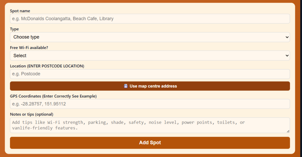
Use the Vanlife Savings Spots App to save your locations. Add your postcode, GPS coordinates and notes, then tap “Add Spot” to place it on the map and get directions.
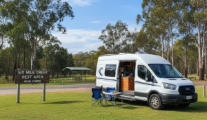
Six Mile Creek Rest Area – Glanmire (Gympie) QLD 4570
Distance from Gympie: 6.9 km south on the Bruce Highway Maximum Stay: 20 hours Self‑Contained Required: No Toilets On‑Site: Yes — clean, maintained public toilets Toilet Address: Bruce Highway, Glanmire QLD 4570 Toilet GPS: -26.2390, 152.6480 (approx.) Showers: No Pet‑Friendly: Yes Caravan‑Friendly / Big‑Rig Access: Yes — suitable for all rig sizes Campervan Access: Yes Camper Trailer Access: Yes Tent Camping Allowed: Yes Vehicle Restrictions: None Telstra Reception: Yes GPS: -26.2390, 152.6480 (Public mapping data) Address: Bruce Highway, Glanmire QLD 4570 Coordinate Source: Public mapping data
Accessibility (Disability‑Friendly Notes)
- Wheelchair-accessible toilets: Yes — accessible toilet block on site
- Accessible parking: Yes — large flat gravel and grassed area
- Pathway surface: Gravel and grassed; reasonably level throughout
- Mobility-friendly access to amenities: Good — flat site with clear paths between areas
- Turning space for mobility devices: Yes — open and spacious
- Suitability for travellers with limited mobility: Good
- Nearby accessible toilets: Within site; Archery Park Gympie (approx. 7 km north)
- Emergency toilet options within 1–5 km: On-site
Access Notes
- Road type: Sealed Bruce Highway; flat loop access road into site
- Turning space: Yes — full loop with turning circles for large rigs
- Caravan/motorhome suitability: Excellent — designed for caravans and big rigs
- Vehicle limitations: None; level gravel and grass throughout
Why Retirees Like It
This is one of the most complete free camps on the Bruce Highway in Queensland. The site sits alongside Six Mile Creek with grassed, shaded areas overlooking the water and the Ray Warren Oval. There are undercover picnic tables, BBQs, a dump point, drinking water, fire pits (check fire restrictions), and toilets — all in one beautifully maintained site. The trees provide generous shade and the creek creates a genuinely peaceful ambient sound. In peak grey nomad season it fills fast — plan to arrive before 3 pm to secure a good spot. The loop road means no awkward manoeuvring for big rigs. It’s the complete package for self-contained camping Gympie travellers.
Nearby Public Wi‑Fi Options
Gympie Library – Gympie QLD 4570 Address: 39 Caledonian Hill, Gympie QLD 4570 Free Wi‑Fi: Yes Toilets: Yes — accessible Toilet Address: 39 Caledonian Hill, Gympie QLD 4570 Toilet GPS: -26.1906, 152.6649 Parking suitability: Street parking; room for campervans on surrounding streets Wi‑Fi GPS: -26.1906, 152.6649 Parking GPS: -26.1906, 152.6649
Driving Directions
➡ From Gympie CBD, head south on the Bruce Highway ➡ After approx. 7 km, watch for Six Mile Creek Rest Area sign on left ➡ Turn left into the loop road — toilets and picnic area visible on entry
Tips
- Arrival time: No later than 2–3 pm in winter (June–August) — it fills quickly
- Weather: Well-treed and shaded; comfortable even in warm weather
- Noise: Highway audible but muted by trees and creek sounds
- Wet season notes: January–March — the creek can rise after heavy rain; use higher gravel sections
- Safety: Very popular and well-used; generally safe overnight
Chatsworth Park RV Area – Chatsworth (Gympie) QLD 4570
Distance from Gympie: 6.5 km north on the Bruce Highway Maximum Stay: 72 hours (3 nights — one of the most generous limits in the region) Self‑Contained Required: No Toilets On‑Site: Yes Toilet Address: Vantage Road, Chatsworth QLD 4570 Toilet GPS: -26.1355, 152.6340 (approx.) Showers: No Pet‑Friendly: Yes Caravan‑Friendly / Big‑Rig Access: Yes — six reverse-in bays plus side parking Campervan Access: Yes Camper Trailer Access: Yes Tent Camping Allowed: Yes Vehicle Restrictions: Turning space is limited at the far end — do not proceed too deep if already tight Telstra Reception: Yes GPS: -26.1355, 152.6340 (Public mapping data) Address: Vantage Road, Chatsworth QLD 4570 (just off Bruce Highway) Coordinate Source: Public mapping data
Accessibility (Disability‑Friendly Notes)
- Wheelchair-accessible toilets: Yes — accessible block on site
- Accessible parking: Yes — flat sealed and gravel surface
- Pathway surface: Sealed and flat near amenities; grassed areas off to side
- Mobility-friendly access to amenities: Good — compact site, short distances
- Turning space for mobility devices: Good near the entry and reverse-in bays
- Suitability for travellers with limited mobility: Good
- Nearby accessible toilets: Within site
- Emergency toilet options within 1–5 km: Gympie CBD approx. 6.5 km south
Access Notes
- Road type: Turn left into Vantage Road off the Bruce Highway, then immediately left into the rest area
- Turning space: Moderate — six dedicated reverse-in bays; limited at far end; don’t drive past the last bay if the road ahead is narrow
- Caravan/motorhome suitability: Yes — designed for caravans and big rigs; arrive early for best bay choice
- Vehicle limitations: Very long combinations (30m+) should approach slowly and assess turning
Why Retirees Like It
Chatsworth Park is frequently praised for its generous 72-hour limit — giving retirees and grey nomads the chance to properly rest and explore the region without rushing. The site has TV and mobile reception, a large flat area, and is just 6.5 km from Gympie’s supermarkets, hospital, cafés and shops. It fills fast in peak season. One RV traveller noted she’d been coming here for three years running — the 72-hour limit means you can actually relax, do your shopping, and enjoy the drive without feeling like you’re just passing through. A genuine base for free caravan camping Gympie style.
Nearby Public Wi‑Fi Options
Gympie McDonald’s – Gympie QLD 4570 Address: 8 Lake Alford Dr, Gympie QLD 4570 Free Wi‑Fi: Yes Toilets: Yes — accessible Toilet Address: 8 Lake Alford Dr, Gympie QLD 4570 Toilet GPS: -26.1942, 152.6711 Parking suitability: Large carpark — excellent for caravans and motorhomes Wi‑Fi GPS: -26.1942, 152.6711 Parking GPS: -26.1942, 152.6711
Driving Directions
➡ From Gympie CBD, head north on the Bruce Highway approx. 6.5 km ➡ Watch for Vantage Road on the right ➡ Turn right into Vantage Road, then immediately left into Chatsworth Park
Tips
- Arrival time: Before 1 pm in peak June–August season — this is extremely popular
- Weather: Some open areas with limited shade — position under any available tree
- Noise: Highway adjacent but wind and trees soften it considerably
- Wet season notes: Site can be muddy in very wet periods; park on sealed or gravel sections
- Safety: Well-frequented; popular with families and retirees; safe overnight
Southside Rest Area – Southside (Gympie) QLD 4570
Distance from Gympie: 1.7 km south-west of Gympie CBD Maximum Stay: As per current signage — verify on arrival Self‑Contained Required: No Toilets On‑Site: Yes Toilet Address: Exhibition Road, Southside QLD 4570 Toilet GPS: -26.1993, 152.6480 (approx.) Showers: No Pet‑Friendly: Yes Caravan‑Friendly / Big‑Rig Access: Yes Campervan Access: Yes Camper Trailer Access: Yes Tent Camping Allowed: Yes Vehicle Restrictions: None noted Telstra Reception: Yes GPS: -26.1993, 152.6480 (Public mapping data) Address: Exhibition Road, Southside QLD 4570 Coordinate Source: Public mapping data
Accessibility (Disability‑Friendly Notes)
- Wheelchair-accessible toilets: Check on arrival — council-managed facility
- Accessible parking: Yes — flat sealed area
- Pathway surface: Sealed; mostly level
- Mobility-friendly access to amenities: Good
- Turning space for mobility devices: Good
- Suitability for travellers with limited mobility: Good
- Nearby accessible toilets: Within site; Gympie CBD approx. 2 km north
- Emergency toilet options within 1–5 km: Gympie CBD and Archery Park (1.5 km)
Access Notes
- Road type: Sealed; accessed via Exhibition Road off the Gympie bypass
- Turning space: Good
- Caravan/motorhome suitability: Good
- Vehicle limitations: None noted
Why Retirees Like It
Located close to Gympie’s southern entry, this site is convenient for travellers who want to be close to town facilities without the full highway noise of the Bruce. The Gympie Showgrounds area is nearby. It’s a flat, functional site that works well as an overnight stop when the more popular sites are full. The Archery Park dump point and dog park are close by, making this a practical double-stop for servicing your rig and resting.
Nearby Public Wi‑Fi Options
Gympie Library – Gympie QLD 4570 Address: 39 Caledonian Hill, Gympie QLD 4570 Free Wi‑Fi: Yes Toilets: Yes — accessible Toilet Address: 39 Caledonian Hill, Gympie QLD 4570 Toilet GPS: -26.1906, 152.6649 Parking suitability: Street parking suitable for campervans Wi‑Fi GPS: -26.1906, 152.6649 Parking GPS: -26.1906, 152.6649
Driving Directions
➡ From Gympie CBD, head south on the Bruce Highway ➡ Turn right onto Exhibition Road (Southside) ➡ Rest area is on the right — approx. 1.7 km from CBD
Tips
- Arrival time: Afternoon is fine — less popular than Six Mile Creek or Chatsworth
- Weather: Some shade; check for open exposed areas in summer
- Safety: Close to town; well-frequented area
- Wet season: Check surface conditions in very wet weather
Fat Hen Creek Rest Area – Kilkivan QLD 4600
Distance from Gympie: Approx. 44 km west via Wide Bay Highway Maximum Stay: 20 hours Self‑Contained Required: No Toilets On‑Site: Yes — flushing toilets Toilet Address: Wide Bay Highway (Bunya Highway), Kilkivan QLD 4600 Toilet GPS: -26.0810, 152.2350 (approx.) Showers: No Pet‑Friendly: Yes Caravan‑Friendly / Big‑Rig Access: Yes Campervan Access: Yes Camper Trailer Access: Yes Tent Camping Allowed: Yes Vehicle Restrictions: None noted Telstra Reception: Yes — good mobile reception reported GPS: -26.0810, 152.2350 (Public mapping data) Address: Wide Bay Highway (Bunya Highway), near Kilkivan QLD 4600 Coordinate Source: Public mapping data
Accessibility (Disability‑Friendly Notes)
- Wheelchair-accessible toilets: Not confirmed — verify on arrival
- Accessible parking: Yes — sealed and flat entry
- Pathway surface: Grass and gravel; mostly level
- Mobility-friendly access to amenities: Moderate — compact site
- Turning space for mobility devices: Good
- Suitability for travellers with limited mobility: Moderate
- Nearby accessible toilets: Kilkivan township approx. 5 km east
- Emergency toilet options within 1–5 km: Kilkivan township
Access Notes
- Road type: Sealed; off the Wide Bay Highway near Fat Hen Creek
- Turning space: Good — flat, open area
- Caravan/motorhome suitability: Good for standard rigs; large rigs have been recorded using the site
- Vehicle limitations: None noted
Why Retirees Like It
This is an underrated gem for overnight parking Gympie westbound travellers heading toward the Bunya Mountains or Kingaroy. The site sits beside a seasonal creek bordered by farmland and highway bushland. The shaded picnic tables are a real asset — this is the kind of rest area where you put the kettle on, sit under the trees and let the world slow down. The big solar light keeps the area well-lit at night. Kangaroos are regularly spotted at dawn and dusk, and bird life is excellent throughout the day. Non-potable water is available on site.
Nearby Public Wi‑Fi Options
Kilkivan Hotel – Kilkivan QLD 4600 Address: 4 Margaret St, Kilkivan QLD 4600 Free Wi‑Fi: Enquire at hotel Toilets: Yes Toilet Address: 4 Margaret St, Kilkivan QLD 4600 Toilet GPS: -26.0841, 152.2316 (approx.) Parking suitability: Good — wide country pub forecourt Wi‑Fi GPS: -26.0841, 152.2316 Parking GPS: -26.0841, 152.2316
Driving Directions
➡ From Gympie, head west on the Wide Bay Highway (becomes Bunya Hwy) ➡ After approx. 44 km, watch for Fat Hen Creek Rest Area sign near Kilkivan ➡ Turn into sealed rest area — picnic shelter and toilets visible from road
Tips
- Arrival time: Any time — less popular than the Bruce Highway sites, so more relaxed
- Weather: Some exposed areas; position under available shade trees
- Noise: Traffic is lighter here than on the Bruce Highway — generally quiet at night
- Safety: Quiet rural road; friendly farming area; safe overnight
Archery Park Day Stop & Dump Point – Gympie QLD 4570
Distance from Gympie: 0.5 km — within Gympie CBD (Cross Street) Maximum Stay: Day stop only — not an overnight camp; use as a service/dump stop Self‑Contained Required: N/A — day use area only Toilets On‑Site: Yes — public toilets on site Toilet Address: Cross St, Gympie QLD 4570 Toilet GPS: -26.1878, 152.6661 (approx.) Showers: No Pet‑Friendly: Yes — dog park on site Caravan‑Friendly / Big‑Rig Access: Yes — flat entry and large area Campervan Access: Yes Camper Trailer Access: Yes Tent Camping Allowed: Not for overnight — day use only Vehicle Restrictions: None Telstra Reception: Yes GPS: -26.1878, 152.6661 (Public mapping data) Address: Cross St, Gympie QLD 4570 Coordinate Source: Public mapping data
Accessibility (Disability‑Friendly Notes)
- Wheelchair-accessible toilets: Yes — accessible facilities on site
- Accessible parking: Yes — flat sealed surface
- Pathway surface: Sealed; level access throughout
- Mobility-friendly access to amenities: Excellent — flat, open, accessible
- Turning space for mobility devices: Good
- Suitability for travellers with limited mobility: Excellent
- Nearby accessible toilets: On-site
- Emergency toilet options within 1–5 km: Within site and Gympie CBD (500m)
Access Notes
- Road type: Sealed CBD road; flat access
- Turning space: Excellent
- Caravan/motorhome suitability: Yes — popular unhitch point for shopping runs
- Vehicle limitations: None
Why Retirees Like It
Archery Park is primarily a service stop rather than a camp, but it’s one of the most useful spots in Gympie for grey nomads. The coin-operated water fill station (currently $1.20 per 200 litres — bring coins; no change given), dump point, dog park, public toilets, and close proximity to Woolworths and the Gympie CBD make it an excellent half-day stop. Many travellers unhitch their caravan at their overnight camp and drive the tow vehicle here for a full service stop before heading back. The staff at the nearby CBD are used to caravaners and are happy to help with directions.
Nearby Public Wi‑Fi Options
Gympie Library – Gympie QLD 4570 Address: 39 Caledonian Hill, Gympie QLD 4570 Free Wi‑Fi: Yes Toilets: Yes — accessible Toilet Address: 39 Caledonian Hill, Gympie QLD 4570 Toilet GPS: -26.1906, 152.6649 Parking suitability: Street parking Wi‑Fi GPS: -26.1906, 152.6649 Parking GPS: -26.1906, 152.6649
Driving Directions
➡ From Bruce Highway, enter Gympie CBD via Calton Hill or Mary St ➡ Head to Cross St — Archery Park is signed from the main road ➡ Flat entry directly off Cross St; dump point and water station visible on arrival
Tips
- Arrival time: Open 24 hours — any time is fine for dump/water
- Coins: Bring $2 coins for the water fill station — no change given
- Hoses: Note that hoses have been removed from water stations to protect public health; bring your own certified drinking water hose
- Safety: Central Gympie location; busy and safe during daylight hours
Corella Road Water Fill Station – Gympie QLD 4570
Distance from Gympie: Within greater Gympie area Maximum Stay: Day stop (water fill only — not overnight camping) Self‑Contained Required: N/A Toilets On‑Site: Not on-site — use Archery Park or CBD facilities Toilet GPS: -26.1906, 152.6649 (Gympie CBD approx.) Showers: No Pet‑Friendly: N/A Caravan‑Friendly / Big‑Rig Access: Yes Campervan Access: Yes Camper Trailer Access: Yes Tent Camping Allowed: Not applicable Vehicle Restrictions: None Telstra Reception: Yes GPS: -26.1780, 152.6410 (approx. — verify current location) Address: Corella Road, Gympie QLD 4570 Coordinate Source: Public mapping data
Note: This is a second council water fill point. Bring coins ($1.20 per 200L) and your own clean certified hose — council has removed hoses from all stations for health reasons. Confirm current availability with Gympie Regional Council (1300 307 800) before visiting.
⭐ Things to Do Nearby (Retiree‑Friendly Tourist Activities)
Activities Near Six Mile Creek Rest Area and Gympie
Mary Valley Rattler Heritage Steam Train – Gympie QLD 4570
One of Queensland’s most beloved heritage steam railways, running from Gympie through the stunning Mary Valley to Imbil. Services operate on Wednesdays, Saturdays and Sundays, with the steam locomotive hauling historic carriages through rolling green farmland and wooded valleys. The Gympie terminal is a lovely heritage building with a café, gift shop, and accessible toilets. Boarding is from a level platform. An extraordinary experience that never gets old — one couple told us it was the single thing they most looked forward to each time they came to Gympie.
- Walking difficulty: Easy — flat platform, seated journey
- Amenities: Café, toilets (accessible), gift shop, seating, heritage station building
- Disability access: Wheelchair boarding available — contact ahead to arrange; accessible toilets at station
- Parking: Good street parking near station; campervans can park on Mary Street or nearby
Gympie Gold Mining and Historical Museum – Gympie QLD 4570
The gold discovery of 1867 saved Queensland from bankruptcy, and this museum tells that story with compelling artefacts, genuine mining equipment, historic machinery and immersive outdoor displays. The grounds include an authentic steam winding engine, stamp mill, and gold panning demonstrations. Indoor sections are air-conditioned. Pensioner discounts available at the gate.
- Walking difficulty: Easy indoors; moderate outdoors (some grassed areas and gravel paths)
- Amenities: Toilets, café nearby, seating, shade structures
- Disability access: Indoor sections accessible; some outdoor exhibits on uneven ground; accessible parking nearby
- Parking: Dedicated car park; street parking adjacent; suitable for campervans
Gympie Regional Gallery – Gympie QLD 4570
A well-regarded public art gallery in the heart of Gympie with rotating exhibitions of Queensland and regional artists. Free entry. Air-conditioned — a welcome relief in summer. The gallery hosts community events, artist talks and regular exhibitions throughout the year. Located centrally with flat footpath access.
- Walking difficulty: Easy — flat, indoor, air-conditioned
- Amenities: Toilets, seating, gift shop with local art
- Disability access: Wheelchair accessible; ramp entry; accessible toilets
- Parking: Street parking and nearby council car park; campervans on surrounding streets
Gympie Heritage Precinct & Town Walk – Gympie QLD 4570
Gympie’s gold rush heritage is written into its beautiful 19th-century streetscapes — ornate pub facades, heritage banks, and original timber Queenslanders line the streets. Pick up a heritage walk map from the Visitor Information Centre on Bruce Highway and take your time through the CBD at your own pace. The walk is flat and suitable for all mobility levels.
- Walking difficulty: Easy — flat CBD; fully sealed accessible footpaths
- Amenities: Cafés, toilets, seating throughout the town; Visitor Information Centre
- Disability access: Good CBD footpaths; most buildings have level or ramp access
- Parking: Council carparks throughout CBD; some streets suitable for campervans
Queens Park – Gympie QLD 4570
A gracious riverside park in the heart of Gympie with a bandstand, rose gardens, heritage trees, flat walking paths and lovely views over the Mary River floodplain. Picnic tables, BBQs and public toilets are on site. An excellent morning stroll for older travellers — completely flat, shaded, and peaceful.
- Walking difficulty: Easy — flat, fully sealed paths throughout the park
- Amenities: Toilets (check accessibility on arrival), BBQ, picnic tables, seating, shade
- Disability access: Flat sealed paths; accessible toilet near main entry
- Parking: Street parking on the perimeter; suitable for campervans
Gympie Visitor Information Centre – Gympie QLD 4570
Located on the Bruce Highway in Gympie, the VIC is an excellent first stop for local maps, event guides, and insider advice on free camps, water points, and attractions. Staff are genuinely knowledgeable and helpful. Air-conditioned. Toilets on site.
- Walking difficulty: None — park and walk in
- Amenities: Toilets, information desk, brochures, seating
- Disability access: Accessible building; ramp entry; accessible toilets; disabled parking
- Parking: Dedicated carpark suitable for caravans and motorhomes
Mary River Fishing – Gympie Region QLD 4570
The Mary River through the Gympie region is renowned for excellent freshwater fishing — golden perch (yellowbelly), saratoga, bass and Australian freshwater cod are all regularly caught. There are several public fishing spots on the river’s edge near the CBD and along Six Mile Creek where it meets the Mary. A calm early morning at the water’s edge is one of the most peaceful ways to start a day in Gympie.
- Walking difficulty: Easy — flat foreshore access at most Gympie river access points
- Amenities: Varies by spot; Queens Park has toilets and seating nearby
- Disability access: Flat grass and gravel access at most spots; some sealed paths
- Parking: Good access at Queens Park and river picnic areas
Gympie Rattler Market – Gympie QLD 4570
A popular local market held at the Mary Valley Rattler heritage precinct — fresh produce, local crafts, food stalls and a friendly community atmosphere. Check current dates with the Visitor Information Centre as market days vary. The Rattler station setting gives it a lovely heritage character.
- Walking difficulty: Easy — flat, outdoor market on sealed and gravel surface
- Amenities: Toilets at station, food stalls, seating
- Disability access: Mostly flat; accessible toilet at station
- Parking: Good — station car park and surrounding streets
Coastal Free Camping Options Near Gympie
MV Sarawak Camping Area – Inskip Peninsula QLD 4581
Approx. 90 km south-east of Gympie via Rainbow Beach Road
Distance from Gympie: Approx. 90 km Maximum Stay: Up to 30 days per permit; nightly fee approx. $7/person/night (verify current rates at parks.qld.gov.au) — Seniors discounts apply Self‑Contained Required: No — toilets on site Toilets: Yes — flush toilets including a wheelchair-accessible block Toilet Address: Inskip Point Road, Inskip QLD 4581 Toilet GPS: -25.8055, 153.0437 (approx.) Showers: No on-site showers; nearest in Rainbow Beach (8 km) Pet‑Friendly: Yes — dogs on lead permitted Caravan‑Friendly / Big‑Rig Access: Yes — accessible by 2WD with caution; 4WD recommended; firm track with some soft sand sections; tight entry bend Campervan Access: Yes Camper Trailer Access: Yes — off-road capable preferred Tent Camping Allowed: Yes Vehicle Restrictions: 4WD strongly recommended; 2WD possible on main tracks with care; no beach driving without 4WD Telstra Reception: Limited — patchy; carry a satellite device GPS: -25.8055, 153.0437 (Public mapping data) Address: Inskip Point Road, Inskip Peninsula QLD 4581 Coordinate Source: Public mapping data
Note: This is a QLD National Parks permit site. Book in advance at parks.qld.gov.au. Seniors/concession card discounts apply. Permits required per person per night.
Accessibility (Disability‑Friendly Notes)
- Wheelchair-accessible toilets: Yes — one block with accessible ramp
- Accessible beach access: Sandy foreshore — challenging for wheelchairs
- Pathway surface: Sand throughout — not suitable for mobility scooters or standard wheelchairs
- Accessible parking: Limited — sand base
- Nearby accessible toilets: On-site accessible block; Rainbow Beach township (8 km)
Access Notes
The main access road off Inskip Point Road is firm sand and suitable for 2WD with caution, but individual camp sites may be on softer sand. There is a tight left-hand bend at the site entry — approach wide and slow. There is a separate one-way circuit road within the site. From Rainbow Beach, follow Clarkson Drive north approximately 10 km.
Why Retirees Like It
This is one of the finest coastal camping experiences in south-east Queensland — and at a modest nightly fee, it’s exceptional value. The site is sheltered under coastal she-oaks and Moreton Bay ash trees with views across the narrow strait to K’gari (Fraser Island). Dolphins are regularly spotted from the beach. The ocean breeze keeps temperatures comfortable. Rainbow Beach township (8 km) has shops, cafés, fuel, a dump point, and excellent fish and chips. Many grey nomads return here year after year as their favourite coastal stop in Queensland.
Nearby Public Wi‑Fi Options
Rainbow Beach Library / Visitor Information – Rainbow Beach QLD 4251 Address: 1 Rainbow Beach Rd, Rainbow Beach QLD 4251 Free Wi‑Fi: Yes Toilets: Yes — accessible Toilet Address: 1 Rainbow Beach Rd, Rainbow Beach QLD 4251 Toilet GPS: -25.9035, 153.0959 (approx.) Parking suitability: Good — suitable for campervans and small caravans Wi‑Fi GPS: -25.9035, 153.0959 Parking GPS: -25.9035, 153.0959
Tin Can Bay Foreshore Rest Area – Tin Can Bay QLD 4580
Approx. 65 km south-east of Gympie
Distance from Gympie: Approx. 65 km via Gympie-Tin Can Bay Road Maximum Stay: As per current signage — check on arrival Self‑Contained Required: Check current requirements Toilets: Yes — public toilets on the foreshore Toilet Address: Tin Can Bay foreshore, Norman Point Dr, Tin Can Bay QLD 4580 Toilet GPS: -25.9120, 152.9850 (approx.) Showers: Enquire locally Pet‑Friendly: Yes — on lead Caravan‑Friendly / Big‑Rig Access: Yes — wide foreshore road with good access Campervan Access: Yes Camper Trailer Access: Yes Tent Camping Allowed: Check current rules Vehicle Restrictions: None noted Telstra Reception: Yes GPS: -25.9120, 152.9850 (Public mapping data) Address: Norman Point Drive, Tin Can Bay QLD 4580 Coordinate Source: Public mapping data
Accessibility (Disability‑Friendly Notes)
- Wheelchair-accessible toilets: Yes — foreshore toilet block
- Accessible beach access: Flat foreshore; good wheelchair access to waterfront
- Pathway surface: Sealed foreshore path — excellent for mobility devices
- Accessible parking: Yes — flat foreshore carpark
Access Notes
Flat, wide foreshore road with generous turning area. Excellent for all rig types. The township of Tin Can Bay is immediately adjacent with all services.
Why Retirees Like It
Tin Can Bay is one of the most tranquil coastal towns in south-east Queensland — calm waters, no surf, no crowds, and the famous wild dolphin feeding at Barnacles Dolphin Centre each morning. The foreshore is flat, sealed, and perfectly accessible. The town has a supermarket, pharmacy, café, bakery and a genuine community feel. This is RV friendly Gympie coastal travel at its most comfortable.
Nearby Public Wi‑Fi Options
Tin Can Bay Library – Tin Can Bay QLD 4580 Address: 9-11 Tin Can Bay Rd, Tin Can Bay QLD 4580 Free Wi‑Fi: Yes Toilets: Yes Toilet Address: 9-11 Tin Can Bay Rd, Tin Can Bay QLD 4580 Toilet GPS: -25.9120, 152.9850 (approx.) Parking suitability: Good — street parking for campervans Wi‑Fi GPS: -25.9120, 152.9850 Parking GPS: -25.9120, 152.9850
Potable Water Fill Points
Archery Park Water Fill Station – Gympie QLD 4570
Address: Cross St, Gympie QLD 4570 GPS: -26.1878, 152.6661 (approx.) Access notes: Coin-operated — $1.20 per 200 litres; bring $2 coins; no change given. Hoses have been removed for public health reasons — bring your own certified drinking water hose. Suitable for up to approx. 1,000 litres. Available 24 hours. Big‑rig suitability: Yes — large flat sealed area; good access Disability access: Flat sealed surface; standard tap height; accessible approach; good parking
Corella Road Water Fill Station – Gympie QLD 4570
Address: Corella Road, Gympie QLD 4570 GPS: -26.1780, 152.6410 (approx. — confirm with council) Access notes: Second council water fill point; coin-operated. Bring your own hose. Verify current access with Gympie Regional Council (1300 307 800). Big‑rig suitability: Good — flat approach Disability access: Generally flat; verify current site condition on arrival
Imbil Water Fill Station – Imbil QLD 4615
Address: Imbil township — verify exact location with Gympie Regional Council GPS: -26.4490, 152.5380 (approx. Imbil township) Access notes: Coin-operated council water fill; confirm current availability. Useful for travellers coming from the Mary Valley. Big‑rig suitability: Enquire with council Disability access: Generally flat access; standard equipment
Dump Points (RV Waste Disposal)
Archery Park Dump Point – Gympie QLD 4570
Address: Cross St, Gympie QLD 4570 GPS: -26.1878, 152.6661 (approx.) Access notes: Free of charge; 24-hour access; includes grey water, black water and sewerage disposal. Well-maintained by Gympie Regional Council. Caravan/motorhome suitability: Excellent — large flat sealed area; suitable for all rig types; popular unhitch point for CBD shopping Disability access: Flat sealed surface; no slope; easy approach; excellent accessibility
Six Mile Creek Rest Area Dump Point – Glanmire QLD 4570
Address: Bruce Highway, Glanmire QLD 4570 GPS: -26.2390, 152.6480 (approx.) Access notes: Located within the rest area; free of charge; most convenient dump point for travellers already staying at the site Caravan/motorhome suitability: Excellent — flat loop road gives easy approach and exit Disability access: Flat gravel surface; reasonable access; no significant slope
Rainbow Beach Dump Point – Rainbow Beach QLD 4251
Address: Rainbow Beach township — verify current location on WikiCamps or CamperMate GPS: -25.9035, 153.0959 (approx. Rainbow Beach) Access notes: Used by Inskip Peninsula campers — fill up, dump and resupply before returning to Inskip Caravan/motorhome suitability: Good Disability access: Generally accessible — flat township area
Fuel Stops Retirees Prefer (Caravan‑Friendly)
United Petroleum – Gympie QLD 4570
Wide forecourt: Yes Diesel availability: Yes Turning space: Good Address: Bruce Highway, Gympie QLD 4570 (check current station locations on Petrol Spy) GPS: -26.1906, 152.6649 (approx. Gympie CBD area) Accessibility: Disabled parking available; accessible toilets — enquire on site
Gympie Puma / Caltex Highway Service Stations – Gympie QLD 4570
Wide forecourt: Yes — highway stations are designed for large vehicles Diesel availability: Yes Turning space: Excellent — designed for trucks and caravans Address: Bruce Highway, Gympie QLD 4570 GPS: -26.1906, 152.6649 (approx.) Accessibility: Accessible toilets; disabled parking; level forecourt
Rainbow Beach Fuel – Rainbow Beach QLD 4251
Wide forecourt: Moderate — town servo; adequate for standard rigs Diesel availability: Yes — note: prices are often higher in coastal tourist towns; check Petrol Spy before leaving Gympie Turning space: Adequate Address: Rainbow Beach Rd, Rainbow Beach QLD 4251 GPS: -25.9035, 153.0959 (approx.) Accessibility: Flat forecourt; accessible approach
Saving Money on Fuel Using Petrol Spy
Petrol Spy is a free Australian fuel-price comparison app and website that shows live diesel and petrol prices across thousands of service stations. It’s updated in near real-time by community members, meaning you can check the price difference between Gympie’s town stations and the Rainbow Beach or Tin Can Bay servos before you leave.
Why Retirees Should Use It
Coastal tourist towns and popular highway stops frequently charge a premium — sometimes 20–30 cents per litre more than slightly off-highway stations nearby. Checking Petrol Spy before entering Rainbow Beach means you can fill up in Gympie and save significantly. For long-distance grey nomad travel, this adds up to real money over a season.
Example Saving
A touring rig with a 150-litre diesel tank filling at a station 20c/L cheaper = $30 saved per fill. Over a 3-month grey nomad season with 12 fills, that’s $360 in savings — more than enough for two weeks of national parks camping fees.
Free Wi‑Fi Locations (Retiree‑Friendly)
Gympie Library – Gympie QLD 4570
Address: 39 Caledonian Hill, Gympie QLD 4570 Free Wi‑Fi: Yes Toilets: Yes — accessible Toilet Address: 39 Caledonian Hill, Gympie QLD 4570 Toilet GPS: -26.1906, 152.6649 Parking suitability: Street parking surrounding the library; campervans can use surrounding streets Wi‑Fi Address: 39 Caledonian Hill, Gympie QLD 4570 Wi‑Fi GPS: -26.1906, 152.6649 Parking Address: Caledonian Hill, Gympie QLD 4570 Parking GPS: -26.1906, 152.6649 Accessibility: Ramp entry; level floors; accessible toilets; disabled parking on street
Gympie McDonald’s – Gympie QLD 4570
Address: 8 Lake Alford Dr, Gympie QLD 4570 Free Wi‑Fi: Yes Toilets: Yes — accessible Toilet Address: 8 Lake Alford Dr, Gympie QLD 4570 Toilet GPS: -26.1942, 152.6711 Parking suitability: Large carpark — excellent for caravans and motorhomes Wi‑Fi Address: 8 Lake Alford Dr, Gympie QLD 4570 Wi‑Fi GPS: -26.1942, 152.6711 Parking Address: Lake Alford Dr, Gympie QLD 4570 Parking GPS: -26.1942, 152.6711 Accessibility: Ramp entry; accessible toilets; disabled parking marked in carpark
Gympie Visitor Information Centre – Gympie QLD 4570
Address: Bruce Hwy, Gympie QLD 4570 Free Wi‑Fi: Yes (enquire at centre) Toilets: Yes — accessible Toilet Address: Bruce Hwy, Gympie QLD 4570 Toilet GPS: -26.1906, 152.6649 (approx.) Parking suitability: Dedicated carpark suitable for caravans and motorhomes Wi‑Fi Address: Bruce Hwy, Gympie QLD 4570 Wi‑Fi GPS: -26.1906, 152.6649 Parking Address: Bruce Hwy, Gympie QLD 4570 Parking GPS: -26.1906, 152.6649 Accessibility: Accessible building; ramp entry; accessible toilets; disabled parking
Rainbow Beach Visitor Information – Rainbow Beach QLD 4251
Address: Rainbow Beach Rd, Rainbow Beach QLD 4251 Free Wi‑Fi: Yes Toilets: Yes — accessible Toilet Address: Rainbow Beach Rd, Rainbow Beach QLD 4251 Toilet GPS: -25.9035, 153.0959 (approx.) Parking suitability: Good — suitable for campervans Wi‑Fi Address: Rainbow Beach Rd, Rainbow Beach QLD 4251 Wi‑Fi GPS: -25.9035, 153.0959 Parking Address: Rainbow Beach Rd, Rainbow Beach QLD 4251 Parking GPS: -25.9035, 153.0959 Accessibility: Level access; accessible toilets; disabled parking
Medical Access (Nearby Services)
Gympie Hospital – Gympie QLD 4570
Type of service: Public hospital — 24/7 Emergency Department; acute regional services; maternity; surgery; renal dialysis; pharmacy Phone Number: (07) 5489 8444 Address: 12 Henry St, Gympie QLD 4570 GPS: -26.1840, 152.6730 (approx.) Call 000 For All Emergency Help Notes on access: Centrally located in Gympie — follow hospital signs from the Bruce Highway. Free 2-hour parking on hospital grounds; free untimed street parking available. A bus stop is on Henry Street outside the main entrance. Disability access: Wheelchair accessible; ramp to main entrance; disabled parking in front of main entrance; accessible toilets; Wishlist Coffee Shop open Mon–Fri 7 am–2:30 pm on ground floor
Gympie GP Clinics – Gympie QLD 4570
Type of service: General practice — bulk billing options (check current availability) Phone Number: Search HotDoc or HealthEngine for current Gympie GP practices; or call the hospital for referral: (07) 5489 8444 Address: Various — Gympie CBD and suburbs GPS: -26.1906, 152.6649 (approx. CBD) Call 000 For All Emergency Help Notes: Phone ahead for appointments; some bulk billing available for concession card holders Disability access: Most modern clinics are wheelchair accessible; enquire when booking
Rainbow Beach Medical Centre – Rainbow Beach QLD 4251
Type of service: General practice — limited hours Phone Number: (07) 5486 3078 Address: 1 Spectrum St, Rainbow Beach QLD 4251 GPS: -25.9035, 153.0959 (approx.) Call 000 For All Emergency Help Notes: Check current opening hours before visiting — limited services in this coastal town. For emergencies, call 000 immediately. Disability access: Enquire on arrival
Retiree‑Specific Safety Notes
Wildlife risks: Kangaroos are a genuine hazard on rural roads around Kilkivan, the Mary Valley and Tin Can Bay Road — especially at dawn and dusk. Drive slowly and be prepared. Snakes (including eastern brown snakes) may be present at bush camps — watch where you walk and don’t reach into long grass. Tick awareness is important in the Mary Valley area year-round; do a full tick check each evening.
Weather considerations: Gympie sits in the Wide Bay region and can experience intense summer storms from October to March. The Mary River is particularly prone to rapid rises in flood events — the 2022 Gympie flood was one of the most severe on record. Always monitor BOM forecasts and have a plan to move to elevated ground quickly if heavy rain is forecast overnight.
Road gradients: The Bruce Highway through Gympie is mostly flat. The Mary Valley Road toward Kenilworth and the Bunya Highway toward Kilkivan have gentle grades. No extreme gradients on the recommended routes in this guide. Fat Hen Creek Rest Area is on a flat section of the Wide Bay Highway.
Best arrival times: Arrive by 2–3 pm at Six Mile Creek and Chatsworth Park in peak grey nomad season (June–August). These sites can be full by mid-afternoon. The off-highway sites (Fat Hen Creek, Southside) are generally more available.
Local council rules: Gympie Regional Council rest areas have specified maximum stays — Chatsworth Park 72 hours, most others 20 hours. Respect these limits so other travellers have access. Do not overstay.
Cyclone or storm season notes: The Wide Bay region is occasionally affected by ex-tropical cyclones, most commonly from November to April. Flooding is a higher risk than direct cyclone impact. Always have a clear evacuation route in mind when camping near creeks or rivers.
Pet safety: Dogs must be on leads at all sites in this guide. Ticks are present year-round in the Gympie region — use monthly tick prevention for your dog. In summer heat, do not leave pets in vehicles.
Vehicle suitability warnings: Chatsworth Park has limited turning space at the far end of the site — do not drive past the last reverse-in bay if the road ahead looks narrow. Very long combinations (30m+) should assess the entry road before committing. The Inskip Peninsula sand tracks require 4WD for most individual camp sites.
Accessibility considerations: Archery Park, Gympie Library and the Visitor Information Centre all offer excellent flat, sealed access for travellers with mobility limitations. Six Mile Creek is the best of the bush camp sites for flat, accessible terrain. Always scout a site on foot before unhooking your van.
Maps & Simple Directions
To Six Mile Creek Rest Area
➡ Gympie CBD ▶ South on Bruce Highway ▶ 6.9 km ▶ Watch for rest area sign on left ▶ Turn left into loop road ▶ Toilets and picnic area immediately visible
To Chatsworth Park
➡ Gympie CBD ▶ North on Bruce Highway ▶ 6.5 km ▶ Right into Vantage Road ▶ Immediately left into Chatsworth Park ▶ Park in bay or along side road
To Southside Rest Area
➡ From Gympie CBD ▶ South on Bruce Highway ▶ Right onto Exhibition Road ▶ Rest area on right
To Fat Hen Creek Rest Area
➡ From Gympie ▶ West on Wide Bay Highway (becomes Bunya Hwy) ▶ Approx. 44 km ▶ Watch for Fat Hen Creek Rest Area sign ▶ Turn into sealed rest area on highway edge
To Archery Park (Service Stop)
➡ Gympie CBD ▶ Cross St ▶ Archery Park is on the left — dump point and dog park visible from street
To Inskip Peninsula (Coastal)
➡ Gympie ▶ East on Rainbow Beach Rd ▶ Approx. 60 km ▶ Through Rainbow Beach ▶ North on Clarkson Drive ▶ Approx. 10 km ▶ MV Sarawak area on right
Local Attractions for Day Trips
Mary Valley Rattler – Gympie QLD 4570
Distance from Gympie: 0 km (departs Gympie Station) Parking: Good — Gympie Station and surrounding streets Walking difficulty: Easy — flat platform; seated journey through the valley Amenities: Café, accessible toilets, gift shop at Gympie Station; further facilities at Imbil terminus Disability access: Wheelchair boarding on request; accessible toilets at station; level platform Why retirees like it: A bucket-list Queensland experience that costs nothing in effort — sit back and let one of Australia’s most beautiful valleys roll past you in style
Tin Can Bay Dolphin Feeding – Barnacles Dolphin Centre – Tin Can Bay QLD 4580
Distance from Gympie: Approx. 65 km Parking: Wide foreshore carpark — suitable for motorhomes; caravans park on foreshore road Walking difficulty: Easy — flat sealed foreshore Amenities: Café, toilets (accessible), seating at Barnacles; foreshore facilities throughout town Disability access: Flat foreshore path; accessible toilet block; accessible parking Why retirees like it: Feeding wild Indo-Pacific humpback dolphins from the beach is a genuinely world-class experience. The dolphins arrive every morning — calm, predictable, and extraordinarily moving
Kenilworth Cheese Factory – Kenilworth QLD 4574
Distance from Gympie: Approx. 55 km south-west via Mary Valley Road Parking: Wide main street — easy for campervans Walking difficulty: Easy — flat main street and café Amenities: Café, toilets, dairy produce shop, bakery, antique shops nearby Disability access: Flat main street; accessible café entry; good footpaths Why retirees like it: The Mary Valley drive is one of Queensland’s most beautiful, and Kenilworth at the other end is a reward worth driving for — excellent cheese, yoghurt and a relaxed country welcome
K’gari (Fraser Island) Day Tours – Rainbow Beach QLD 4251
Distance from Gympie: Approx. 90 km Parking: Good in Rainbow Beach — suitable for leaving tow vehicles Walking difficulty: Day tours are tailored — easy options available Amenities: Tour operators provide meals and facilities; Rainbow Beach has full town amenities Disability access: Check with individual operators — some vehicles accommodate limited mobility Why retirees like it: K’gari is a World Heritage Site and one of the great natural wonders of Queensland — a day trip from Rainbow Beach gives you the highlights without the need for overnight permits
Borumba Dam – Imbil QLD 4570
Distance from Gympie: Approx. 40 km south-west Parking: Large dedicated carpark — suitable for rigs Walking difficulty: Easy — flat sealed and gravel foreshore paths Amenities: Toilets, BBQ, picnic shelters, playground, shade Disability access: Flat foreshore path; accessible toilet facilities Why retirees like it: A peaceful lake surrounded by green hills; excellent fishing, bird-watching and morning koala spotting in the surrounding trees — a genuinely restorative day out
Gympie Heritage Pub Lunch Run – Gympie Region QLD 4570
Distance from Gympie: 5–45 km (various pubs) Parking: Wide country pub forecourts — excellent for caravans and campervans Walking difficulty: None — park and walk in Amenities: Full pub facilities; toilets; hot meals; cold beer Disability access: Most country pubs have level entry; enquire ahead Why retirees like it: The pubs of the Gympie hinterland — including the Theebine Hotel (45 km west) and the pub at Kilkivan — are authentic, welcoming and serve proper counter meals at fair prices
Scenic Drives for Retirees
Mary Valley Heritage Drive – Gympie to Kenilworth via Imbil
Road quality: Sealed bitumen throughout; excellent condition Lookouts: Informal valley pull-offs throughout; Borumba Dam overlook Toilets: Imbil township; Kenilworth township; Borumba Dam day area Picnic spots: Borumba Dam foreshore; Imbil park; Kenilworth foreshore Traffic levels: Low on weekdays; gentle Sunday traffic Disability-friendly lookout access: Most pull-offs are off sealed road — easy access Why retirees enjoy it: The most beautiful valley drive in south-east Queensland. Dairy farms, fruit orchards, heritage rainforest patches and the Mary River winding through it all — unhurried and completely spectacular. At 110 km return, it’s a comfortable day’s drive from any Gympie camp.
Bruce Highway Corridor – Gympie to Maryborough
Road quality: Excellent sealed highway; dual lanes for most of the route Lookouts: Several elevated Bruce Highway sections with views to ranges and coast Toilets: Chatsworth Park; Gunalda Rest Area; Tiaro Memorial Park; Maryborough CBD Picnic spots: Multiple rest areas along route; Tiaro Memorial Park has shade and amenities Traffic levels: Moderate; good overtaking lanes throughout Disability-friendly lookout access: All rest areas along this route are accessible Why retirees enjoy it: Maryborough at the other end is the birthplace of P.L. Travers (Mary Poppins) and a magnificent heritage city with Thursday markets, wide tree-lined streets and some of the best heritage pub architecture in Queensland. The 60 km drive is easy and rewarding.
Cooloola Coast Road – Gympie to Rainbow Beach via Tin Can Bay
Road quality: Sealed throughout; some gentle bends on Gympie-Tin Can Bay Road Lookouts: Carlo Sand Blow carpark (short walk to summit); Inskip Point views to K’gari Toilets: Tin Can Bay foreshore; Rainbow Beach township Picnic spots: Tin Can Bay foreshore; Rainbow Beach township; Inskip Point Traffic levels: Low to moderate; busier on weekends and school holidays Disability-friendly lookout access: Carlo Sand Blow requires a sandy walk — challenging for wheelchairs, but views from the carpark are still good; Inskip Point foreshore is flat and accessible Why retirees enjoy it: The colour transformation from green hinterland to golden sand blow to brilliant blue ocean is genuinely breathtaking. Time it right and you’ll arrive at Barnacles Dolphin Centre for the morning feed — one of the great Queensland experiences.
Kilkivan Heritage Loop – Gympie to Kilkivan and Return
Road quality: Sealed bitumen; flat and well-maintained Wide Bay and Bunya highways Lookouts: Informal rural pull-offs with farming valley views Toilets: Fat Hen Creek Rest Area; Kilkivan township Picnic spots: Fat Hen Creek Rest Area shelter; Kilkivan Memorial Park Traffic levels: Very low — quiet rural highway Disability-friendly lookout access: Fat Hen Creek shelter is flat and accessible; Kilkivan township has flat CBD access Why retirees enjoy it: A peaceful half-day loop through authentic Queensland farming country. Stop at Fat Hen Creek for a picnic and spot kangaroos, then continue into Kilkivan for a counter lunch at the pub. No crowds, no stress, and a real sense of Australia’s working rural heartland.
FAQs – Free Camping Gympie
1. What is the best free camp right in Gympie?
Six Mile Creek Rest Area is consistently voted the best free camp in and around Gympie. Located 6.9 km south on the Bruce Highway, it has clean toilets, drinking water, a dump point, undercover picnic tables, BBQs, fire pits and generous shade trees alongside Six Mile Creek. The 20-hour maximum stay applies — arrive before 3 pm in peak season (June–August) to secure a good spot. It’s suitable for all rig types including big rigs, and it’s dog-friendly.
2. Is Chatsworth Park actually free, and what are the rules?
Yes, Chatsworth Park is free. It’s managed by Gympie Regional Council and located 6.5 km north of Gympie off the Bruce Highway via Vantage Road. The maximum stay is 72 hours — one of the most generous limits in the region. There are six reverse-in bays for caravans plus additional parking. Note that turning space is limited at the far end of the site, so park near the entry bays and don’t drive deeper than necessary. It fills fast in peak season.
3. Where can I fill up with drinking water near Gympie?
Archery Park (Cross Street, Gympie CBD) has a coin-operated potable water fill station — currently $1.20 per 200 litres; bring $2 coins and your own certified drinking water hose (council removed hoses for health reasons). A second council water fill station is located on Corella Road. Gympie Regional Council manages multiple water fill points across the region — call 1300 307 800 to confirm current availability and locations.
4. Where is the nearest dump point to the free camps at Gympie?
Two dump points are most convenient. The first and most comprehensive is at Archery Park (Cross St, Gympie) — free, 24-hour access, and suitable for all grey and black water disposal. The second is within the Six Mile Creek Rest Area itself. If you’re camping at Chatsworth Park, Archery Park is about 8 km south via the Bruce Highway — easily done in the tow vehicle with the caravan unhitched.
5. What is the grey nomad season in Gympie like?
Peak grey nomad camping Gympie season runs from June to August. During these months, Six Mile Creek and Chatsworth Park can both be full by 1–2 pm — so arrive early. The shoulder seasons (April–May and September–October) are ideal: comfortable temperatures, fewer travellers, and the surrounding countryside is lush and green. The Mary Valley is particularly beautiful after the wet season in autumn. Avoid January to March for free camping if possible — heavy rain, flooding risk, and summer heat make for a less comfortable experience.
Conclusion: Free Camping Gympie for Retirees
Not many places in Queensland tick as many boxes as Gympie does for the older traveller. It’s a city that works — proper hospital, real supermarkets, a heritage railway, a dump point in the CBD, and free camps on both sides of town that can comfortably host big rigs. The bush camps have shade and water, the council has invested in accessible facilities, and the surroundings — from the Mary Valley to the Cooloola Coast — are among the most beautiful in the state.
Whether you park up at Six Mile Creek for a night with the creek sounds and kookaburras, or base yourself at Chatsworth Park for three days while you explore the region properly, Gympie rewards the traveller who takes their time. Add the coastal camps at Inskip Peninsula and Tin Can Bay and you have the makings of a remarkable stretch of Queensland travel.
The best way to carry all of it with you — every GPS pin, water fill station, dump point, fuel stop and Wi‑Fi location from this guide — is in the Retire to Vanlife – Savings Spots App, so it’s there the moment you need it, even without reception.
👉 Save all your Gympie locations with the Vanlife Savings Spots App
GPS Accuracy Disclaimer: All GPS coordinates in this guide are sourced from public mapping data and may occasionally be inaccurate due to map updates, device variations, or local changes. Always double‑check locations on your preferred navigation app and follow local signage when arriving at each site.

As an affiliate, I earn from qualifying purchases at no extra cost to you.
As an affiliate, I earn from qualifying purchases at no extra cost to you.