10 Best Rest Areas in Parkes NSW
Free Camping, Highway Stops & GPS Guide (2026) — Everything senior grey nomads, caravanners and road trippers need to know about every rest area, free camp and overnight stop in and around Parkes, Central West NSW. GPS coordinates, road conditions, fuel stops, dump points, facilities and real travel tips.
📅 Last reviewed: January 2026 | Parkes NSW 2870 | Mix of free overnight stops, day-use areas & low-cost camps
📋 Table of Contents
- Why Grey Nomads Stop at Parkes
- Free Camping — Know the Limits for Seniors
- Quick Facts & Key Details 2026
- The 10 Best Rest Areas — Full Listings with GPS
- How to Get to Parkes + Highway Access
- Road Conditions, Flooding & Unsealed Sections
- Fuel Stops Along the Newell & Parkes Highways
- Dump Points Near Parkes
- Free Water Sources in Parkes
- Best Time to Visit Parkes — Month-by-Month
- What to Do Near Parkes — Senior Activity Guide
- Wildlife — Birds, Reptiles & What to Watch For
- Full Facilities Comparison Table
- Caravan Parks — Paid Alternatives
- 🗺️ Vanlife Savings Spots — Save Every Stop
- Phone Signal & Emergency Communications
- Campfires, Cooking & Food Near Parkes
- Pets at Parkes Rest Areas
- Accessibility for Seniors with Mobility Limitations
- Camping Etiquette, Permits & Waste Management
- Emergency Scenarios — What to Do
- Packing List for This Section of Highway
- 5 More Rest Areas Near Parkes
- Senior Safety Checklist
- Reviews — What Grey Nomads Say
- Frequently Asked Questions
- Quick-Reference Card
- Disclaimer
Why Grey Nomads Stop at Parkes
Parkes sits at one of the most strategically important crossroads in inland New South Wales. Located at the junction of the Newell Highway (Australia’s longest inland highway, running north–south between Melbourne and Brisbane) and the Parkes Highway (running east–west between Sydney and Broken Hill), the town is a natural overnight stop for thousands of grey nomads, long-haul travellers and caravanners each year.
At approximately 365 km west of Sydney and 470 km north of Melbourne, Parkes sits squarely in the middle of a massive inland driving corridor. Travellers heading between Queensland and Victoria — or between the coast and the outback — almost inevitably pass through or near Parkes. The town itself is welcoming, well-serviced and surprisingly affordable, with a genuine country character that keeps many travellers returning year after year.
Beyond pure geography, Parkes is famous for The Dish — the CSIRO Parkes Radio Telescope, one of Australia’s most iconic scientific landmarks. It’s also home to the internationally renowned Parkes Elvis Festival, held each January, and serves as the gateway to the Central West’s gold rush history at Escort Rock and the surrounding countryside.
First-hand observation: Pulling into Parkes on a Tuesday afternoon in late April, we counted at least eight caravans already settled at the Cooke Park area, with more arriving before sunset. It’s that sort of town — the kind where other travellers wave hello and share road condition tips over a cup of tea.
Free Camping — Know the Limits for Seniors
In New South Wales, roadside rest areas managed by Transport for NSW (formerly Roads & Maritime Services) are generally designated for fatigue stops only, with a standard maximum stay of 20 hours. This is not intended as an extended camping facility — it is a driver safety provision.
However, a number of the rest areas and parks listed in this guide are managed by Parkes Shire Council or are on Crown Land, which may allow longer stays or have different rules. Bumberry Dam, for example, is a popular free camping spot where longer stays have historically been tolerated — always verify current rules directly with Parkes Shire Council before assuming extended access.
- Transport for NSW roadside rest areas: 20-hour maximum, no facilities beyond toilets and picnic tables at some
- Council-managed parks (e.g. Cooke Park): Day use; camping is not permitted
- Crown Land free camps (e.g. Bumberry Dam): Longer stays possible; verify with council
- Showgrounds: Donation-based or fee-based overnight stays; contact showground directly
Quick Facts & Key Details 2026
| Detail | Information |
|---|---|
| Town | Parkes, NSW 2870 |
| Region | Central West NSW |
| Main Highways | Newell Highway (A39), Parkes Highway (A32) |
| Distance from Sydney | Approx. 365 km west via Great Western Hwy / Parkes Hwy |
| Distance from Melbourne | Approx. 630 km north via Calder & Newell Hwy |
| Distance from Brisbane | Approx. 900 km south via Newell Highway |
| Distance from Orange | Approx. 112 km west via Mid-Western Highway |
| Distance from Dubbo | Approx. 107 km north via Newell Highway |
| Population | Approx. 11,000 (Parkes Shire) |
| Elevation | Approx. 360 m above sea level |
| Climate | Semi-arid; hot dry summers, cool winters, low annual rainfall |
| Nearest Hospital | Parkes District Hospital — cnr Sturt & Bogan Streets, Parkes |
| Police | Parkes Police Station — 131 444 (general) / 000 (emergency) |
| Council | Parkes Shire Council — (02) 6861 2333 |
| Tourist Info | Parkes Visitor Information Centre, 4 Bogan Street, Parkes |
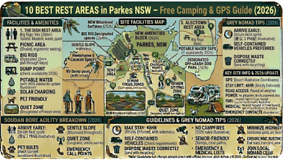
The 10 Best Rest Areas in Parkes NSW — Full Listings with GPS
Below are the 10 best rest areas, free camps and overnight stops in and around Parkes, NSW. Each listing includes GPS coordinates, facilities, road access, suitability for caravans and big rigs, and honest notes about what you’ll actually find on arrival.
1. Currajong Rest Area — Newell Highway
📍 GPS Coordinates
Currajong Rest Area, Newell Highway, south of Parkes NSW 2870
Currajong Rest Area is a highway fatigue stop located on the Newell Highway south of Parkes, making it a convenient pull-off for travellers heading north toward Dubbo or south toward Peak Hill and Narromine. The site is sealed, flat and accessible to large rigs and caravans.
- Facilities: Pit toilets, picnic tables, shaded seating
- Overnight: 20-hour maximum (Transport for NSW rules)
- Surface: Sealed road access, gravel parking area
- Big Rigs: Yes — wide turning area suitable for B-doubles
- Water: No potable water on site
- WiFi: No WiFi; Telstra signal generally adequate
Nearest fuel: Parkes township — approx. 12 km north on the Newell Highway. Multiple service stations available including Ampol and Caltex in town.
More info: Currajong Rest Area — Full Guide on RetireToVanLife
2. Cooke Park — Central Parkes Picnic & Rest Area
📍 GPS Coordinates
Cooke Park, Parkes NSW 2870 — off Bogan Street
Cooke Park is Parkes’ central heritage park — a beautifully maintained green space right in the heart of town. With towering trees, a rotunda, rose gardens, public toilets and picnic facilities, it’s a superb daytime rest stop for grey nomads wanting to stretch their legs, have lunch and feel like a local for an hour.
- Facilities: Flush toilets, BBQ facilities, picnic tables, playground, rose garden, heritage rotunda
- Overnight: Not permitted
- Surface: Fully sealed access via Bogan Street
- Big Rigs: Street parking on Bogan Street — manageable for most caravans with care
- WiFi: Free public WiFi available in the central Parkes CBD area nearby
- Water: Tap water available in park
First-hand: We spent a very pleasant hour at Cooke Park on a mild autumn morning. The rose garden was in full bloom and several other caravanners had done the same — it’s a genuinely lovely spot to recharge before the next leg.
More info: Cooke Park Parkes — Full Guide on RetireToVanLife
3. Memorial Hill Rest Area — Scenic Lookout Over Parkes
📍 GPS Coordinates
Memorial Hill, Parkes NSW 2870 — access via Newell Highway / Hill Street
Memorial Hill is Parkes’ elevated lookout point — a short drive from the town centre that rewards visitors with a panoramic view over the surrounding plains and the town of Parkes itself. A war memorial, interpretive signage and seating make this a meaningful rest stop as well as a scenic one.
- Facilities: Pit toilets, picnic tables, seating, war memorial, interpretive signage
- Overnight: Not generally designated for overnight stays — day use preferred
- Surface: Sealed road to lookout; parking area sealed
- Big Rigs: Tight access road — not recommended for large rigs or caravans; suitable for smaller motorhomes
- Water: No potable water on site
More info: Memorial Hill Rest Area — Full Guide on RetireToVanLife
4. Bumberry Dam — Free Camping & Fishing Spot
📍 GPS Coordinates
Bumberry Dam, Bumberry NSW 2870 — approx. 20 km northwest of Parkes
Bumberry Dam is one of the most popular free camping spots within striking distance of Parkes. Set on a quiet Crown Land reserve around a small dam, it’s used by grey nomads, fishers and travellers looking for a genuinely peaceful overnight stop away from highway noise.
- Facilities: Basic — limited pit toilets at times; bring your own supplies
- Overnight: Free camping historically permitted on Crown Land; verify current rules with Parkes Shire Council (02) 6861 2333
- Surface: Sealed to turnoff, short unsealed section to camping area
- Big Rigs: Small to medium caravans manageable in dry conditions; large rigs not recommended
- Water: No potable water — bring all your own
- Fishing: Permitted on the dam; popular with locals
- WiFi: No WiFi; mobile signal limited — Telstra best option
More info: Bumberry Dam Free Camping — Full Guide on RetireToVanLife
5. Kelly Reserve — Relaxed Riverside Rest Area
Kelly Reserve is a pleasant, low-key reserve on the southern edge of Parkes township — a grassy, shaded rest stop that attracts grey nomads looking for a quiet daytime break within easy reach of town services. It’s a good spot for dog walks and a quiet lunch.
- Facilities: Picnic tables, some shade trees, nearby toilet facilities
- Overnight: Day use preferred; check current council rules for any overnight access
- Surface: Sealed access road; grassy parking area
- Big Rigs: Generally accessible; drive in carefully and check clearance
- Water: Limited — bring your own
More info: Kelly Reserve Parkes — Full Guide on RetireToVanLife
6. Bogan Weir Camping Area — Popular Free Camp Near Peak Hill
📍 GPS Coordinates
Bogan Weir Camping Area, near Peak Hill NSW 2869 — approx. 55 km north of Parkes on the Newell Highway
Bogan Weir is one of the best-known free camps in the Parkes–Dubbo corridor. Located near the Bogan River just off the Newell Highway north of Peak Hill, it’s a genuine grey nomad favourite — shaded, flat and right on the river. Fishing is a drawcard, and the atmosphere is reliably social.
- Facilities: Pit toilets, picnic tables, river access, shade trees
- Overnight: Free camping generally permitted; longer stays tolerated but verify locally
- Surface: Mostly unsealed access tracks near the weir — manageable in dry conditions
- Big Rigs: Medium caravans OK in dry conditions; approach with care on unsealed section
- Water: River water only — not potable; bring your own drinking water
- Fishing: Popular; bring your NSW fishing licence
More info: Bogan Weir Camping Area — Full Guide on RetireToVanLife
7. Escort Rock Rest Area — Historic Gold Rush Stop
📍 GPS Coordinates
Escort Rock Rest Area, Escort Way, south-east of Parkes NSW 2870
Escort Rock is a historic rest area and heritage site on the Escort Way south-east of Parkes. The imposing granite outcrop is deeply connected to the Central West’s 1860s gold rush history, when prospectors camped here on their way to the Forbes goldfields. Interpretive signage tells the story well.
- Facilities: Pit toilets, picnic tables, interpretive signage, short walking track to the rock
- Overnight: 20-hour limit applies (Transport for NSW managed)
- Surface: Sealed access; flat parking area
- Big Rigs: Suitable — wide sealed parking area
- Water: No potable water on site
- Nearest fuel: Parkes — approx. 18 km north-west
More info: Escort Rock Rest Area — Full Guide on RetireToVanLife
8. Wheogo Park — Family-Friendly Rest & Picnic Area
Wheogo Park is a family-oriented picnic and rest area within the Parkes urban area — shaded, grassed and equipped with basic facilities. While primarily a day-use area, it’s a pleasant stop for a meal break, a walk with the dog, or simply a quiet sit-down after driving.
- Facilities: Picnic tables, BBQ facilities, playground equipment, public toilets nearby
- Overnight: Not permitted — day use only
- Surface: Sealed access; grassed parking areas
- Big Rigs: Street parking; manageable for most smaller rigs
- Water: Tap water available
- WiFi: Possible Telstra signal; check before relying on it
More info: Wheogo Park Parkes — Full Guide on RetireToVanLife
9. Lindner Oval Rest Area — Easy Overnight Stop In Town
Lindner Oval is a community sports oval on the edge of Parkes township that has historically been used by grey nomads as an informal overnight stop — particularly during major events like the Parkes Elvis Festival. Access and availability can vary significantly depending on scheduled events and council decisions.
- Facilities: Basic — public toilets nearby; no powered sites
- Overnight: Informal — verify with council first
- Surface: Grassed oval with flat gravel surrounds
- Big Rigs: Generally accessible on sealed perimeter roads
- Walking distance to town: Approx. 10–15 minutes’ walk to Parkes CBD
More info: Lindner Oval Rest Area — Full Guide on RetireToVanLife
10. The Dish (CSIRO Parkes Radio Telescope) — Day Visit & Nearby Camping
📍 GPS Coordinates
CSIRO Parkes Radio Telescope, Telescope Road, Parkes NSW 2870 — approx. 20 km north of Parkes town centre
No visit to Parkes is complete without a stop at The Dish — the iconic 64-metre CSIRO Parkes Radio Telescope, made internationally famous by the 2000 film of the same name and for its role in relaying the Apollo 11 moon landing transmissions. The visitor centre is free to enter and offers one of the best science interpretation experiences in regional Australia.
🔭 The Dish — Visitor Centre
Address: Telescope Road, Parkes NSW 2870 (approx. 20 km north of Parkes on the Newell Highway, then east on Telescope Road)
Entry: Free admission to visitor centre and grounds
Hours: Generally open daily — check CSIRO Parkes website for current hours
Facilities: Visitor centre, café, toilets, gift shop, large parking area for coaches, caravans and motorhomes
Overnight: Camping is not permitted at The Dish — day visit only
- Surface: Fully sealed road from Newell Highway; wide sealed parking area
- Big Rigs: Excellent — large coach and caravan parking area, plenty of room to manoeuvre
- Water: Available at café facilities
- WiFi: Available inside visitor centre
- Nearest fuel: Parkes town centre — approx. 20 km south
How to Get to Parkes + Highway Access
From Sydney (East)
Travel west on the Great Western Highway (A32) through the Blue Mountains — Bathurst — Orange corridor. At Orange, continue west on the Mid-Western Highway or take the more direct route via the Parkes Highway (A32) from Dubbo or connect via the Newell Highway. Total distance from Sydney: approximately 365 km; allow 4–4.5 hours without stops. The highway is fully sealed, dual-lane for most of the journey and suitable for all vehicle types including large motorhomes and caravans.
From Melbourne (South)
Head north on the Calder Highway to Bendigo, then continue north-east toward Hay, then north on the Sturt Highway to West Wyalong, then north-east on the Newell Highway to Parkes. Alternatively, travel north via Albury on the Hume Highway, then west via Wagga Wagga and Forbes to Parkes. Distance: approximately 630 km; allow 7–8 hours. All routes sealed and suitable for caravans.
From Brisbane (North)
Travel south on the Newell Highway (A39) — Australia’s longest inland highway — through Goondiwindi, Moree, Narrabri, Coonabarabran, Dubbo and down to Parkes. Distance: approximately 900 km from Brisbane; allow 9–10 hours over two days. The Newell Highway is fully sealed and widely used by grey nomads and long-haul travellers.
From Broken Hill (West)
Travel east on the Barrier Highway (A32/B83) through Cobar to Nyngan, then south-east on the Newell Highway to Parkes. Alternatively, continue on the Parkes Highway directly east from Nyngan to Parkes. Distance from Broken Hill: approximately 600 km; allow 6–7 hours. Road is sealed throughout.
📍 Parkes Town Centre GPS
Parkes NSW 2870 — town centre reference point
Using our GPS, the easiest access for all rest areas listed in this guide is via the Newell Highway through the Parkes township. We found all main access roads to the listed stops are sealed and manageable for caravans and large motorhomes. The town itself has wide streets and excellent caravan parking near the visitor information centre on Bogan Street.
Road Conditions, Flooding & Unsealed Sections
Main Highway Conditions
The Newell Highway and Parkes Highway through the Parkes area are fully sealed, well-maintained and suitable for all vehicle types. Road trains are common on the Newell Highway — allow plenty of passing distance and never overtake on crests or bends.
Side Roads and Access Tracks
Several of the rest areas and free camps listed in this guide involve short unsealed sections — particularly Bumberry Dam and the Bogan Weir approach track. These are generally manageable for small to medium caravans in dry conditions but can become very slippery and boggy after rain. The same caution applies as to any Central West unsealed road.
Flooding
The Central West of NSW is prone to flooding — particularly the Lachlan River catchment, which passes south of Parkes through Forbes, and the Bogan River catchment further north. During and after significant rainfall events:
- Low-lying rest areas near the Bogan River (e.g. Bogan Weir) may flood
- Some approach roads to free camps may be cut off temporarily
- The Newell Highway itself has flood-prone sections south of Parkes toward Peak Hill and north between Dubbo and Narromine
Always check:
- Live Traffic NSW — livetraffic.com — real-time road conditions and closures
- Bureau of Meteorology — bom.gov.au — weather forecasts and flood warnings
Country Gates — Know the Rules
If accessing any rural property areas or off-highway tracks, observe country gate etiquette at all times:
- If a gate is open — drive through and leave it open
- If a gate is closed — open it, drive through, and close it behind you
- If a gate is closed and locked — do not attempt to open it; it means no access
Fuel Stops Along the Newell & Parkes Highways
Fuel planning is critical when travelling the inland highway network. While Parkes itself has multiple service stations, the stretches between towns on the Newell Highway can be long and remote, particularly heading north toward Narrabri or west toward Cobar.
| Town / Location | Direction from Parkes | Distance from Parkes | Fuel Available | Notes |
|---|---|---|---|---|
| Parkes (town centre) | — | 0 km | Unleaded, Diesel, LPG | Multiple stations; Ampol, Caltex, independent. Use PetrolSpy for best price |
| Peak Hill | North (Newell Hwy) | Approx. 60 km | Unleaded, Diesel | Small town; verify hours before arriving late |
| Dubbo | North (Newell Hwy) | Approx. 107 km | All fuel types | Large regional centre; all major brands available 24/7 |
| Forbes | South-East (Newell Hwy) | Approx. 65 km | Unleaded, Diesel, LPG | Good fuel stop heading south; several stations |
| Orange | East (Mid-Western Hwy) | Approx. 112 km | All fuel types | Large regional city; all major brands available |
| Nyngan | North-West (Barrier Hwy) | Approx. 195 km | Unleaded, Diesel | Last major fuel stop heading west toward Cobar/Broken Hill |
| Condobolin | South-West (Lachlan Valley Way) | Approx. 145 km | Unleaded, Diesel | Fuel up here if heading south-west |
Dump Points Near Parkes
Managing grey water and black water is a practical necessity for long-term travellers. Parkes is well-serviced with dump point access.
| Location | Address | Cost | Notes |
|---|---|---|---|
| Parkes Caravan Park Dump Point | Newell Highway, Parkes NSW 2870 | Gold coin donation or free with stay | Most caravan parks in Parkes offer dump point access |
| Parkes Shire Council Dump Point | Verify location with Council — (02) 6861 2333 | Generally free | Council dump points are available; confirm current location with council |
| Peak Hill (north on Newell) | Peak Hill — approx. 60 km north | Free or gold coin | Check CamperMate for current dump point location |
| Forbes (south-east) | Forbes NSW — approx. 65 km | Free | Good dump point access in Forbes; check CamperMate for exact location |
Free Water Sources in Parkes
- Cooke Park: Tap water available in the park — suitable for filling tanks (potable)
- Parkes Visitor Information Centre: Tap water available — confirm with staff
- Parkes Caravan Parks: Water fill available with a stay or small donation
- Parkes town centre taps: Standard council water points — generally potable mains water
Best Time to Visit Parkes — Month-by-Month Breakdown
Parkes sits in a semi-arid climate zone with hot, dry summers and cool to cold winters. Planning your visit around the season makes a significant difference to comfort and enjoyment.
| Month | Temp Range | Conditions | Grey Nomad Rating |
|---|---|---|---|
| January | 18–36°C | Hot, dry; Elvis Festival (huge crowds) | ⭐⭐⭐ (Elvis fans only) |
| February | 18–35°C | Hot; possible storms; quieter after Elvis | ⭐⭐ |
| March | 14–30°C | Cooling down; pleasant evenings | ⭐⭐⭐⭐ |
| April | 10–25°C | Excellent — warm days, cool nights; ideal | ⭐⭐⭐⭐⭐ |
| May | 7–20°C | Cool and clear; great for touring | ⭐⭐⭐⭐⭐ |
| June | 4–16°C | Cold nights; frost possible; quiet | ⭐⭐⭐ |
| July | 3–15°C | Coldest month; frost common; pack warm | ⭐⭐⭐ |
| August | 4–17°C | Still cool but warming; less frost | ⭐⭐⭐ |
| September | 7–22°C | Spring arriving; beautiful countryside | ⭐⭐⭐⭐ |
| October | 10–26°C | Warm and pleasant; excellent touring | ⭐⭐⭐⭐⭐ |
| November | 13–30°C | Getting warmer; still comfortable | ⭐⭐⭐⭐ |
| December | 16–34°C | Hot; school holidays; crowded | ⭐⭐ |
What to Do Near Parkes — Senior Activity Guide
🔭 CSIRO Parkes Radio Telescope (The Dish)
Free to enter, the visitor centre tells the remarkable story of The Dish — from its construction in 1961 to its role in the Apollo 11 moon landing and modern astronomy research. Suitable for all mobility levels; flat, paved paths throughout. Allow 1.5–2 hours. Café on site.
🌹 Cooke Park Heritage Walk
Parkes’ central park features a lovely self-guided heritage walk through the rose gardens, past the heritage rotunda and through tree-lined pathways. Flat, shaded and very pleasant on a warm morning. Dogs on leads welcome.
⛏️ Escort Rock Historic Site
A short drive south-east of Parkes, Escort Rock marks the route taken by gold rush prospectors in the 1860s. Interpretive signage explains the history, and the natural granite formations are impressive. Short flat walk.
🎶 Parkes Elvis Festival (January)
Held annually in January, the Parkes Elvis Festival is one of Australia’s largest popular music events. The whole town participates — expect costumed performers everywhere, live music, markets and a genuinely good-natured crowd. Book accommodation well in advance if planning to attend.
🐟 Fishing at Bumberry Dam or Bogan Weir
Golden perch (yellowbelly) and catfish are the main catches in the local waterways. A NSW recreational fishing licence is required — available online via the NSW DPI website. Quiet and very popular with grey nomads who enjoy a relaxed morning’s fishing.
🛍️ Parkes Markets and CBD
The Parkes CBD has a good range of independent shops, cafés, bakeries and supermarkets. The Parkes Farmer’s Market (check local event listings for dates) is worth a visit for fresh produce and local goods.
🌄 Memorial Hill Lookout
For a panoramic view over the plains of Central West NSW, the short drive up Memorial Hill is worth it. Sunrise and sunset are the best times to visit for photographers.
Wildlife — Birds, Reptiles & What to Watch For
The Central West’s open farmland, creek lines and remnant bush around Parkes support a surprisingly diverse range of wildlife. Grey nomads who take the time to look will be rewarded.
Birds
- Emus — frequently seen near Bumberry Dam and along rural roadsides; approach with caution when driving
- Galahs, sulphur-crested cockatoos, corellas — common throughout the region, particularly in and around town
- Wedge-tailed eagles — often seen circling above the plains; occasionally seen on roadsides feeding on carrion
- Superb parrots and inland thornbills — present in remnant eucalypt woodland around Bumberry and Bogan Weir
Reptiles
- Eastern brown snake — one of Australia’s most venomous; present throughout the region. Always watch where you step, particularly around logs, rocks and long grass
- Red-bellied black snake — near waterways including Bumberry Dam and Bogan Weir
- Bearded dragons and blue-tongue lizards — common and harmless; often seen sunning on roads
Kangaroos and Wallabies
Eastern grey kangaroos are abundant throughout the Central West. Dawn and dusk driving is particularly hazardous — kangaroos move onto roads and cannot be predicted. Reduce speed significantly in the hour before and after sunrise and sunset, and never swerve to avoid an animal if it puts you at risk.
Full Facilities Comparison Table — All 10 Parkes Rest Areas
| Rest Area | Toilets | Picnic Tables | Water | BBQ | Overnight | Big Rigs | Cost |
|---|---|---|---|---|---|---|---|
| Currajong Rest Area | ✅ Pit | ✅ | ❌ | ❌ | ✅ 20hr | ✅ | Free |
| Cooke Park | ✅ Flush | ✅ | ✅ | ✅ | ❌ Day only | ⚠️ Limited | Free |
| Memorial Hill | ✅ Pit | ✅ | ❌ | ❌ | ⚠️ Day preferred | ⚠️ Small only | Free |
| Bumberry Dam | ⚠️ Basic/seasonal | ⚠️ Limited | ❌ | ❌ | ✅ Free camp | ⚠️ Dry only | Free |
| Kelly Reserve | ✅ Nearby | ✅ | ⚠️ Limited | ❌ | ⚠️ Verify council | ✅ | Free |
| Bogan Weir | ✅ Pit | ✅ | ❌ Potable | ❌ | ✅ Free camp | ⚠️ Dry only | Free |
| Escort Rock | ✅ Pit | ✅ | ❌ | ❌ | ✅ 20hr | ✅ | Free |
| Wheogo Park | ✅ Nearby | ✅ | ✅ | ✅ | ❌ Day only | ⚠️ Limited | Free |
| Lindner Oval | ✅ Nearby | ❌ | ❌ | ❌ | ⚠️ Verify council | ✅ | Free/Donation |
| The Dish (CSIRO) | ✅ Flush | ✅ | ✅ Café | ❌ | ❌ Day only | ✅ Excellent | Free entry |
Caravan Parks — Paid Alternatives in Parkes
When the free camps are full, you need a powered site, or you simply want a proper shower and dump point, Parkes has several caravan park options in and near the town.
| Name | Type | Approx. Cost (2026) | Facilities | Notes |
|---|---|---|---|---|
| Parkes Motor Village | Caravan Park | $35–$55/night powered | Powered sites, camp kitchen, showers, dump point | Newell Highway; convenient for passing through |
| Parkes Showground | Showground / Donation | Donation-based / low fee | Basic — verify facilities with showground committee | Contact Parkes Showground directly; access varies with events |
| Peak Hill Caravan Park | Caravan Park | $25–$40/night powered | Powered sites, amenities block | 60 km north on Newell Hwy — good budget option |
| Forbes Caravan Park | Caravan Park | $35–$50/night powered | Full facilities | 65 km south-east — Forbes is a lovely town to spend a night |
Free campsites and powered sites fill fast during school holidays and peak season — especially during the Elvis Festival in January. If your preferred site is already gone, search remaining accommodation options below.
Accommodation and flight search powered by Expedia. Booking through this search supports this website at no extra cost to you. As an affiliate, I earn from qualifying purchases at no extra cost to you.
🗺️ Vanlife Savings Spots — Save Every Stop on the Interactive Map
Use the interactive map below to find and save every rest area, free camp and overnight stop around Parkes and the broader Central West highway network. Save your favourite spots, add pins and get directions — all in one place built specifically for grey nomads and vanlifers.
COPY PROMPT ➔ ASK AI ➔ SAVE TO FORM ➔ ADD SPOT PIN ➔ GET DIRECTIONS
📍 Interactive map — find free camps, rest areas and overnight stops around Parkes NSW. Enable location for best results.
📍 Parkes Rest Area GPS Coordinates & Postcodes — Save Every Stop
| Rest Area / Stop | Postcode | Latitude | Longitude | Overnight? | Nearby WiFi |
|---|---|---|---|---|---|
| Currajong Rest Area | 2870 | -33.0820 | 148.1920 | ✅ 20hr | Limited — Telstra |
| Cooke Park | 2870 | -33.1368 | 148.1693 | ❌ Day only | CBD WiFi nearby |
| Memorial Hill | 2870 | -33.1278 | 148.1745 | ⚠️ Day preferred | Limited |
| Bumberry Dam | 2870 | -33.0215 | 148.1033 | ✅ Free camp | None |
| Kelly Reserve | 2870 | -33.1450 | 148.1600 | ⚠️ Verify council | Limited |
| Bogan Weir | 2869 | -32.7241 | 148.1930 | ✅ Free camp | None |
| Escort Rock | 2870 | -33.2050 | 148.2210 | ✅ 20hr | None |
| Wheogo Park | 2870 | -33.1320 | 148.1780 | ❌ Day only | Limited |
| Lindner Oval | 2870 | -33.1260 | 148.1830 | ⚠️ Verify council | Limited — Telstra |
| The Dish (CSIRO) | 2870 | -32.9994 | 148.2635 | ❌ Day only | ✅ Visitor centre WiFi |
Phone Signal & Emergency Communications in Parkes
Mobile Coverage
- Parkes town centre: Telstra, Optus and Vodafone all have coverage in town; Telstra is strongest in the region
- Newell Highway (main corridor): Generally good Telstra coverage with occasional black spots between towns
- Bumberry Dam: Mobile signal is weak to non-existent — Telstra 3G/4G may connect intermittently
- Bogan Weir: Limited coverage — do not rely on mobile phone for emergency contact here
- The Dish: Good signal in the visitor centre and surrounding area
Emergency Contacts
- Emergency (Police, Ambulance, Fire): 000
- Parkes District Hospital: (02) 6862 2222
- Parkes Police: (02) 6861 5799
- NSW SES (flood/storm): 132 500
- NRMA Roadside Assistance: 13 11 22
- Live Traffic NSW: 132 701 or livetraffic.com
Campfires, Cooking & Food Near Parkes
Campfire Rules
Open campfires are subject to NSW fire regulations. During Total Fire Ban days — which are declared by the NSW Rural Fire Service during hot, windy and dry conditions — all open fires, including wood campfires, are prohibited throughout the affected area. Penalties for breaching a fire ban are significant.
- Gas cookers: Permitted at all times including Total Fire Ban days (with appropriate design)
- Electric BBQs (where provided): Permitted — available at Cooke Park and Wheogo Park
- Open wood fires at free camps: Permitted when no ban is in force; use existing fire rings if present; never leave unattended; extinguish completely
- At Bumberry Dam / Bogan Weir: Bring your own firewood — do not collect wood from the surrounding area
Food Shopping in Parkes
- Woolworths Parkes: Full supermarket — Clarinda Street, Parkes
- IGA Parkes: Available in town for top-up supplies
- Parkes Bakeries: Several excellent bakeries in town — stock up on fresh bread and pies before heading to remote camps
- Parkes pub meals: Several hotels/pubs serve affordable counter meals — ideal for a night off cooking
Pets at Parkes Rest Areas
- Currajong Rest Area: Pets on leads permitted
- Cooke Park: Dogs on leads permitted; excellent grassy areas for a walk
- Memorial Hill: Dogs on leads permitted
- Bumberry Dam: Pets permitted — keep on lead near water to avoid disturbing wildlife and for snake safety
- Kelly Reserve: Dogs on leads welcome
- Bogan Weir: Pets on leads permitted; keep away from river banks for safety
- Escort Rock: Pets on leads permitted
- The Dish (CSIRO): Pets are generally not permitted inside the visitor centre; check with staff on arrival
Accessibility for Seniors with Mobility Limitations
| Rest Area | Wheelchair Accessible? | Accessible Toilet? | Flat Terrain? | Notes |
|---|---|---|---|---|
| Cooke Park | ✅ Yes | ✅ Yes | ✅ Mostly flat | Best accessibility of all Parkes stops |
| The Dish (CSIRO) | ✅ Yes | ✅ Yes | ✅ Flat paved paths | Excellent disabled access throughout |
| Currajong Rest Area | ⚠️ Limited | ⚠️ Pit toilet only | ✅ Flat | Gravel surface; pit toilet only |
| Wheogo Park | ✅ Generally | ✅ Nearby | ✅ Flat grass | Flat grassed area; manageable for most mobility levels |
| Memorial Hill | ⚠️ Partial | ⚠️ Basic | ❌ Some incline | Short incline to lookout; view partially accessible from car park |
| Bumberry Dam | ❌ Limited | ⚠️ Basic/seasonal | ⚠️ Uneven | Unsealed, uneven surface — not suitable for wheelchairs |
| Escort Rock | ⚠️ Partial | ⚠️ Pit toilet | ✅ Flat parking | Rock walk itself has some rough terrain |
Camping Etiquette, Permits & Waste Management
General Etiquette
- Arrive and set up quietly — other travellers may have arrived before you and be resting
- Respect quiet hours — generally 10pm to 7am
- Pack out all rubbish — many free camps have no waste collection bins
- Do not block access tracks with your vehicle or awning
- Leave the site cleaner than you found it — a golden rule of grey nomad travel
- Do not monopolise shade trees for long periods if others are waiting
Waste Management
- Use designated dump points for grey and black water — never dump near waterways
- Carry all rubbish to the nearest town bin or waste facility
- At Bumberry Dam and Bogan Weir — there are no rubbish bins; take all waste with you
- Human waste: use proper chemical toilet or carry waste out; do not bury waste near waterways
Camping Permits
No formal permit is required for the NSW roadside rest areas listed in this guide (up to the 20-hour maximum). For extended stays at Crown Land sites like Bumberry Dam, contact Parkes Shire Council on (02) 6861 2333 to confirm current rules and whether any registration or fee applies.
Emergency Scenarios — What to Do
Medical Emergency
Call 000 immediately. State your location using the GPS coordinates from this guide — emergency services operators can use these coordinates to dispatch help. Parkes District Hospital: (02) 6862 2222 — Sturt Street, Parkes.
Vehicle Breakdown on Highway
Move your vehicle off the road if safe to do so. Turn on hazard lights. Place warning triangles if you carry them. Call NRMA Roadside Assistance: 13 11 22. Stay with your vehicle during daylight hours — it is more visible than you are. If you must leave the vehicle, leave a note with your intended direction and time.
Flood or Road Cut-Off
Never drive through floodwater — even shallow water can sweep a vehicle off a road. If you arrive at a flooded section, turn around and wait for the water to recede or find an alternate route. Check livetraffic.com and call 132 701 for road condition updates.
Bogged Vehicle
If bogged on an unsealed track (e.g. approach to Bumberry Dam after rain), do not spin wheels — this makes it worse. Use recovery boards if you carry them, or call for assistance. Let someone know your location before heading onto unsealed tracks.
Packing List for This Section of Highway
- Minimum 20L drinking water per person (for remote camps)
- Full fuel tank before leaving Parkes in any direction
- First aid kit including snake bite bandages
- Personal Locator Beacon (PLB) — registered with AMSA
- Recovery boards and tow rope (for unsealed camp access)
- Torch and spare batteries
- Portable gas cooker and sufficient gas cylinders
- Rubbish bags — pack out everything from remote camps
- Portable solar panel or generator for off-grid power
- Portable WiFi device (Telstra recommended for this region)
- Paper maps or downloaded offline maps (roads away from highways)
- NSW fishing licence (if planning to fish at Bumberry or Bogan Weir)
- Dog lead and water bowl (for pet owners)
- Warm bedding — winter nights in the Central West can drop to 3°C
- Sun protection — hat, sunscreen, sunglasses
- Insect repellent — flies and mosquitoes can be significant near water
- Chemical toilet (for sites with no toilet facilities)
- Dump point hose and fittings
5 More Rest Areas Near Parkes on the Highway Network
- Trundle Rest Area — approx. 60 km east of Parkes on the Bogan Way; basic roadside stop with pit toilet; suitable for large vehicles; 20-hour limit
- Peak Hill Rest Area — approx. 60 km north on the Newell Highway; good daytime stop between Parkes and Dubbo; fuel available in Peak Hill township
- Forbes Rest Area (Lachlan Valley Way) — approx. 65 km south-east; sealed access, pit toilets; good stop heading toward the Riverina
- Condobolin Rest Area — approx. 145 km south-west on the Lachlan Valley Way; flat sealed stop with toilet; suitable for all vehicles
- Narromine Rest Area — approx. 140 km north on the Newell Highway; well-maintained Transport for NSW stop; sealed, suitable for big rigs; 20-hour limit
Senior Safety Checklist — On and Off the Road
- Told someone your route and expected arrival time
- Checked Live Traffic NSW for road closures on your planned route
- Checked BOM weather forecast for fire danger and storm risk
- Fuel tank at least half full before departing any town
- Water supply checked — minimum 20L potable water in tank
- Medications packed and accessible (not in locked rear storage)
- First aid kit checked and restocked if necessary
- Phone charged — power bank available as backup
- GPS coordinates for tonight’s stop entered in device
- Emergency contacts list accessible (not only on phone)
- Caravan/van checked — tyres, lights, hitch security
- Rest planned — no more than 2 hours driving without a 15-minute break
- Dog secured safely (if travelling with pets)
- Campfire ban status checked (if planning to use a fire tonight)
- Dump point used before heading to remote camp with no facilities
Reviews — What Grey Nomads Say About Parkes Rest Areas
“We’ve stopped at Parkes four times now on our way between Brisbane and Melbourne, and it never disappoints. The Currajong rest area is easy to find on the Newell and gives us a comfortable 20-hour break. Always clean enough and the pit toilets are maintained.”
“Bumberry Dam is our absolute favourite free camp near Parkes. We spent two nights there last May — completely quiet, watched the stars, caught a couple of yellowbelly. The access road was fine with our 20ft van. No water on site so bring your own.”
“Spent a morning at Cooke Park — lovely old trees and the rose garden was beautiful. Great for walking the dog and having a picnic. You can’t stay overnight but as a daytime rest stop it’s one of the best we’ve found in regional NSW.”
“The Dish is a MUST if you’re passing through Parkes. Free entry, great café, plenty of room to park the rig. We spent two hours there and could have stayed longer. Book into Parkes Motor Village overnight and do The Dish in the morning — perfect combination.”
“Bogan Weir was lovely on a clear day but check the weather — we had light rain and the track in got a bit hairy. Would only recommend for small to medium vans in dry conditions. The fishing is great though.”
What Other Websites Don’t Tell You About Parkes Rest Areas
- The 20-hour limit is enforced — while enforcement is not constant, Transport for NSW does inspect rest areas. Do not assume you can extend your stay indefinitely without consequence.
- Bumberry Dam’s access road changes seasonally — what was gravel in autumn may be rutted clay in winter or after summer storms. The GPS will get you close but the last 500m requires local knowledge.
- The Elvis Festival changes everything — if you’re planning to visit Parkes in January without knowing about the festival, you may be in for a surprise. The town fills to capacity and prices spike. Plan well ahead or avoid the first two weeks of January.
- The Dish can be closed for maintenance periods — always check the CSIRO website before making it a specific day trip destination.
- Parkes has excellent free WiFi in parts of the CBD — useful for downloading maps and checking emails before heading to remote camps.
- Road train frequency on the Newell — the Newell Highway carries significant heavy vehicle traffic including road trains. When pulling back onto the highway from a rest area, wait for a clear gap — road trains cannot stop quickly.
Frequently Asked Questions — Parkes Rest Areas
Can I camp overnight at Parkes rest areas for free?
Yes — several options exist. Roadside rest areas managed by Transport for NSW (such as Currajong and Escort Rock) allow a 20-hour maximum stay at no cost. Free camping for longer periods is available at Crown Land sites such as Bumberry Dam, subject to verification with Parkes Shire Council.
Is Bumberry Dam suitable for large caravans?
Bumberry Dam is suitable for small to medium caravans in dry weather conditions. The access road includes an unsealed section that can become very slippery after rain. Large caravans and fifth-wheelers should approach with caution and verify conditions before arriving.
Where is the nearest dump point to Parkes?
There are dump points available at Parkes caravan parks and through Parkes Shire Council. Use CamperMate.com.au to find the most current dump point location in or near Parkes.
How far is it from Parkes to Dubbo on the Newell Highway?
Parkes to Dubbo is approximately 107 km north on the Newell Highway — approximately 1 hour 10 minutes’ drive time without stops. Fuel is available at Peak Hill (approx. 60 km from Parkes) and in Dubbo.
Does the Newell Highway flood near Parkes?
The Newell Highway can flood at low-lying sections during and after significant rainfall events. The Bogan River crossing north of Peak Hill and sections near Narromine are known flood-risk areas. Always check livetraffic.com before travelling after heavy rain.
Is The Dish (CSIRO Parkes Radio Telescope) free to visit?
Yes — entry to the CSIRO Parkes Radio Telescope visitor centre and grounds is free of charge. A café is available on site. Camping is not permitted at The Dish. Check the CSIRO website for current opening hours before visiting.
What is the best free camp near Parkes for grey nomads?
Bumberry Dam is generally regarded as the best free camping option near Parkes — quiet, scenic and with fishing access. Bogan Weir (north near Peak Hill) is a close second. Both require self-sufficiency with water and are best visited in dry weather.
Are there powered sites near Parkes?
Yes — Parkes Motor Village and other caravan parks in the Parkes area offer powered sites. Costs vary by season — expect approximately $35–$55 per night for a powered site. Book ahead during the Elvis Festival in January.
⚡ Quick-Reference Card — Parkes Rest Areas 2026
| Best Free Camp | Bumberry Dam (overnight, free, fishing) or Bogan Weir (north near Peak Hill) |
| Best Day Stop | Cooke Park (central, facilities) or The Dish (CSIRO, free entry) |
| Overnight Rest Area | Currajong Rest Area or Escort Rock (20hr limit, free) |
| Paid Option | Parkes Motor Village — approx. $35–$55/night powered |
| Nearest Fuel (N) | Peak Hill ~60 km, Dubbo ~107 km |
| Nearest Fuel (S) | Forbes ~65 km, West Wyalong ~160 km |
| Nearest Fuel (E) | Orange ~112 km |
| Nearest Fuel (W) | Nyngan ~195 km |
| Nearest Hospital | Parkes District Hospital — (02) 6862 2222 |
| Council Contact | Parkes Shire Council — (02) 6861 2333 |
| Road Conditions | livetraffic.com | 132 701 |
| Weather | bom.gov.au |
| Dump Points | campermate.com.au |
| Fuel Prices | petrolspy.com.au |
| Emergency | 000 |
📍 Parkes Rest Area & Camping Network — All Known Stops
If you’re travelling through Parkes in regional New South Wales, these rest areas and camping spots form a convenient network of free and low-cost stops. Located along key inland routes, they are popular with caravanners, grey nomads, and road trippers exploring the Central West region.
- Currajong Rest Area — convenient highway stop
- Cooke Park — central Parkes rest and picnic area
- Memorial Hill Rest Area — scenic lookout over Parkes
- Bumberry Dam — quiet camping and fishing spot
- Kelly Reserve — relaxed riverside stop
- Bogan Weir Camping Area — popular free camp near Peak Hill
- Escort Rock Rest Area — historic gold rush stop
- Wheogo Park — family-friendly rest and picnic area
- Lindner Oval Rest Area — easy overnight stop in town
Travelling from the USA? RV LIFE Trip Wizard is a USA-based RV trip planning tool
RV LIFE Trip Wizard is designed specifically for North American RV travellers — it’s a USA-based tool with routing, campground finding and weight rating checks built for US roads and campgrounds. Australian grey nomads visiting this page from the USA may find it useful for planning their home-country RV adventures.

As an affiliate, I earn from qualifying purchases at no extra cost to you.
Travelling solo or overnight in your van? Protect your rig with a StarterStopper vehicle immobiliser.
Exclusive Offer: Get 5% OFF all StarterStopper immobiliser products with promo code: RTV5
Visit StarterStopper.com to see our data-backed security solutions
As an affiliate, I earn from qualifying purchases at no extra cost to you.
© 2026 RetireToVanLife.com — All rights reserved. Written for Senior Grey Nomads. Safe travels. 🚐