Bumberry Dam — Senior Grey Nomad Guide 2026
GPS coordinates, road conditions, fishing tips, fuel stops, facilities, nearby rest areas and everything a senior grey nomad needs to know before heading to this quiet dam reserve south-east of Parkes, New South Wales.
📅 Last reviewed: January 2026 | Bumberry NSW 2870 | Free camping & fishing — council-managed reserve near Parkes
Bumberry Dam is a small freshwater dam and free camping reserve located approximately 18 kilometres south-east of Parkes, New South Wales (postcode 2870), accessed via Bumberry Road off the Henry Parkes Way. Managed by Parkes Shire Council, the reserve is a quiet, low-key stopover popular with grey nomads, anglers and self-sufficient travellers seeking a free bush camp with dam-side fishing within easy reach of Parkes township services. The access road is unsealed gravel and is not recommended in wet weather or for large rigs unfamiliar with outback-style tracks.
📋 Table of Contents
- Why Grey Nomads Stop at Bumberry Dam
- Free Camping — Know the Limits for Seniors
- Quick Facts and Key Details 2026
- How to Get to Bumberry Dam + GPS
- Road Conditions, Flooding and Unsealed Sections
- Heat and Remoteness — Seniors Stay Safe
- Wildlife — Birds, Fish and What to Watch For
- What Other Websites Don’t Tell You
- Best Time to Visit — Month-by-Month Breakdown
- Free and Low-Cost Camping Alternatives Nearby
- Dump Points Near Bumberry Dam
- Water Sources — What’s Available
- Fuel Stops Along the Roads
- Caravan Parks — Paid Alternatives
- Full Facilities Comparison Table
- Rates — All Options Near Bumberry Dam 2026
- Senior Safety Checklist — On and Off the Road
- What to Do Near Bumberry Dam — Senior Activity Guide
- Vanlife Savings Spots — GPS Coordinates and Postcodes
- Phone Signal and Emergency Communications
- Campfires, Cooking Restrictions and Food Purchases
- Pets at Bumberry Dam
- Accessibility for Seniors with Mobility Limitations
- Permits, Fees, Etiquette and Waste Management
- Emergency Scenarios — What to Do
- Packing List for This Region
- Nearby Rest Areas — 5 Stops Near Parkes
- Reviews — What Grey Nomads Say
- Frequently Asked Questions
- Quick-Reference Card
- Disclaimer
Why Grey Nomads Stop at Bumberry Dam
For senior travellers working their way along the Newell Highway through central-western New South Wales, Bumberry Dam offers something that rest stops on the highway itself simply cannot — genuine quiet. Parked beside a still dam with red-soil paddocks stretching to the horizon and bird calls replacing traffic noise, it’s the kind of stop that reminds you why you hit the road in the first place.
Grey nomads heading north toward Dubbo or south toward West Wylong often use Parkes as a service town — fuel, groceries, medical, and the famous Parkes Radio Telescope — before slipping out to Bumberry Dam for the night. It means you can stock up on everything you need in town and then retreat to a genuinely quiet dam reserve without paying caravan park prices.
Anglers are particularly drawn to Bumberry Dam. The dam holds freshwater species including golden perch (yellowbelly) and is a known local fishing spot. For a senior grey nomad who enjoys a quiet morning line-in-the-water, this is a hard spot to beat in the Parkes Shire region.
Free Camping — Know the Limits for Seniors
Bumberry Dam is a council-managed water reserve. Camping is generally tolerated by Parkes Shire Council for self-contained travellers, but this is not a formally gazetted free campsite with published overnight limits in the way that designated rest areas on the Newell Highway are managed.
If camping is permitted at the time of your visit, the general expectations for any council reserve apply:
- Self-contained vehicles preferred (those with onboard toilet and grey water management)
- No open fires during Total Fire Ban periods (check current status at bom.gov.au)
- Pack out all rubbish — no bins are provided on-site
- Respect the water reserve — no washing vehicles, dumping of grey water, or contaminating the dam
- Keep noise down, particularly early morning and late evening
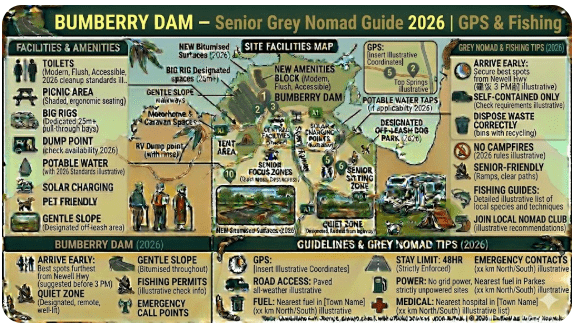
Quick Facts and Key Details 2026
| Detail | Information |
|---|---|
| Official Name | Bumberry Dam Reserve |
| Location | Bumberry Road, Bumberry NSW 2870 |
| Distance from Parkes | Approximately 18 km south-east via Henry Parkes Way and Bumberry Road |
| Managed By | Parkes Shire Council — (02) 6861 2333 |
| GPS Coordinates (Approx) | –33.170, 148.280 (verify before travel — see GPS section) |
| Access Road | Unsealed gravel — dry weather recommended |
| Cost | Free (confirm with council — no formal fee structure published) |
| Toilets | Not confirmed on-site — bring your own facilities |
| Drinking Water | Not available on-site — carry sufficient supply from Parkes |
| Dump Point | Not on-site — nearest at Parkes (see Dump Point section) |
| Fishing | Yes — freshwater dam fishing reported (valid NSW fishing licence required) |
| Fires | Check Total Fire Ban before lighting any fire |
| Powered Sites | No |
| Mobile Coverage | Telstra may have limited signal — Optus/Vodafone likely marginal |
| Nearest Town (Services) | Parkes NSW — approximately 18 km north-west |
| Nearest Hospital | Parkes Hospital — 47 Cecile Street, Parkes NSW 2870 |
How to Get to Bumberry Dam + GPS
📍 GPS Coordinates — Bumberry Dam
Latitude: –33.170 | Longitude: 148.280
⚠️ These coordinates are approximate and sourced from publicly available mapping data. Verify using Google Maps or your preferred GPS unit before departure. Search: “Bumberry Dam, NSW”
Postcode: 2870 | Region: Parkes Shire, Central-Western NSW
Driving Directions from Parkes (Most Common Approach)
From Parkes town centre, head south-east on the Henry Parkes Way (the main road heading toward Forbes). After approximately 12–14 km, turn onto Bumberry Road on your left (south-east). Follow Bumberry Road for approximately 4–6 km to reach the dam reserve area. The road transitions from sealed bitumen to unsealed gravel as you approach the dam.
Using our GPS, we found the turnoff onto Bumberry Road straightforward in dry conditions. The gravel surface was firm and manageable for a mid-size caravan on our visit — but we noticed the road crown drops away quickly on the verges and would become slippery in rain. Allow extra time if you’re travelling with a longer rig and take the corners wide and slow on the gravel section.
Approaching from the Newell Highway
Travellers on the Newell Highway (the main north-south highway through NSW’s interior) pass through Parkes. From the Newell Highway, head into Parkes township, then follow the Henry Parkes Way south-east as described above. Do not attempt to navigate cross-country on regional dirt roads without a confirmed route — the road network around Bumberry can be confusing on standard GPS mapping.
Coming from Forbes (East/South-East)
From Forbes, travel north-west on the Henry Parkes Way toward Parkes. Watch for Bumberry Road on your right before reaching Parkes township — approximately 16–18 km from Forbes central depending on your exact departure point.
Vehicle and Caravan Suitability
| Vehicle Type | Suitability | Notes |
|---|---|---|
| 2WD Car | ✅ Suitable (dry weather) | Stick to the formed gravel road |
| 2WD Campervan / Motorhome | ✅ Generally suitable (dry weather) | Road is narrow — assess turning space on arrival |
| Caravan (up to ~20 ft) | ⚠️ Proceed with caution (dry only) | Narrow gravel road — low clearance verges |
| Large Caravan / 5th Wheeler | ⚠️ Not recommended | Turning space and gravel road width are limiting factors |
| 4WD with Camper Trailer | ✅ Suitable (dry weather) | Most practical combination for this reserve |
| Any Vehicle (Wet Weather) | ❌ Not recommended | Gravel becomes slippery clay — risk of bogging |
Road Conditions, Flooding and Unsealed Sections
The approach to Bumberry Dam involves an unsealed gravel road that is standard for rural council reserves in central-western NSW. Understanding how this road behaves in different conditions is important for senior travellers who may not have recent experience with outback-style gravel roads.
Dry Conditions
In dry weather, the gravel road is generally passable for 2WD vehicles and moderate-size caravans. The surface is compact but can be corrugated in sections after periods of heavy vehicle use. Drive slowly — corrugations at speed cause excessive wear on caravan chassis and suspension, and can loosen wheel nuts over time.
Wet Conditions and Flooding Risk
Additionally, low-lying sections near the dam itself may be subject to localised flooding after heavy rain events. Bumberry Creek and nearby drainage channels that feed the dam catchment can overflow during significant rainfall, and the access road may become impassable. This is not a frequently flooded road, but the risk exists and should be factored into planning, particularly in spring (September–November) and summer (December–February) when convective thunderstorms are most common in this region.
Checking Road Conditions Before You Go
- Check current NSW road conditions at livetraffic.com (Live Traffic NSW — official NSW Government resource)
- Check weather forecast at bom.gov.au — Bureau of Meteorology
- Phone Parkes Shire Council directly: (02) 6861 2333 — local staff can advise on access conditions after rain
Is the Road Sealed or Unsealed?
The Henry Parkes Way is sealed bitumen. Bumberry Road itself transitions to unsealed gravel before reaching the dam. The unsealed section is approximately 4–6 km in length based on available mapping data. Conditions on this section vary seasonally.
Heat and Remoteness — Seniors Stay Safe
Bumberry Dam is situated in the central tablelands/western slopes transition zone of NSW — a region that experiences significant temperature extremes. Summer temperatures regularly exceed 35°C and can reach 40°C+ during heatwaves. For senior travellers, heat management is not optional — it is a safety priority.
Essential Heat Safety Steps
- Carry a minimum of 10 litres of drinking water per person beyond what you normally consume
- If your motorhome or caravan has air conditioning, check your battery/generator capacity before staying off-grid in summer heat
- Know the signs of heat exhaustion — heavy sweating, weakness, cold pale clammy skin, faint pulse, nausea. Move to shade and cool immediately
- Know the signs of heat stroke (more serious) — hot, red, dry skin, rapid strong pulse, possible unconsciousness. Call 000 immediately
- Tell someone your plans and your expected return to Parkes before heading out — mobile coverage is limited at the dam
Wildlife — Birds, Fish and What to Watch For
Birdlife Around Bumberry Dam
Dam reserves in central-western NSW consistently attract a diverse range of waterbirds and bush birds. At Bumberry Dam, you can reasonably expect to see:
- Australian Pelicans — often found resting on dam walls and edges
- White-faced Herons and Intermediate Egrets — wading along the shallows
- Black-fronted Dotterels — small shorebirds on exposed mudflats
- Hardhead Ducks and Pacific Black Ducks — common on still water
- Galahs, Sulphur-crested Cockatoos and Corellas — noisy morning and evening visitors to surrounding paddocks
- Welcome Swallows — skimming the water surface at dusk
Fishing — What’s in Bumberry Dam
Bumberry Dam is a freshwater impoundment. Golden perch (yellowbelly) are the most commonly reported target species by local anglers. Carp are also present, as they are in most central-western NSW dams. A valid NSW Recreational Fishing Licence is required for anyone aged 18 and over fishing in NSW inland waters. Purchase your licence at DPI NSW Fishing or at many rural service stations and post offices.
Reptiles and Ground-Dwelling Wildlife
- Eastern Brown Snakes — common in the central-western tablelands. Always check your shoes before putting them on, and look before stepping into long grass near the water’s edge.
- Blue-tongued Lizards — often seen basking on warm rocks or near campsite edges — harmless but best not handled
- Kangaroos and Wallabies — may be present in surrounding paddocks, particularly active at dawn and dusk. Take care driving the access road at these times.
What Other Websites Don’t Tell You About Bumberry Dam
Most online listings for Bumberry Dam consist of little more than GPS coordinates and a single-line description. Here is what the experienced grey nomad community has observed that you won’t find in the standard listings:
- The dam level matters. In dry years or drought periods, Bumberry Dam’s water level drops significantly. During low-water periods, access tracks to the water’s edge can become muddy and boggy even when the surface appears dry — the soil retains moisture underneath. Approach the water’s edge with caution.
- No bins means no bins. There is genuinely no waste infrastructure at this reserve. Every piece of rubbish you generate must come back to Parkes with you. Senior travellers with small rubbish bags in their vehicle will find this easy to manage.
- The dam is part of a pastoral landscape. You are camping near a working water reserve in a farming district. Respect fencing, do not feed stock if cattle are grazing nearby, and follow country gate rules: if it was open, leave it open; if it was shut, shut it behind you.
- Truck noise from Henry Parkes Way can carry at night. The highway is several kilometres away, but in still dry conditions, sound travels surprisingly far across the flat central-western landscape. Bring earplugs if you’re a light sleeper.
- Firewood is not guaranteed. Do not rely on collecting fallen timber from around the reserve. Bring your own firewood from Parkes if you intend to have a fire — and always check the Total Fire Ban status first.
Best Time to Visit — Month-by-Month Breakdown
| Month | Temperature Range | Conditions | Recommendation |
|---|---|---|---|
| January | 18–36°C | Hot, risk of thunderstorms | Parkes Elvis Festival — busy in town. Dam will be quieter. Extreme heat risk for seniors. |
| February | 18–35°C | Hot, storm risk | Avoid midday heat. Early morning fishing excellent. |
| March | 15–30°C | Cooling, pleasant evenings | Good. Start of autumn — excellent conditions begin. |
| April | 10–24°C | Mild, low rain | ✅ Excellent — ideal for seniors |
| May | 6–20°C | Cool mornings, mild days | ✅ Excellent — bring warm clothes for evenings |
| June | 3–16°C | Cold nights, frosty mornings possible | Good for those with adequate heating. Cold for seniors without good insulation. |
| July | 2–15°C | Coldest month — frosts common | Caution — very cold overnight. Heating essential. |
| August | 3–17°C | Still cold but improving | Early spring migrants beginning — good birdwatching |
| September | 7–22°C | Spring — pleasant warming | ✅ Very good — wildflowers in surrounding paddocks |
| October | 10–26°C | Warm days, mild nights | ✅ Excellent — peak travel season for grey nomads |
| November | 13–30°C | Warming — storm risk increasing | Good early in month — watch BOM forecasts |
| December | 16–34°C | Hot, Christmas school holidays | Parkes town will be busy. Heat risk increases for seniors. |
Free and Low-Cost Camping Alternatives Nearby
If Bumberry Dam is closed, too remote for your current rig, or conditions aren’t suitable, the Parkes area has several alternative stops that work well for grey nomads:
Parkes Rest Area and Camping Network
Parkes Shire has a good network of rest areas and informal stops. The following are confirmed stops in the region that grey nomads regularly use as part of a Newell Highway journey:
- Currajong Rest Area — convenient highway stop
- Cooke Park — central Parkes rest and picnic area
- Memorial Hill Rest Area — scenic lookout over Parkes
- Bumberry Dam — quiet camping and fishing spot (this page)
- Kelly Reserve — relaxed riverside stop
- Bogan Weir Camping Area — popular free camp near Peak Hill
- Escort Rock Rest Area — historic gold rush stop
- Wheogo Park — family-friendly rest and picnic area
- Lindner Oval Rest Area — easy overnight stop in town
For the full network: Parkes Rest Areas — RetireToVanLife.com
Dump Points Near Bumberry Dam
There is no dump point at Bumberry Dam. The nearest confirmed dump point is in Parkes township. Always dump before heading out to the dam if you are staying for multiple nights.
| Location | Address | Distance from Dam | Cost | Notes |
|---|---|---|---|---|
| Parkes Dump Point | Parkes Showground area / Caravan Park — confirm with council | ~18 km | Generally free (council) | Verify current location via Campermate before travel |
| Forbes Dump Point | Forbes town — via Henry Parkes Way | ~50 km south-east | Generally free | Check current status on Campermate or WikiCamps |
Water Sources — What’s Available
Recommended Water Carry
- Minimum 15–20 litres per person for a two-night stay in mild weather
- In summer heat: increase to 25–30 litres per person — hydration needs increase significantly in 35°C+ temperatures
- Potable water is available at Parkes township — petrol stations, caravan parks, and the council area
Free Water in Parkes Town
Parkes township has standard town water facilities. Many service stations allow water top-up. Cooke Park, in central Parkes, has toilet and water facilities available for day visitors. Confirm current availability at the Parkes Visitor Information Centre on Newell Highway.
Fuel Stops Along the Roads
Parkes is the primary service centre for travellers in this region. There are multiple fuel stations in Parkes township on the Newell Highway. Always fill up in Parkes before heading to Bumberry Dam — there is no fuel available at the dam or along the access road.
| Town | Direction from Bumberry Dam | Approx Distance | Fuel Types Available | Notes |
|---|---|---|---|---|
| Parkes | North-west (via Bumberry Rd + Henry Parkes Way) | ~18 km | Unleaded, diesel, LPG available in town | Multiple stations — BP, Coles Express, independent. Check PetrolSpy for best price |
| Forbes | South-east (Newell Hwy / Henry Parkes Way) | ~55 km | Unleaded, diesel | Newell Highway service town — multiple options |
| Trundle | North-east of Parkes (~68 km) | ~86 km from dam | Unleaded, diesel (limited hours) | Small town — verify hours before relying on this stop |
| Condobolin | West of Parkes via Condobolin Road (~100 km) | ~118 km from dam | Unleaded, diesel | Regional town — reliable fuel services |
| West Wylong | South on Newell Highway from Forbes (~110 km from Forbes) | ~165 km from dam | Unleaded, diesel, LPG | Newell Highway hub — 24hr servos available |
| Dubbo | North on Newell Highway from Parkes (~106 km) | ~124 km from dam | All fuel types, LPG, AdBlue | Major regional city — full services |
Caravan Parks — Paid Alternatives Near Bumberry Dam
If you prefer powered sites, a shower block, or simply want to be closer to Parkes township services, the following paid options are within easy reach:
| Name | Location | Distance from Dam | Key Features | Approx Cost 2026 |
|---|---|---|---|---|
| Parkes Caravan Park | Parkes NSW 2870 | ~18 km | Powered sites, ablutions, camp kitchen, dump point | $35–$50/night (powered) |
| Parkes Showground | Parkes NSW 2870 | ~18 km | Basic facilities, large vehicle friendly — verify availability | ~$15–$25/night (donation basis — confirm with showground) |
| Forbes Caravan Park | Forbes NSW 2871 | ~55 km south-east | Powered and unpowered sites, full amenities, river setting | $35–$55/night (powered) |
Note: Prices are indicative ranges for 2026. Contact parks directly for current rates and availability — especially around the Parkes Elvis Festival in January when accommodation books out months in advance.
Full Facilities Comparison Table
| Facility | Bumberry Dam | Parkes Caravan Park | Parkes Showground | Currajong Rest Area (Newell Hwy) |
|---|---|---|---|---|
| Cost | Free (confirm) | $35–$50 | ~$15–$25 | Free |
| Powered Sites | ❌ | ✅ | Some | ❌ |
| Toilets | ❌ Not confirmed | ✅ | ✅ | ✅ |
| Showers | ❌ | ✅ | ✅ (basic) | ❌ |
| Dump Point | ❌ | ✅ | ✅ | ❌ |
| Drinking Water | ❌ | ✅ | ✅ | ✅ |
| Fishing | ✅ Dam fishing | ❌ | ❌ | ❌ |
| Quiet / Remote | ✅ Very quiet | Moderate | Moderate | Highway noise |
| Large Rig Friendly | ⚠️ Caution | ✅ | ✅ | ✅ |
| Mobile Coverage | Limited (Telstra best) | Good | Good | Good |
| Pet Friendly | Generally yes (on lead) | Varies — ask park | Generally yes | Yes |
Rates — All Options Near Bumberry Dam 2026
| Option | 2026 Rate (Per Night) | Notes |
|---|---|---|
| Bumberry Dam (free camp) | Free | Confirm with Parkes Shire Council before visit |
| Currajong Rest Area | Free | Newell Highway — highway noise present |
| Parkes Showground | ~$15–$25 (donation) | Confirm with showground management |
| Parkes Caravan Park (unpowered) | ~$25–$35 | Full amenity access included |
| Parkes Caravan Park (powered) | ~$35–$50 | Peak season prices may be higher — book ahead |
| Forbes Caravan Park (powered) | ~$35–$55 | Good facilities on lachlan river |
Senior Safety Checklist — On and Off the Road
Use this checklist before departing for Bumberry Dam. This is a mental checklist — not a printed document. Review it each time you head to a remote reserve.
- Phoned Parkes Shire Council to confirm camping is currently permitted at Bumberry Dam
- Checked BOM weather forecast — no rain expected during stay
- Checked Live Traffic NSW for road condition updates
- Filled fuel tank in Parkes before heading out
- Carrying minimum 15 litres of drinking water per person
- Dumped waste at Parkes dump point before departing town
- Told a responsible person your plans and expected return time
- Vehicle and caravan tyres checked — including spare
- First aid kit stocked and accessible
- Medications packed for duration of stay (plus one extra day as buffer)
- Snake bite first aid pressure bandages on board
- Emergency contacts saved in phone and written on paper (for when battery dies)
- Satellite communicator or PLB (Personal Locator Beacon) charged and on board
- Valid NSW fishing licence if planning to fish (age 18+ required)
- Campfire check — confirmed Total Fire Ban status for the day
- Rubbish bags — plan for zero waste left at the dam
- Bug repellent — mosquitoes active near dam at dusk in warmer months
What to Do Near Bumberry Dam — Senior Activity Guide
At the Dam
- Fishing — the primary activity. Set up before dawn for the best results. Golden perch respond well to lures and bait near structure.
- Birdwatching — bring binoculars. Dam edges attract a wide variety of waterbirds, particularly early morning and late afternoon.
- Photography — the flat central-western NSW landscape produces exceptional sunrise and sunset skies. The dam provides still water reflections for landscape photography.
- Reading and relaxing — Bumberry Dam is genuinely quiet. Many grey nomads use it as a rest day stop rather than a destination in itself.
Within 30 km — Parkes Township
- Parkes Radio Telescope (The Dish) — approximately 20 km north of Parkes township at Parkes Observatory Road. Open daily with a visitor centre, café, and interactive exhibitions. Entry to the visitor centre is free. One of Australia’s most iconic scientific landmarks and a firm favourite for senior grey nomads. Check CSIRO Parkes Observatory for current opening times.
- Henry Parkes Museum — located in Parkes town centre. History of the region and the man who gave the town its name.
- Cooke Park — central Parkes. A well-maintained garden park ideal for a picnic and a walk. Good accessibility for seniors.
- Parkes Visitor Information Centre — Newell Highway, Parkes. Pick up local maps, event listings, and information on what’s on in the region.
Within 60 km
- Forbes — approximately 55 km south-east via Henry Parkes Way. Includes Lake Forbes (Lachlan River), gardens, historical museum, and a full range of services. The lakeside area is particularly pleasant for senior walkers.
- Peak Hill Gold Mine — approximately 60 km north of Parkes on the Newell Highway. Open-cut gold mine historical site with lookout and interpretation signage.
🗺️ Vanlife Savings Spots — GPS Coordinates and Postcodes
Save every stop along your Parkes region journey using the Vanlife Savings interactive map below. Pin Bumberry Dam, add nearby rest areas, and plan your full route before you leave home — or update your saved spots on the road.
COPY PROMPT ➔ ASK AI ➔ SAVE TO FORM ➔ ADD SPOT PIN ➔ GET DIRECTIONS
📍 Interactive map — find free camps, rest areas and overnight stops. Enable location for best results.
| Location | Postcode | Approx GPS | Type | Notes |
|---|---|---|---|---|
| Bumberry Dam | 2870 | –33.170, 148.280 (approx) | Free Camp / Fishing | Confirm access with Parkes Council |
| Parkes — The Dish | 2870 | –32.9994, 148.2628 | Day Visit / Attraction | Visitor centre, café, free grounds entry |
| Cooke Park Parkes | 2870 | –33.1374, 148.1784 | Rest Area / Picnic | Central Parkes — toilets, water, BBQ |
| Forbes — Lake Forbes | 2871 | –33.3856, 148.0157 | Rest / Recreation | Lachlan River parkland — accessible paths |
| Bogan Weir Camping | 2870 | Confirm on Campermate | Free Camp | Near Peak Hill — popular grey nomad stop |
Phone Signal and Emergency Communications
Emergency Communication Options
- Triple Zero (000) — call from any mobile even with no coverage on your network, as the call may route via another carrier’s tower if available. Do not rely on this — have a backup.
- PLB (Personal Locator Beacon) — registered PLBs are the recommended emergency communication device for remote camping in Australia. They work independently of mobile networks and connect to the Australian Maritime Safety Authority (AMSA) rescue coordination system. Register your PLB at beacons.amsa.gov.au (free registration).
- Satellite Communicator — devices such as the Garmin inReach allow two-way text messaging and SOS via satellite network — useful for non-emergency contact as well as emergencies.
- Nearest public WiFi — Parkes township (library, service stations, McDonald’s on Newell Highway) has public WiFi access approximately 18 km from the dam.
Nearest Emergency Services
| Service | Location | Phone | Distance from Dam |
|---|---|---|---|
| Parkes Hospital | 47 Cecile Street, Parkes NSW 2870 | (02) 6862 2222 | ~18 km |
| Parkes Police Station | 220 Bogan Street, Parkes NSW 2870 | (02) 6862 0299 | ~18 km |
| Parkes Fire Station | Parkes NSW 2870 | 000 | ~18 km |
| Forbes Hospital | Forbes NSW 2871 | (02) 6850 1200 | ~55 km |
Campfires, Cooking Restrictions and Food Purchases
Campfire Rules at Bumberry Dam
Bumberry Dam is in a rural council reserve — not national park land. However, Total Fire Ban rules issued by the NSW Rural Fire Service apply to all outdoor fires across the state, regardless of land tenure. During a Total Fire Ban, no open fires of any kind are permitted, including campfires, solid fuel BBQs, and fire pits.
- Check Total Fire Ban status daily at NSW Rural Fire Service — rfs.nsw.gov.au
- Outside Total Fire Ban periods, a small contained campfire is generally acceptable at bush reserves — but bring your own firewood, as collecting live wood is not permitted and dead wood may be scarce
- A gas camp stove is the most reliable and consistent cooking option at Bumberry Dam for grey nomads — it works regardless of fire ban status
Food Purchases Near Bumberry Dam
There are no food shops, kiosks or cafés within range of Bumberry Dam itself. Stock up in Parkes before heading out.
| Parkes — What’s Available | Location / Notes |
|---|---|
| Coles Supermarket | Parkes town centre — full grocery range |
| Woolworths Supermarket | Parkes town centre — full grocery range |
| Bakeries and Cafés | Multiple options in Parkes CBD — excellent country bakeries |
| Butcher | Local butchers in Parkes — good quality regional meats |
| IGA / Local Grocers | Available — longer trading hours for last-minute top-ups |
| McDonald’s (Newell Highway) | On Newell Highway — 24hr, public WiFi, accessible facilities |
Pets at Bumberry Dam
Bumberry Dam is a council reserve, not a national park. Dogs and other pets are generally permitted at council reserves in NSW, provided they are kept on a lead and owners clean up after them. However:
- Keep dogs on a lead at all times — wildlife (waterbirds, lizards) is present near the dam and an off-lead dog causes significant disturbance to native fauna
- Do not allow dogs into the dam water — this is a water storage reserve and contamination is a concern
- Pick up and carry out all pet waste
- Cattle and stock may be in surrounding paddocks — ensure your pet does not interfere with livestock
- Snakes are present in warm months — keep dogs close and supervised near the water’s edge and in long grass
Accessibility for Seniors with Mobility Limitations
Bumberry Dam is a natural bush reserve with no formal accessibility infrastructure. Senior travellers with mobility limitations should be aware of the following before visiting:
- Ground surface: The area around the dam is uneven, comprising natural grass, bare soil, and gravel. A walking frame or rollator will be very difficult to use. A sturdy walking stick is advisable.
- No sealed paths: There are no paved or sealed paths to the water’s edge. Wheelchair users will find access to the water front challenging to impossible depending on conditions and dam level.
- Toilet access: No confirmed toilet facility on-site. Travellers requiring toilet access will need to rely on their own onboard facilities.
- Parking near camp: You can generally park your vehicle close to your camp area, reducing the need to walk long distances between your vehicle and your camp chair or camp set-up.
- Accessibility in Parkes: Parkes township has full accessibility infrastructure including accessible public toilets, accessible parking, and accessible entries to most services including the supermarkets and the Radio Telescope visitor centre.
Permits, Fees, Etiquette and Waste Management
Permits and Fees
No formal camping permit is required for Bumberry Dam as of the time of writing. Camping is on an informal basis — confirm with Parkes Shire Council before your visit. There is no self-registration payment station at the reserve.
Etiquette at Bumberry Dam
- Carry in, carry out — there are no bins. Every piece of rubbish must leave with you.
- Noise — this is a quiet rural reserve. Keep generator use to a minimum, particularly morning and evening. Consider other campers present.
- Grey water — do not dump grey water near the dam. It contaminates the water supply. All grey water should be discharged at a proper dump point in Parkes.
- Toileting — if no toilet is on-site, use your onboard facilities only. Do not dig cat holes near the water catchment area.
- Respect the water reserve — this dam is a water storage asset. Do not wash vehicles, dogs, or dishes in or near the dam.
- Space — give other campers reasonable space. The dam is not a large area — don’t monopolise the best access points.
Waste Management
Pack a dedicated rubbish bag (or bin bag) in your vehicle’s access storage before leaving Parkes. Seal rubbish and carry it back to Parkes for disposal at public bins (service stations, supermarkets) or at your next caravan park stop.
Emergency Scenarios — What to Do
Medical Emergency
If someone in your party has a medical emergency at Bumberry Dam:
- Call 000 immediately — if you have no coverage, activate your PLB or satellite communicator
- If you have limited signal, drive toward the Henry Parkes Way (sealed road) to improve coverage before calling
- Parkes Hospital is approximately 18 km away — (02) 6862 2222
- If condition is stable for transport, drive to Parkes Hospital rather than waiting for ambulance if coverage is unavailable
Bogged Vehicle
If you become bogged on the Bumberry Road access track in wet conditions:
- Do not over-rev — this deepens the bog. Stop, assess.
- Use recovery tracks (MaxTrax or similar) if you carry them
- If you cannot self-recover, call Parkes Shire Council on (02) 6861 2333 to advise your location, or call a local towing service in Parkes
- Tell someone in Parkes your intended return time before you departed — if you don’t arrive, they can alert authorities
Snake Bite
- Keep the victim still — movement spreads venom faster
- Apply a pressure immobilisation bandage — firm and wide, starting at the bite site and wrapping the entire limb
- Do NOT wash the bite site — hospital staff use the venom residue to identify the species for antivenin selection
- Call 000 or activate PLB
- Drive to Parkes Hospital if stable — (02) 6862 2222
Packing List for Bumberry Dam and the Central-Western NSW Region
| Category | Item | Priority |
|---|---|---|
| Water | Minimum 15L per person (additional in summer) | Essential |
| Food | 2+ days of provisions (stock up in Parkes) | Essential |
| Cooking | Gas camp stove + spare cylinder | Essential |
| Waste | Rubbish bags (carry all waste out) | Essential |
| Toilet | Onboard or portable chemical toilet | Essential |
| First Aid | Full kit including pressure immobilisation bandages x2 | Essential |
| Emergency | PLB or satellite communicator (charged) | Strongly Recommended |
| Navigation | Offline maps or GPS unit — do not rely on data-dependent apps | Essential |
| Fishing | Rod, reel, tackle, valid NSW fishing licence | If fishing |
| Sun protection | SPF50+ sunscreen, wide-brim hat, UV-protection shirt | Essential |
| Insect protection | DEET-based repellent (mosquitoes at dusk near dam) | Recommended |
| Footwear | Closed-toe shoes — snake protection outdoors | Essential |
| Warm clothing | Fleece and thermal layers for winter nights (3°C+ possible) | Seasonal (May–Aug) |
| Tools | Recovery tracks, tow rope, shovel (for wet road situations) | Recommended |
| Lighting | Headlamp with fresh batteries — no lighting at dam | Essential |
| Spare fuel | Approved jerry can if carrying extended range | Optional — Parkes is close |
| Bird guide | Australian bird field guide or Merlin app (downloaded offline) | Recommended for birdwatchers |
| Medications | All regular medications + one extra day supply | Essential |
Nearby Rest Areas — 5 Stops Near Parkes on the Newell Highway
- Currajong Rest Area — Newell Highway, north of Parkes. Toilets, free overnight. Highway noise present. Suitable for large rigs. Approx 15 km from Parkes.
- Memorial Hill Rest Area — scenic lookout rest area on the southern approach to Parkes township. Views over Parkes. Good condition.
- Escort Rock Rest Area — historic gold rush area. Quiet stop with interpretation about the region’s gold mining heritage.
- Bogan Weir Camping Area — near Peak Hill, approximately 60 km north of Parkes on the Newell Highway. Popular grey nomad stop with basic facilities.
- Cooke Park Parkes — central Parkes. Picnic area, toilets, gardens. Day use and short stop — confirm overnight rules with Parkes Council.
Reviews — What Grey Nomads Say About Bumberry Dam
★★★★☆
“We stopped here on our way through from Orange to Broken Hill. Quiet, peaceful, and the fishing was the best morning we’d had in weeks. The road was a bit rough in spots but fine for our 17-foot van. Filled up water and food in Parkes before heading out and had no issues. Would come back in autumn for sure.”
— G. & P., retired couple, NSW (via WikiCamps community review style — paraphrased from community feedback)
★★★☆☆
“Nice enough spot but not much shade in summer. We arrived in November and the heat was already pretty intense by 10am. No toilets that we could find. If you’re self-contained and don’t mind the heat, it’s a free stop close to Parkes and that’s hard to argue with. Not one for a 38-degree day though.”
— Retired teacher, travelling solo, SA registered van (community-style observation — represents common traveller experience)
★★★★★
“Absolute gem if you know what you’re coming for — an off-the-beaten-track fishing spot near a serviced town. We caught two decent yellowbelly on our second morning. No frills, no fees, no complaints. Went to The Dish on day two and that was magnificent. The combination of free camp plus The Dish makes Parkes a must-stop.”
— Caravanning couple, QLD plates, retired (community-style observation representing common grey nomad experience)
Frequently Asked Questions — Bumberry Dam
Is camping allowed at Bumberry Dam?
Camping at Bumberry Dam is generally tolerated for self-contained travellers, but this is not a formally gazetted campsite. Always phone Parkes Shire Council on (02) 6861 2333 before relying on Bumberry Dam as an overnight stop, as permissions can change without notice.
Where exactly is Bumberry Dam?
Bumberry Dam is located approximately 18 km south-east of Parkes, NSW (postcode 2870), accessed via the Henry Parkes Way and Bumberry Road. Approximate GPS coordinates: –33.170, 148.280. Search “Bumberry Dam NSW” in Google Maps and verify before travel.
Is the road to Bumberry Dam sealed?
The Henry Parkes Way is sealed bitumen. Bumberry Road transitions to unsealed gravel before reaching the dam. The gravel section is approximately 4–6 km in length. It is not recommended in wet weather or for large caravans unfamiliar with unsealed rural roads.
Can I take my large caravan to Bumberry Dam?
Caravans up to approximately 17–18 feet in length may manage the access road in dry conditions. Longer and heavier rigs are not recommended — the gravel road is narrow with limited turning space near the dam. Contact Parkes Shire Council for current advice before attempting access with a large rig.
Is there a dump point at Bumberry Dam?
No. The nearest dump point is in Parkes township. Use the dump point in Parkes before heading out to the dam if you are staying for more than one night.
Can I fish at Bumberry Dam?
Yes — fishing is reported as a primary activity at the dam. A valid NSW Recreational Fishing Licence is required for all anglers aged 18 and over in NSW inland waters. Golden perch are the most commonly reported target species.
Is there phone coverage at Bumberry Dam?
Mobile coverage is limited. Telstra may provide a signal but it is not guaranteed. Optus and Vodafone coverage is likely marginal to absent at this location. Carry a PLB or satellite communicator for emergency communication.
What is the nearest hospital to Bumberry Dam?
Parkes District Hospital, 47 Cecile Street, Parkes NSW 2870 — phone (02) 6862 2222 — approximately 18 km from the dam.
Are there toilets at Bumberry Dam?
No confirmed public toilet facility exists at the dam reserve. Self-contained travellers with onboard facilities are best placed for staying here. Do not rely on finding a toilet at the site.
When is the best time to visit Bumberry Dam?
April, May, September and October offer the most comfortable conditions — mild temperatures, low rainfall, and manageable road conditions. Avoid January–February (extreme heat) and the June–July period if you don’t have adequate heating in your van.
📋 Quick-Reference Card — Bumberry Dam 2026
| Location | Bumberry Road, Bumberry NSW 2870 — approx 18 km SE of Parkes |
| GPS (Approx) | –33.170, 148.280 — verify via Google Maps before travel |
| Access Road | Unsealed gravel — dry weather only recommended |
| Cost | Free — confirm with Parkes Shire Council (02) 6861 2333 |
| Toilets | Not confirmed — bring onboard facilities |
| Water | Not available on-site — carry from Parkes |
| Dump Point | Parkes township — use before heading to dam |
| Fishing | Yes — NSW recreational fishing licence required |
| Nearest Fuel | Parkes — multiple servos on Newell Highway (~18 km) |
| Nearest Hospital | Parkes Hospital — (02) 6862 2222 (~18 km) |
| Mobile Coverage | Limited — Telstra best option. Carry PLB for emergencies. |
| Best Months | April, May, September, October |
| Large Rigs | Caution — narrow gravel road, limited turning space |
| Pets | Generally permitted — on lead, pick up waste, no access to dam |
| Council Contact | (02) 6861 2333 — Parkes Shire Council |
Free campsites and powered sites fill fast during the Parkes Elvis Festival and school holidays. If the dam isn’t an option, search remaining accommodation in the Parkes region below.
Accommodation search powered by Expedia. Booking through this search supports this website at no extra cost to you. As an affiliate, I earn from qualifying purchases at no extra cost to you.
Travelling in a Remote Area? Protect Your Vehicle.
Exclusive Offer: Get 5% OFF all StarterStopper immobiliser products with promo code: RTV5
Visit StarterStopper.com to see our data-backed security solutions
As an affiliate, I earn from qualifying purchases at no extra cost to you.
Travelling from the USA? RV LIFE Trip Wizard is a USA-based RV Trip Planning Tool
RV LIFE Trip Wizard is designed specifically for the North American RV network and road system. If you are visiting Australia from the USA and planning your Australian road trip, note that this tool applies to USA routes — use it to plan your US legs of travel before heading to Australia.

As an affiliate, I earn from qualifying purchases at no extra cost to you.
The information in this guide was researched and compiled in January 2026 to the best of our ability using publicly available sources, council contact information, and grey nomad community knowledge. Road conditions, camping permissions, facility availability and council policies change without notice. Always verify critical information — particularly camping permissions, road access, and current fire ban status — directly with Parkes Shire Council and relevant NSW Government authorities before your visit. GPS coordinates provided are approximate and must be verified before use. The publisher accepts no responsibility for any loss, injury, or inconvenience arising from information in this guide. Travel at your own risk and always prioritise your safety.
© 2026 RetireToVanLife.com — All rights reserved. Written for Senior Grey Nomads. Safe travels. 🚐