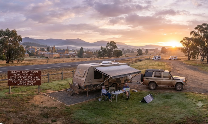
Free Camping Midland Highway Tasmania — Grey Nomad Guide 2026
Overnight stops, rest areas and low-cost camps between Hobart and Launceston — practical planning for caravans, motorhomes and campervans on the inland route.
📅 Last reviewed: July 2026 — facilities and rates subject to change. Confirm locally before relying on any detail in this guide.
- Route: Hobart (south) → Oatlands → Ross → Campbell Town → Launceston (north) via the A1 Midland Highway
- Road surface: Fully sealed dual-lane highway for the entire route
- Best free overnight options: Oatlands Caravan Park area, Ross rest area, Campbell Town rest area and council-designated free camps
- Self-containment required: Yes — at all free roadside rest areas in Tasmania
- Fuel gap: No dangerous gaps — fuel available at each major town along the route
- Who this route suits: Travellers on a schedule, those connecting between Hobart and Launceston quickly, or anyone doing a circuit that doesn’t include the East Coast
- Who should reconsider: Travellers wanting coastal scenery and beach access — the East Coast circuit delivers that instead
📋 Table of Contents
- Location, Route Overview and Drive Time
- Emergency Safety — Can 000 Find You?
- GPS Coordinates for Key Stops
- Why Grey Nomads Use the Midland Highway
- Can You Stay Overnight? Rules and Self-Containment
- Your Two Main Options Side by Side
- Facilities at Each Town — Full Table
- Road Access, Fuel Distances and Flood Risk
- Rig Size Suitability
- What the Midland Highway Doesn’t Tell You Online
- Full Facilities Comparison — Free vs Paid
- Rates — All Options Along the Route
- Senior-Friendly Things to Do
- Month-by-Month Weather and Best Time to Visit
- Wildlife Along the Route
- Medical and Emergency Contacts
- Mobile Coverage by Carrier
- Fires, Generators and Overnight Etiquette
- Accessibility for Seniors and Mobility Considerations
- Senior Packing Checklist — Midland Highway
- Planning Your Tasmania Circuit
- GPS Coordinates and Postcodes Table
- FAQ — 10 Common Questions Answered
- Quick Verdict
- Quick-Reference Card
- Planning Tip and Internal Links
- Disclaimer
📵 Before You Set Up Camp: Can 000 Find You Here?
Most rest areas don’t have a street address. If something goes wrong overnight, “I’m at a rest stop somewhere past the servo” wastes precious minutes. Before you unhitch, open Emergency+ and check it can pin your GPS location or generate a what3words address right where you’re parked — it works offline, so no signal doesn’t mean no location. Get it free — iPhone (App Store) or Android (Google Play).
The habit that matters: do this the moment you arrive, not if you need it. Signal drops in and out at bush camps — testing it early means you already know it works before an emergency makes that the wrong time to find out.
Bonus use: while you’re in the app, grab the GPS coordinates it shows you and save them to your own Van Life Savings Spots pin — a good stop is worth remembering for next time, and now you’ve already got the exact coordinates in hand.
Location, Route Overview and Drive Time
The Midland Highway — officially designated the A1 — runs directly between Hobart and Launceston through Tasmania’s central midlands. The total distance is approximately 200 kilometres. Most drivers complete the trip in around two hours without stops, making it the fastest sealed land route between Tasmania’s two largest cities.
The highway passes through three towns of particular interest to grey nomads: Oatlands (84 km north of Hobart), Ross (119 km north of Hobart) and Campbell Town (138 km north of Hobart). Each offers a different combination of services, history and overnight options.
The route runs north–south through the Midlands. To the east is the East Coast circuit via the A3 and Tasman Highway — a longer, scenic coastal route through Swansea, Bicheno and St Helens. To the west is the Lake Highway and the central highlands — mostly unsealed and not suitable for caravans. The Midland Highway is the practical inland spine of the island.
This is not a scenic coastal drive. The Midlands landscape is open, dry grassland with rolling hills, heritage stone buildings and frequent wildlife at dusk. It is honest, historic country. Travellers who want beaches and ocean views should take the East Coast route instead. Those who need to move efficiently between Hobart and Launceston — or who prefer a straightforward highway with good services — will find the Midland Highway exactly what they need.
GPS Coordinates for Key Stops
📍 Oatlands — Town Centre / Rest Area
-42.0978, 147.3660
Oatlands, TAS 7120 — central Midlands. Rest area and caravan park access off the main highway.
⚠ GPS note: Coordinates are within 50 metres of the stated location and are provided as navigation guidance only. Always confirm on arrival against current signage.
📍 Ross — Historic Village / Rest Area
-41.8979, 147.4884
Ross, TAS 7209 — heritage village approximately 119 km north of Hobart.
⚠ GPS note: Coordinates are within 50 metres of the stated location and are provided as navigation guidance only. Always confirm on arrival against current signage.
📍 Campbell Town — Service Town / Rest Area
-41.9268, 147.4886
Campbell Town, TAS 7210 — approximately 138 km north of Hobart. Largest service stop on the route.
⚠ GPS note: Coordinates are within 50 metres of the stated location and are provided as navigation guidance only. Always confirm on arrival against current signage.
Why Grey Nomads Use the Midland Highway
The Midland Highway is the workhorse route of Tasmanian van travel. It is not the showstopper — the East Coast circuit, Freycinet Peninsula and Bay of Fires draw the crowds for scenery. But the Midland Highway solves a real problem: how do you get between Hobart and Launceston quickly, without doubling back, when you’re on a ferry booking, a medical appointment or a time-sensitive itinerary?
Grey nomads use this route for three main reasons. First, it’s efficient. Two hours of sealed highway beats two to three days of East Coast touring when the schedule demands it. Second, it’s genuinely interesting. The Midlands contains some of Australia’s best-preserved colonial stone architecture. Oatlands, Ross and Campbell Town are National Heritage-listed towns. You’re not just passing through farmland — you’re driving through living history. Third, the fuel and service gaps are manageable. Unlike remote stretches of the mainland, the Midland Highway has a servo within 50 km at all times.
For travellers doing a full Tasmania circuit, this route commonly serves as the return leg. You drive the East Coast circuit north or south, then come home via the Midland Highway — or vice versa. It pairs well with a two-week Tasmania itinerary that needs a clean inland connector.
It also suits travellers who have already done the East Coast on a previous trip and want a different experience. The Midlands offers something the coast doesn’t: quiet, unhurried village stops where most tourists don’t linger.
Can You Stay Overnight? Rules and Self-Containment
Tasmania’s rules for free overnight camping at roadside rest areas are specific and enforced. The key requirement is self-containment. If you are staying outside a licensed caravan park, you must be in a certified self-contained vehicle — meaning your rig holds its waste on board with no need to discharge onto the ground or into general infrastructure.
In Tasmania, self-containment certification follows the Campervan and Motorhome Club of Australia (CMCA) Motorhome Accreditation scheme or equivalent. A formal CMCA self-containment certificate is not universally required at every rest area, but you must be able to demonstrate self-contained capability if challenged. Practically, this means a cassette toilet or onboard tank, grey water retention and no external discharge.
The Tasmanian Government does not require a specific sticker at all roadside stops — but local councils and state authorities do have enforcement powers. Oatlands is in the Central Highlands Council area. Ross and Campbell Town fall under the Northern Midlands Council area. Both councils have issued guidance that roadside rest areas are intended for short breaks — not multi-night stays. One or two nights is generally tolerated at designated rest areas. Longer stays invite attention.
At designated free camp areas associated with each town (distinct from the highway rest stops themselves), different rules may apply. Check current signage on arrival. Rules change, and what was acceptable in 2024 may have been updated by 2026.
Your Two Main Options Side by Side
Every town on the Midland Highway offers a choice: free (or near-free) roadside overnight, or a paid caravan park with full facilities. Here is the honest comparison for each major stop.
Oatlands
| Factor | Free / Low-Cost Option | Paid Caravan Park |
|---|---|---|
| Cost per night | Free (rest area) or low-cost | Approximately $30–$45 powered |
| Toilets | Public toilets at rest area (confirm current availability) | Yes — park amenities block |
| Showers | No | Yes |
| Power | No | Yes — powered sites available |
| Dump point | Confirm locally — see dump point section | Yes (at park) |
| Noise / traffic | Adjacent to highway — truck traffic overnight | Set back from highway, quieter |
| Shade | Limited at most rest areas | Variable — check when booking |
| Best for | CPAP users with own battery/solar, self-contained rigs passing through | Those needing power, a shower or more than one night |
Ross
| Factor | Free / Low-Cost Option | Paid Caravan Park |
|---|---|---|
| Cost per night | Free (rest area near town) | Approximately $30–$45 (confirm locally) |
| Toilets | Public toilets in town (short walk) | Yes |
| Showers | No | Yes |
| Power | No | Yes |
| Proximity to village | Within walking distance of historic bridge and main street | Also walkable to village |
| Noise | Quieter than Oatlands — Ross is set back from the highway | Generally quiet |
| Best for | Self-contained rigs wanting the village experience without the park cost | Those who want a hot shower and a powered site |
Campbell Town
| Factor | Free / Low-Cost Option | Paid Caravan Park |
|---|---|---|
| Cost per night | Free (rest area / designated area) | Approximately $30–$50 powered (confirm locally) |
| Toilets | Public toilets available in town | Yes |
| Showers | No at rest area | Yes |
| Power | No | Yes |
| Services nearby | Excellent — fuel, supermarket, IGA, cafes, bakery | Same access to town services |
| Best for | Overnighting before or after Hobart run — good stock-up point | Longer stays, travellers needing full hook-up |
Facilities at Each Town — Full Table
| Facility | Oatlands | Ross | Campbell Town |
|---|---|---|---|
| Toilets (public) | ✅ Yes | ✅ Yes | ✅ Yes |
| Drinking water | ✅ Town supply available | ✅ Town supply available | ✅ Town supply available |
| Dump point | ⚠ Confirm locally | ⚠ Confirm locally | ✅ Yes — confirm current location |
| Showers (free) | ❌ Not at rest area | ❌ Not at rest area | ❌ Not at rest area |
| Powered sites (free) | ❌ No | ❌ No | ❌ No |
| Fuel | ✅ Yes — servo in town | ✅ Yes — fuel in town | ✅ Yes — multiple servos |
| Supermarket / IGA | ⚠ Small general store — confirm hours | ⚠ Limited — small store | ✅ IGA supermarket |
| Café / meals | ✅ Yes — local cafes | ✅ Yes — bakery and café | ✅ Yes — multiple options |
| Pharmacy | ⚠ Confirm locally | ❌ Not in village | ✅ Yes — confirm hours |
| Medical centre | ⚠ Confirm locally | ❌ None in village | ✅ Yes — see medical section |
| Dog friendly | ✅ On lead in public areas | ✅ On lead in public areas | ✅ On lead in public areas |
| Shade at rest area | ⚠ Limited | ⚠ Variable | ⚠ Variable — confirm on arrival |
| Bins | ✅ Yes | ✅ Yes | ✅ Yes |
| Fires / fire rings | ❌ Not at rest areas | ❌ Not at rest areas | ❌ Not at rest areas |
| Generator use | ⚠ Check council rules — generally limited hours | ⚠ Check council rules | ⚠ Check council rules |
All facilities data above reflects the best available information as of July 2026. Confirm dump point locations with Dump Point Finder Australia or local councils before relying on them. Facilities at rest areas can be removed or upgraded without notice.
Road Access, Fuel Distances and Flood Risk
Road Surface
The Midland Highway (A1) is fully sealed for its entire length between Hobart and Launceston. It is a two-lane highway with overtaking lanes at regular intervals. The surface is generally well-maintained. It is suitable for all vehicle configurations — caravans, motorhomes, fifth-wheelers and campervans of any legal road size.
Flood Risk
The Midland Highway does not commonly flood. The central Midlands sits inland at moderate elevation, away from major flood-prone river systems. However, the Lake River and Elizabeth River cross near Campbell Town and Ross respectively. In extreme rainfall events — particularly in winter — low-lying sections near creek crossings can be affected by surface water.
The more realistic weather hazard on this route is not flooding but ice. In winter (June–August), sections of the highway through the central highlands can experience black ice in the early morning. This is a genuine risk, not a remote one. Frost forms overnight with little warning. Towing a caravan on black ice is dangerous regardless of driver experience. See the weather section for month-by-month detail.
Fuel Distances — North, South, East, West
| Town | Fuel North | Fuel South | Fuel East | Fuel West |
|---|---|---|---|---|
| Oatlands | Ross (~35 km) | Kempton (~29 km) | N/A — no direct sealed east route from here | N/A — no through route west |
| Ross | Campbell Town (~19 km) | Oatlands (~35 km) | Swansea via Lake Leake Rd (~86 km — partly unsealed) | N/A — no through route west |
| Campbell Town | Perth/Longford (~32 km) | Ross (~19 km) | St Marys via B34 (~68 km — partly unsealed) | N/A — no practical sealed route west |
No dangerous fuel gaps exist on the Midland Highway itself. The longest stretch without a fuel option is between Kempton and Oatlands (approximately 29 km) — well within range of any road vehicle. Travellers with large diesel tanks have no concerns. Even those driving petrol vehicles with standard tanks face no risk on this route.
The caveat is if you plan to divert east toward the coast. The Lake Leake Road from Ross to Swansea is partly unsealed and long — carry extra fuel if heading that way. The B34 from Campbell Town toward St Marys is also partly unsealed in sections. Confirm current road conditions with the Tasmania Government road report service before leaving sealed roads with a caravan.
Rig Size Suitability
The Midland Highway accommodates all legal rig sizes. Fifth-wheelers, A-trailers, large motorhomes and triple-axle caravans all travel this route regularly. There are no low bridges, tight tunnels or single-lane sections on the main highway between Hobart and Launceston.
The rest areas and overnight stops are a different matter. Space varies considerably between towns.
- Oatlands rest area: Generally adequate for large rigs. The town sits on relatively flat ground. Turning space is available, but assess on arrival — don’t commit a 26-metre combination to a small car park entrance without walking it first.
- Ross: The historic village has some narrow streets. The main rest area and parking area for large vehicles is signposted. Avoid trying to navigate the oldest laneways of the village in a long rig. The bridge over the Macquarie River (the famous Ross Bridge) is heritage-listed and the village grid was not designed for modern caravans. Park in the designated large-vehicle area and walk.
- Campbell Town: Best of the three for large rigs. The town is laid out on a highway grid with wide verges and a large rest area. Campbell Town is the most rig-friendly overnight stop on this route.
What the Midland Highway Doesn’t Tell You Online
Generic directory listings — CamperMate, WikiCamps, council tourism pages — cover the basics well. They tell you there are rest areas, they tell you which towns have fuel, and they give you a facilities tick-list. Here is what most of them don’t say.
1. Truck traffic overnight at highway rest areas is significant
The Midland Highway is Tasmania’s main freight corridor. Heavy vehicles — B-doubles included — travel this route around the clock. Rest areas directly adjacent to the highway receive truck traffic throughout the night. If you are a light sleeper, expect noise. This is particularly relevant at Oatlands, where the main rest area sits close to the highway. Ross is quieter because the village itself is set slightly off the main alignment. Campbell Town’s rest area varies — some parts are better insulated from traffic than others. If highway noise is a concern, book into the local caravan park rather than use the roadside rest area.
2. The heritage towns look different at dusk — and wildlife strikes spike accordingly
Wombats and wallabies are active along the Midland Highway at dusk and dawn. This is one of the highest-risk corridors in Tasmania for vehicle-wildlife collisions. The open grassland on both sides of the highway provides no natural barrier for animals. Travelling after dark in winter — when dusk falls before 5:30 pm — dramatically increases the risk. If you are towing, a wombat strike at highway speed can cause serious chassis damage and destabilise the rig. No travel guide states this directly enough: plan your day to arrive at your overnight stop before dusk. This is not minor caution — it is the single most important driving advice for the Midland Highway.
3. Dump points are not guaranteed — and their locations change
Online listings frequently show dump point locations that are outdated, removed or temporarily closed. As of the best available information for July 2026, Campbell Town has a known dump point. Oatlands and Ross dump point status should be confirmed locally before arrival. Do not drive a full cassette tank for two days assuming you will find a dump point at a particular town. The Dump Point Finder website (maintained by RV Daily) and the WikiCamps Australia app are the most current sources — but even these lag behind physical changes on the ground. Call the Northern Midlands Council or Central Highlands Council before your trip to confirm.
4. The Midlands in winter is genuinely cold — colder than many mainland travellers expect
Tasmania’s central midlands regularly records overnight temperatures below zero between May and September. The plateau sits above 500 metres in sections. A grey nomad arriving from Queensland or northern NSW in July without adequate insulation, heating and winter water management faces real discomfort — and potential risk. Water hoses freeze. Cassette toilets gel. Condensation inside the van becomes a daily problem. This guide covers winter preparation in the seasonal section, but it needs to be stated plainly here: bring a properly rated sleeping system, a reliable LPG or diesel heater, and lag your water connections.
5. Mobile signal on the highway is patchy — not just in remote sections
Telstra coverage along the Midland Highway is broadly adequate, but there are dead zones. Sections between Oatlands and Ross, and in some areas south of Oatlands toward Kempton, have Telstra signal gaps. Optus and Vodafone coverage is more limited. This matters if you rely on mobile data for streaming, telemedicine or emergency contact. Do not assume uninterrupted coverage simply because you’re on a main highway. See the mobile coverage section for more detail.
Full Facilities Comparison — Free vs Paid Options
| Feature | Free Rest Areas (All Towns) | Caravan Parks (All Towns) |
|---|---|---|
| Cost | Free | ~$30–$50/night powered |
| Power | ❌ No | ✅ Yes (powered sites) |
| Showers | ❌ No | ✅ Yes |
| Flush toilets | ✅ Public toilets available (hours may vary) | ✅ Yes |
| Dump point | ⚠ Varies by town — confirm locally | ✅ Yes |
| Drinking water | ⚠ Town supply — confirm access point | ✅ Yes |
| Noise from highway | ⚠ Often significant — truck corridor | ✅ Usually set back — quieter |
| Security | ⚠ Open to public — no barrier | ✅ Gated or managed site |
| WiFi | ❌ No | ⚠ Some parks offer — variable quality |
| Stay limit | Generally 1–2 nights (council guideline) | As booked |
| CPAP compatibility | ⚠ Battery/solar required | ✅ Powered site supports CPAP |
| Booking required | ❌ No | ✅ Advisable in peak season |
| Pet policy | ✅ Generally yes — on lead | ⚠ Varies by park — check before booking |
Rates — All Camping and Accommodation Options Along the Route
Rates change seasonally and without notice. All figures below are approximate as of July 2026. Confirm directly with each provider before booking.
| Location | Option | Approx. Cost | Notes |
|---|---|---|---|
| Oatlands | Rest area (free overnight) | Free | Self-contained required. 1–2 nights only. |
| Oatlands | Local caravan park (powered) | ~$30–$45/night | Confirm current rates and availability locally. |
| Ross | Rest area (free overnight) | Free | Self-contained required. Quieter than Oatlands rest area. |
| Ross | Local caravan park (powered) | ~$30–$45/night | Confirm current rates locally. |
| Campbell Town | Rest area / designated free camp | Free | Best facilities of the three free options. Confirm signage. |
| Campbell Town | Local caravan park (powered) | ~$35–$50/night | Confirm current rates locally. Larger town, more options. |
| Kempton (south of Oatlands) | Rest area | Free | Small town, basic facilities — good emergency stop. |
| Longford / Perth (north of Campbell Town) | Caravan park options | ~$30–$50/night | These towns are close to Launceston — good final night options. |
Dump Points Along the Midland Highway
Dump point availability is one of the most frequently incorrect details in online travel guides for this route. The following reflects the best available information as of July 2026. Verify all entries before travel using the Dump Point Finder (RV Daily), WikiCamps Australia, or by calling the relevant council directly.
| Town | Dump Point Status | Location Note | Cost |
|---|---|---|---|
| Campbell Town | ✅ Known dump point — confirm current location | Near the town rest area / caravan park — confirm on arrival | Confirm locally — may be coin-operated |
| Oatlands | ⚠ Confirm locally — status uncertain as of research date | Contact Central Highlands Council to confirm | Confirm locally |
| Ross | ⚠ Confirm locally — status uncertain as of research date | Contact Northern Midlands Council to confirm | Confirm locally |
| Kempton | ⚠ Confirm locally | Small town — limited facilities | Confirm locally |
| Launceston | ✅ Multiple dump points — confirm current locations | Check Launceston City Council website for current locations | Confirm locally |
| Hobart | ✅ Multiple dump points — confirm current locations | Check City of Hobart website for current locations | Confirm locally |
Senior-Friendly Things to Do — Day Plan and Flat Walks
The Midland Highway corridor is one of Australia’s richest stretches of colonial heritage. For grey nomads who want more than a service stop, these towns offer genuine interest — and most of the experiences are flat, accessible and short-distance.
Oatlands — Historic Town Walk
Oatlands has more surviving colonial sandstone buildings per square kilometre than any other town in Australia. The main street walk is flat and sealed. The Lake Dulverton foreshore is wheelchair accessible and provides a pleasant lakeside circuit. A 2 km flat loop around the lake takes around 40–50 minutes at a comfortable pace. There is a picnic area with tables and shelter at the lake.
The Callington Mill is the headline attraction — a fully restored 1837 windmill. You can view it from outside at no cost. Internal tours are available (check current operating times and any access fees locally). The mill site has a café adjacent. The steps inside the mill make internal access difficult for limited mobility visitors, but the exterior and grounds are fully accessible.
Ross — Heritage Village and the Ross Bridge
Ross is arguably the most picturesque of the three towns. The Ross Bridge (1836) is one of the oldest bridges in Australia and is free to view. It sits at the edge of the village and is a short flat walk from the main rest area. The bridge crosses the Macquarie River and the stonework is remarkable. The walk from the parking area to the bridge is under 200 metres on a flat path.
The village main street is flat and walkable. The Ross Bakery — one of Tasmania’s most famous — produces bread in a wood-fired oven. A flat walk from one end of the main street to the other and back takes around 25–30 minutes. There are benches. There is no steep gradient. Ross is ideal for seniors who want a one-hour wander.
The Tasmanian Wool Centre in Ross houses a museum and gallery focused on the Midlands wool industry. Entry is ticketed — confirm current price locally. The space is indoors, climate-controlled and fully accessible.
Campbell Town — Red Bridge and Heritage Walk
Campbell Town’s Red Bridge (1838) is one of the oldest convict-built bridges in Australia. It sits within 200 metres of the main rest area. The approach path is flat and sealed. The bridge itself is narrow — do not attempt to drive over it in a large vehicle. View it from the heritage walk path instead.
Campbell Town has a well-signposted Heritage Highway Walk taking in the convict-era brick buildings along the main street. The route is flat and takes around 45 minutes to an hour at a comfortable pace. There are public toilets and a rest area with seating at the bridge end of the walk.
The town also has a public library, a town park with seating and a reasonable café/bakery strip. For seniors who want to spend half a day here, there is genuinely enough to do.
Suggested One-Day Itinerary — Hobart to Launceston (Midland Highway)
| Time | Activity | Notes |
|---|---|---|
| 8:30 am | Depart Hobart after peak hour. Fill fuel in Bridgewater if needed. | Allows ice to clear if it is a cold morning |
| 10:00 am | Arrive Oatlands. Lake Dulverton walk. Coffee at local café. Browse main street. | Allow 1–1.5 hours |
| 11:30 am | Drive to Ross (~35 km). Park in designated large-vehicle area. | ~30 min drive |
| 12:00 pm | Ross Bakery lunch. Walk to Ross Bridge. Browse main street. | Allow 1.5–2 hours |
| 2:00 pm | Drive to Campbell Town (~19 km). Red Bridge walk. Top up fuel. | Allow 1 hour in town |
| 3:30 pm | Depart Campbell Town for Launceston (~62 km). Arrive before dusk. | Critical — arrive before dusk to avoid wildlife risk |
Month-by-Month Weather and Best Time to Visit
The Midland Highway is a year-round route. It does not close seasonally. However, conditions vary significantly by month — especially for grey nomads towing in winter. The table below covers all 12 months.
| Month | Avg. Day Temp | Avg. Night Temp | Rainfall | Crowd Level | Verdict for Grey Nomads |
|---|---|---|---|---|---|
| January | 23–25°C | 10–13°C | Low | High (peak season) | Warm and dry — book caravan parks early. Afternoons can be very hot in full sun at rest areas with limited shade. |
| February | 23–25°C | 10–13°C | Low | High | Similar to January. Bushfire risk in the broader region — monitor alerts. |
| March | 20–22°C | 8–11°C | Moderate | Medium | Excellent month — summer heat fading, autumn light good, crowds easing. Recommended. |
| April | 16–19°C | 5–8°C | Moderate | Low–Medium | Autumn colours in the Midlands. Cool nights — bring warm bedding. Pleasant driving conditions. |
| May | 13–16°C | 3–6°C | Moderate–High | Low | Shoulder season — fewer travellers, quiet stops. Morning frost possible. Watch for ice on departure. |
| June | 10–13°C | 1–4°C | High | Very Low | Cold and quiet. Black ice risk on early mornings. Not recommended without proper cold-weather van setup. Dusk by 5:15 pm — wildlife risk elevated. |
| July | 9–12°C | 0–3°C | High | Very Low | Coldest month. Overnight temps at or below zero. Suitable only for well-prepared rigs with reliable heating. Not recommended for first-time winter van travellers in Tasmania. |
| August | 10–13°C | 1–4°C | High | Very Low | Still cold — conditions similar to July. Days beginning to lengthen slightly from late August. |
| September | 13–16°C | 4–7°C | Moderate | Low–Medium | Spring beginning — conditions improving. Variable weather. Still cold overnight. Good for prepared travellers who want a quiet route. |
| October | 16–19°C | 6–9°C | Moderate | Medium | Excellent — spring wildflowers, mild days, manageable nights. One of the best months for this route. |
| November | 18–21°C | 8–11°C | Low–Moderate | Medium | Very good — warming up, long daylight hours, quieter than December. Recommended. |
| December | 21–24°C | 10–13°C | Low | High | Peak season building. Book caravan parks well ahead. Rest areas filling earlier in the day over the Christmas–New Year period. |
Wildlife Along the Route
The Midland Highway corridor is one of Tasmania’s most active zones for wildlife-vehicle collisions. Open grassland on both sides of the road, combined with high vehicle speeds, creates serious risk — particularly at dawn and dusk.
Common species along the route:
- Wombats: Extremely common. Solid, low to the ground and slow to react. A wombat strike at 100 km/h can cause serious undercarriage damage to a vehicle or caravan. One of the most damaging wildlife strike scenarios on Tasmanian roads.
- Wallabies and Bennett’s wallabies: Abundant throughout the Midlands. Freeze in headlights. Most active from 1 hour before sunset to 1 hour after sunrise.
- Eastern grey kangaroos: Less common than wallabies in this area but present, particularly near Oatlands and Campbell Town.
- Tasmanian devils: Mostly nocturnal — rarely seen but present. Often spotted as roadkill scavengers alongside the highway at dusk.
- Rabbits and hares: Very common. Less of a vehicle risk but frequent on the road shoulders.
- Raptors (wedge-tailed eagles, brown falcons): Often perched or feeding on roadkill. Can be slow to take flight from the road surface — reduce speed when you see them.
The practical advice for this route: plan your drive to arrive at your overnight stop before dusk. In winter, that means arriving by 4:30–5:00 pm. In summer, the window extends to 8:30 pm. Build this into your day plan — not as a nice-to-have but as a genuine safety discipline.
Medical and Emergency Contacts
The Midland Highway is an inland route. Medical facilities are not at every town. Planning ahead matters — particularly for grey nomads managing ongoing health conditions.
| Location | Facility | Type | Phone | Distance from Route |
|---|---|---|---|---|
| Campbell Town | Campbell Town Health Centre | Community health centre / GP services | ⚠ Confirm locally — search “Campbell Town Health Centre Tasmania” for current number | In town |
| Oatlands | Medical services | ⚠ Confirm current availability — GP services vary in small towns | Confirm locally | In town |
| Ross | No hospital or medical centre in village | N/A | N/A — nearest is Campbell Town or Launceston | Campbell Town ~19 km north |
| Launceston | Launceston General Hospital | Major public hospital — emergency department | ⚠ Confirm locally — search Healthdirect for current number | ~62 km north of Campbell Town |
| Hobart | Royal Hobart Hospital | Major public hospital — emergency department | ⚠ Confirm locally — search Healthdirect for current number | ~138 km south of Campbell Town |
The nearest major emergency department for anyone at the midpoint of the route (Ross or Campbell Town) is Launceston General Hospital, approximately 62 km north of Campbell Town. Royal Hobart Hospital is approximately 200 km south. In a genuine emergency, call 000 and let the dispatcher guide you — they will direct ambulance to your GPS location.
Always have the Emergency+ app installed and tested before departing. It generates a GPS coordinate that the 000 dispatcher can use to direct an ambulance to a location without a street address.
Pharmacy Access
- Campbell Town: Pharmacy available — confirm current hours locally. Hours in small towns can change.
- Oatlands: Pharmacy access — confirm locally. Small-town pharmacies may have limited hours or may require advance orders for specialist medications.
- Ross: No pharmacy in the village. Nearest is Campbell Town (~19 km) or the nearest city.
Mobile Coverage by Carrier
Mobile coverage on the Midland Highway is broadly adequate for Telstra users but patchy in sections. Other carriers have more significant gaps. The following reflects the best available general guidance — confirm current coverage via each carrier’s coverage checker before your trip.
| Carrier | Coverage Summary | Known Gaps | Recommendation |
|---|---|---|---|
| Telstra | Best coverage of the three carriers — covers most of the highway corridor and all three major towns | Some gaps between towns, particularly south of Oatlands toward Kempton. Remote sections north of Campbell Town. In-building coverage at rest areas can be poor. | Recommended primary carrier for this route |
| Optus | Coverage in major towns — weaker between towns | Significant gaps between Oatlands and Ross, and south of Oatlands. Not reliable as a sole carrier for this route. | Adequate if you don’t need coverage between towns. Supplement with a Telstra SIM or satellite device for emergency use. |
| Vodafone | Limited — town-focused coverage only | Limited to major town centres. No reliable coverage between towns on this route. | Not recommended as your primary carrier for the Midland Highway. Supplement with Telstra or a satellite communicator. |
| Starlink / Satellite | Full coverage if you carry a device | N/A | Ideal supplement for travellers who rely on telemedicine, streaming or consistent internet access. Starlink roam plans available for Australian travellers as of 2026. |
For emergency use, 000 typically connects across multiple carrier networks — including towers from other carriers. However, do not rely on this assumption in deep rural sections. The Emergency+ app uses GPS independently of phone signal, which is why it matters more than signal strength in a genuine emergency.
Fires, Generators and Overnight Etiquette
Open Fires
Open fires are not permitted at roadside rest areas on the Midland Highway. This applies year-round. The rest areas do not have fire rings, fire pits or designated fire zones. Any open fire on the roadside or in a public rest area is a fire risk and is not allowed under Tasmanian fire regulations.
During Total Fire Ban days (declared seasonally by the Tasmania Fire Service), no outdoor fires of any kind are permitted anywhere in the affected zones. Check the TFS website or app for current fire ban status before your trip — particularly in summer (December–March).
LPG camp stoves and BBQs on self-contained rigs are generally acceptable — but check for any Total Fire Ban declarations, as these can restrict even gas cooking outside.
Generators
Generators are not prohibited at all rest areas, but they are subject to noise restrictions and community standards. Running a generator between 8 pm and 7 am at a shared rest area is inconsiderate and in many cases violates council noise ordinances. If you need power overnight for CPAP or refrigeration, plan for a powered caravan park site or ensure your battery and solar system can carry you through the night without generator use.
A 100Ah lithium battery with a correctly sized solar input will typically run a CPAP machine (standard pressure, no heated humidifier) through a 9-hour night in Tasmania’s conditions — with adequate solar recharging through the previous day. This is worth planning before you travel, not working out at 11 pm in a rest area.
Overnight Etiquette
- Arrive before dusk — this is a safety rule as much as an etiquette one.
- Do not occupy more space than your rig requires. Rest areas serve multiple vehicles.
- Keep noise down after 9 pm — other travellers start early.
- Take all rubbish with you or use the bins provided. Do not leave rubbish at rest areas — it contributes to councils removing facilities entirely.
- Do not discharge any waste — grey water or black water — onto the ground or into roadside drains. This is illegal and the primary reason councils restrict van camping at rest areas.
- Respect other travellers’ space and keep pets on a lead at all times.
Accessibility for Seniors and Mobility Considerations
The Midland Highway towns are generally good for seniors with mobility limitations — better than many rural Australian highways. Here is what to expect at each stop.
Oatlands
The main street is flat and sealed. Lake Dulverton has a smooth path suitable for wheelchairs and walkers. The Callington Mill grounds are accessible but the mill interior has steep steps. Public toilets in the town are wheelchair accessible — confirm current state of facilities on arrival. The rest area has a sealed surface but may have minor gravel sections — check before positioning your rig near the facilities.
Ross
The main street of Ross is flat. The path to the Ross Bridge is flat and sealed. The village is entirely walkable for anyone who can manage 200–400 metres on flat ground. The Ross Bakery has a step entry — a small threshold step rather than a full flight. The Tasmanian Wool Centre has level entry and is wheelchair accessible. The village toilets are wheelchair accessible — confirm on arrival. Ross does not have a medical centre, pharmacy or hospital, which matters for seniors managing health conditions.
Campbell Town
The most accessible of the three towns for seniors. Wide footpaths, level terrain, accessible public toilets, a full supermarket (IGA) with accessible entry, and a pharmacy. The Red Bridge heritage walk is flat and sealed. The rest area has good sealed surfaces. Campbell Town is the recommended overnight stop for seniors with mobility or medical needs — it offers the best combination of accessibility, services and rest area space.
CPAP Users — Specific Advice
If you use a CPAP machine and rely on powered sites, plan your nights accordingly. Campbell Town’s caravan park offers powered sites. Oatlands and Ross also have caravan parks — confirm powered site availability before arrival. At free rest areas, you need independent power: a lithium battery bank with adequate solar or a small inverter generator (used within reasonable hours). A CPAP without power is not a minor inconvenience — for many users, it is a health necessity. Do not leave this to chance.
Rig Entry and Exit
If you have knee or hip limitations, consider how you enter and exit your rig. Tasmania’s rest area surfaces can be uneven at the margins. Carry a step stool or entry step if your rig doorway is high. Frozen ground in winter can be slippery — grippy footwear matters in the cold months. A torch for night-time toilet trips to the public facilities block is essential.
Senior Packing Checklist — Midland Highway Tasmania
☐ Cold-weather rated sleeping system
The Midlands plateau regularly drops to 0–3°C overnight in winter and below 8°C in autumn and spring. A sleeping bag or quilt rated to at least -5°C is recommended for June–August travel. Summer travellers still need a quality quilt — Tasmanian nights are cool even in January.
☐ Reliable LPG or diesel heater
A portable electric heater is not adequate at a free rest area with no power. This route requires an LPG or diesel-fuelled heater for winter travel. Check your LPG bottle level before departing Hobart — gas refills are available in Campbell Town and Launceston, but not at every point on the route.
☐ CPAP battery backup (lithium preferred)
Free rest areas on this route have no powered sites. A 100Ah lithium battery with adequate solar input will carry most CPAP machines through a 9-hour night. Test your system at home before depending on it at a remote stop. A heated humidifier significantly increases power draw — factor this in.
☐ Two weeks of prescription medication (minimum)
Ross has no pharmacy. Oatlands has limited pharmacy hours. Campbell Town has a pharmacy but hours may vary. Carry a minimum two-week buffer of all regular medications — scripts can be slow to fill in small Tasmanian towns, and some specialists compounds require advance ordering.
☐ Emergency+ app installed and tested
Rest areas on this route do not have street addresses. Emergency+ generates a GPS coordinate that the 000 dispatcher can use to locate you. Test it the moment you arrive at each overnight stop — before you need it. It works offline, but testing it live confirms the GPS lock is active.
☐ Wildlife strike plan — including insurance details
Wildlife strikes are common on the Midland Highway at dusk and dawn. Know your caravan or motorhome insurer’s after-hours claims number before you travel. A wombat strike at speed can cause significant undercarriage and hitch damage. Carry basic tools to assess damage before continuing to drive.
☐ Torch or headlamp for night-time toilet visits
Public toilet blocks at rest areas are not always well-lit overnight. In winter, the ground around them can be frosty and slippery. A hands-free headlamp is safer than a handheld torch — you need your hands free to manage doors, rails and steps in cold conditions.
☐ Lagged water connections / anti-freeze measures
Water hoses and connections at rest areas can freeze overnight in the Midlands from May through to September. Use foam pipe lagging on external hose connections if you fill water at rest areas. Carry enough onboard fresh water to last overnight without needing a hose connection in freezing conditions.
☐ Sunscreen and hat (summer)
Rest areas on the Midland Highway have limited shade. In summer, UV levels in Tasmania are high and the open Midlands landscape provides no tree cover at most stops. A broad-brimmed hat and SPF50+ sunscreen are essential for even a short outdoor stop between November and March.
☐ Towing emergency kit
Carry wheel chocks, a spare tyre (for both the tow vehicle and the caravan if applicable), a basic toolset, tyre repair foam or plugs, a hi-lift jack and reflective triangles. The Midland Highway has roadside assistance from RAA Tasmania (RACT) — confirm your membership covers Tasmania before departing the mainland.
☐ Gripping footwear for winter stops
Overnight frost on grass and bitumen at rest areas in the Midlands from May to September creates slip risk. Rubber-soled footwear with grip — not thongs or smooth-soled shoes — is important for any night-time or early morning movement around the rig and to the toilet block.
☐ Current fuel level and range assessment
No dangerous fuel gaps exist on the Midland Highway itself, but if you plan to divert east toward the coast via Lake Leake Road or the B34, fuel availability changes significantly. Fill up at Campbell Town before any eastern diversion. Never rely on fuel being available at a small town on an unsealed route.
Planning Your Tasmania Circuit
The Midland Highway does not exist in isolation. Most grey nomads travelling Tasmania use it as part of a broader circuit — sometimes as the return leg from an East Coast loop, sometimes as a deliberate inland alternative.
If you are planning a full Tasmania van trip and need to understand your free and low-cost camping options across the whole island, our full guide covers the state comprehensively: Free Camping Tasmania — the complete grey nomad guide.
If you want to make the most of every stop along the Midland Highway — and across your broader Tasmania trip — knowing which spots are worth saving for a return visit is useful. The Van Life Savings Spots guide shows you how to log and remember the best locations you find along the way.
GPS Coordinates and Postcodes — Quick Reference
| Town / Location | GPS (Approx.) | Postcode | Distance from Hobart | Distance from Launceston |
|---|---|---|---|---|
| Hobart (start) | -42.8821, 147.3272 | 7000 | 0 km | ~200 km |
| Kempton | -42.5227, 147.2066 | 7030 | ~55 km | ~145 km |
| Oatlands (rest area) | -42.0978, 147.3660 | 7120 | ~84 km | ~116 km |
| Ross (rest area) | -41.8979, 147.4884 | 7209 | ~119 km | ~81 km |
| Campbell Town (rest area) | -41.9268, 147.4886 | 7210 | ~138 km | ~62 km |
| Launceston (end) | -41.4332, 147.1441 | 7250 | ~200 km | 0 km |
⚠ GPS note: All coordinates in this table are within 50 metres of the stated location and are provided as navigation guidance only. Always confirm on arrival against current signage.
FAQ — Common Questions About Free Camping on the Midland Highway Tasmania
1. Is free camping legal on the Midland Highway Tasmania?
Yes — overnight stays at designated roadside rest areas are legal for self-contained vehicles on the Midland Highway. You must be in a certified self-contained rig that holds all waste on board. The stays are intended for one or two nights as a traveller’s break, not extended camping. Rest areas are managed by local councils (Northern Midlands Council and Central Highlands Council) and the state government. Rules are subject to change — confirm current regulations with the relevant council before your trip.
2. Do I need a self-containment certificate to free camp on the Midland Highway?
Tasmania does not mandate a specific CMCA self-containment sticker at all rest areas, but your rig must be genuinely self-contained — capable of holding all waste on board for your stay. In practice, enforcement is not as rigorous as in some other Australian states, but discharging waste at a rest area is illegal and the primary reason councils restrict camping at these sites. Carry your self-containment documentation if you have it. If you don’t, ensure your rig has a functioning cassette toilet, grey water tank and no external discharge.
3. Where is the best free overnight stop on the Midland Highway?
Campbell Town is the recommended free overnight stop for grey nomads based on a combination of rest area space, town facilities, pharmacy access and rig accessibility. It has the most reliable dump point, the best supermarket access (IGA), and the most caravan-friendly road layout of the three major stops. Ross is the most scenic and quietest, but it lacks services. Oatlands sits midpoint and is convenient but has more highway noise at the rest area.
4. Is there a dump point at Ross Tasmania?
Dump point availability at Ross is uncertain as of July 2026. Online listings have historically shown varying status for this location. Before relying on a dump point at Ross, call the Northern Midlands Council or check the Dump Point Finder (RV Daily) for current status. The safest approach is to assume you may not find a dump point at Ross and plan your cassette capacity accordingly — with Campbell Town as your confirmed dump point option.
5. Can I tow a large caravan or fifth-wheeler on the Midland Highway?
Yes — the Midland Highway is fully sealed, dual-lane and suitable for all legal road rig configurations. There are no weight restrictions, low bridges or tunnel clearance issues on the main A1 route. The caution for large rigs is at town level: Ross village has narrow heritage streets that are not suitable for large combinations. Always park in the designated large-vehicle areas in each town and walk to the attractions rather than driving through historic laneways.
6. What is the wildlife risk on the Midland Highway and how do I reduce it?
The Midland Highway has a high rate of wildlife-vehicle collisions, particularly at dusk and dawn. Wombats, wallabies and kangaroos are common. The practical risk reduction strategy is simple: do not drive after dusk or before dawn. Plan your day to arrive at your overnight stop before sunset. If you must drive at low light, reduce your speed below the posted limit, use high beam when no oncoming traffic is present, and scan both road shoulders continuously. Fitting a wildlife alert (ultrasonic whistle on the vehicle) has mixed evidence for effectiveness but is popular with many travellers.
7. How cold does it get overnight at Midland Highway rest areas in winter?
The central Midlands plateau regularly records overnight temperatures between 0°C and -3°C during June, July and August. Frost on the ground is common. In some years, temperatures can fall lower at exposed rest areas. A properly rated sleeping system (minimum -5°C rated), a reliable heater (LPG or diesel — not a portable electric heater requiring mains power) and lagged water connections are essential for winter travel. This is not optional caution — it is genuine safety preparation for Tasmania’s winter conditions.
8. Is there mobile phone coverage at rest areas on the Midland Highway?
Telstra coverage is broadly available at all three major towns (Oatlands, Ross, Campbell Town) and for much of the highway between them. There are gap sections, particularly between towns and in low-lying areas. Optus and Vodafone have weaker and less reliable coverage between towns. For emergency use, install the Emergency+ app before your trip — it generates your GPS location offline and does not rely on mobile signal to pinpoint your position for a 000 call.
9. How long does it take to drive the Midland Highway with stops?
The direct drive from Hobart to Launceston is approximately two hours without stops. With a typical grey nomad travel day — a coffee and short walk at Oatlands, lunch at Ross and a heritage walk at Campbell Town — allow six to seven hours from departure to arrival. This pace suits a comfortable one-day drive. It also keeps you arriving at your overnight stop before dusk, which is the recommended approach for wildlife safety.
10. Should I take the Midland Highway or the East Coast route from Hobart to Launceston?
The answer depends on your priority. The East Coast route (via the A3, Swansea, Bicheno and St Helens) offers coastal scenery, beaches and national parks — but takes two to three days minimum if you want to enjoy it properly. The Midland Highway is an efficient, fully serviced inland route that takes one day. If you are short on time, on a schedule or prefer rural heritage over coastal scenery, take the Midland Highway. Most experienced grey nomads doing a full Tasmania circuit combine both: East Coast one way, Midland Highway the other. That gives you the variety of both routes without retracing either.
Quick Verdict
The Midland Highway is Tasmania’s most practical grey nomad connector route. It is fully sealed, well-serviced and significantly underrated as a travel experience in its own right. The three heritage towns — Oatlands, Ross and Campbell Town — offer genuine interest, flat walkable streets and good enough services for a comfortable one or two-night stop.
Free overnight camping is legal for self-contained rigs at rest areas in all three towns. Campbell Town is the strongest all-round choice: best facilities, most reliable dump point access, best supermarket and pharmacy coverage. Ross is the most scenic and peaceful. Oatlands sits in the middle — convenient but noisier from highway traffic.
The honest trade-off: free rest areas on this route mean no power, no showers and highway noise. For travellers who need power (CPAP users in particular), the local caravan parks at each town offer powered sites at reasonable rates for Tasmania. A single powered night mid-route keeps batteries topped and CPAP functioning — worth the $40–$50 cost.
The most important single piece of advice for this route is not about facilities — it is about timing. Arrive at your overnight stop before dusk. The Midland Highway has one of Tasmania’s highest wildlife strike rates. That risk is almost entirely eliminated by not driving at low light. Plan your day around it.
Overall rating: ✅ Recommended for grey nomads — well-serviced, manageable, genuinely interesting. Best in March–May and October–November. Suitable with preparation in winter. Most rig sizes accommodated on the highway itself.
Quick-Reference Card — Screenshot This
| Detail | Information |
|---|---|
| Route | Hobart → Oatlands → Ross → Campbell Town → Launceston (A1 Midland Highway) |
| Total distance | ~200 km Hobart to Launceston |
| Drive time (no stops) | ~2 hours |
| Road surface | Fully sealed — entire route |
| Flood risk | Low — ice risk in winter mornings is the primary hazard |
| Best free overnight | Campbell Town (most facilities), Ross (quietest), Oatlands (midpoint) |
| Self-containment required | Yes — at all free rest areas |
| Dump point | Campbell Town ✅ confirmed. Oatlands/Ross ⚠ confirm locally. |
| Fuel gaps | None dangerous — fuel in all major towns |
| Nearest hospital (north) | Launceston General Hospital — ~62 km from Campbell Town |
| Nearest hospital (south) | Royal Hobart Hospital — ~138 km from Campbell Town |
| Mobile coverage | Telstra best — gaps between towns. Use Emergency+ app as backup. |
| Wildlife risk | High at dusk/dawn — arrive at camp before sunset |
| Best months | March, April, October, November |
| Winter caution | Sub-zero nights June–August. Ice on road. Depart after 9 am. |
| Free camp cost | Free — self-contained rigs only |
| Powered site cost | ~$30–$50/night at local caravan parks |
| Last reviewed | July 2026 |
Planning Tip and Further Reading
These guides will help you build the full picture before you travel:
- Free Camping Tasmania — complete grey nomad guide — covers free and low-cost camps across the whole island, not just the Midland Highway corridor.
- Van Life Savings Spots — how to record and remember the best overnight stops you find, using GPS coordinates from your Emergency+ app.
Save this page before you leave — rest area facilities can change, but the planning framework here stays useful regardless of minor updates on the ground.
COPY PROMPT ➔ ASK AI ➔ SAVE TO FORM ➔ ADD SPOT PIN ➔ GET DIRECTIONS
📍 Interactive map — find free camps, rest areas and overnight stops. Enable location for best results.

As an affiliate, I earn from qualifying purchases at no extra cost to you.
Exclusive Offer: Get 5% OFF all StarterStopper immobiliser products with promo code: RTV5
Visit StarterStopper.com to see our data-backed security solutions
As an affiliate, I earn from qualifying purchases at no extra cost to you.