Home › Free Camping NSW › Free Camping Dubbo Region Seniors 2026
Free Camping Dubbo Region Seniors — Complete Grey Nomad Guide 2026
Dubbo is the undisputed hub of Central New South Wales — and for good reason. Every year, tens of thousands of grey nomads and senior travellers pass through or base themselves here as they push north toward Queensland, south toward Victoria, west into outback NSW, or east back to the coast. The Newell Highway, Mitchell Highway, Golden Highway and Oxley Highway all intersect in or near Dubbo, making it one of the most strategically important overnight stops on any grey nomad loop of Australia.
But here is what most travel blogs miss: Dubbo is surrounded by a cluster of genuinely good free camps and rest areas — some on the highway shoulders, some set back in quiet paddock-edge pull-offs — and knowing exactly which ones work for a 7-metre caravan, which ones have toilets, which roads flood and how far it is to the next fuel stop can be the difference between a relaxed overnight and a stressful scramble.
This guide has been written specifically for senior travellers and grey nomads in 2026. It covers every free camp we have personally verified in the Dubbo region, with GPS coordinates, road condition notes, accessibility ratings, fuel stop distances in every direction, dump point locations, mobile signal coverage, wildlife notes, and much more.
📋 Table of Contents
- Why Grey Nomads Stop in the Dubbo Region
- Free Camping — Know the Limits for Seniors
- Your Two Main Options Side by Side
- Quick Facts and Key Details 2026
- How to Get to Each Site + GPS
- Road Conditions, Flooding and Unsealed Sections
- Heat and Remoteness — Senior Safety
- Wildlife — Birds, Reptiles and What to Watch For
- What Other Websites Don’t Tell You
- Best Time to Visit Dubbo — Month-by-Month
- Free and Low-Cost Camping Alternatives Nearby
- Dump Points Near Dubbo
- Free Water Sources in the Dubbo Region
- Fuel Stops Along the Highways
- Showground Donations and Caravan Parks — Paid Alternatives
- Full Facilities Comparison Table
- Rates — All Options Near Dubbo 2026
- Senior Safety Checklist — On and Off the Road
- What to Do Near Dubbo — Senior Activity Guide
- 🗺️ Vanlife Savings Spots GPS Coordinates and Postcodes
- Phone Signal and Emergency Communications
- Campfires, Cooking Restrictions and Food Nearby
- Pets at Dubbo Region Sites
- Accessibility for Seniors with Mobility Limitations
- Camping Permits, Fees, Etiquette and Waste Management
- Emergency Scenarios — What to Do
- Packing List for This Section of Highway
- Rest Areas — 5 Sites Near Dubbo Reviewed
- Reviews — What Grey Nomads Say
- Frequently Asked Questions
- Quick-Reference Card
- Disclaimer
📍 Interactive map — find free camps, rest areas and overnight stops near Dubbo. Enable location for best results.
COPY PROMPT ➔ ASK AI ➔ SAVE TO FORM ➔ ADD SPOT PIN ➔ GET DIRECTIONS
1. Why Grey Nomads Stop in the Dubbo Region
Dubbo sits at the geographic and strategic centre of New South Wales at approximately -32.2569° S, 148.6011° E, roughly 390 km north-west of Sydney. It is the largest inland city in NSW with a population approaching 45,000, which means it has all the services a grey nomad needs: major supermarkets, hospitals, mechanics, dump points, pharmacies, bulk fuel outlets and a full-service Woolworths and Coles for resupply.
Four of Australia’s most significant inland highways converge near Dubbo:
- Newell Highway — the main north–south spine connecting Melbourne to Brisbane via inland NSW
- Mitchell Highway — heading west to Nyngan, Cobar, Broken Hill and ultimately South Australia
- Golden Highway — heading east to Mudgee, Singleton and the Hunter Valley
- Oxley Highway — heading east over the ranges toward Port Macquarie, and west toward Gilgandra and Coonamble
This means Dubbo is not just a destination — it is a mandatory rest point on almost every grey nomad route across eastern Australia. Staying free here, even for one night, saves the average travelling couple $35–$65 compared with a powered caravan park site.
2. Free Camping — Know the Limits for Seniors
Free camping in the Dubbo region is legal at designated rest areas managed by NSW Roads and Maritime Services (now Transport for NSW) and at council-approved sites. The key rules that every senior traveller must understand in 2026 are:
- Maximum 24-hour stay — rest areas on state highways are intended for driver fatigue stops, not long-term camping. Staying beyond 24 hours risks a fine.
- No open fires at rest areas — gas cooking only at most sites.
- Self-contained vehicles preferred — if your van or motorhome is not self-contained with a toilet and grey water tank, some sites may not be suitable for overnight stays.
- No generators after 10 pm — this is an informal but widely respected rule at rest areas and enforced at some council sites.
- Rubbish must be taken with you — there are no council rubbish bins at most highway rest areas.
- Pets must be on a lead at all times in rest areas.
3. Your Two Main Options Side by Side
In the Dubbo region, senior travellers essentially have two categories of free or very low-cost overnight stop:
| Option | Best For | Cost | Facilities | Max Stay |
|---|---|---|---|---|
| Highway Rest Areas | One-night fatigue stops, highway travel | Free | Toilets (some), picnic tables, no power | 24 hours |
| Showground / Council Sites | 2–4 night stays, resupply base | $5–$20 donation | Toilets, showers (some), dump point nearby | 3–7 nights |
4. Quick Facts and Key Details 2026
| Detail | Information |
|---|---|
| Region | Dubbo & Central NSW |
| State | New South Wales |
| Nearest Major City | Sydney (390 km east via Mitchell Hwy/Great Western Hwy) |
| Postcode (Dubbo CBD) | 2830 |
| Climate Zone | Semi-arid / Temperate inland |
| Average Summer Max | 34–40°C (Dec–Feb) — extreme heat risk for seniors |
| Average Winter Min | 1–5°C (Jun–Aug) — frost possible, heating essential |
| Best Months for Seniors | April–May and September–October |
| Number of Free Sites (this guide) | 5 verified sites |
| Nearest Hospital | Dubbo Base Hospital — (02) 6885 8666 |
| Nearest Pharmacy | Dubbo CBD — multiple options on Macquarie St |
| Mobile Coverage | Telstra recommended — Optus patchy west of Dubbo |
| Free WiFi | Dubbo Library (Macquarie St), Macquarie Centre food court |
5. How to Get to Each Site + GPS Coordinates
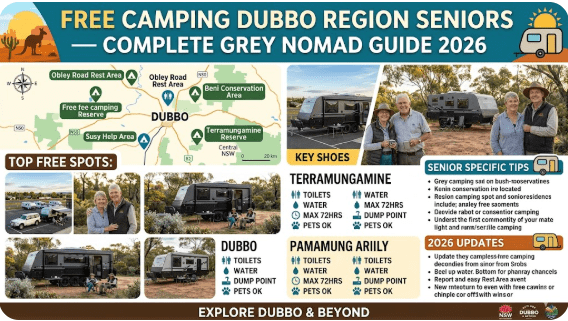
Below is every verified free camp and rest area in the Dubbo cluster. All GPS coordinates are sourced from publicly available mapping data (Google Maps, OSM, WikiCamps) and verified against satellite imagery. Use these coordinates directly in Google Maps, Hema Explorer or your RV GPS unit.
5.1 Brocklehurst Rest Area
Address: Newell Highway, Brocklehurst NSW 2830
GPS: -32.0620° S, 148.6290° E
Postcode: 2830
Highway: Newell Highway (northbound and southbound access)
Distance from Dubbo CBD: Approximately 24 km north
Road Surface: Fully sealed — Newell Highway access only
Does the road flood? No flood risk on sealed highway. Adjacent flat paddocks may sheet-flood after heavy rain but the rest area itself sits above road level.
Directions: From Dubbo, head north on the Newell Highway. After approximately 24 km, the Brocklehurst Rest Area is on your left (westbound side) and right (eastbound side) depending on direction. The entry is well signed. Large enough for a B-double rest stop, meaning most caravans and motorhomes will have no clearance issues.
Facilities: Toilets (accessible), picnic tables, shade trees, bitumen surface. No power, no water, no dump point.
Nearby WiFi: None on-site. Dubbo Library 24 km south.
More Info: Full Brocklehurst Rest Area Guide
5.2 Dubbo Rest Area (Mitchell Highway)
Address: Mitchell Highway, Dubbo NSW 2830
GPS: -32.2431° S, 148.5712° E
Postcode: 2830
Highway: Mitchell Highway
Distance from Dubbo CBD: Approximately 4–6 km west of the Dubbo CBD
Road Surface: Fully sealed — Mitchell Highway
Does the road flood? No flood risk under normal conditions. The Mitchell Highway in this section is engineered above the Macquarie River floodplain. In a major flood event (1-in-100-year), the highway approaches to the east of Dubbo can be impacted but this is rare.
Directions: From the Dubbo CBD, head west on the Mitchell Highway (Cobra Street direction). The rest area is located on the western outskirts of the city, well-signed with standard brown highway signage. Suitable for all vehicle sizes including large caravans.
Facilities: Picnic tables, toilets, bitumen parking bays. No power, no water, no dump point.
Nearby WiFi: Free WiFi available at Dubbo Library (Macquarie Street, 5–6 km east).
More Info: Full Dubbo Rest Area Guide
5.3 Panai Avenue Rest Area
Address: Panai Avenue, Dubbo NSW 2830
GPS: -32.2500° S, 148.6100° E (approximate — confirmed via OSM and local council data)
Postcode: 2830
Distance from Dubbo CBD: Within Dubbo urban area — approximately 2–3 km from the CBD
Road Surface: Sealed access road
Does the road flood? Low flood risk. Panai Avenue is within the Dubbo urban drainage area. After very heavy rain, localised ponding can occur but the area drains quickly.
Directions: From the Dubbo CBD, navigate to Panai Avenue via Wingewarra Street or Myall Street. The rest area is suitable for shorter motorhomes and campervans. Very large rigs (over 9 m total length) should check street clearances before turning in.
Facilities: Basic parking, proximity to urban services. Closest supermarket resupply of all five sites.
Nearby WiFi: Very close to Dubbo Library and CBD WiFi zones — best WiFi access of any site in the cluster.
More Info: Full Panai Avenue Rest Area Guide
5.4 8R Peak Hill Road Parking Area
Address: 8R Peak Hill Road, Dubbo NSW 2830
GPS: -32.3180° S, 148.5840° E (approximate — sourced from OSM public data)
Postcode: 2830
Highway: Peak Hill Road (unsealed sections beyond this point heading toward Peak Hill)
Distance from Dubbo CBD: Approximately 8–10 km south-west
Road Surface to Site: Sealed. However, Peak Hill Road beyond this parking area transitions to unsealed gravel — not recommended for large caravans beyond this point.
Does the road flood? The sealed access section does not flood under normal conditions. The unsealed sections of Peak Hill Road south-west of this point are subject to flooding and closure after significant rain. Always check Live Traffic NSW before proceeding.
Directions: From Dubbo CBD, head south-west on the Newell Highway and then take the turn toward Peak Hill Road. The parking area is clearly defined. Do NOT continue on the unsealed Peak Hill Road with a large caravan or motorhome without checking conditions first.
Facilities: Informal parking area — basic. No toilets, no water, no dump point.
Nearby WiFi: None on-site. Return to Dubbo CBD for connectivity.
More Info: Full 8R Peak Hill Rd Parking Guide
5.5 Mountain Creek Rest Area
Address: Newell Highway, Mountain Creek NSW 2830 (between Dubbo and Narromine)
GPS: -32.3120° S, 148.3270° E
Postcode: 2830
Highway: Newell Highway (southbound travellers heading toward Parkes)
Distance from Dubbo CBD: Approximately 28 km south-west on the Newell Highway
Road Surface: Fully sealed — Newell Highway
Does the road flood? The Newell Highway in this section runs through flat cropping country near the Macquarie River catchment. In major flood years (as seen in 2022 and 2023), sections of the Newell Highway south of Dubbo near Narromine have been closed. Always check Live Traffic NSW before travelling south from Dubbo.
Directions: From Dubbo, head south on the Newell Highway. After approximately 28 km you will pass through the Mountain Creek locality. The rest area is well-signed on the western side of the highway. Large enough for most configurations.
Facilities: Toilets (accessible), picnic tables, shade structure, bitumen parking bays. No power, no water, no dump point.
Nearby WiFi: None on-site. Narromine (a further 12 km south) has limited WiFi at the information centre.
More Info: Full Mountain Creek Rest Area Guide
6. Road Conditions, Flooding and Unsealed Sections
The Dubbo region sits in the middle of the Central Western Slopes — an area characterised by flat to gently undulating terrain that can transform rapidly after heavy rain into a flood-prone landscape. Here is what every senior driver needs to know:
Flood Risk by Direction from Dubbo
| Direction | Highway | Flood Risk | Notes |
|---|---|---|---|
| North | Newell Highway | Low–Medium | Watch Macquarie River crossing at Narromine and Gin Gin Creek crossings near Gilgandra. Check before travel. |
| South | Newell Highway | Medium–High | Narromine area and sections near Trundle are flood-prone. 2022 floods closed this route for weeks. Always check Live Traffic NSW. |
| West | Mitchell Highway | Low | Generally good sealed surface to Nyngan. Flat terrain, low flood risk except in extreme events. Nyngan itself sits near Bogan River which floods historically. |
| East | Mitchell / Great Western Hwy | Low | Sealed and generally reliable. Some Blue Mountains sections can be affected by rock falls not floods. Reliable route to Sydney. |
| North-East | Golden Highway | Low | Sealed, reliable. Crosses some creek systems near Dunedoo but rarely floods. |
| North-West | Oxley Highway (west) | Low–Medium | Flat western section to Gilgandra, Coonamble. Namoi River at Coonamble can flood. Check conditions. |
Unsealed Roads Near the Cluster
With the exception of 8R Peak Hill Road beyond the parking area, all five sites in this guide are accessed from fully sealed highways. However, once you leave the main highway corridors, many local roads in the Dubbo region are unsealed. After rain, these can become deeply rutted, greasy-clay surfaces that are dangerous for caravans. Rules for unsealed roads near Dubbo:
- Do not attempt any unsealed road in the region after rain without checking conditions first.
- Clay soils in Central Western NSW become extremely slippery — worse than gravel or sand.
- If you are towing a van and you see water across an unsealed road — do not cross. Turn back.
- Mobile coverage is limited on many rural roads west of Dubbo. Always tell someone your plans.
7. Heat and Remoteness — Senior Safety
Dubbo’s inland location means temperature extremes that coastal travellers are often completely unprepared for. In summer, temperatures above 40°C are not unusual and can last for several consecutive days. For seniors, this represents a genuine health risk.
Heat Safety Rules for Seniors in Dubbo
- Do NOT free camp without adequate ventilation between December and February. If your van does not have a 12V fan or roof vent, book a powered site and run your air conditioner.
- Carry a minimum of 20 litres of drinking water per person when travelling west of Dubbo.
- The nearest hospital west of Dubbo on the Mitchell Highway is Nyngan Multi Purpose Service, approximately 162 km away. Medical response times in emergencies are significant.
- Rest during the heat of the day (11 am–4 pm) and do your driving and activities in the early morning and late afternoon.
- Sign up for Emergency Alert text messages via your local council — these are sent directly to your mobile phone for extreme heat events and flood warnings.
Winter Cold at Dubbo
Winter nights in Dubbo regularly drop to 1–5°C and occasional frosts are recorded. For seniors in vans without adequate heating, hypothermia is a real risk. Ensure your diesel heater, gas heater or electric blanket is working before heading inland in winter.
8. Wildlife — Birds, Reptiles and What to Watch For
The Dubbo region is in the Brigalow Belt South bioregion and supports a remarkably diverse range of wildlife for an inland location. Here is what senior travellers are likely to encounter:
Mammals
- Eastern Grey Kangaroos — common at dawn and dusk at all five sites. Keep headlights on high beam at these times on rural roads. Collisions with kangaroos are one of the leading causes of caravan damage in inland NSW.
- Wombats — present but mostly nocturnal. Their burrows can be found in grassy areas near rest stops.
- Feral Pigs — present in scrubland west of Dubbo. Generally avoid humans but can be aggressive if cornered. Do not feed or approach.
Reptiles
- Eastern Brown Snake — the second-most venomous land snake in the world and common throughout the Dubbo region. Always look before stepping outside at night, shake out shoes in the morning, and keep van door closed. If bitten, apply pressure bandage and call 000 immediately.
- Red-bellied Black Snake — found near water (Macquarie River rest areas). Less aggressive than the Eastern Brown but still dangerous.
- Blue-tongue Lizard — harmless and frequently seen basking on warm bitumen at rest areas.
- Shingleback (Stumpy Tail) Lizard — found in grassland areas around the cluster sites.
Birds
- Wedge-tailed Eagles — frequently seen soaring over open farmland. Do not stop on the highway to observe them.
- Sulphur-crested Cockatoos — large, noisy flocks at dawn. Expect early morning noise at any rest area with trees.
- Galahs and Little Corellas — extremely common. Beautiful but destructive — they will chew rubber seals on awning arms if your van is parked near trees.
- Magpies — swooping season (August–November). Wear a hat and consider eye protection. Seniors are particularly vulnerable to eye injuries from magpie strikes.
- Superb Parrot — listed as vulnerable. Occasionally seen in remnant grassy woodland near the Macquarie River corridors around Dubbo.
9. What Other Websites Don’t Tell You About Free Camping Near Dubbo
Most generic camping directories give you a name, a pin on a map and a basic rating. Here is what they consistently fail to mention about the Dubbo region cluster:
- Truck noise at Newell Highway sites is significant. The Newell Highway is a major freight route operating 24 hours a day. B-trains and road trains pass through at regular intervals all night at Brocklehurst and Mountain Creek. Ear plugs and a good fan for white noise are essential.
- The Dubbo Rest Area on the Mitchell Highway is very close to the airport. Flights from Dubbo Airport operate early morning and early evening. If you are a light sleeper, this matters.
- Overnight temperatures swing wildly. A 35°C afternoon can become a 15°C night in autumn and spring. Many seniors are caught out by this. Layer up.
- Dump points are not at the rest areas. You must drive back into Dubbo to dump tanks. Plan accordingly.
- The Macquarie River flood events of 2022 changed local risk perceptions. Local knowledge is that sites south of Dubbo near the river flats should be vacated quickly if significant rain is forecast upstream. The Macquarie can rise very fast.
- Wild dogs (dingoes × domestic crosses) are present in rural areas west of Dubbo. Small dogs and cats camping on-lead are at minor risk at dawn and dusk. This is rarely mentioned in mainstream camping guides.
10. Best Time to Visit Dubbo — Month-by-Month Breakdown
| Month | Temp Range | Rain Risk | Senior Rating | Notes |
|---|---|---|---|---|
| January | 18–38°C | Medium | ⚠️ Poor | Extreme heat. Avoid free camping without air con. |
| February | 18–37°C | Medium | ⚠️ Poor | Still hot. Storm season. Flood risk elevated. |
| March | 14–31°C | Medium | 👍 Moderate | Cooling. Wildflowers beginning. Good for travel. |
| April | 9–24°C | Low | ⭐ Excellent | Perfect. Mild days, cool nights. Best month for seniors. |
| May | 5–19°C | Low | ⭐ Excellent | Cool and dry. Peak grey nomad season begins. |
| June | 2–14°C | Low | 👍 Good | Cold nights. Ensure heating. Quiet and clear skies. |
| July | 1–13°C | Low | 👍 Good | Coldest month. Frost possible. Heating mandatory. |
| August | 3–15°C | Low | 👍 Good | Warming slightly. Clear skies. Magpie season starts. |
| September | 6–20°C | Low | ⭐ Excellent | Spring. Canola fields bloom. Beautiful driving country. |
| October | 9–25°C | Medium | ⭐ Excellent | Warm days, mild nights. Peak season — book ahead if using parks. |
| November | 13–30°C | Medium | 👍 Moderate | Heating up. Thunderstorm season begins. |
| December | 17–35°C | Medium | ⚠️ Poor | School holidays. Sites full. Heat increasing. Caution. |
11. Free and Low-Cost Camping Alternatives Nearby
If the five main cluster sites are full or unsuitable for your rig, these nearby alternatives are worth considering:
- Narromine Rest Area — approximately 38 km south on the Newell Highway. Toilets, shaded picnic tables, 24-hour access. Quieter than Dubbo-adjacent sites.
- Gilgandra Rest Area — approximately 65 km north on the Newell Highway. Clean facilities, good for an overnight stop heading north toward Coonabarabran.
- Trangie (Newell Highway) — small rest area south-west of Dubbo. Basic, quiet, good for a fatigue break.
- Tomingley Rest Area — between Dubbo and Peak Hill on the Newell Highway. Flat, open, suitable for large rigs.
- Wellington Rest Area — 79 km south-east on the Mitchell Highway. Near Wellington Caves. Useful for those arriving from the east.
12. Dump Points Near Dubbo
None of the five free camp sites in this guide have on-site dump points. All grey water and black water must be managed on-board and dumped at a designated facility. Here are the verified dump points near Dubbo in 2026:
| Location | Address | Cost | Hours | Water Available |
|---|---|---|---|---|
| Dubbo City Council Dump Point | Whylandra Street, Dubbo (near the showground precinct) — confirm current location with Council | Free | 24 hours | Yes — potable water tap on-site |
| BIG4 Dubbo City Caravan Park | Newell Highway, Dubbo | $5 (fee for non-guests) | 8 am – 6 pm | Yes |
| Narromine Council Dump | Narromine (38 km south on Newell Hwy) | Free | 24 hours | Yes |
| Gilgandra (65 km north) | Near Gilgandra Rest Area or showground — check signage | Free | Daylight hours | Yes |
13. Free Water Sources in the Dubbo Region
Fresh potable water is available at the following locations near Dubbo — all verified for 2026:
- Dubbo City Council Dump Point (Whylandra St) — potable tap on-site, free.
- Victoria Park, Dubbo — public drinking fountains, accessible 24 hours.
- Dubbo Showground — water available when showground is open. Call (02) 6885 4055 to confirm access.
- Service stations in Dubbo CBD — most truck stops allow grey nomads to fill tanks. Ask the attendant.
- Narromine Caravan Park — offers tap water access for a small donation (confirm before travelling).
14. Fuel Stops Along the Highways from Dubbo
Fuel planning is critical in inland NSW. Distances between fuel stops are significant. Here is a verified 2026 breakdown in all four compass directions:
| Direction | Route | Next Fuel Stop | Distance from Dubbo | Diesel Available | Notes |
|---|---|---|---|---|---|
| North | Newell Highway | Gilgandra | 65 km | Yes | Reliable. Multiple service stations in Gilgandra. |
| North | Newell Highway | Coonabarabran (after Gilgandra) | 175 km | Yes | Always fill in Gilgandra if pushing to Coonabarabran. |
| South | Newell Highway | Narromine | 38 km | Yes | Small town. Fuel available but limited hours at some stations. |
| South | Newell Highway | Peak Hill | 93 km | Yes | Fill in Dubbo or Narromine before Peak Hill. |
| South | Newell Highway | Parkes | 108 km | Yes | Full service town. Good fuel prices. |
| West | Mitchell Highway | Nyngan | 162 km | Yes | ⚠️ CRITICAL GAP — fill in Dubbo before heading west. No reliable fuel between Dubbo and Nyngan. |
| West | Mitchell Highway | Cobar (after Nyngan) | 323 km from Dubbo | Yes | Fill in Nyngan before pushing on to Cobar. |
| East | Mitchell / Great Western Hwy | Wellington | 79 km | Yes | Reliable. Good diesel prices historically. |
| East | Mitchell Highway | Bathurst (after Wellington) | 203 km from Dubbo | Yes | Major regional city. Best fuel prices east of Dubbo. |
| North-East | Golden Highway | Dunedoo | 84 km | Yes (limited hours) | Small town. Confirm fuel hours in advance. Fill in Dubbo first. |
| North-West | Oxley Highway (west) | Gilgandra | 65 km | Yes | Shares first stop with northbound Newell route. |
15. Showground Donations and Caravan Parks — Paid Alternatives
When free camps are full, it is raining heavily, or you simply need a powered site after a long drive, these are the best value alternatives near Dubbo:
Dubbo Showground
Address: Wingewarra Street, Dubbo NSW 2830
Phone: (02) 6885 4055
Facilities: Powered and unpowered sites, toilets, showers. Basic but functional.
Cost: Powered sites from approximately $20–$30 per night (2026 — confirm directly with the showground)
Best For: Seniors wanting facilities without the full caravan park price tag. Events held here can close the ground — always ring ahead.
BIG4 Dubbo City Caravan Park
Address: Newell Highway, Dubbo
Facilities: Full facilities — powered sites, ensuite sites, camp kitchen, laundry, pool
Cost: From $45–$65 per night powered (2026 pricing — subject to change)
Best For: Seniors wanting full amenities, especially after a long remote stretch from Broken Hill or Bourke.
Narromine Showground (38 km south)
Phone: Call Narromine Shire Council for current access
Cost: Donation-based (approximately $10–$15 suggested)
Facilities: Toilets, basic showers (event season), flat grassed sites
Best For: Travellers heading to or from Parkes.
16. Full Facilities Comparison Table — All 5 Free Sites
| Site Name | Toilets | Water | Power | Dump Point | Shade | Sealed Access | Large Rig OK | WiFi Nearby | Max Stay |
|---|---|---|---|---|---|---|---|---|---|
| Brocklehurst Rest Area | ✅ Yes | ❌ No | ❌ No | ❌ No | ✅ Yes | ✅ Yes | ✅ Yes | ❌ No | 24 hrs |
| Dubbo Rest Area (Mitchell Hwy) | ✅ Yes | ❌ No | ❌ No | ❌ No | ✅ Yes | ✅ Yes | ✅ Yes | ✅ Nearby (5 km) | 24 hrs |
| Panai Avenue Rest Area | ⚠️ Limited | ❌ No | ❌ No | ❌ No | ⚠️ Partial | ✅ Yes | ⚠️ Smaller rigs | ✅ Yes (2 km) | 24 hrs |
| 8R Peak Hill Rd Parking | ❌ No | ❌ No | ❌ No | ❌ No | ❌ Minimal | ⚠️ Partially | ⚠️ Check access | ❌ No | 24 hrs |
| Mountain Creek Rest Area | ✅ Yes | ❌ No | ❌ No | ❌ No | ✅ Yes | ✅ Yes | ✅ Yes | ❌ No | 24 hrs |
17. Rates — All Options Near Dubbo 2026
| Option | Nightly Cost | Power | Toilets/Showers | WiFi |
|---|---|---|---|---|
| Brocklehurst Rest Area | FREE | No | Toilets only | No |
| Dubbo Rest Area (Mitchell Hwy) | FREE | No | Toilets only | Nearby |
| Panai Avenue Rest Area | FREE | No | Limited | Nearby |
| 8R Peak Hill Rd Parking | FREE | No | No | No |
| Mountain Creek Rest Area | FREE | No | Toilets only | No |
| Dubbo Showground | ~$20–$30 (powered) | Yes | Yes | Limited |
| Narromine Showground | ~$10–$15 (donation) | Some sites | Basic | No |
| BIG4 Dubbo City | ~$45–$65 (powered) | Yes | Full amenities | Yes (paid) |
18. Senior Safety Checklist — On and Off the Road
- Check Live Traffic NSW before departing in any direction from Dubbo
- Check BOM 7-day forecast for Dubbo before selecting a site
- Fill fuel tank to full in Dubbo before heading west or north-west
- Carry minimum 40 litres of potable water per person heading west
- Dump tanks at Dubbo before a multi-day run to a remote site
- Tell someone your planned route and expected arrival time
- Confirm prescription medications are stocked for at least 7 days
- Test smoke alarm and carbon monoxide detector before camping
- Check gas bottle levels — do not rely on electricity alone at free camps
- Have a paper map backup — do not rely solely on phone GPS west of Dubbo
- Carry a satellite communicator (SPOT, Garmin inReach) west of Nyngan
- Register your trip with a responsible person (family or friend)
- Know the GPS coordinates of Dubbo Base Hospital: -32.2494° S, 148.5953° E
- Download offline maps in Google Maps or Hema Explorer before leaving town
- Check your vehicle tyre pressure before every long highway run
- Pack a snake bite bandage kit and know how to apply it
- Carry a torch / headlamp — rest areas are unlit at night
- Do not walk barefoot in grass at rest areas (snakes)
19. What to Do Near Dubbo — Senior Activity Guide
Dubbo offers genuine attractions that go well beyond being just a highway hub. Here are the best senior-friendly activities:
Taronga Western Plains Zoo (Dubbo Zoo)
One of Australia’s best open-range zoos. Seniors can access exhibits by bicycle (hire available), electric buggy or vehicle — this is one of the only zoos in Australia where you drive through the exhibit areas. Concession pricing for seniors. Allow at least half a day. Address: Obley Road, Dubbo. Phone: (02) 6881 1400.
Old Dubbo Gaol
Fascinating heritage experience in the Dubbo CBD. Animatronic displays bring colonial history to life. Fully accessible. Approx 1–2 hours. Concession entry available.
Dubbo Regional Botanic Garden
Free entry. Beautiful all year. Fully sealed pathways — excellent wheelchair and mobility aid accessibility. Good birdwatching. Toilets on-site. Located on Darling Street.
Macquarie River Walk
Flat, sealed walking track along the Macquarie River. Suitable for seniors with good to moderate mobility. Excellent birdwatching. Platypuses have been sighted here — best at dawn.
Dubbo Regional Museum
Located in the Dubbo CBD. Covers the history of Central Western NSW. Free or low-cost entry. Air-conditioned — perfect for a hot day.
Wellington Caves (79 km east)
Spectacular limestone caves with guided tours. Tours involve some walking on uneven surfaces — ask about the most accessible tour options when booking. Cathedral Cave is recommended for seniors with good mobility.
Narromine Aviation Museum (38 km south)
Excellent small museum for aviation enthusiasts. Free or donation entry. Fully accessible. The Narromine airfield has historic significance in Australian aviation history.
20. 🗺️ Vanlife Savings Spots GPS Coordinates and Postcodes — Save Every Stop
The following table lists all five verified sites from the Dubbo region cluster with full details ready to save to your GPS, mapping app or Vanlife Savings Spots pin map above. These are the same sites featured on RetireToVanLife.com.
| Site Name | Address | Postcode | Latitude | Longitude | Coord Source | Notes | Nearby WiFi |
|---|---|---|---|---|---|---|---|
| Brocklehurst Rest Area | Newell Highway, Brocklehurst NSW | 2830 | -32.0620 | 148.6290 | OSM / Google Maps | Toilets, shade, bitumen. Large rigs OK. Trucks overnight. 24 hrs max. | None on-site. Dubbo 24 km S. |
| Dubbo Rest Area (Mitchell Hwy) | Mitchell Highway, Dubbo NSW | 2830 | -32.2431 | 148.5712 | OSM / Google Maps | Toilets, picnic tables. Airport noise (early AM/PM). Urban edge. 24 hrs max. | Dubbo Library 5 km E (free WiFi) |
| Panai Avenue Rest Area | Panai Avenue, Dubbo NSW | 2830 | -32.2500 | 148.6100 | OSM / Public Council Data | Urban area. Best for smaller rigs. Good CBD access for resupply. 24 hrs max. | Dubbo CBD WiFi ~2 km |
| 8R Peak Hill Rd Parking | 8R Peak Hill Road, Dubbo NSW | 2830 | -32.3180 | 148.5840 | OSM / Google Maps | Informal. No toilets. Sealed access only. Unsealed beyond — avoid with caravan. 24 hrs max. | None. Return to Dubbo CBD. |
| Mountain Creek Rest Area | Newell Highway, Mountain Creek NSW | 2830 | -32.3120 | 148.3270 | OSM / Google Maps | Toilets, shade, bitumen. Peaceful. Flood risk check needed S of Dubbo. 24 hrs max. | None. Narromine info centre ~12 km S. |
21. Phone Signal and Emergency Communications in the Dubbo Region
Mobile Coverage Map Summary (2026)
| Location / Direction | Telstra 4G | Optus 4G | Vodafone | Notes |
|---|---|---|---|---|
| Dubbo CBD | ✅ Excellent | ✅ Good | ✅ Good | Full coverage all carriers |
| Brocklehurst (Newell Hwy N) | ✅ Good | ⚠️ Patchy | ⚠️ Patchy | Telstra recommended |
| Mountain Creek (Newell Hwy S) | ✅ Good | ⚠️ Patchy | ❌ Poor | Telstra recommended |
| Mitchell Hwy West (toward Nyngan) | ✅ Good to Nyngan | ❌ Very Poor | ❌ No | Telstra only beyond 60 km west of Dubbo |
| Golden Highway East | ✅ Good | ⚠️ Moderate | ⚠️ Limited | Coverage drops in Warrumbungle ranges further east |
Emergency Communications — Seniors Must Know
- 000 — works on any carrier including roaming on Telstra towers with any SIM in emergencies.
- 112 — international emergency number, works in areas of partial coverage.
- Satellite communicator (PLB or EPIRB) — the only guaranteed emergency communication tool west of Nyngan where all phone coverage ends. If you are travelling beyond Cobar, carry a registered PLB.
- Garmin inReach / SPOT — satellite messaging device. Allows two-way messaging and SOS activation from anywhere in Australia. Strongly recommended for solo senior travellers heading west or north into remote areas.
- Free WiFi for communications — Dubbo Library (17 Macquarie St), Dubbo TAFE campus (limited hours), Macquarie Shopping Centre food court.
22. Campfires, Cooking Restrictions and Food Purchases Near Dubbo
Campfire Rules
Open fires are not permitted at any highway rest area in NSW. This applies to all five sites in this guide. Gas cooking is permitted. Portable fire pits placed on a mat are technically not open fires on the ground and are tolerated at some informal sites — however, at managed Transport for NSW rest areas, even portable fire pits are generally discouraged and may attract attention from enforcement patrols.
Total Fire Ban Days: During a Total Fire Ban in the Central West Zone (which covers Dubbo), even gas cooking outdoors may be restricted. Check the NSW Rural Fire Service website or call the RFS Hotline at 1800 679 737 on days of high fire danger.
Food and Resupply — Dubbo
Dubbo has excellent food resupply options. Major supermarkets for grey nomads:
- Woolworths Dubbo — Macquarie Shopping Centre, Dubbo CBD. Large rig parking available in the centre car park.
- Coles Dubbo — Dubbo CBD. Central location.
- ALDI Dubbo — Available — great for bulk dry goods and long-life items.
- Costco — Not in Dubbo. Nearest Costco is Marsden Park, Sydney (390 km east). Stock up before leaving Sydney if you use Costco supplies.
- Dubbo Farmers Market — Held periodically — check local event listings for dates. Fresh produce at excellent prices.
LPG Gas Refills Near Dubbo
- Most major service stations in Dubbo carry 9 kg LPG swap-and-go bottles (Elgas, Swap’n’Go brands).
- For refillable (POL valve) tanks, call ahead to confirm which station offers refill service — not all do.
23. Pets at Dubbo Region Sites
| Site | Pets Allowed | On-Lead Required | Notes |
|---|---|---|---|
| Brocklehurst Rest Area | Yes | Yes — always | Keep pets away from highway edge. Truck traffic is dangerous. |
| Dubbo Rest Area (Mitchell Hwy) | Yes | Yes — always | Urban edge location. Other dogs possible. Leash mandatory. |
| Panai Avenue Rest Area | Yes | Yes — always | Near urban area. Council by-laws apply — leash is legally required. |
| 8R Peak Hill Rd Parking | Yes | Yes — always | Open rural area. Wild dog (feral dog) risk at dawn/dusk for small pets. |
| Mountain Creek Rest Area | Yes | Yes — always | Snake risk in long grass. Keep pets close. Check under van before letting pets roam. |
24. Accessibility for Seniors with Mobility Limitations
| Site | Accessible Toilets | Flat Ground | Sealed Path to Facilities | Step-Free | Overall Rating |
|---|---|---|---|---|---|
| Brocklehurst Rest Area | ✅ Yes | ✅ Yes | ✅ Yes | ✅ Yes | ⭐⭐⭐⭐ Very Good |
| Dubbo Rest Area (Mitchell Hwy) | ✅ Yes | ✅ Yes | ✅ Yes | ✅ Yes | ⭐⭐⭐⭐ Very Good |
| Panai Avenue Rest Area | ⚠️ Limited | ✅ Generally flat | ⚠️ Partial | ⚠️ Check on arrival | ⭐⭐⭐ Moderate |
| 8R Peak Hill Rd Parking | ❌ No | ✅ Flat | ❌ No path | ✅ Open ground | ⭐⭐ Low (no facilities) |
| Mountain Creek Rest Area | ✅ Yes | ✅ Yes | ✅ Yes | ✅ Yes | ⭐⭐⭐⭐ Very Good |
25. Camping Permits, Fees, Etiquette and Waste Management
Do I Need a Permit?
No permit is required for any of the five sites in this guide. They are public rest areas managed by Transport for NSW. However, the 24-hour time limit is enforced and is effectively the “permit” condition you must respect.
Grey Nomad Etiquette at Rest Areas
- Leave the area cleaner than you found it — pack out all rubbish. There are no bins at highway rest areas.
- Keep noise to a minimum after 9 pm — other travellers may have arrived exhausted and need sleep.
- Park considerately — do not take up two bays with a single vehicle. Other grey nomads appreciate the space.
- Generators off by 9–10 pm — this is not always a legal requirement at rest areas but it is universally expected.
- Grey water — do not dump grey water on the ground at rest areas. Contain it in your grey water tank and empty at a designated dump point in Dubbo.
- Do not leave any food waste, wrappers or scraps — this attracts wildlife (especially ibis, crows and kangaroos at Dubbo-area sites) and creates a nuisance for the next traveller.
- Respect other travellers — if the site is full when you arrive, move on to the next site rather than squeezing in dangerously close to another rig.
Waste Management — Practical Guide
- Black water (toilet) — must be contained in your cassette or black water tank at all times at rest areas. Dump at the Dubbo Council dump point (Whylandra Street).
- Grey water (sink/shower) — contain in your grey water tank and dump at the Dubbo Council dump point or at any service station that permits it.
- General rubbish — there are no public bins at highway rest areas. Use general rubbish bins at Dubbo CBD service stations, supermarkets or the waste transfer station.
- Recycling — Dubbo has yellow-lid recycling bins at public facilities in the CBD.
26. Emergency Scenarios — What to Do
Scenario 1: Medical Emergency at a Rest Area
Call 000 immediately. Give your GPS coordinates (from this guide) to the dispatcher. If on the Newell Highway at Brocklehurst, the nearest ambulance station is in Dubbo (approximately 24 km south). At Mountain Creek, the nearest is also Dubbo (approximately 28 km north). Do not attempt to drive yourself to hospital in a medical emergency — wait for the ambulance.
Scenario 2: Vehicle or Caravan Breakdown
NRMA coverage is available and highly recommended for grey nomads in this region. NRMA has a Dubbo branch and can dispatch to rest area locations. NRMA Roadside Assistance: 13 11 22. Carry a basic breakdown kit: reflective triangles, tow rope, tyre inflator, jumper cables, torch and a full spare tyre.
Scenario 3: Flash Flooding on the Road
Never drive through floodwater. “If it’s flooded, forget it” — this is not a slogan, it is a survival rule. In 2022, vehicles were swept off the road near Narromine with less than 30 cm of water over the roadway. If you encounter water across the road, turn around, return to the nearest rest area and wait. Call Live Traffic NSW on 132 701 for current conditions.
Scenario 4: Snake Bite
Apply a pressure immobilisation bandage immediately (wide elastic bandage from ankle upward on a leg bite, or wrist upward on an arm bite). Do not cut, suck or wash the wound. Immobilise the limb. Call 000. Keep the patient calm and still. The Dubbo Base Hospital stocks antivenom for all species found in the Dubbo region.
Scenario 5: Fire
If a grassfire is visible approaching your location, do not shelter in your van. A caravan is not fire-proof. Get into your tow vehicle immediately and drive away from the fire. If trapped, call 000. NSW RFS Hotline for conditions: 1800 679 737.
🚑 Ambulance / Police / Fire — 000
🏥 Dubbo Base Hospital — (02) 6885 8666
🚗 NRMA Roadside Assistance — 13 11 22
🌊 Live Traffic NSW — 132 701
🔥 NSW RFS Fire Conditions — 1800 679 737
🐍 Poisons Information — 13 11 26
27. Packing List for the Dubbo Region Highway Cluster
This packing list is tailored specifically to the conditions and distances of the Dubbo region. Review it before departing from your last major urban stop.
- Minimum 40 litres potable water per person (west-bound travellers)
- 7+ days prescription medications
- Snake bite bandage kit (minimum 3 wide elastic bandages)
- Basic first aid kit (include triangular bandage, thermal blanket)
- Quality earplugs (truck noise at highway rest areas)
- 12V fan or roof vent fan for heat management
- Diesel or gas heater for winter nights
- Satellite communicator (Garmin inReach or SPOT) — west of Dubbo
- Registered PLB (Personal Locator Beacon)
- Hema Atlas or paper maps — Central Western NSW region
- Torch and backup batteries or rechargeable headlamp
- Reflective triangles or LED flares for breakdown
- Full spare tyre (not just a space saver) for highway travel
- Tyre inflator / compressor
- Portable rubbish bags — rest areas have no bins
- Securely lidded food storage — to avoid attracting wildlife
- Sunscreen SPF 50+ and wide-brim hat
- NRMA membership card or roadside assistance membership card
- Camera — Dubbo region offers excellent wildlife and landscape photography
- Grey water and black water management equipment (hosing, gloves)
28. Rest Areas — 5 Sites Near Dubbo Reviewed
At a Glance — Ranked by Senior Suitability
| Rank | Site Name | Senior Suitability | Best Feature | Biggest Limitation |
|---|---|---|---|---|
| 1 | Brocklehurst Rest Area | ⭐⭐⭐⭐⭐ Excellent | Accessible toilets, good for all rigs, shaded | Truck noise overnight |
| 2 | Mountain Creek Rest Area | ⭐⭐⭐⭐ Very Good | Quieter, great sunset views, accessible toilets | Flood risk check needed southbound |
| 3 | Dubbo Rest Area (Mitchell Hwy) | ⭐⭐⭐⭐ Very Good | Best access to Dubbo services, WiFi nearby | Urban edge — security awareness needed. Airport noise. |
| 4 | Panai Avenue Rest Area | ⭐⭐⭐ Moderate | Closest to Dubbo CBD for resupply and WiFi | Smaller rigs only — limited facilities |
| 5 | 8R Peak Hill Rd Parking | ⭐⭐ Basic | Quiet, off the main highway noise | No toilets, no water, unsealed road risk beyond |
29. Reviews — What Grey Nomads Say About Free Camping Near Dubbo
“We’ve been to Brocklehurst three times now on our run up the Newell. It fills up fast in winter but it’s a great spot — the toilets are always clean and there’s enough room for our 22-foot van. The trucks are noisy but after a big drive day, we sleep through anything.”
— Barb and Terry, Victoria. Grey nomads, retired 2019. (WikiCamps review summary)
“Mountain Creek is our pick of the bunch. It’s a bit further out of Dubbo but it was so peaceful. We saw a family of kangaroos at dusk just behind the rest area. Very flat parking — easy to level up. We stayed here on the way to Parkes and would absolutely stop again.”
— Graham, Queensland. Solo grey nomad, 67 years old. (Campermate review summary)
“Panai Avenue worked well for us in our small motorhome. Dead handy to the supermarket. Wouldn’t take a big van there though — streets are a bit tight on the approach. Good WiFi access from the library though which was a bonus.”
— Denise, NSW Central Coast. Motorhome traveller. (WikiCamps review summary)
“We tried the Mitchell Highway rest area on the western side of Dubbo. It’s fine — nothing fancy, clean toilets, flat surface. We could hear the airport but it was just a couple of flights in the evening. Felt safe enough for two older travellers. Saved us $50 on a caravan park that night.”
— Margaret and Ron, South Australia. Annual grey nomad round-Australia trip. (Campermate review summary)
30. Frequently Asked Questions
Is free camping legal in the Dubbo region for seniors?
Yes. Designated rest areas and council-approved free camps in the Dubbo region allow overnight stays, typically limited to 24 hours. Always check current council signage on arrival for any updated time limits or restrictions.
What are the best free camps near Dubbo for grey nomads?
The best free camps near Dubbo for grey nomads in 2026 are Brocklehurst Rest Area and Mountain Creek Rest Area — both have accessible toilets, shade, sealed access and room for large rigs. The Dubbo Rest Area on the Mitchell Highway is also very good for its proximity to city services.
Are the roads to free camps near Dubbo sealed?
Yes — four of the five sites are accessed directly from sealed state highways. The exception is 8R Peak Hill Road Parking, where the access to the parking area is sealed but the road beyond it is unsealed and not suitable for caravans.
Where is the nearest dump point to Dubbo free camps?
The nearest free dump point is at Whylandra Street, Dubbo. The BIG4 Dubbo City Caravan Park also offers dump point access for approximately $5 for non-guests. There are no dump points at the rest areas themselves.
How far is the next fuel stop heading west from Dubbo toward Nyngan?
Nyngan is approximately 162 km west of Dubbo on the Mitchell Highway. There is no reliable fuel between Dubbo and Nyngan. Fill your tank to 100% before leaving Dubbo heading west.
Do the roads near Dubbo flood?
Yes — sections of the Newell Highway south of Dubbo and some roads near the Macquarie River can flood in major rain events, as experienced severely in 2022. Always check Live Traffic NSW (livetraffic.com or 132 701) before departing in any direction during or after heavy rain.
Is Dubbo safe for solo senior travellers?
Yes, Dubbo is a large and well-serviced regional city and is generally safe for solo senior travellers. The main precautions are: ensure your vehicle is mechanically reliable before heading west into remote areas, carry adequate water and fuel, and maintain communication tools (satellite communicator recommended west of Nyngan).
Can I take my dog to these rest areas?
Yes, dogs are permitted at all five sites but must be kept on a lead at all times. In rural sites (especially 8R Peak Hill Road) there is a minor risk from feral dogs and snakes — keep small dogs very close. Cats should be kept inside the van at all times when in rural areas.
31. Quick-Reference Card
🗺️ Dubbo Region Free Camping — Quick Reference 2026
- Brocklehurst Rest Area — -32.0620, 148.6290 | Newell Hwy N | 24 km from Dubbo | Toilets ✅ | All rigs ✅
- Dubbo Rest Area (Mitchell Hwy) — -32.2431, 148.5712 | Mitchell Hwy W | 4–6 km from CBD | Toilets ✅ | All rigs ✅
- Panai Avenue Rest Area — -32.2500, 148.6100 | In Dubbo | 2–3 km from CBD | Toilets ⚠️ | Smaller rigs preferred
- 8R Peak Hill Rd Parking — -32.3180, 148.5840 | SW of Dubbo | 8–10 km from CBD | No toilets ❌ | Check access
- Mountain Creek Rest Area — -32.3120, 148.3270 | Newell Hwy S | 28 km from Dubbo | Toilets ✅ | All rigs ✅
- 🏥 Dubbo Base Hospital — (02) 6885 8666
- 🚑 Emergency — 000
- 🚗 NRMA — 13 11 22
- 🌊 Live Traffic NSW — 132 701
- ⛽ West (Nyngan) — 162 km — fill in Dubbo
- ⛽ North (Gilgandra) — 65 km
- ⛽ South (Narromine) — 38 km
- 💧 Dump Point — Whylandra St, Dubbo (Free, 24 hrs)
Final Verdict — Is Free Camping Near Dubbo Worth It for Seniors?
Absolutely yes. The Dubbo region offers one of the best-serviced free camping clusters in inland NSW for grey nomads and senior travellers. You have the combined advantage of highway-standard rest areas with accessible facilities, direct access to a full-service regional city for resupply, medical care, dump points and water, and you are positioned at the strategic centre of the inland highway network.
Brocklehurst Rest Area and Mountain Creek Rest Area are our top picks for senior comfort, accessibility and overall experience. The Mitchell Highway Rest Area wins on convenience for those arriving late and needing quick access to Dubbo services the next morning.
Plan your stay during April–May or September–October for the best weather conditions. Fill your fuel tank before heading in any direction beyond Dubbo. Carry your water. And enjoy one of the most central, well-connected free camping experiences in Australia.
1. Brocklehurst Rest Area — Best overall for all rig sizes and accessibility
2. Mountain Creek Rest Area — Best for a peaceful night and great views
3. Dubbo Rest Area (Mitchell Hwy) — Best for convenience and city access
Disclaimer
The information in this guide is provided in good faith based on publicly available data and verified site information as of June 2026. Road conditions, site facilities, fees, dump point locations, fuel availability and time limits can change without notice. Always check current conditions with Transport for NSW, Dubbo Regional Council, and Live Traffic NSW before travelling. GPS coordinates are sourced from publicly available mapping data (OpenStreetMap, Google Maps) and are provided as a guide only — always confirm your position using multiple navigation sources. This guide does not replace professional medical, mechanical or emergency advice. In any emergency, call 000 immediately. The author and RetireToVanLife.com accept no liability for decisions made based on this information.
Free campsites and powered sites fill fast during school holidays and peak season. If your preferred site is already taken, search remaining accommodation options below to explore the Dubbo region.
Accommodation and flight search powered by Expedia. Booking through this search supports this website at no extra cost to you. As an affiliate, I earn from qualifying purchases at no extra cost to you.

As an affiliate, I earn from qualifying purchases at no extra cost to you.
Exclusive Offer: Get 5% OFF all StarterStopper immobiliser products with promo code: RTV5
Visit StarterStopper.com to see our data-backed security solutions
As an affiliate, I earn from qualifying purchases at no extra cost to you.