Proserpine sits in the sweet spot of the Whitsunday region — a real sugar-cane town with a proper hospital, a genuinely good bakery, wide country streets, and a council that has repeatedly backed grey nomads with free and low-cost camping options that bring real money back to local businesses. Your practical, retiree‑friendly guide to free camps, water points, dump points, fuel stops, Wi‑Fi, medical access, disability access and safety around Proserpine. Whether you’re a grey nomad, caravanner or vanlifer, this guide gives you accurate GPS coordinates, access notes, amenities and local insights to help you travel confidently and comfortably.
Free Camping Near Proserpine (Best Retiree‑Friendly Spots)
Proserpine punches well above its weight for grey nomad camping. The town has run one of Queensland’s most celebrated free RV parks, recently voted to reopen it after a short closure, and manages the outstanding Peter Faust Dam campground just 20 km west — one of the most beautiful low-cost camping spots in the entire state. Free caravan camping Proserpine travellers also have easy access to the Collinsville Road corridor, Cedar Creek Falls, Airlie Beach day trips and the full Whitsunday experience, all within 30 minutes of town. One grey nomad who’d been planning her route for three months told us she nearly drove straight through to Airlie Beach — and then spent a week at the dam instead, wondering why she’d been in a hurry. Slow down. Proserpine rewards those who stop.
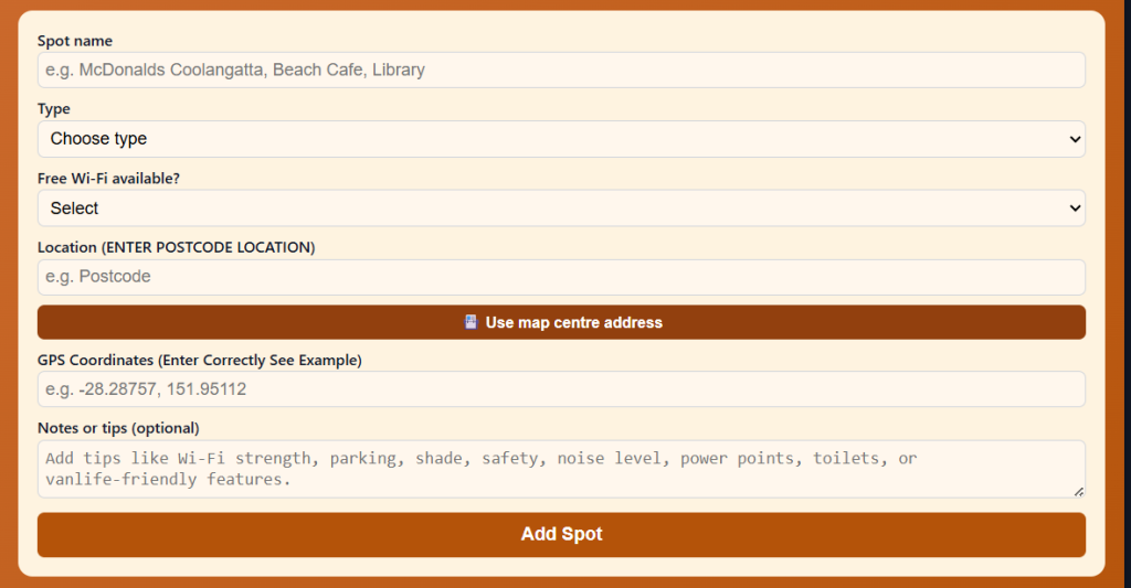
Use the Vanlife Savings Spots App to save your locations. Add your postcode, GPS coordinates and notes, then tap “Add Spot” to place it on the map and get directions.
Proserpine RV Rest Stop (St Catherine’s Church) – Proserpine QLD 4800
Distance from Proserpine: 0 km — heart of the town, directly behind St Catherine’s Catholic Church on Main Street Maximum Stay: 48 hours — strictly enforced; rangers record registrations; overstay = $280+ fine Self‑Contained Required: Yes — fully self-contained vehicles only (no external toilet access on site); dump point and tap water installed on site Toilets On‑Site: Dump point and water tap on site; nearest public toilets at Pioneer Park across the road (corner Anzac Road and Herbert Street) Toilet Address: Pioneer Park, cnr Anzac Road and Herbert Street, Proserpine QLD 4800 Toilet GPS: -20.4005, 148.5797 (approx.) Showers: No Pet‑Friendly: Yes — dogs on lead Caravan‑Friendly / Big‑Rig Access: Yes — flat area suitable for most rigs; very large bus conversions (19m+) have reported insufficient turning space — assess before committing; up to approximately 18 self-contained bays Campervan Access: Yes Camper Trailer Access: Yes Tent Camping Allowed: No — self-contained vehicles only Vehicle Restrictions: Self-contained vehicles only; very large combinations should assess turning space before entering Telstra Reception: Yes — good in-town coverage GPS: -20.4005, 148.5797 (Public mapping data) Address: Behind St Catherine’s Catholic Church, Main Street, Proserpine QLD 4800 (one street off the Bruce Highway) Coordinate Source: Public mapping data
⚠️ Important current status notice: The Proserpine RV Rest Stop behind St Catherine’s Church was closed in late 2023 after the council decided not to spend $600,000 on drainage and infrastructure upgrades on leased land. However, Whitsunday Regional Council voted unanimously in early 2025 to reopen the site, with the official reopening scheduled for April 2026. The site will operate seasonally — open April to October (dry season) only, closed November to March (wet season). Verify current status with Whitsunday Regional Council (1300 972 744) before visiting. When operating, rangers enforce 48-hour limits and $280+ fines apply for overstays.
Accessibility (Disability‑Friendly Notes)
- Wheelchair-accessible toilets: Across the road at Pioneer Park — accessible facilities confirmed
- Accessible parking: Yes — flat bitumen and gravel surface on site
- Pathway surface: Flat; gravel and bitumen mix; mostly level
- Mobility-friendly access to amenities: Good — public toilets are across the road with kerb ramps; dump point and water tap on site
- Turning space for mobility devices: Good — open flat area
- Suitability for travellers with limited mobility: Good — flat site; Proserpine main street is flat and accessible within easy walking distance
- Nearby accessible toilets: Pioneer Park across the road; Proserpine CBD within 150 m
- Emergency toilet options within 1–5 km: Pioneer Park; multiple CBD options
Access Notes
- Road type: Sealed — enter from Main Street; the site is one street off Bruce Highway, directly behind St Catherine’s Church
- Turning space: Adequate for standard caravans and motorhomes; very large bus conversions (19m+) have reported difficulties — inspect before entering; the site accommodates up to approximately 18 bays
- Caravan/motorhome suitability: Good for most configurations
- Vehicle limitations: 19m+ bus conversions may not have sufficient turning space — confirm on arrival
Why Retirees Like It
When this site was operating, grey nomads consistently reported spending $150–$250 in Proserpine per visit — fuel, bakery, pub meals, groceries, hardware. The economy of the town visibly felt it. The RV Rest Stop is right in the heart of Main Street, walking distance from the supermarket, chemist, bakery, service stations and the pub. It’s the kind of site that makes Proserpine worth stopping for rather than driving through — which is exactly why the council voted 7-0 to bring it back. RV friendly Proserpine travellers who plan their timing around the April–October season will have one of the best-positioned free town stops on the entire Bruce Highway corridor.
Nearby Public Wi‑Fi Options
Proserpine Library – Proserpine QLD 4800 Address: 46 Main St, Proserpine QLD 4800 Free Wi‑Fi: Yes Toilets: Yes — accessible Toilet Address: 46 Main St, Proserpine QLD 4800 Toilet GPS: -20.4005, 148.5797 (approx.) Parking suitability: Good — wide main street; suitable for campervans Wi‑Fi GPS: -20.4005, 148.5797 Parking GPS: -20.4005, 148.5797
Driving Directions
➡ From north or south on Bruce Highway, turn into Proserpine Main Street ➡ St Catherine’s Catholic Church is on the right (east) side of Main Street ➡ The RV Rest Stop is directly behind the church — follow signage; entrance off Main Street
Tips
- Check current status: Scheduled to reopen April 2026 — verify before visiting on 1300 972 744
- Self-containment: Rangers are strict — $280+ fine for non-compliant vehicles; no exceptions
- 48 hours: Rangers record registrations daily; overstay = fine
- Spend in town: Respect the community’s generosity — buy fuel, food, coffee, groceries
- Wet season closure: Site closed November to March; plan accordingly
- Very large rigs: 19m+ bus conversions — assess turning space before committing; site has limited manoeuvring area
Lake Proserpine Campground (Peter Faust Dam) – Proserpine QLD 4800
Distance from Proserpine: Approx. 20 km west via the Collinsville Road / dam access road — approximately 20–25 minutes Maximum Stay: 7 nights Self‑Contained Required: No — full facilities on site including toilets, hot showers, and a live-in kiosk caretaker Toilets On‑Site: Yes — modern clean toilet block; hot showers available Toilet Address: Peter Faust Dam Road, Lake Proserpine QLD 4800 Toilet GPS: -20.4690, 148.3860 (approx.) Showers: Yes — hot showers available Pet‑Friendly: Yes — dogs on lead; dogs must be restrained at all times; no leash-free areas; dog waste bags required; please use provided doggy bags; pets not to be left unattended Caravan‑Friendly / Big‑Rig Access: Yes — 2WD accessible via sealed road; suitable for all rig types including large motorhomes; flat, open campground Campervan Access: Yes Camper Trailer Access: Yes Tent Camping Allowed: Yes Vehicle Restrictions: No beach driving; boat ramp access for registered watercraft; stay 200 m from dam wall Telstra Reception: Very limited to none on camp sites — mobile coverage near the dam wall is reported by some; carry a satellite device or PLB GPS: -20.4690, 148.3860 (Public mapping data) Address: Peter Faust Dam Road, via Proserpine QLD 4800 — approximately 20 km west of Proserpine township Coordinate Source: Public mapping data
Note: Current nightly fee approximately $10–$15 per adult per night (verified 2024–2025 — exact rate subject to change; check current pricing at the kiosk on arrival or via Whitsunday Regional Council on 1300 972 744). Families and concession pricing may apply. All guests must check in at the kiosk on arrival prior to finding a campsite. The dump point for this camp is back in Proserpine — dump before heading to the dam. Free Wi-Fi is available at the campground (limited; check with kiosk on arrival).
Future planned upgrades include 10 cabins, powered caravan sites, new BBQs and a camp kitchen — verify current status of these upgrades on arrival.
Accessibility (Disability‑Friendly Notes)
- Wheelchair-accessible toilets: Yes — modern toilet block with accessible facilities; verify condition on arrival
- Accessible parking: Yes — large flat open area; suitable for all mobility devices
- Pathway surface: Flat grassed and gravel areas throughout the campground; generally level
- Mobility-friendly access to amenities: Good — modern facilities in a flat, open setting
- Turning space for mobility devices: Excellent — large open campground
- Suitability for travellers with limited mobility: Good — flat lakeside site; modern toilet facilities; short distances to amenities; excellent for those who cannot access more remote camps
- Nearby accessible toilets: On-site — modern block
- Emergency toilet options within 1–5 km: On-site; Proserpine township 20 km east
Access Notes
- Road type: Sealed bitumen road the full 20 km from Proserpine — excellent for all 2WD configurations including full-size caravans
- Turning space: Excellent — large open campground; good turning areas throughout
- Caravan/motorhome suitability: Excellent — all rig types welcomed and regularly present; large motorhomes and caravans are common
- Vehicle limitations: None noted; stay at least 200 m from the dam wall as marked by buoy line
Why Retirees Like It
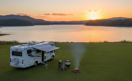
Lake Proserpine at sunset is one of those genuinely jaw-dropping experiences that reminds you why you went van life in the first place. The vast blue of the lake reflects the tropical sky, the rolling hills behind the dam wall turn gold, camp fires are permitted in the designated fire pits, and the whole place settles into an extraordinary quiet that you don’t find at busier coastal camps. The fishing is outstanding — barramundi, bass and bream in the lake; boating access via the ramp; and three fishing pontoons right in the camping area. The kiosk sells basic supplies, ice and fuel for boat motors, and the Little Vintage Café operates Wednesday to Sunday 7:30 am–2 pm for coffee and food. For retirees who want a beautiful, full-facilities camp with a strong community feel and extraordinary scenery, Peter Faust Dam consistently delivers. Many grey nomads arrive for 2 nights and stay the full 7 days. Overnight parking Proserpine travellers heading to the dam need to dump in town first — the dump point is at Proserpine, not at the lake.
Nearby Public Wi‑Fi Options
Proserpine Library – Proserpine QLD 4800 Address: 46 Main St, Proserpine QLD 4800 Free Wi‑Fi: Yes Toilets: Yes — accessible Toilet Address: 46 Main St, Proserpine QLD 4800 Toilet GPS: -20.4005, 148.5797 (approx.) Parking suitability: Good — wide main street Wi‑Fi GPS: -20.4005, 148.5797 Parking GPS: -20.4005, 148.5797
Driving Directions
➡ From Proserpine township, head west on the Collinsville Road / dam access road ➡ Follow for approx. 20 km — dam is well-signed ➡ Check in at the kiosk on arrival before finding your campsite
Tips
- Check in at kiosk: Compulsory — do not find a site before checking in; a vehicle letter may be issued if you arrive after hours, requiring morning check-in
- Dump point: Dump in Proserpine before heading to the dam — the dump point is in town, not at the lake
- Water: Fill your tanks in Proserpine before arriving — bring more than you think you’ll need
- Reception: No phone signal on most camp sites — let a trusted contact know your plan before you leave Proserpine
- Fires: Permitted in designated fire pits; firewood sometimes green or limited — bring your own
- Dogs: On lead at all times; doggy bags required; do not leave pets unattended
- Swimming: Permitted in the lake away from exclusion zones; obey all signage; no swimming near the dam wall (200 m exclusion zone)
- Boats: Boat ramp available; no unlicensed or unregistered watercraft
- Wet season: January–March; lake levels rise; access road and campground remain generally accessible but conditions vary — check ahead
Collinsville Rest Area – Collinsville QLD 4804
Distance from Proserpine: Approx. 94 km west on the Collinsville Road — a natural staging point for those exploring the inland route Maximum Stay: 24 hours Self‑Contained Required: No — public amenities in the township Toilets On‑Site: Yes — public toilets in Collinsville township near the rest area; the Collinsville township has full public amenities Toilet GPS: -20.5548, 147.8534 (approx. Collinsville township) Showers: No on-site showers at rest area; enquire at council or community centre for alternatives Pet‑Friendly: Yes Caravan‑Friendly / Big‑Rig Access: Yes — 2WD accessible; wide flat access Campervan Access: Yes Camper Trailer Access: Yes Tent Camping Allowed: Yes Vehicle Restrictions: None noted Telstra Reception: Yes — Telstra in township GPS: -20.5548, 147.8534 (Public mapping data) Address: Collinsville township QLD 4804 — via Collinsville Road from Proserpine Coordinate Source: Public mapping data
Note: Collinsville is an RV-friendly inland mining town with a strong grey nomad welcome. The township actively supports travellers. Verify current rest area location and rules with Isaac Regional Council on 1300 ISAACS (472 227). Collinsville is approximately 94 km west of Proserpine via the Collinsville Road past Peter Faust Dam — a beautiful inland drive through the ranges.
Accessibility (Disability‑Friendly Notes)
- Wheelchair-accessible toilets: Yes — township public facilities; flat CBD access
- Accessible parking: Yes — wide flat township streets
- Pathway surface: Sealed township footpaths; mostly flat
- Mobility-friendly access to amenities: Good — compact, flat country town
- Suitability for travellers with limited mobility: Good — flat town; accessible facilities
- Nearby accessible toilets: Township public facilities
- Emergency toilet options within 1–5 km: Township
Access Notes
- Road type: Sealed Collinsville Road from Proserpine — well-maintained; passes Peter Faust Dam on the way west; some gentle rises through the ranges
- Turning space: Wide country town streets; good for all rig types
- Caravan/motorhome suitability: Good — highway-standard sealed road all the way from Proserpine
- Vehicle limitations: None on main route; check any access tracks within town
Why Retirees Like It
Collinsville is one of those genuine outback Queensland towns that still knows how to welcome a traveller. The drive west from Proserpine through the ranges and on past Peter Faust Dam is a beautiful scenic alternative to retracing the Bruce Highway. It’s not often used by coastal-focused travellers, which makes it an authentic, uncrowded experience. The town has a pub, supermarket and all essential services. The evening light on the surrounding ranges is beautiful. Low-cost camping Proserpine travellers who want a quiet inland detour find Collinsville a genuine discovery.
Nearby Public Wi‑Fi Options
Collinsville Library or Council Office – Collinsville QLD 4804 Address: Collinsville township QLD 4804 — enquire at council Free Wi‑Fi: Enquire with Isaac Regional Council or library Toilets: Yes — township Toilet GPS: -20.5548, 147.8534 (approx.) Parking suitability: Good — wide country streets Wi‑Fi GPS: -20.5548, 147.8534 Parking GPS: -20.5548, 147.8534
Driving Directions
➡ From Proserpine ▶ West on Collinsville Road ▶ Past Peter Faust Dam (20 km) ▶ Continue west approx. 74 km through the ranges ▶ Collinsville township
Tips
- Drive: The Collinsville Road past the dam is beautiful — allow time to stop at the dam on the way through
- Fuel: Fill in Proserpine before departing; limited fuel options west of the dam
- Safety: Notify a trusted contact of your planned route; limited phone coverage through ranges
Guthalungra Rest Area – Guthalungra QLD 4805
Distance from Proserpine: Approx. 80 km north via Bruce Highway — between Proserpine and Bowen Maximum Stay: 24 hours Self‑Contained Required: No — toilets on site Toilets On‑Site: Yes — new amenities block including wheelchair-accessible toilets Toilet Address: Lot 86 Coventry Road, Guthalungra QLD 4805 Toilet GPS: -19.5100, 147.7030 (approx.) Showers: No Pet‑Friendly: Yes — dogs welcome Caravan‑Friendly / Big‑Rig Access: Yes — 2WD accessible; suitable for all rig types including big rigs Campervan Access: Yes Camper Trailer Access: Yes Tent Camping Allowed: Yes Vehicle Restrictions: None noted Telstra Reception: Yes — Telstra coverage reported on site GPS: -19.5100, 147.7030 (Public mapping data) Address: Lot 86 Coventry Road, Guthalungra QLD 4805 — direct access off Bruce Highway Coordinate Source: Public mapping data
Note: Donation box on site — please contribute. Adjacent Guthalungra Roadhouse (operating since 1963) sells fuel, sandwiches, pies, sausage rolls and quality rolls. Wood-burning BBQs on site — bring your own wood. The parks nearest the amenities block are furthest from the highway and quietest.
Accessibility (Disability‑Friendly Notes)
- Wheelchair-accessible toilets: Yes — new amenities block
- Accessible parking: Yes — large flat area
- Pathway surface: Sealed and gravel; mostly level
- Mobility-friendly access to amenities: Good — well-maintained, modern facility
- Turning space for mobility devices: Good
- Suitability for travellers with limited mobility: Good — one of the most accessible free camps on the Bruce Highway north of Proserpine
- Nearby accessible toilets: On-site; Guthalungra Roadhouse (adjacent)
- Emergency toilet options within 1–5 km: On-site; Roadhouse
Access Notes
- Road type: Direct access off Bruce Highway — well-maintained entry
- Turning space: Good — large circular road/parking area
- Caravan/motorhome suitability: Excellent — designed for all rig types
- Vehicle limitations: None noted
Why Retirees Like It
Guthalungra is consistently rated one of the best free camps on the entire Bruce Highway north of Mackay — and with good reason. The upgrades to the amenities block, the BBQ areas and the covered eating spaces have made it a genuinely comfortable overnight stop. For Proserpine travellers heading north toward Bowen and Townsville, it’s the natural first-night stop. The Guthalungra Roadhouse has been serving travellers since 1963 and the quality sandwiches and pies are genuine. Arrive early in peak season (June–August) — the site fills by mid-afternoon.
Nearby Public Wi‑Fi Options
Guthalungra Roadhouse – Guthalungra QLD 4805 Address: Bruce Highway, Guthalungra QLD 4805 Free Wi‑Fi: Enquire at roadhouse Toilets: Yes Toilet GPS: -19.5100, 147.7030 (approx.) Parking suitability: Good — roadhouse forecourt Wi‑Fi GPS: -19.5100, 147.7030 Parking GPS: -19.5100, 147.7030
Driving Directions
➡ From Proserpine ▶ North on Bruce Highway approx. 80 km ➡ Watch for Guthalungra Rest Area sign ▶ Turn into Coventry Road ➡ Follow circular road — parks nearest amenities block are furthest from highway and quietest
Tips
- Arrival time: Before 2 pm in peak season — popular site
- Firewood: Bring your own for the wood BBQs
- Donation: The box is there for a reason — please use it
- Noise: Furthest parks from the highway are significantly quieter
- Safety: Well-frequented; safe overnight
Camp Kanga (Lions Club) – Peter Faust Dam QLD 4800
Distance from Proserpine: Approx. 20 km west — adjacent to the Lake Proserpine Campground at Peter Faust Dam Maximum Stay: By arrangement — enquire with the Lions Club Self‑Contained Required: No — toilets, showers and powered sites available Toilets On‑Site: Yes — shower and toilet block Toilet GPS: -20.4690, 148.3860 (approx. Peter Faust Dam area) Showers: Yes Pet‑Friendly: Yes — well-behaved dogs welcome; on lead; 3 friendly Lions Club dogs on site Caravan‑Friendly / Big‑Rig Access: Yes — powered sites from $30/night; unpowered sites available Campervan Access: Yes Camper Trailer Access: Yes Tent Camping Allowed: Yes Vehicle Restrictions: None noted; large flat grassed area Telstra Reception: Very limited — same as Lake Proserpine Campground GPS: -20.4690, 148.3860 (approx. — Public mapping data) Address: Peter Faust Dam Road, Lake Proserpine QLD 4800 (adjacent to Lake Proserpine Campground) Coordinate Source: Public mapping data
Note: Camp Kanga is run by the local Lions Club and is primarily a base for fishing anglers, including those flying in. Powered sites from $30/night; cabin accommodation also available ($35/person shared, $50 solo). This is a low-cost paid option rather than free, but included here as it provides powered sites and cabin accommodation that the adjacent council campground does not currently offer. Fees accurate as of 2024 — verify current rates directly with Camp Kanga before visiting.
Accessibility (Disability‑Friendly Notes)
- Wheelchair-accessible toilets: Enquire on arrival — community-managed facility
- Accessible parking: Yes — flat open grassed area
- Pathway surface: Flat grass; mostly level
- Mobility-friendly access to amenities: Moderate — compact community facility
- Suitability for travellers with limited mobility: Moderate — flat but less formally accessible than the council campground next door
- Nearby accessible toilets: Lake Proserpine Campground adjacent (modern accessible block)
Access Notes
Adjacent to the Lake Proserpine Campground via the same Peter Faust Dam Road access — well-signed. Suitable for 2WD configurations.
Why Retirees Like It
Camp Kanga fills a gap that the council campground next door doesn’t cover — powered sites and cabin accommodation at the lake. For retirees who want power access (CPAP machines, powered mobility aids) without driving back to a caravan park in Proserpine, Camp Kanga is the only option at the dam. The community feel of a Lions Club-managed facility, the friendly dogs, and the proximity to the fishing are all genuine draws. An excellent complement to the free council camp next door.
Nearby Public Wi‑Fi Options
Proserpine Library – Proserpine QLD 4800 Address: 46 Main St, Proserpine QLD 4800 Free Wi‑Fi: Yes Toilets: Yes — accessible Toilet GPS: -20.4005, 148.5797 (approx.) Parking suitability: Good Wi‑Fi GPS: -20.4005, 148.5797 Parking GPS: -20.4005, 148.5797
Driving Directions
➡ From Proserpine ▶ West on Collinsville Road / dam access road ▶ 20 km ▶ Follow signs to Peter Faust Dam ➡ Camp Kanga is adjacent to the council campground — follow signs on arrival
Tips
- Book ahead: Enquire before arriving — Lions Club managed
- Power: Confirm power availability for your needs before arrival
- Fishing: Exceptional fishing access at the adjacent boat ramp and pontoons
- Dogs: Welcome but on lead at all times
⭐ Things to Do Nearby (Retiree‑Friendly Tourist Activities)
Activities Near Proserpine and the Whitsunday Region
Cedar Creek Falls – Conway National Park QLD 4800
One of the most popular day trips from Proserpine — a beautiful natural freshwater swimming hole and waterfall in the Conway Range, approximately 25 km south-east of Proserpine. The falls are at their most dramatic in and after the wet season (December–March) but are worth visiting year-round. The walk from the carpark to the falls is approximately 600 m return on a sealed path with some steps — short but steep in parts. Swimming is permitted in the pool below the falls (check current conditions — avoid after heavy rain when currents can be strong).
- Walking difficulty: Moderate — short but some steps; 600 m return from carpark; comfortable footwear essential
- Amenities: Toilets at carpark; no café; seating near the falls; bring your own food and water
- Disability access: Sealed path from carpark but steps at the falls — partially accessible; accessible toilets at carpark; carpark view of the upper section is available for those unable to descend
- Parking: Good — sealed carpark; suitable for campervans
Airlie Beach Foreshore and Lagoon Pool – Airlie Beach QLD 4802
A 27 km drive east from Proserpine brings you to Airlie Beach — the tourism heart of the Whitsundays. The famous free public lagoon pool on the foreshore is one of Queensland’s great tropical experiences — a stinger-free swimming lagoon on the edge of the Coral Sea with views to the Whitsunday Islands. Flat, sealed and fully accessible. The main street of Airlie Beach is lively, well-serviced and flat for easy walking.
- Walking difficulty: Easy — flat sealed foreshore throughout
- Amenities: Cafés, restaurants, accessible toilets throughout foreshore; supermarket; pharmacy; full town services
- Disability access: Excellent — flat sealed foreshore; accessible lagoon pool entry; accessible toilets; disabled parking at foreshore
- Parking: Good — foreshore carpark; campervans on surrounding streets; leave tow vehicle and caravan in Proserpine if possible
Proserpine Museum – Proserpine QLD 4800
A well-regarded community museum in the Proserpine township telling the story of the region’s sugar-cane history, pioneering settlement, and Cyclone Debbie’s 2017 impact. Small entry fee with pensioner concession. Air-conditioned and well-presented. An excellent wet-day option — flat, accessible and genuinely interesting.
- Walking difficulty: Easy — flat, indoor, CBD location
- Amenities: CBD cafés and services within easy walking distance; toilets nearby
- Disability access: Enquire with museum on arrival — CBD building; flat access
- Parking: Good — wide main street and CBD carparks; suitable for campervans
Whitsunday Islands Day Tour – from Airlie Beach QLD 4802
The Whitsunday Islands — 74 islands within the Great Barrier Reef Marine Park — are 27 km east of Proserpine via Airlie Beach. Day tours to Whitehaven Beach (consistently rated among the world’s finest beaches — pure silica sand and turquoise water) and the reef depart from the Airlie Beach Cruise Whitsundays terminal. Everything is handled by the tour operator — no 4WD, no boat license, no planning required. Just book a seat.
- Walking difficulty: Easy on guided tours — short guided walks on firm sand; optional longer walks available
- Amenities: Tour operators provide meals and facilities; Airlie Beach has full town services
- Disability access: Check with individual tour operators — some vessels can accommodate limited mobility travellers
- Parking: Good — leave tow vehicle and caravan in Proserpine; campervans park at Airlie Beach foreshore or main street
Lake Proserpine Fishing – Peter Faust Dam QLD 4800
The lake impounded by Peter Faust Dam is one of the best barramundi, bass and bream fishing spots in Central Queensland. Three fishing pontoons are installed in the camping area, and a boat ramp provides full lake access for watercraft. Early morning and late afternoon are the prime fishing times. Bring your own gear — no hire available on site.
- Walking difficulty: Easy — flat campground; short walk to pontoons from most sites
- Amenities: On-site kiosk (sells ice, bait and limited supplies); Little Vintage Café Wed–Sun 7:30 am–2 pm; toilets and showers on site
- Disability access: Flat campground; accessible toilet block; pontoons require a short flat walk
- Parking: Good — large open campground area
Whitsunday Crocodile Safari – Proserpine River QLD 4800
Whitsunday Crocodile Safari operates from the Proserpine River, offering boat tours to observe wild saltwater crocodiles in their natural mangrove habitat. A surprisingly popular and genuinely fascinating experience that gives you an up-close perspective on one of Australia’s most extraordinary predators — from the safety of a guided boat. Tours operate from the Proserpine township area.
- Walking difficulty: Easy — board the boat and go
- Amenities: Guided tour; toilets available before departure; Proserpine township for all other needs
- Disability access: Enquire with tour operator about mobility access to the boat; the Proserpine wharf area is generally flat
- Parking: Good — Proserpine township
Bowen Heritage Trail and Beaches Day Trip – Bowen QLD 4805
A 58 km drive north from Proserpine brings you to Bowen — home to seven of Queensland’s finest beaches, a beautiful colonial heritage CBD, and the famous Horseshoe Bay where fringing Barrier Reef coral is accessible by simply wading from the sand. The Bowen Heritage Trail (self-guided, available at the VIC) covers the town’s finest Victorian-era buildings in a flat, easy 1.5-hour walk.
- Walking difficulty: Easy — flat beach and CBD; gentle heritage trail
- Amenities: Full town services in Bowen; cafés, restaurants, accessible toilets; snorkel gear hire at Horseshoe Bay
- Disability access: Flat sealed foreshore paths throughout Bowen; accessible toilets; Horseshoe Bay flat beach approach
- Parking: Good — wide foreshore roads and CBD carparks; suitable for campervans
Proserpine Bakery and Main Street Café Crawl – Proserpine QLD 4800
Proserpine’s Main Street is flat, walkable and has a genuinely good selection of cafés, bakeries and restaurants for a town its size. The bakery is regularly praised by grey nomads for its quality. A morning coffee crawl from the RV Rest Stop to the bakery, then the chemist, newsagency and IGA is a genuinely pleasant way to spend a morning — and it supports the businesses that support the free camping.
- Walking difficulty: Easy — flat main street; short distances
- Amenities: Everything within 400 m of the RV Rest Stop
- Disability access: Good flat footpaths; accessible business premises throughout main street
- Parking: On-site at the RV Rest Stop or wide street parking
Coastal Free Camping Options Near Proserpine
Midge Point Beach Camping Area – Midge Point QLD 4799
Approx. 50 km south-east of Proserpine — a quiet community beach village on the Whitsunday Coast
Distance from Proserpine: Approx. 50 km south-east via Bruce Highway south and Midge Point Road Maximum Stay: Donation-based or low council fee — verify current status with Whitsunday Regional Council (1300 972 744) Self‑Contained Required: No — public facilities in township Toilets: Yes — public toilets in Midge Point village Toilet Address: Midge Point village QLD 4799 Toilet GPS: -20.6240, 148.7130 (approx.) Showers: No on-site showers — nearest at paid caravan parks or Proserpine Pet‑Friendly: Yes — dogs allowed on lead Caravan‑Friendly / Big‑Rig Access: Yes — 2WD accessible; suitable for caravans and motorhomes Campervan Access: Yes Camper Trailer Access: Yes Tent Camping Allowed: Yes Vehicle Restrictions: None noted Telstra Reception: Yes — in town GPS: -20.6240, 148.7130 (Public mapping data) Address: Midge Point village QLD 4799 — via Midge Point Road off the Bruce Highway Coordinate Source: Public mapping data
Note: Midge Point is a small quiet coastal village with a tavern bistro, boat ramp and beach access. The tavern (worth booking ahead for meals). The beach access and boat ramp make it an excellent fishing base. A Hipcamp listing nearby notes it as “2WD accessible, suitable for tents, camper trailers, caravans and RVs” with the tavern bistro “just down the road for delicious meals, icy drinks and pool”. Verify current camping rules and costs with local council or on WikiCamps/CamperMate before visiting.
Accessibility (Disability‑Friendly Notes)
- Wheelchair-accessible toilets: Public toilets in township — verify condition on arrival
- Accessible beach access: Flat foreshore access; sandy beach
- Pathway surface: Sealed township; flat
- Accessible parking: Good — flat open area
Access Notes
Sealed road off the Bruce Highway — easy access for all 2WD configurations. The township is 5 minutes from Jimmy’s Rocks Boat Ramp (good for fishing and crabbing). Beach access is flat and easy.
Why Retirees Like It
Midge Point is one of the Whitsunday region’s quieter community coastal villages — genuine and unpolished, with excellent fishing, crabbing and beach access. The lack of Airlie Beach-style tourist development is the point. Coastal breezes keep it cooler than you’d expect. It’s a find rather than a destination — which is exactly what experienced grey nomads value.
Conway Beach Camping – Conway Beach QLD 4800
Approx. 40 km east of Proserpine — near the Conway National Park and Airlie Beach
Distance from Proserpine: Approx. 40 km east via Proserpine-Airlie Beach Road Maximum Stay: Verify with Whitsunday Regional Council Self‑Contained Required: No — facilities in the community Toilets: Yes — public toilet facilities at Conway Beach Toilet GPS: -20.4500, 148.7500 (approx.) Showers: Enquire locally Pet‑Friendly: Yes — dogs on lead on beach Caravan‑Friendly / Big‑Rig Access: Yes — 2WD accessible Campervan Access: Yes Camper Trailer Access: Yes Tent Camping Allowed: Yes Vehicle Restrictions: None noted Telstra Reception: Yes GPS: -20.4500, 148.7500 (Public mapping data) Address: Conway Beach QLD 4800 — 10 minutes from Cedar Creek Falls Coordinate Source: Public mapping data
Accessibility (Disability‑Friendly Notes)
- Wheelchair-accessible toilets: Enquire locally — public facilities at beach
- Accessible beach access: Flat coastal foreshore
- Pathway surface: Flat sealed road access; grassed foreshore
Access Notes
Conway Beach is within easy striking distance of both Cedar Creek Falls (5 minutes) and Airlie Beach (20 minutes). A quiet, family-community beach with genuine local character.
Why Retirees Like It
A peaceful, community beach between the national park and Airlie Beach — without the tourist pricing. An excellent base for exploring Conway National Park, Cedar Creek Falls and Airlie Beach while staying in a genuine local community rather than a tourist hub.
Nearby Public Wi‑Fi Options
Airlie Beach Library – Airlie Beach QLD 4802 Address: 16 Main St, Airlie Beach QLD 4802 Free Wi‑Fi: Yes Toilets: Yes — accessible Toilet GPS: -20.2737, 148.7193 (approx.) Parking suitability: Good Wi‑Fi GPS: -20.2737, 148.7193 Parking GPS: -20.2737, 148.7193
Potable Water Fill Points
Proserpine RV Rest Stop (Water Tap) – Proserpine QLD 4800
Address: Behind St Catherine’s Church, Main Street, Proserpine QLD 4800 GPS: -20.4005, 148.5797 (approx.) Access notes: Water tap installed on site at the RV Rest Stop — available to self-contained visitors; free; bring your own certified drinking water hose; verify current operational status (site scheduled to reopen April 2026) Big‑rig suitability: Good — flat site; standard tap height Disability access: Flat surface; good access from parking area
Proserpine Service Stations – Proserpine QLD 4800
Address: Various — Proserpine Main Street and Bruce Highway approaches GPS: -20.4005, 148.5797 (approx. Proserpine CBD) Access notes: Water available at major service stations — enquire for current fill point access; bring your own hose; best option when the RV Rest Stop is closed (wet season) Big‑rig suitability: Good — highway-sized forecourts Disability access: Flat forecourts; accessible at all major stations
Planning note: Fill water tanks in Proserpine before heading to Peter Faust Dam. No coin-operated water fill station at the lake — you are reliant on whatever water you carry with you. Carry at least 2–3 days of water beyond your planned stay at the dam. The kiosk sells bottled water at retail prices — do not rely on this as your water supply.
Dump Points (RV Waste Disposal)
Proserpine RV Rest Stop Dump Point – Proserpine QLD 4800
Address: Behind St Catherine’s Church, Main Street, Proserpine QLD 4800 GPS: -20.4005, 148.5797 (approx.) Access notes: Free dump point installed on site at the RV Rest Stop; available to all travellers when the site is operational; free of charge; 24-hour access when open; use before heading to Peter Faust Dam — there is no dump point at the lake Caravan/motorhome suitability: Good — flat site; suitable for all standard configurations Disability access: Flat surface; good accessibility
Critical note for Peter Faust Dam visitors: Dump before leaving Proserpine. The nearest dump point to the dam is back in Proserpine township. If you arrive at the dam with a full tank, you will need to return to town to empty before your 7-night stay — plan this before departing.
Proserpine Sewage Treatment Works Dump Point – Proserpine QLD 4800
Address: Verify current location with Whitsunday Regional Council (1300 972 744) — a second dump point option in Proserpine GPS: -20.4005, 148.5797 (approx. — verify exact location) Access notes: Free; 24-hour access; confirm current availability before relying on this location; the RV Rest Stop dump point is the primary option when operational Caravan/motorhome suitability: Enquire with council Disability access: Enquire with council
Fuel Stops Retirees Prefer (Caravan‑Friendly)
Proserpine Service Stations (Multiple) – Proserpine QLD 4800
Wide forecourt: Yes — multiple highway-standard stations in Proserpine Diesel availability: Yes Turning space: Excellent — designed for trucks and caravans Address: Main Street and Bruce Highway approaches, Proserpine QLD 4800 GPS: -20.4005, 148.5797 (approx.) Accessibility: Accessible toilets at major stations; disabled parking; flat forecourts
Note: Proserpine fuel prices are consistently lower than Airlie Beach (27 km east) and other tourist-area stations. Always check Petrol Spy before leaving Proserpine if heading toward Airlie Beach or north. Fill up in Proserpine before heading to Peter Faust Dam — no fuel available at the lake.
Collinsville Service Station – Collinsville QLD 4804
Wide forecourt: Moderate Diesel availability: Yes — verify current availability Turning space: Good — wide country town streets Address: Collinsville township QLD 4804 GPS: -20.5548, 147.8534 (approx.) Accessibility: Flat township; accessible Note: The fuel stop for those driving the inland route from Proserpine to Collinsville. Fill in Proserpine before departing — don’t rely on availability at Collinsville.
Guthalungra Roadhouse – Guthalungra QLD 4805
Wide forecourt: Moderate — adequate for standard rigs Diesel availability: Yes — verify current fuel types Turning space: Adequate Address: Bruce Highway, Guthalungra QLD 4805 GPS: -19.5100, 147.7030 (approx.) Accessibility: Flat forecourt; basic facilities Note: 80 km north of Proserpine on the Bruce Highway; useful for north-bound travellers. Check Petrol Spy before leaving Proserpine and decide whether to fill here or wait.
Saving Money on Fuel Using Petrol Spy
Petrol Spy is a free Australian fuel-price comparison app showing live diesel and petrol prices across thousands of service stations. For Proserpine travellers, it’s particularly valuable because Airlie Beach and other tourist-focused stations typically charge a premium of 15–30 cents per litre above the Proserpine town price.
Why Retirees Should Use It
Airlie Beach is only 27 km from Proserpine but fuel prices in the tourist zone can be significantly higher than in Proserpine. Checking Petrol Spy before leaving Proserpine means you fill the tank at the best available price — and you never get caught out at a roadhouse in the ranges where pricing can be unpredictable. For those heading west to Collinsville or north to Bowen and Townsville, this matters.
Example Saving
A touring rig with a 150-litre diesel tank: filling 20c/L cheaper in Proserpine rather than Airlie Beach or a remote roadhouse = $30 saved per fill. Over a 3-month season with 12 fills, that’s $360 in savings — more than enough to cover seven nights at Peter Faust Dam at current rates.
Free Wi‑Fi Locations (Retiree‑Friendly)
Proserpine Library – Proserpine QLD 4800
Address: 46 Main St, Proserpine QLD 4800 Free Wi‑Fi: Yes Toilets: Yes — accessible Toilet Address: 46 Main St, Proserpine QLD 4800 Toilet GPS: -20.4005, 148.5797 (approx.) Parking suitability: Good — wide main street; suitable for campervans Wi‑Fi Address: 46 Main St, Proserpine QLD 4800 Wi‑Fi GPS: -20.4005, 148.5797 Parking Address: Main St, Proserpine QLD 4800 Parking GPS: -20.4005, 148.5797 Accessibility: Level entry; accessible toilets; disabled parking on street
Proserpine RV Rest Stop (Wi‑Fi when operational) – Proserpine QLD 4800
Address: Behind St Catherine’s Church, Main Street, Proserpine QLD 4800 Free Wi‑Fi: Yes — Wi-Fi was available at the original site; confirm current availability when site reopens April 2026 Toilets: Pioneer Park across the road — accessible Toilet GPS: -20.4005, 148.5797 (approx.) Parking suitability: On-site Wi‑Fi GPS: -20.4005, 148.5797 Accessibility: Flat site; accessible
Lake Proserpine Campground (Wi‑Fi) – Proserpine QLD 4800
Address: Peter Faust Dam Road, Lake Proserpine QLD 4800 Free Wi‑Fi: Yes — free Wi-Fi at the campground (limited); check current availability at the kiosk on arrival Toilets: Yes — modern accessible block Toilet GPS: -20.4690, 148.3860 (approx.) Parking suitability: Excellent — large open campground Wi‑Fi GPS: -20.4690, 148.3860 Parking GPS: -20.4690, 148.3860 Accessibility: Flat open site; accessible amenities block; accessible parking
Airlie Beach McDonald’s – Airlie Beach QLD 4802
Address: 243 Shute Harbour Rd, Airlie Beach QLD 4802 Free Wi‑Fi: Yes Toilets: Yes — accessible Toilet GPS: -20.2737, 148.7193 (approx.) Parking suitability: Good — large carpark suitable for campervans Wi‑Fi GPS: -20.2737, 148.7193 Parking GPS: -20.2737, 148.7193 Accessibility: Ramp entry; accessible toilets; disabled parking marked
Medical Access (Nearby Services)
Proserpine Hospital – Proserpine QLD 4800
Type of service: Public hospital — 24-hour Emergency Department; general medical and surgical; high dependency unit; obstetrics and maternity; oncology; midwifery; elective general surgery; cardiac rehabilitation; paediatrics; palliative care; mental health; dental clinic; 33 beds Phone Number: (07) 4813 9400 Address: 26-32 Taylor Street, Proserpine QLD 4800 GPS: -20.4003, 148.5849 (approx. Taylor Street, Proserpine) Call 000 For All Emergency Help Notes on access: Located in the centre of Proserpine township; follow hospital signs from the main street. Free limited parking at the hospital including accessible spaces. Free street parking on surrounding streets. Pick-up and drop-off areas in front of main entrance and Emergency Department. Phone interpreter service available. The hospital serves the Whitsunday region. Open 24 hours, 7 days. Disability access: Accessible building; ramp access; accessible parking spaces; accessible toilets; wheelchair accessible throughout
Whitsunday Doctors Service – Proserpine QLD 4800
Type of service: General practice — fees apply; book via HotDoc; mixed billing Phone Number: (07) 4964 6700 Address: 35 Chapman Street, Proserpine QLD 4800 GPS: -20.4005, 148.5797 (approx. Chapman Street, Proserpine) Call 000 For All Emergency Help Notes: Monday to Friday — book via HotDoc or phone ahead; fees apply; check current bulk-billing arrangements for concession card holders; Dr Konrad Kangru and Dr Frans Badenhorst are listed GPs Disability access: Enquire when booking
Proserpine Medical Centre – Proserpine QLD 4800
Type of service: General practice — a second GP option in town Phone Number: Search proserpinemedicalcentre.com.au or via HealthEngine Address: 60A Main St, Proserpine QLD 4800 GPS: -20.4005, 148.5797 (approx. Main Street, Proserpine) Call 000 For All Emergency Help Notes: Located on the main street — flat, accessible location; phone ahead for appointments and billing arrangements Disability access: Flat main street access; enquire when booking
Retiree‑Specific Safety Notes
Wildlife risks — CROCODILES: Saltwater crocodiles ARE present in the Proserpine River and all tidal waterways, estuaries, creeks and mangrove areas around Proserpine and the broader Whitsunday region. The Proserpine Crocodile Safari is conducted on the Proserpine River for good reason — it is genuine saltwater crocodile habitat. Never swim, wade or stand at the water’s edge in any tidal creek, estuary, river or mangrove area in the Proserpine region. Peter Faust Dam (a freshwater impoundment) is generally considered lower risk, but always obey posted signage at the lake. This applies year-round.
Wildlife risks — other: Box jellyfish are present in Whitsunday coastal waters from October to May — do not swim in unpatrolled ocean areas without protective clothing. Irukandji jellyfish are also present during stinger season. Freshwater crocodiles may also be present in inland waterways — generally not considered dangerous unless provoked or cornered. Snakes (including eastern brown snakes) are present in the bush around Peter Faust Dam and inland areas — watch where you step. Mosquitoes are prevalent around the lake in the warmer months — bring repellent.
Weather considerations: Proserpine is in the tropics. The dry season (April to October) is the ideal travel window — the RV Rest Stop also operates only during this period. The wet season (December–March) brings cyclone risk (Cyclone Debbie devastated the region in 2017), monsoonal rain, flooding and dangerous conditions. Monitor BOM forecasts during the wet season. The RV Rest Stop at St Catherine’s is closed November to March. Peter Faust Dam campground remains open year-round but conditions can vary — check with the kiosk.
Road gradients: Bruce Highway through Proserpine is mostly flat. The Collinsville Road west of the dam rises through ranges — sealed but with some bends; suitable for caravans. The road to Cedar Creek Falls has some bends on approach but is accessible for campervans.
Best arrival times: Lake Proserpine Campground fills in peak season (June–August) — check in at the kiosk on arrival, which is mandatory. Mid-week arrivals (Tuesday–Thursday) have more site choice. The Proserpine RV Rest Stop (when operational) has up to 18 bays — arrive by mid-afternoon for best placement. Guthalungra Rest Area fills by mid-afternoon in peak season — aim for before 2 pm.
Local council rules: Whitsunday Regional Council manages both the RV Rest Stop and Peter Faust Dam campground. The RV Rest Stop has strictly enforced 48-hour limits with $280+ fines. Peter Faust Dam has a 7-night maximum stay with a live-in caretaker monitoring compliance. All fees must be paid at the kiosk on arrival at the dam. Check current rules before visiting: 1300 972 744.
Cyclone or storm season notes: Proserpine is in a cyclone-affected region. Cyclone Debbie (2017) was catastrophic for the area. The official cyclone season is November to April. If a cyclone watch or warning is issued, move to solid shelter immediately — do not shelter in a caravan or motorhome. Know the location of the nearest evacuation centre before the wet season.
Pet safety: Dogs permitted at Lake Proserpine Campground and Camp Kanga (on lead; doggy bags required). Permitted at the RV Rest Stop (on lead). Not permitted at Cedar Creek Falls or Conway National Park camping areas. Keep dogs away from all tidal water areas — crocodiles are a genuine threat. Never leave pets in vehicles in the tropical heat. Ticks are present in bush areas — use tick prevention year-round.
Vehicle suitability warnings: Very large bus conversions (19m+) do not have sufficient turning space at the Proserpine RV Rest Stop — do not attempt; the site cannot accommodate them. Peter Faust Dam and Guthalungra are suitable for all rig types. The Collinsville Road is suitable for caravans to the ranges — sealed throughout.
Accessibility considerations: Proserpine Hospital has excellent accessible facilities. Proserpine township is flat and accessible throughout. Peter Faust Dam campground is flat and open with a modern accessible toilet block — excellent for travellers with limited mobility. The Proserpine RV Rest Stop is flat with accessible public toilets at Pioneer Park across the road. Cedar Creek Falls involves some steps on the walking track — the carpark view is accessible for those who cannot descend.
Maps & Simple Directions
To Proserpine RV Rest Stop (St Catherine’s Church)
➡ Bruce Highway into Proserpine ▶ Turn into Main Street ▶ St Catherine’s Catholic Church visible on right ▶ RV Rest Stop directly behind the church ▶ Follow signage — entrance off Main Street
To Lake Proserpine Campground (Peter Faust Dam)
➡ Proserpine ▶ West on Collinsville Road / dam access road ▶ 20 km ▶ Well-signed ▶ Check in at kiosk on arrival
To Camp Kanga (Peter Faust Dam)
➡ Same route as Lake Proserpine Campground ▶ Adjacent to council campground ▶ Follow signs on arrival
To Collinsville Rest Area
➡ Proserpine ▶ West on Collinsville Road ▶ Past Peter Faust Dam (20 km) ▶ Continue 74 km west through ranges ▶ Collinsville township
To Guthalungra Rest Area
➡ Proserpine ▶ North on Bruce Highway approx. 80 km ▶ Watch for rest area sign ▶ Turn into Coventry Road ▶ Circular road — furthest parks are quietest
To Cedar Creek Falls
➡ Proserpine ▶ East toward Airlie Beach on Shute Harbour Road ▶ Turn right onto Cedar Creek Falls Road (look for national park signs) ▶ 25 km ▶ Sealed carpark
To Airlie Beach
➡ Proserpine ▶ East on Shute Harbour Road ▶ 27 km ▶ Airlie Beach foreshore
Local Attractions for Day Trips
Cedar Creek Falls – Conway National Park QLD 4800
Distance from Proserpine: Approx. 25 km east Parking: Sealed carpark; suitable for campervans Walking difficulty: Moderate — 600 m return with steps at the falls Amenities: Accessible toilets at carpark; no café; seating near falls; bring own water Disability access: Sealed path from carpark; steps at the falls; carpark view accessible for those unable to descend Why retirees like it: A beautiful natural freshwater swimming hole with a backdrop of rainforest — short, rewarding and completely free
Airlie Beach Lagoon Pool and Foreshore – Airlie Beach QLD 4802
Distance from Proserpine: 27 km east Parking: Foreshore carpark and surrounding streets; suitable for campervans Walking difficulty: Easy — flat sealed foreshore throughout Amenities: Full town services; cafés, restaurants, accessible toilets, pharmacy, supermarket Disability access: Excellent — flat, sealed, accessible lagoon pool entry, accessible toilets Why retirees like it: The free public lagoon pool on a tropical foreshore with views to the Whitsunday Islands is one of Queensland’s great outdoor experiences — and it costs nothing
Whitsunday Islands Day Tour – from Airlie Beach QLD 4802
Distance from Proserpine: 27 km to departure point Parking: Good in Airlie Beach — secure parking available Walking difficulty: Easy on guided tours Amenities: Tour operators provide everything Disability access: Enquire with tour operators Why retirees like it: A World Heritage experience at your doorstep — Whitehaven Beach is genuinely one of the most beautiful places on Earth and day tours make the logistics completely effortless
Whitsunday Crocodile Safari – Proserpine River QLD 4800
Distance from Proserpine: 0 km — operates from the Proserpine River area Parking: Good — Proserpine township Walking difficulty: None — guided boat tour Amenities: Guided tour; Proserpine township for all other needs Disability access: Enquire with tour operator about vessel accessibility Why retirees like it: A safe, guided experience observing wild saltwater crocodiles in their natural habitat — genuinely extraordinary and not something you can do elsewhere in the region
Peter Faust Dam Sunset and Fishing – Lake Proserpine QLD 4800
Distance from Proserpine: 20 km west Parking: Large open campground; excellent Walking difficulty: Easy — flat campground and pontoons Amenities: Kiosk; Little Vintage Café Wed–Sun 7:30 am–2 pm; modern toilets and showers Disability access: Flat campground; accessible amenities; short flat walk to pontoons Why retirees like it: The sunset over Lake Proserpine from the fishing pontoons or the lake’s edge is extraordinary — and the barramundi fishing is as good as anywhere in Queensland
Bowen Heritage Beach Tour – Bowen QLD 4805
Distance from Proserpine: 58 km north Parking: Wide foreshore roads and CBD carparks; suitable for campervans Walking difficulty: Easy — flat beaches and CBD Amenities: Full town services; cafés, restaurants, accessible toilets, snorkel gear hire Disability access: Excellent — flat sealed foreshore paths; accessible toilets throughout Bowen Why retirees like it: Seven world-class beaches including the famous Horseshoe Bay with wade-in fringing reef snorkelling — extraordinary natural beauty within an easy day trip
Scenic Drives for Retirees
Proserpine to Airlie Beach — The Whitsunday Approach
Road quality: Excellent sealed road throughout the 27 km — well-maintained with a mix of sugarcane and eucalyptus country transitioning to tropical coastal Lookouts: Ranges viewpoint above Airlie Beach on the descent into town; Coral Sea visible on approach Toilets: Proserpine township; Airlie Beach foreshore Picnic spots: Airlie Beach lagoon and foreshore; Conway Beach (off the main road) Traffic levels: Moderate; busier approaching Airlie Beach in peak season Disability-friendly lookout access: Airlie Beach foreshore lookout is flat and accessible; good highway pull-offs en route Why retirees enjoy it: The transition from cane fields and hinterland into the tropical coastal world of the Whitsundays — with that first glimpse of blue water from the ranges — is one of Queensland’s great scenic drives
Collinsville Road — Proserpine to Peter Faust Dam and the Ranges
Road quality: Excellent sealed bitumen throughout — including the 20 km to the dam and beyond through the ranges to Collinsville Lookouts: Range viewpoints on the Collinsville Road beyond the dam; open tropical country views Toilets: Proserpine township; Lake Proserpine Campground (20 km) Picnic spots: Lake Proserpine day-use area; roadside pull-offs in the ranges Traffic levels: Very low — a quiet inland road Disability-friendly lookout access: Dam camp area is flat and accessible; highway pull-offs generally accessible Why retirees enjoy it: The Collinsville Road is one of the best inland drives from Proserpine — through the sugarcane fields, opening onto the vast expanse of Lake Proserpine, then rising into the ranges with beautiful tropical hill country. Almost no traffic. A real feel of the interior of North Queensland.
Pioneer Valley Heritage Loop — Proserpine to Mackay via Finch Hatton
Road quality: Sealed Bruce Highway to Mackay (175 km south); sealed Pioneer Valley Road through the valley; Eungella Range road NOT suitable for caravans — drive the tow vehicle only for the mountain section Lookouts: Pioneer Valley panorama; Eungella Range lookouts; Broken River platypus viewing Toilets: Proserpine; Mackay; Mirani; Eungella township; Broken River Picnic spots: Broken River day use area; Mirani; Eungella township Traffic levels: Low to moderate on valley road; moderate on Bruce Highway Disability-friendly lookout access: Broken River viewing area is flat and accessible; Pioneer Valley main access points accessible Why retirees enjoy it: The 175 km south to Mackay followed by the drive west into the Pioneer Valley delivers one of Queensland’s greatest contrasts — tropical coast, cane fields and then the extraordinary mountain rainforest of Eungella with its world-famous platypus viewing. A perfect full-day loop.
North Coast Highway — Proserpine to Bowen via Guthalungra
Road quality: Excellent sealed Bruce Highway throughout; flat with some gentle rises Lookouts: Coastal range views approaching Bowen; Bowen headland lookout on arrival Toilets: Proserpine; Guthalungra Rest Area (80 km north); Bowen Picnic spots: Guthalungra Rest Area (BBQs, undercover tables); Bowen foreshore Traffic levels: Moderate highway; quiet on weekdays Disability-friendly lookout access: Guthalungra Rest Area is flat and accessible; Bowen foreshore fully accessible Why retirees enjoy it: A clean, easy highway drive through tropical cane country that delivers you to Bowen’s seven world-class beaches — with Guthalungra’s excellent free rest stop as the perfect halfway break. One of the most straightforward and rewarding drives on the entire Bruce Highway.
5 x FAQs – Free Camping Proserpine
1. Is the Proserpine free RV Rest Stop open right now?
The original Proserpine RV Rest Stop behind St Catherine’s Church on Main Street was closed in late 2023 after the council decided not to spend $600,000 on drainage and lighting infrastructure on land it did not own. However, Whitsunday Regional Council voted unanimously in early 2025 to reopen the site, with the official reopening scheduled for April 2026. When operational, the site is open April to October (dry season only) and is closed November to March. Always verify current status before visiting — call Whitsunday Regional Council on 1300 972 744 or check the council website at whitsundayrc.qld.gov.au.
2. Is Peter Faust Dam still free camping?
No — Peter Faust Dam (Lake Proserpine) is no longer free. A fee of approximately $10–$15 per adult per night now applies (rates have varied and increased since the initial free period in 2019; verify current pricing with the kiosk on arrival or with Whitsunday Regional Council on 1300 972 744). The 7-night maximum stay remains. Facilities have been significantly upgraded — modern toilets, hot showers, a live-in kiosk caretaker, free Wi-Fi, designated fire pits, fishing pontoons and a boat ramp are all available. It remains exceptional value for the quality of the setting. All guests must check in at the kiosk on arrival.
3. Where do I dump and fill water for Peter Faust Dam?
Dump your RV waste in Proserpine before heading to the dam — the dump point is at the RV Rest Stop behind St Catherine’s Church (when operational) or enquire with Whitsunday Regional Council (1300 972 744) for the current alternative dump point location in Proserpine. There is no dump point at Peter Faust Dam itself. For water: fill your tanks at a Proserpine service station before heading to the dam. The kiosk at the dam sells bottled water but this is not a practical tank-filling option. Carry at least 2–3 days of water beyond your planned stay.
4. What medical services are available in Proserpine?
Proserpine Hospital at 26-32 Taylor Street provides 24-hour Emergency Department services — call (07) 4813 9400 for the main switchboard. In an emergency, always call 000. For non-emergency GP care, Whitsunday Doctors Service at 35 Chapman Street, Proserpine, phone (07) 4964 6700, is bookable via HotDoc. Proserpine Medical Centre at 60A Main Street is a second GP option. The Proserpine Hospital is the nearest 24-hour ED for Peter Faust Dam — approximately 20 km east via the sealed dam access road. For major specialist care, Mackay Base Hospital (175 km south) is the nearest major facility: (07) 4885 6000.
5. Can I take a caravan to Cedar Creek Falls and is Peter Faust Dam 2WD accessible?
Peter Faust Dam is fully accessible by 2WD vehicles — the entire 20 km from Proserpine is sealed bitumen, and the campground is a large flat open area suitable for all rig types including big caravans and motorhomes. Cedar Creek Falls is also accessible by 2WD on the sealed access road — campervans have no issues. Proserpine town sites are all flat and 2WD accessible. For the broader region, the Collinsville Road is sealed and suitable for caravans all the way to Collinsville. The only significant caution is the Eungella Range road (if visiting Eungella from Mackay) — steep, narrow and NOT suitable for caravans; unhitch and drive the tow vehicle only.
Conclusion: Free Camping Proserpine for Retirees
Proserpine is the kind of town that gets grey nomads on its side — and keeps them. A council that has backed its free RV park through pressure, closure and unanimous vote to reopen it. A hospital right in the main street. A bakery worth stopping for. And 20 km west, one of the most beautiful low-cost camping spots in Queensland at the edge of a vast tropical lake that turns extraordinary colours at sunset.
Plan your visit around the dry season (April to October) to make the most of the RV Rest Stop when it reopens in April 2026, dump and fill before heading to the dam, book the Whitehaven Beach day tour from Airlie Beach while you’re in the area, and feed the local economy in return for the welcome it extends. That’s the grey nomad deal, and Proserpine understands it better than most.
Load every GPS coordinate, dump point, water fill station, fuel stop, Wi-Fi location and medical facility from this guide into the Retire to Vanlife – Savings Spots App before you leave — because when you’re watching the sun drop behind the hills at Peter Faust Dam with a fire going and the barramundi jumping, the last thing you want to be doing is looking for information on your phone.
👉 Save your Proserpine locations in the Vanlife Savings Spots App
GPS Accuracy Disclaimer: All GPS coordinates in this guide are sourced from public mapping data and may occasionally be inaccurate due to map updates, device variations, or local changes. Always double‑check locations on your preferred navigation app and follow local signage when arriving at each site.

As an affiliate, I earn from qualifying purchases at no extra cost to you.
As an affiliate, I earn from qualifying purchases at no extra cost to you.