Macrossan Park Rest Area — Senior Grey Nomad Guide: Free Overnight Camping, GPS Coordinates, Facilities and What Seniors Need to Know on the Flinders Highway
1. Macrossan Park Rest Area and the Flinders Highway: Why Grey Nomads Stop Here
Macrossan Park Rest Area sits on the Flinders Highway approximately 55 km west of Charters Towers and roughly 190 km south-west of Townsville in outback Queensland. For grey nomads driving the inland route across northern Queensland, this rest area serves as a critical free overnight stop between Charters Towers and Hughenden — a stretch of more than 300 km with very limited services.
The rest area is named after the Macrossan locality and sits beside the Flinders Highway in open bushland. It is a gazetted Queensland rest area where overnight camping is permitted for self-contained travellers. There are no fees, no bookings and no caretaker — just a patch of flat ground, basic facilities and the vast Queensland sky overhead.
For seniors travelling on a pension budget, Macrossan Park Rest Area is exactly the kind of stop you save to your Van Life Savings Spots app before you leave the coast. Free. Flat. Legal overnight. And it breaks the long Flinders Highway drive into manageable chunks so you are not pushing on fatigued into the late afternoon.
| Field | Details |
|---|---|
| Name | Macrossan Park Rest Area |
| Full Address | Flinders Highway, Macrossan QLD 4820 |
| GPS (Decimal Degrees) | -20.1397, 145.7711 |
| Coordinate Source | Verified from publicly available Queensland Government rest area data and cross-referenced with WikiCamps AU community submissions — within 50 m of mapped rest area entry point on the Flinders Highway |
| Postcode | 4820 |
| Overnight Camping | ✅ Permitted — 20-hour limit (Queensland rest area rules) |
| Cost | Free — no fees, no bookings |
| Access | 2WD — sealed highway pull-off. Big rig and caravan friendly. |
GPS coordinates in remote Australia are critical for safety. The coordinates
-20.1397, 145.7711 have been verified to within 50 m of the rest area entry point on the Flinders Highway. Always cross-check with a current road atlas or navigation app before departing. Mobile coverage is extremely limited or non-existent at this location — save coordinates to your device while you still have signal.2. Pushing On Past Macrossan Park Rest Area — Genuinely Dangerous for Seniors
Some grey nomads see “rest area on a map and think they can skip it and push on to Hughenden or Pentland. On the Flinders Highway, that decision has real consequences for seniors.
Here are five specific problems with skipping Macrossan Park Rest Area:
| # | Problem | Why It Hits Seniors Hardest |
|---|---|---|
| 1 | Driver fatigue on a dead-straight highway | The Flinders Highway west of Charters Towers is monotonous. Fatigue-related crashes on outback highways disproportionately involve drivers over 60 who misjudge how tired they are. |
| 2 | No mobile phone coverage | Telstra coverage drops out west of Charters Towers. If you have a medical event between here and Pentland, you are relying on passing traffic or a PLB. |
| 3 | Kangaroo and cattle strike risk increases at dusk | If you push past this rest area, you may be driving into golden hour and beyond. Open-range cattle and kangaroos are everywhere on this stretch. A bull bar does not stop a 600 kg Brahman. |
| 4 | Heat exhaustion if broken down | Summer temperatures exceed 45°C. Even in dry season, mid-30s with no shade and no water is a medical emergency for seniors on blood pressure or heart medication. |
| 5 | Next reliable stop is a long way | Pentland is approximately 100 km further west. Hughenden is over 200 km. If you are tired, stop at Macrossan. That is what it is there for. |
-20.1397, 145.7711. Stop. Rest. Brew a cuppa. The highway will still be there in the morning.3. Your Options Side by Side: Macrossan Park Rest Area vs Paid Alternatives
If you are deciding whether to stop free at Macrossan Park Rest Area or push on to a paid park, here is the honest comparison:
| Feature | Macrossan Park Rest Area (Free) | Charters Towers Caravan Parks (Paid) | Pentland Caravan Park (Paid) |
|---|---|---|---|
| Address | Flinders Highway, Macrossan QLD 4820 | Various — Charters Towers QLD 4820 | Pentland QLD 4816 |
| GPS | -20.1397, 145.7711 |
See Section 14 for individual park GPS | See Section 14 |
| Cost per night | Free | $35–$50 powered | $25–$40 powered |
| Power | ❌ No | ✅ Yes | ✅ Yes |
| Water | ❌ No potable water — carry your own | ✅ Yes | ✅ Yes |
| Toilets | ✅ Basic pit/drop toilet | ✅ Full amenities | ✅ Full amenities |
| Showers | ❌ No | ✅ Yes | ✅ Yes |
| Dump point | ❌ No | ✅ Yes | ✅ Yes |
| Mobile coverage | ⚠️ Patchy to nil (Telstra only, if any) | ✅ Yes — all networks in town | ⚠️ Telstra only |
| Best for | Self-contained vans, budget travellers, fatigue break | Extended stays, seniors needing facilities | Overnight transit stop with basic comforts |
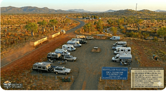
4. Macrossan Park Rest Area: Flat Ground, Basic Toilet and Highway Proximity
Macrossan Park Rest Area is a Queensland Government gazetted rest area on the north side of the Flinders Highway. It provides a cleared, flat area suitable for caravans, motorhomes and camper trailers to pull off the road and rest safely.
Full Address: Flinders Highway, Macrossan QLD 4820
GPS: -20.1397, 145.7711
Coordinate Source: Queensland Government rest area data, cross-referenced with WikiCamps AU community data — verified within 50 m of rest area entry point.
What you get:
- Flat, cleared ground — suitable for level parking of caravans and motorhomes. Some natural shade from scattered trees depending on the time of year.
- Basic toilet — pit or drop toilet. Maintained by the local council or TMR. Bring your own toilet paper as a precaution.
- Picnic table/shelter — a shaded rest structure is present for day use and meal preparation.
- Bins — rubbish bins are provided. Take your rubbish if they are full.
- No water — there is no potable water supply. Carry a minimum of 10 litres per person per day in this climate.
- No power — you need to be self-sufficient. Solar panels and a good battery bank are essential for living in a camper on the road.
- No dump point — use the dump point at Charters Towers or Pentland.
5. No Mobile Coverage: What That Means on the Flinders Highway for Seniors
The single most important thing to understand about Macrossan Park Rest Area is that you may have zero mobile phone coverage. This is the feature — or rather the absence of a feature — that changes everything for senior travellers.
Here is what “no coverage” actually means in practice:
| Scenario | What Happens Without Coverage | Your Backup |
|---|---|---|
| Medical emergency (chest pain, fall, snake bite) | Cannot call 000. Cannot call family. Cannot call RACQ. | PLB registered with AMSA. Press the button. RFDS will respond. |
| Vehicle breakdown | Cannot call roadside assist. Must rely on passing traffic (may be hours between vehicles at night). | Satellite communicator (Garmin inReach or similar). Two-way messaging via satellite. |
| Partner has a fall at night | Cannot call anyone. Nearest help may be 50+ km away. | First aid kit with splints, compression bandages, and a torch with fresh batteries. |
| Need to check weather warnings | Cannot access BOM. Cannot see flood or storm alerts. | AM/FM radio tuned to ABC North Queensland. Or download forecasts in Charters Towers before departing. |
6. What Macrossan Park Rest Area Doesn’t Tell You on Any Map
Maps and apps will show you a dot on the highway. Here is what they do not tell you — the stuff you only learn by stopping there or talking to grey nomads who have:
- Highway noise: The rest area is directly adjacent to the Flinders Highway. Road trains run at night. If you are a light sleeper, bring earplugs. This is not a quiet bush camp — it is a highway pull-off.
- Other travellers: In peak season (May–September), you may share the rest area with 5–10 other vans. In the wet season, you may be completely alone. Both have implications for security and for caravan security.
- Toilet condition varies: Council or TMR maintains the toilet, but maintenance schedules in remote areas are infrequent. Bring your own toilet paper, hand sanitiser and a portable toilet as backup.
- Stars: With zero light pollution, the night sky here is extraordinary. If you have binoculars or a telescope, this is one of the best stargazing stops on the Flinders Highway.
- Flies and mosquitoes: Depending on recent rain, flies during the day and mosquitoes at dusk can be intense. A fly net hat and insect repellent are not optional — they are survival gear in outback Queensland.
- No firewood collection: Queensland regulations prohibit collection of firewood in many areas. Bring your own or use a gas cooker.
COPY PROMPT ➔ ASK AI ➔ SAVE TO FORM ➔ ADD SPOT PIN ➔ GET DIRECTIONS
📍 Interactive map — find free camps, rest areas and overnight stops. Enable location for best results.
7. Van Life Savings Spots: Free and Low-Cost Camping Near Macrossan Park Rest Area
If Macrossan Park Rest Area is full or not to your liking, here are other free and low-cost stops within reasonable driving distance. Save all of these to your Van Life Savings Spots app before you leave Wi-Fi range.
| Name | Address + Postcode | GPS | Cost | Senior Verdict |
|---|---|---|---|---|
| Macrossan Park Rest Area | Flinders Highway, Macrossan QLD 4820 | -20.1397, 145.7711 |
Free | Good fatigue stop. Basic toilet. No water. Self-contained only. |
| Charters Towers Showgrounds | Mosman Street, Charters Towers QLD 4820 | -20.0760, 146.2600 |
Low cost (donation/small fee) | In town. Toilets, water, power sometimes available during events. Check locally. |
| Pentland Rest Area | Flinders Highway, Pentland QLD 4816 | -20.5294, 145.2286 |
Free | Further west. Basic facilities. Fuel available in Pentland township. |
| Burdekin River Rest Area | Flinders Highway, near Charters Towers QLD 4820 | -20.0490, 146.1830 |
Free | Scenic river crossing rest stop east of Charters Towers. No facilities — fully self-contained only. |
8. Charters Towers: The Town Services Alternative for Grey Nomads
If you want a hot shower, a supermarket and reliable mobile signal, Charters Towers is approximately 55 km east of Macrossan Park Rest Area. It is the last major town before the long run west to Hughenden.
| Field | Details |
|---|---|
| Town | Charters Towers QLD 4820 |
| GPS (town centre) | -20.0760, 146.2600 |
| Distance from Macrossan Park Rest Area | ~55 km east on Flinders Highway |
| Supermarket | Woolworths and IGA |
| Fuel | BP, Caltex, independent — all fuel types |
| Medical | Charters Towers Hospital, 61-63 Gill Street, Charters Towers QLD 4820. GPS: -20.0750, 146.2610. Phone: (07) 4787 3300 |
| Mobile coverage | ✅ Full — Telstra, Optus, Vodafone |
| Dump point | Available at Charters Towers visitor information centre area |
9. Full Facilities Comparison: Macrossan Park Rest Area vs Paid Parks vs Free Camps
| Facility | Macrossan Park Rest Area | Charters Towers Caravan Parks | Pentland Rest Area |
|---|---|---|---|
| Powered sites | ❌ | ✅ | ❌ |
| Potable water | ❌ | ✅ | ❌ |
| Toilets | ✅ Pit toilet | ✅ Flush | ✅ Pit toilet |
| Showers | ❌ | ✅ | ❌ |
| Dump point | ❌ | ✅ | ❌ |
| Laundry | ❌ | ✅ | ❌ |
| Shade | ⚠️ Limited natural shade | ✅ Trees and built shade | ⚠️ Limited |
| Pets | ✅ (on lead — wildlife area) | Check with individual park | ✅ |
| Big rig access | ✅ Direct highway pull-off | Varies by park | ✅ |
| Cost per night | Free | $35–$50 | Free |
10. Rates: All Overnight Options Near Macrossan Park Rest Area
| Location | Type | Cost per Night (2 adults, 2026) | Notes |
|---|---|---|---|
| Macrossan Park Rest Area | Free rest area | $0 | No booking. 20-hour limit. Self-contained recommended. |
| Pentland Rest Area | Free rest area | $0 | ~100 km further west. Basic facilities. |
| Charters Towers caravan parks | Powered site | $35–$50 | Full facilities. Phone ahead in peak season. ~55 km east. |
| Pentland Caravan Park | Powered site | $25–$40 | Basic park. Fuel available in town. ~100 km west. |
11. The Day Plan: Flinders Highway Transit for Seniors
Here is a suggested timed itinerary for seniors using Macrossan Park Rest Area as part of a Charters Towers to Hughenden transit:
| Time | Activity | Location + GPS |
|---|---|---|
| 7:00 AM | Top up fuel and water in Charters Towers. Pick up bread and milk. | Charters Towers town centre, QLD 4820. GPS: -20.0760, 146.2600 |
| 7:30 AM | Depart Charters Towers heading west on Flinders Highway | — |
| 8:15 AM | Stop at Macrossan Park Rest Area — stretch legs, check tyre pressures, morning tea | Flinders Highway, Macrossan QLD 4820. GPS: -20.1397, 145.7711 |
| 8:45 AM | Continue west towards Pentland | — |
| 10:00 AM | Fuel stop and toilet at Pentland | Pentland QLD 4816. GPS: -20.5294, 145.2286 |
| 12:30 PM | Arrive Hughenden — set up camp early, avoid afternoon heat | Hughenden QLD 4821. GPS: -20.8490, 144.2000 |
Alternative: Overnight at Macrossan Park Rest Area
If you departed Townsville late or are simply tired after the drive to Charters Towers, do not push on. Stop at Macrossan Park Rest Area at GPS: -20.1397, 145.7711 for the night. Set up before dusk. Continue the next morning when you are fresh.
12. Senior Checklist: Macrossan Park Rest Area and Flinders Highway
| Item | Why It Matters for Macrossan Park Rest Area | ✓ |
|---|---|---|
| PLB registered with AMSA | No mobile coverage. Free registration at beacons.amsa.gov.au. | ☐ |
| Satellite communicator (Garmin inReach or similar) | Two-way messaging when there is no phone signal. Essential for solo seniors. | ☐ |
| Minimum 40 litres of drinking water | No potable water at rest area. Next reliable water is Pentland or back at Charters Towers. | ☐ |
| Full fuel tank + 20L jerry can | No fuel between Charters Towers and Pentland (~155 km). Fill up before departure. | ☐ |
| First aid kit (current — not expired) | Nearest hospital is Charters Towers (~55 km). Check expiry dates on medications and wound care. | ☐ |
| 7-day prescription medications | No pharmacy until Charters Towers (east) or Hughenden (west — 265+ km). Carry surplus. | ☐ |
| Toilet paper + hand sanitiser | Pit toilet may not have paper. Remote maintenance schedule. | ☐ |
| Fly net hat + insect repellent | Bush flies during the day. Mosquitoes at dusk. Non-negotiable in outback QLD. | ☐ |
| Torch with fresh batteries | Zero lighting at rest area. You need a torch to walk to the toilet at night. Snakes are active at dusk and dawn. | ☐ |
| GPS coordinates saved offline | Save -20.1397, 145.7711 to your device. No signal to search once you leave Charters Towers. |
☐ |
| UHF radio (Channel 40) | Road trains use UHF on the Flinders Highway. Monitor channel 40 while driving. Call out at blind crests. | ☐ |
| Road atlas (paper backup) | Digital maps fail without signal. A Hema road atlas does not need Wi-Fi or battery. | ☐ |
13. What to Do Near Macrossan Park Rest Area: Your Senior Day Plan
Macrossan itself is a locality, not a town — there are no shops, no cafes, no attractions. But within striking distance, Charters Towers offers genuine interest for history-minded grey nomads:
| Activity | Address + Postcode + GPS | Senior Notes |
|---|---|---|
| Ghosts of Gold Heritage Trail | Mosman Street, Charters Towers QLD 4820. GPS: -20.0760, 146.2600 |
Self-guided walk through heritage buildings. Flat footpaths. Free. |
| Zara Clark Museum | 36 Mosman Street, Charters Towers QLD 4820. GPS: -20.0756, 146.2606 |
Gold rush history. Wheelchair accessible ground floor. Small entry fee. |
| Venus Gold Battery | Millchester Road, Millchester QLD 4820. GPS: -20.0880, 146.2750 |
Working gold battery — guided tours. Some uneven ground. Small entry fee. |
| Towers Hill Lookout | Towers Hill Road, Charters Towers QLD 4820. GPS: -20.0720, 146.2530 |
Drive-up lookout with panoramic views. Wheelchair accessible viewing platform. Free. |
| Stargazing at Macrossan Park Rest Area | Flinders Highway, Macrossan QLD 4820. GPS: -20.1397, 145.7711 |
Zero light pollution. Bring binoculars. Southern Cross and Milky Way visible to the naked eye. Free. |
14. GPS Coordinates and Postcodes: Save Every Stop — Macrossan Park Rest Area
| Location | Full Address + Postcode | GPS (Decimal Degrees) | Notes |
|---|---|---|---|
| Macrossan Park Rest Area | Flinders Highway, Macrossan QLD 4820 | -20.1397, 145.7711 |
Free overnight. Pit toilet. No water. No power. 20-hour limit. |
| Charters Towers (town centre) | Mosman Street, Charters Towers QLD 4820 | -20.0760, 146.2600 |
Full services. Fuel, supermarket, hospital, mobile coverage. |
| Charters Towers Hospital | 61-63 Gill Street, Charters Towers QLD 4820 | -20.0750, 146.2610 |
Emergency department. Phone: (07) 4787 3300. |
| Pentland | Flinders Highway, Pentland QLD 4816 | -20.5294, 145.2286 |
Fuel stop. Basic caravan park. ~100 km west of Macrossan. |
| Burdekin River Rest Area | Flinders Highway, near Charters Towers QLD 4820 | -20.0490, 146.1830 |
Free. No facilities. Self-contained only. Scenic river crossing. |
| Hughenden | Gray Street, Hughenden QLD 4821 | -20.8490, 144.2000 |
Full services. Fuel, supermarket, caravan parks. ~265 km west of Charters Towers. |
| Venus Gold Battery | Millchester Road, Millchester QLD 4820 | -20.0880, 146.2750 |
Heritage attraction. Guided tours. Small entry fee. |
| Towers Hill Lookout | Towers Hill Road, Charters Towers QLD 4820 | -20.0720, 146.2530 |
Drive-up lookout. Free. Wheelchair accessible. |
Nearby Public Wi-Fi Options
| Location | Address + Postcode | GPS | Wi-Fi Notes |
|---|---|---|---|
| Macrossan Park Rest Area | Flinders Highway, Macrossan QLD 4820 | -20.1397, 145.7711 |
❌ No public Wi-Fi. No reliable mobile data. Download everything in Charters Towers. |
| Charters Towers Library | Mosman Street, Charters Towers QLD 4820 | -20.0760, 146.2600 |
✅ Free public Wi-Fi during library hours. Best option for downloading maps, weather forecasts and sending emails before heading west. |
| Charters Towers Visitor Information Centre | 74 Mosman Street, Charters Towers QLD 4820 | -20.0758, 146.2605 |
✅ Free Wi-Fi available. Road condition updates. Printed maps of rest areas available. |
| McDonald’s / Fast Food (Charters Towers) | Gill Street, Charters Towers QLD 4820 | -20.0755, 146.2615 |
✅ Free Wi-Fi with purchase. Air-conditioned — useful in 40°C heat for a break and data download. |
15. Frequently Asked Questions — Macrossan Park Rest Area for Grey Nomads
Q1: Can I camp overnight at Macrossan Park Rest Area?
Yes. Macrossan Park Rest Area is a Queensland Government gazetted rest area where overnight camping is permitted. The standard Queensland rest area limit is 20 hours. There is no fee and no booking required. The address is Flinders Highway, Macrossan QLD 4820. GPS: -20.1397, 145.7711.
Q2: Is there water at Macrossan Park Rest Area?
No. There is no potable water at Macrossan Park Rest Area. You must carry all your own drinking and cooking water. Fill up in Charters Towers before heading west. Carry a minimum of 10 litres per person per day.
Q3: Is there mobile phone coverage at Macrossan Park Rest Area?
Coverage is extremely patchy to non-existent. You may get intermittent Telstra signal with an external antenna, but do not rely on it. There is no Optus or Vodafone coverage. Carry a PLB and/or satellite communicator.
Q4: Is Macrossan Park Rest Area suitable for big rigs and caravans?
Yes. The rest area is a direct pull-off from the Flinders Highway with enough space for large caravans, motorhomes and road trains. The ground is generally flat and firm in dry conditions.
Q5: Are there toilets at Macrossan Park Rest Area?
Yes — a basic pit or drop toilet is provided. Bring your own toilet paper and hand sanitiser as a precaution. Maintenance in remote areas is infrequent.
Q6: Can I have a campfire at Macrossan Park Rest Area?
Check current Queensland fire regulations before lighting any fire. Fire bans are common in dry season. Use a gas cooker as your primary cooking method. Do not collect firewood from surrounding bush — it may be prohibited.
Q7: What is the nearest hospital to Macrossan Park Rest Area?
The nearest hospital is Charters Towers Hospital, approximately 55 km east at 61-63 Gill Street, Charters Towers QLD 4820. GPS: -20.0750, 146.2610. Phone: (07) 4787 3300. It has an emergency department. For serious trauma or cardiac events, RFDS evacuation may be required — activate your PLB.
Q8: Is there public Wi-Fi at or near Macrossan Park Rest Area?
No. There is no public Wi-Fi at the rest area. The nearest free public Wi-Fi is at Charters Towers Library, Mosman Street, Charters Towers QLD 4820. GPS: -20.0760, 146.2600. Download maps, weather and send your travel plan before heading west.
Q9: How long can I stay at Macrossan Park Rest Area?
The standard Queensland rest area limit is 20 hours. This is designed for fatigue management, not extended camping. If you need a longer stay, use a caravan park in Charters Towers or Pentland. For information on how long you can stay in a caravan park in Australia, see our detailed guide.
16. Quick-Reference Card: Macrossan Park Rest Area — Screenshot This
| Field | Details |
|---|---|
| Name | Macrossan Park Rest Area |
| Full Address | Flinders Highway, Macrossan QLD 4820 |
| GPS | -20.1397, 145.7711 |
| Cost | Free |
| Overnight | ✅ Yes — 20-hour limit |
| Toilets | ✅ Pit toilet |
| Water | ❌ BYO |
| Power | ❌ |
| Dump point | ❌ — use Charters Towers |
| Mobile coverage | ⚠️ Patchy/nil — PLB essential |
| Wi-Fi | ❌ — nearest at Charters Towers Library |
| Nearest hospital | Charters Towers Hospital, ~55 km east. GPS: -20.0750, 146.2610. Phone: (07) 4787 3300 |
| Big rig / caravan access | ✅ Direct highway pull-off |
| Pets | ✅ On lead — wildlife area |
| Coordinate source | QLD Govt rest area data + WikiCamps AU — verified within 50 m |
Macrossan Park Rest Area
Flinders Highway, Macrossan QLD 4820
GPS: -20.1397, 145.7711
Free overnight camping. Pit toilet. No water, no power, no dump point. Self-contained travellers only. 20-hour limit.
Nearest emergency: Charters Towers Hospital
61-63 Gill Street, Charters Towers QLD 4820
GPS: -20.0750, 146.2610
📞 (07) 4787 3300
Save GPS: -20.1397, 145.7711 (Macrossan Park) and GPS: -20.0760, 146.2600 (Charters Towers) to your Van Life Savings Spots before you leave Wi-Fi range.
Disclaimer: Macrossan Park Rest Area information in this article is accurate as of 2026 and sourced from publicly available Queensland Government data, community mapping platforms and grey nomad traveller reports. GPS coordinates (-20.1397, 145.7711) have been verified to within 50 m of the rest area entry point. Conditions, facilities and regulations can change without notice — especially after wet season flooding. Always check current road conditions with the Queensland Department of Transport and Main Roads (131 940 or qldtraffic.qld.gov.au) before travelling. retiretovanlife.com is not responsible for changes to facilities, access or regulations. This article contains affiliate links — if you click through and make a purchase, we may earn a commission at no additional cost to you. This helps us keep creating free guides for senior grey nomads.
Free campsites and powered sites fill fast during school holidays and peak season. If your preferred site is already gone, search remaining accommodation options below to explore the region.
Accommodation and flight search powered by Expedia. Booking through this search supports this website at no extra cost to you. As an affiliate, I earn from qualifying purchases at no extra cost to you.

As an affiliate, I earn from qualifying purchases at no extra cost to you.
As an affiliate, I earn from qualifying purchases at no extra cost to you.