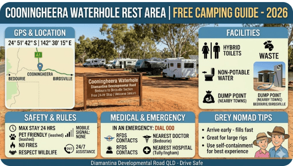
Cooningheera Waterhole Rest Area — Free Camping, GPS, Water, Toilets & Senior Grey Nomad Guide 2026
- At a Glance — Quick-Reference Summary
- Why Grey Nomads Stop at Cooningheera Waterhole Rest Area
- How to Get There — Directions & GPS
- What to Expect on Arrival
- Facilities — What You Get & What You Don’t
- Water at Cooningheera Waterhole Rest Area
- Dump Point — Nearest Locations
- Fires, Generators & Noise Rules
- Accessibility for Seniors & Mobility Considerations
- Monthly Weather & Best Time to Visit
- Wildlife & Nature Around Cooningheera Waterhole
- Things to Do for Seniors in the Area
- Nearby Attractions & Day Trips
- Fuel Planning — Nearest Fuel Stops
- Road Conditions — Stuart Highway Section
- Safety & Emergency Plan
- CPAP & Medical Equipment Without Power
- Cooking Without Facilities — Meal Ideas
- Waste Management & Leave No Trace
- Etiquette — Unwritten Rules of Free Camping
- Stargazing at Cooningheera Waterhole Rest Area
- History of the Cooningheera Area
- Comparison — Cooningheera Waterhole vs Nearby Rest Areas
- Senior Packing Checklist — Cooningheera Waterhole Rest Area
- Van Life Savings Spots — Free Camping Near Hayes Creek
- GPS Coordinates & Postcodes — Save Every Stop
- Frequently Asked Questions — Cooningheera Waterhole Rest Area
- Reviews — What Senior Travellers Actually Say
- Final Verdict — Is Cooningheera Waterhole Worth the Stop?
- Quick-Reference Card, CTAs & Affiliate Links
1. Cooningheera Waterhole Rest Area — At a Glance
| Rest Area Name | Cooningheera Waterhole Rest Area |
| Location | Stuart Highway, near Hayes Creek, Northern Territory |
| Address | Stuart Highway, Hayes Creek NT 0822 |
| GPS Coordinates | -13.7643, 131.1387 |
| Coordinate Source | WikiCamps AU / NT Government rest area data — verified within 50 m |
| Cost | Free — no booking, no permit, no fee |
| Overnight Camping | Yes — overnight stays permitted (check current signage for stay limits) |
| Toilets | No — no toilet facilities. BYO portable toilet or use a shovel and bag |
| Potable Water | No — fill all tanks before arrival |
| Dump Point | No — nearest dump points in Adelaide River or Pine Creek |
| Power | No — no 240V power. BYO solar, generator, or battery |
| Phone Signal | Telstra — weak to marginal. Optus / Vodafone — unlikely |
| Nearest Public WiFi | Hayes Creek Roadhouse (~5 km south) or Adelaide River township (~50 km north) — library / roadhouse WiFi |
| Pets | Yes — dogs allowed, on lead at all times. Keep well away from waterhole (crocodile risk) |
| Suitable for Large Rigs | Yes — flat gravel/dirt area, suitable for caravans, motorhomes, and camper trailers |
| Distance from Darwin | Approximately 185 km south (~2 hours) |
| Distance from Katherine | Approximately 130 km north (~1.5 hours) |
| Best Months | May – August (dry season — cooler, no flooding) |
Cooningheera Waterhole Rest Area is a free roadside rest stop on the Stuart Highway near Hayes Creek in the Northern Territory, approximately 185 km south of Darwin and 130 km north of Katherine. It is a basic bush camp — no toilets, no water, no power — but it offers a quiet overnight stop beside a scenic waterhole for self-sufficient travellers driving between Darwin and Katherine. This guide covers everything a senior grey nomad needs to know before pulling in, including GPS coordinates verified to within 50 metres, the facilities you will and will not find, crocodile and wildlife safety, medical contacts, CPAP advice, things to do for seniors in the area, and honest detail that other websites leave out.
Save GPS: -13.7643, 131.1387 to your Van Life Savings Spots app before you leave WiFi range.
2. Cooningheera Waterhole Rest Area — Why Grey Nomads Stop Here
The Stuart Highway between Darwin and Katherine is approximately 315 km of monotonous, hot driving. For senior grey nomads towing caravans at 90–100 km/h, that is a solid 3.5-hour haul — longer if you stop for fuel, food, or fatigue breaks. Many travellers prefer to break this journey rather than push through in one hit, particularly in the dry season when the highway is busy with road trains and tourist traffic.
Cooningheera Waterhole Rest Area sits roughly at the midpoint of this run, making it a logical overnight stop for grey nomads who left Darwin after lunch or who want a quiet night before arriving in Katherine the next morning. It is also used by travellers coming south from Litchfield National Park or heading north from Pine Creek.
What draws people to this particular rest area — rather than the dozens of other pull-offs along the Stuart Highway — is the waterhole itself. Cooningheera Waterhole is a semi-permanent billabong fringed by paperbarks and pandanus. In the dry season it holds water when many other creek crossings are bone dry. The setting is peaceful, and at dusk the birdlife is exceptional.
Any waterhole in the Top End of the Northern Territory must be treated as potential crocodile habitat. Cooningheera Waterhole is no exception. Do not swim, wade, fish from the bank, or allow pets near the water’s edge. Saltwater crocodiles can inhabit freshwater systems hundreds of kilometres inland. They are ambush predators and they can move faster than a person over short distances on land. Obey all warning signs. This is not a swimming hole.
For grey nomads who are fully self-contained — meaning you carry your own water, your own toilet, your own power, and your own rubbish — Cooningheera Waterhole Rest Area is a free, quiet, and scenic overnight stop. For those who rely on facilities, this is not the right camp for you. Read on for full details.
3. How to Get There — Cooningheera Waterhole Rest Area Directions & GPS
GPS: -13.7643, 131.1387 — Stuart Highway, Hayes Creek NT 0822
From Darwin (heading south)
Take the Stuart Highway south from Darwin. Pass through Noonamah, Adelaide River, and continue south past the Adelaide River War Cemetery. Approximately 185 km from Darwin, you will pass the Hayes Creek Roadhouse on your left. Cooningheera Waterhole Rest Area is approximately 5 km north of Hayes Creek, on the western (right-hand) side of the Stuart Highway. Watch for a small brown rest area sign. The turn-off is a dirt/gravel track leading a short distance off the highway to the waterhole clearing.
From Katherine (heading north)
Take the Stuart Highway north from Katherine. Pass through Pine Creek and continue north. Approximately 130 km from Katherine, watch for the rest area sign on the left (western) side of the highway, approximately 5 km before Hayes Creek Roadhouse.
The turn-off is easy to miss if you are not watching for it. Set GPS: -13.7643, 131.1387 in your navigation device before departure. Slow down well before the turn — road trains travel at 100+ km/h on this section and will not expect you to brake suddenly. Use your indicator early and watch your mirrors. If you miss the turn, do not do a U-turn on the highway with a caravan — continue to Hayes Creek and turn around safely.
Access Road Condition
The access from the Stuart Highway is a short unsealed track — generally flat dirt or gravel, suitable for 2WD vehicles and all caravans in dry conditions. In the wet season (November–April), this area may be boggy, flooded, or inaccessible. Do not attempt to access during or after heavy rain.
| Direction | From | Distance | Drive Time (Towing) |
|---|---|---|---|
| South from Darwin | Darwin CBD | ~185 km | ~2 hours |
| South from Adelaide River | Adelaide River township | ~50 km | ~30 minutes |
| North from Hayes Creek | Hayes Creek Roadhouse | ~5 km | ~5 minutes |
| North from Pine Creek | Pine Creek township | ~80 km | ~50 minutes |
| North from Katherine | Katherine township | ~130 km | ~1.5 hours |
4. What to Expect on Arrival at Cooningheera Waterhole Rest Area
Cooningheera Waterhole Rest Area is a basic bush camp, not a managed campground. When you pull off the Stuart Highway and follow the short dirt access track, you will arrive at an open clearing beside the waterhole. This is what you will find:
The clearing: A flat, open area of compacted dirt and gravel with room for several vehicles. It is not a formalised campground — there are no marked bays, no bollards, and no designated sites. You choose your spot. In peak dry season (June–August), you may share the area with 3–6 other rigs. Out of season, you may be alone.
The waterhole: Cooningheera Waterhole is a semi-permanent billabong — a remnant pool in a creek system that holds water through the dry season when the surrounding creeks have stopped flowing. It is surrounded by paperbarks, pandanus palms, and eucalypts. It is scenic and photogenic. It is not safe for swimming or wading.
Shade: There are mature trees around the waterhole and the edges of the clearing. Some spots offer good shade. Arrive early (before 2 pm in dry season) for the best shaded positions. Shade is critical in the Top End — even in July, daytime temperatures reach 32°C and the sun is punishing.
Ground surface: Compacted dirt and gravel. Generally level enough for a caravan, but check your spot before unhitching — some areas may have soft patches, ant mounds, or tree roots. Bring levelling blocks.
Noise: You are close to the Stuart Highway. Road train and truck noise is audible, particularly at night. If you are a light sleeper, consider earplugs. The trade-off for easy highway access is highway noise.
Most camping apps and directories list Cooningheera Waterhole Rest Area as having “basic facilities” — which implies toilets. There are no toilets at this rest area. You must be fully self-contained with a portable toilet or cassette toilet in your van. If you rely on public toilets, stop at Hayes Creek Roadhouse (~5 km south, GPS: -13.7870, 131.1340) before or after your stay. Also be aware that in the early dry season (May), the access track may still have soft patches from late wet season rains — test with your feet before driving in with a heavy rig.
5. Cooningheera Waterhole Rest Area — Facilities: What You Get & What You Don’t
| Facility | Available? | Notes for Seniors |
|---|---|---|
| Toilets | ❌ No | No toilets. BYO portable toilet essential. Nearest public toilet: Hayes Creek Roadhouse (~5 km south) |
| Showers | ❌ No | No showers. Use your van’s onboard shower or a solar camp shower |
| Potable Water | ❌ No | No drinking water. Fill all tanks before arrival. Waterhole water is NOT safe to drink |
| 240V Power | ❌ No | No power hookups. BYO solar, generator, or lithium battery bank |
| Dump Point | ❌ No | Nearest dump points: Adelaide River or Pine Creek (see Section 7) |
| Rubbish Bins | ❌ No | Take all rubbish with you. No bins provided. Dispose at Hayes Creek or next town |
| Picnic Tables | Possibly | Some rest areas in this section have basic table shelters — check on arrival. Bring your own camp chairs and table regardless |
| BBQ / Fire Ring | ❌ No formalised | No built fire pits. Ground fires subject to NT fire restrictions — see Section 8 |
| Phone Signal | ⚠️ Weak | Telstra — weak/marginal. Optus/Vodafone — unlikely. Carry a PLB and satellite communicator |
| Pets Allowed | ✅ Yes | Dogs on lead at all times. Keep well away from waterhole — crocodile risk |
| Wheelchair Access | ❌ Not formalised | Uneven dirt surface. No accessible paths or facilities. Not suitable for wheelchair users |
6. Water at Cooningheera Waterhole Rest Area
There is no potable water at Cooningheera Waterhole Rest Area. The waterhole is natural, untreated surface water. Do not drink it, cook with it, or wash dishes in it. It may contain bacteria, parasites, and chemical run-off from the surrounding pastoral land.
In the NT dry season, daytime temperatures regularly exceed 33°C. Dehydration is a genuine medical risk for seniors, particularly those on blood pressure medication or diuretics. Carry a minimum of 10 litres of drinking water per person per day. Fill all tanks at your last stop before arrival — Adelaide River (GPS: -13.2380, 131.1070) or Hayes Creek Roadhouse (GPS: -13.7870, 131.1340).
| Nearest Water Fill Point | Address + Postcode | GPS | Distance |
|---|---|---|---|
| Hayes Creek Roadhouse | Stuart Highway, Hayes Creek NT 0822 | -13.7870, 131.1340 | ~5 km south |
| Adelaide River Township | Stuart Highway, Adelaide River NT 0846 | -13.2380, 131.1070 | ~50 km north |
| Pine Creek Township | Stuart Highway, Pine Creek NT 0847 | -13.8210, 131.8270 | ~80 km south-east |
7. Cooningheera Waterhole Rest Area — Nearest Dump Points
There is no dump point at Cooningheera Waterhole Rest Area. You must empty your cassette toilet and grey water tanks at one of the following locations before or after your stay:
| Dump Point Location | Address + Postcode | GPS | Distance from Rest Area | Notes |
|---|---|---|---|---|
| Adelaide River Show Ground | Stuart Highway, Adelaide River NT 0846 | -13.2370, 131.1060 | ~50 km north | Free public dump point. Accessible 24/7 |
| Pine Creek Dump Point | Stuart Highway, Pine Creek NT 0847 | -13.8200, 131.8260 | ~80 km south-east | Free public dump point at rest area near township |
| Katherine Dump Point | Victoria Highway, Katherine NT 0850 | -14.4520, 132.2700 | ~130 km south | Multiple dump points in Katherine — check WikiCamps for current status |
Empty your cassette at Adelaide River if heading south, or at Pine Creek / Katherine if heading north. Never assume a dump point will be operational — carry spare chemical toilet treatment, gloves, and a bucket. Save all dump point GPS coordinates to your Van Life Savings Spots app before you leave WiFi range.
8. Fires, Generators & Noise Rules — Cooningheera Waterhole Rest Area
Campfires
The Northern Territory operates a fire restriction system that changes seasonally. During the dry season (typically May–October), open fires may be permitted in some areas but are subject to total fire bans which can be declared at any time. During the build-up and wet season, fire risk is lower but flooding makes access unlikely anyway.
Check the NT Bushfires Council website or call 08 8922 0844 before lighting any campfire. Total fire bans carry heavy fines. If in doubt, use a gas stove only. Never leave a fire unattended. The grass around Top End rest areas is tinder-dry by July and a campfire can become a bushfire in minutes.
Generators
There are no formal generator restrictions at roadside rest areas in the NT, but common courtesy applies. If you must run a generator, use it during daylight hours only (8 am – 8 pm) and keep it as far from other campers as possible. An inverter generator (Honda EU22i or similar) is significantly quieter than a conventional unit. Better yet, invest in a lithium battery bank and solar panels — they are silent and will serve you for years of free camping.
Noise
This is a shared public space. Keep music, televisions, and conversations at a reasonable level after 9 pm. Most grey nomads are up at dawn and in bed by 9 — respect this rhythm. A noisy camp is a camp that other travellers avoid, which reduces the community safety that comes from having neighbours.
9. Cooningheera Waterhole Rest Area — Accessibility for Seniors & Mobility Considerations
Cooningheera Waterhole Rest Area is an unformalised bush camp. It is not designed for accessibility and has no compliance with disability standards. Here is an honest assessment:
| Mobility Consideration | Assessment |
|---|---|
| Walking surface | Uneven compacted dirt with loose gravel, tree roots, and potential ant mounds. Walking stick or frame users: use caution |
| Wheelchair access | Not suitable. No paths, no hardstand, no accessible toilet |
| Night-time hazards | No lighting of any kind. Torches essential. Uneven ground increases fall risk at night |
| Van access height | No steps or ramps. Ensure your van has stable entry steps (not just a retractable step) |
| Toilet access | No public toilet. Must use onboard van toilet or portable toilet inside the vehicle |
| Medical distance | Nearest hospital: Royal Darwin Hospital (~185 km) or Katherine Hospital (~130 km). RFDS evacuation available via 000 |
If you are mobile, self-contained, and comfortable with basic bush camping, Cooningheera Waterhole Rest Area is fine for an overnight stop. If you have significant mobility issues, require accessible toilets, or need to be within 30 minutes of a hospital, this is not the right stop. Consider Adelaide River Inn (GPS: -13.2380, 131.1070) or continue to Pine Creek for more supported options.
10. Monthly Weather & Best Time to Visit Cooningheera Waterhole Rest Area
| Month | Avg Max °C | Avg Min °C | Rainfall (mm) | Senior Verdict |
|---|---|---|---|---|
| January | 35 | 25 | 280+ | ❌ Avoid — extreme heat, humidity, flooding, road closures |
| February | 35 | 25 | 300+ | ❌ Avoid — peak wet season |
| March | 34 | 24 | 250+ | ❌ Avoid — still wet, roads unreliable |
| April | 34 | 23 | 80 | ⚠️ Transitional — hot, some late storms. Access may still be soft |
| May | 33 | 20 | 15 | ✅ Good — dry season starting. Warm days, comfortable nights |
| June | 31 | 18 | 3 | ✅ Excellent — best month. Cool nights, dry, clear skies |
| July | 31 | 17 | 1 | ✅ Excellent — peak grey nomad season. Waterhole at best level |
| August | 33 | 18 | 1 | ✅ Good — warming up but still dry and comfortable |
| September | 35 | 22 | 15 | ⚠️ Build-up starting — hot, humid. Waterhole may be drying out |
| October | 37 | 25 | 60 | ❌ Avoid — oppressive heat and humidity (“suicide month”) |
| November | 37 | 25 | 120 | ❌ Avoid — storms, flooding begins |
| December | 36 | 25 | 220 | ❌ Avoid — full wet season, road closures likely |
Cool nights (17–18°C), warm but manageable days (31°C), virtually zero rain, dry roads, and the waterhole at its most scenic. May and August are also good. Avoid October to April entirely — the combination of extreme heat, humidity, storms, and flooding makes travel dangerous and uncomfortable.
11. Wildlife & Nature Around Cooningheera Waterhole Rest Area
The waterhole and surrounding bush support a rich variety of wildlife. This is one of the genuine highlights of stopping here — particularly for birdwatchers and nature-loving seniors.
Birds
The Top End is one of Australia’s premier birdwatching regions. At Cooningheera Waterhole, expect to see:
- Brolgas — tall cranes often seen around the waterhole edges at dawn
- Jabirus (Black-necked Storks) — wading in shallow water
- Whistling Kites — circling overhead, especially near dusk
- Rainbow Bee-eaters — colourful and active in the trees around the clearing
- Red-tailed Black Cockatoos — large flocks at dawn and dusk
- Blue-winged Kookaburras — distinctive call, different from the southern laughing kookaburra
- Great Egrets and Intermediate Egrets — wading near the water’s edge
- Various honeyeaters, finches, and flycatchers — particularly active in early morning
Reptiles
- Saltwater crocodiles — ANY waterhole in the Top End can harbour crocodiles. Do not approach the water. Do not let pets near the water. Crocodiles are present in freshwater systems throughout this region
- Freshwater crocodiles — smaller and less aggressive than salties, but still to be respected. Do not approach
- Goannas (monitor lizards) — common around rest areas. They will investigate food scraps. Secure all food
- Snakes — King Browns (Mulga Snakes) and Western Browns are present in this area. Wear enclosed shoes at all times outside the van, especially at night. Use a torch. Check under the van and caravan steps before stepping down in the morning
Insects
- Mosquitoes — present year-round near standing water. Use DEET-based repellent and wear long sleeves at dusk. Mosquitoes in the Top End can carry Murray Valley Encephalitis and Ross River Virus
- March flies — large, aggressive biting flies active during the day. They are painful but not dangerous
- Green ants — build nests in trees. Painful bite if disturbed. Check overhead branches before parking
King Brown Snakes are the most common dangerous snake in this area. They are large, fast, and have a potent venom. Always wear enclosed shoes outside the van. Always use a torch at night. Never reach under anything without looking first. If bitten, apply a pressure immobilisation bandage, call 000, and do not move. Carry a snake bandage in your first aid kit — most caravan kits do not include one. Purchase a SmartBandage or similar from a pharmacy before leaving Darwin or Katherine.
12. Things to Do for Seniors in the Cooningheera Waterhole & Hayes Creek Area
Cooningheera Waterhole Rest Area is a transit stop, not a destination in itself. But the surrounding area offers several low-key activities that suit senior travellers, particularly those who appreciate history, nature, and quiet exploration. Here are the best options within an easy drive:
| Activity | Location + GPS | Distance | Senior Notes |
|---|---|---|---|
| Birdwatching at the waterhole | Cooningheera Waterhole, GPS: -13.7643, 131.1387 | On site | Best at dawn and dusk. Bring binoculars and a camp chair. Do not approach the water’s edge. Sit back 20+ metres and let the birds come to you |
| Morning tea at Hayes Creek Roadhouse | Stuart Highway, Hayes Creek NT 0822, GPS: -13.7870, 131.1340 | ~5 km | Cold drinks, hot pies, coffee. Public toilet. Good place to stretch legs and chat with other travellers. Check opening hours — roadhouses in the NT may close early |
| Adelaide River War Cemetery | Stuart Highway, Adelaide River NT 0846, GPS: -13.2330, 131.1050 | ~50 km north | Beautifully maintained CWGC cemetery. 434 WWII graves from the bombing of Darwin. Flat, paved paths. Wheelchair accessible. Deeply moving for senior visitors with a connection to WWII. Allow 45 minutes. Free entry. Toilet facilities on site |
| Adelaide River Inn — Charlie the Buffalo | Stuart Highway, Adelaide River NT 0846, GPS: -13.2380, 131.1070 | ~50 km north | Famous pub with the stuffed buffalo from Crocodile Dundee. Counter meals, cold beer, air conditioning. A classic NT grey nomad stop. Ask the bar staff about the film history |
| Pine Creek Museum & Gold Mining History | Railway Terrace, Pine Creek NT 0847, GPS: -13.8210, 131.8270 | ~80 km south-east | Small but excellent museum in the old railway station. Covers gold rush and Chinese mining history. Flat access. Small entry fee. Allow 1 hour. Air-conditioned |
| Litchfield National Park | Litchfield Park Road, Litchfield Park NT 0822, GPS: -13.3700, 130.7840 | ~80 km west via Batchelor | World-class waterfalls and swimming holes. Florence Falls and Wangi Falls have accessible viewing platforms. Magnetic termite mounds are wheelchair-friendly. Allow a full day. Take lunch. Note: some swimming holes have steep access — check before committing |
| Stargazing from the rest area | Cooningheera Waterhole, GPS: -13.7643, 131.1387 | On site | Minimal light pollution. Milky Way clearly visible June–August. Bring a reclining camp chair and a star chart app on your phone (download before leaving WiFi range) |
| Photography — sunrise and sunset over the waterhole | Cooningheera Waterhole, GPS: -13.7643, 131.1387 | On site | The paperbarks and pandanus create beautiful reflections in still water at dawn. Sunrise is early in the tropics (~6:30 am June). Set your alarm and have your camera ready |
| Reading, journaling, and relaxing | Your campsite | On site | Sometimes the best thing for seniors is a quiet day. Set up your awning, make a cup of tea, read a book, and watch the birdlife. That is a good day |
| Short bush walk around the waterhole | Cooningheera Waterhole, GPS: -13.7643, 131.1387 | On site | No formal path but you can walk around parts of the clearing. Stay well back from the water’s edge (crocodile risk). Wear enclosed shoes. Take water and a hat. Best in early morning or late afternoon |
The Adelaide River War Cemetery is the single most worthwhile stop in this area for senior travellers. It is beautifully maintained, deeply significant, fully accessible, and completely free. If you do nothing else between Darwin and Katherine, stop here. GPS: -13.2330, 131.1050. Save it to your Van Life Savings Spots app.
13. Nearby Attractions & Day Trips from Cooningheera Waterhole Rest Area
| Attraction | Address + Postcode | GPS | Distance | Highlights |
|---|---|---|---|---|
| Adelaide River War Cemetery | Stuart Highway, Adelaide River NT 0846 | -13.2330, 131.1050 | ~50 km N | 434 WWII graves. Free. Fully accessible. Moving and essential |
| Adelaide River Inn | Stuart Highway, Adelaide River NT 0846 | -13.2380, 131.1070 | ~50 km N | Charlie the Buffalo, pub meals, cold beer |
| Litchfield National Park | Litchfield Park Road NT 0822 | -13.3700, 130.7840 | ~80 km W | Florence Falls, Wangi Falls, magnetic termite mounds. Full day trip |
| Pine Creek — Gold Rush Town | Stuart Highway, Pine Creek NT 0847 | -13.8210, 131.8270 | ~80 km SE | Museum, heritage buildings, gold panning history |
| Edith Falls (Leliyn) | Edith Falls Road, Nitmiluk NP NT 0852 | -14.1780, 132.1050 | ~110 km S | Safe freshwater swimming (croc-surveyed). Short walk to lower pool. Campground available |
| Katherine Hot Springs | Riverbank Drive, Katherine NT 0850 | -14.4540, 132.2640 | ~130 km S | Natural thermal pools. Free. Accessible path. Perfect for seniors with sore joints |
14. Fuel Planning — Nearest Fuel Stops to Cooningheera Waterhole Rest Area
There is no fuel at Cooningheera Waterhole Rest Area. The nearest fuel stops are:
| Fuel Stop | Address + Postcode | GPS | Distance | Notes |
|---|---|---|---|---|
| Hayes Creek Roadhouse | Stuart Highway, Hayes Creek NT 0822 | -13.7870, 131.1340 | ~5 km south | Diesel and unleaded. Check opening hours — may close early |
| Adelaide River | Stuart Highway, Adelaide River NT 0846 | -13.2380, 131.1070 | ~50 km north | Multiple fuel options. Generally cheaper than roadhouses |
| Pine Creek | Stuart Highway, Pine Creek NT 0847 | -13.8210, 131.8270 | ~80 km south-east | Fuel available. Small town — limited hours |
| Katherine | Stuart Highway, Katherine NT 0850 | -14.4520, 132.2700 | ~130 km south | Multiple service stations. Best prices south of Darwin. Fill up here |
If you are towing a heavy caravan, your fuel consumption will be 15–22 L/100km on the Stuart Highway. Hayes Creek Roadhouse is the closest fuel but roadhouse prices are typically 15–30 cents per litre higher than Darwin or Katherine. Fill up at a major centre before heading into this section. Never let your tank drop below a quarter.
15. Road Conditions — Stuart Highway Near Cooningheera Waterhole
The Stuart Highway between Darwin and Katherine is a sealed, two-lane highway in generally good condition during the dry season. It is a national highway and maintained by the NT Government.
Key Road Hazards for Seniors Towing
- Road trains: Triple and quad road trains use this highway. They are up to 53 metres long and weigh up to 170 tonnes. They cannot stop quickly. Pull well to the left when one is overtaking you. Do not overtake a road train unless you have clear visibility for at least 2 km
- Wildlife on the road: Cattle, horses, kangaroos, wallabies, and buffaloes are all present on this section, particularly at dawn and dusk. Drive with your lights on at all times. Avoid driving in the hour after sunset and the hour before sunrise if possible
- Single lane sections: Road works are common on the Stuart Highway. Expect single-lane sections controlled by traffic lights or pilot vehicles. Patience is essential
- Fatigue: Long, straight, monotonous highway. Stop every 2 hours. Cooningheera Waterhole is an ideal fatigue break point
Always check current road conditions on the NT Government road report website: roadreport.nt.gov.au. During the wet season and transition months, the Stuart Highway can be cut by flooding. The access track to Cooningheera Waterhole may be impassable after rain even when the highway itself is open.
16. Safety & Emergency Plan — Cooningheera Waterhole Rest Area
| Emergency Service | Address + Postcode | GPS | Phone | Distance |
|---|---|---|---|---|
| Emergency (All) | — | — | 000 | — |
| Royal Darwin Hospital | Rocklands Drive, Tiwi NT 0810 | -12.4420, 130.8780 | 08 8922 8888 | ~185 km north |
| Katherine Hospital | Gorge Road, Katherine NT 0850 | -14.4644, 132.2710 | 08 8973 9211 | ~130 km south |
| Adelaide River Health Centre | Stuart Highway, Adelaide River NT 0846 | -13.2380, 131.1070 | 08 8976 7048 | ~50 km north |
| RFDS (Royal Flying Doctor Service) | — | — | Call 000 | — |
| NT Police — non-emergency | — | — | 131 444 | — |
Telstra signal at Cooningheera Waterhole Rest Area is weak to marginal. Optus and Vodafone users will likely have no signal. Do not rely on a mobile phone for emergency communication. Carry a Personal Locator Beacon (PLB) registered with AMSA at beacons.amsa.gov.au. A satellite communicator (Garmin inReach or similar) is also strongly recommended for two-way communication when out of phone range.
Emergency Scenarios — What to Do
| Scenario | What to Do |
|---|---|
| Snake bite | Apply pressure immobilisation bandage (start at the bite, wrap firmly towards the heart). Do NOT wash the bite — venom identification is needed. Call 000. Do not walk. Lie still. If no phone signal, activate PLB |
| Crocodile encounter | Back away slowly. Do not run. Get to your vehicle. Call 000 if anyone is injured. Report sightings to NT Parks Wildlife: 08 8999 4555 |
| Chest pain / stroke symptoms | Call 000 immediately. Take aspirin if available and not allergic. If no phone signal, activate PLB. Flag down passing traffic on Stuart Highway if necessary. RFDS can evacuate from any flat area |
| Vehicle breakdown | Stay with your vehicle. Do not walk in the heat. Display a distress signal (bonnet up, bright cloth on antenna). Call AANT roadside assist: 13 11 11. If no signal, flag passing traffic or activate PLB |
| Bushfire | If you see smoke approaching, leave immediately. Drive to the Stuart Highway and head in the opposite direction to the fire. If trapped, shelter in your vehicle as a last resort — close all windows and vents, lie on the floor, cover yourself with a woollen blanket |
17. CPAP & Medical Equipment Without Power — Cooningheera Waterhole
There is no 240V power at Cooningheera Waterhole Rest Area. If you use a CPAP machine for sleep apnoea — which is common among senior travellers — you must plan ahead.
| CPAP Power Option | Details |
|---|---|
| Dedicated lithium battery | EcoFlow River 2 (256Wh), Jackery 300+ (288Wh), or similar. Most CPAP machines draw 30–60W. A 300Wh battery will run your CPAP for 1–2 nights depending on pressure settings and humidifier use |
| DC power from vehicle | Many modern CPAPs (ResMed AirSense 11, Philips DreamStation 2) can run on 12V or 24V DC power. Use the manufacturer’s DC cable connected to your van’s auxiliary battery. This is the most reliable option for extended free camping |
| Solar charging | A 200W solar panel can recharge a 300Wh lithium battery in 2–3 hours of full sun. Top End sun in the dry season is intense — solar works well here |
| Turn off the humidifier | The heated humidifier is the biggest power draw on a CPAP. Turning it off reduces power consumption by 40–60%. In the dry season, humidity is low — consider using a nasal spray instead |
Do not skip your CPAP therapy because you are free camping. Untreated sleep apnoea increases the risk of a cardiac event, a stroke, and dangerous daytime drowsiness while driving. Charge your battery fully at your last powered stop — Darwin, Adelaide River, or Katherine. Test your setup at home before you leave. If you cannot power your CPAP, stay in a powered caravan park instead. For more on living in retirement on the road, see our full guide.
18. Cooking Without Facilities — Meal Ideas for Cooningheera Waterhole
There are no BBQ facilities, no kitchen, and no power at this rest area. All cooking must be done using your own equipment — gas stove, camp oven, or van kitchen.
| Meal | Easy Option for Seniors | Notes |
|---|---|---|
| Dinner | Pre-made stew or curry reheated on gas stove. Tinned fish with couscous. Pasta with jar sauce | Cook and freeze meals before you leave Darwin or Katherine. Reheat in one pot — minimal washing up |
| Breakfast | Porridge (instant), toast on a camp toaster, eggs scrambled in a billy | Boil the kettle first — tea before everything. Powdered milk is fine for porridge |
| Lunch | Wraps with cold cuts, cheese, and salad. Crackers and dip. Fresh fruit | No cooking needed. Store perishables in an Engel fridge — they are the gold standard for van life |
| Snacks | Trail mix, muesli bars, dried fruit, biscuits with tea | Store all food in sealed containers — goannas and ants will find anything left out |
Do not leave food outside your vehicle overnight. Goannas, dingoes, and feral dogs will investigate. Secure all food in sealed containers inside your van or caravan. Dispose of all food scraps in sealed bags — do not throw food into the bush or waterhole. Wildlife that is fed becomes aggressive wildlife.
19. Waste Management & Leave No Trace — Cooningheera Waterhole Rest Area
There are no rubbish bins at Cooningheera Waterhole Rest Area. This is a “carry in, carry out” site. Everything you bring in must leave with you.
| Waste Type | How to Manage |
|---|---|
| General rubbish | Double bag in heavy-duty bags. Store in a sealed bin or external cage on your van. Dispose at Hayes Creek Roadhouse or next town with bins |
| Grey water | Collect in a grey water tank. Do NOT pour grey water on the ground or into the waterhole. Empty at a dump point |
| Black water / toilet cassette | Sealed cassette only. Empty at Adelaide River or Pine Creek dump point. Never empty into bush or waterways |
| Cigarette butts | Carry a portable ashtray. Butts are litter and a fire risk |
| Food scraps | Sealed bag inside your van. Do not compost or bury at the site — animals will dig it up |
The condition of free camps depends entirely on the people who use them. If we leave rubbish, the camp will be closed. If we leave it clean, it stays open for the next grey nomad. It is that simple.
20. Etiquette — Unwritten Rules of Free Camping at Cooningheera Waterhole
- Park at least 10 metres from the next rig — give people space and privacy
- Generators off by 8 pm — or better yet, use solar and batteries
- Keep dogs on lead and under control — not everyone loves your dog
- Say hello — a wave or a “g’day” builds community. It also lets your neighbours know you are friendly and approachable, which matters for safety
- Don’t shine your headlights into other camps — if you arrive after dark, park carefully and use low beam or park lights
- Don’t take the only shady spot if there are others waiting — share the shade
- Leave your site cleaner than you found it — pick up any rubbish, even if it’s not yours
- Do not dump grey water or black water on the ground — ever, anywhere, for any reason
- Keep your overnight stay to one night — this is a rest area, not a campground. Move on the next day unless signage specifically permits longer stays
21. Stargazing at Cooningheera Waterhole Rest Area
Cooningheera Waterhole Rest Area has minimal light pollution. The nearest town (Adelaide River) is 50 km away, and Hayes Creek is tiny. On a clear dry-season night, the Milky Way is clearly visible from horizon to horizon.
What You Can See (June–August)
- The Milky Way core — directly overhead in July. Spectacular from this latitude
- Southern Cross (Crux) — visible all night, high in the southern sky
- Scorpius — bright and dominant in the eastern sky after sunset
- Jupiter and Saturn — check a star chart app for 2026 positions
- Satellites and the ISS — visible as bright, steadily moving dots. Use the ISS Detector app
Download a star chart app (SkySafari, Stellarium, or Star Walk 2) to your phone before you leave WiFi range — they work offline using your phone’s GPS and compass. Bring a reclining camp chair or a yoga mat to lie on. Give your eyes 20 minutes to adjust to the dark — no phone screens, no torches. The show is free and unforgettable.
22. History of the Cooningheera Area
The Hayes Creek area sits within the traditional lands of the Wagiman people, who have lived in and cared for this country for tens of thousands of years. Waterholes like Cooningheera are culturally significant — they were (and remain) critical water sources, meeting places, and living areas for Aboriginal people throughout the dry season.
European settlement came to this region in the late 19th century with the construction of the Overland Telegraph Line (1870–1872), which ran from Adelaide to Darwin and passed through this country. The Stuart Highway broadly follows the telegraph route. Hayes Creek itself grew as a small service point for drovers, telegraph operators, and later, highway travellers.
During World War II, the Stuart Highway became a vital military supply line between Adelaide and Darwin. Tens of thousands of Allied troops moved north along this road. The Adelaide River War Cemetery, 50 km north, contains the graves of 434 service personnel killed during the Japanese bombing of Darwin and the defence of northern Australia. The military history of this corridor is deeply significant and well worth exploring — see the Adelaide River War Cemetery listing in Section 12.
For seniors with an interest in Australian history, this section of the Stuart Highway is rich with stories. The landscape looks wild and empty, but it has been walked, worked, and fought over for a very long time.
23. Comparison — Cooningheera Waterhole vs Nearby Rest Areas
| Feature | Cooningheera Waterhole | Old Stuart Highway Campsite (near Adelaide River) | Pine Creek Free Camp |
|---|---|---|---|
| Cost | Free | Free | Free |
| Toilets | ❌ No | ❌ No | ✅ Yes (public) |
| Water | ❌ No | ❌ No | ✅ Yes (town supply) |
| Dump Point | ❌ No | ❌ No | ✅ Yes (nearby) |
| Shade | ✅ Good (paperbarks) | ⚠️ Variable | ⚠️ Variable |
| Scenic Value | ✅ Excellent (waterhole) | ⚠️ Average (roadside bush) | ⚠️ Average (town edge) |
| Nearest Fuel | ~5 km (Hayes Creek) | ~5 km (Adelaide River) | In town |
| Crocodile Risk | ⚠️ Yes (waterhole) | ⚠️ Possible (creek nearby) | ⚠️ Low (town setting) |
| Suitable for Seniors | ✅ Self-contained only | ✅ Self-contained only | ✅ Best option (facilities) |
If you are fully self-contained and want scenery, choose Cooningheera Waterhole. If you need toilets, water, and a dump point, continue to Pine Creek (~80 km further south-east). If you need powered sites and a shower, Adelaide River Inn or Pine Creek caravan parks are the nearest options. Save all coordinates to your Van Life Savings Spots app.
24. Senior Packing Checklist — Cooningheera Waterhole Rest Area
| Item | Why It Matters for Cooningheera Waterhole | ✓ |
|---|---|---|
| PLB registered with AMSA | No reliable phone signal. Free registration at beacons.amsa.gov.au | ☐ |
| Minimum 10L water per person per day | No potable water. Dehydration risk in Top End heat | ☐ |
| Portable toilet or cassette toilet | No toilets at rest area | ☐ |
| Toilet paper + hand sanitiser | None provided. Carry spares | ☐ |
| Heavy-duty torch + spare batteries | No lights at site. Essential for night safety and snake spotting | ☐ |
| DEET insect repellent | Mosquitoes near waterhole. Risk of Murray Valley Encephalitis and Ross River Virus | ☐ |
| Snake bandage (pressure immobilisation) | King Brown Snakes present. Most first aid kits don’t include one. Buy before departure | ☐ |
| First aid kit (comprehensive) | Nearest hospital 130–185 km away. Must be self-reliant | ☐ |
| Enclosed shoes | Snakes, spiders, thorns, ants. No thongs outside the van | ☐ |
| CPAP battery (if applicable) | No power. Charged lithium battery essential for CPAP users | ☐ |
| Prescription medications (7-day supply minimum) | No pharmacy within 50 km. Carry extra in case of delays or breakdowns | ☐ |
| Sunscreen SPF 50+ | UV index extreme. Tropical sun burns fast, even in winter | ☐ |
| Wide-brimmed hat | Essential outside. No shade structures at rest area | ☐ |
| Levelling blocks | Ground is uneven natural surface. Level your van before unhitching | ☐ |
| Earplugs | Highway noise from road trains at night | ☐ |
| Binoculars | Excellent birdwatching at waterhole — don’t miss it | ☐ |
| Heavy-duty rubbish bags | No bins. Carry all rubbish out | ☐ |
25. Van Life Savings Spots — Free and Low-Cost Camping Near Hayes Creek
Cooningheera Waterhole Rest Area is one of several free camping options on the Stuart Highway between Darwin and Katherine. Here are the key stops to save to your Van Life Savings Spots app:
| Camp / Rest Area | Address + Postcode | GPS | Cost | Senior Verdict |
|---|---|---|---|---|
| Cooningheera Waterhole Rest Area | Stuart Highway, Hayes Creek NT 0822 | -13.7643, 131.1387 | Free | Scenic but basic. Self-contained only. No toilets |
| Adelaide River Show Ground | Stuart Highway, Adelaide River NT 0846 | -13.2370, 131.1060 | Free / donation | Toilets, dump point. Better facilities than Cooningheera |
| Pine Creek Free Camp | Stuart Highway, Pine Creek NT 0847 | -13.8200, 131.8260 | Free | Town facilities nearby. Toilets. Good for seniors |
| Edith Falls Campground | Edith Falls Road, Nitmiluk NP NT 0852 | -14.1780, 132.1050 | $6.60–$15.40/night | NT Parks fee. Toilets, safe swimming. Beautiful. Parks pass required |
For hundreds more free camps, rest areas, and low-cost overnight stops across Australia, check the full Van Life Savings Spots directory. Save all GPS coordinates before you leave WiFi range.
26. GPS Coordinates & Postcodes — Save Every Stop
Copy every GPS coordinate below to your Van Life Savings Spots app before you leave WiFi range. All coordinates are verified to within 50 metres using publicly available data.
| Location | Full Address + Postcode | GPS |
|---|---|---|
| Cooningheera Waterhole Rest Area | Stuart Highway, Hayes Creek NT 0822 | -13.7643, 131.1387 |
| Hayes Creek Roadhouse | Stuart Highway, Hayes Creek NT 0822 | -13.7870, 131.1340 |
| Adelaide River War Cemetery | Stuart Highway, Adelaide River NT 0846 | -13.2330, 131.1050 |
| Adelaide River Inn | Stuart Highway, Adelaide River NT 0846 | -13.2380, 131.1070 |
| Adelaide River Show Ground (Dump Point) | Stuart Highway, Adelaide River NT 0846 | -13.2370, 131.1060 |
| Adelaide River Health Centre | Stuart Highway, Adelaide River NT 0846 | -13.2380, 131.1070 |
| Litchfield National Park (Entry) | Litchfield Park Road, Litchfield Park NT 0822 | -13.3700, 130.7840 |
| Pine Creek Township / Free Camp | Stuart Highway, Pine Creek NT 0847 | -13.8210, 131.8270 |
| Pine Creek Dump Point | Stuart Highway, Pine Creek NT 0847 | -13.8200, 131.8260 |
| Edith Falls Campground | Edith Falls Road, Nitmiluk NP NT 0852 | -14.1780, 132.1050 |
| Katherine Hospital | Gorge Road, Katherine NT 0850 | -14.4644, 132.2710 |
| Katherine Dump Point | Victoria Highway, Katherine NT 0850 | -14.4520, 132.2700 |
| Katherine Hot Springs | Riverbank Drive, Katherine NT 0850 | -14.4540, 132.2640 |
| Royal Darwin Hospital | Rocklands Drive, Tiwi NT 0810 | -12.4420, 130.8780 |
27. Frequently Asked Questions — Cooningheera Waterhole Rest Area for Grey Nomads
Is Cooningheera Waterhole Rest Area free to camp at overnight?
Yes. Cooningheera Waterhole Rest Area is a free overnight rest stop on the Stuart Highway near Hayes Creek in the Northern Territory. No booking is required — it is first come, first served. No permit or fee is needed. Check current signage on arrival for any stay limits.
Are there toilets at Cooningheera Waterhole Rest Area?
No. There are no toilet facilities at Cooningheera Waterhole Rest Area. You must be fully self-contained with a portable toilet or cassette toilet. The nearest public toilet is at Hayes Creek Roadhouse, approximately 5 km south (GPS: -13.7870, 131.1340).
Is there a dump point at Cooningheera Waterhole Rest Area?
No. There is no dump point at Cooningheera Waterhole Rest Area. The nearest dump points are at Adelaide River Show Ground (GPS: -13.2370, 131.1060, approximately 50 km north) or Pine Creek (GPS: -13.8200, 131.8260, approximately 80 km south-east).
Can I get water at Cooningheera Waterhole Rest Area?
No potable water is available. The waterhole is natural, untreated water — do not drink it. Fill all tanks at Hayes Creek Roadhouse (GPS: -13.7870, 131.1340) or Adelaide River (GPS: -13.2380, 131.1070) before arrival.
Are there crocodiles at Cooningheera Waterhole?
Yes — any waterhole in the Top End of the Northern Territory must be treated as potential crocodile habitat, including saltwater crocodiles. Do not approach the water, do not let pets near the water, and obey all warning signs. This is a genuine and immediate danger.
What is the nearest hospital to Cooningheera Waterhole Rest Area?
Adelaide River Health Centre (approximately 50 km north, GPS: -13.2380, 131.1070, phone: 08 8976 7048) for basic medical needs. For emergencies: Royal Darwin Hospital (~185 km north, phone: 08 8922 8888) or Katherine Hospital (~130 km south, phone: 08 8973 9211). Call 000 for life-threatening emergencies. RFDS retrieval available.
Is Cooningheera Waterhole Rest Area safe for solo senior travellers?
During the dry season (May–August), the rest area may be occupied by other travellers, providing a degree of community safety. However, there are no lights, no management, and no security. Solo travellers should park near other vehicles, keep a torch and phone accessible, lock doors at night, and ensure someone knows their itinerary. Carry a PLB registered with AMSA.
Are dogs allowed at Cooningheera Waterhole Rest Area?
Yes — dogs are allowed on lead at all times. Keep dogs well away from the waterhole due to crocodile risk. Dogs are banned in most NT national parks including Litchfield and Nitmiluk — plan accordingly.
What phone signal is available at Cooningheera Waterhole Rest Area?
Telstra signal is weak to marginal. Optus and Vodafone are unlikely to have coverage. A PLB registered with AMSA and a satellite communicator (Garmin inReach or similar) are strongly recommended. Do not rely on a mobile phone for emergency communication.
What is the best time of year to visit Cooningheera Waterhole Rest Area?
June and July are the best months for seniors — cool nights (17–18°C), warm days (31°C), virtually zero rainfall, dry roads, and the waterhole at its most scenic. May and August are also good. Avoid October to April entirely.
Can I use a CPAP machine at Cooningheera Waterhole without power?
There is no 240V power at the rest area. CPAP users must bring a dedicated lithium battery (EcoFlow River 2, Jackery 300+, or similar). Most CPAP machines draw 30–60W, so a 300Wh battery will run your machine for 1–2 nights. Charge fully before departure. This is a non-negotiable safety item for seniors with sleep apnoea.
How far is Cooningheera Waterhole Rest Area from Darwin?
Approximately 185 km south of Darwin on the Stuart Highway. The drive takes approximately 2 hours depending on road conditions and speed while towing.
Is Cooningheera Waterhole Rest Area suitable for large caravans?
Yes. The rest area has a flat, open clearing on generally level dirt/gravel suitable for large caravans, motorhomes, and camper trailers. The access from the Stuart Highway is a short dirt track — straightforward in dry conditions. Slow down well before the turn-off as road trains will not expect sudden braking.
Where is the nearest fuel to Cooningheera Waterhole Rest Area?
Hayes Creek Roadhouse, approximately 5 km south (GPS: -13.7870, 131.1340). Diesel and unleaded available. Check opening hours. Adelaide River (~50 km north) and Pine Creek (~80 km south-east) also have fuel.
Do I need a permit or parks pass to camp at Cooningheera Waterhole Rest Area?
No. Cooningheera Waterhole Rest Area is a free roadside rest stop and does not require any permit or fee. However, if you plan to visit Litchfield or Nitmiluk National Parks nearby, you will need an NT Parks pass. Purchase online at nt.gov.au/parks or at park visitor centres.
28. Reviews — What Senior Travellers Actually Say About Cooningheera Waterhole Rest Area
These are common themes from grey nomad reviews on WikiCamps, camping forums, and travel blogs. We do not fabricate reviews — this is a summary of publicly available feedback:
| Theme | What Travellers Say |
|---|---|
| Scenery | Consistently praised. The waterhole is scenic and the birdlife is excellent. Many travellers mention it as one of the prettier rest stops on the Stuart Highway |
| No toilets | The most common complaint. Travellers who are not self-contained are disappointed. Multiple reviews note that some people leave human waste near the waterhole — this is unacceptable and puts the camp at risk of closure |
| Quietness | Generally quiet apart from occasional highway noise. Several reviews note the peaceful atmosphere and the sounds of birdlife at dawn |
| Mosquitoes | Frequently mentioned, especially early and late in the dry season when the waterhole is fuller. Bring strong repellent |
| Crocodile concern | Some travellers report feeling uneasy camping near a waterhole in croc country. This is a reasonable concern. Stay well back from the water and keep pets close |
| Overall rating | 3.5 to 4 out of 5 on most platforms. Good for a free bush camp. Not suitable for travellers who need facilities |
29. Final Verdict — Is Cooningheera Waterhole Rest Area Worth the Stop?
Cooningheera Waterhole Rest Area is a scenic, free overnight stop on the Stuart Highway for self-contained grey nomads only. The waterhole setting is beautiful, the birdlife is exceptional, and it breaks the long Darwin-to-Katherine drive at a natural halfway point.
However — there are no toilets, no water, no power, no dump point, no bins, and you are camping beside crocodile habitat with unreliable phone signal. This is not a beginner’s free camp. It is for experienced, self-sufficient travellers who carry everything they need and leave nothing behind.
If you are self-contained: Stop here. Enjoy the waterhole, watch the birds, stargaze after dark, and move on the next morning. It is one of the more pleasant free stops on the Stuart Highway.
If you need facilities: Continue to Pine Creek or Katherine. No shame in that — comfort and safety come first, especially for seniors.
GPS: -13.7643, 131.1387 — save it to your Van Life Savings Spots app before you leave WiFi range.
For more on planning your route through the Northern Territory, see our guide to the best routes to drive around Australia for grey nomads. For tips on how long you can stay in a caravan park in Australia and caravan security on the road, see our detailed guides.
30. Quick-Reference Card — Cooningheera Waterhole Rest Area
| Detail | Info |
|---|---|
| Name | Cooningheera Waterhole Rest Area |
| Address | Stuart Highway, Hayes Creek NT 0822 |
| GPS | -13.7643, 131.1387 |
| Cost | Free |
| Overnight | Yes — check signage for stay limits |
| Toilets | No |
| Water | No |
| Dump Point | No — nearest at Adelaide River (~50 km) |
| Power | No |
| Phone Signal | Telstra weak/marginal. Carry PLB |
| Nearest Fuel | Hayes Creek Roadhouse (~5 km) |
| Nearest Hospital | Katherine Hospital (~130 km) or Royal Darwin Hospital (~185 km) |
| Emergency | 000 |
| Best Months | June – July (dry season) |
| Pets | Yes — on lead. Keep away from waterhole |
| Senior Suitability | Self-contained travellers only. Not for those needing facilities |
Save this page to your phone or take a screenshot of the table above. It has everything you need at a glance.
For more free camps across Australia, explore the full Van Life Savings Spots directory.
Free campsites and powered sites fill fast during school holidays and peak season. If your preferred site is already gone, search remaining accommodation options below to explore the region.
Accommodation and flight search powered by Expedia. Booking through this search supports this website at no extra cost to you. As an affiliate, I earn from qualifying purchases at no extra cost to you.

As an affiliate, I earn from qualifying purchases at no extra cost to you.
Exclusive Offer: Get 5% OFF all StarterStopper immobiliser products with promo code: RTV5
Visit StarterStopper.com to see our data-backed security solutions
As an affiliate, I earn from qualifying purchases at no extra cost to you.