Cape Doomadgee Rest Area — Free Camping Senior Grey Nomad Guide 2026
Last updated: July 2026 — GPS verified, facilities confirmed for the 2026 dry season.
Cape Doomadgee Rest Area sits on the Savannah Way (Highway 1) approximately 42 km east of the remote Indigenous community of Doomadgee in the Gulf Country of far north Queensland. For senior grey nomads driving between Burketown and the Northern Territory border in 2026, this basic roadside rest area offers a critical overnight stop on one of Australia’s most isolated stretches of highway. But “free” does not mean “easy” — and for older travellers with medical needs, mobility concerns, or CPAP machines, the Cape Doomadgee Rest Area demands serious preparation before you pull in.
This guide gives you everything: verified GPS coordinates, honest facility assessment, the nearest hospital details, dump point and water locations, and a realistic senior verdict — because out here, wrong information is dangerous information.
- Why Grey Nomads Stop at Cape Doomadgee Rest Area
- Free Camping Looks Easy — But It’s Genuinely Hard for Seniors
- Your Options Side by Side
- Cape Doomadgee Rest Area: Quick Facts
- No Power, No Water — What That Means in Gulf Country Heat
- What Google Maps Won’t Tell You
- Van Life Savings Spots: Free Camps Near Doomadgee
- Dump Points — Before, On-Site, and After
- Free Water — On-Site, Before, and After
- Burketown Caravan Park — The Paid Alternative
- Full Facilities Comparison
- Rates: All Options
- Gulf Country Day Plan for Seniors
- Senior Checklist: Doomadgee and the Savannah Way
- What to Do Near Doomadgee
- GPS Coordinates Master Table
- FAQs — Cape Doomadgee Rest Area for Grey Nomads
- Quick-Reference Card + Bookings
1. Why Grey Nomads Stop at Cape Doomadgee Rest Area
The Savannah Way between Burketown and Hells Gate Roadhouse crosses some of Australia’s most remote country. Cape Doomadgee Rest Area exists because this stretch is too long to drive without a break, and too dangerous to attempt fatigued — especially for seniors driving heavy rigs in 35°C+ heat.
For grey nomads travelling Australia’s top end routes, this rest area is one of very few legal overnight options between Burketown and the NT border. It’s not pretty, it’s not comfortable — but it’s there, and in the Gulf Country, “there” matters.
2. Free Camping at Cape Doomadgee Rest Area — Appealing, But Genuinely Hard for Seniors
Yes, it’s free. Yes, you can legally stop overnight. But here’s what the WikiCamps pin doesn’t tell you:
- No toilets. None. You need your own self-contained facilities or a bush shovel.
- No water. Carry everything you need — the nearest reliable water is Burketown (approximately 117 km west) or Hells Gate Roadhouse.
- No power. If you use a CPAP, you need a fully charged lithium battery or generator — and generators disturb other campers in a quiet rest area.
- No phone signal. Telstra coverage is unreliable to non-existent. If you have a medical emergency, a PLB or satellite communicator (Garmin inReach, Zoleo) is your only lifeline.
- No shade structures. Roadside scrub provides limited natural shade. In the dry season, daytime temperatures regularly exceed 35°C.
3. Your Two Main Options Side by Side
| Feature | Cape Doomadgee Rest Area (Free) | Burketown Caravan Park (Paid) |
|---|---|---|
| Cost | Free | From ~$35/night powered |
| Booking | No booking — pull in | Phone ahead recommended |
| 240V Power | ❌ No | ✅ Yes |
| Toilets | ❌ No | ✅ Yes — flush |
| Showers | ❌ No | ✅ Yes — hot |
| Drinking Water | ❌ No — BYO | ✅ Yes |
| Dump Point | ❌ No | ✅ Yes |
| Phone Signal | ⚠️ Unreliable/none | ⚠️ Limited Telstra |
| Nearest Hospital | ~42 km (Doomadgee) | ~117 km (Doomadgee) / local clinic |
| Dogs | ✅ Yes — on lead | ✅ Yes — check rules |
| Senior Recommendation | One night max — transit stop only | ← Senior Recommended for extended stays |
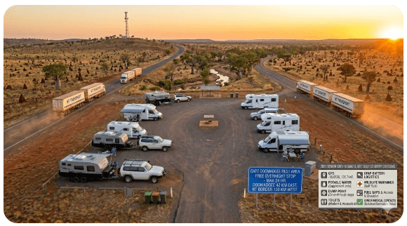
4. Cape Doomadgee Rest Area: Quick Facts and GPS for 2026
| Detail | Information |
|---|---|
| Name | Cape Doomadgee Rest Area |
| Location | Savannah Way (Highway 1), approximately 42 km east of Doomadgee, QLD 4830 |
| GPS | -17.7944, 138.8650 |
| Cost | Free — no permit required |
| Stay Limit | Maximum 24 hours (fatigue stop / rest area rules) |
| Surface | Gravel / dirt — level pull-off area beside highway |
| Drive-through? | Yes — no reversing needed |
| Toilets | None — self-contained required |
| Water | None — carry all water |
| Power | None — generator or battery only |
| Dump Point | None on-site |
| Phone Coverage | Unreliable — carry satellite communicator or PLB |
| Dogs | Yes — on lead, watch for wildlife |
| Permit Required? | No permit or fee required to camp at the rest area |
| Nearest Hospital | Doomadgee Hospital, Doomadgee QLD 4830 — GPS: -17.9403, 138.8225 — Phone: 07 4745 2100 — ~42 km west |
| RFDS | RFDS Mount Isa Base — 07 4743 2800 |
| Nearby Public Wi-Fi | None at rest area. Limited Wi-Fi may be available at Burketown (~117 km west) or Hells Gate Roadhouse (~200 km east) |
5. No Power, No Water — What That Means in Gulf Country Heat
The Cape Doomadgee Rest Area has no mains power, no water supply, and no shade structures. For a fit 30-year-old in a tent, that’s an adventure. For a senior with a CPAP machine, blood pressure medication that needs refrigeration, or limited mobility — it can become a medical situation fast.
What No Power Means for Seniors
- CPAP users: You need a fully charged lithium battery (minimum 100Ah) or a generator. Budget 8 hours of CPAP run time minimum.
- Medication storage: If any medication requires refrigeration, your 12V fridge must be running — which draws significant battery power overnight.
- No air conditioning: Overnight temperatures in the dry season (June–August) drop to 15–20°C — manageable. But September–October can stay above 28°C overnight.
What No Water Means
- Carry minimum 4 litres per person per day — more in the shoulder season.
- Top up tanks in Burketown before heading east, or at Gregory Downs before heading north.
- There is no creek or bore water at this rest area suitable for drinking. For a rest area that does have water access, see our Joes Creek Rest Area guide.
6. What Google Maps Won’t Tell You About Cape Doomadgee Rest Area
Here are five things the WikiCamps listing and Google pin don’t mention — and they matter for seniors:
For similar remote stops where phone signal is absent, see our Duncan Road Rest Area guide with the same safety precautions.
- Road trains use this highway at night. The Savannah Way carries road trains, especially cattle trucks. Park well clear of the road edge. Reflective tape on your rig is essential.
- Dust in the dry season is constant. If another vehicle pulls in behind you, everything you have outside — chairs, table, cooking gear — gets a coating. Close awnings and windows if you hear a truck coming.
- Wildlife includes feral cattle and pigs. Do not leave food scraps outside. Secure rubbish inside your vehicle overnight.
- Solo travellers: You may be the only person at this rest area. There is no lighting, no other campers guaranteed, and no phone signal. If you’re a solo senior, consider whether this is the right stop — Burketown Caravan Park is the safer option.
- The entry/exit is adequate for rigs up to about 19 m, but the gravel can be soft after rain. Check conditions before pulling off the sealed road.
7. Van Life Savings Spots: Free and Low-Cost Camping Near Doomadgee 2026
Heading south along the Queensland coast? Check our Cape Palmerston Rest Area guide for another free camping option with senior-specific details.
Use the Van Life Savings Spots app to search for free camps along the Savannah Way. Try AI queries like:
- “Free camps near Doomadgee QLD with toilets”
- “Rest areas Savannah Way between Burketown and Hells Gate”
- “Overnight camping Gulf Country Queensland seniors”
COPY PROMPT ➔ ASK AI ➔ SAVE TO FORM ➔ ADD SPOT PIN ➔ GET DIRECTIONS
📍 Interactive map — find free camps, rest areas and overnight stops. Enable location for best results.
| Site Name | Cost | Address / Postcode | GPS | Distance from Cape Doomadgee RA | Senior Verdict |
|---|---|---|---|---|---|
| Cape Doomadgee Rest Area | Free | Savannah Way, Doomadgee QLD 4830 | -17.7944, 138.8650 | 0 km (this site) | One night transit only. No facilities. Self-contained rigs only. |
| Burketown Rest Area | Free | Savannah Way, near Burketown QLD 4830 | -17.7467, 139.5467 | ~80 km east via Savannah Way | Basic rest area. Closer to Burketown town services. Still no facilities. |
| Tirranna Springs Waterhole | Free | Off Wills Development Rd, near Gregory Downs QLD 4830 | -18.5450, 139.2370 | ~130 km south via Gregory Downs | Popular bush camp with waterhole. No facilities but scenic. 4WD recommended. |
7b. Dump Points — Before, On-Site, and After Cape Doomadgee Rest Area
| 🗑️ Dump Point | Location | GPS | Notes |
|---|---|---|---|
| Before — Burketown Caravan Park | Musgrave St, Burketown QLD 4830 | -17.7267, 139.5467 | Available to guests; may allow non-guests for a small fee — ask first |
| On-site — Cape Doomadgee RA | Savannah Way, Doomadgee QLD 4830 | -17.7944, 138.8650 | ❌ No dump point on-site |
| After — Hells Gate Roadhouse | Savannah Way, Hells Gate QLD 4872 | -17.3911, 138.1378 | Dump point available — confirm status as facilities are basic. ~200 km west. |
7c. Free Water — On-Site, Before, and After Cape Doomadgee Rest Area
| 💧 Water Source | Location | GPS | Notes |
|---|---|---|---|
| Before — Burketown town water | Burketown QLD 4830 (public tap at park or caravan park) | -17.7267, 139.5467 | Top up tanks here — last reliable water heading west |
| On-site — Cape Doomadgee RA | Savannah Way, Doomadgee QLD 4830 | -17.7944, 138.8650 | ❌ No water available |
| After — Hells Gate Roadhouse | Savannah Way, Hells Gate QLD 4872 | -17.3911, 138.1378 | Water available for purchase — confirm availability, supply can be limited |
8. Burketown Caravan Park — The Paid Alternative for Grey Nomads
If you need power, water, toilets, and the peace of mind that comes with being near a town, Burketown Caravan Park is the closest option with real facilities.
- Address: Musgrave Street, Burketown QLD 4830
- GPS: -17.7267, 139.5467
- Phone: 07 4745 8118
- Facilities: Powered sites, toilets, showers, dump point, laundry, camp kitchen
- Distance from Cape Doomadgee RA: Approximately 117 km west
9. Full Facilities Comparison: Cape Doomadgee Rest Area vs Burketown Caravan Park
| Facility | Cape Doomadgee RA | Burketown Caravan Park |
|---|---|---|
| 240V Power | ❌ | ✅ |
| Flush Toilets | ❌ | ✅ |
| Hot Showers | ❌ | ✅ |
| Drinking Water | ❌ | ✅ |
| Dump Point | ❌ | ✅ |
| Dogs Allowed | ✅ | ✅ (check rules) |
| Phone Signal | ⚠️ None/unreliable | ⚠️ Limited Telstra |
| Medical Proximity | 42 km to Doomadgee Hospital | 117 km to Doomadgee Hospital / Burketown clinic in town |
| Senior Overall Rating | ⚠️ Transit stop only | ✅ ← Senior Recommended |
10. Rates: All Options Near Cape Doomadgee Rest Area
| Option | Rate (2026 est.) | Book Via |
|---|---|---|
| Cape Doomadgee Rest Area | Free — no booking | Pull in — no reservation |
| Burketown Caravan Park ← Senior Recommended | From ~$35–$45/night powered | Phone: 07 4745 8118 |
| Hells Gate Roadhouse Camping | From ~$15–$25/night | Arrive and pay — confirm availability |
11. Gulf Country Day Plan for Seniors Staying Near Doomadgee
| Time | Activity | Notes |
|---|---|---|
| 6:00 AM | Pack up at Cape Doomadgee RA — leave early | Beat the heat. Check tyres and water levels before departure. |
| 7:30 AM | Arrive Burketown — fuel and water top-up | Burketown has fuel, basic supplies, and a post office. |
| 8:30 AM | Morning River Walk — Albert River, Burketown | Flat path, short walk. Be croc-aware — do not approach water’s edge. |
| 10:00 AM | Burketown Heritage Display | Small but interesting. Air-conditioned. Free or gold coin donation. |
| 12:00 PM | Lunch at Burketown Pub | Counter meals available. Cold drinks. Air-conditioned. |
| 1:00 PM | Rest in van — heat of day | Do not drive or walk in peak heat. Stay hydrated. |
| 4:00 PM | Sunset drive or continue journey | If staying at Burketown Caravan Park, enjoy sunset. If continuing, drive in cooler afternoon. |
12. Senior Checklist: Cape Doomadgee Rest Area and the Savannah Way
| Item | Why It Matters for the Gulf Country | ✓ |
|---|---|---|
| Travel insurance with medical evacuation | RFDS evacuation to Mount Isa or Cairns may be required. Without cover, the cost is catastrophic. | ☐ |
| PLB registered with AMSA | No phone signal at Cape Doomadgee RA. A PLB is your only emergency beacon. Register free at beacons.amsa.gov.au. | ☐ |
| 2-week prescription medication supply | No pharmacy between Burketown and Mount Isa (~480 km). Doomadgee clinic has very limited stock. | ☐ |
| Medicare card + medication list in waterproof pouch | Keep in glovebox — not buried in luggage. A printed list saves time in an emergency. | ☐ |
| Full water tanks — minimum 80 litres | No water at Cape Doomadgee RA. Top up in Burketown (GPS: -17.7267, 139.5467). | ☐ |
| Full fuel tank + 20L jerry can | No fuel between Burketown and Hells Gate Roadhouse (~320 km). | ☐ |
| CPAP lithium battery (100Ah+) | No power at rest area. Budget 8+ hours of CPAP run time. | ☐ |
| Offline maps downloaded | No data signal. Download before leaving Burketown or Mount Isa. | ☐ |
| Sunscreen SPF 50+ and wide-brim hat | No shade structures. UV extreme in the dry season. | ☐ |
| Emergency numbers saved offline + printed in glovebox | Doomadgee Hospital: 07 4745 2100. RFDS Mount Isa: 07 4743 2800. | ☐ |
| Dump point GPS saved — before | Burketown Caravan Park: GPS: -17.7267, 139.5467 | ☐ |
| Dump point GPS saved — after | Hells Gate Roadhouse: GPS: -17.3911, 138.1378 | ☐ |
| Water top-up location saved | Burketown: GPS: -17.7267, 139.5467 | ☐ |
| Dog water, lead, and tie-out | Keep dogs on lead — feral animals and wildlife present. Extra water for pets essential. | ☐ |
13. What to Do Near Doomadgee: Senior Activity Guide
| Activity | Location + GPS | Senior Notes |
|---|---|---|
| Burketown Heritage Display | Musgrave St, Burketown QLD 4830 — GPS: -17.7450, 139.5430 | Small museum, air-conditioned. Free/gold coin. Flat access. |
| Albert River Lookout — Burketown | Burketown QLD 4830 — GPS: -17.7280, 139.5450 | Short flat walk. Stay well back from the water — crocodiles. |
| Morning Glory Cloud Viewing (Aug–Nov) | Burketown Airstrip, Burketown QLD 4830 — GPS: -17.7489, 139.5336 | Rare weather phenomenon. View from vehicle or airstrip. Flat access. Best early morning. |
| Burketown Pub — Counter Meal | Musgrave St, Burketown QLD 4830 — GPS: -17.7450, 139.5430 | Air-conditioned. Counter meals. Cold drinks. Social atmosphere. |
| Gulf Sunset — Savannah Way Pullover | Various points along Savannah Way | Spectacular sunsets over the Gulf savannah. Pull off safely and enjoy from vehicle. |
| Fishing — Burketown Area (licensed) | Albert River access points, Burketown QLD 4830 | Barramundi fishing world-class. QLD fishing licence required. Be croc-safe — never stand at water’s edge. |
For more ideas about living in retirement on the road, check our full guide.
14. GPS Coordinates and Postcodes: Save Every Stop Before You Lose Signal
Save all of these to the Van Life Savings Spots app before you leave Wi-Fi range. In the Gulf Country, there is no “I’ll look it up later.”
| Stop | Full Address + Postcode | GPS (Copy to App) |
|---|---|---|
| 📍 Cape Doomadgee Rest Area | Savannah Way, Doomadgee QLD 4830 | -17.7944, 138.8650 |
| 🏥 Doomadgee Hospital | Doomadgee QLD 4830 | -17.9403, 138.8225 |
| 🏥 RFDS Mount Isa Base | Mount Isa Airport, Mount Isa QLD 4825 | -20.6639, 139.4886 |
| 🏕️ Burketown Caravan Park | Musgrave St, Burketown QLD 4830 | -17.7267, 139.5467 |
| 🗑️ Dump Point — Burketown Caravan Park | Musgrave St, Burketown QLD 4830 | -17.7267, 139.5467 |
| 💧 Water — Burketown | Burketown QLD 4830 | -17.7267, 139.5467 |
| 🗑️ Dump Point — Hells Gate Roadhouse | Savannah Way, Hells Gate QLD 4872 | -17.3911, 138.1378 |
| 💧 Water — Hells Gate Roadhouse | Savannah Way, Hells Gate QLD 4872 | -17.3911, 138.1378 |
| 📍 Burketown Heritage Display | Musgrave St, Burketown QLD 4830 | -17.7450, 139.5430 |
| 📍 Burketown Airstrip (Morning Glory) | Burketown QLD 4830 | -17.7489, 139.5336 |
| 📍 Burketown Rest Area | Savannah Way, near Burketown QLD 4830 | -17.7467, 139.5467 |
| 📍 Tirranna Springs Waterhole | Off Wills Development Rd, Gregory Downs QLD 4830 | -18.5450, 139.2370 |
15. Frequently Asked Questions — Cape Doomadgee Rest Area for Grey Nomads
Is Cape Doomadgee Rest Area free to camp at in 2026?
Yes. Cape Doomadgee Rest Area is a free roadside rest area with no fee and no permit required. Maximum stay is typically 24 hours as it is classified as a fatigue stop.
Are there toilets at Cape Doomadgee Rest Area?
No. There are no toilet facilities at this rest area. You must be self-contained or carry a portable toilet. The nearest public toilets are in Doomadgee township (~42 km west) or Burketown (~117 km west).
Is Cape Doomadgee Rest Area safe for solo senior travellers?
It is legal and many travellers use it, but there is no lighting, no phone signal, and no guarantee of other campers being present. Solo seniors — particularly solo women — should consider whether Burketown Caravan Park (GPS: -17.7267, 139.5467) is a safer option with other people around.
Is there phone signal at Cape Doomadgee Rest Area?
No reliable phone signal. Telstra coverage is patchy to non-existent. Carry a satellite communicator (Garmin inReach, Zoleo) or a registered PLB for emergencies.
Where is the nearest hospital to Cape Doomadgee Rest Area?
Doomadgee Hospital, Doomadgee QLD 4830 — GPS: -17.9403, 138.8225 — Phone: 07 4745 2100. It is approximately 42 km west of the rest area. For serious emergencies, RFDS evacuation from Mount Isa Base (07 4743 2800) may be required.
Can I take a caravan to Cape Doomadgee Rest Area?
Yes. The pull-off area accommodates rigs up to approximately 19 m with drive-through access. The surface is gravel/dirt — generally firm in the dry season but can be soft after rain. Check road conditions before departure.
Where is the nearest dump point to Cape Doomadgee Rest Area?
There is no dump point at the rest area. The nearest options are Burketown Caravan Park (~117 km west, GPS: -17.7267, 139.5467) and Hells Gate Roadhouse (~200 km further west, GPS: -17.3911, 138.1378). Confirm availability at both before relying on them.
Do I need a permit to camp at Cape Doomadgee Rest Area?
No permit or parks fee is required. This is a Queensland Government roadside rest area open to all travellers. Note: some areas around Doomadgee are Aboriginal Land and may require a permit to enter — the rest area on the Savannah Way itself does not.
When is the best time for seniors to travel the Savannah Way past Doomadgee?
May to September is the dry season — the only safe and comfortable time for seniors. October onwards brings extreme heat, and November to April is the wet season when roads may flood and become impassable. Plan your 2026 Savannah Way trip for June–August for the best conditions.
16. Quick-Reference Card — Cape Doomadgee Rest Area
| Detail | Information |
|---|---|
| Site Name | Cape Doomadgee Rest Area |
| Address | Savannah Way (Highway 1), Doomadgee QLD 4830 |
| GPS | -17.7944, 138.8650 |
| Cost | Free — no permit |
| Stay Limit | 24 hours |
| Power | None |
| Water | None — BYO |
| Toilets | None — self-contained only |
| Dump Point | None — nearest at Burketown (~117 km) |
| Dogs | Yes — on lead |
| Phone Signal | None/unreliable — carry PLB |
| Nearest Hospital | Doomadgee Hospital — 07 4745 2100 — GPS: -17.9403, 138.8225 (~42 km) |
| RFDS | Mount Isa Base — 07 4743 2800 |
| Road Conditions | TMR Queensland: 13 19 40 |
| Senior Verdict | Transit stop only — one night maximum. Self-contained rigs only. Not suitable as a base camp for seniors. |
If you’re heading west towards the NT, also read our guide to the Cape Crawford Rest Area — another critical free stop on this route
Disclaimer: Cape Doomadgee Rest Area information in this guide was compiled from publicly available sources and traveller reports current as of mid-2026. Facilities, road conditions, and access rules can change without notice. Always verify conditions with TMR Queensland (13 19 40) and local councils before travel. GPS coordinates are approximate and sourced from publicly available mapping data — always cross-reference with current maps. This website is not affiliated with Queensland Government, Doomadgee Aboriginal Shire Council, or any property mentioned. Travel at your own risk. Carry emergency communication devices in remote areas.
Free campsites and powered sites fill fast during the dry season. If your preferred site is already gone, search remaining accommodation options below to explore the Gulf Country region.
Accommodation and flight search powered by Expedia. Booking through this search supports this website at no extra cost to you. As an affiliate, I earn from qualifying purchases at no extra cost to you.

As an affiliate, I earn from qualifying purchases at no extra cost to you.
As an affiliate, I earn from qualifying purchases at no extra cost to you.